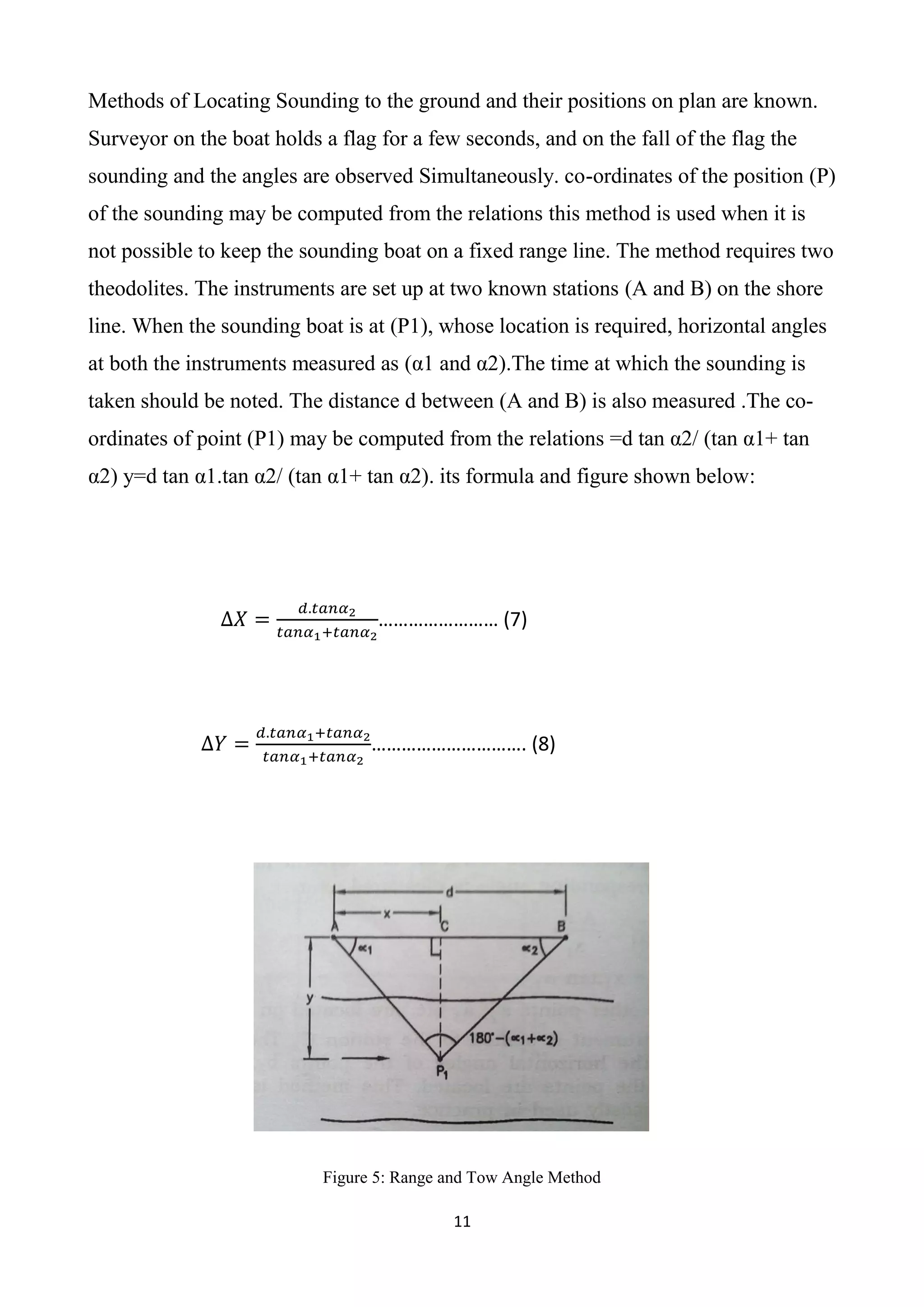
This report discusses methods for fixing horizontal control positions in hydrographic surveying, emphasizing their importance and application in determining water depths and coordinates. It outlines various techniques, including the methods of transit & stadia, range and one angle, and two angles from the shore, detailing their advantages and disadvantages. The aim is to highlight the significance of accurate coordinate systems and the processes required for effective hydrographic surveys.