SlideShare a Scribd company logo
1 of 12
Center for Research and Application for Satellite Remote Sensing
Yamaguchi University
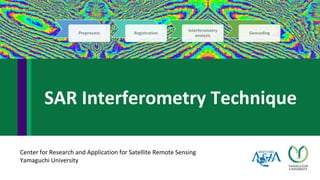
SAR Interferometry Technique
Preprocess Registration
Interferometry
analysis
Geocoding
2
Young’s double slit experiment
- Constructive interference (bright)
- Destructive interference (dark)
SAR Interferometry is a radar technique used
in geodesy and remote sensing. This geodetic method
uses two or more synthetic aperture radar (SAR) images
to generate maps of surface deformation or digital
elevation, using differences in the phase of the waves
returning to the satellite
Differential SAR Interferometry is a technique stemming
from SAR-Interferometry. During interferogram
generation, the phase due to both the curvature of the
Earth and the topography were removed. Its goal is to
detect changes in topography.
http://media-2.web.britannica.com/eb-media/96/96596-004-1D8E9F0F.jpg
http://www.intechopen.com/source/html/10381/media/image8.jpg
Differential SAR Interferometry
Sample Applications of DInSAR
• Synthetic aperture radar interferometry (InSAR) is very powerful technique to detect deformation and
measure displacement of the earth’s surface. Thus, it is very useful for disaster detection and
monitoring such as landslide, land subsidence, volcanic activity and earthquake.
Uplift and subsidence associated with a June 2007 earthquake
swarm on Kilauea Volcano (Zhong Lu, USGS,)
InSAR monitor fault Hector Mine earthquake in 1999 (NASA)
Landslide Deformations in Three Gorges Area
(Tantianuparp et al., 2013)
http://www.nasa.gov/images/content/48847main_hectormine.jpg
http://www.mdpi.com/remotesensing/remotesensing-05-
02704/article_deploy/html/images/remotesensing-05-02704f3b-1024.png
https://media.asf.alaska.edu/uploads/InSAR/november_sm.gif
Software and conditions of image acquisition
The conditions of DInSAR technique
▪ Two or more SAR images are required.
▪ Both the images should be collected with same SAR geometry.
▪ Both the images should have same frequency (X, C, S, L)
▪ Need Digital Elevation Model (DEM) cover SAR scene.
Software
▪ GMTSAR http://topex.ucsd.edu/gmtsar/
▪ GAMMA http://www.gamma-rs.ch/
▪ NEST ESA https://earth.esa.int/web/nest/home
▪ DORIS http://doris.tudelft.nl/
Differential SAR Interferometry
DInSAR Two pass method
DInSAR Three pass method
DInSAR Four pass method
Reference: http://www.geo.uzh.ch/en/units/rsl/research/radar-
remote-sensing-sarlab/former-research-projects/differential-sar-
interferometry/
Differential
Interferogram
Real
Interferogram
Orbit 1
Orbit 2
Synthetic
Interferogram
DEM
Differential
Interferogram
Real
Interferogram
Orbit 1
Orbit 2
Synthetic
Interferogram
Orbit 1
Orbit 3
Differential
Interferogram
Real
Interferogram
Orbit 1
Orbit 2
Synthetic
Interferogram
Orbit 3
Orbit 4
Steps of DInSAR two pass method based on GMTSAR
Preprocess
Registration
Interferogram
Generation
Phase
Unwrapping
Geocoding
Range Doppler processing
Range Compression
Azimuth Compression
Single look complex (SLC)
Multi look image
SAR processing
RAW
data
Sensor Parameter Processing Parameter
Reference: GMTSAR (2011)
Steps of DInSAR two pass method based on GMTSAR
Preprocess
Registration
Interferogram
Generation
Phase
Unwrapping
Geocoding
Co-registration of SLC Data: co-registration is the process of fitting one SAR
image accurately upon another SAR image. Co-registration of complex images
involves two steps.
1) the location of each pixel in the slave image is changed with respect to the
master image.
2) the amplitudes and phases of the sensors are recalculated by interpolation.
GMTSAR is used for this research using cross correlation algorithm (xcorr) for
registration. “xcorr” uses window size of 64 pixels and has never failed to
provide accurate co-registration even in cases where the interferometric
coherence is close to zero.
Reference: GMTSAR (2011)
Preprocess
Registration
Interferogram
Generation
Phase
Unwrapping
Geocoding
Concept of repeat orbit interferometry
The phase difference φ to point on the
ground is related to the range difference
;Therefore
ρ - range from reference track to reflector
B - total baseline distance between reference and repeat track
θ - look angle
α - angle between the baseline vector and the tangent plane
= Bcos(θ-α)
= Bsin(θ-α)
θ-α
Reference: GMTSAR (2011)
Steps of DInSAR two pass method based on GMTSAR
Preprocess
Registration
Interferogram
Generation
Phase
Unwrapping
Geocoding
Correction of earth curvature and topographic phase
Interpolate the topography
For other information, it can be computed from SAR data
b(a) - radius of the spacecraft orbit for the
reference image
B(a) - the length of the baseline
α(a) - the orientation of the baseline
topography (range, azimuth)
Reference: GMTSAR (2011)
Steps of DInSAR two pass method based on GMTSAR
Preprocess
Registration
Interferogram
Generation
Phase
Unwrapping
Geocoding
Phase due to earth curvature and topography
Law of cosine
It can be rewritten as
Phase to range =
So, Phase difference = φ1- φ2
Reference: GMTSAR (2011)
δρ = -B sin (θ-α)
Steps of DInSAR two pass method based on GMTSAR
Preprocess
Registration
Interferogram
Generation
Phase
Unwrapping
Geocoding
Phase unwrapping: The interferometric phase shows many discontinuities,
which originate the classical fringe pattern. The interferometric phase is
almost linearly proportional to the topographic height. The difficulty is that
the interferometric phase is only known to module 360 degrees. If the phase
variation exceeds 360 degrees, it wraps around to 0 degrees. It is necessary
to unwrap the phase in the interferogram by using several algorithms for
converting the interferometric phase to topographic phase.
Steps of DInSAR two pass method based on GMTSAR
Preprocess
Registration
Interferogram
Generation
Phase
Unwrapping
Geocoding
The final step is to geocode all the products by transforming from
the range/azimuth coordinate system of the master image to
longitude and latitude.
Geocode
Amplitude image
Interferogram image
Sample image from http://topex.ucsd.edu/gmtsar/downloads/
Steps of DInSAR two pass method based on GMTSAR

More Related Content

What's hot

Introduction to sar-marjolaine_rouault
Introduction to sar-marjolaine_rouaultIntroduction to sar-marjolaine_rouault
Introduction to sar-marjolaine_rouaultNaivedya Mishra
 
Remote Sensing in Digital Model Elevation
Remote Sensing in Digital Model ElevationRemote Sensing in Digital Model Elevation
Remote Sensing in Digital Model ElevationShishir Meshram
 
Remote Sensing: Image Classification
Remote Sensing: Image ClassificationRemote Sensing: Image Classification
Remote Sensing: Image ClassificationKamlesh Kumar
 
spatial resolutionin remote sensing
 spatial resolutionin remote sensing spatial resolutionin remote sensing
spatial resolutionin remote sensingGhassan Hadi
 
Chapter 3: Remote sensing Technology
Chapter 3: Remote sensing TechnologyChapter 3: Remote sensing Technology
Chapter 3: Remote sensing TechnologyShankar Gangaju
 
Remote Sensing and GIS for Natural Hazards Assessment and Disaster Risk Manag...
Remote Sensing and GIS for Natural Hazards Assessment and Disaster Risk Manag...Remote Sensing and GIS for Natural Hazards Assessment and Disaster Risk Manag...
Remote Sensing and GIS for Natural Hazards Assessment and Disaster Risk Manag...Cees van Westen
 
Introduction to LiDAR presentation.
Introduction to LiDAR presentation.Introduction to LiDAR presentation.
Introduction to LiDAR presentation.Bob Champoux
 
Remote Sensing - Fundamentals
Remote Sensing - FundamentalsRemote Sensing - Fundamentals
Remote Sensing - FundamentalsAjay Singh Lodhi
 
Microwave remote sensing
Microwave remote sensingMicrowave remote sensing
Microwave remote sensingRohit Kumar
 
Training and hands-on SNAP Sentinel-1 IW SLC Interferogram and Displacement
Training and hands-on SNAP Sentinel-1 IW SLC Interferogram and DisplacementTraining and hands-on SNAP Sentinel-1 IW SLC Interferogram and Displacement
Training and hands-on SNAP Sentinel-1 IW SLC Interferogram and DisplacementEmmanuel Mathot
 
Surveying ii ajith sir class4
Surveying ii ajith sir class4Surveying ii ajith sir class4
Surveying ii ajith sir class4SHAMJITH KM
 

What's hot (20)

Introduction to sar-marjolaine_rouault
Introduction to sar-marjolaine_rouaultIntroduction to sar-marjolaine_rouault
Introduction to sar-marjolaine_rouault
 
Remote Sensin
Remote SensinRemote Sensin
Remote Sensin
 
Remote Sensing in Digital Model Elevation
Remote Sensing in Digital Model ElevationRemote Sensing in Digital Model Elevation
Remote Sensing in Digital Model Elevation
 
Remote Sensing: Image Classification
Remote Sensing: Image ClassificationRemote Sensing: Image Classification
Remote Sensing: Image Classification
 
GEOID-DETERMINAION
GEOID-DETERMINAIONGEOID-DETERMINAION
GEOID-DETERMINAION
 
Errors and biasis
Errors and biasisErrors and biasis
Errors and biasis
 
spatial resolutionin remote sensing
 spatial resolutionin remote sensing spatial resolutionin remote sensing
spatial resolutionin remote sensing
 
GIS file types
GIS file typesGIS file types
GIS file types
 
Band combinations (1)
Band combinations (1)Band combinations (1)
Band combinations (1)
 
Chapter 3: Remote sensing Technology
Chapter 3: Remote sensing TechnologyChapter 3: Remote sensing Technology
Chapter 3: Remote sensing Technology
 
Remote Sensing and GIS for Natural Hazards Assessment and Disaster Risk Manag...
Remote Sensing and GIS for Natural Hazards Assessment and Disaster Risk Manag...Remote Sensing and GIS for Natural Hazards Assessment and Disaster Risk Manag...
Remote Sensing and GIS for Natural Hazards Assessment and Disaster Risk Manag...
 
Introduction to LiDAR presentation.
Introduction to LiDAR presentation.Introduction to LiDAR presentation.
Introduction to LiDAR presentation.
 
Landsat.pptx
Landsat.pptxLandsat.pptx
Landsat.pptx
 
Remote Sensing - Fundamentals
Remote Sensing - FundamentalsRemote Sensing - Fundamentals
Remote Sensing - Fundamentals
 
GPS-errors-2
GPS-errors-2GPS-errors-2
GPS-errors-2
 
Microwave remote sensing
Microwave remote sensingMicrowave remote sensing
Microwave remote sensing
 
Training and hands-on SNAP Sentinel-1 IW SLC Interferogram and Displacement
Training and hands-on SNAP Sentinel-1 IW SLC Interferogram and DisplacementTraining and hands-on SNAP Sentinel-1 IW SLC Interferogram and Displacement
Training and hands-on SNAP Sentinel-1 IW SLC Interferogram and Displacement
 
Surveying ii ajith sir class4
Surveying ii ajith sir class4Surveying ii ajith sir class4
Surveying ii ajith sir class4
 
GPS introduction
GPS introductionGPS introduction
GPS introduction
 
Basic remote sensing and gis
Basic remote sensing and gisBasic remote sensing and gis
Basic remote sensing and gis
 

Similar to SAR Interferometry Technique

Cai lomver gold2010
Cai lomver gold2010Cai lomver gold2010
Cai lomver gold2010grssieee
 
Synthetic aperture radar
Synthetic aperture radarSynthetic aperture radar
Synthetic aperture radarMahesh pawar
 
Elsherbini_IGARSS.pptx
Elsherbini_IGARSS.pptxElsherbini_IGARSS.pptx
Elsherbini_IGARSS.pptxgrssieee
 
IGARSS11_FFBP_CSAR_v3.ppt
IGARSS11_FFBP_CSAR_v3.pptIGARSS11_FFBP_CSAR_v3.ppt
IGARSS11_FFBP_CSAR_v3.pptgrssieee
 
IGARSS11_FFBP_CSAR_v3.ppt
IGARSS11_FFBP_CSAR_v3.pptIGARSS11_FFBP_CSAR_v3.ppt
IGARSS11_FFBP_CSAR_v3.pptgrssieee
 
TH1.L09 - GEODETICALLY ACCURATE INSAR DATA PROCESSOR FOR TIME SERIES ANALYSIS
TH1.L09 - GEODETICALLY ACCURATE INSAR DATA PROCESSOR FOR TIME SERIES ANALYSISTH1.L09 - GEODETICALLY ACCURATE INSAR DATA PROCESSOR FOR TIME SERIES ANALYSIS
TH1.L09 - GEODETICALLY ACCURATE INSAR DATA PROCESSOR FOR TIME SERIES ANALYSISgrssieee
 
In tech recent-advances_in_synthetic_aperture_radar_enhancement_and_informati...
In tech recent-advances_in_synthetic_aperture_radar_enhancement_and_informati...In tech recent-advances_in_synthetic_aperture_radar_enhancement_and_informati...
In tech recent-advances_in_synthetic_aperture_radar_enhancement_and_informati...Naivedya Mishra
 
Liwenchao.ppt
Liwenchao.pptLiwenchao.ppt
Liwenchao.pptgrssieee
 
Liwenchao.ppt
Liwenchao.pptLiwenchao.ppt
Liwenchao.pptgrssieee
 
IGARSSAirSWOTv2.ppt
IGARSSAirSWOTv2.pptIGARSSAirSWOTv2.ppt
IGARSSAirSWOTv2.pptgrssieee
 
TH1.L10.1: TANDEM-X: SCIENTIFIC CONTRIBUTIONS
TH1.L10.1: TANDEM-X: SCIENTIFIC CONTRIBUTIONSTH1.L10.1: TANDEM-X: SCIENTIFIC CONTRIBUTIONS
TH1.L10.1: TANDEM-X: SCIENTIFIC CONTRIBUTIONSgrssieee
 
Remote sensing Techniques Dr. Ange Felix NSANZIYERA
Remote sensing Techniques Dr. Ange Felix NSANZIYERARemote sensing Techniques Dr. Ange Felix NSANZIYERA
Remote sensing Techniques Dr. Ange Felix NSANZIYERAAnge Felix NSANZIYERA
 
FR2.L09 - PROCESSING OF MEMPHIS MILLIMETER WAVE MULTI-BASELINE INSAR DATA
FR2.L09 - PROCESSING OF MEMPHIS MILLIMETER WAVE MULTI-BASELINE INSAR DATAFR2.L09 - PROCESSING OF MEMPHIS MILLIMETER WAVE MULTI-BASELINE INSAR DATA
FR2.L09 - PROCESSING OF MEMPHIS MILLIMETER WAVE MULTI-BASELINE INSAR DATAgrssieee
 
Digital Elevation Models
Digital Elevation ModelsDigital Elevation Models
Digital Elevation ModelsBernd Flmla
 
FR4.T05.4.ppt
FR4.T05.4.pptFR4.T05.4.ppt
FR4.T05.4.pptgrssieee
 

Similar to SAR Interferometry Technique (20)

Phase Unwrapping Via Graph Cuts
Phase Unwrapping Via Graph CutsPhase Unwrapping Via Graph Cuts
Phase Unwrapping Via Graph Cuts
 
Cai lomver gold2010
Cai lomver gold2010Cai lomver gold2010
Cai lomver gold2010
 
TRS
TRSTRS
TRS
 
Synthetic aperture radar
Synthetic aperture radarSynthetic aperture radar
Synthetic aperture radar
 
Elsherbini_IGARSS.pptx
Elsherbini_IGARSS.pptxElsherbini_IGARSS.pptx
Elsherbini_IGARSS.pptx
 
IGARSS11_FFBP_CSAR_v3.ppt
IGARSS11_FFBP_CSAR_v3.pptIGARSS11_FFBP_CSAR_v3.ppt
IGARSS11_FFBP_CSAR_v3.ppt
 
IGARSS11_FFBP_CSAR_v3.ppt
IGARSS11_FFBP_CSAR_v3.pptIGARSS11_FFBP_CSAR_v3.ppt
IGARSS11_FFBP_CSAR_v3.ppt
 
TH1.L09 - GEODETICALLY ACCURATE INSAR DATA PROCESSOR FOR TIME SERIES ANALYSIS
TH1.L09 - GEODETICALLY ACCURATE INSAR DATA PROCESSOR FOR TIME SERIES ANALYSISTH1.L09 - GEODETICALLY ACCURATE INSAR DATA PROCESSOR FOR TIME SERIES ANALYSIS
TH1.L09 - GEODETICALLY ACCURATE INSAR DATA PROCESSOR FOR TIME SERIES ANALYSIS
 
TH1.L09 - GEODETICALLY ACCURATE INSAR DATA PROCESSOR FOR TIME SERIES ANALYSIS
TH1.L09 - GEODETICALLY ACCURATE INSAR DATA PROCESSOR FOR TIME SERIES ANALYSISTH1.L09 - GEODETICALLY ACCURATE INSAR DATA PROCESSOR FOR TIME SERIES ANALYSIS
TH1.L09 - GEODETICALLY ACCURATE INSAR DATA PROCESSOR FOR TIME SERIES ANALYSIS
 
In tech recent-advances_in_synthetic_aperture_radar_enhancement_and_informati...
In tech recent-advances_in_synthetic_aperture_radar_enhancement_and_informati...In tech recent-advances_in_synthetic_aperture_radar_enhancement_and_informati...
In tech recent-advances_in_synthetic_aperture_radar_enhancement_and_informati...
 
Liwenchao.ppt
Liwenchao.pptLiwenchao.ppt
Liwenchao.ppt
 
Liwenchao.ppt
Liwenchao.pptLiwenchao.ppt
Liwenchao.ppt
 
IGARSSAirSWOTv2.ppt
IGARSSAirSWOTv2.pptIGARSSAirSWOTv2.ppt
IGARSSAirSWOTv2.ppt
 
TH1.L10.1: TANDEM-X: SCIENTIFIC CONTRIBUTIONS
TH1.L10.1: TANDEM-X: SCIENTIFIC CONTRIBUTIONSTH1.L10.1: TANDEM-X: SCIENTIFIC CONTRIBUTIONS
TH1.L10.1: TANDEM-X: SCIENTIFIC CONTRIBUTIONS
 
Remote sensing Techniques Dr. Ange Felix NSANZIYERA
Remote sensing Techniques Dr. Ange Felix NSANZIYERARemote sensing Techniques Dr. Ange Felix NSANZIYERA
Remote sensing Techniques Dr. Ange Felix NSANZIYERA
 
FR2.L09 - PROCESSING OF MEMPHIS MILLIMETER WAVE MULTI-BASELINE INSAR DATA
FR2.L09 - PROCESSING OF MEMPHIS MILLIMETER WAVE MULTI-BASELINE INSAR DATAFR2.L09 - PROCESSING OF MEMPHIS MILLIMETER WAVE MULTI-BASELINE INSAR DATA
FR2.L09 - PROCESSING OF MEMPHIS MILLIMETER WAVE MULTI-BASELINE INSAR DATA
 
Digital Elevation Models
Digital Elevation ModelsDigital Elevation Models
Digital Elevation Models
 
FR4.T05.4.ppt
FR4.T05.4.pptFR4.T05.4.ppt
FR4.T05.4.ppt
 
C011121114
C011121114C011121114
C011121114
 
Pasadena Poster Fa15
Pasadena Poster Fa15Pasadena Poster Fa15
Pasadena Poster Fa15
 

More from NopphawanTamkuan

Application of OpenStreetMap in Disaster Risk Management
Application of OpenStreetMap in Disaster Risk ManagementApplication of OpenStreetMap in Disaster Risk Management
Application of OpenStreetMap in Disaster Risk ManagementNopphawanTamkuan
 
Unmanned Aerial Vehicle Application
Unmanned Aerial Vehicle ApplicationUnmanned Aerial Vehicle Application
Unmanned Aerial Vehicle ApplicationNopphawanTamkuan
 
Co-Registration of Small-Scale Satellite Data
Co-Registration of Small-Scale Satellite DataCo-Registration of Small-Scale Satellite Data
Co-Registration of Small-Scale Satellite DataNopphawanTamkuan
 
Disaster Damage Assessment and Recovery Monitoring Using Night-Time Light on GEE
Disaster Damage Assessment and Recovery Monitoring Using Night-Time Light on GEEDisaster Damage Assessment and Recovery Monitoring Using Night-Time Light on GEE
Disaster Damage Assessment and Recovery Monitoring Using Night-Time Light on GEENopphawanTamkuan
 
Differential SAR Interferometry Using Sentinel-1 Data for Kumamoto Earthquake
Differential SAR Interferometry Using Sentinel-1 Data for Kumamoto EarthquakeDifferential SAR Interferometry Using Sentinel-1 Data for Kumamoto Earthquake
Differential SAR Interferometry Using Sentinel-1 Data for Kumamoto EarthquakeNopphawanTamkuan
 
SAR Data Applications for Disasters
SAR Data Applications for DisastersSAR Data Applications for Disasters
SAR Data Applications for DisastersNopphawanTamkuan
 
Color Composite in ENVI (Case Study: Flood in Vietnam)
Color Composite in ENVI (Case Study: Flood in Vietnam)Color Composite in ENVI (Case Study: Flood in Vietnam)
Color Composite in ENVI (Case Study: Flood in Vietnam)NopphawanTamkuan
 
Earthquake Damage Detection Using SAR Interferometric Coherence
Earthquake Damage Detection Using SAR Interferometric CoherenceEarthquake Damage Detection Using SAR Interferometric Coherence
Earthquake Damage Detection Using SAR Interferometric CoherenceNopphawanTamkuan
 
Flood Detection Using ALOS-2 Images in SNAP
Flood Detection Using ALOS-2 Images in SNAPFlood Detection Using ALOS-2 Images in SNAP
Flood Detection Using ALOS-2 Images in SNAPNopphawanTamkuan
 
Differential SAR Interferometry Using ALOS-2 Data for Nepal Earthquake
Differential SAR Interferometry Using ALOS-2 Data for Nepal EarthquakeDifferential SAR Interferometry Using ALOS-2 Data for Nepal Earthquake
Differential SAR Interferometry Using ALOS-2 Data for Nepal EarthquakeNopphawanTamkuan
 
Flood Detection Using During-Flood SAR Image in QGIS
Flood Detection Using During-Flood SAR Image in QGISFlood Detection Using During-Flood SAR Image in QGIS
Flood Detection Using During-Flood SAR Image in QGISNopphawanTamkuan
 
Color Composite in ENVI (Case Study: Flood in Myanmar)
Color Composite in ENVI (Case Study: Flood in Myanmar)Color Composite in ENVI (Case Study: Flood in Myanmar)
Color Composite in ENVI (Case Study: Flood in Myanmar)NopphawanTamkuan
 
Play with Vector and Make Map
Play with Vector and Make MapPlay with Vector and Make Map
Play with Vector and Make MapNopphawanTamkuan
 
Raster Analysis (Color Composite and Remote Sensing Indices)
Raster Analysis (Color Composite and Remote Sensing Indices)Raster Analysis (Color Composite and Remote Sensing Indices)
Raster Analysis (Color Composite and Remote Sensing Indices)NopphawanTamkuan
 
Understanding Basic of Python
Understanding Basic of PythonUnderstanding Basic of Python
Understanding Basic of PythonNopphawanTamkuan
 
Introduction to Geospatial Data
Introduction to Geospatial DataIntroduction to Geospatial Data
Introduction to Geospatial DataNopphawanTamkuan
 
Geospatial Processing with Python
Geospatial Processing with PythonGeospatial Processing with Python
Geospatial Processing with PythonNopphawanTamkuan
 

More from NopphawanTamkuan (20)

Application of OpenStreetMap in Disaster Risk Management
Application of OpenStreetMap in Disaster Risk ManagementApplication of OpenStreetMap in Disaster Risk Management
Application of OpenStreetMap in Disaster Risk Management
 
Unmanned Aerial Vehicle Application
Unmanned Aerial Vehicle ApplicationUnmanned Aerial Vehicle Application
Unmanned Aerial Vehicle Application
 
Co-Registration of Small-Scale Satellite Data
Co-Registration of Small-Scale Satellite DataCo-Registration of Small-Scale Satellite Data
Co-Registration of Small-Scale Satellite Data
 
Visualizing CDR Data
Visualizing CDR DataVisualizing CDR Data
Visualizing CDR Data
 
Disaster Damage Assessment and Recovery Monitoring Using Night-Time Light on GEE
Disaster Damage Assessment and Recovery Monitoring Using Night-Time Light on GEEDisaster Damage Assessment and Recovery Monitoring Using Night-Time Light on GEE
Disaster Damage Assessment and Recovery Monitoring Using Night-Time Light on GEE
 
Differential SAR Interferometry Using Sentinel-1 Data for Kumamoto Earthquake
Differential SAR Interferometry Using Sentinel-1 Data for Kumamoto EarthquakeDifferential SAR Interferometry Using Sentinel-1 Data for Kumamoto Earthquake
Differential SAR Interferometry Using Sentinel-1 Data for Kumamoto Earthquake
 
SAR Data Applications for Disasters
SAR Data Applications for DisastersSAR Data Applications for Disasters
SAR Data Applications for Disasters
 
Color Composite in ENVI (Case Study: Flood in Vietnam)
Color Composite in ENVI (Case Study: Flood in Vietnam)Color Composite in ENVI (Case Study: Flood in Vietnam)
Color Composite in ENVI (Case Study: Flood in Vietnam)
 
Earthquake Damage Detection Using SAR Interferometric Coherence
Earthquake Damage Detection Using SAR Interferometric CoherenceEarthquake Damage Detection Using SAR Interferometric Coherence
Earthquake Damage Detection Using SAR Interferometric Coherence
 
Flood Detection Using ALOS-2 Images in SNAP
Flood Detection Using ALOS-2 Images in SNAPFlood Detection Using ALOS-2 Images in SNAP
Flood Detection Using ALOS-2 Images in SNAP
 
Differential SAR Interferometry Using ALOS-2 Data for Nepal Earthquake
Differential SAR Interferometry Using ALOS-2 Data for Nepal EarthquakeDifferential SAR Interferometry Using ALOS-2 Data for Nepal Earthquake
Differential SAR Interferometry Using ALOS-2 Data for Nepal Earthquake
 
Flood Detection Using During-Flood SAR Image in QGIS
Flood Detection Using During-Flood SAR Image in QGISFlood Detection Using During-Flood SAR Image in QGIS
Flood Detection Using During-Flood SAR Image in QGIS
 
Color Composite in ENVI (Case Study: Flood in Myanmar)
Color Composite in ENVI (Case Study: Flood in Myanmar)Color Composite in ENVI (Case Study: Flood in Myanmar)
Color Composite in ENVI (Case Study: Flood in Myanmar)
 
Play with Vector and Make Map
Play with Vector and Make MapPlay with Vector and Make Map
Play with Vector and Make Map
 
Raster Analysis (Color Composite and Remote Sensing Indices)
Raster Analysis (Color Composite and Remote Sensing Indices)Raster Analysis (Color Composite and Remote Sensing Indices)
Raster Analysis (Color Composite and Remote Sensing Indices)
 
Image Classification
Image ClassificationImage Classification
Image Classification
 
Useful Tools in QGIS
Useful Tools in QGISUseful Tools in QGIS
Useful Tools in QGIS
 
Understanding Basic of Python
Understanding Basic of PythonUnderstanding Basic of Python
Understanding Basic of Python
 
Introduction to Geospatial Data
Introduction to Geospatial DataIntroduction to Geospatial Data
Introduction to Geospatial Data
 
Geospatial Processing with Python
Geospatial Processing with PythonGeospatial Processing with Python
Geospatial Processing with Python
 

Recently uploaded

Graduate Outcomes Presentation Slides - English
Graduate Outcomes Presentation Slides - EnglishGraduate Outcomes Presentation Slides - English
Graduate Outcomes Presentation Slides - Englishneillewis46
 
UGC NET Paper 1 Unit 7 DATA INTERPRETATION.pdf
UGC NET Paper 1 Unit 7 DATA INTERPRETATION.pdfUGC NET Paper 1 Unit 7 DATA INTERPRETATION.pdf
UGC NET Paper 1 Unit 7 DATA INTERPRETATION.pdfNirmal Dwivedi
 
FICTIONAL SALESMAN/SALESMAN SNSW 2024.pdf
FICTIONAL SALESMAN/SALESMAN SNSW 2024.pdfFICTIONAL SALESMAN/SALESMAN SNSW 2024.pdf
FICTIONAL SALESMAN/SALESMAN SNSW 2024.pdfPondicherry University
 
QUATER-1-PE-HEALTH-LC2- this is just a sample of unpacked lesson
QUATER-1-PE-HEALTH-LC2- this is just a sample of unpacked lessonQUATER-1-PE-HEALTH-LC2- this is just a sample of unpacked lesson
QUATER-1-PE-HEALTH-LC2- this is just a sample of unpacked lessonhttgc7rh9c
 
On_Translating_a_Tamil_Poem_by_A_K_Ramanujan.pptx
On_Translating_a_Tamil_Poem_by_A_K_Ramanujan.pptxOn_Translating_a_Tamil_Poem_by_A_K_Ramanujan.pptx
On_Translating_a_Tamil_Poem_by_A_K_Ramanujan.pptxPooja Bhuva
 
How to Create and Manage Wizard in Odoo 17
How to Create and Manage Wizard in Odoo 17How to Create and Manage Wizard in Odoo 17
How to Create and Manage Wizard in Odoo 17Celine George
 
Tatlong Kwento ni Lola basyang-1.pdf arts
Tatlong Kwento ni Lola basyang-1.pdf artsTatlong Kwento ni Lola basyang-1.pdf arts
Tatlong Kwento ni Lola basyang-1.pdf artsNbelano25
 
Towards a code of practice for AI in AT.pptx
Towards a code of practice for AI in AT.pptxTowards a code of practice for AI in AT.pptx
Towards a code of practice for AI in AT.pptxJisc
 
How to Manage Global Discount in Odoo 17 POS
How to Manage Global Discount in Odoo 17 POSHow to Manage Global Discount in Odoo 17 POS
How to Manage Global Discount in Odoo 17 POSCeline George
 
Sensory_Experience_and_Emotional_Resonance_in_Gabriel_Okaras_The_Piano_and_Th...
Sensory_Experience_and_Emotional_Resonance_in_Gabriel_Okaras_The_Piano_and_Th...Sensory_Experience_and_Emotional_Resonance_in_Gabriel_Okaras_The_Piano_and_Th...
Sensory_Experience_and_Emotional_Resonance_in_Gabriel_Okaras_The_Piano_and_Th...Pooja Bhuva
 
Accessible Digital Futures project (20/03/2024)
Accessible Digital Futures project (20/03/2024)Accessible Digital Futures project (20/03/2024)
Accessible Digital Futures project (20/03/2024)Jisc
 
OSCM Unit 2_Operations Processes & Systems
OSCM Unit 2_Operations Processes & SystemsOSCM Unit 2_Operations Processes & Systems
OSCM Unit 2_Operations Processes & SystemsSandeep D Chaudhary
 
Jamworks pilot and AI at Jisc (20/03/2024)
Jamworks pilot and AI at Jisc (20/03/2024)Jamworks pilot and AI at Jisc (20/03/2024)
Jamworks pilot and AI at Jisc (20/03/2024)Jisc
 
Exploring_the_Narrative_Style_of_Amitav_Ghoshs_Gun_Island.pptx
Exploring_the_Narrative_Style_of_Amitav_Ghoshs_Gun_Island.pptxExploring_the_Narrative_Style_of_Amitav_Ghoshs_Gun_Island.pptx
Exploring_the_Narrative_Style_of_Amitav_Ghoshs_Gun_Island.pptxPooja Bhuva
 
How to setup Pycharm environment for Odoo 17.pptx
How to setup Pycharm environment for Odoo 17.pptxHow to setup Pycharm environment for Odoo 17.pptx
How to setup Pycharm environment for Odoo 17.pptxCeline George
 
Unit 3 Emotional Intelligence and Spiritual Intelligence.pdf
Unit 3 Emotional Intelligence and Spiritual Intelligence.pdfUnit 3 Emotional Intelligence and Spiritual Intelligence.pdf
Unit 3 Emotional Intelligence and Spiritual Intelligence.pdfDr Vijay Vishwakarma
 
FSB Advising Checklist - Orientation 2024
FSB Advising Checklist - Orientation 2024FSB Advising Checklist - Orientation 2024
FSB Advising Checklist - Orientation 2024Elizabeth Walsh
 
The basics of sentences session 3pptx.pptx
The basics of sentences session 3pptx.pptxThe basics of sentences session 3pptx.pptx
The basics of sentences session 3pptx.pptxheathfieldcps1
 
Model Attribute _rec_name in the Odoo 17
Model Attribute _rec_name in the Odoo 17Model Attribute _rec_name in the Odoo 17
Model Attribute _rec_name in the Odoo 17Celine George
 

Recently uploaded (20)

VAMOS CUIDAR DO NOSSO PLANETA! .
VAMOS CUIDAR DO NOSSO PLANETA!                    .VAMOS CUIDAR DO NOSSO PLANETA!                    .
VAMOS CUIDAR DO NOSSO PLANETA! .
 
Graduate Outcomes Presentation Slides - English
Graduate Outcomes Presentation Slides - EnglishGraduate Outcomes Presentation Slides - English
Graduate Outcomes Presentation Slides - English
 
UGC NET Paper 1 Unit 7 DATA INTERPRETATION.pdf
UGC NET Paper 1 Unit 7 DATA INTERPRETATION.pdfUGC NET Paper 1 Unit 7 DATA INTERPRETATION.pdf
UGC NET Paper 1 Unit 7 DATA INTERPRETATION.pdf
 
FICTIONAL SALESMAN/SALESMAN SNSW 2024.pdf
FICTIONAL SALESMAN/SALESMAN SNSW 2024.pdfFICTIONAL SALESMAN/SALESMAN SNSW 2024.pdf
FICTIONAL SALESMAN/SALESMAN SNSW 2024.pdf
 
QUATER-1-PE-HEALTH-LC2- this is just a sample of unpacked lesson
QUATER-1-PE-HEALTH-LC2- this is just a sample of unpacked lessonQUATER-1-PE-HEALTH-LC2- this is just a sample of unpacked lesson
QUATER-1-PE-HEALTH-LC2- this is just a sample of unpacked lesson
 
On_Translating_a_Tamil_Poem_by_A_K_Ramanujan.pptx
On_Translating_a_Tamil_Poem_by_A_K_Ramanujan.pptxOn_Translating_a_Tamil_Poem_by_A_K_Ramanujan.pptx
On_Translating_a_Tamil_Poem_by_A_K_Ramanujan.pptx
 
How to Create and Manage Wizard in Odoo 17
How to Create and Manage Wizard in Odoo 17How to Create and Manage Wizard in Odoo 17
How to Create and Manage Wizard in Odoo 17
 
Tatlong Kwento ni Lola basyang-1.pdf arts
Tatlong Kwento ni Lola basyang-1.pdf artsTatlong Kwento ni Lola basyang-1.pdf arts
Tatlong Kwento ni Lola basyang-1.pdf arts
 
Towards a code of practice for AI in AT.pptx
Towards a code of practice for AI in AT.pptxTowards a code of practice for AI in AT.pptx
Towards a code of practice for AI in AT.pptx
 
How to Manage Global Discount in Odoo 17 POS
How to Manage Global Discount in Odoo 17 POSHow to Manage Global Discount in Odoo 17 POS
How to Manage Global Discount in Odoo 17 POS
 
Sensory_Experience_and_Emotional_Resonance_in_Gabriel_Okaras_The_Piano_and_Th...
Sensory_Experience_and_Emotional_Resonance_in_Gabriel_Okaras_The_Piano_and_Th...Sensory_Experience_and_Emotional_Resonance_in_Gabriel_Okaras_The_Piano_and_Th...
Sensory_Experience_and_Emotional_Resonance_in_Gabriel_Okaras_The_Piano_and_Th...
 
Accessible Digital Futures project (20/03/2024)
Accessible Digital Futures project (20/03/2024)Accessible Digital Futures project (20/03/2024)
Accessible Digital Futures project (20/03/2024)
 
OSCM Unit 2_Operations Processes & Systems
OSCM Unit 2_Operations Processes & SystemsOSCM Unit 2_Operations Processes & Systems
OSCM Unit 2_Operations Processes & Systems
 
Jamworks pilot and AI at Jisc (20/03/2024)
Jamworks pilot and AI at Jisc (20/03/2024)Jamworks pilot and AI at Jisc (20/03/2024)
Jamworks pilot and AI at Jisc (20/03/2024)
 
Exploring_the_Narrative_Style_of_Amitav_Ghoshs_Gun_Island.pptx
Exploring_the_Narrative_Style_of_Amitav_Ghoshs_Gun_Island.pptxExploring_the_Narrative_Style_of_Amitav_Ghoshs_Gun_Island.pptx
Exploring_the_Narrative_Style_of_Amitav_Ghoshs_Gun_Island.pptx
 
How to setup Pycharm environment for Odoo 17.pptx
How to setup Pycharm environment for Odoo 17.pptxHow to setup Pycharm environment for Odoo 17.pptx
How to setup Pycharm environment for Odoo 17.pptx
 
Unit 3 Emotional Intelligence and Spiritual Intelligence.pdf
Unit 3 Emotional Intelligence and Spiritual Intelligence.pdfUnit 3 Emotional Intelligence and Spiritual Intelligence.pdf
Unit 3 Emotional Intelligence and Spiritual Intelligence.pdf
 
FSB Advising Checklist - Orientation 2024
FSB Advising Checklist - Orientation 2024FSB Advising Checklist - Orientation 2024
FSB Advising Checklist - Orientation 2024
 
The basics of sentences session 3pptx.pptx
The basics of sentences session 3pptx.pptxThe basics of sentences session 3pptx.pptx
The basics of sentences session 3pptx.pptx
 
Model Attribute _rec_name in the Odoo 17
Model Attribute _rec_name in the Odoo 17Model Attribute _rec_name in the Odoo 17
Model Attribute _rec_name in the Odoo 17
 

SAR Interferometry Technique

  • 1. Center for Research and Application for Satellite Remote Sensing Yamaguchi University SAR Interferometry Technique Preprocess Registration Interferometry analysis Geocoding
  • 2. 2 Young’s double slit experiment - Constructive interference (bright) - Destructive interference (dark) SAR Interferometry is a radar technique used in geodesy and remote sensing. This geodetic method uses two or more synthetic aperture radar (SAR) images to generate maps of surface deformation or digital elevation, using differences in the phase of the waves returning to the satellite Differential SAR Interferometry is a technique stemming from SAR-Interferometry. During interferogram generation, the phase due to both the curvature of the Earth and the topography were removed. Its goal is to detect changes in topography. http://media-2.web.britannica.com/eb-media/96/96596-004-1D8E9F0F.jpg http://www.intechopen.com/source/html/10381/media/image8.jpg Differential SAR Interferometry
  • 3. Sample Applications of DInSAR • Synthetic aperture radar interferometry (InSAR) is very powerful technique to detect deformation and measure displacement of the earth’s surface. Thus, it is very useful for disaster detection and monitoring such as landslide, land subsidence, volcanic activity and earthquake. Uplift and subsidence associated with a June 2007 earthquake swarm on Kilauea Volcano (Zhong Lu, USGS,) InSAR monitor fault Hector Mine earthquake in 1999 (NASA) Landslide Deformations in Three Gorges Area (Tantianuparp et al., 2013) http://www.nasa.gov/images/content/48847main_hectormine.jpg http://www.mdpi.com/remotesensing/remotesensing-05- 02704/article_deploy/html/images/remotesensing-05-02704f3b-1024.png https://media.asf.alaska.edu/uploads/InSAR/november_sm.gif
  • 4. Software and conditions of image acquisition The conditions of DInSAR technique ▪ Two or more SAR images are required. ▪ Both the images should be collected with same SAR geometry. ▪ Both the images should have same frequency (X, C, S, L) ▪ Need Digital Elevation Model (DEM) cover SAR scene. Software ▪ GMTSAR http://topex.ucsd.edu/gmtsar/ ▪ GAMMA http://www.gamma-rs.ch/ ▪ NEST ESA https://earth.esa.int/web/nest/home ▪ DORIS http://doris.tudelft.nl/
  • 5. Differential SAR Interferometry DInSAR Two pass method DInSAR Three pass method DInSAR Four pass method Reference: http://www.geo.uzh.ch/en/units/rsl/research/radar- remote-sensing-sarlab/former-research-projects/differential-sar- interferometry/ Differential Interferogram Real Interferogram Orbit 1 Orbit 2 Synthetic Interferogram DEM Differential Interferogram Real Interferogram Orbit 1 Orbit 2 Synthetic Interferogram Orbit 1 Orbit 3 Differential Interferogram Real Interferogram Orbit 1 Orbit 2 Synthetic Interferogram Orbit 3 Orbit 4
  • 6. Steps of DInSAR two pass method based on GMTSAR Preprocess Registration Interferogram Generation Phase Unwrapping Geocoding Range Doppler processing Range Compression Azimuth Compression Single look complex (SLC) Multi look image SAR processing RAW data Sensor Parameter Processing Parameter Reference: GMTSAR (2011)
  • 7. Steps of DInSAR two pass method based on GMTSAR Preprocess Registration Interferogram Generation Phase Unwrapping Geocoding Co-registration of SLC Data: co-registration is the process of fitting one SAR image accurately upon another SAR image. Co-registration of complex images involves two steps. 1) the location of each pixel in the slave image is changed with respect to the master image. 2) the amplitudes and phases of the sensors are recalculated by interpolation. GMTSAR is used for this research using cross correlation algorithm (xcorr) for registration. “xcorr” uses window size of 64 pixels and has never failed to provide accurate co-registration even in cases where the interferometric coherence is close to zero. Reference: GMTSAR (2011)
  • 8. Preprocess Registration Interferogram Generation Phase Unwrapping Geocoding Concept of repeat orbit interferometry The phase difference φ to point on the ground is related to the range difference ;Therefore ρ - range from reference track to reflector B - total baseline distance between reference and repeat track θ - look angle α - angle between the baseline vector and the tangent plane = Bcos(θ-α) = Bsin(θ-α) θ-α Reference: GMTSAR (2011) Steps of DInSAR two pass method based on GMTSAR
  • 9. Preprocess Registration Interferogram Generation Phase Unwrapping Geocoding Correction of earth curvature and topographic phase Interpolate the topography For other information, it can be computed from SAR data b(a) - radius of the spacecraft orbit for the reference image B(a) - the length of the baseline α(a) - the orientation of the baseline topography (range, azimuth) Reference: GMTSAR (2011) Steps of DInSAR two pass method based on GMTSAR
  • 10. Preprocess Registration Interferogram Generation Phase Unwrapping Geocoding Phase due to earth curvature and topography Law of cosine It can be rewritten as Phase to range = So, Phase difference = φ1- φ2 Reference: GMTSAR (2011) δρ = -B sin (θ-α) Steps of DInSAR two pass method based on GMTSAR
  • 11. Preprocess Registration Interferogram Generation Phase Unwrapping Geocoding Phase unwrapping: The interferometric phase shows many discontinuities, which originate the classical fringe pattern. The interferometric phase is almost linearly proportional to the topographic height. The difficulty is that the interferometric phase is only known to module 360 degrees. If the phase variation exceeds 360 degrees, it wraps around to 0 degrees. It is necessary to unwrap the phase in the interferogram by using several algorithms for converting the interferometric phase to topographic phase. Steps of DInSAR two pass method based on GMTSAR
  • 12. Preprocess Registration Interferogram Generation Phase Unwrapping Geocoding The final step is to geocode all the products by transforming from the range/azimuth coordinate system of the master image to longitude and latitude. Geocode Amplitude image Interferogram image Sample image from http://topex.ucsd.edu/gmtsar/downloads/ Steps of DInSAR two pass method based on GMTSAR