SlideShare a Scribd company logo
1 of 16
Center for Research and Application for Satellite Remote Sensing
Yamaguchi University
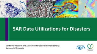
SAR Data Utilizations for Disasters
• Floods
• Japan flood in 2018
• Thailand flood in 2011
• Other floods in Laos, Myanmar, India in 2018
• Landslides
o Landslides after heavy rain in Kyushu
o Landslides after earthquake in Hokkaido
• Earthquakes
o Nepal earthquake in 2015
o Taiwan earthquake in 2016
o Kumamoto earthquake in 2016
o Hokkaido earthquake in 2018
o Indonesia earthqukae: Lombok and Sulawesi in 2018
2
Disasters
3
A false color composite is created, with two of the RGB bands on the "during"
image and one on the "before"
Red : SAR Image before disaster
Green : SAR Image during flood
Blue : SAR Image during flood
http://gsp.humboldt.edu/olm_2015/Courses/GSP_216_Online/images/sartable.png
Before flood
During flood
Bright pixel
Dark pixel
Then, flood is red color
Color composite for detecting disaster
• Roughly identify by backscattering coefficient of water
• Automatic threshold methods (Ostu, clustering)
4
Flood thresholding
• ALOS-2 images
• Image before disaster: 2016/04/29
• Image after disaster: 2017/07/07
Flood in Laos
5
Color composite for detecting disaster
Occurrence date: 23 July 2018
Input data:
ALOS-2 ScanSAR on 29 July 2018 and 1 July 2018
ALOS-2 StripMap on 2 August 2018
Analysis method:
• water detection by before- and during- flood images
• water detection by during flood image
Flood in Myanmar
Flood in Laos
Occurrence date: 23 July 2018
Information: dam collapsed
Input data: ALOS-2 StripMap (SM1)
on 25 July 2018
Analysis method: water detection by
during flood image
Flood in Thailand
Occurrence date: 29 July 2018
Input data:
ALOS-2 StripMap (SM3) on 10 August and 6
April 2018
Analysis method:
• water detection by before- and during-
flood images
Flood in Laos and Thailand
Occurrence date: 9 August 2018
Input data:
Before ALOS-2 StripMap (SM3) on 7 April 2018
Before ALOS-2 ScanSAR (WD1) on 30 April 2018
After ALOS-2 ScanSAR (WD1) on 14 August 2018
After ALOS-2 StripMap (SM3) on 17 August 2018
Analysis method:
• water detection by multi-temporal images
Blue: permanent water
Green: seasonal water
Red: flood water
Flood in India
Interferometry technique
(Source: Soussa abd Bastos 2013)
https://www.nat-hazards-earth-syst-sci.net/13/659/2013/nhess-13-659-2013.pdf
Differential SAR Interferometry (DInSAR) uses
two or more SAR images to generate maps of
surface deformation, using differences in the
phase of the waves returning to the satellite
The need of InSAR technique
▪ Two SAR images are required.
▪ Both the images should have same frequency
(X, C, S, L) and SAR geometry.
9
Nepal Earthquake — 7.8 Mw. on 25 April 2015
Pre-seismic Pre-seismic
Damage assessment by Interferometric coherence
Surface displacement by Interferogram
Nepal Earthquake
Damage assessment by Interferometric coherence
Surface displacement by Interferogram
Kumamoto Earthquake (15 April 2016)
Occurrence date: 29 July 2018
Information: 6.4 Mw.
Input data:
ALOS-2 StripMap on 4 August and 12 May 2018
Analysis method:
• Differential SAR interferometry (DInSAR)
Occurrence date: 5 August 2018
Information: 6.9 Mw.
Input data:
ALOS-2 StripMap on 7 August 2018 and 29 December 2015
Analysis method:
• Differential SAR interferometry (DInSAR)
Earthquake in Lombok Island, Indonesia
Earthquake in Hokkaido, Japan
Occurrence date: 5 September 2018
Information: 6.7 M
Input data:
ALOS-2 StripMap on 6 September and 23 August 2018
Analysis method:
• Before and after-images color composite
• Differential SAR interferometry (DInSAR)
• Backscattering change detection
Occurrence date: 28 September 2018
Information: M7.5, induce tsunami and liquefaction
Input data:
ALOS-2 StripMap on 2018/10/01
ALOS-2 SCANSAR on 2018/10/02, 2018/08/21, 2018/07/10
ALOS-2 StripMap on 2018/10/12, 2018/08/17, 2018/05/11
Analysis method:
• Change of backscattering pattern
• Differential SAR interferometry (DInSAR)
• Interferometric coherence change ScanSAR StripMap
Earthquake and tsunami in Palu, Indonesia
Sentinel-2
ALOS-2
Damaged area
by tsunami
Liquefaction
Damaged area
by tsunami
Liquefaction

More Related Content

What's hot

side-looking airborne radar
side-looking airborne radarside-looking airborne radar
side-looking airborne radarSneha Nalla
 
Thermal remote sensing BY Hariom Ahlawat
Thermal remote sensing BY Hariom AhlawatThermal remote sensing BY Hariom Ahlawat
Thermal remote sensing BY Hariom AhlawatHariom Ahlawat
 
Optical remote sensing
Optical remote sensingOptical remote sensing
Optical remote sensingSumant Diwakar
 
Synthetic aperture radar
Synthetic aperture radar Synthetic aperture radar
Synthetic aperture radar Cigi Cletus
 
Synthetic Aperture Radar (SAR) Basics.pptx
Synthetic Aperture Radar (SAR) Basics.pptxSynthetic Aperture Radar (SAR) Basics.pptx
Synthetic Aperture Radar (SAR) Basics.pptxsapna kinattinkara
 
PHOTOGRAMMETRY (REMOTE SENSING & GIS).pptx
PHOTOGRAMMETRY  (REMOTE SENSING & GIS).pptxPHOTOGRAMMETRY  (REMOTE SENSING & GIS).pptx
PHOTOGRAMMETRY (REMOTE SENSING & GIS).pptxBSuresh26
 
Scanners, image resolution, orbit in remote sensing, pk mani
Scanners, image resolution, orbit in remote sensing, pk maniScanners, image resolution, orbit in remote sensing, pk mani
Scanners, image resolution, orbit in remote sensing, pk maniP.K. Mani
 
1 2 aerial photography
1 2 aerial photography1 2 aerial photography
1 2 aerial photographymayasubodh22
 
Lecture 08 tilted photograph
Lecture 08  tilted photographLecture 08  tilted photograph
Lecture 08 tilted photographSarhat Adam
 
Thermal remote sensing and its applications
Thermal remote sensing and its applicationsThermal remote sensing and its applications
Thermal remote sensing and its applicationschandan00781
 

What's hot (20)

side-looking airborne radar
side-looking airborne radarside-looking airborne radar
side-looking airborne radar
 
Remote sensing
Remote sensingRemote sensing
Remote sensing
 
Introduction-of-GNSS-2
Introduction-of-GNSS-2Introduction-of-GNSS-2
Introduction-of-GNSS-2
 
Thermal remote sensing BY Hariom Ahlawat
Thermal remote sensing BY Hariom AhlawatThermal remote sensing BY Hariom Ahlawat
Thermal remote sensing BY Hariom Ahlawat
 
Microwave remote sensing
Microwave remote sensingMicrowave remote sensing
Microwave remote sensing
 
Optical remote sensing
Optical remote sensingOptical remote sensing
Optical remote sensing
 
Synthetic aperture radar
Synthetic aperture radar Synthetic aperture radar
Synthetic aperture radar
 
Spot satellite
Spot satelliteSpot satellite
Spot satellite
 
Thermal remote sensing
Thermal remote sensingThermal remote sensing
Thermal remote sensing
 
Stereoscopic Parallax
Stereoscopic ParallaxStereoscopic Parallax
Stereoscopic Parallax
 
Synthetic Aperture Radar (SAR) Basics.pptx
Synthetic Aperture Radar (SAR) Basics.pptxSynthetic Aperture Radar (SAR) Basics.pptx
Synthetic Aperture Radar (SAR) Basics.pptx
 
Remote sensing
Remote sensingRemote sensing
Remote sensing
 
PHOTOGRAMMETRY (REMOTE SENSING & GIS).pptx
PHOTOGRAMMETRY  (REMOTE SENSING & GIS).pptxPHOTOGRAMMETRY  (REMOTE SENSING & GIS).pptx
PHOTOGRAMMETRY (REMOTE SENSING & GIS).pptx
 
Scanners, image resolution, orbit in remote sensing, pk mani
Scanners, image resolution, orbit in remote sensing, pk maniScanners, image resolution, orbit in remote sensing, pk mani
Scanners, image resolution, orbit in remote sensing, pk mani
 
1 2 aerial photography
1 2 aerial photography1 2 aerial photography
1 2 aerial photography
 
Optical remote sensing
Optical remote sensingOptical remote sensing
Optical remote sensing
 
Lecture 08 tilted photograph
Lecture 08  tilted photographLecture 08  tilted photograph
Lecture 08 tilted photograph
 
Sar
SarSar
Sar
 
Thermal remote sensing and its applications
Thermal remote sensing and its applicationsThermal remote sensing and its applications
Thermal remote sensing and its applications
 
Gps
GpsGps
Gps
 

Similar to SAR Data Applications for Disasters

2021_Article_.pdf
2021_Article_.pdf2021_Article_.pdf
2021_Article_.pdfgautam3392
 
Flood risk mapping using GIS and remote sensing and SAR
Flood risk mapping using GIS and remote sensing and SARFlood risk mapping using GIS and remote sensing and SAR
Flood risk mapping using GIS and remote sensing and SARRohan Tuteja
 
PSD-T1-AT1-1107-042_TERRASAR-X_FOR_THE_MONITORING_OF_NATURAL_DISASTERS.ppt
PSD-T1-AT1-1107-042_TERRASAR-X_FOR_THE_MONITORING_OF_NATURAL_DISASTERS.pptPSD-T1-AT1-1107-042_TERRASAR-X_FOR_THE_MONITORING_OF_NATURAL_DISASTERS.ppt
PSD-T1-AT1-1107-042_TERRASAR-X_FOR_THE_MONITORING_OF_NATURAL_DISASTERS.pptgrssieee
 
4th SEM THESIS Anurag Ghosh.pptx
4th SEM THESIS Anurag Ghosh.pptx4th SEM THESIS Anurag Ghosh.pptx
4th SEM THESIS Anurag Ghosh.pptxBANKURA UNIVERSITY
 
Snow Cover Estimation from Resourcesat-1 AWiFS – Image Processing with an Aut...
Snow Cover Estimation from Resourcesat-1 AWiFS – Image Processing with an Aut...Snow Cover Estimation from Resourcesat-1 AWiFS – Image Processing with an Aut...
Snow Cover Estimation from Resourcesat-1 AWiFS – Image Processing with an Aut...CSCJournals
 
Disaster monitoring by multi-temporal images of the 2011 Tohoku Earthquake an...
Disaster monitoring by multi-temporal images of the 2011 Tohoku Earthquake an...Disaster monitoring by multi-temporal images of the 2011 Tohoku Earthquake an...
Disaster monitoring by multi-temporal images of the 2011 Tohoku Earthquake an...grssieee
 
Disaster Damage Assessment and Recovery Monitoring Using Night-Time Light on GEE
Disaster Damage Assessment and Recovery Monitoring Using Night-Time Light on GEEDisaster Damage Assessment and Recovery Monitoring Using Night-Time Light on GEE
Disaster Damage Assessment and Recovery Monitoring Using Night-Time Light on GEENopphawanTamkuan
 
Sensor Network for Landslide Monitoring With Laser Ranging System Avoiding Ra...
Sensor Network for Landslide Monitoring With Laser Ranging System Avoiding Ra...Sensor Network for Landslide Monitoring With Laser Ranging System Avoiding Ra...
Sensor Network for Landslide Monitoring With Laser Ranging System Avoiding Ra...Waqas Tariq
 
Water-Body Area Extraction From High Resolution Satellite Images-An Introduct...
Water-Body Area Extraction From High Resolution Satellite Images-An Introduct...Water-Body Area Extraction From High Resolution Satellite Images-An Introduct...
Water-Body Area Extraction From High Resolution Satellite Images-An Introduct...CSCJournals
 
Mapping the Tohoku 2011 Tsunami event with a remote sensing satellite constel...
Mapping the Tohoku 2011 Tsunami event with a remote sensing satellite constel...Mapping the Tohoku 2011 Tsunami event with a remote sensing satellite constel...
Mapping the Tohoku 2011 Tsunami event with a remote sensing satellite constel...Peter Löwe
 
Application of Remote Sensing and GIS Technology for Pre and Post Flood Analy...
Application of Remote Sensing and GIS Technology for Pre and Post Flood Analy...Application of Remote Sensing and GIS Technology for Pre and Post Flood Analy...
Application of Remote Sensing and GIS Technology for Pre and Post Flood Analy...Uzma Fatima Ch.
 
Change detection of water resources using satellite images
Change detection of water resources using satellite imagesChange detection of water resources using satellite images
Change detection of water resources using satellite imagesKasiviswanathChalla
 
Earthquake Damage Detection Using SAR Interferometric Coherence
Earthquake Damage Detection Using SAR Interferometric CoherenceEarthquake Damage Detection Using SAR Interferometric Coherence
Earthquake Damage Detection Using SAR Interferometric CoherenceNopphawanTamkuan
 
Remote Sensing Method for Flood Management System
 Remote Sensing Method for Flood Management System Remote Sensing Method for Flood Management System
Remote Sensing Method for Flood Management SystemIJMREMJournal
 
LARGE SCALE FLOOD MAPPING USING GEOMORPHIC METHODS
LARGE SCALE FLOOD MAPPING USING GEOMORPHIC METHODSLARGE SCALE FLOOD MAPPING USING GEOMORPHIC METHODS
LARGE SCALE FLOOD MAPPING USING GEOMORPHIC METHODSSalvatore Manfreda
 
Supervised classification and improved filtering method for shoreline detection.
Supervised classification and improved filtering method for shoreline detection.Supervised classification and improved filtering method for shoreline detection.
Supervised classification and improved filtering method for shoreline detection.Dr Amira Bibo
 

Similar to SAR Data Applications for Disasters (20)

2021_Article_.pdf
2021_Article_.pdf2021_Article_.pdf
2021_Article_.pdf
 
Flood risk mapping using GIS and remote sensing and SAR
Flood risk mapping using GIS and remote sensing and SARFlood risk mapping using GIS and remote sensing and SAR
Flood risk mapping using GIS and remote sensing and SAR
 
CL#21-0488.pdf
CL#21-0488.pdfCL#21-0488.pdf
CL#21-0488.pdf
 
PSD-T1-AT1-1107-042_TERRASAR-X_FOR_THE_MONITORING_OF_NATURAL_DISASTERS.ppt
PSD-T1-AT1-1107-042_TERRASAR-X_FOR_THE_MONITORING_OF_NATURAL_DISASTERS.pptPSD-T1-AT1-1107-042_TERRASAR-X_FOR_THE_MONITORING_OF_NATURAL_DISASTERS.ppt
PSD-T1-AT1-1107-042_TERRASAR-X_FOR_THE_MONITORING_OF_NATURAL_DISASTERS.ppt
 
4th SEM THESIS Anurag Ghosh.pptx
4th SEM THESIS Anurag Ghosh.pptx4th SEM THESIS Anurag Ghosh.pptx
4th SEM THESIS Anurag Ghosh.pptx
 
Snow Cover Estimation from Resourcesat-1 AWiFS – Image Processing with an Aut...
Snow Cover Estimation from Resourcesat-1 AWiFS – Image Processing with an Aut...Snow Cover Estimation from Resourcesat-1 AWiFS – Image Processing with an Aut...
Snow Cover Estimation from Resourcesat-1 AWiFS – Image Processing with an Aut...
 
Disaster monitoring by multi-temporal images of the 2011 Tohoku Earthquake an...
Disaster monitoring by multi-temporal images of the 2011 Tohoku Earthquake an...Disaster monitoring by multi-temporal images of the 2011 Tohoku Earthquake an...
Disaster monitoring by multi-temporal images of the 2011 Tohoku Earthquake an...
 
Disaster Damage Assessment and Recovery Monitoring Using Night-Time Light on GEE
Disaster Damage Assessment and Recovery Monitoring Using Night-Time Light on GEEDisaster Damage Assessment and Recovery Monitoring Using Night-Time Light on GEE
Disaster Damage Assessment and Recovery Monitoring Using Night-Time Light on GEE
 
Sensor Network for Landslide Monitoring With Laser Ranging System Avoiding Ra...
Sensor Network for Landslide Monitoring With Laser Ranging System Avoiding Ra...Sensor Network for Landslide Monitoring With Laser Ranging System Avoiding Ra...
Sensor Network for Landslide Monitoring With Laser Ranging System Avoiding Ra...
 
Water-Body Area Extraction From High Resolution Satellite Images-An Introduct...
Water-Body Area Extraction From High Resolution Satellite Images-An Introduct...Water-Body Area Extraction From High Resolution Satellite Images-An Introduct...
Water-Body Area Extraction From High Resolution Satellite Images-An Introduct...
 
Mapping the Tohoku 2011 Tsunami event with a remote sensing satellite constel...
Mapping the Tohoku 2011 Tsunami event with a remote sensing satellite constel...Mapping the Tohoku 2011 Tsunami event with a remote sensing satellite constel...
Mapping the Tohoku 2011 Tsunami event with a remote sensing satellite constel...
 
Mapping the Tohoku 2011 Tsunami event with a remote sensing satellite constel...
Mapping the Tohoku 2011 Tsunami event with a remote sensing satellite constel...Mapping the Tohoku 2011 Tsunami event with a remote sensing satellite constel...
Mapping the Tohoku 2011 Tsunami event with a remote sensing satellite constel...
 
Flood Inundated Agricultural Damage and Loss Assessment Using Earth Observati...
Flood Inundated Agricultural Damage and Loss Assessment Using Earth Observati...Flood Inundated Agricultural Damage and Loss Assessment Using Earth Observati...
Flood Inundated Agricultural Damage and Loss Assessment Using Earth Observati...
 
Application of Remote Sensing and GIS Technology for Pre and Post Flood Analy...
Application of Remote Sensing and GIS Technology for Pre and Post Flood Analy...Application of Remote Sensing and GIS Technology for Pre and Post Flood Analy...
Application of Remote Sensing and GIS Technology for Pre and Post Flood Analy...
 
Change detection of water resources using satellite images
Change detection of water resources using satellite imagesChange detection of water resources using satellite images
Change detection of water resources using satellite images
 
Earthquake Damage Detection Using SAR Interferometric Coherence
Earthquake Damage Detection Using SAR Interferometric CoherenceEarthquake Damage Detection Using SAR Interferometric Coherence
Earthquake Damage Detection Using SAR Interferometric Coherence
 
Remote Sensing Method for Flood Management System
 Remote Sensing Method for Flood Management System Remote Sensing Method for Flood Management System
Remote Sensing Method for Flood Management System
 
LARGE SCALE FLOOD MAPPING USING GEOMORPHIC METHODS
LARGE SCALE FLOOD MAPPING USING GEOMORPHIC METHODSLARGE SCALE FLOOD MAPPING USING GEOMORPHIC METHODS
LARGE SCALE FLOOD MAPPING USING GEOMORPHIC METHODS
 
F05843238
F05843238F05843238
F05843238
 
Supervised classification and improved filtering method for shoreline detection.
Supervised classification and improved filtering method for shoreline detection.Supervised classification and improved filtering method for shoreline detection.
Supervised classification and improved filtering method for shoreline detection.
 

More from NopphawanTamkuan

Application of OpenStreetMap in Disaster Risk Management
Application of OpenStreetMap in Disaster Risk ManagementApplication of OpenStreetMap in Disaster Risk Management
Application of OpenStreetMap in Disaster Risk ManagementNopphawanTamkuan
 
Unmanned Aerial Vehicle Application
Unmanned Aerial Vehicle ApplicationUnmanned Aerial Vehicle Application
Unmanned Aerial Vehicle ApplicationNopphawanTamkuan
 
Co-Registration of Small-Scale Satellite Data
Co-Registration of Small-Scale Satellite DataCo-Registration of Small-Scale Satellite Data
Co-Registration of Small-Scale Satellite DataNopphawanTamkuan
 
Introduction to Synthetic Aperture Radar (SAR)
Introduction to Synthetic Aperture Radar (SAR)Introduction to Synthetic Aperture Radar (SAR)
Introduction to Synthetic Aperture Radar (SAR)NopphawanTamkuan
 
Differential SAR Interferometry Using Sentinel-1 Data for Kumamoto Earthquake
Differential SAR Interferometry Using Sentinel-1 Data for Kumamoto EarthquakeDifferential SAR Interferometry Using Sentinel-1 Data for Kumamoto Earthquake
Differential SAR Interferometry Using Sentinel-1 Data for Kumamoto EarthquakeNopphawanTamkuan
 
Color Composite in ENVI (Case Study: Flood in Vietnam)
Color Composite in ENVI (Case Study: Flood in Vietnam)Color Composite in ENVI (Case Study: Flood in Vietnam)
Color Composite in ENVI (Case Study: Flood in Vietnam)NopphawanTamkuan
 
Flood Detection Using ALOS-2 Images in SNAP
Flood Detection Using ALOS-2 Images in SNAPFlood Detection Using ALOS-2 Images in SNAP
Flood Detection Using ALOS-2 Images in SNAPNopphawanTamkuan
 
Differential SAR Interferometry Using ALOS-2 Data for Nepal Earthquake
Differential SAR Interferometry Using ALOS-2 Data for Nepal EarthquakeDifferential SAR Interferometry Using ALOS-2 Data for Nepal Earthquake
Differential SAR Interferometry Using ALOS-2 Data for Nepal EarthquakeNopphawanTamkuan
 
Flood Detection Using During-Flood SAR Image in QGIS
Flood Detection Using During-Flood SAR Image in QGISFlood Detection Using During-Flood SAR Image in QGIS
Flood Detection Using During-Flood SAR Image in QGISNopphawanTamkuan
 
Color Composite in ENVI (Case Study: Flood in Myanmar)
Color Composite in ENVI (Case Study: Flood in Myanmar)Color Composite in ENVI (Case Study: Flood in Myanmar)
Color Composite in ENVI (Case Study: Flood in Myanmar)NopphawanTamkuan
 
Play with Vector and Make Map
Play with Vector and Make MapPlay with Vector and Make Map
Play with Vector and Make MapNopphawanTamkuan
 
Raster Analysis (Color Composite and Remote Sensing Indices)
Raster Analysis (Color Composite and Remote Sensing Indices)Raster Analysis (Color Composite and Remote Sensing Indices)
Raster Analysis (Color Composite and Remote Sensing Indices)NopphawanTamkuan
 
Understanding Basic of Python
Understanding Basic of PythonUnderstanding Basic of Python
Understanding Basic of PythonNopphawanTamkuan
 
Introduction to Geospatial Data
Introduction to Geospatial DataIntroduction to Geospatial Data
Introduction to Geospatial DataNopphawanTamkuan
 
Geospatial Processing with Python
Geospatial Processing with PythonGeospatial Processing with Python
Geospatial Processing with PythonNopphawanTamkuan
 
Setting-Up Python Environment (Jupyter Notebook)
Setting-Up Python Environment (Jupyter Notebook)Setting-Up Python Environment (Jupyter Notebook)
Setting-Up Python Environment (Jupyter Notebook)NopphawanTamkuan
 

More from NopphawanTamkuan (20)

Application of OpenStreetMap in Disaster Risk Management
Application of OpenStreetMap in Disaster Risk ManagementApplication of OpenStreetMap in Disaster Risk Management
Application of OpenStreetMap in Disaster Risk Management
 
Unmanned Aerial Vehicle Application
Unmanned Aerial Vehicle ApplicationUnmanned Aerial Vehicle Application
Unmanned Aerial Vehicle Application
 
Co-Registration of Small-Scale Satellite Data
Co-Registration of Small-Scale Satellite DataCo-Registration of Small-Scale Satellite Data
Co-Registration of Small-Scale Satellite Data
 
Visualizing CDR Data
Visualizing CDR DataVisualizing CDR Data
Visualizing CDR Data
 
Introduction to Synthetic Aperture Radar (SAR)
Introduction to Synthetic Aperture Radar (SAR)Introduction to Synthetic Aperture Radar (SAR)
Introduction to Synthetic Aperture Radar (SAR)
 
Differential SAR Interferometry Using Sentinel-1 Data for Kumamoto Earthquake
Differential SAR Interferometry Using Sentinel-1 Data for Kumamoto EarthquakeDifferential SAR Interferometry Using Sentinel-1 Data for Kumamoto Earthquake
Differential SAR Interferometry Using Sentinel-1 Data for Kumamoto Earthquake
 
Color Composite in ENVI (Case Study: Flood in Vietnam)
Color Composite in ENVI (Case Study: Flood in Vietnam)Color Composite in ENVI (Case Study: Flood in Vietnam)
Color Composite in ENVI (Case Study: Flood in Vietnam)
 
Flood Detection Using ALOS-2 Images in SNAP
Flood Detection Using ALOS-2 Images in SNAPFlood Detection Using ALOS-2 Images in SNAP
Flood Detection Using ALOS-2 Images in SNAP
 
Differential SAR Interferometry Using ALOS-2 Data for Nepal Earthquake
Differential SAR Interferometry Using ALOS-2 Data for Nepal EarthquakeDifferential SAR Interferometry Using ALOS-2 Data for Nepal Earthquake
Differential SAR Interferometry Using ALOS-2 Data for Nepal Earthquake
 
Flood Detection Using During-Flood SAR Image in QGIS
Flood Detection Using During-Flood SAR Image in QGISFlood Detection Using During-Flood SAR Image in QGIS
Flood Detection Using During-Flood SAR Image in QGIS
 
Color Composite in ENVI (Case Study: Flood in Myanmar)
Color Composite in ENVI (Case Study: Flood in Myanmar)Color Composite in ENVI (Case Study: Flood in Myanmar)
Color Composite in ENVI (Case Study: Flood in Myanmar)
 
Play with Vector and Make Map
Play with Vector and Make MapPlay with Vector and Make Map
Play with Vector and Make Map
 
Raster Analysis (Color Composite and Remote Sensing Indices)
Raster Analysis (Color Composite and Remote Sensing Indices)Raster Analysis (Color Composite and Remote Sensing Indices)
Raster Analysis (Color Composite and Remote Sensing Indices)
 
Image Classification
Image ClassificationImage Classification
Image Classification
 
Useful Tools in QGIS
Useful Tools in QGISUseful Tools in QGIS
Useful Tools in QGIS
 
Understanding Basic of Python
Understanding Basic of PythonUnderstanding Basic of Python
Understanding Basic of Python
 
Introduction to Geospatial Data
Introduction to Geospatial DataIntroduction to Geospatial Data
Introduction to Geospatial Data
 
Geospatial Processing with Python
Geospatial Processing with PythonGeospatial Processing with Python
Geospatial Processing with Python
 
Setting-Up Python Environment (Jupyter Notebook)
Setting-Up Python Environment (Jupyter Notebook)Setting-Up Python Environment (Jupyter Notebook)
Setting-Up Python Environment (Jupyter Notebook)
 
Keras and TensorFlow
Keras and TensorFlowKeras and TensorFlow
Keras and TensorFlow
 

Recently uploaded

Measures of Central Tendency: Mean, Median and Mode
Measures of Central Tendency: Mean, Median and ModeMeasures of Central Tendency: Mean, Median and Mode
Measures of Central Tendency: Mean, Median and ModeThiyagu K
 
18-04-UA_REPORT_MEDIALITERAСY_INDEX-DM_23-1-final-eng.pdf
18-04-UA_REPORT_MEDIALITERAСY_INDEX-DM_23-1-final-eng.pdf18-04-UA_REPORT_MEDIALITERAСY_INDEX-DM_23-1-final-eng.pdf
18-04-UA_REPORT_MEDIALITERAСY_INDEX-DM_23-1-final-eng.pdfssuser54595a
 
Contemporary philippine arts from the regions_PPT_Module_12 [Autosaved] (1).pptx
Contemporary philippine arts from the regions_PPT_Module_12 [Autosaved] (1).pptxContemporary philippine arts from the regions_PPT_Module_12 [Autosaved] (1).pptx
Contemporary philippine arts from the regions_PPT_Module_12 [Autosaved] (1).pptxRoyAbrique
 
How to Make a Pirate ship Primary Education.pptx
How to Make a Pirate ship Primary Education.pptxHow to Make a Pirate ship Primary Education.pptx
How to Make a Pirate ship Primary Education.pptxmanuelaromero2013
 
CARE OF CHILD IN INCUBATOR..........pptx
CARE OF CHILD IN INCUBATOR..........pptxCARE OF CHILD IN INCUBATOR..........pptx
CARE OF CHILD IN INCUBATOR..........pptxGaneshChakor2
 
Student login on Anyboli platform.helpin
Student login on Anyboli platform.helpinStudent login on Anyboli platform.helpin
Student login on Anyboli platform.helpinRaunakKeshri1
 
microwave assisted reaction. General introduction
microwave assisted reaction. General introductionmicrowave assisted reaction. General introduction
microwave assisted reaction. General introductionMaksud Ahmed
 
SOCIAL AND HISTORICAL CONTEXT - LFTVD.pptx
SOCIAL AND HISTORICAL CONTEXT - LFTVD.pptxSOCIAL AND HISTORICAL CONTEXT - LFTVD.pptx
SOCIAL AND HISTORICAL CONTEXT - LFTVD.pptxiammrhaywood
 
Hybridoma Technology ( Production , Purification , and Application )
Hybridoma Technology  ( Production , Purification , and Application  ) Hybridoma Technology  ( Production , Purification , and Application  )
Hybridoma Technology ( Production , Purification , and Application ) Sakshi Ghasle
 
1029-Danh muc Sach Giao Khoa khoi 6.pdf
1029-Danh muc Sach Giao Khoa khoi  6.pdf1029-Danh muc Sach Giao Khoa khoi  6.pdf
1029-Danh muc Sach Giao Khoa khoi 6.pdfQucHHunhnh
 
Paris 2024 Olympic Geographies - an activity
Paris 2024 Olympic Geographies - an activityParis 2024 Olympic Geographies - an activity
Paris 2024 Olympic Geographies - an activityGeoBlogs
 
Mastering the Unannounced Regulatory Inspection
Mastering the Unannounced Regulatory InspectionMastering the Unannounced Regulatory Inspection
Mastering the Unannounced Regulatory InspectionSafetyChain Software
 
Separation of Lanthanides/ Lanthanides and Actinides
Separation of Lanthanides/ Lanthanides and ActinidesSeparation of Lanthanides/ Lanthanides and Actinides
Separation of Lanthanides/ Lanthanides and ActinidesFatimaKhan178732
 
mini mental status format.docx
mini    mental       status     format.docxmini    mental       status     format.docx
mini mental status format.docxPoojaSen20
 
Call Girls in Dwarka Mor Delhi Contact Us 9654467111
Call Girls in Dwarka Mor Delhi Contact Us 9654467111Call Girls in Dwarka Mor Delhi Contact Us 9654467111
Call Girls in Dwarka Mor Delhi Contact Us 9654467111Sapana Sha
 
The basics of sentences session 2pptx copy.pptx
The basics of sentences session 2pptx copy.pptxThe basics of sentences session 2pptx copy.pptx
The basics of sentences session 2pptx copy.pptxheathfieldcps1
 
Nutritional Needs Presentation - HLTH 104
Nutritional Needs Presentation - HLTH 104Nutritional Needs Presentation - HLTH 104
Nutritional Needs Presentation - HLTH 104misteraugie
 
URLs and Routing in the Odoo 17 Website App
URLs and Routing in the Odoo 17 Website AppURLs and Routing in the Odoo 17 Website App
URLs and Routing in the Odoo 17 Website AppCeline George
 

Recently uploaded (20)

Measures of Central Tendency: Mean, Median and Mode
Measures of Central Tendency: Mean, Median and ModeMeasures of Central Tendency: Mean, Median and Mode
Measures of Central Tendency: Mean, Median and Mode
 
18-04-UA_REPORT_MEDIALITERAСY_INDEX-DM_23-1-final-eng.pdf
18-04-UA_REPORT_MEDIALITERAСY_INDEX-DM_23-1-final-eng.pdf18-04-UA_REPORT_MEDIALITERAСY_INDEX-DM_23-1-final-eng.pdf
18-04-UA_REPORT_MEDIALITERAСY_INDEX-DM_23-1-final-eng.pdf
 
Staff of Color (SOC) Retention Efforts DDSD
Staff of Color (SOC) Retention Efforts DDSDStaff of Color (SOC) Retention Efforts DDSD
Staff of Color (SOC) Retention Efforts DDSD
 
Contemporary philippine arts from the regions_PPT_Module_12 [Autosaved] (1).pptx
Contemporary philippine arts from the regions_PPT_Module_12 [Autosaved] (1).pptxContemporary philippine arts from the regions_PPT_Module_12 [Autosaved] (1).pptx
Contemporary philippine arts from the regions_PPT_Module_12 [Autosaved] (1).pptx
 
Mattingly "AI & Prompt Design: Structured Data, Assistants, & RAG"
Mattingly "AI & Prompt Design: Structured Data, Assistants, & RAG"Mattingly "AI & Prompt Design: Structured Data, Assistants, & RAG"
Mattingly "AI & Prompt Design: Structured Data, Assistants, & RAG"
 
How to Make a Pirate ship Primary Education.pptx
How to Make a Pirate ship Primary Education.pptxHow to Make a Pirate ship Primary Education.pptx
How to Make a Pirate ship Primary Education.pptx
 
CARE OF CHILD IN INCUBATOR..........pptx
CARE OF CHILD IN INCUBATOR..........pptxCARE OF CHILD IN INCUBATOR..........pptx
CARE OF CHILD IN INCUBATOR..........pptx
 
Student login on Anyboli platform.helpin
Student login on Anyboli platform.helpinStudent login on Anyboli platform.helpin
Student login on Anyboli platform.helpin
 
microwave assisted reaction. General introduction
microwave assisted reaction. General introductionmicrowave assisted reaction. General introduction
microwave assisted reaction. General introduction
 
SOCIAL AND HISTORICAL CONTEXT - LFTVD.pptx
SOCIAL AND HISTORICAL CONTEXT - LFTVD.pptxSOCIAL AND HISTORICAL CONTEXT - LFTVD.pptx
SOCIAL AND HISTORICAL CONTEXT - LFTVD.pptx
 
Hybridoma Technology ( Production , Purification , and Application )
Hybridoma Technology  ( Production , Purification , and Application  ) Hybridoma Technology  ( Production , Purification , and Application  )
Hybridoma Technology ( Production , Purification , and Application )
 
1029-Danh muc Sach Giao Khoa khoi 6.pdf
1029-Danh muc Sach Giao Khoa khoi  6.pdf1029-Danh muc Sach Giao Khoa khoi  6.pdf
1029-Danh muc Sach Giao Khoa khoi 6.pdf
 
Paris 2024 Olympic Geographies - an activity
Paris 2024 Olympic Geographies - an activityParis 2024 Olympic Geographies - an activity
Paris 2024 Olympic Geographies - an activity
 
Mastering the Unannounced Regulatory Inspection
Mastering the Unannounced Regulatory InspectionMastering the Unannounced Regulatory Inspection
Mastering the Unannounced Regulatory Inspection
 
Separation of Lanthanides/ Lanthanides and Actinides
Separation of Lanthanides/ Lanthanides and ActinidesSeparation of Lanthanides/ Lanthanides and Actinides
Separation of Lanthanides/ Lanthanides and Actinides
 
mini mental status format.docx
mini    mental       status     format.docxmini    mental       status     format.docx
mini mental status format.docx
 
Call Girls in Dwarka Mor Delhi Contact Us 9654467111
Call Girls in Dwarka Mor Delhi Contact Us 9654467111Call Girls in Dwarka Mor Delhi Contact Us 9654467111
Call Girls in Dwarka Mor Delhi Contact Us 9654467111
 
The basics of sentences session 2pptx copy.pptx
The basics of sentences session 2pptx copy.pptxThe basics of sentences session 2pptx copy.pptx
The basics of sentences session 2pptx copy.pptx
 
Nutritional Needs Presentation - HLTH 104
Nutritional Needs Presentation - HLTH 104Nutritional Needs Presentation - HLTH 104
Nutritional Needs Presentation - HLTH 104
 
URLs and Routing in the Odoo 17 Website App
URLs and Routing in the Odoo 17 Website AppURLs and Routing in the Odoo 17 Website App
URLs and Routing in the Odoo 17 Website App
 

SAR Data Applications for Disasters

  • 1. Center for Research and Application for Satellite Remote Sensing Yamaguchi University SAR Data Utilizations for Disasters
  • 2. • Floods • Japan flood in 2018 • Thailand flood in 2011 • Other floods in Laos, Myanmar, India in 2018 • Landslides o Landslides after heavy rain in Kyushu o Landslides after earthquake in Hokkaido • Earthquakes o Nepal earthquake in 2015 o Taiwan earthquake in 2016 o Kumamoto earthquake in 2016 o Hokkaido earthquake in 2018 o Indonesia earthqukae: Lombok and Sulawesi in 2018 2 Disasters
  • 3. 3 A false color composite is created, with two of the RGB bands on the "during" image and one on the "before" Red : SAR Image before disaster Green : SAR Image during flood Blue : SAR Image during flood http://gsp.humboldt.edu/olm_2015/Courses/GSP_216_Online/images/sartable.png Before flood During flood Bright pixel Dark pixel Then, flood is red color Color composite for detecting disaster
  • 4. • Roughly identify by backscattering coefficient of water • Automatic threshold methods (Ostu, clustering) 4 Flood thresholding
  • 5. • ALOS-2 images • Image before disaster: 2016/04/29 • Image after disaster: 2017/07/07 Flood in Laos 5 Color composite for detecting disaster
  • 6. Occurrence date: 23 July 2018 Input data: ALOS-2 ScanSAR on 29 July 2018 and 1 July 2018 ALOS-2 StripMap on 2 August 2018 Analysis method: • water detection by before- and during- flood images • water detection by during flood image Flood in Myanmar
  • 7. Flood in Laos Occurrence date: 23 July 2018 Information: dam collapsed Input data: ALOS-2 StripMap (SM1) on 25 July 2018 Analysis method: water detection by during flood image Flood in Thailand Occurrence date: 29 July 2018 Input data: ALOS-2 StripMap (SM3) on 10 August and 6 April 2018 Analysis method: • water detection by before- and during- flood images Flood in Laos and Thailand
  • 8. Occurrence date: 9 August 2018 Input data: Before ALOS-2 StripMap (SM3) on 7 April 2018 Before ALOS-2 ScanSAR (WD1) on 30 April 2018 After ALOS-2 ScanSAR (WD1) on 14 August 2018 After ALOS-2 StripMap (SM3) on 17 August 2018 Analysis method: • water detection by multi-temporal images Blue: permanent water Green: seasonal water Red: flood water Flood in India
  • 9. Interferometry technique (Source: Soussa abd Bastos 2013) https://www.nat-hazards-earth-syst-sci.net/13/659/2013/nhess-13-659-2013.pdf Differential SAR Interferometry (DInSAR) uses two or more SAR images to generate maps of surface deformation, using differences in the phase of the waves returning to the satellite The need of InSAR technique ▪ Two SAR images are required. ▪ Both the images should have same frequency (X, C, S, L) and SAR geometry. 9
  • 10. Nepal Earthquake — 7.8 Mw. on 25 April 2015 Pre-seismic Pre-seismic Damage assessment by Interferometric coherence Surface displacement by Interferogram Nepal Earthquake
  • 11. Damage assessment by Interferometric coherence Surface displacement by Interferogram Kumamoto Earthquake (15 April 2016)
  • 12. Occurrence date: 29 July 2018 Information: 6.4 Mw. Input data: ALOS-2 StripMap on 4 August and 12 May 2018 Analysis method: • Differential SAR interferometry (DInSAR) Occurrence date: 5 August 2018 Information: 6.9 Mw. Input data: ALOS-2 StripMap on 7 August 2018 and 29 December 2015 Analysis method: • Differential SAR interferometry (DInSAR) Earthquake in Lombok Island, Indonesia
  • 13. Earthquake in Hokkaido, Japan Occurrence date: 5 September 2018 Information: 6.7 M Input data: ALOS-2 StripMap on 6 September and 23 August 2018 Analysis method: • Before and after-images color composite • Differential SAR interferometry (DInSAR) • Backscattering change detection
  • 14.
  • 15. Occurrence date: 28 September 2018 Information: M7.5, induce tsunami and liquefaction Input data: ALOS-2 StripMap on 2018/10/01 ALOS-2 SCANSAR on 2018/10/02, 2018/08/21, 2018/07/10 ALOS-2 StripMap on 2018/10/12, 2018/08/17, 2018/05/11 Analysis method: • Change of backscattering pattern • Differential SAR interferometry (DInSAR) • Interferometric coherence change ScanSAR StripMap Earthquake and tsunami in Palu, Indonesia