This content shows how to download data from USGS explorer, color composition for Landsat-8 and Sentinel-2, extract specific area, and remote sensing indices (NDVI and NDWI) using raster calculator.
Data Processing Using IRS Satellite Imagery for Disaster Monitoring (Case Stu...NopphawanTamkuan
This content shows IRS specification (Indian satellite), color composition, NDVI calculation, extracting damaged areas and comparison of Landsat-8 and IRS for the case study of earthquake in Indonesia.
Data Processing Using THEOS Satellite Imagery for Disaster Monitoring (Case S...NopphawanTamkuan
This content shows the specification of THEOS/Thaichote (Thai satellite), information of flood in Vietnam, comparison of pre-disaster image (Landsat-8) and post-disaster image (THEOS) by different methods such as color composite, thresholding, and segmentation for flooded areas classification.
Data Processing Using DIWATA-1 Microsatellite Imagery for Disaster MonitoringNopphawanTamkuan
This content shows the specification of DIWATA-1 (Philippine Microsatellite), create a new account, data downloading, image processing (NDVI and color composition) between pre- and post-flood.
Data Processing Using DubaiSat Satellite Imagery for Disaster Monitoring (Cas...NopphawanTamkuan
This content shows the specification of DubaiSat (UAE satellite), information of Hokkaido earthquake, data processing, pre-processing, pan-sharpening, Natural color composite, false color composite, NDVI calculation, image classification by clustering for the damaged area and landslide detection.
Introduce variable/ Indices using landsat imageKabir Uddin
Image Index is a “synthetic image layer” created from the existing bands of a multispectral image. This new layer often provides unique and valuable information not found in any of the other individual bands.
Image index is a calculated result or generated product from satellite band/channels
It helps to identify different land cover from mathematical definition .
Multi-Spectral Analysis of Satellite Imagery for Inventory of Sensitive Marin...Keith VanGraafeiland
An inventory of benthic marine habitats can be obtained from recent satellite images. During Sub Sea Survey 2008 in Galveston Texas opportunities to preform multi-spectral analysis against satellite imagery were discussed in this presentation.
Crop identification using geo spatial technologiesGodiSaiKiran
The ability to identify crop type makes it possible to estimate the area allocated to each crop type and thus compute relevant statistics providing essential information for crop control of area-based subsidies .Accurate and faster estimation of crop area is very essential for projecting yearly agriculture and deciding agriculture policies.
. Government agencies and agricultural managers require information on the spatial distribution and area of cultivated crops for planning purposes. Agencies can more adequately plan the import and export of food products based on such information. Although some ministries of agriculture and food security annually commission their staff to map different crop types, these ground surveys are expensive and yet cover only a sample of farms. Remote sensing data, together with ancillary lo information, enable the determination of the spatial distribution of crops at varying spatial scales with relatively little financial resources.
A gentle introduction into remote sensing by Harald Schernthanner, Christian Kuntzsch and Andreas Frigge. The presentation was held at Maytime BER on march 1st.
This content presents a guide to access satellite (Landsat-8) and microsatellite (Diwata), and how to use gdal and AROSIC (Python-based open-source software) for co-registration.
Pixel Classification of SAR ice images using ANFIS-PSO Classifierijeei-iaes
Synthetic Aperture Radar (SAR) is playing a vital role in taking extremely high resolution radar images. It is greatly used to monitor the ice covered ocean regions. Sea monitoring is important for various purposes which includes global climate systems and ship navigation. Classification on the ice infested area gives important features which will be further useful for various monitoring process around the ice regions. Main objective of this paper is to classify the SAR ice image that helps in identifying the regions around the ice infested areas. In this paper three stages are considered in classification of SAR ice images. It starts with preprocessing in which the speckled SAR ice images are denoised using various speckle removal filters; comparison is made on all these filters to find the best filter in speckle removal. Second stage includes segmentation in which different regions are segmented using K-means and watershed segmentation algorithms; comparison is made between these two algorithms to find the best in segmenting SAR ice images. The last stage includes pixel based classification which identifies and classifies the segmented regions using various supervised learning classifiers. The algorithms includes Back propagation neural networks (BPN), Fuzzy Classifier, Adaptive Neuro Fuzzy Inference Classifier (ANFIS) classifier and proposed ANFIS with Particle Swarm Optimization (PSO) classifier; comparison is made on all these classifiers to propose which classifier is best suitable for classifying the SAR ice image. Various evaluation metrics are performed separately at all these three stages.
Application of OpenStreetMap in Disaster Risk ManagementNopphawanTamkuan
This content presents the four procedures were investigated in detail with an emphasis on simplicity for application to disaster management (download from OSM website, download using QGIS plugin, download a file converted to a universal file format (shapefile) and adding rendered map in the background). The use of these data for resilient urban planning are demonstrated including setting a hazard layer (flood Model), setting an exposure layer (population) and exposure analysis using InaSAFE plugin.
Introduce variable/ Indices using landsat imageKabir Uddin
Image Index is a “synthetic image layer” created from the existing bands of a multispectral image. This new layer often provides unique and valuable information not found in any of the other individual bands.
Image index is a calculated result or generated product from satellite band/channels
It helps to identify different land cover from mathematical definition .
Multi-Spectral Analysis of Satellite Imagery for Inventory of Sensitive Marin...Keith VanGraafeiland
An inventory of benthic marine habitats can be obtained from recent satellite images. During Sub Sea Survey 2008 in Galveston Texas opportunities to preform multi-spectral analysis against satellite imagery were discussed in this presentation.
Crop identification using geo spatial technologiesGodiSaiKiran
The ability to identify crop type makes it possible to estimate the area allocated to each crop type and thus compute relevant statistics providing essential information for crop control of area-based subsidies .Accurate and faster estimation of crop area is very essential for projecting yearly agriculture and deciding agriculture policies.
. Government agencies and agricultural managers require information on the spatial distribution and area of cultivated crops for planning purposes. Agencies can more adequately plan the import and export of food products based on such information. Although some ministries of agriculture and food security annually commission their staff to map different crop types, these ground surveys are expensive and yet cover only a sample of farms. Remote sensing data, together with ancillary lo information, enable the determination of the spatial distribution of crops at varying spatial scales with relatively little financial resources.
A gentle introduction into remote sensing by Harald Schernthanner, Christian Kuntzsch and Andreas Frigge. The presentation was held at Maytime BER on march 1st.
This content presents a guide to access satellite (Landsat-8) and microsatellite (Diwata), and how to use gdal and AROSIC (Python-based open-source software) for co-registration.
Pixel Classification of SAR ice images using ANFIS-PSO Classifierijeei-iaes
Synthetic Aperture Radar (SAR) is playing a vital role in taking extremely high resolution radar images. It is greatly used to monitor the ice covered ocean regions. Sea monitoring is important for various purposes which includes global climate systems and ship navigation. Classification on the ice infested area gives important features which will be further useful for various monitoring process around the ice regions. Main objective of this paper is to classify the SAR ice image that helps in identifying the regions around the ice infested areas. In this paper three stages are considered in classification of SAR ice images. It starts with preprocessing in which the speckled SAR ice images are denoised using various speckle removal filters; comparison is made on all these filters to find the best filter in speckle removal. Second stage includes segmentation in which different regions are segmented using K-means and watershed segmentation algorithms; comparison is made between these two algorithms to find the best in segmenting SAR ice images. The last stage includes pixel based classification which identifies and classifies the segmented regions using various supervised learning classifiers. The algorithms includes Back propagation neural networks (BPN), Fuzzy Classifier, Adaptive Neuro Fuzzy Inference Classifier (ANFIS) classifier and proposed ANFIS with Particle Swarm Optimization (PSO) classifier; comparison is made on all these classifiers to propose which classifier is best suitable for classifying the SAR ice image. Various evaluation metrics are performed separately at all these three stages.
Similar to Raster Analysis (Color Composite and Remote Sensing Indices) (20)
Application of OpenStreetMap in Disaster Risk ManagementNopphawanTamkuan
This content presents the four procedures were investigated in detail with an emphasis on simplicity for application to disaster management (download from OSM website, download using QGIS plugin, download a file converted to a universal file format (shapefile) and adding rendered map in the background). The use of these data for resilient urban planning are demonstrated including setting a hazard layer (flood Model), setting an exposure layer (population) and exposure analysis using InaSAFE plugin.
This content describes Call Detail Records (CDR) data format, data acquisition method, visualize in Mobmap and the applications for disaster management.
Disaster Damage Assessment and Recovery Monitoring Using Night-Time Light on GEENopphawanTamkuan
This content shows the possibility and useful cases of night-time light data to assess disaster damages and recovery in post-disaster situations such as Hokkaido earthquake, dam eruption in Laos and Kerala flood in India. Moreover, how to browse and profiling night-time light on GEE are demonstrated here.
This content presents for basic of Synthetic Aperture Radar (SAR) including its geometry, how the image is created, essential parameters, interpretation, SAR sensor specification, and advantages and disadvantages.
Differential SAR Interferometry Using Sentinel-1 Data for Kumamoto EarthquakeNopphawanTamkuan
This content presents step by step of Differential SAR Interferometry or DInSAR analysis in SNAP. The case study is Kumamoto Earthquake using Sentinel-1.
Earthquake Damage Detection Using SAR Interferometric CoherenceNopphawanTamkuan
This content presents how to apply interferometric analysis for damage detection. The case study is the Kumamoto earthquake in 2016. ALOS-2 images are used to calculate interferometric coherence, and estimate coherence change of images between before- and during earthquake to estimate possible degree of damage areas.
How to better understand SAR, interpret SAR products and realize the limitationsNopphawanTamkuan
This content shows how to better understand SAR (how to interpret SAR images and read SAR interferogram ). Moreover, capacities and limitations of SAR are discussed for each disaster emergency mapping (Flood, Landslide and Earthquake).
This content presents how to detect water or flood areas using ALOS-2 images before and during floods. First, it shows how to calibrate intensity to dB, find threshold value and apply to images.
Differential SAR Interferometry Using ALOS-2 Data for Nepal EarthquakeNopphawanTamkuan
This content presents Differential SAR Interferometry or DInSAR analysis with GMTSAR (on Linux based OS, download DEM, prepare directories for processing). The case study is Nepal earthquake in 2015 using ALOS-2.
This content shows geospatial data sources for Japan and global data, coordinate reference system, and create a map of population density (Vector analysis: dissolve vector, join table, calculate area and population density.
This content presents how to classify satellite image by QGIS Semi-automatic classification plugin. It includes pre-processing, create a region of interest (AOI), and applying classification methods.
This content provides basic python before starting geospatial analysis. It starts from data type, variable, basic coding, condition statement, loop, while, and how to read file.
This content introduces geospatial data and preparing the environment (install QGIS, Gdal, python, and some necessary libraries). Moreover, it shows how to start coding python and using Jupyter.
Welcome to TechSoup New Member Orientation and Q&A (May 2024).pdfTechSoup
In this webinar you will learn how your organization can access TechSoup's wide variety of product discount and donation programs. From hardware to software, we'll give you a tour of the tools available to help your nonprofit with productivity, collaboration, financial management, donor tracking, security, and more.
The French Revolution, which began in 1789, was a period of radical social and political upheaval in France. It marked the decline of absolute monarchies, the rise of secular and democratic republics, and the eventual rise of Napoleon Bonaparte. This revolutionary period is crucial in understanding the transition from feudalism to modernity in Europe.
For more information, visit-www.vavaclasses.com
How to Create Map Views in the Odoo 17 ERPCeline George
The map views are useful for providing a geographical representation of data. They allow users to visualize and analyze the data in a more intuitive manner.
Unit 8 - Information and Communication Technology (Paper I).pdfThiyagu K
This slides describes the basic concepts of ICT, basics of Email, Emerging Technology and Digital Initiatives in Education. This presentations aligns with the UGC Paper I syllabus.
The Indian economy is classified into different sectors to simplify the analysis and understanding of economic activities. For Class 10, it's essential to grasp the sectors of the Indian economy, understand their characteristics, and recognize their importance. This guide will provide detailed notes on the Sectors of the Indian Economy Class 10, using specific long-tail keywords to enhance comprehension.
For more information, visit-www.vavaclasses.com
2024.06.01 Introducing a competency framework for languag learning materials ...Sandy Millin
http://sandymillin.wordpress.com/iateflwebinar2024
Published classroom materials form the basis of syllabuses, drive teacher professional development, and have a potentially huge influence on learners, teachers and education systems. All teachers also create their own materials, whether a few sentences on a blackboard, a highly-structured fully-realised online course, or anything in between. Despite this, the knowledge and skills needed to create effective language learning materials are rarely part of teacher training, and are mostly learnt by trial and error.
Knowledge and skills frameworks, generally called competency frameworks, for ELT teachers, trainers and managers have existed for a few years now. However, until I created one for my MA dissertation, there wasn’t one drawing together what we need to know and do to be able to effectively produce language learning materials.
This webinar will introduce you to my framework, highlighting the key competencies I identified from my research. It will also show how anybody involved in language teaching (any language, not just English!), teacher training, managing schools or developing language learning materials can benefit from using the framework.
Palestine last event orientationfvgnh .pptxRaedMohamed3
An EFL lesson about the current events in Palestine. It is intended to be for intermediate students who wish to increase their listening skills through a short lesson in power point.
Read| The latest issue of The Challenger is here! We are thrilled to announce that our school paper has qualified for the NATIONAL SCHOOLS PRESS CONFERENCE (NSPC) 2024. Thank you for your unwavering support and trust. Dive into the stories that made us stand out!
Overview on Edible Vaccine: Pros & Cons with Mechanism
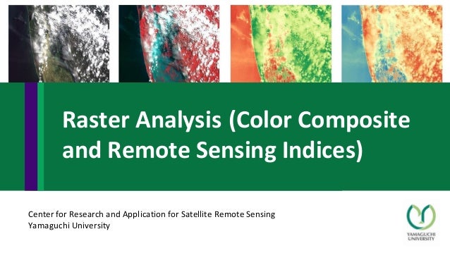
Raster Analysis (Color Composite and Remote Sensing Indices)
1. Center for Research and Application for Satellite Remote Sensing
Yamaguchi University
Raster Analysis (Color Composite
and Remote Sensing Indices)
2. Contents
• Color composite
• True color composite
• False color
• Remote Sensing Indices
• Normalized difference vegetation index (NDVI)
• Normalized difference water index (NDWI)
4. Apply your account
https://earthexplorer.usgs.gov/
There are 4 steps of search criteria
1) set location and time
2) Select data sets
3) Additional criteria (can skip or
set your criteria such as %less cloud)
4) See the results of the criteria
1 2 3 4
USGS explorer for downloading data
16. 1st method
• Right click at the image layer → save as → select map view extent
2nd method
• QGIS 3 => Raster → extraction → clip raster by extent → In clipping extent
→ click “…” → use layer/canvas extent → use canvas extent → name your
output file and save
• QGIS 2.18 => Raster → extraction → clipper → extent → drag on canvas →
name your output file and save
Extract only specific area
18. • True color composite
• False color composite
http://gsp.humboldt.edu/olm_2016/courses/GSP_216_Online/lesson3-1/composite.html
Red: red band (Band 4, Landsat-8)
Green: green band (Band 3, Landsat-8)
Blue: blue band (Band 2, Landsat-8)
Red: NIR band (Band 5, Landsat-8)
Green: red band (Band 4, Landsat-8)
Blue: green band (Band 3, Landsat-8)
Satellite image visualization
19. • Right click at layer → properties → Style → in band rendering select “multiband color”
True color composite
False color composite
20. Normalized difference vegetation index (NDVI)
NDVI = (NIR – RED) / (NIR + RED)
Normalized difference water index (NDWI)
NDWI = (Green – NIR) / (Green + NIR)
0
-1 +1
0
-1 +1
Healthy vegetation
Non-vegetation
Water
Non-water
https://midopt.com/healthy-crop/
defined by McFeeters (1996)
Remote sensing indices
Image:
22. Landsat-8 : NDVI
• Normalized difference vegetation index (NDVI)
NDVI = (NIR – RED) / (NIR + RED)
You can find more indices here: https://medium.com/regen-network/remote-sensing-indices-389153e3d947
• Therefore, NDVI of Landsat-8 is
NDVI = (Band 5 – Band 4) / (Band 5 + Band 4)
• OR, NDVI of our merged image is
NDVI = (Layer 4 – Layer 3) / (Layer 4 + Layer 3)
23. Landsat-8 : NDWI
• Normalized difference water index (NDWI)
NDWI = (Green – NIR) / (Green + NIR)
• Therefore, NDWI of Landsat-8 is
NDWI = (Band 3 – Band 5) / (Band 3 + Band 5)
• OR, NDWI of our merged image is
NDWI = (Layer 2 – Layer 4) / (Layer 2 + Layer 4)
You can find more indices here: https://medium.com/regen-network/remote-sensing-indices-389153e3d947
Photo by Anastasia
Taioglou on Unsplash
24. Sentinel-2 : NDVI
• Normalized difference vegetation index (NDVI)
NDVI = (NIR – RED) / (NIR + RED)
You can find more indices here: https://medium.com/regen-network/remote-sensing-indices-389153e3d947
• Therefore, NDVI of Sentinel-2 is
NDVI = (Band 8 – Band 4) / (Band 8 + Band 4)
• OR, NDVI of our merged image is
NDVI = (Layer 4 – Layer 3) / (Layer 4 + Layer 3)
Photo by Marita
Kavelashvili on Unsplash
25. Sentinel-2 : NDWI
• Normalized difference water index (NDWI)
NDWI = (Green – NIR) / (Green + NIR)
• Therefore, NDWI of Sentinel-2 is
NDWI = (Band 3 – Band 8) / (Band 3 + Band 8)
• OR, NDWI of our merged image is
NDWI = (Layer 2 – Layer 4) / (Layer 2 + Layer 4)
You can find more indices here: https://medium.com/regen-network/remote-sensing-indices-389153e3d947
Photo by Anastasia
Taioglou on Unsplash
26. • Raster → Raster calculator
High NDVI
High NDVI
Low NDVI
Low NDVI
Image can be colored → go to layer properties
→ Singleband pseudocolor → change color