SlideShare a Scribd company logo
1 of 15
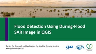
Center for Research and Application for Satellite Remote Sensing
Yamaguchi University
Flood Detection Using During-Flood
SAR Image in QGIS
Photo by rachman reilli on Unsplash
Background
Floods in Bangladesh on 28 September 2015
Data used Sentinel Asia
- Geotiff SAR Image
- “JPJXisis0001201509080028.tif”
Schematic Diagram of the Methodology
Step 01
3
Launch QGIS and Read the Image
Layer> Add Layer> Add Raster Layer
Steps in QGIS
Study the Image, Look for Range of DN values for
Probable Flooded Areas
4
Step 02
Use the Identify feature to see the range of dark
pixels in the image
After Several ROIs, fix the range of DN values for the
probable flooded areas
In the Image, we will use a range of say [10 , 28]
Steps in QGIS
5
Masking the Image
Image Name
Expression
Step 03 Raster > Raster Calculator
"JPJXisis0001201509080028@1" >= 10 AND "JPJXisis0001201509080028@1" <= 28
Steps in QGIS
6
Repeat the Process (with different ranges) Unless you are Satisfied With the Masking Results
White Pixels Probable
Flooded Areas
Perform an Unsupervised Classification
7
Step 04 Processing >
Toolbox
Unsupervised KMeans image classification
We need only 2 classes
8
Output Classified Image Black Pixels
Probable
Flooded
Areas
The Classified Image
9
Subset
Step 05
Raster > Extraction > Clipper
Steps in QGIS
10
The Classified clipped Image
11
Step 06
Raster > Analysis > Sieve
Before Smoothing
After Smoothing
Smoothing
12
Project > New Print Composer
Step 07
Title of the Map
Add New Map
Step 08
Drag and Drop here
Create Map
13
Add Legend and Draw Grid
Step 09
Create Map
Add North Arrow and Title
Step 10
Add Map Information and the Logos
Step 11
Create Map
15
Web > Open Layer Plugins > Bing Maps
> Bing Aerial with Lebels
Step 12
Value Addition

More Related Content

Similar to Flood Detection Using During-Flood SAR Image in QGIS

A PROJECT REPORT ON REMOVAL OF UNNECESSARY OBJECTS FROM PHOTOS USING MASKING
A PROJECT REPORT ON REMOVAL OF UNNECESSARY OBJECTS FROM PHOTOS USING MASKINGA PROJECT REPORT ON REMOVAL OF UNNECESSARY OBJECTS FROM PHOTOS USING MASKING
A PROJECT REPORT ON REMOVAL OF UNNECESSARY OBJECTS FROM PHOTOS USING MASKINGIRJET Journal
 
Trajectory Based Unusual Human Movement Identification for ATM System
	 Trajectory Based Unusual Human Movement Identification for ATM System	 Trajectory Based Unusual Human Movement Identification for ATM System
Trajectory Based Unusual Human Movement Identification for ATM SystemIRJET Journal
 
IRJET-Reversible Image Watermarking Based on Histogram Shifting Technique
IRJET-Reversible Image Watermarking Based on Histogram Shifting TechniqueIRJET-Reversible Image Watermarking Based on Histogram Shifting Technique
IRJET-Reversible Image Watermarking Based on Histogram Shifting TechniqueIRJET Journal
 
Reversible Image Watermarking Based on Histogram Shifting Technique
Reversible Image Watermarking Based on Histogram Shifting TechniqueReversible Image Watermarking Based on Histogram Shifting Technique
Reversible Image Watermarking Based on Histogram Shifting TechniqueIRJET Journal
 
Qgis2threejs demo by Neetmaps
Qgis2threejs demo by NeetmapsQgis2threejs demo by Neetmaps
Qgis2threejs demo by NeetmapsMatt Travis
 
GEE Intro 2018.pptx
GEE Intro 2018.pptxGEE Intro 2018.pptx
GEE Intro 2018.pptxGorgorGIS
 
increasing the action gap - new operators for reinforcement learning
increasing the action gap - new operators for reinforcement learningincreasing the action gap - new operators for reinforcement learning
increasing the action gap - new operators for reinforcement learningRyo Iwaki
 
DEEP LEARNING BASED TARGET TRACKING AND CLASSIFICATION DIRECTLY IN COMPRESSIV...
DEEP LEARNING BASED TARGET TRACKING AND CLASSIFICATION DIRECTLY IN COMPRESSIV...DEEP LEARNING BASED TARGET TRACKING AND CLASSIFICATION DIRECTLY IN COMPRESSIV...
DEEP LEARNING BASED TARGET TRACKING AND CLASSIFICATION DIRECTLY IN COMPRESSIV...sipij
 
Review on Various Algorithm for Cloud Detection and Removal for Images
Review on Various Algorithm for Cloud Detection and Removal for ImagesReview on Various Algorithm for Cloud Detection and Removal for Images
Review on Various Algorithm for Cloud Detection and Removal for ImagesIJERA Editor
 
IRJET - Finger Vein Extraction and Authentication System for ATM
IRJET -  	  Finger Vein Extraction and Authentication System for ATMIRJET -  	  Finger Vein Extraction and Authentication System for ATM
IRJET - Finger Vein Extraction and Authentication System for ATMIRJET Journal
 
AIML4 CNN lab 5-1 BreastCancer ML course student report 2022 spring (111-1).pdf
AIML4 CNN lab 5-1 BreastCancer ML course student report 2022 spring (111-1).pdfAIML4 CNN lab 5-1 BreastCancer ML course student report 2022 spring (111-1).pdf
AIML4 CNN lab 5-1 BreastCancer ML course student report 2022 spring (111-1).pdfssuserb4d806
 

Similar to Flood Detection Using During-Flood SAR Image in QGIS (11)

A PROJECT REPORT ON REMOVAL OF UNNECESSARY OBJECTS FROM PHOTOS USING MASKING
A PROJECT REPORT ON REMOVAL OF UNNECESSARY OBJECTS FROM PHOTOS USING MASKINGA PROJECT REPORT ON REMOVAL OF UNNECESSARY OBJECTS FROM PHOTOS USING MASKING
A PROJECT REPORT ON REMOVAL OF UNNECESSARY OBJECTS FROM PHOTOS USING MASKING
 
Trajectory Based Unusual Human Movement Identification for ATM System
	 Trajectory Based Unusual Human Movement Identification for ATM System	 Trajectory Based Unusual Human Movement Identification for ATM System
Trajectory Based Unusual Human Movement Identification for ATM System
 
IRJET-Reversible Image Watermarking Based on Histogram Shifting Technique
IRJET-Reversible Image Watermarking Based on Histogram Shifting TechniqueIRJET-Reversible Image Watermarking Based on Histogram Shifting Technique
IRJET-Reversible Image Watermarking Based on Histogram Shifting Technique
 
Reversible Image Watermarking Based on Histogram Shifting Technique
Reversible Image Watermarking Based on Histogram Shifting TechniqueReversible Image Watermarking Based on Histogram Shifting Technique
Reversible Image Watermarking Based on Histogram Shifting Technique
 
Qgis2threejs demo by Neetmaps
Qgis2threejs demo by NeetmapsQgis2threejs demo by Neetmaps
Qgis2threejs demo by Neetmaps
 
GEE Intro 2018.pptx
GEE Intro 2018.pptxGEE Intro 2018.pptx
GEE Intro 2018.pptx
 
increasing the action gap - new operators for reinforcement learning
increasing the action gap - new operators for reinforcement learningincreasing the action gap - new operators for reinforcement learning
increasing the action gap - new operators for reinforcement learning
 
DEEP LEARNING BASED TARGET TRACKING AND CLASSIFICATION DIRECTLY IN COMPRESSIV...
DEEP LEARNING BASED TARGET TRACKING AND CLASSIFICATION DIRECTLY IN COMPRESSIV...DEEP LEARNING BASED TARGET TRACKING AND CLASSIFICATION DIRECTLY IN COMPRESSIV...
DEEP LEARNING BASED TARGET TRACKING AND CLASSIFICATION DIRECTLY IN COMPRESSIV...
 
Review on Various Algorithm for Cloud Detection and Removal for Images
Review on Various Algorithm for Cloud Detection and Removal for ImagesReview on Various Algorithm for Cloud Detection and Removal for Images
Review on Various Algorithm for Cloud Detection and Removal for Images
 
IRJET - Finger Vein Extraction and Authentication System for ATM
IRJET -  	  Finger Vein Extraction and Authentication System for ATMIRJET -  	  Finger Vein Extraction and Authentication System for ATM
IRJET - Finger Vein Extraction and Authentication System for ATM
 
AIML4 CNN lab 5-1 BreastCancer ML course student report 2022 spring (111-1).pdf
AIML4 CNN lab 5-1 BreastCancer ML course student report 2022 spring (111-1).pdfAIML4 CNN lab 5-1 BreastCancer ML course student report 2022 spring (111-1).pdf
AIML4 CNN lab 5-1 BreastCancer ML course student report 2022 spring (111-1).pdf
 

More from NopphawanTamkuan

Application of OpenStreetMap in Disaster Risk Management
Application of OpenStreetMap in Disaster Risk ManagementApplication of OpenStreetMap in Disaster Risk Management
Application of OpenStreetMap in Disaster Risk ManagementNopphawanTamkuan
 
Unmanned Aerial Vehicle Application
Unmanned Aerial Vehicle ApplicationUnmanned Aerial Vehicle Application
Unmanned Aerial Vehicle ApplicationNopphawanTamkuan
 
Co-Registration of Small-Scale Satellite Data
Co-Registration of Small-Scale Satellite DataCo-Registration of Small-Scale Satellite Data
Co-Registration of Small-Scale Satellite DataNopphawanTamkuan
 
Disaster Damage Assessment and Recovery Monitoring Using Night-Time Light on GEE
Disaster Damage Assessment and Recovery Monitoring Using Night-Time Light on GEEDisaster Damage Assessment and Recovery Monitoring Using Night-Time Light on GEE
Disaster Damage Assessment and Recovery Monitoring Using Night-Time Light on GEENopphawanTamkuan
 
Introduction to Synthetic Aperture Radar (SAR)
Introduction to Synthetic Aperture Radar (SAR)Introduction to Synthetic Aperture Radar (SAR)
Introduction to Synthetic Aperture Radar (SAR)NopphawanTamkuan
 
Differential SAR Interferometry Using Sentinel-1 Data for Kumamoto Earthquake
Differential SAR Interferometry Using Sentinel-1 Data for Kumamoto EarthquakeDifferential SAR Interferometry Using Sentinel-1 Data for Kumamoto Earthquake
Differential SAR Interferometry Using Sentinel-1 Data for Kumamoto EarthquakeNopphawanTamkuan
 
SAR Data Applications for Disasters
SAR Data Applications for DisastersSAR Data Applications for Disasters
SAR Data Applications for DisastersNopphawanTamkuan
 
Color Composite in ENVI (Case Study: Flood in Vietnam)
Color Composite in ENVI (Case Study: Flood in Vietnam)Color Composite in ENVI (Case Study: Flood in Vietnam)
Color Composite in ENVI (Case Study: Flood in Vietnam)NopphawanTamkuan
 
Earthquake Damage Detection Using SAR Interferometric Coherence
Earthquake Damage Detection Using SAR Interferometric CoherenceEarthquake Damage Detection Using SAR Interferometric Coherence
Earthquake Damage Detection Using SAR Interferometric CoherenceNopphawanTamkuan
 
How to better understand SAR, interpret SAR products and realize the limitations
How to better understand SAR, interpret SAR products and realize the limitationsHow to better understand SAR, interpret SAR products and realize the limitations
How to better understand SAR, interpret SAR products and realize the limitationsNopphawanTamkuan
 
SAR Interferometry Technique
SAR Interferometry TechniqueSAR Interferometry Technique
SAR Interferometry TechniqueNopphawanTamkuan
 
Flood Detection Using ALOS-2 Images in SNAP
Flood Detection Using ALOS-2 Images in SNAPFlood Detection Using ALOS-2 Images in SNAP
Flood Detection Using ALOS-2 Images in SNAPNopphawanTamkuan
 
Differential SAR Interferometry Using ALOS-2 Data for Nepal Earthquake
Differential SAR Interferometry Using ALOS-2 Data for Nepal EarthquakeDifferential SAR Interferometry Using ALOS-2 Data for Nepal Earthquake
Differential SAR Interferometry Using ALOS-2 Data for Nepal EarthquakeNopphawanTamkuan
 
Color Composite in ENVI (Case Study: Flood in Myanmar)
Color Composite in ENVI (Case Study: Flood in Myanmar)Color Composite in ENVI (Case Study: Flood in Myanmar)
Color Composite in ENVI (Case Study: Flood in Myanmar)NopphawanTamkuan
 
Play with Vector and Make Map
Play with Vector and Make MapPlay with Vector and Make Map
Play with Vector and Make MapNopphawanTamkuan
 
Raster Analysis (Color Composite and Remote Sensing Indices)
Raster Analysis (Color Composite and Remote Sensing Indices)Raster Analysis (Color Composite and Remote Sensing Indices)
Raster Analysis (Color Composite and Remote Sensing Indices)NopphawanTamkuan
 
Understanding Basic of Python
Understanding Basic of PythonUnderstanding Basic of Python
Understanding Basic of PythonNopphawanTamkuan
 

More from NopphawanTamkuan (20)

Application of OpenStreetMap in Disaster Risk Management
Application of OpenStreetMap in Disaster Risk ManagementApplication of OpenStreetMap in Disaster Risk Management
Application of OpenStreetMap in Disaster Risk Management
 
Unmanned Aerial Vehicle Application
Unmanned Aerial Vehicle ApplicationUnmanned Aerial Vehicle Application
Unmanned Aerial Vehicle Application
 
Co-Registration of Small-Scale Satellite Data
Co-Registration of Small-Scale Satellite DataCo-Registration of Small-Scale Satellite Data
Co-Registration of Small-Scale Satellite Data
 
Visualizing CDR Data
Visualizing CDR DataVisualizing CDR Data
Visualizing CDR Data
 
Disaster Damage Assessment and Recovery Monitoring Using Night-Time Light on GEE
Disaster Damage Assessment and Recovery Monitoring Using Night-Time Light on GEEDisaster Damage Assessment and Recovery Monitoring Using Night-Time Light on GEE
Disaster Damage Assessment and Recovery Monitoring Using Night-Time Light on GEE
 
Introduction to Synthetic Aperture Radar (SAR)
Introduction to Synthetic Aperture Radar (SAR)Introduction to Synthetic Aperture Radar (SAR)
Introduction to Synthetic Aperture Radar (SAR)
 
Differential SAR Interferometry Using Sentinel-1 Data for Kumamoto Earthquake
Differential SAR Interferometry Using Sentinel-1 Data for Kumamoto EarthquakeDifferential SAR Interferometry Using Sentinel-1 Data for Kumamoto Earthquake
Differential SAR Interferometry Using Sentinel-1 Data for Kumamoto Earthquake
 
SAR Data Applications for Disasters
SAR Data Applications for DisastersSAR Data Applications for Disasters
SAR Data Applications for Disasters
 
Color Composite in ENVI (Case Study: Flood in Vietnam)
Color Composite in ENVI (Case Study: Flood in Vietnam)Color Composite in ENVI (Case Study: Flood in Vietnam)
Color Composite in ENVI (Case Study: Flood in Vietnam)
 
Earthquake Damage Detection Using SAR Interferometric Coherence
Earthquake Damage Detection Using SAR Interferometric CoherenceEarthquake Damage Detection Using SAR Interferometric Coherence
Earthquake Damage Detection Using SAR Interferometric Coherence
 
How to better understand SAR, interpret SAR products and realize the limitations
How to better understand SAR, interpret SAR products and realize the limitationsHow to better understand SAR, interpret SAR products and realize the limitations
How to better understand SAR, interpret SAR products and realize the limitations
 
SAR Interferometry Technique
SAR Interferometry TechniqueSAR Interferometry Technique
SAR Interferometry Technique
 
Flood Detection Using ALOS-2 Images in SNAP
Flood Detection Using ALOS-2 Images in SNAPFlood Detection Using ALOS-2 Images in SNAP
Flood Detection Using ALOS-2 Images in SNAP
 
Differential SAR Interferometry Using ALOS-2 Data for Nepal Earthquake
Differential SAR Interferometry Using ALOS-2 Data for Nepal EarthquakeDifferential SAR Interferometry Using ALOS-2 Data for Nepal Earthquake
Differential SAR Interferometry Using ALOS-2 Data for Nepal Earthquake
 
Color Composite in ENVI (Case Study: Flood in Myanmar)
Color Composite in ENVI (Case Study: Flood in Myanmar)Color Composite in ENVI (Case Study: Flood in Myanmar)
Color Composite in ENVI (Case Study: Flood in Myanmar)
 
Play with Vector and Make Map
Play with Vector and Make MapPlay with Vector and Make Map
Play with Vector and Make Map
 
Raster Analysis (Color Composite and Remote Sensing Indices)
Raster Analysis (Color Composite and Remote Sensing Indices)Raster Analysis (Color Composite and Remote Sensing Indices)
Raster Analysis (Color Composite and Remote Sensing Indices)
 
Image Classification
Image ClassificationImage Classification
Image Classification
 
Useful Tools in QGIS
Useful Tools in QGISUseful Tools in QGIS
Useful Tools in QGIS
 
Understanding Basic of Python
Understanding Basic of PythonUnderstanding Basic of Python
Understanding Basic of Python
 

Recently uploaded

Beyond the EU: DORA and NIS 2 Directive's Global Impact
Beyond the EU: DORA and NIS 2 Directive's Global ImpactBeyond the EU: DORA and NIS 2 Directive's Global Impact
Beyond the EU: DORA and NIS 2 Directive's Global ImpactPECB
 
Basic Civil Engineering first year Notes- Chapter 4 Building.pptx
Basic Civil Engineering first year Notes- Chapter 4 Building.pptxBasic Civil Engineering first year Notes- Chapter 4 Building.pptx
Basic Civil Engineering first year Notes- Chapter 4 Building.pptxDenish Jangid
 
An Overview of Mutual Funds Bcom Project.pdf
An Overview of Mutual Funds Bcom Project.pdfAn Overview of Mutual Funds Bcom Project.pdf
An Overview of Mutual Funds Bcom Project.pdfSanaAli374401
 
microwave assisted reaction. General introduction
microwave assisted reaction. General introductionmicrowave assisted reaction. General introduction
microwave assisted reaction. General introductionMaksud Ahmed
 
This PowerPoint helps students to consider the concept of infinity.
This PowerPoint helps students to consider the concept of infinity.This PowerPoint helps students to consider the concept of infinity.
This PowerPoint helps students to consider the concept of infinity.christianmathematics
 
psychiatric nursing HISTORY COLLECTION .docx
psychiatric  nursing HISTORY  COLLECTION  .docxpsychiatric  nursing HISTORY  COLLECTION  .docx
psychiatric nursing HISTORY COLLECTION .docxPoojaSen20
 
PROCESS RECORDING FORMAT.docx
PROCESS      RECORDING        FORMAT.docxPROCESS      RECORDING        FORMAT.docx
PROCESS RECORDING FORMAT.docxPoojaSen20
 
How to Give a Domain for a Field in Odoo 17
How to Give a Domain for a Field in Odoo 17How to Give a Domain for a Field in Odoo 17
How to Give a Domain for a Field in Odoo 17Celine George
 
SOCIAL AND HISTORICAL CONTEXT - LFTVD.pptx
SOCIAL AND HISTORICAL CONTEXT - LFTVD.pptxSOCIAL AND HISTORICAL CONTEXT - LFTVD.pptx
SOCIAL AND HISTORICAL CONTEXT - LFTVD.pptxiammrhaywood
 
Grant Readiness 101 TechSoup and Remy Consulting
Grant Readiness 101 TechSoup and Remy ConsultingGrant Readiness 101 TechSoup and Remy Consulting
Grant Readiness 101 TechSoup and Remy ConsultingTechSoup
 
1029 - Danh muc Sach Giao Khoa 10 . pdf
1029 -  Danh muc Sach Giao Khoa 10 . pdf1029 -  Danh muc Sach Giao Khoa 10 . pdf
1029 - Danh muc Sach Giao Khoa 10 . pdfQucHHunhnh
 
Accessible design: Minimum effort, maximum impact
Accessible design: Minimum effort, maximum impactAccessible design: Minimum effort, maximum impact
Accessible design: Minimum effort, maximum impactdawncurless
 
Ecological Succession. ( ECOSYSTEM, B. Pharmacy, 1st Year, Sem-II, Environmen...
Ecological Succession. ( ECOSYSTEM, B. Pharmacy, 1st Year, Sem-II, Environmen...Ecological Succession. ( ECOSYSTEM, B. Pharmacy, 1st Year, Sem-II, Environmen...
Ecological Succession. ( ECOSYSTEM, B. Pharmacy, 1st Year, Sem-II, Environmen...Shubhangi Sonawane
 
Unit-V; Pricing (Pharma Marketing Management).pptx
Unit-V; Pricing (Pharma Marketing Management).pptxUnit-V; Pricing (Pharma Marketing Management).pptx
Unit-V; Pricing (Pharma Marketing Management).pptxVishalSingh1417
 
Mixin Classes in Odoo 17 How to Extend Models Using Mixin Classes
Mixin Classes in Odoo 17  How to Extend Models Using Mixin ClassesMixin Classes in Odoo 17  How to Extend Models Using Mixin Classes
Mixin Classes in Odoo 17 How to Extend Models Using Mixin ClassesCeline George
 
Paris 2024 Olympic Geographies - an activity
Paris 2024 Olympic Geographies - an activityParis 2024 Olympic Geographies - an activity
Paris 2024 Olympic Geographies - an activityGeoBlogs
 

Recently uploaded (20)

Mattingly "AI & Prompt Design: Structured Data, Assistants, & RAG"
Mattingly "AI & Prompt Design: Structured Data, Assistants, & RAG"Mattingly "AI & Prompt Design: Structured Data, Assistants, & RAG"
Mattingly "AI & Prompt Design: Structured Data, Assistants, & RAG"
 
Beyond the EU: DORA and NIS 2 Directive's Global Impact
Beyond the EU: DORA and NIS 2 Directive's Global ImpactBeyond the EU: DORA and NIS 2 Directive's Global Impact
Beyond the EU: DORA and NIS 2 Directive's Global Impact
 
Basic Civil Engineering first year Notes- Chapter 4 Building.pptx
Basic Civil Engineering first year Notes- Chapter 4 Building.pptxBasic Civil Engineering first year Notes- Chapter 4 Building.pptx
Basic Civil Engineering first year Notes- Chapter 4 Building.pptx
 
An Overview of Mutual Funds Bcom Project.pdf
An Overview of Mutual Funds Bcom Project.pdfAn Overview of Mutual Funds Bcom Project.pdf
An Overview of Mutual Funds Bcom Project.pdf
 
microwave assisted reaction. General introduction
microwave assisted reaction. General introductionmicrowave assisted reaction. General introduction
microwave assisted reaction. General introduction
 
Mattingly "AI & Prompt Design: The Basics of Prompt Design"
Mattingly "AI & Prompt Design: The Basics of Prompt Design"Mattingly "AI & Prompt Design: The Basics of Prompt Design"
Mattingly "AI & Prompt Design: The Basics of Prompt Design"
 
This PowerPoint helps students to consider the concept of infinity.
This PowerPoint helps students to consider the concept of infinity.This PowerPoint helps students to consider the concept of infinity.
This PowerPoint helps students to consider the concept of infinity.
 
INDIA QUIZ 2024 RLAC DELHI UNIVERSITY.pptx
INDIA QUIZ 2024 RLAC DELHI UNIVERSITY.pptxINDIA QUIZ 2024 RLAC DELHI UNIVERSITY.pptx
INDIA QUIZ 2024 RLAC DELHI UNIVERSITY.pptx
 
psychiatric nursing HISTORY COLLECTION .docx
psychiatric  nursing HISTORY  COLLECTION  .docxpsychiatric  nursing HISTORY  COLLECTION  .docx
psychiatric nursing HISTORY COLLECTION .docx
 
PROCESS RECORDING FORMAT.docx
PROCESS      RECORDING        FORMAT.docxPROCESS      RECORDING        FORMAT.docx
PROCESS RECORDING FORMAT.docx
 
How to Give a Domain for a Field in Odoo 17
How to Give a Domain for a Field in Odoo 17How to Give a Domain for a Field in Odoo 17
How to Give a Domain for a Field in Odoo 17
 
Mehran University Newsletter Vol-X, Issue-I, 2024
Mehran University Newsletter Vol-X, Issue-I, 2024Mehran University Newsletter Vol-X, Issue-I, 2024
Mehran University Newsletter Vol-X, Issue-I, 2024
 
SOCIAL AND HISTORICAL CONTEXT - LFTVD.pptx
SOCIAL AND HISTORICAL CONTEXT - LFTVD.pptxSOCIAL AND HISTORICAL CONTEXT - LFTVD.pptx
SOCIAL AND HISTORICAL CONTEXT - LFTVD.pptx
 
Grant Readiness 101 TechSoup and Remy Consulting
Grant Readiness 101 TechSoup and Remy ConsultingGrant Readiness 101 TechSoup and Remy Consulting
Grant Readiness 101 TechSoup and Remy Consulting
 
1029 - Danh muc Sach Giao Khoa 10 . pdf
1029 -  Danh muc Sach Giao Khoa 10 . pdf1029 -  Danh muc Sach Giao Khoa 10 . pdf
1029 - Danh muc Sach Giao Khoa 10 . pdf
 
Accessible design: Minimum effort, maximum impact
Accessible design: Minimum effort, maximum impactAccessible design: Minimum effort, maximum impact
Accessible design: Minimum effort, maximum impact
 
Ecological Succession. ( ECOSYSTEM, B. Pharmacy, 1st Year, Sem-II, Environmen...
Ecological Succession. ( ECOSYSTEM, B. Pharmacy, 1st Year, Sem-II, Environmen...Ecological Succession. ( ECOSYSTEM, B. Pharmacy, 1st Year, Sem-II, Environmen...
Ecological Succession. ( ECOSYSTEM, B. Pharmacy, 1st Year, Sem-II, Environmen...
 
Unit-V; Pricing (Pharma Marketing Management).pptx
Unit-V; Pricing (Pharma Marketing Management).pptxUnit-V; Pricing (Pharma Marketing Management).pptx
Unit-V; Pricing (Pharma Marketing Management).pptx
 
Mixin Classes in Odoo 17 How to Extend Models Using Mixin Classes
Mixin Classes in Odoo 17  How to Extend Models Using Mixin ClassesMixin Classes in Odoo 17  How to Extend Models Using Mixin Classes
Mixin Classes in Odoo 17 How to Extend Models Using Mixin Classes
 
Paris 2024 Olympic Geographies - an activity
Paris 2024 Olympic Geographies - an activityParis 2024 Olympic Geographies - an activity
Paris 2024 Olympic Geographies - an activity
 

Flood Detection Using During-Flood SAR Image in QGIS

  • 1. Center for Research and Application for Satellite Remote Sensing Yamaguchi University Flood Detection Using During-Flood SAR Image in QGIS Photo by rachman reilli on Unsplash
  • 2. Background Floods in Bangladesh on 28 September 2015 Data used Sentinel Asia - Geotiff SAR Image - “JPJXisis0001201509080028.tif” Schematic Diagram of the Methodology
  • 3. Step 01 3 Launch QGIS and Read the Image Layer> Add Layer> Add Raster Layer Steps in QGIS
  • 4. Study the Image, Look for Range of DN values for Probable Flooded Areas 4 Step 02 Use the Identify feature to see the range of dark pixels in the image After Several ROIs, fix the range of DN values for the probable flooded areas In the Image, we will use a range of say [10 , 28] Steps in QGIS
  • 5. 5 Masking the Image Image Name Expression Step 03 Raster > Raster Calculator "JPJXisis0001201509080028@1" >= 10 AND "JPJXisis0001201509080028@1" <= 28 Steps in QGIS
  • 6. 6 Repeat the Process (with different ranges) Unless you are Satisfied With the Masking Results White Pixels Probable Flooded Areas
  • 7. Perform an Unsupervised Classification 7 Step 04 Processing > Toolbox Unsupervised KMeans image classification We need only 2 classes
  • 8. 8 Output Classified Image Black Pixels Probable Flooded Areas The Classified Image
  • 9. 9 Subset Step 05 Raster > Extraction > Clipper Steps in QGIS
  • 11. 11 Step 06 Raster > Analysis > Sieve Before Smoothing After Smoothing Smoothing
  • 12. 12 Project > New Print Composer Step 07 Title of the Map Add New Map Step 08 Drag and Drop here Create Map
  • 13. 13 Add Legend and Draw Grid Step 09 Create Map
  • 14. Add North Arrow and Title Step 10 Add Map Information and the Logos Step 11 Create Map
  • 15. 15 Web > Open Layer Plugins > Bing Maps > Bing Aerial with Lebels Step 12 Value Addition