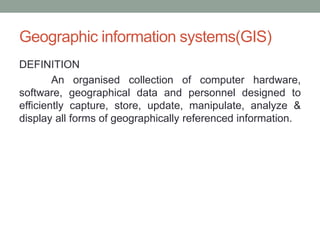
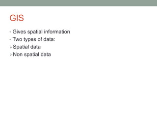
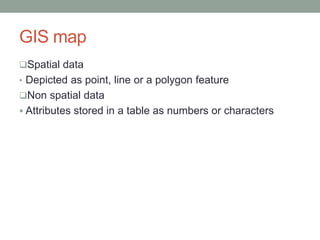
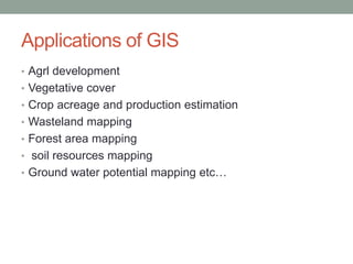
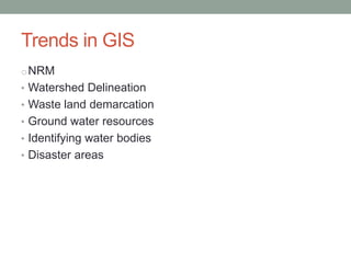
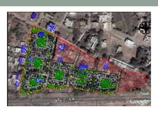
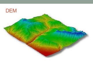
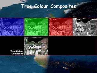
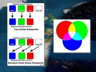
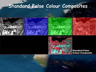
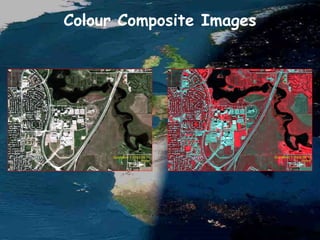
Geographic information systems(GIS)
DEFINITION
An organised collection of computer hardware,
software, geographical data and personnel designed to
efficiently capture, store, update, manipulate, analyze &
display all forms of geographically referenced information.
GIS
• Gives spatial information
• Two types of data:
Spatial data
Non spatial data
GIS map
Spatial data
• Depicted as point, line or a polygon feature
Non spatial data
 Attributes stored in a table as numbers or characters
Storing data
• Vector formats- linear feature
• Raster formats- stored as image- looks real. Line, polygon
and point features
• GIS takes care of features, attributes and layers.
Applications of GIS
• Agrl development
• Vegetative cover
• Crop acreage and production estimation
• Wasteland mapping
• Forest area mapping
• soil resources mapping
• Ground water potential mapping etc…
Trends in GIS
oNRM
• Watershed Delineation
• Waste land demarcation
• Ground water resources
• Identifying water bodies
• Disaster areas
Modern tools for planning watersheds
• DEM map( Digital Elevation Model)
to represent continually varying surface by isolines
or contours.
Global system – WGS 84
In India - LCC
Web portals – Google earth, Bhuvan(ISRO)
Co ordinates taken in UTM plane
India falls in 43, 44, 45,46 planes
DEM
DEM
Images on GIS
REMOTE SENSING
Remote sensing
• Technique of obtaining information about an object
through analysis of data collected without coming in touch
with the object.
Stages in RS
• Emission of EMR
• Transmission, absorption and scattering of energy from
source to earth’s surface
• Interaction of EMR with earth surface
• Transmission of energy from surface to remote sensor
• Data output transmission, processing and analysis
Basic hypothesis
• Any object on earth is having a unique spectral signature
This helps to distinguish one object from another
The Electromagnetic Spectrum
What is Light?
What is Colour?
Why Do We See Colour?
after Campbell, J.B., 1987. Introduction to Remote Sensing. New York: Guildford.
near IRblue green red
Spectral Bands
A fundamental premise in remote
sensing is that we can identify and
learn about objects and features on
the Earth's surface by studying the
spectral characteristics of the
radiation reflected (and/or emitted)
by these features.
Colour Composite Displays
• We typically create multispectral
image displays or colour composite
images by showing different image
bands in varying display
combinations.
True Colour Composites
Standard False Colour Composites
Colour Composite Images
Feature True Colour False Colour
trees and bushes olive green red
crops medium to light green pink to red
wetland vegetation dark green to black dark red
water shades of blue & green blue to black
urban areas white to light blue blue to grey
bare soil white to light grey blue to grey
Source: U.S. Department of Defense, 1995. Multispectral Users Guide.
General Appearance of Surface
Features on Colour Composite Images
What is Spatial Resolution?
• The fineness of spatial detail visible in
an image
• Most affected by contrast
• Determined by the sensor’s
Instantaneous Field of View (IFOV)
• “Resolution”
Low Spatial Resolution
Spatial Resolution: 80 m
File Size: 0.5 Mb
Ground Dimensions: 33 x 33 km
Image Dimensions: 418 x 418
Landsat Multispectral Scanner Image
A
Medium Spatial Resolution
Spatial Resolution: 30 m
File Size: 0.5 Mb
Ground Dimensions: 12.5 x 12.5 km
Image Dimensions: 418 x 418
Image size required to cover area in A:
1.2 Mb (1100 x 1100 )
Landsat Thematic Mapper Image
B
High Spatial Resolution
Spatial Resolution: 1.5 m
File Size: 0.5 Mb
Ground Dimensions: 625 x 625 m
Image Dimensions: 418 x 418
Image size required to cover area in A:
500 Mb (22,300 x 22,300 )
SPIN-2 Panchromatic Image
C
Spatial Resolution: 500 m
Terra MODIS August 24, 2002 NASA Earth Observatory
Spatial Resolution: 30 m
Landsat 7 ETM August 27, 2000
Spatial Resolution: 30 m
Landsat 7 ETM August 27, 2000
Spatial Resolution: 2.4 m
QuickBird 1 September 11, 2002
Spatial Resolution: 0.62 m
QuickBird 1 September 11, 2002
Instantaneous Field of View
Satellites
• Geo stationary satellites
Orbit in synchrony with earth’s rotation
Altitude of 35000km
Mainly for communication and meterology
GEOS,METOSAT, INTELSAT,INSAT
• Sun synchronous satellites
All remote sensing resource satellites
LANDSAT,IRS,CARTOSAT
GLOBAL POSTIONING SYSTEM(GPS)
• GPS is a satellite based radio-navigation system
established by US dept of Defence for military purposes.
• 24 satellites and their ground stations involved.
• Provides information on latitude, longitude,elevation and
direction
GPS
position
• Unique position
corresponding to a reference
system
• WGS 84 (global)
• NAD 83 (US)
• LCC (India)
• NARSTAR satellites are
involved
System
• Handle device
• Satellite
• Ground station
• Processing station
2D position – 3 satellites are involved
3D position – 4 satellites are involved
Remote sensing & gis

Remote sensing & gis

  • 1.
  • 2.
    Geographic information systems(GIS) DEFINITION Anorganised collection of computer hardware, software, geographical data and personnel designed to efficiently capture, store, update, manipulate, analyze & display all forms of geographically referenced information.
  • 3.
    GIS • Gives spatialinformation • Two types of data: Spatial data Non spatial data
  • 4.
    GIS map Spatial data •Depicted as point, line or a polygon feature Non spatial data  Attributes stored in a table as numbers or characters
  • 5.
    Storing data • Vectorformats- linear feature • Raster formats- stored as image- looks real. Line, polygon and point features • GIS takes care of features, attributes and layers.
  • 6.
    Applications of GIS •Agrl development • Vegetative cover • Crop acreage and production estimation • Wasteland mapping • Forest area mapping • soil resources mapping • Ground water potential mapping etc…
  • 7.
    Trends in GIS oNRM •Watershed Delineation • Waste land demarcation • Ground water resources • Identifying water bodies • Disaster areas
  • 8.
    Modern tools forplanning watersheds • DEM map( Digital Elevation Model) to represent continually varying surface by isolines or contours. Global system – WGS 84 In India - LCC Web portals – Google earth, Bhuvan(ISRO) Co ordinates taken in UTM plane India falls in 43, 44, 45,46 planes
  • 10.
  • 11.
  • 12.
  • 13.
  • 14.
    Remote sensing • Techniqueof obtaining information about an object through analysis of data collected without coming in touch with the object.
  • 15.
    Stages in RS •Emission of EMR • Transmission, absorption and scattering of energy from source to earth’s surface • Interaction of EMR with earth surface • Transmission of energy from surface to remote sensor • Data output transmission, processing and analysis
  • 17.
    Basic hypothesis • Anyobject on earth is having a unique spectral signature This helps to distinguish one object from another
  • 18.
  • 19.
  • 20.
  • 21.
    Why Do WeSee Colour? after Campbell, J.B., 1987. Introduction to Remote Sensing. New York: Guildford.
  • 22.
    near IRblue greenred Spectral Bands
  • 23.
    A fundamental premisein remote sensing is that we can identify and learn about objects and features on the Earth's surface by studying the spectral characteristics of the radiation reflected (and/or emitted) by these features.
  • 24.
    Colour Composite Displays •We typically create multispectral image displays or colour composite images by showing different image bands in varying display combinations.
  • 26.
  • 28.
  • 29.
  • 30.
  • 31.
    Feature True ColourFalse Colour trees and bushes olive green red crops medium to light green pink to red wetland vegetation dark green to black dark red water shades of blue & green blue to black urban areas white to light blue blue to grey bare soil white to light grey blue to grey Source: U.S. Department of Defense, 1995. Multispectral Users Guide. General Appearance of Surface Features on Colour Composite Images
  • 32.
    What is SpatialResolution? • The fineness of spatial detail visible in an image • Most affected by contrast • Determined by the sensor’s Instantaneous Field of View (IFOV) • “Resolution”
  • 33.
    Low Spatial Resolution SpatialResolution: 80 m File Size: 0.5 Mb Ground Dimensions: 33 x 33 km Image Dimensions: 418 x 418 Landsat Multispectral Scanner Image A
  • 34.
    Medium Spatial Resolution SpatialResolution: 30 m File Size: 0.5 Mb Ground Dimensions: 12.5 x 12.5 km Image Dimensions: 418 x 418 Image size required to cover area in A: 1.2 Mb (1100 x 1100 ) Landsat Thematic Mapper Image B
  • 35.
    High Spatial Resolution SpatialResolution: 1.5 m File Size: 0.5 Mb Ground Dimensions: 625 x 625 m Image Dimensions: 418 x 418 Image size required to cover area in A: 500 Mb (22,300 x 22,300 ) SPIN-2 Panchromatic Image C
  • 36.
    Spatial Resolution: 500m Terra MODIS August 24, 2002 NASA Earth Observatory
  • 37.
    Spatial Resolution: 30m Landsat 7 ETM August 27, 2000
  • 38.
    Spatial Resolution: 30m Landsat 7 ETM August 27, 2000
  • 39.
    Spatial Resolution: 2.4m QuickBird 1 September 11, 2002
  • 40.
    Spatial Resolution: 0.62m QuickBird 1 September 11, 2002
  • 41.
  • 42.
    Satellites • Geo stationarysatellites Orbit in synchrony with earth’s rotation Altitude of 35000km Mainly for communication and meterology GEOS,METOSAT, INTELSAT,INSAT • Sun synchronous satellites All remote sensing resource satellites LANDSAT,IRS,CARTOSAT
  • 43.
    GLOBAL POSTIONING SYSTEM(GPS) •GPS is a satellite based radio-navigation system established by US dept of Defence for military purposes. • 24 satellites and their ground stations involved. • Provides information on latitude, longitude,elevation and direction
  • 44.
    GPS position • Unique position correspondingto a reference system • WGS 84 (global) • NAD 83 (US) • LCC (India) • NARSTAR satellites are involved
  • 45.
    System • Handle device •Satellite • Ground station • Processing station 2D position – 3 satellites are involved 3D position – 4 satellites are involved

Editor's Notes