SlideShare a Scribd company logo
1 of 95
Download to read offline
National Aeronautics and Space Administration
April 6, 2023
Crop Mapping using Synthetic Aperture Radar
(SAR) and Optical Remote Sensing
2
NASA’s Applied Remote Sensing Training Program
Training Outline
Crop Classification with
Time Series of
Polarimetric SAR Data
Monitoring Crop Growth
Through SAR-Derived Crop
Structural Parameters
Crop Classification with
Time Series Optical and
Radar Data
April 4, 2023 April 6, 2023 April 11, 2023
3
NASA’s Applied Remote Sensing Training Program
Homework and Certificate
• Homework Assignment:
– Answers must be submitted via Google Form
– Due Date: April 25, 2023
• A certificate of completion will be awarded to those who:
– Attend all live webinars
– Complete the homework assignment by the deadline (access from website)
– You will receive a certificate approximately two months after the completion
of the course from: marines.martins@ssaihq.com
4
NASA’s Applied Remote Sensing Training Program
Training Objectives
After participating in this 3-part training, attendees will be able to:
• Explain how polarimetric parameters are used for crop condition assessment
• Demonstrate how to perform Sentinel-1 SAR preprocessing to derive quasi polarimetric
parameters
• Perform a calibration of a SAR-based vegetation index to NDVI
• Monitor crop growth with multitemporal polarimetric SAR (PolSAR) data from Sentinel-1
• Examine crop growth using a canopy structure dynamic model and time series of Sentinel-
1 imagery
• Classify crop type using a time series of radar and optical imagery (Sentinel-1 & Sentinel-2)
National Aeronautics and Space Administration
Prof. Krištof Oštir, Asist. Matej Račič
April 6, 2023
Monitoring Crop Growth Through SAR-Derived Crop
Structural Parameters
6
NASA’s Applied Remote Sensing Training Program
Outline
• Satellite Image Time Series
• Copernicus and the Sentinels
• Time series generation
• Analysis ready data
• Time series analysis
• Sentinel Hub
• Statistical API
• Machine learning
• eo-learn
• eo-workflow
7
NASA’s Applied Remote Sensing Training Program
Space4SDGs: How space can be used in support of the 2030
Agenda for Sustainable Development (unoosa.org)
8
NASA’s Applied Remote Sensing Training Program
Google Earth
Amazon Web Services
Google Earth Engine
Sentinel Hub
Microsoft Planetary Computing
Copernicus data access service
ERS-1
RADARSAT
ERS-2 ENVISAT
TerraSAR-X
CosmoSkyMed
Landsat 1 Landsat 5
SPOT 1
Ikonos
Terra
Aqua
RapidEye
Landsat 8
Sentinel-1
Planet
Sentinel-2
Sentinel-3
Sentinel-5P
Sputnik 1
Vanguard 2
TIROS-1
Copernicus design
Landsat archive opening
1950 1960 1970 1980 1990 2000 2010 2020 2030
Data processing Radar Optical Historical
Major Milestones
Long and dense time series
10
NASA’s Applied Remote Sensing Training Program
Satellite Image Time Series – SITS
• Medium and high-resolution data is freely available
• Landsat archive – 2008
• Copernicus – complete, free and open
• Long SITS
– 1972 –
• Dense SITS
– weekly, daily
• Harmonized SITS
– Landsat – Sentinel-2
– Optical – radar
– Sentinel-2 – Planet
11
NASA’s Applied Remote Sensing Training Program
Landsat SITS
• Landsat, 1972 –
• Thematic Mapper (TM), 1982 –
• Operational Land Imager (OLI), 2013 –
• Every 16 day
• Optical → clouds
Landsat Image Gallery - Making Sense of Amazon Deforestation Patterns (nasa.gov)
14
NASA’s Applied Remote Sensing Training Program
Sentinel Satellites
S1A/B: Radar observations
S2A/B: High-resolution optical observation
S3A/B: resolution imaging and altimetry
S4A/B: Observation of the atmosphere from the geostationary orbit
S5P: Observation of the atmosphere from low orbit - predecessor
S5A/B/C: Observation of the atmosphere from low orbit
2014
2016–2021
2015
2017
2016
2018
2022
2017
2015
2017
15
NASA’s Applied Remote Sensing Training Program
Sentinel-1
• Sentinel-1A – 2014
• Sentinel-1B – 2016 – not working since 23.12.2021
• Observation of land, forests, water, soil and agriculture
– Rapid mapping in case of natural disasters
– Shipping traffic
– Observing ice at sea
• C-SAR (C-band Synthetic Aperture Radar)
• Resolution: 250 km – 5 x 20 m
• InSAR
16
NASA’s Applied Remote Sensing Training Program
Sentinel-1
17
NASA’s Applied Remote Sensing Training Program
Sentinel-2
• Sentinel-2A – 2015
• Sentinel-2B – 2017
• Observation of land, vegetation, soil, water surfaces, coastal bands
– Land cover detection and changes
– Rapid mapping in case of natural disasters
– Climate change observation
• Orbit repeatability 10 days, 5 days with two satellites
• MSI (Multispectral Imager)
• Resolution: 290 km – 10 m, 20 m, and 60 m
18
NASA’s Applied Remote Sensing Training Program
Sentinel-2
S2A S2B
Band Number
Central wavelength
(nm)
Bandwidth (nm)
Central wavelength
(nm)
Bandwidth (nm)
Spatial resolution
(m)
1 442.7 20 442.3 20 60
2 492.7 65 492.3 65 10
3 559.8 35 558.9 35 10
4 664.6 30 664.9 31 10
5 704.1 14 703.8 15 20
6 740.5 14 739.1 13 20
7 782.8 19 779.7 19 20
8 832.8 105 832.9 104 10
8a 864.7 21 864.0 21 20
9 945.1 19 943.2 20 60
10 1373.5 29 1376.9 29 60
11 1613.7 90 1610.4 94 20
12 2202.4 174 2185.7 184 20
19
NASA’s Applied Remote Sensing Training Program
2 3 4 8a
5 6 7 8b 11 12
1 9 10
10 m
20 m
60 m
0
20
40
60
0.5 1.0 1.5 2.0 2.5
Wavelength (nm)
Reflectance
(%)
Soil Vegetation Water
Sentinel−2
20
NASA’s Applied Remote Sensing Training Program
Sentinel-2
21
NASA’s Applied Remote Sensing Training Program
Sentinel-2 Archive
Paper: Six years of Sentinel-2 archive of Slovenia | Geodetski vestnik (geodetski-vestnik.com)
Time Series Generation
23
NASA’s Applied Remote Sensing Training Program
Time Series
• Set of satellite images taken over the
same area of interest at different times
• Same or multiple sensors
• Time Series:
– understanding how Earth is
changing
– determining the causes of these
changes
– predicting future changes
– discriminating features
Land Cover Classification with eo-learn: Part 2 | by Matic Lubej | Sentinel Hub Blog | Medium
24
NASA’s Applied Remote Sensing Training Program
Time Series - Sentinel-2
8, 4, 3 NDVI
25
NASA’s Applied Remote Sensing Training Program
Time Series – Sentinel-1
VH VV
26
NASA’s Applied Remote Sensing Training Program
Analysis Ready Data (ARD)
• CEOS – Committee on Earth
Observation Satellites:
– Analysis Ready Data (ARD) are
satellite data that have been
processed to a minimum set of
requirements and organized into a
form that allows immediate
analysis with a minimum of
additional user effort and
interoperability both through time
and with other datasets.
• Data which is ready to use.
CEOS Analysis Ready Data
Analysis Ready Data Defined. Cloud Native Geoprocessing Part 2 | by Chris Holmes | Planet Stories | Medium
Harness the power of Sentinel Hub, xcube, EOxHub, GeoDB and more in Euro Data Cube | by Dorothy Rono | Euro Data Cube | Medium
27
NASA’s Applied Remote Sensing Training Program
Analysis Ready Data (ARD)
• ARD processing may differ
between applications.
• Image clipping
• Masking – Usable/Unusable
Data Masks
• Atmospheric Correction
• Pixel Alignment
• Sensor Alignment
Analysis Ready Data Defined. Cloud Native Geoprocessing Part 2 | by Chris Holmes | Planet Stories | Medium
28
NASA’s Applied Remote Sensing Training Program
Harmonization of the Time Series
Algorithms « Harmonized Landsat Sentinel-2 (nasa.gov)
29
NASA’s Applied Remote Sensing Training Program
Sentinel-2 – Landsat 7,8 – harmonization
Remote Sensing | Free Full-Text | Harmonization of Landsat and Sentinel 2 for Crop
Monitoring in Drought Prone Areas: Case Studies of Ninh Thuan (Vietnam) and
Bekaa (Lebanon) (mdpi.com)
Vegetation on optical and radar images
31
NASA’s Applied Remote Sensing Training Program
Vegetation Spectra – optical
• Certain wavelengths are sensitive to
certain chemicals and compounds.
• They result in absorption
characteristics.
• Make measurements in relation to
these compounds.
• Indices make use of these wavelength
features.
32
NASA’s Applied Remote Sensing Training Program
Radar backscattering
• Wavelength/frequency
• Polarization (horizontal, vertical)
• Incidence angle
• Resolution
• Structure of the observed
phenomenon
• Roughness (roughness) of the terrain
• The conductivity and dielectricity of
the surface
• Orientation
Radar
Surface
What is Synthetic Aperture Radar? | Earthdata (nasa.gov)
SAR Satellites for Agriculture - Groundstation
33
NASA’s Applied Remote Sensing Training Program
Radar Interferometry
• Two images from slightly displaced
orbits
• Phase differences due to
– Parallax
– Elevation differences
– Surface movements
– Atmospheric phenomena
• Elevations in m
• Displacements in mm
• Coherence
Elastic Earth science for global monitoring | Elastic Blog
34
NASA’s Applied Remote Sensing Training Program
Coherence for Vegetation Mapping
• The coherence of an InSAR data pair
represents the magnitude of the
complex correlation between two
SAR images on a pixel-by-pixel basis.
• Is a quantitative measure of the
amount of noise in the interferogram.
6 12 18 days
Is NDVI enough?
36
NASA’s Applied Remote Sensing Training Program
Vegetation Indices
• VI - Vegetation Index
• NDVI - Normalized Difference
Vegetation Index
• EVI - Enhanced Vegetation Index
• SAVI - Soil Adjusted NDVI
• AVI - Advanced Vegetation Index
• NDMI - Normalized Difference
Moisture Index ...
IDB - Index DataBase
37
NASA’s Applied Remote Sensing Training Program
IDB - Agriculture
38
NASA’s Applied Remote Sensing Training Program
Sentinel-2 – Bands and indices
39
NASA’s Applied Remote Sensing Training Program
Correlation with NDVI
Time Series Analysis
41
NASA’s Applied Remote Sensing Training Program
Temporal Development of Vegetation
• a - beginning of season
• b - end of season
• c - length of season
• d - base value
• e - middle of season
• f - maximum value
• g - amplitude
Welcome to the TIMESAT pages! (lu.se)
42
NASA’s Applied Remote Sensing Training Program
Sweetgum Leaves - (Liquidambar styraciflua L.)
PowerPoint Presentation (ucdavis.edu)
43
NASA’s Applied Remote Sensing Training Program
European Beech - Fagus sylvatica
44
NASA’s Applied Remote Sensing Training Program
Time Series of Images
Apr May Jun Jul
Aug Sep Oct Nov
45
NASA’s Applied Remote Sensing Training Program
Time series classification
• Quasi time series classification
– Images are attributes
– Multidimensional classification,
time sequence not considered
• Full time series classification
– uses information about the
development
Euclidean distance
Dynamic time warping
Dynamic time warping - Wikipedia
46
NASA’s Applied Remote Sensing Training Program
Classification based on time series
Apr May Jun Jul Aug Sep Oct Nov
NDVI
Barley
Maize
Rapeseed
Triticale
Wheat
?
47
NASA’s Applied Remote Sensing Training Program
Time Interpolation/Aggregation
• No
• 5 D
• 10 D
• 1 M
48
NASA’s Applied Remote Sensing Training Program
Time synchronization
• Time series have different timestamps
• Time of image acquisition
– Clouds
– Different satellites
– Different sensors
• Synchronize to the same timestamps
– Week
– 10 days
– Month
49
NASA’s Applied Remote Sensing Training Program
Time synchronization
50
NASA’s Applied Remote Sensing Training Program
How long must the time series be
• Yearly vegetation cycle
• Multiyear
– Disturbances
• Beginning of the year
51
NASA’s Applied Remote Sensing Training Program
How long must the time series be
Sentinel Hub
53
NASA’s Applied Remote Sensing Training Program
Copernicus Data Space Ecosystem
54
NASA’s Applied Remote Sensing Training Program
WMS
Commercial EO data – WorldWind, GeoEye, ...
Aerial imagery (drone, airplane)
Other raster and vector data
Open EO data - Sentinel-1, Sentinel-2, Landsat, ...
WMTS
WCS
Scripting (Python, R, ENVI…)
Web / Mobile apps
Desktop (QGIS, ArcGIS…)
Cloud GIS
Sinergise
55
NASA’s Applied Remote Sensing Training Program
Sinergise
56
NASA’s Applied Remote Sensing Training Program
Sinergise
57
NASA’s Applied Remote Sensing Training Program
Create Sentinel Hub Account
58
NASA’s Applied Remote Sensing Training Program
Create Sentinel Hub Account
59
NASA’s Applied Remote Sensing Training Program
Create Sentinel Hub Account
• After you create an account, you enter the trial mode
• Send the Sentinel Hub registered email to matej.racic@fgg.uni-lj.si
• You will get credits for processing and advanced use
• ESA (Network of Resources) and Sinergise are sponsoring the use for ARSET
participants
60
NASA’s Applied Remote Sensing Training Program
EO Browser
61
NASA’s Applied Remote Sensing Training Program
EO Browser
62
NASA’s Applied Remote Sensing Training Program
EO Browser
63
NASA’s Applied Remote Sensing Training Program
EO Browser
64
NASA’s Applied Remote Sensing Training Program
EO Browser
65
NASA’s Applied Remote Sensing Training Program
EO Browser
66
NASA’s Applied Remote Sensing Training Program
EO Browser
67
NASA’s Applied Remote Sensing Training Program
EO Browser
68
NASA’s Applied Remote Sensing Training Program
EO Browser
69
NASA’s Applied Remote Sensing Training Program
EO Browser
Radar and optical Integration
71
NASA’s Applied Remote Sensing Training Program
SAR/Optical Integration
72
NASA’s Applied Remote Sensing Training Program
Radar backscatter
Remote Sensing | Free Full-Text | Analyzing Temporal and Spatial Characteristics
of Crop Parameters Using Sentinel-1 Backscatter Data (mdpi.com)
73
NASA’s Applied Remote Sensing Training Program
NDVI and NDRE
Remote Sensing | Free Full-Text | Land Cover and Crop Classification Based on
Red Edge Indices Features of GF-6 WFV Time Series Data (mdpi.com)
74
NASA’s Applied Remote Sensing Training Program
Mapping Grassland – Intensive/Extensive
75
NASA’s Applied Remote Sensing Training Program
Optical (NDVI) and radar (coherence)
Sen4Cap (esa-sen4cap.org)
76
NASA’s Applied Remote Sensing Training Program
Machine learning
• Scene classification
• Object detection
• Segmentation
• Pixel classification
Artificial intelligence
Machine learning
Deep
learning
Automated Extraction of Energy Systems Information from Remotely Sensed Data: A Review and Analysis
77
NASA’s Applied Remote Sensing Training Program
Machine learning – satellite image time series
• Machine learning
– Decision trees
– Random Forest
– LightGBM
• Deep learning
– RNN
– CNN
– Transformers
A Decision-Tree Classifier for Extracting Transparent Plastic-Mulched Landcover from Landsat-5 TM Images
Temporal Convolutional Neural Network for the Classification of Satellite Image Time Series
78
NASA’s Applied Remote Sensing Training Program
Transformers – Satellite image time series
• Pre-processing is not mandatory but can improve results
• Models can infer:
– Interpolation
– Cloud mask
• Knowledge transfer:
– Domain
– Year
– Season
Attention Is All You Need
Self-Supervised Pretraining of Transformers for Satellite Image Time Series Classification
79
NASA’s Applied Remote Sensing Training Program
Dense and rare mowing
Extensive and intensive grassland
80
NASA’s Applied Remote Sensing Training Program
Extensive and intensive grassland – statistics
0
10
20
30
40
50
60
70
80
90
HAB 1 HAB 2 HAB 3 HAB 4 HAB 5
PORTION
[%]
HAB REGIONALIZATION – BY TYPE
Ekstenzivni travniki [2017] Intenzivni travniki [2017]
Ekstenzivni travniki [2018] Intenzivni travniki [2018]
EXTENSIVE 2017
EXTENSIVE 2018
INTENSIVE 2017
INTENSIVE 2018
Practical
82
NASA’s Applied Remote Sensing Training Program
Credentials
1. INSTANCE_ID: Configuration Utility > Id
2. CLIENT ID: User settings > Oauth clients > ID (Client credentials)
3. CLIENT_SECRET: „secret“
83
NASA’s Applied Remote Sensing Training Program
Credentials
• Configuration Utility – INSTANCE_ID • OAuth clients – CLIENT_ID
• Save the secret key – CLIENT_SECRET
84
NASA’s Applied Remote Sensing Training Program
GitHub - ARSET23
• https://github.com/EarthObservation/ARSET23
• Repository
– Theory
– Practical
• Git clone https://github.com/EarthObservation/ARSET23.git
GitHub - ARSET23
85
NASA’s Applied Remote Sensing Training Program
Practical - Notebooks
• credentials_SH.ipynb
– Sign Up
– sentinelhub.id
– config
• data_sources_explorer.ipynb
– DataCollection
– evalscript
– Imagery retrival
– Visualisation
• earth_observation_with_StatAPI.ipynb
– Inspecting AOI
– Statistical API
– Time series visualisation
• extra_land_cover.ipynb
– EO workflow
• Splitting AOI
• Data download
• Adding reference
• Machine learning
86
NASA’s Applied Remote Sensing Training Program
Practical - Data
• Region of Interest (ROI)
• Country outline
• Divided into smaller regions
– 1000 x 1000 pixels
• Denmark splitted into 45x35 patches
87
NASA’s Applied Remote Sensing Training Program
WMS
Commercial EO data – WorldWind, GeoEye, ...
Aerial imagery (drone, airplane)
Other raster and vector data
Open EO data - Sentinel-1, Sentinel-2, Landsat, ...
WMTS
WCS
Scripting (Python, R, ENVI…)
Web / Mobile apps
Desktop (QGIS, ArcGIS…)
Cloud GIS
Sinergise
88
NASA’s Applied Remote Sensing Training Program
Sentinel-hub – Statistical API – Data – GEOJSON
89
NASA’s Applied Remote Sensing Training Program
Sentinel-hub – Statistical API
90
NASA’s Applied Remote Sensing Training Program
eo-learn
91
NASA’s Applied Remote Sensing Training Program
eo-workflow
extra_land_cover.ipynb
• Region-of-Interest (ROI)
– Outline (geojson, or similar)
– Split into smaller tiles
• Download patch (sentinelhub-py)
– Time interval, bands, masks
• Machine learning
– Prepare training data
– Model training
– Validation
• Visualisation of results
More materials:
• https://github.com/sentinel-hub/eo-learn-examples
• https://github.com/sentinel-hub/eo-learn-workshop
92
NASA’s Applied Remote Sensing Training Program
Thank You!
93
NASA’s Applied Remote Sensing Training Program
Questions?
• Please enter your questions in
the Q&A box. We will answer
them in the order they were
received.
• We will post the Q&A to the
training website following the
conclusion of the webinar.
https://earthobservatory.nasa.gov/images/6034/pothole-lakes-in-siberia
94
NASA’s Applied Remote Sensing Training Program
Contacts
• Trainers:
– Prof. Krištof Oštir: kristof.ostir@fgg.uni-lj.si
– Matej Račič: matej.racic@fgg.uni-lj.si
• https://github.com/EarthObservation/ARSET23
• Training Webpage:
– https://appliedsciences.nasa.gov/join-mission/training/english/arset-crop-
mapping-using-synthetic-aperture-radar-sar-and-optical-0
• ARSET Website:
– https://appliedsciences.nasa.gov/arset
Check out our sister programs:
95
NASA’s Applied Remote Sensing Training Program
Thank You!

More Related Content

Similar to Advances in Agricultural remote sensings

REMOTE SENSING PLATFORMS.ppt
REMOTE SENSING PLATFORMS.pptREMOTE SENSING PLATFORMS.ppt
REMOTE SENSING PLATFORMS.pptDivyaPriya700213
 
4_REMOTE SENSING PLATFORMS.ppt
4_REMOTE SENSING PLATFORMS.ppt4_REMOTE SENSING PLATFORMS.ppt
4_REMOTE SENSING PLATFORMS.pptDivyaPriya700213
 
remote sensing platforms materials for student
remote sensing platforms materials for studentremote sensing platforms materials for student
remote sensing platforms materials for studentWidyastutiSAA
 
Multi-Spectral Analysis of Satellite Imagery for Inventory of Sensitive Marin...
Multi-Spectral Analysis of Satellite Imagery for Inventory of Sensitive Marin...Multi-Spectral Analysis of Satellite Imagery for Inventory of Sensitive Marin...
Multi-Spectral Analysis of Satellite Imagery for Inventory of Sensitive Marin...Keith VanGraafeiland
 
Fundamentals remote sensing land used
Fundamentals remote sensing land usedFundamentals remote sensing land used
Fundamentals remote sensing land usedHidraulica Tymanzo
 
Rahul seminar2 2_for_slideshare.pptx
Rahul seminar2 2_for_slideshare.pptxRahul seminar2 2_for_slideshare.pptx
Rahul seminar2 2_for_slideshare.pptxRahulSingh769902
 
20_CEOS_LSI-VC-2_NASAb.pptx
20_CEOS_LSI-VC-2_NASAb.pptx20_CEOS_LSI-VC-2_NASAb.pptx
20_CEOS_LSI-VC-2_NASAb.pptxSumeshSpanko
 
Remote Sensing PPT
Remote Sensing PPTRemote Sensing PPT
Remote Sensing PPTAmal Murali
 
MODIS (Moderate Resolution Imaging Spectrometer)
MODIS (Moderate Resolution Imaging Spectrometer)MODIS (Moderate Resolution Imaging Spectrometer)
MODIS (Moderate Resolution Imaging Spectrometer)Nepal Flying Labs
 
Remote sensing of biophysical parameters: linking field, airborne and contine...
Remote sensing of biophysical parameters: linking field, airborne and contine...Remote sensing of biophysical parameters: linking field, airborne and contine...
Remote sensing of biophysical parameters: linking field, airborne and contine...TERN Australia
 
Pasolli_TU1_TO3.4.pptx
Pasolli_TU1_TO3.4.pptxPasolli_TU1_TO3.4.pptx
Pasolli_TU1_TO3.4.pptxgrssieee
 
Pasolli_TU1_TO3.4.pptx
Pasolli_TU1_TO3.4.pptxPasolli_TU1_TO3.4.pptx
Pasolli_TU1_TO3.4.pptxgrssieee
 
Analytics on Vegetation & Soil Index time-series and DataCube End Point service
Analytics on Vegetation & Soil Index time-series and DataCube End Point serviceAnalytics on Vegetation & Soil Index time-series and DataCube End Point service
Analytics on Vegetation & Soil Index time-series and DataCube End Point serviceENVISION H2020
 
Vicarious Radiometric Calibration
Vicarious Radiometric CalibrationVicarious Radiometric Calibration
Vicarious Radiometric CalibrationBetsy Kenaston
 
NDGISUC2017 - Bringing Remote Sensing Data to your GIS Application
NDGISUC2017 - Bringing Remote Sensing Data to your GIS ApplicationNDGISUC2017 - Bringing Remote Sensing Data to your GIS Application
NDGISUC2017 - Bringing Remote Sensing Data to your GIS ApplicationNorth Dakota GIS Hub
 
Free and open source software for remote sensing and GIS
Free and open source software for remote sensing and GISFree and open source software for remote sensing and GIS
Free and open source software for remote sensing and GISNopphawanTamkuan
 

Similar to Advances in Agricultural remote sensings (20)

Remote sensing
Remote sensingRemote sensing
Remote sensing
 
REMOTE SENSING PLATFORMS.ppt
REMOTE SENSING PLATFORMS.pptREMOTE SENSING PLATFORMS.ppt
REMOTE SENSING PLATFORMS.ppt
 
4_REMOTE SENSING PLATFORMS.ppt
4_REMOTE SENSING PLATFORMS.ppt4_REMOTE SENSING PLATFORMS.ppt
4_REMOTE SENSING PLATFORMS.ppt
 
remote sensing platforms materials for student
remote sensing platforms materials for studentremote sensing platforms materials for student
remote sensing platforms materials for student
 
Multi-Spectral Analysis of Satellite Imagery for Inventory of Sensitive Marin...
Multi-Spectral Analysis of Satellite Imagery for Inventory of Sensitive Marin...Multi-Spectral Analysis of Satellite Imagery for Inventory of Sensitive Marin...
Multi-Spectral Analysis of Satellite Imagery for Inventory of Sensitive Marin...
 
Fundamentals remote sensing land used
Fundamentals remote sensing land usedFundamentals remote sensing land used
Fundamentals remote sensing land used
 
Rahul seminar2 2_for_slideshare.pptx
Rahul seminar2 2_for_slideshare.pptxRahul seminar2 2_for_slideshare.pptx
Rahul seminar2 2_for_slideshare.pptx
 
20_CEOS_LSI-VC-2_NASAb.pptx
20_CEOS_LSI-VC-2_NASAb.pptx20_CEOS_LSI-VC-2_NASAb.pptx
20_CEOS_LSI-VC-2_NASAb.pptx
 
Remote Sensing PPT
Remote Sensing PPTRemote Sensing PPT
Remote Sensing PPT
 
MODIS (Moderate Resolution Imaging Spectrometer)
MODIS (Moderate Resolution Imaging Spectrometer)MODIS (Moderate Resolution Imaging Spectrometer)
MODIS (Moderate Resolution Imaging Spectrometer)
 
Remote sensing of biophysical parameters: linking field, airborne and contine...
Remote sensing of biophysical parameters: linking field, airborne and contine...Remote sensing of biophysical parameters: linking field, airborne and contine...
Remote sensing of biophysical parameters: linking field, airborne and contine...
 
In sar 1-1-2011
In sar 1-1-2011In sar 1-1-2011
In sar 1-1-2011
 
Pasolli_TU1_TO3.4.pptx
Pasolli_TU1_TO3.4.pptxPasolli_TU1_TO3.4.pptx
Pasolli_TU1_TO3.4.pptx
 
Pasolli_TU1_TO3.4.pptx
Pasolli_TU1_TO3.4.pptxPasolli_TU1_TO3.4.pptx
Pasolli_TU1_TO3.4.pptx
 
Analytics on Vegetation & Soil Index time-series and DataCube End Point service
Analytics on Vegetation & Soil Index time-series and DataCube End Point serviceAnalytics on Vegetation & Soil Index time-series and DataCube End Point service
Analytics on Vegetation & Soil Index time-series and DataCube End Point service
 
Unit-1 GNSS.pdf
Unit-1 GNSS.pdfUnit-1 GNSS.pdf
Unit-1 GNSS.pdf
 
Vicarious Radiometric Calibration
Vicarious Radiometric CalibrationVicarious Radiometric Calibration
Vicarious Radiometric Calibration
 
Land management
Land managementLand management
Land management
 
NDGISUC2017 - Bringing Remote Sensing Data to your GIS Application
NDGISUC2017 - Bringing Remote Sensing Data to your GIS ApplicationNDGISUC2017 - Bringing Remote Sensing Data to your GIS Application
NDGISUC2017 - Bringing Remote Sensing Data to your GIS Application
 
Free and open source software for remote sensing and GIS
Free and open source software for remote sensing and GISFree and open source software for remote sensing and GIS
Free and open source software for remote sensing and GIS
 

Recently uploaded

Dashanga agada a formulation of Agada tantra dealt in 3 Rd year bams agada tanta
Dashanga agada a formulation of Agada tantra dealt in 3 Rd year bams agada tantaDashanga agada a formulation of Agada tantra dealt in 3 Rd year bams agada tanta
Dashanga agada a formulation of Agada tantra dealt in 3 Rd year bams agada tantaPraksha3
 
Neurodevelopmental disorders according to the dsm 5 tr
Neurodevelopmental disorders according to the dsm 5 trNeurodevelopmental disorders according to the dsm 5 tr
Neurodevelopmental disorders according to the dsm 5 trssuser06f238
 
SOLUBLE PATTERN RECOGNITION RECEPTORS.pptx
SOLUBLE PATTERN RECOGNITION RECEPTORS.pptxSOLUBLE PATTERN RECOGNITION RECEPTORS.pptx
SOLUBLE PATTERN RECOGNITION RECEPTORS.pptxkessiyaTpeter
 
Grafana in space: Monitoring Japan's SLIM moon lander in real time
Grafana in space: Monitoring Japan's SLIM moon lander  in real timeGrafana in space: Monitoring Japan's SLIM moon lander  in real time
Grafana in space: Monitoring Japan's SLIM moon lander in real timeSatoshi NAKAHIRA
 
Recombination DNA Technology (Nucleic Acid Hybridization )
Recombination DNA Technology (Nucleic Acid Hybridization )Recombination DNA Technology (Nucleic Acid Hybridization )
Recombination DNA Technology (Nucleic Acid Hybridization )aarthirajkumar25
 
All-domain Anomaly Resolution Office U.S. Department of Defense (U) Case: “Eg...
All-domain Anomaly Resolution Office U.S. Department of Defense (U) Case: “Eg...All-domain Anomaly Resolution Office U.S. Department of Defense (U) Case: “Eg...
All-domain Anomaly Resolution Office U.S. Department of Defense (U) Case: “Eg...Sérgio Sacani
 
TOPIC 8 Temperature and Heat.pdf physics
TOPIC 8 Temperature and Heat.pdf physicsTOPIC 8 Temperature and Heat.pdf physics
TOPIC 8 Temperature and Heat.pdf physicsssuserddc89b
 
Boyles law module in the grade 10 science
Boyles law module in the grade 10 scienceBoyles law module in the grade 10 science
Boyles law module in the grade 10 sciencefloriejanemacaya1
 
Genomic DNA And Complementary DNA Libraries construction.
Genomic DNA And Complementary DNA Libraries construction.Genomic DNA And Complementary DNA Libraries construction.
Genomic DNA And Complementary DNA Libraries construction.k64182334
 
Natural Polymer Based Nanomaterials
Natural Polymer Based NanomaterialsNatural Polymer Based Nanomaterials
Natural Polymer Based NanomaterialsAArockiyaNisha
 
Behavioral Disorder: Schizophrenia & it's Case Study.pdf
Behavioral Disorder: Schizophrenia & it's Case Study.pdfBehavioral Disorder: Schizophrenia & it's Case Study.pdf
Behavioral Disorder: Schizophrenia & it's Case Study.pdfSELF-EXPLANATORY
 
Call Girls in Munirka Delhi 💯Call Us 🔝8264348440🔝
Call Girls in Munirka Delhi 💯Call Us 🔝8264348440🔝Call Girls in Munirka Delhi 💯Call Us 🔝8264348440🔝
Call Girls in Munirka Delhi 💯Call Us 🔝8264348440🔝soniya singh
 
Nanoparticles synthesis and characterization​ ​
Nanoparticles synthesis and characterization​  ​Nanoparticles synthesis and characterization​  ​
Nanoparticles synthesis and characterization​ ​kaibalyasahoo82800
 
A relative description on Sonoporation.pdf
A relative description on Sonoporation.pdfA relative description on Sonoporation.pdf
A relative description on Sonoporation.pdfnehabiju2046
 
Traditional Agroforestry System in India- Shifting Cultivation, Taungya, Home...
Traditional Agroforestry System in India- Shifting Cultivation, Taungya, Home...Traditional Agroforestry System in India- Shifting Cultivation, Taungya, Home...
Traditional Agroforestry System in India- Shifting Cultivation, Taungya, Home...jana861314
 
BIOETHICS IN RECOMBINANT DNA TECHNOLOGY.
BIOETHICS IN RECOMBINANT DNA TECHNOLOGY.BIOETHICS IN RECOMBINANT DNA TECHNOLOGY.
BIOETHICS IN RECOMBINANT DNA TECHNOLOGY.PraveenaKalaiselvan1
 
Biopesticide (2).pptx .This slides helps to know the different types of biop...
Biopesticide (2).pptx  .This slides helps to know the different types of biop...Biopesticide (2).pptx  .This slides helps to know the different types of biop...
Biopesticide (2).pptx .This slides helps to know the different types of biop...RohitNehra6
 
PossibleEoarcheanRecordsoftheGeomagneticFieldPreservedintheIsuaSupracrustalBe...
PossibleEoarcheanRecordsoftheGeomagneticFieldPreservedintheIsuaSupracrustalBe...PossibleEoarcheanRecordsoftheGeomagneticFieldPreservedintheIsuaSupracrustalBe...
PossibleEoarcheanRecordsoftheGeomagneticFieldPreservedintheIsuaSupracrustalBe...Sérgio Sacani
 
Recombinant DNA technology( Transgenic plant and animal)
Recombinant DNA technology( Transgenic plant and animal)Recombinant DNA technology( Transgenic plant and animal)
Recombinant DNA technology( Transgenic plant and animal)DHURKADEVIBASKAR
 
Lucknow 💋 Russian Call Girls Lucknow Finest Escorts Service 8923113531 Availa...
Lucknow 💋 Russian Call Girls Lucknow Finest Escorts Service 8923113531 Availa...Lucknow 💋 Russian Call Girls Lucknow Finest Escorts Service 8923113531 Availa...
Lucknow 💋 Russian Call Girls Lucknow Finest Escorts Service 8923113531 Availa...anilsa9823
 

Recently uploaded (20)

Dashanga agada a formulation of Agada tantra dealt in 3 Rd year bams agada tanta
Dashanga agada a formulation of Agada tantra dealt in 3 Rd year bams agada tantaDashanga agada a formulation of Agada tantra dealt in 3 Rd year bams agada tanta
Dashanga agada a formulation of Agada tantra dealt in 3 Rd year bams agada tanta
 
Neurodevelopmental disorders according to the dsm 5 tr
Neurodevelopmental disorders according to the dsm 5 trNeurodevelopmental disorders according to the dsm 5 tr
Neurodevelopmental disorders according to the dsm 5 tr
 
SOLUBLE PATTERN RECOGNITION RECEPTORS.pptx
SOLUBLE PATTERN RECOGNITION RECEPTORS.pptxSOLUBLE PATTERN RECOGNITION RECEPTORS.pptx
SOLUBLE PATTERN RECOGNITION RECEPTORS.pptx
 
Grafana in space: Monitoring Japan's SLIM moon lander in real time
Grafana in space: Monitoring Japan's SLIM moon lander  in real timeGrafana in space: Monitoring Japan's SLIM moon lander  in real time
Grafana in space: Monitoring Japan's SLIM moon lander in real time
 
Recombination DNA Technology (Nucleic Acid Hybridization )
Recombination DNA Technology (Nucleic Acid Hybridization )Recombination DNA Technology (Nucleic Acid Hybridization )
Recombination DNA Technology (Nucleic Acid Hybridization )
 
All-domain Anomaly Resolution Office U.S. Department of Defense (U) Case: “Eg...
All-domain Anomaly Resolution Office U.S. Department of Defense (U) Case: “Eg...All-domain Anomaly Resolution Office U.S. Department of Defense (U) Case: “Eg...
All-domain Anomaly Resolution Office U.S. Department of Defense (U) Case: “Eg...
 
TOPIC 8 Temperature and Heat.pdf physics
TOPIC 8 Temperature and Heat.pdf physicsTOPIC 8 Temperature and Heat.pdf physics
TOPIC 8 Temperature and Heat.pdf physics
 
Boyles law module in the grade 10 science
Boyles law module in the grade 10 scienceBoyles law module in the grade 10 science
Boyles law module in the grade 10 science
 
Genomic DNA And Complementary DNA Libraries construction.
Genomic DNA And Complementary DNA Libraries construction.Genomic DNA And Complementary DNA Libraries construction.
Genomic DNA And Complementary DNA Libraries construction.
 
Natural Polymer Based Nanomaterials
Natural Polymer Based NanomaterialsNatural Polymer Based Nanomaterials
Natural Polymer Based Nanomaterials
 
Behavioral Disorder: Schizophrenia & it's Case Study.pdf
Behavioral Disorder: Schizophrenia & it's Case Study.pdfBehavioral Disorder: Schizophrenia & it's Case Study.pdf
Behavioral Disorder: Schizophrenia & it's Case Study.pdf
 
Call Girls in Munirka Delhi 💯Call Us 🔝8264348440🔝
Call Girls in Munirka Delhi 💯Call Us 🔝8264348440🔝Call Girls in Munirka Delhi 💯Call Us 🔝8264348440🔝
Call Girls in Munirka Delhi 💯Call Us 🔝8264348440🔝
 
Nanoparticles synthesis and characterization​ ​
Nanoparticles synthesis and characterization​  ​Nanoparticles synthesis and characterization​  ​
Nanoparticles synthesis and characterization​ ​
 
A relative description on Sonoporation.pdf
A relative description on Sonoporation.pdfA relative description on Sonoporation.pdf
A relative description on Sonoporation.pdf
 
Traditional Agroforestry System in India- Shifting Cultivation, Taungya, Home...
Traditional Agroforestry System in India- Shifting Cultivation, Taungya, Home...Traditional Agroforestry System in India- Shifting Cultivation, Taungya, Home...
Traditional Agroforestry System in India- Shifting Cultivation, Taungya, Home...
 
BIOETHICS IN RECOMBINANT DNA TECHNOLOGY.
BIOETHICS IN RECOMBINANT DNA TECHNOLOGY.BIOETHICS IN RECOMBINANT DNA TECHNOLOGY.
BIOETHICS IN RECOMBINANT DNA TECHNOLOGY.
 
Biopesticide (2).pptx .This slides helps to know the different types of biop...
Biopesticide (2).pptx  .This slides helps to know the different types of biop...Biopesticide (2).pptx  .This slides helps to know the different types of biop...
Biopesticide (2).pptx .This slides helps to know the different types of biop...
 
PossibleEoarcheanRecordsoftheGeomagneticFieldPreservedintheIsuaSupracrustalBe...
PossibleEoarcheanRecordsoftheGeomagneticFieldPreservedintheIsuaSupracrustalBe...PossibleEoarcheanRecordsoftheGeomagneticFieldPreservedintheIsuaSupracrustalBe...
PossibleEoarcheanRecordsoftheGeomagneticFieldPreservedintheIsuaSupracrustalBe...
 
Recombinant DNA technology( Transgenic plant and animal)
Recombinant DNA technology( Transgenic plant and animal)Recombinant DNA technology( Transgenic plant and animal)
Recombinant DNA technology( Transgenic plant and animal)
 
Lucknow 💋 Russian Call Girls Lucknow Finest Escorts Service 8923113531 Availa...
Lucknow 💋 Russian Call Girls Lucknow Finest Escorts Service 8923113531 Availa...Lucknow 💋 Russian Call Girls Lucknow Finest Escorts Service 8923113531 Availa...
Lucknow 💋 Russian Call Girls Lucknow Finest Escorts Service 8923113531 Availa...
 

Advances in Agricultural remote sensings

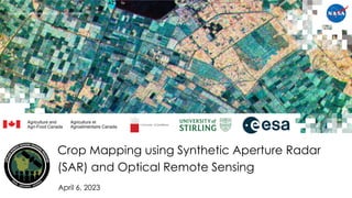
  • 1. National Aeronautics and Space Administration April 6, 2023 Crop Mapping using Synthetic Aperture Radar (SAR) and Optical Remote Sensing
  • 2. 2 NASA’s Applied Remote Sensing Training Program Training Outline Crop Classification with Time Series of Polarimetric SAR Data Monitoring Crop Growth Through SAR-Derived Crop Structural Parameters Crop Classification with Time Series Optical and Radar Data April 4, 2023 April 6, 2023 April 11, 2023
  • 3. 3 NASA’s Applied Remote Sensing Training Program Homework and Certificate • Homework Assignment: – Answers must be submitted via Google Form – Due Date: April 25, 2023 • A certificate of completion will be awarded to those who: – Attend all live webinars – Complete the homework assignment by the deadline (access from website) – You will receive a certificate approximately two months after the completion of the course from: marines.martins@ssaihq.com
  • 4. 4 NASA’s Applied Remote Sensing Training Program Training Objectives After participating in this 3-part training, attendees will be able to: • Explain how polarimetric parameters are used for crop condition assessment • Demonstrate how to perform Sentinel-1 SAR preprocessing to derive quasi polarimetric parameters • Perform a calibration of a SAR-based vegetation index to NDVI • Monitor crop growth with multitemporal polarimetric SAR (PolSAR) data from Sentinel-1 • Examine crop growth using a canopy structure dynamic model and time series of Sentinel- 1 imagery • Classify crop type using a time series of radar and optical imagery (Sentinel-1 & Sentinel-2)
  • 5. National Aeronautics and Space Administration Prof. Krištof Oštir, Asist. Matej Račič April 6, 2023 Monitoring Crop Growth Through SAR-Derived Crop Structural Parameters
  • 6. 6 NASA’s Applied Remote Sensing Training Program Outline • Satellite Image Time Series • Copernicus and the Sentinels • Time series generation • Analysis ready data • Time series analysis • Sentinel Hub • Statistical API • Machine learning • eo-learn • eo-workflow
  • 7. 7 NASA’s Applied Remote Sensing Training Program Space4SDGs: How space can be used in support of the 2030 Agenda for Sustainable Development (unoosa.org)
  • 8. 8 NASA’s Applied Remote Sensing Training Program Google Earth Amazon Web Services Google Earth Engine Sentinel Hub Microsoft Planetary Computing Copernicus data access service ERS-1 RADARSAT ERS-2 ENVISAT TerraSAR-X CosmoSkyMed Landsat 1 Landsat 5 SPOT 1 Ikonos Terra Aqua RapidEye Landsat 8 Sentinel-1 Planet Sentinel-2 Sentinel-3 Sentinel-5P Sputnik 1 Vanguard 2 TIROS-1 Copernicus design Landsat archive opening 1950 1960 1970 1980 1990 2000 2010 2020 2030 Data processing Radar Optical Historical Major Milestones
  • 9. Long and dense time series
  • 10. 10 NASA’s Applied Remote Sensing Training Program Satellite Image Time Series – SITS • Medium and high-resolution data is freely available • Landsat archive – 2008 • Copernicus – complete, free and open • Long SITS – 1972 – • Dense SITS – weekly, daily • Harmonized SITS – Landsat – Sentinel-2 – Optical – radar – Sentinel-2 – Planet
  • 11. 11 NASA’s Applied Remote Sensing Training Program Landsat SITS • Landsat, 1972 – • Thematic Mapper (TM), 1982 – • Operational Land Imager (OLI), 2013 – • Every 16 day • Optical → clouds Landsat Image Gallery - Making Sense of Amazon Deforestation Patterns (nasa.gov)
  • 12.
  • 13.
  • 14. 14 NASA’s Applied Remote Sensing Training Program Sentinel Satellites S1A/B: Radar observations S2A/B: High-resolution optical observation S3A/B: resolution imaging and altimetry S4A/B: Observation of the atmosphere from the geostationary orbit S5P: Observation of the atmosphere from low orbit - predecessor S5A/B/C: Observation of the atmosphere from low orbit 2014 2016–2021 2015 2017 2016 2018 2022 2017 2015 2017
  • 15. 15 NASA’s Applied Remote Sensing Training Program Sentinel-1 • Sentinel-1A – 2014 • Sentinel-1B – 2016 – not working since 23.12.2021 • Observation of land, forests, water, soil and agriculture – Rapid mapping in case of natural disasters – Shipping traffic – Observing ice at sea • C-SAR (C-band Synthetic Aperture Radar) • Resolution: 250 km – 5 x 20 m • InSAR
  • 16. 16 NASA’s Applied Remote Sensing Training Program Sentinel-1
  • 17. 17 NASA’s Applied Remote Sensing Training Program Sentinel-2 • Sentinel-2A – 2015 • Sentinel-2B – 2017 • Observation of land, vegetation, soil, water surfaces, coastal bands – Land cover detection and changes – Rapid mapping in case of natural disasters – Climate change observation • Orbit repeatability 10 days, 5 days with two satellites • MSI (Multispectral Imager) • Resolution: 290 km – 10 m, 20 m, and 60 m
  • 18. 18 NASA’s Applied Remote Sensing Training Program Sentinel-2 S2A S2B Band Number Central wavelength (nm) Bandwidth (nm) Central wavelength (nm) Bandwidth (nm) Spatial resolution (m) 1 442.7 20 442.3 20 60 2 492.7 65 492.3 65 10 3 559.8 35 558.9 35 10 4 664.6 30 664.9 31 10 5 704.1 14 703.8 15 20 6 740.5 14 739.1 13 20 7 782.8 19 779.7 19 20 8 832.8 105 832.9 104 10 8a 864.7 21 864.0 21 20 9 945.1 19 943.2 20 60 10 1373.5 29 1376.9 29 60 11 1613.7 90 1610.4 94 20 12 2202.4 174 2185.7 184 20
  • 19. 19 NASA’s Applied Remote Sensing Training Program 2 3 4 8a 5 6 7 8b 11 12 1 9 10 10 m 20 m 60 m 0 20 40 60 0.5 1.0 1.5 2.0 2.5 Wavelength (nm) Reflectance (%) Soil Vegetation Water Sentinel−2
  • 20. 20 NASA’s Applied Remote Sensing Training Program Sentinel-2
  • 21. 21 NASA’s Applied Remote Sensing Training Program Sentinel-2 Archive Paper: Six years of Sentinel-2 archive of Slovenia | Geodetski vestnik (geodetski-vestnik.com)
  • 23. 23 NASA’s Applied Remote Sensing Training Program Time Series • Set of satellite images taken over the same area of interest at different times • Same or multiple sensors • Time Series: – understanding how Earth is changing – determining the causes of these changes – predicting future changes – discriminating features Land Cover Classification with eo-learn: Part 2 | by Matic Lubej | Sentinel Hub Blog | Medium
  • 24. 24 NASA’s Applied Remote Sensing Training Program Time Series - Sentinel-2 8, 4, 3 NDVI
  • 25. 25 NASA’s Applied Remote Sensing Training Program Time Series – Sentinel-1 VH VV
  • 26. 26 NASA’s Applied Remote Sensing Training Program Analysis Ready Data (ARD) • CEOS – Committee on Earth Observation Satellites: – Analysis Ready Data (ARD) are satellite data that have been processed to a minimum set of requirements and organized into a form that allows immediate analysis with a minimum of additional user effort and interoperability both through time and with other datasets. • Data which is ready to use. CEOS Analysis Ready Data Analysis Ready Data Defined. Cloud Native Geoprocessing Part 2 | by Chris Holmes | Planet Stories | Medium Harness the power of Sentinel Hub, xcube, EOxHub, GeoDB and more in Euro Data Cube | by Dorothy Rono | Euro Data Cube | Medium
  • 27. 27 NASA’s Applied Remote Sensing Training Program Analysis Ready Data (ARD) • ARD processing may differ between applications. • Image clipping • Masking – Usable/Unusable Data Masks • Atmospheric Correction • Pixel Alignment • Sensor Alignment Analysis Ready Data Defined. Cloud Native Geoprocessing Part 2 | by Chris Holmes | Planet Stories | Medium
  • 28. 28 NASA’s Applied Remote Sensing Training Program Harmonization of the Time Series Algorithms « Harmonized Landsat Sentinel-2 (nasa.gov)
  • 29. 29 NASA’s Applied Remote Sensing Training Program Sentinel-2 – Landsat 7,8 – harmonization Remote Sensing | Free Full-Text | Harmonization of Landsat and Sentinel 2 for Crop Monitoring in Drought Prone Areas: Case Studies of Ninh Thuan (Vietnam) and Bekaa (Lebanon) (mdpi.com)
  • 30. Vegetation on optical and radar images
  • 31. 31 NASA’s Applied Remote Sensing Training Program Vegetation Spectra – optical • Certain wavelengths are sensitive to certain chemicals and compounds. • They result in absorption characteristics. • Make measurements in relation to these compounds. • Indices make use of these wavelength features.
  • 32. 32 NASA’s Applied Remote Sensing Training Program Radar backscattering • Wavelength/frequency • Polarization (horizontal, vertical) • Incidence angle • Resolution • Structure of the observed phenomenon • Roughness (roughness) of the terrain • The conductivity and dielectricity of the surface • Orientation Radar Surface What is Synthetic Aperture Radar? | Earthdata (nasa.gov) SAR Satellites for Agriculture - Groundstation
  • 33. 33 NASA’s Applied Remote Sensing Training Program Radar Interferometry • Two images from slightly displaced orbits • Phase differences due to – Parallax – Elevation differences – Surface movements – Atmospheric phenomena • Elevations in m • Displacements in mm • Coherence Elastic Earth science for global monitoring | Elastic Blog
  • 34. 34 NASA’s Applied Remote Sensing Training Program Coherence for Vegetation Mapping • The coherence of an InSAR data pair represents the magnitude of the complex correlation between two SAR images on a pixel-by-pixel basis. • Is a quantitative measure of the amount of noise in the interferogram. 6 12 18 days
  • 36. 36 NASA’s Applied Remote Sensing Training Program Vegetation Indices • VI - Vegetation Index • NDVI - Normalized Difference Vegetation Index • EVI - Enhanced Vegetation Index • SAVI - Soil Adjusted NDVI • AVI - Advanced Vegetation Index • NDMI - Normalized Difference Moisture Index ... IDB - Index DataBase
  • 37. 37 NASA’s Applied Remote Sensing Training Program IDB - Agriculture
  • 38. 38 NASA’s Applied Remote Sensing Training Program Sentinel-2 – Bands and indices
  • 39. 39 NASA’s Applied Remote Sensing Training Program Correlation with NDVI
  • 41. 41 NASA’s Applied Remote Sensing Training Program Temporal Development of Vegetation • a - beginning of season • b - end of season • c - length of season • d - base value • e - middle of season • f - maximum value • g - amplitude Welcome to the TIMESAT pages! (lu.se)
  • 42. 42 NASA’s Applied Remote Sensing Training Program Sweetgum Leaves - (Liquidambar styraciflua L.) PowerPoint Presentation (ucdavis.edu)
  • 43. 43 NASA’s Applied Remote Sensing Training Program European Beech - Fagus sylvatica
  • 44. 44 NASA’s Applied Remote Sensing Training Program Time Series of Images Apr May Jun Jul Aug Sep Oct Nov
  • 45. 45 NASA’s Applied Remote Sensing Training Program Time series classification • Quasi time series classification – Images are attributes – Multidimensional classification, time sequence not considered • Full time series classification – uses information about the development Euclidean distance Dynamic time warping Dynamic time warping - Wikipedia
  • 46. 46 NASA’s Applied Remote Sensing Training Program Classification based on time series Apr May Jun Jul Aug Sep Oct Nov NDVI Barley Maize Rapeseed Triticale Wheat ?
  • 47. 47 NASA’s Applied Remote Sensing Training Program Time Interpolation/Aggregation • No • 5 D • 10 D • 1 M
  • 48. 48 NASA’s Applied Remote Sensing Training Program Time synchronization • Time series have different timestamps • Time of image acquisition – Clouds – Different satellites – Different sensors • Synchronize to the same timestamps – Week – 10 days – Month
  • 49. 49 NASA’s Applied Remote Sensing Training Program Time synchronization
  • 50. 50 NASA’s Applied Remote Sensing Training Program How long must the time series be • Yearly vegetation cycle • Multiyear – Disturbances • Beginning of the year
  • 51. 51 NASA’s Applied Remote Sensing Training Program How long must the time series be
  • 53. 53 NASA’s Applied Remote Sensing Training Program Copernicus Data Space Ecosystem
  • 54. 54 NASA’s Applied Remote Sensing Training Program WMS Commercial EO data – WorldWind, GeoEye, ... Aerial imagery (drone, airplane) Other raster and vector data Open EO data - Sentinel-1, Sentinel-2, Landsat, ... WMTS WCS Scripting (Python, R, ENVI…) Web / Mobile apps Desktop (QGIS, ArcGIS…) Cloud GIS Sinergise
  • 55. 55 NASA’s Applied Remote Sensing Training Program Sinergise
  • 56. 56 NASA’s Applied Remote Sensing Training Program Sinergise
  • 57. 57 NASA’s Applied Remote Sensing Training Program Create Sentinel Hub Account
  • 58. 58 NASA’s Applied Remote Sensing Training Program Create Sentinel Hub Account
  • 59. 59 NASA’s Applied Remote Sensing Training Program Create Sentinel Hub Account • After you create an account, you enter the trial mode • Send the Sentinel Hub registered email to matej.racic@fgg.uni-lj.si • You will get credits for processing and advanced use • ESA (Network of Resources) and Sinergise are sponsoring the use for ARSET participants
  • 60. 60 NASA’s Applied Remote Sensing Training Program EO Browser
  • 61. 61 NASA’s Applied Remote Sensing Training Program EO Browser
  • 62. 62 NASA’s Applied Remote Sensing Training Program EO Browser
  • 63. 63 NASA’s Applied Remote Sensing Training Program EO Browser
  • 64. 64 NASA’s Applied Remote Sensing Training Program EO Browser
  • 65. 65 NASA’s Applied Remote Sensing Training Program EO Browser
  • 66. 66 NASA’s Applied Remote Sensing Training Program EO Browser
  • 67. 67 NASA’s Applied Remote Sensing Training Program EO Browser
  • 68. 68 NASA’s Applied Remote Sensing Training Program EO Browser
  • 69. 69 NASA’s Applied Remote Sensing Training Program EO Browser
  • 70. Radar and optical Integration
  • 71. 71 NASA’s Applied Remote Sensing Training Program SAR/Optical Integration
  • 72. 72 NASA’s Applied Remote Sensing Training Program Radar backscatter Remote Sensing | Free Full-Text | Analyzing Temporal and Spatial Characteristics of Crop Parameters Using Sentinel-1 Backscatter Data (mdpi.com)
  • 73. 73 NASA’s Applied Remote Sensing Training Program NDVI and NDRE Remote Sensing | Free Full-Text | Land Cover and Crop Classification Based on Red Edge Indices Features of GF-6 WFV Time Series Data (mdpi.com)
  • 74. 74 NASA’s Applied Remote Sensing Training Program Mapping Grassland – Intensive/Extensive
  • 75. 75 NASA’s Applied Remote Sensing Training Program Optical (NDVI) and radar (coherence) Sen4Cap (esa-sen4cap.org)
  • 76. 76 NASA’s Applied Remote Sensing Training Program Machine learning • Scene classification • Object detection • Segmentation • Pixel classification Artificial intelligence Machine learning Deep learning Automated Extraction of Energy Systems Information from Remotely Sensed Data: A Review and Analysis
  • 77. 77 NASA’s Applied Remote Sensing Training Program Machine learning – satellite image time series • Machine learning – Decision trees – Random Forest – LightGBM • Deep learning – RNN – CNN – Transformers A Decision-Tree Classifier for Extracting Transparent Plastic-Mulched Landcover from Landsat-5 TM Images Temporal Convolutional Neural Network for the Classification of Satellite Image Time Series
  • 78. 78 NASA’s Applied Remote Sensing Training Program Transformers – Satellite image time series • Pre-processing is not mandatory but can improve results • Models can infer: – Interpolation – Cloud mask • Knowledge transfer: – Domain – Year – Season Attention Is All You Need Self-Supervised Pretraining of Transformers for Satellite Image Time Series Classification
  • 79. 79 NASA’s Applied Remote Sensing Training Program Dense and rare mowing Extensive and intensive grassland
  • 80. 80 NASA’s Applied Remote Sensing Training Program Extensive and intensive grassland – statistics 0 10 20 30 40 50 60 70 80 90 HAB 1 HAB 2 HAB 3 HAB 4 HAB 5 PORTION [%] HAB REGIONALIZATION – BY TYPE Ekstenzivni travniki [2017] Intenzivni travniki [2017] Ekstenzivni travniki [2018] Intenzivni travniki [2018] EXTENSIVE 2017 EXTENSIVE 2018 INTENSIVE 2017 INTENSIVE 2018
  • 82. 82 NASA’s Applied Remote Sensing Training Program Credentials 1. INSTANCE_ID: Configuration Utility > Id 2. CLIENT ID: User settings > Oauth clients > ID (Client credentials) 3. CLIENT_SECRET: „secret“
  • 83. 83 NASA’s Applied Remote Sensing Training Program Credentials • Configuration Utility – INSTANCE_ID • OAuth clients – CLIENT_ID • Save the secret key – CLIENT_SECRET
  • 84. 84 NASA’s Applied Remote Sensing Training Program GitHub - ARSET23 • https://github.com/EarthObservation/ARSET23 • Repository – Theory – Practical • Git clone https://github.com/EarthObservation/ARSET23.git GitHub - ARSET23
  • 85. 85 NASA’s Applied Remote Sensing Training Program Practical - Notebooks • credentials_SH.ipynb – Sign Up – sentinelhub.id – config • data_sources_explorer.ipynb – DataCollection – evalscript – Imagery retrival – Visualisation • earth_observation_with_StatAPI.ipynb – Inspecting AOI – Statistical API – Time series visualisation • extra_land_cover.ipynb – EO workflow • Splitting AOI • Data download • Adding reference • Machine learning
  • 86. 86 NASA’s Applied Remote Sensing Training Program Practical - Data • Region of Interest (ROI) • Country outline • Divided into smaller regions – 1000 x 1000 pixels • Denmark splitted into 45x35 patches
  • 87. 87 NASA’s Applied Remote Sensing Training Program WMS Commercial EO data – WorldWind, GeoEye, ... Aerial imagery (drone, airplane) Other raster and vector data Open EO data - Sentinel-1, Sentinel-2, Landsat, ... WMTS WCS Scripting (Python, R, ENVI…) Web / Mobile apps Desktop (QGIS, ArcGIS…) Cloud GIS Sinergise
  • 88. 88 NASA’s Applied Remote Sensing Training Program Sentinel-hub – Statistical API – Data – GEOJSON
  • 89. 89 NASA’s Applied Remote Sensing Training Program Sentinel-hub – Statistical API
  • 90. 90 NASA’s Applied Remote Sensing Training Program eo-learn
  • 91. 91 NASA’s Applied Remote Sensing Training Program eo-workflow extra_land_cover.ipynb • Region-of-Interest (ROI) – Outline (geojson, or similar) – Split into smaller tiles • Download patch (sentinelhub-py) – Time interval, bands, masks • Machine learning – Prepare training data – Model training – Validation • Visualisation of results More materials: • https://github.com/sentinel-hub/eo-learn-examples • https://github.com/sentinel-hub/eo-learn-workshop
  • 92. 92 NASA’s Applied Remote Sensing Training Program Thank You!
  • 93. 93 NASA’s Applied Remote Sensing Training Program Questions? • Please enter your questions in the Q&A box. We will answer them in the order they were received. • We will post the Q&A to the training website following the conclusion of the webinar. https://earthobservatory.nasa.gov/images/6034/pothole-lakes-in-siberia
  • 94. 94 NASA’s Applied Remote Sensing Training Program Contacts • Trainers: – Prof. Krištof Oštir: kristof.ostir@fgg.uni-lj.si – Matej Račič: matej.racic@fgg.uni-lj.si • https://github.com/EarthObservation/ARSET23 • Training Webpage: – https://appliedsciences.nasa.gov/join-mission/training/english/arset-crop- mapping-using-synthetic-aperture-radar-sar-and-optical-0 • ARSET Website: – https://appliedsciences.nasa.gov/arset Check out our sister programs:
  • 95. 95 NASA’s Applied Remote Sensing Training Program Thank You!