Download to read offline


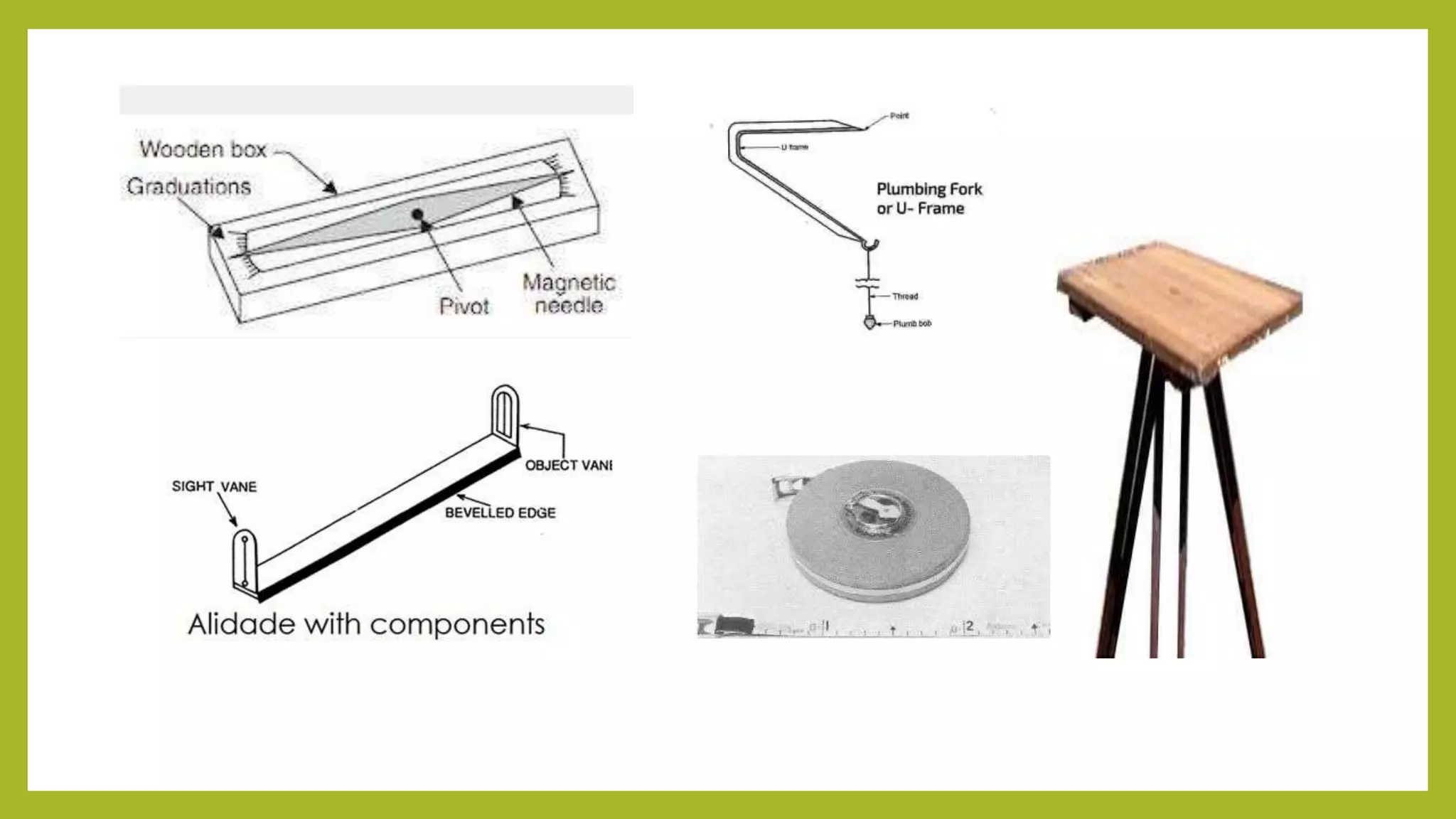


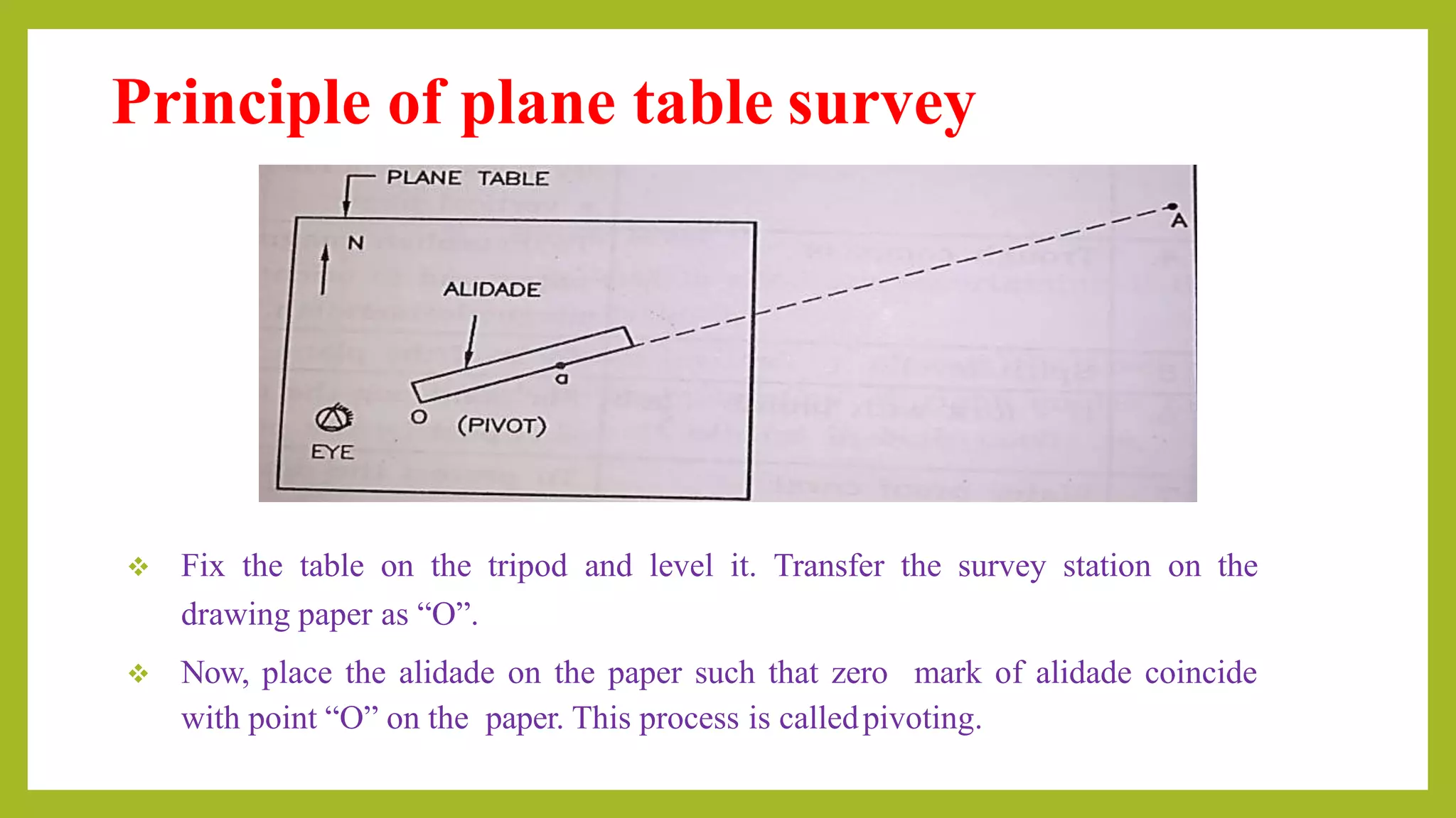

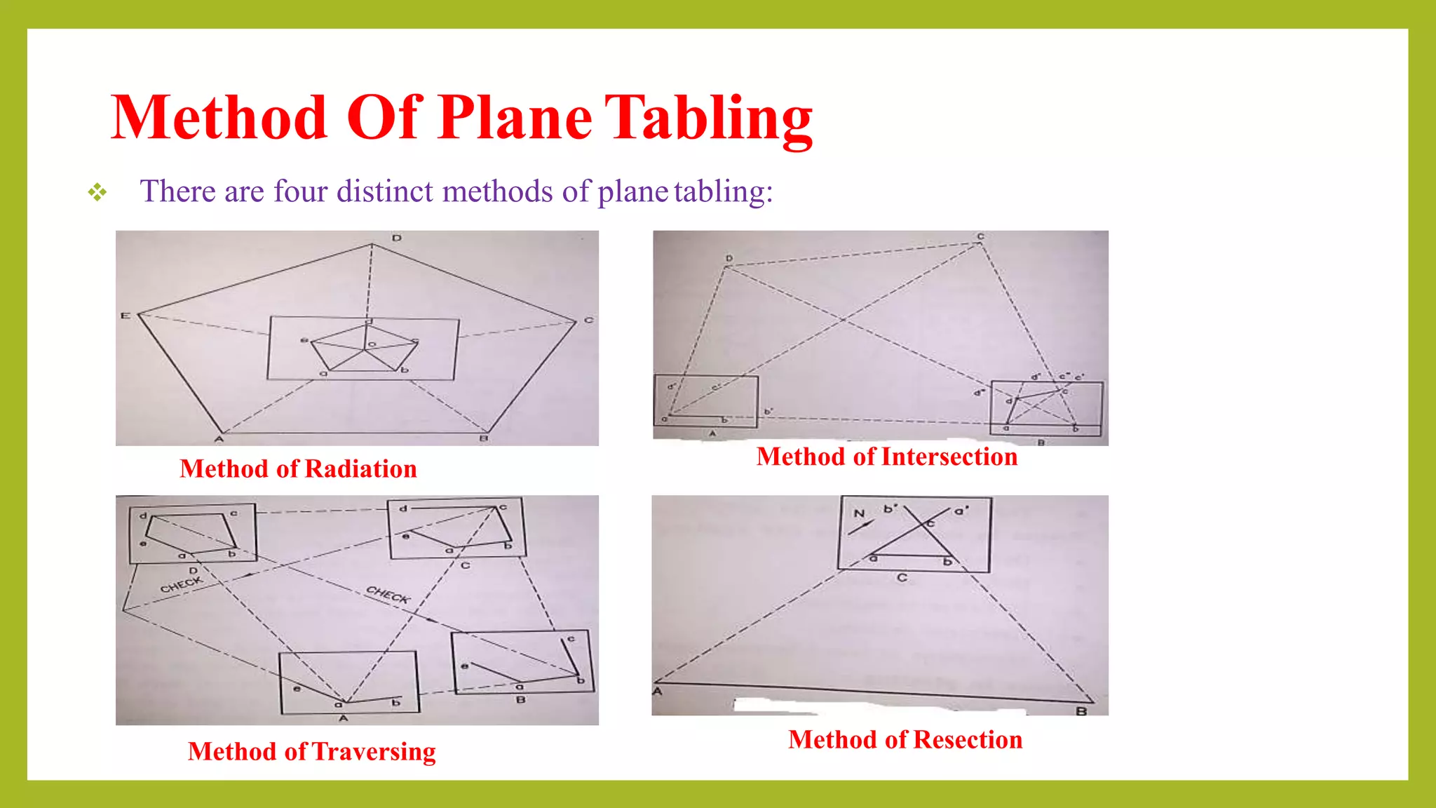


Plane table surveying is a graphical method used for mapping small areas, allowing simultaneous fieldwork and plotting. It involves various accessories like a drawing board, alidade, and tripod, offering advantages such as rapid mapping and cost-effectiveness, though it is less accurate and unsuitable for wet climates. The process includes centering, leveling, and orienting the table, with methods including radiation, intersection, traversing, and resection.

![Geotechnical Engineering-I [Lec #21: Consolidation Problems]](https://cdn.slidesharecdn.com/ss_thumbnails/21-180924141121-thumbnail.jpg?width=640&height=640&fit=bounds)


![Module-III SURVEYING-I [BTCVC304]](https://cdn.slidesharecdn.com/ss_thumbnails/module-iii-191020180049-thumbnail.jpg?width=640&height=640&fit=bounds)


