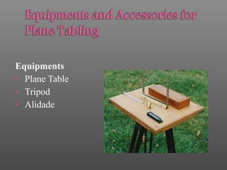
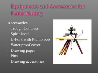
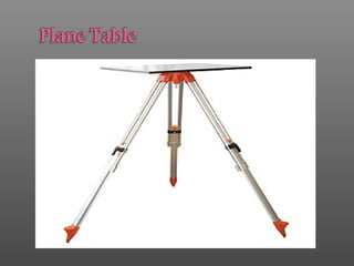
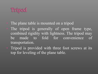
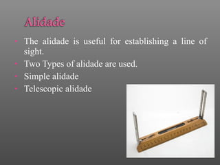
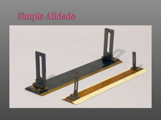
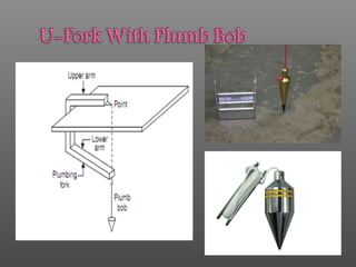
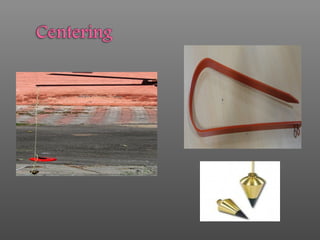
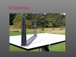
SURVEYING
 PARTH DESAI 151100106008
 DHRUV PATEL 151100106010
 KHUSHI AHIR 151100106017
 ANKUR PATEL 151100106030
 DIMPAL PATEL 151100106038
• Plane Table Surveying is a graphical method
of survey in which the field observations and
plotting aredonesimultaneously.
• Simple & cheaper.
• Most suitablefor small scalemaps.
• Drawn by the surveyor in the field, while the area
to besurveyed isbeforehiseyes.
Equipments
• Plane Table
• Tripod
• Alidade
Accessories
• Trough Compass
• Spirit level
• U-Fork with Plumb bob
• Water proof cover
• Drawing paper
• Pins
• Drawing accessories
• The plane table is mounted on a tripod
• The tripod is generally of open frame type,
combined rigidity with lightness. The tripod may
be made to fold for convenience of
transportation.
• Tripod is provided with three foot screws at its
top for leveling of the plane table.
• The alidade is useful for establishing a line of
sight.
• Two Types of alidade are used.
• Simple alidade
• Telescopic alidade
Trough Compass
• The trough compass is required for drawing
the line showing magnetic meridian on the
paper. It is used to orient the table to the
magnetic meridian.
• 00
at each end - themagnetic north.
• A Spirit Level is used for ascertaining If the
table is properly level.
• Two positions at right angles and getting the
bubblecentral in both positions.
• An umbrella is used to protect the drawing paper
from rain.
• Drawing paper is used for plotting the ground
details.
Advantages
• The plan is drawn by the surveyor himself
while the area to be surveyed is before his eyes.
Therefore, there is no possibility of omitting
the necessary measurements.
• The surveyor Can compare the plotted work
with theactual featuresof thearea.
• It is simple and cheaper than the theodolite
survey.
• It ismost suitable forsmall scale maps.
• No great skill is required to produce a
satisfactory map and work may be entrusted to a
subordinate.
• It is useful in magnetic areas where compass
may not beused.
• The mistakes in writing field books are
eliminated.
Disadvantages (Limitations)
• It is not intended for very accurate work.
• It is not suitable in monsoon.
• It is essentially a tropical instrument.
• Due to heaviness, it is inconvenient to
transport.
• Since there are so many accessories, there is
likelihood of them being lost.
• Parallelism Principle: “All the rays drawn
through various details should pass through
the survey station.”
• The Position of plane table at each station must
be identical, i.e. at each survey station the table
must be oriented in the direction of magnetic
north.
• Leveling
• Centering
• Orientation
• The Table should be set up at convenient height
for working on the board, say about 1 m. The
legs of Tripod should be spread well apart and
firmly into theground.
• The table should be so placed over the
station on the ground that the point plotted
on the sheet corresponding to the station
occupied should be exactly over the station
on the ground. The operation is known as
centering the plane table. It is done by U-fork
and plumb bob.
• For leveling the table ordinary spirit level may be
used. The table is leveled by placing the level on
the board in two positions at right angles and
getting thebubblecentral in both directions.
• The Process by which the positions occupied
by the board at various survey stations are
kept parallel is known as the orientation.
• There are two methods of orientation:
1)By magnetic needle
2)By back sighting
• In this method, the magnetic north is drawn on
paperat a particularstation.
• At the next station, the trough compass is placed
along the line of magnetic north and the table is
turned that the ends of magnetic needle are opposite
to zerosof thescale.
• The board is then fixed in position by clamps. This
method is inaccurate since that the results maybe
affected by thelocal attraction.
• A= First survey station
• B= Second survey station
• Suppose a line is drawn from station A on paper as
ab, representing lineAB on ground
• The table is turned till the line of sight bisects the
ranging rod at A. The board is then clamped in this
position.
• This method is better than the previous one and it
givesperfect orientation.
THANK YOU

PLANE TABLE SURVEYING

  • 1.
  • 3.
     PARTH DESAI151100106008  DHRUV PATEL 151100106010  KHUSHI AHIR 151100106017  ANKUR PATEL 151100106030  DIMPAL PATEL 151100106038
  • 4.
    • Plane TableSurveying is a graphical method of survey in which the field observations and plotting aredonesimultaneously. • Simple & cheaper. • Most suitablefor small scalemaps. • Drawn by the surveyor in the field, while the area to besurveyed isbeforehiseyes.
  • 5.
  • 6.
    Accessories • Trough Compass •Spirit level • U-Fork with Plumb bob • Water proof cover • Drawing paper • Pins • Drawing accessories
  • 8.
    • The planetable is mounted on a tripod • The tripod is generally of open frame type, combined rigidity with lightness. The tripod may be made to fold for convenience of transportation. • Tripod is provided with three foot screws at its top for leveling of the plane table.
  • 9.
    • The alidadeis useful for establishing a line of sight. • Two Types of alidade are used. • Simple alidade • Telescopic alidade
  • 12.
    Trough Compass • Thetrough compass is required for drawing the line showing magnetic meridian on the paper. It is used to orient the table to the magnetic meridian. • 00 at each end - themagnetic north.
  • 14.
    • A SpiritLevel is used for ascertaining If the table is properly level. • Two positions at right angles and getting the bubblecentral in both positions.
  • 16.
    • An umbrellais used to protect the drawing paper from rain.
  • 17.
    • Drawing paperis used for plotting the ground details.
  • 18.
    Advantages • The planis drawn by the surveyor himself while the area to be surveyed is before his eyes. Therefore, there is no possibility of omitting the necessary measurements. • The surveyor Can compare the plotted work with theactual featuresof thearea.
  • 19.
    • It issimple and cheaper than the theodolite survey. • It ismost suitable forsmall scale maps. • No great skill is required to produce a satisfactory map and work may be entrusted to a subordinate. • It is useful in magnetic areas where compass may not beused. • The mistakes in writing field books are eliminated.
  • 20.
    Disadvantages (Limitations) • Itis not intended for very accurate work. • It is not suitable in monsoon. • It is essentially a tropical instrument. • Due to heaviness, it is inconvenient to transport. • Since there are so many accessories, there is likelihood of them being lost.
  • 21.
    • Parallelism Principle:“All the rays drawn through various details should pass through the survey station.” • The Position of plane table at each station must be identical, i.e. at each survey station the table must be oriented in the direction of magnetic north.
  • 22.
  • 24.
    • The Tableshould be set up at convenient height for working on the board, say about 1 m. The legs of Tripod should be spread well apart and firmly into theground.
  • 25.
    • The tableshould be so placed over the station on the ground that the point plotted on the sheet corresponding to the station occupied should be exactly over the station on the ground. The operation is known as centering the plane table. It is done by U-fork and plumb bob. • For leveling the table ordinary spirit level may be used. The table is leveled by placing the level on the board in two positions at right angles and getting thebubblecentral in both directions.
  • 27.
    • The Processby which the positions occupied by the board at various survey stations are kept parallel is known as the orientation. • There are two methods of orientation: 1)By magnetic needle 2)By back sighting
  • 28.
    • In thismethod, the magnetic north is drawn on paperat a particularstation. • At the next station, the trough compass is placed along the line of magnetic north and the table is turned that the ends of magnetic needle are opposite to zerosof thescale. • The board is then fixed in position by clamps. This method is inaccurate since that the results maybe affected by thelocal attraction.
  • 30.
    • A= Firstsurvey station • B= Second survey station • Suppose a line is drawn from station A on paper as ab, representing lineAB on ground • The table is turned till the line of sight bisects the ranging rod at A. The board is then clamped in this position. • This method is better than the previous one and it givesperfect orientation.
  • 32.