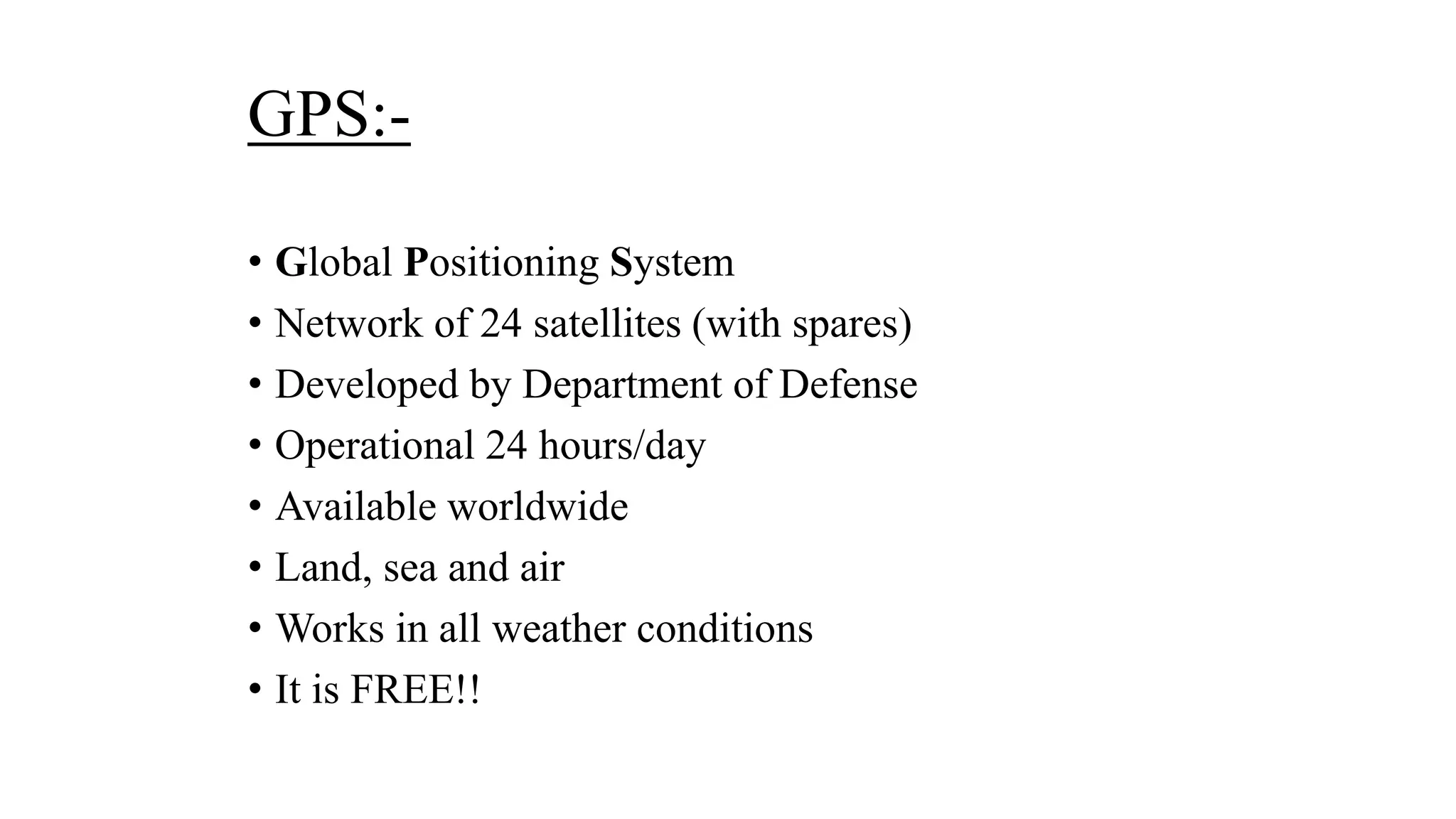
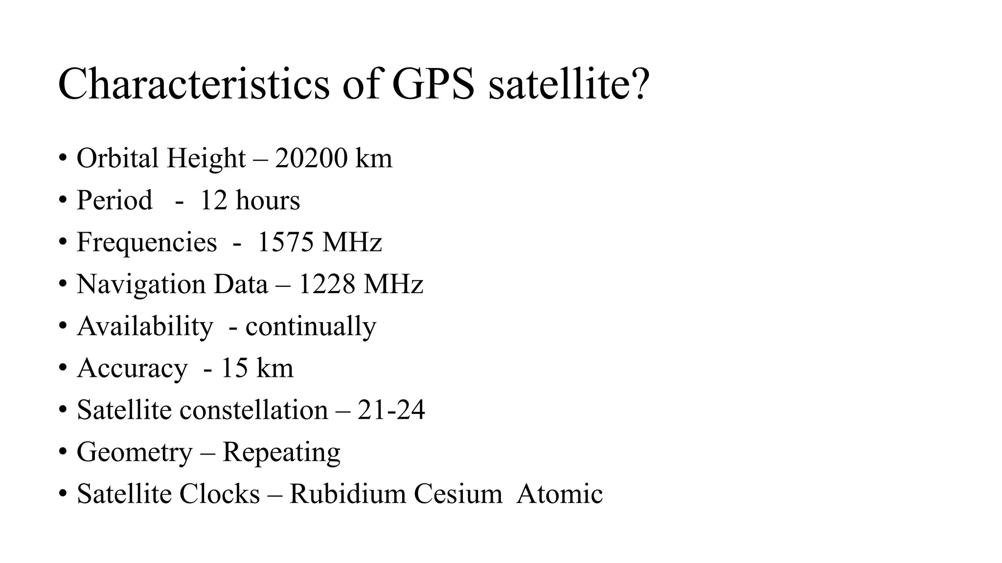
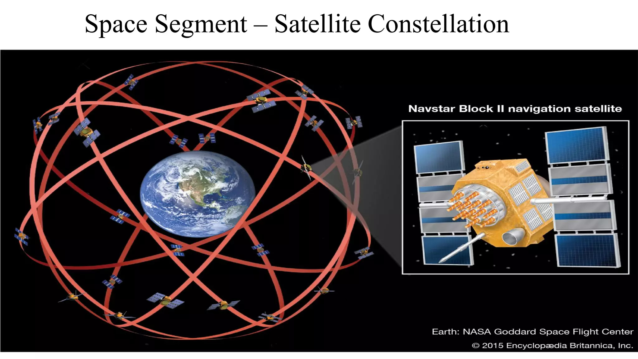
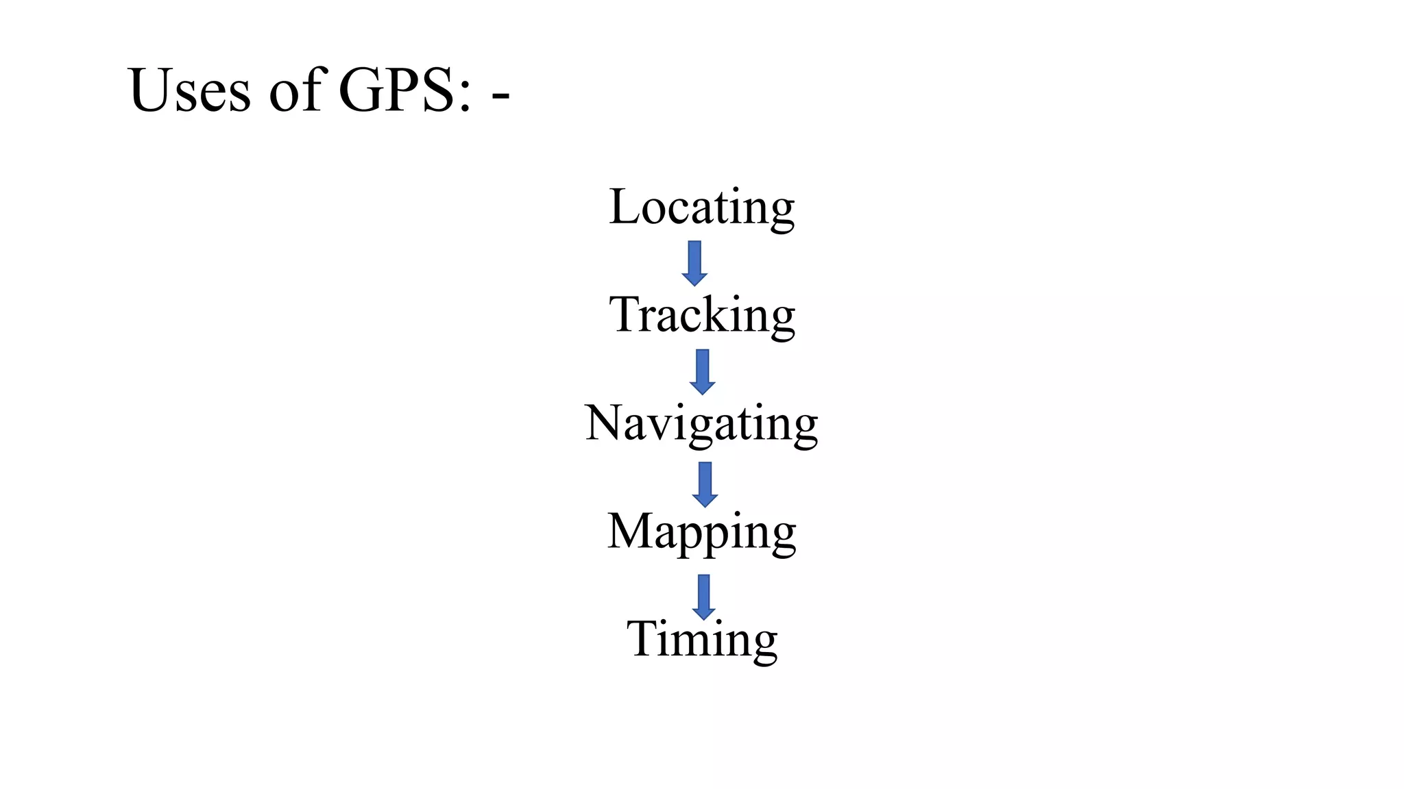
SlideShare a Scribd company logo
Global Positioning System
(GPS)
Manju
M.Phil.(Geography)
NET,NFSC
Maharshi Dayanand University (Rohtak)
What is GPS?
• The Global Positioning System (GPS), originally Navstar GPS, is a
satellite-based radionavigation system owned by the United States
government and operated by the United States Space Force.
• It is one of the global navigation satellite systems (GNSS) that
provides geolocation and time information to a GPS receiver
anywhere on or near the Earth where there is an unobstructed line of
sight to four or more GPS satellites.
• Obstacles such as mountains and buildings block the relatively weak
GPS signals.
GPS:-
• Global Positioning System
• Network of 24 satellites (with spares)
• Developed by Department of Defense
• Operational 24 hours/day
• Available worldwide
• Land, sea and air
• Works in all weather conditions
• It is FREE!!
Characteristics of GPS satellite?
• Orbital Height – 20200 km
• Period - 12 hours
• Frequencies - 1575 MHz
• Navigation Data – 1228 MHz
• Availability - continually
• Accuracy - 15 km
• Satellite constellation – 21-24
• Geometry – Repeating
• Satellite Clocks – Rubidium Cesium Atomic
History of GPS?
• The GPS project was launched in the United States in 1973 to overcome the limitations of
previous navigation systems, integrating ideas from several predecessors, including classified
engineering design studies from the 1960s. The U.S. Department of Defense developed the
system, which originally used 24 satellites. It was initially developed for use by the United
States military and became fully operational in 1995. Civilian use was allowed from the
1980s. Roger L. Easton of the Naval Research Laboratory, Ivan A. Getting of The Aerospace
Corporation, and Bradford Parkinson of the Applied Physics Laboratory are credited with
inventing it. The work of Gladys West is credited as instrumental in the development of
computational techniques for detecting satellite positions with the precision needed for GPS.
• The design of GPS is based partly on similar ground-based radio-navigation systems, such as
LORAN and the Decca Navigator, developed in the early 1940s.
• In 1955, Friedwardt Winterberg proposed a test of general relativity – detecting time slowing
in a strong gravitational field using accurate atomic clocks placed in orbit inside artificial
satellites. Special and general relativity predict that the clocks on the GPS satellites would be
seen by the Earth's observers to run 38 microseconds faster per day than the clocks on the
Earth. The GPS calculated positions would quickly drift into error, accumulating to 10
kilometers per day (6 mi/d). This was corrected for in the design of GPS.
Segments of GPS
I. Space Segment – Satellite Constellation.
II. Control Segment– Monitoring Stations and Ground Antennas.
III. User Segment – Receivers.
Segments of GPS?
Space Segment – Satellite Constellation
Control Segment-Monitoring Stations and Ground Antennas
User Segment
GPS receiver equipment:-
Some examples are: Our
airplane receivers,
handheld devices (mobile
phone, iPads etc.)
Uses of GPS: -
Locating
Tracking
Navigating
Mapping
Timing
Using GPS continued:-
• Survey disaster areas, Map movement of
environmental disasters (Oil spills, wild fires, floods,
etc)
• Mapping fallout shelters, sidewalks, streets, trees,
trails, etc.
• Measuring the growth or decline of mountains
Conclusion
❑ GPS is an organization of satellites that ceaselessly send coded
data, which makes it conceivable to decisively distinguish areas on
earth by estimating distance from the satellites.
❑GPS despite the fact that was created for military purposes,
however the quantity of regular citizen clients of GPS effectively well
far surpasses than number of possible military .
❑As examined in past subject, its application field is huge and new
applications will keep on being made as the innovation advances.
Reference:-
• Sharma, R.(2010). Air Photo Interpretation Remote Sensing and
Geographical Information System. Udaipur: Himanshu Publication.
• Chaunihal, D.(2012). Remote Sensing & Geographical Information
System. Allahabad: Sharda Pushtak, Bhawan,
THANK YOU

More Related Content

What's hot

Introduction to GPS
Introduction to GPSIntroduction to GPS
Introduction to GPS
Daniel Kim
 
GPS (Global Positioning System)
GPS (Global Positioning System)GPS (Global Positioning System)
GPS (Global Positioning System)
TANMAY SHARMA
 
Global positioning System
Global positioning SystemGlobal positioning System
Global positioning System
ayushrajput
 
GPS introduction
GPS introductionGPS introduction
GPS introduction
Jayantha Samarasinghe
 
Global Positioning System
Global Positioning SystemGlobal Positioning System
Global Positioning System
Navdeep Dhingra
 
gps technology
gps technologygps technology
gps technology
Naga Dinesh
 
Introduction of gps global navigation satellite systems
Introduction of gps   global navigation satellite systems Introduction of gps   global navigation satellite systems
Introduction of gps global navigation satellite systems DocumentStory
 
Global Positioning System
Global Positioning System Global Positioning System
Global Positioning System Varun B P
 
Global Positing System
Global Positing SystemGlobal Positing System
Global Positing System
Pranay Mondal
 
Gps
GpsGps
introduction-of-GNSS-1
introduction-of-GNSS-1introduction-of-GNSS-1
introduction-of-GNSS-1
Kutubuddin ANSARI
 
Introduction-of-GNSS-2
Introduction-of-GNSS-2Introduction-of-GNSS-2
Introduction-of-GNSS-2
Kutubuddin ANSARI
 
Gps-signal
Gps-signalGps-signal
Gps-signal
Kutubuddin ANSARI
 
"GPS" Global Positioning System [PDF]
"GPS" Global Positioning System  [PDF]"GPS" Global Positioning System  [PDF]
"GPS" Global Positioning System [PDF]
Course Hero
 
Gps
GpsGps
Gps
alexbar
 
Introduction to the Global Positioning System
Introduction to the Global Positioning SystemIntroduction to the Global Positioning System
Introduction to the Global Positioning System
Ningeni sionmosesaam
 
Gps
GpsGps
Global positioning system (GPS)
Global positioning system (GPS)Global positioning system (GPS)
Global positioning system (GPS)
Chandana R
 
GPS
GPSGPS

What's hot (20)

Introduction to GPS
Introduction to GPSIntroduction to GPS
Introduction to GPS
 
GPS (Global Positioning System)
GPS (Global Positioning System)GPS (Global Positioning System)
GPS (Global Positioning System)
 
Global positioning System
Global positioning SystemGlobal positioning System
Global positioning System
 
GPS introduction
GPS introductionGPS introduction
GPS introduction
 
Gps
GpsGps
Gps
 
Global Positioning System
Global Positioning SystemGlobal Positioning System
Global Positioning System
 
gps technology
gps technologygps technology
gps technology
 
Introduction of gps global navigation satellite systems
Introduction of gps   global navigation satellite systems Introduction of gps   global navigation satellite systems
Introduction of gps global navigation satellite systems
 
Global Positioning System
Global Positioning System Global Positioning System
Global Positioning System
 
Global Positing System
Global Positing SystemGlobal Positing System
Global Positing System
 
Gps
GpsGps
Gps
 
introduction-of-GNSS-1
introduction-of-GNSS-1introduction-of-GNSS-1
introduction-of-GNSS-1
 
Introduction-of-GNSS-2
Introduction-of-GNSS-2Introduction-of-GNSS-2
Introduction-of-GNSS-2
 
Gps-signal
Gps-signalGps-signal
Gps-signal
 
"GPS" Global Positioning System [PDF]
"GPS" Global Positioning System  [PDF]"GPS" Global Positioning System  [PDF]
"GPS" Global Positioning System [PDF]
 
Gps
GpsGps
Gps
 
Introduction to the Global Positioning System
Introduction to the Global Positioning SystemIntroduction to the Global Positioning System
Introduction to the Global Positioning System
 
Gps
GpsGps
Gps
 
Global positioning system (GPS)
Global positioning system (GPS)Global positioning system (GPS)
Global positioning system (GPS)
 
GPS
GPSGPS
GPS
 

Similar to Global Positioning System (GPS)

Gps
GpsGps
Gps
Mororoz
 
Global positioning system (GPS)
Global positioning system (GPS)Global positioning system (GPS)
Global positioning system (GPS)
Henil Shah
 
GPS
GPSGPS
Gps
GpsGps
Gps
Ria Das
 
Gps and its application
Gps and its applicationGps and its application
Gps and its application
shubham paliwal
 
Global Positioning System (GPS) in Helthcare
Global Positioning System (GPS) in HelthcareGlobal Positioning System (GPS) in Helthcare
Global Positioning System (GPS) in Helthcare
Zulfiquer Ahmed Amin
 
Global Positioning System
Global Positioning SystemGlobal Positioning System
Global Positioning SystemIshwar Bulbule
 
Global positioning system
Global positioning systemGlobal positioning system
Global positioning system
jananisivakumar97
 
Gps
GpsGps
Presentation on GPS by Harvendra Singh
Presentation on GPS by Harvendra SinghPresentation on GPS by Harvendra Singh
Presentation on GPS by Harvendra Singh
Self employed
 
Gps device in the geological field mapping
Gps device in the geological field mappingGps device in the geological field mapping
Gps device in the geological field mapping
Ensaf Atef
 
Global position system
Global position systemGlobal position system
Global position system
Iqbal Khan
 
Global positioning system
Global positioning systemGlobal positioning system
Global positioning systemDivya Lattoo
 
Gps
GpsGps
GPS.pptx
GPS.pptxGPS.pptx
Gps
GpsGps
558215 634216980498557500
558215 634216980498557500558215 634216980498557500
558215 634216980498557500
Rahul Mundra
 
GPS Surveying
GPS SurveyingGPS Surveying
GPS Surveying
Malla Reddy University
 

Similar to Global Positioning System (GPS) (20)

Seminar
SeminarSeminar
Seminar
 
Gps
GpsGps
Gps
 
Global positioning system (GPS)
Global positioning system (GPS)Global positioning system (GPS)
Global positioning system (GPS)
 
GPS
GPSGPS
GPS
 
Gps
GpsGps
Gps
 
Gps and its application
Gps and its applicationGps and its application
Gps and its application
 
Global Positioning System (GPS) in Helthcare
Global Positioning System (GPS) in HelthcareGlobal Positioning System (GPS) in Helthcare
Global Positioning System (GPS) in Helthcare
 
Global Positioning System
Global Positioning SystemGlobal Positioning System
Global Positioning System
 
Global positioning system
Global positioning systemGlobal positioning system
Global positioning system
 
Gps
GpsGps
Gps
 
Presentation on GPS by Harvendra Singh
Presentation on GPS by Harvendra SinghPresentation on GPS by Harvendra Singh
Presentation on GPS by Harvendra Singh
 
Gps device in the geological field mapping
Gps device in the geological field mappingGps device in the geological field mapping
Gps device in the geological field mapping
 
Global position system
Global position systemGlobal position system
Global position system
 
Global positioning system
Global positioning systemGlobal positioning system
Global positioning system
 
Gps
GpsGps
Gps
 
GPS.pptx
GPS.pptxGPS.pptx
GPS.pptx
 
Gps
GpsGps
Gps
 
Gps
GpsGps
Gps
 
558215 634216980498557500
558215 634216980498557500558215 634216980498557500
558215 634216980498557500
 
GPS Surveying
GPS SurveyingGPS Surveying
GPS Surveying
 

Recently uploaded

The Roman Empire A Historical Colossus.pdf
The Roman Empire A Historical Colossus.pdfThe Roman Empire A Historical Colossus.pdf
The Roman Empire A Historical Colossus.pdf
kaushalkr1407
 
The Challenger.pdf DNHS Official Publication
The Challenger.pdf DNHS Official PublicationThe Challenger.pdf DNHS Official Publication
The Challenger.pdf DNHS Official Publication
Delapenabediema
 
Sha'Carri Richardson Presentation 202345
Sha'Carri Richardson Presentation 202345Sha'Carri Richardson Presentation 202345
Sha'Carri Richardson Presentation 202345
beazzy04
 
Phrasal Verbs.XXXXXXXXXXXXXXXXXXXXXXXXXX
Phrasal Verbs.XXXXXXXXXXXXXXXXXXXXXXXXXXPhrasal Verbs.XXXXXXXXXXXXXXXXXXXXXXXXXX
Phrasal Verbs.XXXXXXXXXXXXXXXXXXXXXXXXXX
MIRIAMSALINAS13
 
Language Across the Curriculm LAC B.Ed.
Language Across the  Curriculm LAC B.Ed.Language Across the  Curriculm LAC B.Ed.
Language Across the Curriculm LAC B.Ed.
Atul Kumar Singh
 
Chapter 3 - Islamic Banking Products and Services.pptx
Chapter 3 - Islamic Banking Products and Services.pptxChapter 3 - Islamic Banking Products and Services.pptx
Chapter 3 - Islamic Banking Products and Services.pptx
Mohd Adib Abd Muin, Senior Lecturer at Universiti Utara Malaysia
 
The geography of Taylor Swift - some ideas
The geography of Taylor Swift - some ideasThe geography of Taylor Swift - some ideas
The geography of Taylor Swift - some ideas
GeoBlogs
 
Mule 4.6 & Java 17 Upgrade | MuleSoft Mysore Meetup #46
Mule 4.6 & Java 17 Upgrade | MuleSoft Mysore Meetup #46Mule 4.6 & Java 17 Upgrade | MuleSoft Mysore Meetup #46
Mule 4.6 & Java 17 Upgrade | MuleSoft Mysore Meetup #46
MysoreMuleSoftMeetup
 
Cambridge International AS A Level Biology Coursebook - EBook (MaryFosbery J...
Cambridge International AS  A Level Biology Coursebook - EBook (MaryFosbery J...Cambridge International AS  A Level Biology Coursebook - EBook (MaryFosbery J...
Cambridge International AS A Level Biology Coursebook - EBook (MaryFosbery J...
AzmatAli747758
 
The approach at University of Liverpool.pptx
The approach at University of Liverpool.pptxThe approach at University of Liverpool.pptx
The approach at University of Liverpool.pptx
Jisc
 
ESC Beyond Borders _From EU to You_ InfoPack general.pdf
ESC Beyond Borders _From EU to You_ InfoPack general.pdfESC Beyond Borders _From EU to You_ InfoPack general.pdf
ESC Beyond Borders _From EU to You_ InfoPack general.pdf
Fundacja Rozwoju Społeczeństwa Przedsiębiorczego
 
Synthetic Fiber Construction in lab .pptx
Synthetic Fiber Construction in lab .pptxSynthetic Fiber Construction in lab .pptx
Synthetic Fiber Construction in lab .pptx
Pavel ( NSTU)
 
Additional Benefits for Employee Website.pdf
Additional Benefits for Employee Website.pdfAdditional Benefits for Employee Website.pdf
Additional Benefits for Employee Website.pdf
joachimlavalley1
 
Introduction to Quality Improvement Essentials
Introduction to Quality Improvement EssentialsIntroduction to Quality Improvement Essentials
Introduction to Quality Improvement Essentials
Excellence Foundation for South Sudan
 
MARUTI SUZUKI- A Successful Joint Venture in India.pptx
MARUTI SUZUKI- A Successful Joint Venture in India.pptxMARUTI SUZUKI- A Successful Joint Venture in India.pptx
MARUTI SUZUKI- A Successful Joint Venture in India.pptx
bennyroshan06
 
Polish students' mobility in the Czech Republic
Polish students' mobility in the Czech RepublicPolish students' mobility in the Czech Republic
Polish students' mobility in the Czech Republic
Anna Sz.
 
Model Attribute Check Company Auto Property
Model Attribute  Check Company Auto PropertyModel Attribute  Check Company Auto Property
Model Attribute Check Company Auto Property
Celine George
 
Unit 8 - Information and Communication Technology (Paper I).pdf
Unit 8 - Information and Communication Technology (Paper I).pdfUnit 8 - Information and Communication Technology (Paper I).pdf
Unit 8 - Information and Communication Technology (Paper I).pdf
Thiyagu K
 
Digital Tools and AI for Teaching Learning and Research
Digital Tools and AI for Teaching Learning and ResearchDigital Tools and AI for Teaching Learning and Research
Digital Tools and AI for Teaching Learning and Research
Vikramjit Singh
 
Palestine last event orientationfvgnh .pptx
Palestine last event orientationfvgnh .pptxPalestine last event orientationfvgnh .pptx
Palestine last event orientationfvgnh .pptx
RaedMohamed3
 

Recently uploaded (20)

The Roman Empire A Historical Colossus.pdf
The Roman Empire A Historical Colossus.pdfThe Roman Empire A Historical Colossus.pdf
The Roman Empire A Historical Colossus.pdf
 
The Challenger.pdf DNHS Official Publication
The Challenger.pdf DNHS Official PublicationThe Challenger.pdf DNHS Official Publication
The Challenger.pdf DNHS Official Publication
 
Sha'Carri Richardson Presentation 202345
Sha'Carri Richardson Presentation 202345Sha'Carri Richardson Presentation 202345
Sha'Carri Richardson Presentation 202345
 
Phrasal Verbs.XXXXXXXXXXXXXXXXXXXXXXXXXX
Phrasal Verbs.XXXXXXXXXXXXXXXXXXXXXXXXXXPhrasal Verbs.XXXXXXXXXXXXXXXXXXXXXXXXXX
Phrasal Verbs.XXXXXXXXXXXXXXXXXXXXXXXXXX
 
Language Across the Curriculm LAC B.Ed.
Language Across the  Curriculm LAC B.Ed.Language Across the  Curriculm LAC B.Ed.
Language Across the Curriculm LAC B.Ed.
 
Chapter 3 - Islamic Banking Products and Services.pptx
Chapter 3 - Islamic Banking Products and Services.pptxChapter 3 - Islamic Banking Products and Services.pptx
Chapter 3 - Islamic Banking Products and Services.pptx
 
The geography of Taylor Swift - some ideas
The geography of Taylor Swift - some ideasThe geography of Taylor Swift - some ideas
The geography of Taylor Swift - some ideas
 
Mule 4.6 & Java 17 Upgrade | MuleSoft Mysore Meetup #46
Mule 4.6 & Java 17 Upgrade | MuleSoft Mysore Meetup #46Mule 4.6 & Java 17 Upgrade | MuleSoft Mysore Meetup #46
Mule 4.6 & Java 17 Upgrade | MuleSoft Mysore Meetup #46
 
Cambridge International AS A Level Biology Coursebook - EBook (MaryFosbery J...
Cambridge International AS  A Level Biology Coursebook - EBook (MaryFosbery J...Cambridge International AS  A Level Biology Coursebook - EBook (MaryFosbery J...
Cambridge International AS A Level Biology Coursebook - EBook (MaryFosbery J...
 
The approach at University of Liverpool.pptx
The approach at University of Liverpool.pptxThe approach at University of Liverpool.pptx
The approach at University of Liverpool.pptx
 
ESC Beyond Borders _From EU to You_ InfoPack general.pdf
ESC Beyond Borders _From EU to You_ InfoPack general.pdfESC Beyond Borders _From EU to You_ InfoPack general.pdf
ESC Beyond Borders _From EU to You_ InfoPack general.pdf
 
Synthetic Fiber Construction in lab .pptx
Synthetic Fiber Construction in lab .pptxSynthetic Fiber Construction in lab .pptx
Synthetic Fiber Construction in lab .pptx
 
Additional Benefits for Employee Website.pdf
Additional Benefits for Employee Website.pdfAdditional Benefits for Employee Website.pdf
Additional Benefits for Employee Website.pdf
 
Introduction to Quality Improvement Essentials
Introduction to Quality Improvement EssentialsIntroduction to Quality Improvement Essentials
Introduction to Quality Improvement Essentials
 
MARUTI SUZUKI- A Successful Joint Venture in India.pptx
MARUTI SUZUKI- A Successful Joint Venture in India.pptxMARUTI SUZUKI- A Successful Joint Venture in India.pptx
MARUTI SUZUKI- A Successful Joint Venture in India.pptx
 
Polish students' mobility in the Czech Republic
Polish students' mobility in the Czech RepublicPolish students' mobility in the Czech Republic
Polish students' mobility in the Czech Republic
 
Model Attribute Check Company Auto Property
Model Attribute  Check Company Auto PropertyModel Attribute  Check Company Auto Property
Model Attribute Check Company Auto Property
 
Unit 8 - Information and Communication Technology (Paper I).pdf
Unit 8 - Information and Communication Technology (Paper I).pdfUnit 8 - Information and Communication Technology (Paper I).pdf
Unit 8 - Information and Communication Technology (Paper I).pdf
 
Digital Tools and AI for Teaching Learning and Research
Digital Tools and AI for Teaching Learning and ResearchDigital Tools and AI for Teaching Learning and Research
Digital Tools and AI for Teaching Learning and Research
 
Palestine last event orientationfvgnh .pptx
Palestine last event orientationfvgnh .pptxPalestine last event orientationfvgnh .pptx
Palestine last event orientationfvgnh .pptx
 

Global Positioning System (GPS)

  • 3. • The Global Positioning System (GPS), originally Navstar GPS, is a satellite-based radionavigation system owned by the United States government and operated by the United States Space Force. • It is one of the global navigation satellite systems (GNSS) that provides geolocation and time information to a GPS receiver anywhere on or near the Earth where there is an unobstructed line of sight to four or more GPS satellites. • Obstacles such as mountains and buildings block the relatively weak GPS signals.
  • 4. GPS:- • Global Positioning System • Network of 24 satellites (with spares) • Developed by Department of Defense • Operational 24 hours/day • Available worldwide • Land, sea and air • Works in all weather conditions • It is FREE!!
  • 5. Characteristics of GPS satellite? • Orbital Height – 20200 km • Period - 12 hours • Frequencies - 1575 MHz • Navigation Data – 1228 MHz • Availability - continually • Accuracy - 15 km • Satellite constellation – 21-24 • Geometry – Repeating • Satellite Clocks – Rubidium Cesium Atomic
  • 6. History of GPS? • The GPS project was launched in the United States in 1973 to overcome the limitations of previous navigation systems, integrating ideas from several predecessors, including classified engineering design studies from the 1960s. The U.S. Department of Defense developed the system, which originally used 24 satellites. It was initially developed for use by the United States military and became fully operational in 1995. Civilian use was allowed from the 1980s. Roger L. Easton of the Naval Research Laboratory, Ivan A. Getting of The Aerospace Corporation, and Bradford Parkinson of the Applied Physics Laboratory are credited with inventing it. The work of Gladys West is credited as instrumental in the development of computational techniques for detecting satellite positions with the precision needed for GPS. • The design of GPS is based partly on similar ground-based radio-navigation systems, such as LORAN and the Decca Navigator, developed in the early 1940s. • In 1955, Friedwardt Winterberg proposed a test of general relativity – detecting time slowing in a strong gravitational field using accurate atomic clocks placed in orbit inside artificial satellites. Special and general relativity predict that the clocks on the GPS satellites would be seen by the Earth's observers to run 38 microseconds faster per day than the clocks on the Earth. The GPS calculated positions would quickly drift into error, accumulating to 10 kilometers per day (6 mi/d). This was corrected for in the design of GPS.
  • 7. Segments of GPS I. Space Segment – Satellite Constellation. II. Control Segment– Monitoring Stations and Ground Antennas. III. User Segment – Receivers.
  • 9. Space Segment – Satellite Constellation
  • 10. Control Segment-Monitoring Stations and Ground Antennas
  • 11. User Segment GPS receiver equipment:- Some examples are: Our airplane receivers, handheld devices (mobile phone, iPads etc.)
  • 12. Uses of GPS: - Locating Tracking Navigating Mapping Timing
  • 13. Using GPS continued:- • Survey disaster areas, Map movement of environmental disasters (Oil spills, wild fires, floods, etc) • Mapping fallout shelters, sidewalks, streets, trees, trails, etc. • Measuring the growth or decline of mountains
  • 14. Conclusion ❑ GPS is an organization of satellites that ceaselessly send coded data, which makes it conceivable to decisively distinguish areas on earth by estimating distance from the satellites. ❑GPS despite the fact that was created for military purposes, however the quantity of regular citizen clients of GPS effectively well far surpasses than number of possible military . ❑As examined in past subject, its application field is huge and new applications will keep on being made as the innovation advances.
  • 15. Reference:- • Sharma, R.(2010). Air Photo Interpretation Remote Sensing and Geographical Information System. Udaipur: Himanshu Publication. • Chaunihal, D.(2012). Remote Sensing & Geographical Information System. Allahabad: Sharda Pushtak, Bhawan,