The manuals for the CO2 laser cutting and engraving machine control system RDS 6442 g.
This is the most popular control system for the Chinese co2 laser machine.
In this manual, you can see how to operate the co2 laser machine with cutting and engraving, etc.
Tiêu chuẩn ISO 14644 cho phòng sạch phần 14: đánh giá tính phù hợp để sử dụng thiết bị bằng nồng độ hạt trong không khí. Xem thêm các tài liệu khác trên kênh của Công ty Cổ phần Tư vấn Thiết kế GMP EU
International Property Measurement Standards, created by the IPMS Coalition resolves the difficulties that different local standards of measuring real estate pose for investor, financing institutions or international occupiers. It was an absolute necessity and the problem has now been resolved. This presentation explain the Standards for office buildings.
Project ANEMELO : this document is a part of the preparation for the project Handbook.
The project is co-funded by the Erasmus+ Programme of the European Union. The content in this document only reflects the views of the project responsibles. The European Commission is in no way responsible for any use that may be made of the information it contains.
PharmaLedger – Dissemination and In-Project Exploitation PlanPharmaLedger
This document provides an overview of the PharmaLedger dissemination and exploitation strategy, drawn up according to a 36-month plan (January 2020-December 2022), to be reviewed yearly, to ensure the maximum project visibility, transparency, awareness raising on the targeted communities and exploitation of results through the project life cycle.
The PharmaLedger dissemination and exploitation strategy is based on the following principles:
• The objectives of the dissemination and exploitation will support three perspectives, (1) Project Focus, (2) Engagement Focus, and (3) Result-driven Focus.
• Each dissemination pillar will be supported by five components: WHY (ensuring awareness of the project), WHO (target audiences), WHAT (Key messages of project assets), HOW (communication channels) and WHEN (implementation and time planner).
• The dissemination activities will be conceived as knowledge sharing of the eight prioritised use cases in three Domain Reference Applications (DRAs), supporting and raising awareness about all PharmaLedger’s activities and results.
• Establish collaboration with related national, international and EU funded projects and initiatives.
• Publish PharmaLedger results and tools/services related to the blockchain enabled healthcare system in relevant national and international scientific journals addressing the pharmaceuticals, healthcare, and IT communities.
• Organise focused networking events such as workshops etc. However, due to the Covid-19 pandemic physical workshops will be replaced by virtual sessions and webcasts.
• Participate in external events and conferences (virtual during pandemic) in Healthcare, Pharmaceuticals, ICT etc., produce press releases, brochures, and posters.
The number of FTA satellite channels in the Arab World reached 716 channels by May 2013. The 716 analyzed channels broadcast on Arabsat, Nilesat, Noorsat and Yahlive (fully operational channels reached 658). The majority of the analyzed FTA satellite channels broadcast in Standard Definition (SD), while 9.7% broadcast in High Definition (HD).
Space In-Orbit Refueling Market is still in the development and demonstration phase. Space In-Orbit Refueling Industry to reach $1,090.8 million by 2032.
View: https://bisresearch.com/industry-report/space-in-orbit-refueling-market.html
Space In-Orbit Refueling Market Survey Report 2022-2032BIS Research Inc.
The space industry is continuously innovating and developing advanced technologies with the objective of enhancing space capabilities. With the increasing demand for sustainable and reusable space systems, the industry has developed in-orbit services to extend the lives of satellites and extract greater return on investment (ROI) out of their in-orbit assets.
Download the Sample Report at: https://bit.ly/3MmCiuN
Comprehensive Multi-year Plan - Universal Immunization Program -
In India Universal Immunization Program - (UIP) is bring forward by the Government, UIP ( Universal Immunization Program) in India is among the most successful vaccination program and cost-effective public health interventions.
Routine Immunization Program in India, Immunization Technical Support, routine immunization services in India, Ministry of Health and Family Welfare, Adverse Event Following Immunization Secretariat, Vaccine logistics and supply chain,Universal Immunization Program in India
Automobile Management System Project Report.pdfKamal Acharya
The proposed project is developed to manage the automobile in the automobile dealer company. The main module in this project is login, automobile management, customer management, sales, complaints and reports. The first module is the login. The automobile showroom owner should login to the project for usage. The username and password are verified and if it is correct, next form opens. If the username and password are not correct, it shows the error message.
When a customer search for a automobile, if the automobile is available, they will be taken to a page that shows the details of the automobile including automobile name, automobile ID, quantity, price etc. “Automobile Management System” is useful for maintaining automobiles, customers effectively and hence helps for establishing good relation between customer and automobile organization. It contains various customized modules for effectively maintaining automobiles and stock information accurately and safely.
When the automobile is sold to the customer, stock will be reduced automatically. When a new purchase is made, stock will be increased automatically. While selecting automobiles for sale, the proposed software will automatically check for total number of available stock of that particular item, if the total stock of that particular item is less than 5, software will notify the user to purchase the particular item.
Also when the user tries to sale items which are not in stock, the system will prompt the user that the stock is not enough. Customers of this system can search for a automobile; can purchase a automobile easily by selecting fast. On the other hand the stock of automobiles can be maintained perfectly by the automobile shop manager overcoming the drawbacks of existing system.
Courier management system project report.pdfKamal Acharya
It is now-a-days very important for the people to send or receive articles like imported furniture, electronic items, gifts, business goods and the like. People depend vastly on different transport systems which mostly use the manual way of receiving and delivering the articles. There is no way to track the articles till they are received and there is no way to let the customer know what happened in transit, once he booked some articles. In such a situation, we need a system which completely computerizes the cargo activities including time to time tracking of the articles sent. This need is fulfilled by Courier Management System software which is online software for the cargo management people that enables them to receive the goods from a source and send them to a required destination and track their status from time to time.
Cosmetic shop management system project report.pdfKamal Acharya
Buying new cosmetic products is difficult. It can even be scary for those who have sensitive skin and are prone to skin trouble. The information needed to alleviate this problem is on the back of each product, but it's thought to interpret those ingredient lists unless you have a background in chemistry.
Instead of buying and hoping for the best, we can use data science to help us predict which products may be good fits for us. It includes various function programs to do the above mentioned tasks.
Data file handling has been effectively used in the program.
The automated cosmetic shop management system should deal with the automation of general workflow and administration process of the shop. The main processes of the system focus on customer's request where the system is able to search the most appropriate products and deliver it to the customers. It should help the employees to quickly identify the list of cosmetic product that have reached the minimum quantity and also keep a track of expired date for each cosmetic product. It should help the employees to find the rack number in which the product is placed.It is also Faster and more efficient way.
Immunizing Image Classifiers Against Localized Adversary Attacksgerogepatton
This paper addresses the vulnerability of deep learning models, particularly convolutional neural networks
(CNN)s, to adversarial attacks and presents a proactive training technique designed to counter them. We
introduce a novel volumization algorithm, which transforms 2D images into 3D volumetric representations.
When combined with 3D convolution and deep curriculum learning optimization (CLO), itsignificantly improves
the immunity of models against localized universal attacks by up to 40%. We evaluate our proposed approach
using contemporary CNN architectures and the modified Canadian Institute for Advanced Research (CIFAR-10
and CIFAR-100) and ImageNet Large Scale Visual Recognition Challenge (ILSVRC12) datasets, showcasing
accuracy improvements over previous techniques. The results indicate that the combination of the volumetric
input and curriculum learning holds significant promise for mitigating adversarial attacks without necessitating
adversary training.
Democratizing Fuzzing at Scale by Abhishek Aryaabh.arya
Presented at NUS: Fuzzing and Software Security Summer School 2024
This keynote talks about the democratization of fuzzing at scale, highlighting the collaboration between open source communities, academia, and industry to advance the field of fuzzing. It delves into the history of fuzzing, the development of scalable fuzzing platforms, and the empowerment of community-driven research. The talk will further discuss recent advancements leveraging AI/ML and offer insights into the future evolution of the fuzzing landscape.
Sachpazis:Terzaghi Bearing Capacity Estimation in simple terms with Calculati...Dr.Costas Sachpazis
Terzaghi's soil bearing capacity theory, developed by Karl Terzaghi, is a fundamental principle in geotechnical engineering used to determine the bearing capacity of shallow foundations. This theory provides a method to calculate the ultimate bearing capacity of soil, which is the maximum load per unit area that the soil can support without undergoing shear failure. The Calculation HTML Code included.
Overview of the fundamental roles in Hydropower generation and the components involved in wider Electrical Engineering.
This paper presents the design and construction of hydroelectric dams from the hydrologist’s survey of the valley before construction, all aspects and involved disciplines, fluid dynamics, structural engineering, generation and mains frequency regulation to the very transmission of power through the network in the United Kingdom.
Author: Robbie Edward Sayers
Collaborators and co editors: Charlie Sims and Connor Healey.
(C) 2024 Robbie E. Sayers
Saudi Arabia stands as a titan in the global energy landscape, renowned for its abundant oil and gas resources. It's the largest exporter of petroleum and holds some of the world's most significant reserves. Let's delve into the top 10 oil and gas projects shaping Saudi Arabia's energy future in 2024.
Event Management System Vb Net Project Report.pdfKamal Acharya
In present era, the scopes of information technology growing with a very fast .We do not see any are untouched from this industry. The scope of information technology has become wider includes: Business and industry. Household Business, Communication, Education, Entertainment, Science, Medicine, Engineering, Distance Learning, Weather Forecasting. Carrier Searching and so on.
My project named “Event Management System” is software that store and maintained all events coordinated in college. It also helpful to print related reports. My project will help to record the events coordinated by faculties with their Name, Event subject, date & details in an efficient & effective ways.
In my system we have to make a system by which a user can record all events coordinated by a particular faculty. In our proposed system some more featured are added which differs it from the existing system such as security.
NO1 Uk best vashikaran specialist in delhi vashikaran baba near me online vas...Amil Baba Dawood bangali
Contact with Dawood Bhai Just call on +92322-6382012 and we'll help you. We'll solve all your problems within 12 to 24 hours and with 101% guarantee and with astrology systematic. If you want to take any personal or professional advice then also you can call us on +92322-6382012 , ONLINE LOVE PROBLEM & Other all types of Daily Life Problem's.Then CALL or WHATSAPP us on +92322-6382012 and Get all these problems solutions here by Amil Baba DAWOOD BANGALI
#vashikaranspecialist #astrologer #palmistry #amliyaat #taweez #manpasandshadi #horoscope #spiritual #lovelife #lovespell #marriagespell#aamilbabainpakistan #amilbabainkarachi #powerfullblackmagicspell #kalajadumantarspecialist #realamilbaba #AmilbabainPakistan #astrologerincanada #astrologerindubai #lovespellsmaster #kalajaduspecialist #lovespellsthatwork #aamilbabainlahore#blackmagicformarriage #aamilbaba #kalajadu #kalailam #taweez #wazifaexpert #jadumantar #vashikaranspecialist #astrologer #palmistry #amliyaat #taweez #manpasandshadi #horoscope #spiritual #lovelife #lovespell #marriagespell#aamilbabainpakistan #amilbabainkarachi #powerfullblackmagicspell #kalajadumantarspecialist #realamilbaba #AmilbabainPakistan #astrologerincanada #astrologerindubai #lovespellsmaster #kalajaduspecialist #lovespellsthatwork #aamilbabainlahore #blackmagicforlove #blackmagicformarriage #aamilbaba #kalajadu #kalailam #taweez #wazifaexpert #jadumantar #vashikaranspecialist #astrologer #palmistry #amliyaat #taweez #manpasandshadi #horoscope #spiritual #lovelife #lovespell #marriagespell#aamilbabainpakistan #amilbabainkarachi #powerfullblackmagicspell #kalajadumantarspecialist #realamilbaba #AmilbabainPakistan #astrologerincanada #astrologerindubai #lovespellsmaster #kalajaduspecialist #lovespellsthatwork #aamilbabainlahore #Amilbabainuk #amilbabainspain #amilbabaindubai #Amilbabainnorway #amilbabainkrachi #amilbabainlahore #amilbabaingujranwalan #amilbabainislamabad
NO1 Uk best vashikaran specialist in delhi vashikaran baba near me online vas...
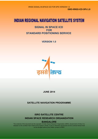
Irnss sps icd_june_2014 (1)
1. IRNSS SIGNAL-IN-SPACE ICD FOR SPS VERSION 1.0
ISRO-IRNSS-ICD-SPS-1.0
SIGNAL IN SPACE ICD
FOR
STANDARD POSITIONING SERVICE
VERSION 1.0
JUNE 2014
SATELLITE NAVIGATION PROGRAMME
ISRO SATELLITE CENTRE
INDIAN SPACE RESEARCH ORGANIZATION
BANGALORE
The contents of this document are the copyright of Indian Space Research Organization (ISRO), Government of India. It is
released on the condition that it shall not be copied in whole, in part or otherwise reproduced and the contents thereof shall
not be divulged without prior written consent of ISRO
2. ISRO-IRNSS-ICD-SPS-1.0
IRNSS SIS ICD FOR
STANDARD POSITIONING SERVICE
VERSION 1.0
JUNE 2014
REVIEWED BY
_____________________________
L. MRUTHYUNJAYA
HEAD, SATELLITE NAVIGATION
PROGRAMME MANAGEMENT OFFICE
APPROVED BY
_____________________________
A.S.GANESHAN
PROGRAMME DIRECTOR
SATELLITE NAVIGATION PROGRAMME
ISRO SATELLITE CENTRE
INDIAN SPACE RESEARCH ORGANIZATION
BANGALORE
3. IRNSS SIGNAL-IN-SPACE ICD FOR SPS VERSION 1.0
Preface
This document provides the Signal and the Data Structure for Standard Positioning Service
(SPS) of the Indian Regional Navigational Satellite System (IRNSS). The document
addresses the signal modulations, the frequency bands, the received power levels, the data
structures and their interpretations, user algorithms etc.
This document is filed for copyright registration by Indian Space Research Organization (ISRO), Government of India in July
2014. It is released on the condition that it shall not be copied in whole, in part or otherwise reproduced and the contents
thereof shall not be divulged without prior written consent of ISRO
4. Terms of Use & Disclaimers
The IRNSS Signal-in-Space ICD for SPS is released to the public to provide the essential
information on the IRNSS signal-in-space, to facilitate research & development and aid the
commercial use of the IRNSS signals for navigation-based applications, according to the
terms and conditions specified hereafter:
– The publishing authority does not make any assurance on the fitness of the information
furnished in the document for any specific purpose. The contents of the document are
only for information and the publishing authority does not assume any legal liability
for any product developed based on the information. No liability is herby assumed for
any consequences arising out of the usage of the information contained in the IRNSS
SIS ICD for SPS.
– The IRNSS SIS ICD for SPS shall not be reproduced or transmitted, partly or wholly, in
electronic or print medium without the consent of the publishing authority.
– The information furnished in the IRNSS SIS ICD for SPS could be subject to
modification and update. Although the publishing authority shall take its best efforts
to notify the public about the updates in the SIS ICD, it does not assume any
obligation to advise any person or organization on its future updates of SIS ICD.
5. Table of Contents
1. INTRODUCTION..............................................................................................................1
1.1 SCOPE OF THE DOCUMENT..........................................................................................1
1.2 DOCUMENT OVERVIEW................................................................................................1
2 IRNSS SYSTEM OVERVIEW.........................................................................................2
2.1 IRNSS ARCHITECTURE..................................................................................................2
2.2 IRNSS SPACE SEGMENT................................................................................................2
2.3 IRNSS GROUND SEGMENT............................................................................................3
2.4 USER SEGMENT...............................................................................................................3
2.5 IRNSS SERVICES..............................................................................................................3
3 IRNSS SIGNAL CHARACTERISITCS.........................................................................4
3.1 IRNSS FREQUENCY BANDS..........................................................................................4
3.2 IRNSS CARRIER FREQUENCIES...................................................................................4
3.3 MODULATION SCHEME.................................................................................................5
3.3.1 Standard Positioning Service.................................................................................................5
3.3.2 Interplex Modulation.............................................................................................................5
3.4 TRANSMITTED SIGNAL PHASE NOISE.......................................................................7
3.5 CORRELATION LOSS......................................................................................................8
3.6 TRANSMITTED SIGNALS CODE/DATA COHERENCY..............................................8
3.7 SPURIOUS CHARACTERISTICS....................................................................................8
3.8 RECIEVED POWER LEVELS ON GROUND..................................................................8
3.8.1 Minimum Levels...................................................................................................................8
3.8.2 Maximum Levels...................................................................................................................8
3.9 POLARIZATION CHARACTERISTICS..........................................................................9
3.10 CHANNEL GROUP DELAY...........................................................................................9
4 IRNSS PRN CODES........................................................................................................10
4.1 PRN CODES FOR SPS.....................................................................................................10
4.1.1 SPS Code Generation..........................................................................................................10
5 IRNSS DATA STRUCTURE..........................................................................................13
5.1 BIT AND BYTE ORDERING CRITERIA.......................................................................13
6. 5.2 FEC ENCODING..............................................................................................................13
5.3 INTERLEAVING..............................................................................................................14
5.4 SYNC WORD...................................................................................................................14
5.5 TAIL BITS........................................................................................................................14
5.6 CYCLIC REDUNDANCY CHECK (CRC).....................................................................14
5.7 IRNSS SYSTEM TIME....................................................................................................15
5.8 COORDINATE SYSTEM................................................................................................15
5.9 FRAME STRUCTURE.....................................................................................................15
5.9.1 Sub Frame Structure............................................................................................................15
5.10 IRNSS NAVIGATION DATA.......................................................................................17
5.10.1 Primary Navigation Parameters.........................................................................................17
5.10.2 Secondary Navigation Parameters.....................................................................................17
5.10.3 Idle Pattern........................................................................................................................18
6 SUBFRAME STRUCTURE...........................................................................................19
6.1 SUBFRAME DATA FORMAT........................................................................................19
6.1.1 Subframe 1 Data Format......................................................................................................19
6.1.2 Subframe 2 Data Format......................................................................................................20
6.1.3 Subframe 3 & 4 Data Format (IRNSS Message Structure)..................................................21
6.2 DATA CONTENTS..........................................................................................................29
6.2.1 Subframe 1 & Subframe 2...................................................................................................29
6.2.2 Message Type 5 Data Contents............................................................................................32
6.2.3 Message Type 7 Data Contents............................................................................................36
6.2.4 Message Type 9 Data Contents............................................................................................36
6.2.5 Message Type 11 Data Contents..........................................................................................37
6.2.6 Message Type 14 Data Contents..........................................................................................38
6.2.7 Message Type 18 Data Contents..........................................................................................39
6.2.8 Message Type 26 Data Contents..........................................................................................40
6.2.9 Message Type 0 Data Contents............................................................................................41
6.3 BROADCAST INTERVALS............................................................................................41
7. Appendix A. Algorithm For Satellite time correction.........................................................43
Appendix B. Algorithm For Ephemeris Computation.......................................................44
Appendix C. Algorithm for 1
st
Order Ionosphere Free Range for Dual Frequency
User 46
Appendix D. Algorithm for Ionosphere Delay Corrections for Single Frequency User
using Ionosphere Grid Corrections47
Appendix E. Algorithm for Satellite Position Computation using Almanac....................51
Appendix F. Algorithm for IRNSS Time offsets computation with respect to UTC,
UTC(NPLI) and other GNSS 53
Appendix G. Algorithm for application of EOP..................................................................55
Appendix H. Algorithm For Ionosphere Delay computation using coefficients...............56
Appendix I. Algorithm for Satellite Position and Clock offset computation using
Differential Corrections 58
8. IRNSS SIGNAL-IN-SPACE ICD FOR SPS VERSION 1.0
List of figures
Figure 1: IRNSS Architecture....................................................................................................2
Figure 2: IRNSS Space Segment Interface with User Segment................................................3
Figure 3: Spectrum for Radio Navigation Satellite Services in L Band....................................4
Figure 4: Spectrum for IRNSS Signal in S Band.......................................................................4
Figure 5: Composites Signal Generation...................................................................................7
Figure 6: SPS code generator...................................................................................................12
Figure 7 : IRNSS Code Timing Diagram................................................................................12
Figure 8 : IRNSS Subframe Structure.....................................................................................13
Figure 9: FEC Encoding..........................................................................................................13
Figure 10: Master Frame Structure..........................................................................................15
Figure 11: Structure of Subframe 1 & 2..................................................................................16
Figure 12: Structure of Subframe 3 & 4..................................................................................16
Figure 13: Subframe 1 Data Layout.........................................................................................20
Figure 14: Subframe 2 Data Layout.........................................................................................20
Figure 15: Message Type 5 Data Layout.................................................................................23
Figure 16: Message Type 7 Data Layout.................................................................................24
Figure 17: Message Type 9 data layout...................................................................................25
Figure 18: Message Type 11 data layout.................................................................................26
Figure 19: Message Type 14 Data Layout...............................................................................27
Figure 20: Message Type 18 data layout.................................................................................27
Figure 21: Message Type 26 data layout.................................................................................28
Figure 22: Message Type 0 data layout...................................................................................29
Figure 23: Identified IGPs for Grid Based Corrections over Indian Region...........................33
Figure 24: Ionospheric Pierce Point Geometry........................................................................47
Figure 25: Four Point Interpolation Algorithm........................................................................48
Figure 26: Three Point Interpolation Algorithm......................................................................49
9. IRNSS SIGNAL-IN-SPACE ICD FOR SPS VERSION 1.0
List of tables
Table 1: Carrier Frequencies and bandwidths...........................................................................5
Table 2: Symbol Definitions......................................................................................................6
Table 3: Parameter Values for Composite Signal Generation...................................................7
Table 4: Minimum received power of IRNSS signals...............................................................8
Table 5: Maximum received power of IRNSS signals..............................................................9
Table 6: Code lengths of IRNSS signals..................................................................................10
Table 7: Code Phase assignment for SPS signals....................................................................11
Table 8: FEC encoding parameters..........................................................................................14
Table 9: Interleaving parameters.............................................................................................14
Table 10:Subframe ID to Subframe Mapping.........................................................................17
Table 11: Subframe 1 format...................................................................................................19
Table 12:Subframe 2 format....................................................................................................20
Table 13: IRNSS Message Types............................................................................................21
Table 14: IRNSS PRN Numbers..............................................................................................21
Table 15: Message Type 5 format...........................................................................................22
Table 16: Message Type 7 format...........................................................................................23
Table 17: Message Type 9 format...........................................................................................24
Table 18: Message type 11 format...........................................................................................25
Table 19: Message Type 14 format.........................................................................................26
Table 20: Message Type 18 format.........................................................................................27
Table 21: Message Type 26 format.........................................................................................28
Table 22: Message Type 0 format...........................................................................................29
Table 23: Issue of Data Ephemeris & Clock (IODEC) and its Applicability..........................30
Table 24: URA Index to URA Mapping..................................................................................30
Table 25: Signal Health Flags..................................................................................................31
Table 26: Ephemeris Parameters.............................................................................................32
Table 27: Region Id and index for identified IGP locations....................................................33
Table 28: Evaluation of GIVEI................................................................................................35
Table 29: Almanac Parameters Definitions.............................................................................36
Table 30: UDRA to UDRAI Mapping.....................................................................................38
Table 31: Timescale ID to Timescale Mapping.......................................................................40
Table 32: Subframe/Message Broadcast Interval....................................................................41
10. IRNSS SIGNAL-IN-SPACE ICD FOR SPS VERSION 1.0
1. INTRODUCTION
1.1 SCOPE OF THE DOCUMENT
The Signal In Space (SIS) Interface Control Document (ICD) for Standard Positioning
Service version-1.0 specifies the interface between the IRNSS space segment and the IRNSS
user segment for SPS service.
1.2 DOCUMENT OVERVIEW
The document is organized as follows:
Chapter 1 contains the scope of the document.
Chapter 2 contains the IRNSS system overview.
Chapter 3 contains the signal characteristics such as frequency bands, modulation,
PRN codes and frame structure.
Chapter 4 provides the characteristics of the spreading codes.
Chapter 5 provides the features of IRNSS data structure.
Chapter 6 provides the formats and the contents of the subframes.
Copyright registration under progress - 1 -
11. IRNSS SIGNAL-IN-SPACE ICD FOR SPS VERSION 1.0
2 IRNSS SYSTEM OVERVIEW
Indian Regional Navigation Satellite System (IRNSS) is an independent, indigenously
developed satellite navigation system fully planned, established and controlled by the Indian
Space Research Organization (ISRO).
2.1 IRNSS ARCHITECTURE
The IRNSS architecture mainly consists of:
Space Segment
Ground Segment
User Segment
Figure 1 depicts the IRNSS architecture
Figure 1: IRNSS Architecture
2.2 IRNSS SPACE SEGMENT
Based on various considerations the minimum number of satellites required for IRNSS
constellation is worked out to be 7 (3 GSO and 4 IGSO). The 3 GSOs will be located at 32.5º
E, 83º E and 131.5º E and the 4 IGSOs have their longitude crossings 55º E and 111.75º E
(two in each plane).
Copyright registration under progress - 2 -
12. IRNSS SIGNAL-IN-SPACE ICD FOR SPS VERSION 1.0
2.3 IRNSS GROUND SEGMENT
Ground Segment is responsible for the maintenance and operation of the IRNSS
constellation. The Ground segment comprises of:
ISRO Navigation Centre
IRNSS Spacecraft Control Facility
IRNSS Range and Integrity Monitoring Stations
IRNSS Network Timing Centre
IRNSS CDMA Ranging Stations
Laser Ranging Stations
Data Communication Network
2.4 USER SEGMENT
The User segment mainly consists of:
Single frequency IRNSS receiver capable of receiving SPS signal at L5 or S band frequency.
A dual frequency IRNSS receiver capable of receiving both L5 and S band frequencies.
A receiver compatible to IRNSS and other GNSS signals.
Figure 2 specifies the radio frequency interface between space and user segments. Each
IRNSS satellite provides SPS signals in L5 and S bands.
IRNSS Space Segment
Space Vehicles (SV)
L5 S
SPS SPS
IRNSS
User Segment
Figure 2: IRNSS Space Segment Interface with User Segment
2.5 IRNSS SERVICES
Standard Position Services (SPS), an open service without encryption and Restricted Service
(RS), an authorized with encryption are the basic services offered by IRNSS.
Copyright registration under progress - 3 -
13. IRNSS SIGNAL-IN-SPACE ICD FOR SPS VERSION 1.0
3 IRNSS SIGNAL CHARACTERISITCS
3.1 IRNSS FREQUENCY BANDS
The IRNSS SPS service is transmitted on L5 (1164.45 – 1188.45 MHz) and S (2483.5-2500
MHz) bands. The frequency in L5 band has been selected in the allocated spectrum of Radio
Navigation Satellite Services as indicated in Figure 3 and S band as indicated in Figure 4.
Figure 3: Spectrum for Radio Navigation Satellite Services in L Band
2483.50MHz
2492.028MHz
2500.00MHz
IRNSS Band
Figure 4: Spectrum for IRNSS Signal in S Band
3.2 IRNSS CARRIER FREQUENCIES
The IRNSS carrier frequencies and the bandwidths of transmission for the SPS service is
shown in Table 1.
Copyright registration under progress - 4 -
14. IRNSS SIGNAL-IN-SPACE ICD FOR SPS VERSION 1.0
Table 1: Carrier Frequencies and bandwidths
Signal Carrier Frequency Bandwidth
SPS – L5 1176.45 MHz 24 MHz (1164.45 -1188.45 MHz)
SPS – S 2492.028 MHz 16.5MHz (2483.50 – 2500.00MHz)
3.3 MODULATION SCHEME
3.3.1 Standard Positioning Service
The SPS signal is BPSK(1) modulated on L5 and S bands. The navigation data at data rate of
50 sps (1/2 rate FEC encoded) is modulo 2 added to PRN code chipped at 1.023 Mcps
identified for SPS service. The CDMA modulated code, modulates the L5 and S carriers at
1176.45MHz and 2492.028 MHz respectively.
3.3.2 Interplex Modulation
Figure 5 depicts the modulation scheme adopted in IRNSS. Each carrier is modulated by
three signals namely, BPSK (1), Data channel BOC (5, 2) and Pilot channel BOC (5, 2).
These signals when passed through power amplifier or TWTA operated at saturation will
produce a non constant envelope. Hence additional fourth signal namely, interplex signal is
added in order to have a constant envelope at the output of TWTA RF spectrum.
3.3.2.1 Mathematical Description
The mathematical description for baseband navigation signals, using symbol definitions
given above is as follows:
SPS Data Signal
∞
ssps(t) = csps(|i|L_sps) . dsps ([i]CD_sps). rectTc,sps (t-iTc,sps)…………………………………..….(1)
i=-∞
RS BOC Pilot Signal
∞
srs_p(t) = crs_p(|i|L_rs_p) . rectTc,rs_p(t-iTc,rs_p). scrs_p(t,0)…………… …………..……………(2)
i=-∞
RS BOC Signal
∞
srs_d(t) = crs_d(|i|L_rs_d) . drs_d([i]CD_rs_d). rectTc,rs_d(t-iTc,rs_d). scrs_d(t,0)………………..….(3)
i=-∞
The sub-carrier is defined as :
scx(t,φ) = sgn[sin(2πfsc,xt + φ)]………………………………………………… …………………..(4)
Copyright registration under progress - 5 -
15. IRNSS SIGNAL-IN-SPACE ICD FOR SPS VERSION 1.0
The IRNSS RS data and pilot BOC signals are sinBOC.
Hence the subcarrier phase φ=0.
The complex envelope of composite signal with Interplex signal (I(t)) is:
1
s(t) = 3 [√2 (ssps(t) + srs_p(t)) + j(2. srs_d(t) – I(t))]…………………… ………………………….(5)
The Interplex signal I(t) is generated to realize the constant envelope composite signal.
Symbol definitions are given in Table 2.
Table 2: Symbol Definitions
Symbol Description
cx(i) ‗i‘th chip of spreading code
dx(i) ‗i‘th bit of navigation message
scx(t) Binary NRZ subcarrier
|i|X
‗i‘ modulo ‗X‘
[i]X
Integer part of (i/X)
CD_x No. of chips per navigation data bit
L_x Length of spreading code in chips
rectx (t) Rectangular pulse function with duration ‗x‘
Tc,x Spreading code chip duration
fsc Subcarrier frequency
φ Subcarrier phase
The operation |i|X gives the code chip index for any signal. Similarly [i]X gives data bit
index for any signal. Table 3 gives data, code and subcarrier rates for composite signal
generation.
Copyright registration under progress - 6 -
16. IRNSS SIGNAL-IN-SPACE ICD FOR SPS VERSION 1.0
d
sps (Rd_sps)
c
rs_p
drs(Rd_rs)
c
rs_d
ssps (t)
c
sps (Rc_sps)
s
rs_p
(t) Constant
Envelope s(t)
Mux
sc(t)
srs_d (t)
(Rc_rs)
sc(t) (Rsc)
Figure 5: Composites Signal Generation
Below table shows parameter values for composite signal generation.
Table 3: Parameter Values for Composite Signal Generation
Parameter Unit Value Description
Rd_sps sps 50 SPS data rate
Rc_sps Mcps 1.023 SPS code chip rate
Rd_rs sps 50 RS data rate
Rc_rs Mcps 2.046 RS code chip rate
Rsc Mcps 5.115 Sub-carrier frequency
3.4 TRANSMITTED SIGNAL PHASE NOISE
The Phase Noise spectral density of the un-modulated carrier will allow a second order phase
locked loop with 10 Hz one sided noise bandwidth to track the carrier to an accuracy of 0.1
radians RMS.
Copyright registration under progress - 7 -
17. IRNSS SIGNAL-IN-SPACE ICD FOR SPS VERSION 1.0
3.5 CORRELATION LOSS
Correlation loss is defined as the difference between the transmitted power received in the
specified signal bandwidth and the signal power recovered in the ideal receiver of the same
bandwidth, which perfectly correlates using an exact replica of the waveform within an ideal
band-pass filter with linear phase. For all IRNSS signals, the correlation loss that occurs in
the navigation payload shall not exceed 0.6 dB.
3.6 TRANSMITTED SIGNALS CODE/DATA COHERENCY
The raising/ leading edge of each data symbol coincides with the starting edge of the PRN
code chip. The starting edge of each secondary code chip coincides with the starting edge of
primary code chip.
3.7 SPURIOUS CHARACTERISTICS
For all IRNSS signals, in-band spurious transmission shall be at least -50 dB with respect to
power level of un-modulated carrier wave.
3.8 RECIEVED POWER LEVELS ON GROUND
3.8.1 Minimum Levels
Table 4 indicates the assured minimum power levels of the IRNSS signals received by a user
receiver on ground. The minimum received power on ground is measured at the output of an
ideally matched RHCP 0 dBi user receiving antenna when the spacecraft elevation angle is
higher than 5°.
Table 4: Minimum received power of IRNSS signals
Signal Signal Component Minimum Received Power (dBW)
L5 SPS BPSK(1) -159.0
S SPS BPSK (1) -162.3
3.8.2 Maximum Levels
Table 5 indicates the Maximum power levels of the IRNSS signals received by a user
receiver on ground. The maximum received power on ground is measured at the output of an
ideally matched RHCP 0 dBi user receiving antenna when the spacecraft elevation angle is
higher than 5°.
Copyright registration under progress - 8 -
18. IRNSS SIGNAL-IN-SPACE ICD FOR SPS VERSION 1.0
Table 5: Maximum received power of IRNSS signals
Signal Signal Component Maximum Received Power (dBW)
L5 SPS BPSK(1) -154.0
S SPS BPSK (1) -157.3
3.9 POLARIZATION CHARACTERISTICS
All the IRNSS signals are Right Hand Circularly Polarized. The antenna axial ratio does not
exceed 2.0 dB.
3.10 CHANNEL GROUP DELAY
Channel group delay is defined as a time difference between transmitted RF signal (measured
at phase center of transmitting antenna) and signal at the output of the onboard frequency
source.
There are three different delay parameters: Fixed/Bias group delay, Differential group delay
and Group delay uncertainty in bias and differential value.
The fixed delay or Hardware group delay is a bias term. It is included in the clock correction
parameters transmitted in the navigation data, and is therefore accounted for by the user
computations of system time.
The group delay uncertainty shows the variability in the path delay due to operational
environment uncertainty and other factors. The effective uncertainty of the group delay will
be in the range of 3nsec (2σ).
Differential Group Delay is the delay difference between two navigation signals. It consists
of random plus bias components. The mean differential is defined as the bias component and
will be either positive or negative. For a given navigation payload redundancy configuration,
the absolute value of the mean differential delay shall not exceed 30nsec. The random
variations about the mean will be in the range of 3nsec (two sigma). To correct the bias
component of the group delay, TGD parameter is provided to the user in the navigation
message.
Copyright registration under progress - 9 -
19. IRNSS SIGNAL-IN-SPACE ICD FOR SPS VERSION 1.0
4 IRNSS PRN CODES
IRNSS utilizes Gold codes for the SPS signal. The codes are selected based on the auto-
correlation and cross-correlation properties. The codes are generated using Linear Feedback
Shift Registers.
The code lengths for each signal component are listed in Table 6.
Table 6: Code lengths of IRNSS signals
Channel Code Length Primary Secondary
(ms) ( chips) (Chips)
L5 - SPS 1 ms 1023 ------
S - SPS 1ms 1023 ------
4.1 PRN CODES FOR SPS
PRN Codes selected for Standard Positioning System are similar to GPS C/A Gold codes.
The length of each code is 1023 chips. The code is chipped at 1.023 Mcps.
4.1.1 SPS Code Generation
For SPS code generation, the two polynomials G1 and G2 are as defined below:
G1: X
10
+ X
3
+ 1 and G2: X
10
+X
9
+ X
8
+ X
6
+X
3
+ X
2
+ 1
Polynomial G1 and G2 are similar to the ones used by GPS C/A signal. The G1 and G2
generators are realized by using 10 bits Maximum Length Feedback Shift Registers
(MLFSR). The initial state of G2 provides the chip delay. G1 and G2 are XOR‘ed for the
generation of the final 1023 chip long PRN sequence. The time period of the PRN sequence
is 1 millisecond.
Table 7 shows the identified SPS codes for various SVs for the SPS service.
Copyright registration under progress - 10 -
20. IRNSS SIGNAL-IN-SPACE ICD FOR SPS VERSION 1.0
Table 7: Code Phase assignment for SPS signals
L5 –SPS S-SPS
PRN SV Initial Condition Initial Condition
for First 10 Chips in for First 10 Chips in
ID Location
G2 Register Octal2 G2 Register Octal2
1 55 E 1110100111 130 0011101111 1420
2 55 E 0000100110 1731 0101111101 1202
3 83 E 1000110100 0713 1000110001 0716
4 111.75 E 0101110010 1215 0010101011 1524
5 111.75 E 1110110000 0117 1010010001 0556
6 32.5 E 0001101011 1624 0100101100 1323
7 131.5 E 0000010100 1753 0010001110 1561
PRN ID mentioned in the table is also reflected in Table 14.
The Figure 6 shows the generation of SPS code. Figure 7 depicts the timing diagram of
IRNSS code generations
Copyright registration under progress - 11 -
22. IRNSS SIGNAL-IN-SPACE ICD FOR SPS VERSION 1.0
5 IRNSS DATA STRUCTURE
IRNSS Signal In Space transmits Navigation message contents on SPS service, in L5 and S
bands. The IRNSS Master frame comprises of four Sub Frames. Each Subframe is 600
symbols transmitted at 50 sps. Each subframe has 16 bit Sync word followed by 584 bits of
interleaved data. The subframe format is shown in Figure 8.
600 symbols
Sync
code
16 bits
Subframe
584 symbols
Figure 8 : IRNSS Subframe Structure
The 584 symbols of interleaved data is obtained from FEC encoding 292 subframe bits.
5.1 BIT AND BYTE ORDERING CRITERIA
The following bit and byte ordering criteria will be used while formatting the IRNSS
navigation data:
The most significant bit/byte is numbered as bit/byte 1
The most significant bit/byte is transmitted first
5.2 FEC ENCODING
The Navigation data subframe of 292 bits is rate 1/2 convolution encoded and clocked at 50
symbols per second. Figure 9 depicts the convolution coding scheme in IRNSS
G1
q-1 q-1 q-1 q-1 q-1 q-1
Input Output
G2
Figure 9: FEC Encoding
The convolution encoding for the navigation data is performed as per the parameters given in
Table 8.
24. IRNSS SIGNAL-IN-SPACE ICD FOR SPS VERSION 1.0
Table 8: FEC encoding parameters
Parameter Value
g ( X )
25. Coding Rate ½
Coding Scheme Convolution
Constraint Length 7
Generator Polynomial G1 = (171)o
G2 = (133)o
Encoding Sequence G1 then G2
Each subframe of 292 bits, after encoding, results in 584 symbols.
5.3 INTERLEAVING
The 584 symbols of FEC encoded navigation data is interleaved using a block interleaver
with n columns and k rows. Data is written in columns and then, read in rows. Table 9
indicates the interleaving mechanism.
Table 9: Interleaving parameters
Parameter Arrangement
Block Interleaver size 584
Block Interleaver Dimensions (n columns x k rows) 73 x 8
5.4 SYNC WORD
The Synchronization pattern for each of the subframe is 16 bit word. The Synchronization
word is not encoded. The synchronization pattern allows the receiver to achieve
synchronization to the subframe. The Sync pattern is EB90 Hex.
5.5 TAIL BITS
The tail bit field consists of 6 zero value bits enabling completion of the FEC decoding of
each subframe in the user receiver.
5.6 CYCLIC REDUNDANCY CHECK (CRC)
The data signal contains parity coding according to the following conventions. CRC – 24Q
polynomial shall be used for each Sub frame. Twenty-four bits of CRC parity will provide
protection against burst as well as random errors with a probability of undetected error ≤ 2
-24
= 5.96x10
-8
for
all channel bit error probabilities ≤ 0.5
24
The generator polynomial is given as
i 0
gi=1 for i equal to 0, 1, 3, 4, 5, 6, 7, 10, 11, 14, 17,
= 0 otherwise
gi X i
18, 23, 24…….…………(6)
Copyright registration under progress - 14 -
26. IRNSS SIGNAL-IN-SPACE ICD FOR SPS VERSION 1.0
5.7 IRNSS SYSTEM TIME
The IRNSS system time is given as 27-bit binary number composed of two parameters as
follows:
The Week Number is an integer counter that gives the sequential week number from the
origin of the IRNSS time. This parameter is coded on 10 bits appearing in the first subframe,
which covers 1024 weeks (about 19 years).
The Time of Week Count (TOWC) indicates the number of 12 second counts at which the
next subframe will begin. It is represented in 17 bits. The TOW count value ranges from 1 to
50400 to cover one entire week. The Time Of Week (TOW) in seconds is obtained by
multiplying TOWC with 12. The TOWC will have a value of 1 at 00:00:00 Sunday
(Changeover from Saturday to Sunday).
The IRNSS System Time start epoch shall be 00:00 UT on Sunday August 22
nd
1999
(midnight between August 21
st
and 22
nd
). At the start epoch, IRNSS System Time shall be
ahead of UTC by 13 leap seconds. (i.e. IRNSS time, August 22
nd
1999, 00:00:00 corresponds
to UTC time August 21
st
1999, 23:59:47)
The epoch denoted in the navigation messages by TOWC and WN will be measured relative
to the leading edge of the first chip of the first code sequence of the first subframe symbol.
The transmission timing of the navigation message provided through the TOWC is
synchronized to IRNSS System Time.
5.8 COORDINATE SYSTEM
IRNSS navigation system uses WGS 84 coordinate system for the computation of user
position.
5.9 FRAME STRUCTURE
The IRNSS Master Frame is of 2400 symbols long made of four sub frames. Each sub frame
is 600 symbols long. Sub frames 1 and 2 transmit fixed primary navigation parameters. Sub
frames 3 and 4 transmit secondary navigation parameters in the form of messages. The master
frame structure is shown in Figure 10. All subframes transmit TLM, TOWC, Alert, Autonav,
Subframe ID, Spare bit, Navigation data, CRC and Tail bits. Subframe 3 and 4 in addition
transmit Message ID and PRN ID.
MASTER FRAME
SUBFRAME 1 SUBFRAME 2 SUBFRAME 3 SUBFRAME 4
600 Symbols 600 Symbols 600 Symbols 600 Symbols
Figure 10: Master Frame Structure
5.9.1 Sub Frame Structure
Each Subframe is 292 bits long (without FEC encoding and Sync Word). The start of each
subframe is with TLM word of 8 bits. Each subframe ends with 24 bit CRC followed by 6 tail
bits.
Copyright registration under progress - 15 -
27. IRNSS SIGNAL-IN-SPACE ICD FOR SPS VERSION 1.0
In subframes 1 and 2 the Navigation data is allotted 232 bits starting from bit number 31. In
subframes 3 and 4 the Navigation data is allotted 220 bits starting from bit number 37. The
structure of a typical subframe 1 & 2 is shown in Figure 11. The structure of a typical
subframe 3 & 4 is shown in Figure 12.
1 9 26 27 28 30 31 263 287
TLM
TOWC
ALERT
AUTONAV
SUBFRAME
ID
SPARE
DATA
CRC
Tail
8 BITS 17BITS 1 BIT 1 BIT 2 BIT 1 BIT 232 BITS 24BITS 6BITS
Figure 11: Structure of Subframe 1 & 2
1 9 26 27 28 30 31 37 257 263 287
TLM
TOWC
ALERT
AUTONAV
SUBFRAME
ID
SPARE
MESSAGE
ID
DATA
PRNID
CRC
Tail
8 BITS 17BITS 1 BIT 1 BIT 2 BIT 1 BIT 6 BITS 220 BITS 6 24 6 BITS
BITS
Figure 12: Structure of Subframe 3 & 4
5.9.1.1 TLM
The 8 bits of TLM word are reserved for future.
5.9.1.2 Time of Week Count (TOWC)
Following the TLM word is 17 bits of Time Of Week Count (TOWC). The value of TOWC is
multiplied with 12 to obtain the time in seconds corresponding to the start of the next
subframe.
5.9.1.3 Alert Flag
Bit 26 is allotted to the Alert Flag. The Alert flag signifies to users that the utilization of
navigation data from that particular satellite shall be at the users‘ own risk.
5.9.1.4 AutoNav
Bit 27 is allotted to the Autonav. Satellites store 7 days ephemeris and clock parameter sets as
AutoNav data sets. Satellite can support broadcast of primary navigation parameters from
AutoNav data sets with no uplink from ground for maximum of 7 days. During AutoNav
mode, the AutoNav flag is set to 1.
5.9.1.5 Subframe ID
Each subframe in the master frame can be identified by the 2 bit subframe ID allotted in bit
number 28 and 29. The mapping between 2-bit subframe identifier and subframe number is
provided in Table 10.
Copyright registration under progress - 16 -
28. IRNSS SIGNAL-IN-SPACE ICD FOR SPS VERSION 1.0
Table 10:Subframe ID to Subframe Mapping
Subframe ID Subframe
00 1
01 2
10 3
11 4
5.9.1.6 Spare Bit
Bit 30 is identified as spare bit for future use.
5.9.1.7 Message ID
Each message in the subframe 3 and 4 has a 6 bit message identifier that uniquely identifies
the message type in the subframe. The lists of messages are defined in section 6.1.3. The bits
allocated for the message identifier are Bit 31 to Bit 36.
5.9.1.8 PRN ID
Each message in the subframe 3 and 4 has a 6 bit PRN identifier that uniquely identifies the
spacecraft transmitting the corresponding message. The PRN IDs for IRNSS spacecrafts are
defined in Table 14. The PRN ID is allocated Bit 257 - Bit 262 of subframe 3 & subframe 4.
5.10 IRNSS NAVIGATION DATA
The navigation data (NAV data) includes IRNSS satellite ephemeris, IRNSS time, satellite
clock correction parameters, status messages and other secondary information etc. Navigation
data modulated on top of the ranging codes can be identified as primary and secondary
navigation parameters
5.10.1Primary Navigation Parameters
• Satellite Ephemeris
• Satellite clock correction parameters
• Satellite & signal health status
• User Range Accuracy
• Total group delay
5.10.2Secondary Navigation Parameters
• Satellite almanac
• Ionospheric grid delays and confidence
• IRNSS Time Offsets with respect to to UTC & GNSS
• Ionospheric delay correction coefficients
• Text messages
• Differential corrections
• Earth orientation parameters
Copyright registration under progress - 17 -
29. IRNSS SIGNAL-IN-SPACE ICD FOR SPS VERSION 1.0
5.10.3 Idle Pattern
Under certain conditions Idle Pattern containing alternating zeroes and ones is transmitted in
the data part of the navigation sub-frames of IRNSS. Idle pattern shall begin from bit 41 in
Sub-frame 1, bit 31 in sub-frame 2, and bit 37 in sub-frame 3&4, the first bit being a zero.
An idle pattern in Sub-frame 1 or 2 is accompanied by an Alert flag and a valid CRC for the
sub-frame. When idle pattern is transmitted in Sub-frame 3 or 4 the Alert flag is not set, but
the CRC will be corrupted for the corresponding sub-frame.
Copyright registration under progress - 18 -
30. IRNSS SIGNAL-IN-SPACE ICD FOR SPS VERSION 1.0
6 SUBFRAME STRUCTURE
The primary navigation parameters are transmitted in Subframe 1 and 2. Subframe 3 and 4
cater to the transmission of secondary navigation parameters viz. ionosphere grid corrections,
almanac, IRNSS time offsets with respect to UTC and other GNSS, ionosphere correction
coefficients, Earth orientation parameters, differential corrections, and text messages. The
secondary navigation parameters are transmitted in the form of messages.
6.1 SUBFRAME DATA FORMAT
6.1.1 Subframe 1 Data Format
Table 11 below specifies the contents of data section of subframe 1. The bit layout of
subframe 1 is provided in Figure 13.
Table 11: Subframe 1 format
Parameter Notation Scale factor (LSB) Size (bits) Units
Week Number WN 1 10 week
Clock bias a
fo 2-31
22* sec
Clock drift a
f 1 2-43
16* sec/sec
Clock drift rate a
f 2 2-55
8* sec/sec2
SV Accuracy URA 1 4
Time of clock t
o c
16 16 sec
Total Group Delay T 2-31 8* sec
GD
Mean Motion Difference ∆n 2-41 22* semi-circles/sec
Issue of Data Ephemeris & Clock IODEC 1 8 -
Reserved - 1 10 -
L5 Flag 1 1 -
S Flag 1 1 -
Amplitude of the Cosine Harmonic
2-28Correction Term to the Argument C 15* radians
of Latitude uc
Amplitude of the Sine Harmonic
2-28Correction Term to the Argument C 15* radians
of Latitude us
Amplitude of the Cosine Harmonic
2-28Correction Term to the Angle of C 15* radians
Inclination ic
Amplitude of the Sine Harmonic
2-28Correction Term to the Angle of C 15* radians
Inclination is
Amplitude of the Cosine Harmonic
Correction Term to the Orbit C 2-4
15* meters
Radius rc
Amplitude of the Sine Harmonic
2-4Correction Term to the Orbit C 15* meters
Radius rs
Rate of Inclination angle IDOT 2-43 14* semi-circles/sec
Spare 2 -
* Parameters indicated are 2‘s complement
Copyright registration under progress - 19 -
31. IRNSS SIGNAL-IN-SPACE ICD FOR SPS VERSION 1.0BitIndex
31-40
41-62
63-78
79-86
87-90
91-106
107-114
115-136
137-144
145-154
155
156
157-171
172-186
187-201
202-216
217-231
232-246
247-260
261-262
Notatio
n
WN
a
a
a
URA
t
T
∆n
IODEC
Reserved
L5Flag
SFlag
C
C
C
C
C
C
IDOT
Spare
f0
f1
f2
oc
GD
uc
us
ic
is
rc
rs
Size(bits
)
10 22* 16* 8* 4 16 8* 22* 8 10 1 1 15* 15* 15* 15* 15* 15* 14* 2
Figure 13: Subframe 1 Data Layout
6.1.2 Subframe 2 Data Format
Table 12 provides the data contents of Subframe 2 and their notation and Figure 14 provides
the data layout. The subframe 2 contains remaining Satellite ephemeris parameters.
Table 12:Subframe 2 format
Parameter Notation Scale factor (LSB) Size (bits) Units
Mean Anomaly Mo 2-31 32* semi-circles
Time of ephemeris t
o e
16 16 sec
Eccentricity e 2-33 32 dimensionless
Square root of Semi major axis √A 2-19 32
Long of Ascending Node o
2-31
32 * semi-circles
Argument of perigee 2-31 32* semi-circles
Rate of RAAN
2-41
22* semi-circles/sec
Inclination i0 2-31 32* semi-circles
Spare 2
* Parameters indicated are 2‘s complement
BitIndex
31-62
63-78
79-110
111-142
143-174
175-206
207-228
229-260
261-262
Notation
M
t
e
√A
i
Spare
0
oe
0
Size(bits)
32* 16 32 32 32 * 32* 22* 32* 2
Figure 14: Subframe 2 Data Layout
Note: Time of Clock toc (broadcasted in subframe 1) and toe in (broadcasted in subframe 2) to
be matched for data integrity.
Copyright registration under progress - 20 -
32. IRNSS SIGNAL-IN-SPACE ICD FOR SPS VERSION 1.0
6.1.3 Subframe 3 & 4 Data Format (IRNSS Message Structure)
Subframe 3 and Subframe 4 transmit IRNSS navigation parameters as Messages. The Table
13 identifies the message types that the IRNSS satellites will transmit. Provision exists to
define new message for future requirements in IRNSS. Each message is identified by a
unique message identifier. Each message transmits 220 bits of Navigation data.
Table 13: IRNSS Message Types
PARAMETER MSG ID
Ionospheric grid parameters for 15 grid points 5
(1 of 6 regions)
Almanac parameters 7
UTC and Time Sync Parameters with respect to GPS 9
EOP and Ionosphere coefficients 11
Differential corrections for one satellite 14
Text message 18
UTC and Time Sync Parameters with respect to GNSS 26
Null Message 0
Reserved for future 1-4, 6, 8, 10, 12, 13,
15-17, 19-25, 27-63
It is planned to indicate the PRN number of the transmitting SV in 6 bits after data portion of
the IRNSS messages. The list of PRN IDs for the currently defined IRNSS satellites is given
in Table 14.
Table 14: IRNSS PRN Numbers
SV Location PRN ID PRN ID in Binary
55⁰ E - 1 1 000001
55⁰ E - 2 2 000010
83⁰ E 3 000011
111.75⁰ E - 1 4 000100
111.75⁰ E -2 5 000101
32.5⁰ E 6 000110
131.5⁰ E 7 000111
6.1.3.1 Message Type 5 Data Format
Message Type 5 transmits the ionospheric grid corrections in the form of GIVEI and GIVD
for one region. Thus, 6 messages of message type 5 (one for each region with 15 IGPs)
together provide the complete set of ionospheric grid based parameters for Indian region.
Table 15 defines the parameters and the notations used in Message Type 5. The bit-layout for
data contents of Message-type 5 is provided in Figure 15.
Copyright registration under progress - 21 -
34. IRNSS SIGNAL-IN-SPACE ICD FOR SPS VERSION 1.0
BitIndex
155-158
159-167
168-171
172-180
181-184
185-193
194-197
198-206
207-210
211-219
220-223
224-232
233-236
237-245
246-248
249-256
257-262
Notation
GIVEI
GIVD
GIVEI
GIVD
GIVEI
GIVD
GIVEI
GIVD
GIVEI
GIVD
GIVEI
GIVD
GIVEI
GIVD
IODI
SPARE
PRNID
Size(bits)
4
9
4
9
4
9
4
9
4
9
4
9
4
9
3
8
6
Figure 15: Message Type 5 Data Layout
6.1.3.2 Message Type 7 Data Format
Each message type 7 contains the almanac of one IRNSS spacecraft. Thus, a set of seven
messages of type 7(one for each IRNSS spacecraft) together provide the almanac for
complete IRNSS constellation. Table 16 below defines the parameters and the notations used
in Message Type 7. The bit-layout for data contents of message type 7 is given in Figure 16.
Table 16: Message Type 7 format
Parameter Notation Scale Size Units
Factor (bits)
Week number for almanac WNa
10
Eccentricity e
2-21
16 Dimensionless
Time of almanac toa
2
4 16 sec
Inclination i0
2-23
24* semi-circles
Rate ofRAAN
2-38
16* semi-circles/sec
SQRT A A 2-11
24
Longitude of ascending Ω0 2-23 24* semi-circles
node(LAN)
Argument of perigee
2-23
24* semi-circles
Mean anomaly M0 2-23
24* semi-circles
Clock bias A0 a
fo 2-20
11* sec
Clock drift A1 a
f 1 2-38
11* sec/sec
PRN ID for Almanac PRN ID AL 6
Inter Signal Correction
2-31
8* sec
Spare 6
PRN ID PRN ID 6
* Parameters indicated are 2‘s complement
Copyright registration under progress - 23 -
35. IRNSS SIGNAL-IN-SPACE ICD FOR SPS VERSION 1.0
BitIndex
37-46
47-62
63-78
79-102
103-118
119-142
143-166
167-190
191-214
215-225
226-236
237-242
243-250
251256--
257-262
Notation
WN
e
t
i
√A
Ω
ω
M
a
a
PRNIDAL
InterSignal
Correction
Spare
PRNI
D
a
0
oa
0
0
f0
f1
Size(bits)
10
16
16
24*
16*
24
24*
24*
24*
11*
11*
6
8*
6
6
Figure 16: Message Type 7 Data Layout
6.1.3.3 Message Type 9 Data Format
Message type 9 provides the IRNSS time offset with respect to UTC and GPS. The Table 17
below defines the parameters and the notations used in Message Type 9 and Figure 17
provides the data layout.
(Note:- The message type 9 shall be a sub-set of message type 26, that shall transmit IRNSS time
offset with respect to UTC (NPLI) and other GNSS.)
Table 17: Message Type 9 format
Parameter Notation Scale Size (bits) Units
Factor
IRNSS – UTC PARAMETERS
Bias coefficient of IRNSS time scale relative A0utc 2-35 16* sec
to UTC time scale
Drift coefficient of IRNSS time scale relative A1utc
2-51 13* sec/sec
to UTC time scale
Drift rate coefficient of IRNSS time scale A2utc
2-68 7* sec/sec2
relative to UTC time scale
Current or past leap second count ∆tLS 1 8* sec
Time data reference time of week toutc 24 16 sec
Time data reference week number WNoutc 1 10 week
Leap second reference week number WNLSF 1 10 week
Leap second reference day number DN 1 4 days
Current or future leap second count ∆tLSF 1 8* sec
IRNSS – GPS PARAMETERS
Bias coefficient of IRNSS time scale relative A0 2-35 16* sec
to GPS time scale
Drift coefficient of IRNSS time scale relative A1 2-51 13* sec/sec
to GPS time scale
Drift rate correction coefficient of IRNSS A2 2-68 7* sec/sec2
time scale relative of GPS time scale
Time data reference time of week tot 24
16 sec
Time data reference week number WNot 1 10 week
GNSS type id for GPS GNSSID 3
Spare 63
PRN ID PRN ID 6
Copyright registration under progress - 24 -
36. IRNSS SIGNAL-IN-SPACE ICD FOR SPS VERSION 1.0
BitIndex
37-52
53-65
66-72
73-80
81-96
97-106
107-116
117-120
121-128
129-144
145-157
158-164
165-180
181-190
191-193
194-256
257-262
Notation
A
A
A
∆t
t
WN
WN
DN
∆t
A
A
A
t
WN
GNSSID
Spare
PRNID
0utc
1utc
2utc
LS
outc
outc
LSF
LSF
0
1
2
ot
ot
Size(bits)
16*
13*
7*
8*
16
10
10
4
8*
16*
13*
7*
16
10
3
63
6
* Parameters indicated are 2‘s complement
Figure 17: Message Type 9 data layout
6.1.3.4 Message Type 11 Data Format
Message type 11 contains the ionospheric coefficients and Earth orientation parameters. The
Table 18 below defines the parameters and the notations used in Message Type11 and Figure
18 provides the data layout.
Table 18: Message type 11 format
Parameter Notation Scale Factor Size (bits) Units
EARTH ORIENTATION PARAMETERS
EOP Data Reference Time tEOP 24
16 sec
X-Axis Polar Motion Value at Reference PM_X 2-20 21* arc-sec
Time.
X-Axis Polar Motion Drift at Reference Time. . 2-21 15* arc-sec/day
PM_ X
Y-Axis Polar Motion Value at Reference PM_Y 2-20 21* arc-sec
Time.
Y-Axis Polar Motion Drift at Reference Time. . 2-21 15* arc-sec/day
PM_ Y
UT1-UTC Difference at Reference Time. ∆UT1 2-24 31* sec
Rate of UT1-UTC Difference at Reference . 2-25 19* sec/day
Time. ∆U T 1
IONOSPHERE COEFFICIENTS*
Alpha 0 α0 2-30
8* sec
Alpha 1 α1 2-27
8* sec/semi-circle
Alpha 2 α2 2-24
8* sec/(semi-circle)2
Alpha 3 α3 2-24
8* sec/(semi-circle)3
Beta 0 β0 211
8* sec
Beta 1 β1 214
8* sec/semi-circle
Beta 2 β2 216
8* sec/(semi-circle)2
Beta 3 β3 216
8* sec/(semi-circle)3
Spare 18
PRN ID PRN ID 6
* Parameters indicated are 2‘s complement
Copyright registration under progress - 25 -
37. IRNSS SIGNAL-IN-SPACE ICD FOR SPS VERSION 1.0
BitIndex
37-52
53-73
74-88
89-109
110-124
125-155
156-174
175-182
183-190
191-198
199-206
207-214
215-222
223-230
231-238
239-256
257-262
Notatio
n
t
PMX_
.
PMX_
PMY_
.
PMY_
∆UT1
.
∆UT1
α
α
α
α
β
β
β
β
Spare
PRNID
EOP
0
1
2
3
0
1
2
3
Size(bits)
16
21*
15*
21*
15*
31*
19*
8*
8*
8*
8*
8*
8*
8*
8*
18
6
* Parameters indicated are 2‘s complement
Figure 18: Message Type 11 data layout
6.1.3.5 Message Type 14 Data Format
The Table 19 below defines the parameters and the notations used in Message Type 14 and
Figure 19 provides the data layout.
Table 19: Message Type 14 format
Parameter Notation Scale Size (bits) Units
Factor
Reserved 1
PRN ID of spacecraft for applying PRN ID DC 6
differential corrections
SV clock bias correction δaf0 2-35 13* sec
SV clock drift correction δaf1 2-51 8* sec/sec
User Differential Range Accuracy Index UDRA 5*
Alpha correction to ephemeris ∆α 2-34 14* Dimension-less
parameters
Beta correction to ephemeris parameters ∆β 2-34 14* Dimension-less
Gamma correction to ephemeris ∆γ 2-32 15* semi-circles
parameters
Angle of inclination correction ∆i 2-32 12* semi-circles
Angle of right ascension correction ∆Ω 2-32 12* semi-circles
Semi-major correction ∆A 2-9 12* meters
Change rate of User Differential Range . 5*
Accuracy Index UD R A
Issue of Data Ephemeris & Clock IODEC** 8
Reserved 10
Time of Differential Correction t od 16 16 sec
Spare 69
PRN ID PRN ID 6
* Parameters indicated are 2‘s complement
**The IODEC parameters are used to map the differential corrections to the ephemeris &
clock set being broadcast in the autonav mode of the satellite.
Copyright registration under progress - 26 -
38. IRNSS SIGNAL-IN-SPACE ICD FOR SPS VERSION 1.0
BitIndex
37
38-43
44-56
57-64
65-69
70-83
84-97
98-112
113-124
125-136
137-148
149-153
154-161
162-171
172-187
188-256
257-262
Notation
Reserved
PRNIDDC
δa
δa
UDRA
∆α
∆β
∆γ
∆i
∆Ω
∆A
.
UDRA
IODEC
Reserved
t
Spare
PRNID
f0
f1
od
Size(bits)
1
6
13*
8*
5*
14*
14*
15*
12*
12*
12*
5*
8
10
16
69
6
*Parameters so indicated are 2‘s complement
Figure 19: Message Type 14 Data Layout
6.1.3.6 Message Type 18 Data Format
The Table 20 below defines the parameters and the notations used in Message Type18 and
Figure 20 provides the data layout.
Table 20: Message Type 18 format
S. No Parameter Size (bits)
1 Text ID 4
2 Block count 8
3 Block ID 8
4 Text data (25 chars of 8 bits each) 200
5 PRN ID 6
BitIndex
37-40
41-48
49-56
57-256
257-262
Parameter
TextID
Blockcount
BlockID
Textdata(25
charsof8bits
each)
PRNID
Size(bits)
4
8
8
200
6
Figure 20: Message Type 18 data layout
6.1.3.7 Message Type 26 Data Format
Message type 26 provides the IRNSS time offset with respect to UTC, UTC (NPLI) and other
GNSS like GPS, GALILEO, GLONASS etc. The Table 21 below defines the parameters and
the notations used in Message Type 26 and Figure 21 provides the data layout.
Copyright registration under progress - 27 -
39. IRNSS SIGNAL-IN-SPACE ICD FOR SPS VERSION 1.0
Table 21: Message Type 26 format
Parameter Notation Scale Size (bits) Units
Factor
IRNSS – UTC PARAMETERS
Bias coefficient of IRNSS time scale relative to A0utc 2-35 16* sec
UTC time scale
Drift coefficient of IRNSS time scale relative to A1utc
2-51 13* sec/sec
UTC time scale
Drift rate coefficient of IRNSS time scale A2utc
2-68 7* sec/sec2
relative to UTC time scale
Current or past leap second count ∆tLS 1 8* sec
Time data reference time of week toutc 24
16 sec
Time data reference week number WNoutc 1 10 week
Leap second reference week number WNLSF 1 10 week
Leap second reference day number DN 1 4 days
Current or future leap second count ∆tLSF 1 8* sec
IRNSS – UTC (NPLI) / OTHER GNSS
PARAMETERS
Bias coefficient of IRNSS time scale relative to A0 2-35 16* sec
GNSS time scale
Drift coefficient of IRNSS time scale relative to A1 2-51 13* sec/sec
GNSS time scale
Drift rate correction coefficient of IRNSS time A2 2-68 7* sec/sec2
scale relative of GNSS time scale
Time data reference time of week tot 24
16 sec
Time data reference week number WNot 1 10 week
GNSS type id GNSSID 3
Spare 63
PRN ID PRN ID 6
* Parameters indicated are 2‘s complement
BitIndex
37-52
53-65
66-72
73-80
81-96
97-106
107-116
117-120
121-128
129-144
145-157
158-164
165-180
181-190
191-193
194-256
257-262
Notation
A
A
A
∆t
t
WN
WN
DN
∆t
A
A
A
t
WN
GNSSID
Spare
PRNID
0utc
1utc
2utc
LS
outc
outc
LSF
LSF
0
1
2
ot
ot
Size(bits)
16*
13*
7*
8*
16
10
10
4
8*
16*
13*
7*
16
10
3
63
6
* Parameters indicated are 2‘s complement
Figure 21: Message Type 26 data layout
6.1.3.8 Message Type 0 (Null Message) Data Format
The Table 22 below defines the parameters and the notations used in Message Type 0 and
Figure 22 provides the data layout.
Copyright registration under progress - 28 -
40. IRNSS SIGNAL-IN-SPACE ICD FOR SPS VERSION 1.0
Table 22: Message Type 0 format
S. No Parameter Size (bits)
1 0 1
2 1 1
3 0 1
...255 0 1
256 1 1
257 PRN ID 6
BitIndex
37
38
39
40
…
255
256
221-226
Parameter
0
1
0
1
…
0
1
PRNID
Size(bits)
1
1
1
1
1
1
6
Figure 22: Message Type 0 data layout
6.2 DATA CONTENTS
6.2.1Subframe 1 & Subframe 2
6.2.1.1 Week Number (WN)
The Week Number is an integer counter that gives the sequential week number from the
origin of the IRNSS time. IRNSS Time is the reference time generated by IRNWT located at
INC. This parameter is coded in 10 bits which covers 1024 weeks (about 19 years).
6.2.1.2 Clock Parameters
The clock coefficients (af0, af1 and af2) transmitted as part of subframe 1 are used for IRNSS
time and clock corrections. These estimated corrections account for the deterministic Satellite
clock error having characteristics of bias, drift and aging. Bias is the difference between a
measured on-time pulse (signal) and a reference on-time pulse (signal) of IRNSS System
Time. Drift is the linear component of a systematic change in frequency of an oscillator over
a period of time. It is caused by aging, by environmental changes and by other internal factors
of the oscillator. Drift rate is the rate of change of drift. Time of clock, toc is the clock data
reference time in seconds. The above parameters are discussed in Appendix A
6.2.1.3 Issue of Data Ephemeris & Clock (IODEC)
For IRNSS satellites, the IODEC is a 8-bit number which indicates the issue number of the
data set and thereby provides the user with a convenient means of detecting any change in the
ephemeris and clock parameters. Each time the user equipment is powered on, it must ensure
that it is using up-to-date ephemeris and clock data for the satellites involved in its position
computation. The IODEC range assigned are defined in Table 23.
Copyright registration under progress - 29 -
41. IRNSS SIGNAL-IN-SPACE ICD FOR SPS VERSION 1.0
Table 23: Issue of Data Ephemeris & Clock (IODEC) and its Applicability
Period IODEC range Update rate Remarks
Broadcast period 0 to 11 2 hours Nominal sets
Broadcast period 12 to 23 2 hours Update to nominal set
Broadcast period 24 to 29 4 hours -
Autonav period 76 to 159 2 hours Future 7 Days upload
Broadcast Period 160 to 255 < 30 mins Frequent update
The interpretation of above table is as follows:
Current day broadcast ephemeris and clock parameters are uplinked in advance as
nominal sets with IODEC values in the range 0 to 11(12 sets).
IODEC values for update to nominal sets is in the range of 12 to 23.
For the ephemeris and clock parameters with update rate greater than 2 hours, IODEC
values are in the range 24 to 29.
For the ephemeris and clock parameters with update rate lesser than 30 minutes,
IODEC values are in the range from 160 to 255.
During AutoNav mode of operation, IODEC values are in the range 76 to 159.
The IODEC values in the range 30 to 75 are reserved for future.
6.2.1.4 User Range Accuracy (URA)
URA is a statistical indicator of the ranging accuracies obtainable with a specific SV. URA is
a one-sigma estimate of the user range errors in the navigation data for the transmitting
satellite and its index value ranges from 0-15. The details on mapping between URA Index
(URAI) and URA are provided in Table 24.
Table 24: URA Index to URA Mapping
URA INDEX URA (meters)
0 0.00 < URA ≤ 2.40
1 2.40 < URA ≤ 3.40
2 3.40 < URA ≤ 4.85
3 4.85 < URA ≤ 6.85
4 6.85 < URA ≤ 9.65
5 9.65 < URA ≤ 13.65
6 13.65 < URA ≤ 24.00
7 24.00 < URA ≤ 48.00
8 48.00 < URA ≤ 96.00
9 96.00 < URA ≤ 192.00
10 192.00 < URA ≤ 384.00
11 384.00 < URA ≤ 768.00
12 768.00 < URA ≤ 1536.00
13 1536.00 < URA ≤ 3072.00
14 3072.00 < URA ≤ 6144.00
15 6144.00 < URA (or no accuracy prediction is available -
unauthorized users are advised to use the SV at their own risk.)
Copyright registration under progress - 30 -
42. IRNSS SIGNAL-IN-SPACE ICD FOR SPS VERSION 1.0
For each URA index (N), users may compute a nominal URA value (X) as given by:
• If the value of N is 6 or less, X = 2
(1 + N/2),
• If the value of N is 6 or more, but less than 15, X = 2
(N - 2),
• N = 15 shall indicate the absence of an accuracy prediction and shall advise the
unauthorized user to use that SV at his own risk.
For N = 1, 3, and 5, X should be rounded to 2.8, 5.7, and 11.3 meters, respectively.
6.2.1.5 Total Group Delay (TGD)
Total group delay (TGD), is broadcasted to account for the effect of SV group delay
differential between L5-SPS and S-SPS based on measurements made by the SV
manufacturer. The value of TGD for each SV may be subsequently updated to reflect the
actual on-orbit group delay differential.
This correction term is only for the benefit of "single-frequency" S or L5 frequency SPS
users; it is necessitated by the fact that the SV clock offset estimates reflected in the af0 clock
correction coefficient are based on the effective PRN code phase as apparent with two
frequency (S and L5) ionospheric corrections. Thus, the user who utilizes the S signal only
shall modify the code phase offset in accordance with the equation:
(∆tSV)S,SPS=∆tSV – TGD
For the user who utilizes L5 only, the code phase modification is given by
(∆tSV)L5,SPS=∆tSV– γTGD
Where γ = (fS/fL5)
2
and fS and fL5 denote the nominal center frequencies of S and L5
respectively.
6.2.1.6 Signal Health Flags
The one-bit health flags: L5 flag and S flag indicate the health of NAV data on L5 and S
signals as follows.
Table 25: Signal Health Flags
Flag Value Description
L5 flag 0 All navigation data on L5 SPS signal are OK
L5 flag 1 Some or all navigation data on L5 SPS signal are bad
S flag 0 All navigation data on S SPS signal are OK
S flag 1 Some or all navigation data on S SPS signal are bad
6.2.1.7 Other Parameters
The parameters Cuc, Cus, Cic, Cis, Crc, Crs and IDOT form part of ephemeris parameters
and discussed in Table 26 under section 6.2.1.8.
6.2.1.8 Ephemeris Parameters
The coordinates of the IRNSS satellite‘s antenna phase center position in ECEF reference
frame shall be computed by the user utilizing the Ephemeris parameters in subframes 1 and 2.
The user algorithm to find Ephemeris parameters is discussed in Appendix B. The ephemeris
parameters are provided for satellite‘s antenna phase center. The ephemeris parameters
definitions are provided in Table 26.
Copyright registration under progress - 31 -
43. IRNSS SIGNAL-IN-SPACE ICD FOR SPS VERSION 1.0
Table 26: Ephemeris Parameters
Parameters Definitions
∆n Mean Motion difference from computed value
Cuc Amplitude of the Cosine Harmonic Correction term to the Argument of Latitude
Cus Amplitude of the Sine Harmonic Correction term to the Argument of Latitude
Cic Amplitude of the Cosine Harmonic Correction term to the Angle of Inclination
Cis Amplitude of the Sine Harmonic Correction term to the Angle of Inclination
Crc Amplitude of the Cosine Harmonic Correction term to the Orbit Radius
Crs Amplitude of the Sine Harmonic Correction term to the Orbit Radius
IDOT Rate of Inclination Angle
Mo Mean Anomaly at Reference Time
t
o e
Ephemeris Reference time
e Eccentricity
√A Square Root of the Semi-Major Axis
o Longitude of Ascending Node of Orbit Plane at Weekly Epoch
Argument of Perigee
Rate of Right Ascension
i0 Inclination Angle at Reference Time
IODEC Issue of Data for Ephemeris and Clock
6.2.2 Message Type 5 Data Contents
Message type 5 contains the ionosphere grid corrections for grid points over Indian region.
The ionospheric delay corrections are broadcasted as vertical delay estimates at specified
ionospheric grid points (IGPs), applicable to a signal on L5 for the single frequency users
over the Indian land mass. This includes 90 IGPs at 350 km above the Earth surface. The 90
IGPs identified for grid based servicing is shown in Figure 23. Since the total IGPs cannot be
broadcasted in a single message, these 90 IGPS are divided into 6 regions. Each message
contains the corrections for 1 region, containing 15 IGPs (with grid size of 5
o
x5
o
). The grid
based corrections for the single frequency users (L5) over the Indian region include:
Region ID
Grid Ionosphere Vertical Delay (GIVD)
Grid Ionosphere Vertical Error Indicator (GIVEI)
Regions Masked (10 bits)
Issue of Data Ionosphere (IODI)
The corrections: Grid Ionosphere Vertical Delay on L5 (GIVD) & their 99.9 % accuracy,
called the Grid Ionosphere Vertical Error Indicator (GIVEI) are provided at each IGP. The
region masked indicates the total number of regions for which the corrections are provided.
For the current service area of IRNSS, regions masked are 6. IODI is used to indicate a
change in region masked. It ranges from 0 to 7. It is incremented by 1 with a change in
regions masked and is reset to 0 after reaching maximum of 7. The description of the region
id and index with respect to the IGP location is provided in Table 27. The IGP locations must
be stored permanently by the user along with the region id for each IGP within the region.
For the broadcast region id, the user in-turn will derive the IGP latitude and longitude from
the stored values.
Copyright registration under progress - 32 -
44. IRNSS SIGNAL-IN-SPACE ICD FOR SPS VERSION 1.0
Figure 23: Identified IGPs for Grid Based Corrections over Indian Region
Table 27: Region Id and index for identified IGP locations
S.N Lon (deg) Lat (deg) Region ID Index
1 60 0 0 0
2 65 0 0 1
3 70 0 0 2
4 75 0 0 3
5 80 0 0 4
6 85 0 0 5
7 90 0 0 6
8 95 0 0 7
9 100 0 0 8
10 105 0 0 9
11 60 5 0 10
12 65 5 0 11
13 70 5 0 12
14 75 5 0 13
15 80 5 0 14
16 85 5 1 0
17 90 5 1 1
18 95 5 1 2
19 100 5 1 3
20 105 5 1 4
21 60 10 1 5
22 65 10 1 6
23 70 10 1 7
24 75 10 1 8
25 80 10 1 9
Copyright registration under progress - 33 -
46. IRNSS SIGNAL-IN-SPACE ICD FOR SPS VERSION 1.0
S.N Lon (deg) Lat (deg) Region ID Index
74 75 35 4 13
75 80 35 4 14
76 85 35 5 0
77 90 35 5 1
78 95 35 5 2
79 100 35 5 3
80 105 35 5 4
81 60 40 5 5
82 65 40 5 6
83 70 40 5 7
84 75 40 5 8
85 80 40 5 9
86 85 40 5 10
87 90 40 5 11
88 95 40 5 12
89 100 40 5 13
90 105 40 5 14
The 9-bit IGP vertical delays have a 0.125 meter resolution, for 0 to 63.750 meter valid range. The
GIVEI is a 4-bit GIVE indicator and it ranges from 0 to 15. The corresponding GIVE value for each
of the indicator is provided in the following Table 28.
Table 28: Evaluation of GIVEI
GIVEIi GIVEì Meters ²i, GIVE Meters²
0 0.3 0.0084
1 0.6 0.0333
2 0.9 0.0749
3 1.20 0.1331
4 1.5 0.2079
5 1.8 0.2994
6 2.1 0.4075
7 2.4 0.5322
8 2.7 0.6735
9 3.0 0.8315
10 3.6 1.1974
11 4.5 1.8709
12 6.0 3.3260
13 15.0 20.7870
14 45.0 187.0826
15 Not Monitored Not Monitored
A vertical delay of 63.875 meters (111111111) will indicate Don‘t Use which means there are
no IGP vertical delays greater than 63.750 meters. If that range exceeds, a Don‘t Use
indication will be given and the user will not use the IGP for interpolation technique used in
the computation of ionospheric error along his line-of-sight. The user algorithm for
computing the delay and associated confidence for the user Line of Sight (LOS) from GIVD
and GIVE, is described in detail in Appendix D.
Copyright registration under progress - 35 -
47. IRNSS SIGNAL-IN-SPACE ICD FOR SPS VERSION 1.0
6.2.3 Message Type 7 Data Contents
Message Type 7 contains satellite almanac data. The almanac is a subset of the clock and
ephemeris data, with reduced precision. The user algorithm is essentially the same as the user
algorithm used for computing the precise ephemeris from the subframe 1 and 2 parameters
and is given in Appendix B. The almanac content for one SV is given in Table 29 which
holds good for other IRNSS satellites as well.
Table 29: Almanac Parameters Definitions
Parameters Definitions
Mo Mean Anomaly at Reference Time
toa Almanac Reference time
e Eccentricity
√A Square Root of the Semi-Major Axis
o
Longitude of Ascending Node of Orbit Plane at Weekly Epoch
Argument of Perigee
Rate of Right Ascension
i0 Inclination Angle
a
fo Clock Bias Term
a
f 1 Clock Drift Term
6.2.4 Message Type 9 Data Contents
Message type 9 contains the parameters required to relate the IRNSS time to UTC and
GPS. IRNSS time offset with respect to UTC is provided by the following parameters:
1. Bias coefficient of IRNSS time scale relative to UTC time scale (A0utc)
2. Drift coefficient of IRNSS time scale relative to UTC time scale (A1utc)
3. Drift rate correction coefficient of IRNSS time scale relative to UTC time scale(A2utc)
4. Current or past leap second count (∆tLS)
5. Time data reference time of week (toutc)
6. Time data reference week number (WNoutc)
7. Leap second reference week number (WNLSF)
8. Leap second reference day number (DN)
9. Current or future leap second count (∆tLSF)
These parameters relate the IRNSS time to UTC and provide information to the user
regarding the scheduled future or recent past (relative to the current broadcast time offset
parameters) value of delta time due to leap seconds (∆tLSF) together with the week number
(WNLSF) and the day number (DN) at the end of which the leap second becomes effective.
Day one is the first day relative to the end/start of week and WNLSF is the leap second
reference week number to which the DN is referenced.
The user algorithm to derive the UTC time (tutc) from the parameters is given in Appendix F.
Copyright registration under progress - 36 -
48. IRNSS SIGNAL-IN-SPACE ICD FOR SPS VERSION 1.0
IRNSS time can be related to GPS using the IRNSS time offsets with respect to following
GPS parameters:
1. Bias coefficient of IRNSS time scale relative to GPS time scale (A0 )
2. Drift coefficient of IRNSS time scale relative to GPS time scale (A1 )
3. Drift rate correction coefficient of IRNSS time scale relative of GPS time scale (A2 )
4. Time data reference time of week (tot )
5. Time data reference week number (WNot )
6. GNSS ID for GPS is 0.
The algorithm to derive GPS time as GNSS time is provided in Appendix F.
6.2.5 Message Type 11 Data Contents
6.2.5.1 Earth Orientation Parameters
The Earth Orientation Parameters message provides the users with parameters to construct
the ECEF and ECI coordinate transformation. The parameters are
a) UT1- UTC Difference at reference time
b) X-Axis Polar motion value at reference time and
c) Y-Axis Polar motion value at reference time.
The time difference between the UT1 and UTC time scale is designated as ΔUT1 and the
parameter is represented with two parameters. and . The first parameter
indicates the time difference between UT1 and UTC at the reference time and the
second parameter represents the rate of change of the time difference.
The X Axis Polar motion value at reference time is represented with two parameters,
and . The first parameter indicates the predicted angular displacement of instantaneous
Celestial Intermediate Pole with respect to semi-minor axis of the reference ellipsoid along
Greenwich meridian. The second parameter represents the rate of change of the X Axis polar
motion.
The Y Axis Polar motion value at reference time is represented with two parameters,
and . The first parameter indicates the predicted angular displacement of instantaneous
Celestial Intermediate Pole with respect to semi-minor axis of the reference ellipsoid along a
line directed 90˚W of Greenwich meridian. The second parameter represents the rate of
change of the Y Axis polar motion.
For information regarding the usage of the Earth Orientation Parameters,refer to Appendix G.
6.2.5.2 Ionosphere Correction Coefficients
Ionospheric error correction for single frequency (L5) users of the IRNSS will be provided
through a set of eight coefficients.
The correction coefficients are:
Copyright registration under progress - 37 -
49. IRNSS SIGNAL-IN-SPACE ICD FOR SPS VERSION 1.0
4 Alpha Coefficients (αn; n=0,1,2,3)
These are the coefficients of the cubic polynomial representing the Amplitude of the
positive cosine curve in the cosine model approximation of ionospheric delay.
4 Beta Coefficients (βn; n=0,1,2,3)
These are the coefficients of the cubic polynomial representing the Period of the
positive cosine curve in the cosine model approximation of ionospheric delay.
This ionospheric error along the user‘s line-of-sight is computed using the algorithm
described in Appendix H.
6.2.6 Message Type 14 Data Contents
The differential correction (DC) parameters are provided in message type 14. These
parameters provide users with sets of correction terms that apply to the clock and ephemeris
data transmitted by other satellites in AutoNav mode.
Each DC data packet contains two types of corrections: ephemeris differential corrections
(EDC) and satellite clock differential corrections (CDC). The correction parameters are
applied to ephemeris and clock coefficients broadcasted by satellite in AutoNav mode. The
CDC parameters contain corrections to satellite clock polynomial coefficients, i.e. correction
to satellite clock bias coefficient (δaf0) and satellite clock drift coefficient (δaf1).
The EDC parameters contain correction to six keplerian elements, i.e., Alpha correction to
Ephemeris parameters (∆α), Beta correction to Ephemeris parameters (∆β), Gamma
correction to Ephemeris parameters (∆γ), Angle of inclination correction (∆i), Angle of Right
Ascension correction (∆Ω) and Semi-major correction (∆A).
The User Differential Range Accuracy (UDRA) enable users to estimate the accuracy
obtained after differential corrections are applied. UDRA is mapped to UDRA Index as
defined in the following Table 30.
Table 30: UDRA to UDRAI Mapping
Index Value UDRA(meters) . -6
UD R A (10 meter/sec)
15 6144.00< UDRA 6144.00
.
R
14 3072.00< UDRA≤ 6144.00 3072
13 1536.00< UDRA≤ 3072.00 1536
12 768.00 < UDRA≤ 1536.00 768
11 384.00< UDRA≤ 768.00 384
10 192.00< UDRA≤ 384.00 192
9 96.00 < UDRA≤ 192.00 96
8 48.00< UDRA≤ 96.00 48
7 24.00< UDRA≤ 48.00 24
6 13.65< UDRA≤ 24.00 13.65
Copyright registration under progress - 38 -
50. IRNSS SIGNAL-IN-SPACE ICD FOR SPS VERSION 1.0
Index Value UDRA(meters) . -6
UD R A (10 meter/sec)
5 9.65 < UDRA≤ 13.65 9.65
4 6.85 < UDRA≤ 9.65 6.85
3 4.85 < UDRA≤ 6.85 4.85
2 3.40 < UDRA≤ 4.85 3.4
1 2.40 < UDRA≤ 3.40 2.4
0 1.70 < UDRA≤ 2.40 1.7
-1 1.20 < UDRA≤ 1.70 1.2
-2 0.85 < UDRA≤ 1.20 0.85
-3 0.60 < UDRA≤ 0.85 0.6
-4 0.43 < UDRA≤ 0.60 0.43
-5 0.30 < UDRA≤ 0.43 0.3
-6 0.21 < UDRA≤ 0.30 0.21
-7 0.15 < UDRA≤ 0.21 0.15
-8 0.11 < UDRA≤ 0.15 0.11
-9 0.08 < UDRA≤ 0.11 0.08
-10 0.06 < UDRA≤ 0.08 0.06
-11 0.04 < UDRA≤ 0.06 0.04
-12 0.03 < UDRA≤ 0.04 0.03
-13 0.02 < UDRA≤ 0.03 0.02
-14 0.01 < UDRA≤ 0.02 0.01
-15 UDRA≤ 0.01 0.005
-16 No accuracy prediction available—use at own risk
For any time, tk, other than tod, UDRA is found by,
.
UDRA = UDRA+ UD R A (tk – tod)
The algorithm for computing the satellite position after applying differential corrections is
described in detail in Appendix I .
6.2.7 Message Type 18 Data Contents
Message type 18 provides the text data. Text ID represents a unique identifier for the text
being transmitted. The block count represents the number of messages of type 18 the user
receiver needs to receive with the same text id to form meaningful text information. The
block id represents the position of the text information in the complete text message with the
cascaded messages of type 18. With this, a text data of maximum 25 characters can be
transmitted in a block.
Copyright registration under progress - 39 -
51. IRNSS SIGNAL-IN-SPACE ICD FOR SPS VERSION 1.0
6.2.8 Message Type 26 Data Contents
Message type 26 contains the parameters required to relate the IRNSS time to UTC,
UTC(NPLI) and other GNSS viz. GPS, GALILEO and GLONASS. IRNSS time offset with
respect to UTC is provided by the following parameters:
1. Bias coefficient of IRNSS time scale relative to UTC time scale (A0utc)
2. Drift coefficient of IRNSS time scale relative to UTC time scale (A1utc)
3. Drift rate correction coefficient of IRNSS time scale relative to UTC time scale(A2utc)
4. Current or past leap second count (∆tLS)
5. Time data reference time of week (toutc)
6. Time data reference week number (WNoutc)
7. Leap second reference week number (WNLSF)
8. Leap second reference day number (DN)
9. Current or future leap second count (∆tLSF)
These parameters relate the IRNSS time to UTC and provide information to the user
regarding the scheduled future or recent past (relative to the current broadcast time offset
parameters) value of delta time due to leap seconds (∆tLSF) together with the week number
(WNLSF) and the day number (DN) at the end of which the leap second becomes effective.
Day one is the first day relative to the end/start of week and WNLSF is the leap second
reference week number to which the DN is referenced.
IRNSS time can be related to GPS, GLONASS, GALILEO and UTC (NPLI) using the
following parameters:
1. Bias coefficient of IRNSS time scale relative to UTC (NPLI)/GNSS time scale (A0)
2. Drift coefficient of IRNSS time scale relative to UTC (NPLI)/GNSS time scale (A1)
3. Drift rate correction coefficient of IRNSS time scale relative of UTC (NPLI)/GNSS
timescale (A2)
4. Time data reference time of week (tot)
5. Time data reference week number (WNot)
6. Timescale id (Timescale ID)
Timescale ID identifies the Timescale for which the time offsets with respect to IRNSS are
provided in the message type 26. The mapping between Timescale ID and the corresponding
Timescale is provided below.
Table 31: Timescale ID to Timescale Mapping
Timescale ID Timescale
0 GPS
1 GALILEO
2 GLONASS
7 UTC(NPLI)
3-6 Reserved
The algorithm to derive UTC time (tUTC), UTC (NPLI) time (tUTC(NPLI)) and GNSS time
(tGNSS) are provided in Appendix F.
Copyright registration under progress - 40 -
52. IRNSS SIGNAL-IN-SPACE ICD FOR SPS VERSION 1.0
6.2.9 Message Type 0 Data Contents
Message type 0 is transmitted in the event of no other message waiting for broadcast. The
DATA contents of message type 0 shall be alternating 0s and 1s.
6.3 BROADCAST INTERVALS
Broadcast of subframes and messages is sequenced to provide optimum user performance as
defined in Table 32. Subframes 1 & 2 shall be broadcast at least once every 48 seconds. All
other messages shall be broadcast in-between as part of subframe 3/4, not exceeding the
maximum broadcast interval. Message type 0 is transmitted when there are no messages that
have reached their maximum broadcast interval and no messages waiting for broadcast.
Flexibility exists in IRNSS for broadcast of messages as distributed across IRNSS spacecrafts
for better service. In addition, messages with multiple segments can be broadcasted such that
different IRNSS spacecrafts broadcast different segments for the same message. The receiver
is expected to collect the segments across spacecrafts for navigation service. Message
broadcast sequence need not be synchronized across all IRNSS spacecrafts.
Table 32: Subframe/Message Broadcast Interval
Subframe/Message data Subframe Id/Message id Maximum Broadcast
Intervals (@ 50sps)
Ephemeris SF 1 & SF 2 48 sec
Clock SF 1 48 sec
Ionosphere grid parameters MT 5 5 min
Almanac MT 7 60 min
IRNSS time offset with respect to UTC & MT 9 20 min
GPS
Ionosphere coefficients & EOP MT 11 10 min
Differential corrections MT 14 as needed
Text MT 18 as needed
IRNSS time offset with respect to UTC & MT 26 20 min
other GNSS
Null Message MT 0 as needed
Copyright registration under progress - 41 -
53. IRNSS SIGNAL-IN-SPACE ICD FOR SPS VERSION 1.0
APPENDICES
Copyright registration under progress - 42 -
54. IRNSS SIGNAL-IN-SPACE ICD FOR SPS VERSION 1.0
Appendix A. Algorithm For Satellite time correction
The clock coefficients transmitted as part of subframe 1 are used for IRNSS time and
clock correction. The coefficients transmitted in subframe 1 describe the offset
apparent to the user for the interval of time in which the parameters are transmitted.
This estimated correction accounts for the deterministic satellite clock error
characteristics of bias, drift and aging. The user equipment shall determine the
requisite relativistic correction. Accordingly, the offset given below includes a term to
perform this function.
The user shall correct the time received from the Satellite with the equation (in
seconds):
t = tsv - ∆tsv where,
t = IRNSS system time (seconds) at message transmission time
tsv = effective satellite PRN code phase time at message transmission time (seconds),
∆tsv = satellite PRN code phase time offset (seconds).
The Satellite PRN code phase offset is given by:
∆tsv = af0 + af1(t - toc) + af2(t - toc)
2
+ ∆tr where,
af0, af1 and af2 are the polynomial coefficients given in subframe 1, toc is the clock
data reference time in seconds, and ∆tr is the relativistic correction term (seconds)
which is given by:
∆tr = Fe A sin(Ek)
The orbit parameters (e, A, Ek) used here are defined in Appendix
B, While F is a constant given by
2
F 4.442807633 10 10
sec/ meter
c2
Copyright registration under progress - 43 -
55. IRNSS SIGNAL-IN-SPACE ICD FOR SPS VERSION 1.0
Appendix B. Algorithm For Ephemeris Computation
The user shall compute the ECEF coordinates of position for the phase center of the
IRNSS Satellite antennas utilizing the equations shown below. Subframes 1 and 2
parameters are Keplerian in appearance;
µ = 3.986005 x 10
14
meters
3
/sec
2 -WGS 84 value of the Earth's gravitational
constant for IRNSS user
e = 7.2921151467 x 10
-5
rad/sec -WGS 84 value of the Earth's rotation rate
a = ( A)
2 -Semi-major axis in meters
n0
= (µ/a)/a -Computed mean motion (rad/sec)
Time from ephemeris reference epoch:
tk = t - toe
t is IRNSS system time at time of transmission, i.e., IRNSS time corrected for transit
time (range/speed of light)
toe Time of ephemeris in seconds
If tk ≥ 302400 subtract 604800 from tk
If tk ≤ -302400 add 604800 to tk
Corrected mean motion:
n = n0 + ∆n
Mean anomaly:
Mk = M0 + ntk
Kepler's Equation for Eccentric Anomaly, Ek (may be solved by iteration):
Mk = Ek - e sin Ek
True Anomaly:
1 sin v
vktan
k
cos v
k
where
sin vk 1 e 2
sin Ek /(1 e cos Ek )
cos vk (cos Ek e) / (1 e cos Ek )
Argument of Latitude:
k vk
Copyright registration under progress - 44 -
56. IRNSS SIGNAL-IN-SPACE ICD FOR SPS VERSION 1.0
Second Harmonic Perturbations:
u k cus sin 2 k cuc cos 2 k rk crs sin 2 k crc
cos 2 k ik cis sin 2 k cic cos 2 k
Corrected Argument of Latitude:
u k k uk
Corrected Radius:
rk a (1 e cos Ek ) rk
Corrected Inclination:
ik i0 ik ( IDOT )tk
Position in orbital Plane:
x '
r cos uk k k
y ' r sin u
k k k
Corrected longitude of ascending node:
k0(e )tke toe
Earth-fixed coordinates:
x x ' '
cos i sin
cosy
k k kk k k
' '
yk cos ikxk sin kyk cos k
z k
'
sin ikyk
Copyright registration under progress - 45 -
57. IRNSS SIGNAL-IN-SPACE ICD FOR SPS VERSION 1.0
Appendix C. Algorithm for 1
st
Order Ionosphere Free Range for
Dual Frequency User
The two frequencies L5 and S user shall correct for the group delay due to 1
st
order
ionospheric effects by applying the relationship:
ρ = (ρL5 - ρS) / (1- )
where, denoting the nominal center frequencies of L5 and S respectively,
= (fS
2
/ fL5
2
)
ρ = pseudorange corrected for 1
st
order ionospheric effects.
ρL5, ρS = pseudorange measured on the channel indicated by the subscript.
Copyright registration under progress - 46 -
58. IRNSS SIGNAL-IN-SPACE ICD FOR SPS VERSION 1.0
Appendix D. Algorithm for Ionosphere Delay Corrections for
Single Frequency User using Ionosphere Grid Corrections
The corrections are provided at 5
o
x5
o
grids at 350 km altitude. The user first computes
the point where its LOS cuts the 350 km altitude. This point is termed as the
―Ionosphere Pierce Point (IPP) of the user. Further, using an interpolation scheme,‖
the users takes the information (GIVD, GIVE) from the surrounding grid points to its
IPP to compute the vertical delay and the confidence at the IPP. The vertical delay is
then converted to slant (along the LOS) using a mapping function.
Pierce Point Location Determination:
Considering the satellite and user locations, the user must first determine the location
of the ionospheric pierce point of the signal path from the satellite. The following
equations provide the latitude and longitude of that pierce point. First, the latitude is
computed as:
pp = sin
-1
(sin( u).cos( pp) + cos( u).sin( pp).cos(Az)) radians
where, as illustrated in Figure 24, pp is the Earth's central angle between the user
position and the Earth projection of the pierce point and is computed as:
pp = /2 – El - sin
-1
((Re/(Re+h))*cos(El)) radians
Az and El are the azimuth and elevation angles of the satellite from the user's location
( u, u), measured with respect to the local-tangent-plane, Re is the approximate radius
of the Earth‘s ellipsoid (taken to be 6378.137 km), and h is the height of the
maximum electron density (assumed to be equal to 350 km). The longitude of the
pierce point is then:
pp = u + sin
-1
( sin( pp)sin(Az)/cos( pp)) radians
Figure 24: Ionospheric Pierce Point Geometry
Copyright registration under progress - 47 -
59. IRNSS SIGNAL-IN-SPACE ICD FOR SPS VERSION 1.0
Selection of Ionospheric Grid Points (IGPs):
After determining the location of the user ionospheric pierce point, the user must
select the IGPs to be used to interpolate the ionospheric corrections. This selection is
done without regard to whether or not the selected IGPs are monitored, not monitored,
or with don‘t use status.
The selection of IGPs is accomplished as follows.
- Select the four IGPs that define a 5
o
x 5
o
cell around the IPP are selected if
all the IGPs are Monitored (i.e., the GIVEI <=14). Else,
- Select the three IGPs that define a 5
o
x 5
o
triangle that circumscribes the
IPP are selected
- If one of the IGPs out of the three selected have GIVEI>14, then
no ionospheric corrections are available for that LOS
Ionospheric Pierce Point Vertical Delay & Model Variance Interpolation:
Given three or four nodes of a cell of the IGP grid described above that surround the
user's ionospheric pierce point to a satellite, the user can interpolate from those nodes
to his pierce point using the algorithm described below.
The IGPs as selected must be used for interpolation, with one exception. If four IGPs
were selected, and one of the four is identified as ―not monitored , then the three-‖
point interpolation should be used if the user‘s pierce point is within the triangular
region covered by the three corrections that are provided. If one of the four is
identified as ―don‘t use , the entire square must not be used.‖
Four Point Interpolation:
Figure 25: Four Point Interpolation Algorithm
Definition:
For four-point interpolation, the mathematical formulation for interpolated vertical
ionospheric pierce point delay vpp( pp, pp) as a function of ionospheric pierce point
latitude pp and longitude pp is:
vpp( pp, pp) = Wi(xpp,ypp) i, i = 1 to 4
Where the general equation for the weighting function is:
f(x,y) = xy
Copyright registration under progress - 48 -
60. IRNSS SIGNAL-IN-SPACE ICD FOR SPS VERSION 1.0
i are the broadcast pierce point vertical delay values at four or three corners of the
IGP grid, as shown in Figure 25 and Figure 26. vpp is the output value at desired
pierce point pp, whose geographical coordinates are ( pp, pp)
W1(x, y) = f (x, y)
W2(x, y) = f (1- x, y)
W3(x, y) = f (1- x, 1-y)
W4(x, y) = f(x, 1-y)
pp = pp - 1
pp = pp - 1,
where,
xpp = pp/( 2 - 1); ypp = pp/( 2 - 1);
Three Point Interpolation:
Figure 26: Three Point Interpolation Algorithm
Definition:
The algorithm for three point interpolation is similar to the 4 point interpolation,
except for the weighting functions as given below:
vpp( pp, pp) = Wi(xpp,ypp) i, i = 1 to 3
W1(x,y) = f(1,y)
W2(x,y) = f(1,1-x-y)
W3(x,y) = f(x,1)
IGPs are numbered as shown in Figure 26, so that grid point #2 is always the vertex
opposite the hypotenuse and the distance-ratios (x, y) are always determined relative
Copyright registration under progress - 49 -
61. IRNSS SIGNAL-IN-SPACE ICD FOR SPS VERSION 1.0
to the distance to grid point #2. It should be noted that there are an additional three
orientations of the triangle shown in Figure 26.
The UIVE will be interpolated by the users from the GIVEs defined at the IGPs to the
IPP (using four point or three point interpolations) as follows:
4
UIVE
W
n
x
pp
, y
pp
.
n 1
or
3
UIVE
W
n
x
pp
, y
pp
.
n 1
GIVEn
GIVEn
Computing Slant Ionospheric Delay and Ionospheric Model Variance:
Once the user establishes the vertical delay at the pierce point, the user can then
multiply that vertical delay by the obliquity factor Fpp to obtain the ionospheric
correction (IC) to be added to the pseudorange measurement:
IC = - spp( pp, pp) = -Fpp. vpp( pp, pp)
where vpp is the interpolated vertical delay at the user-to-satellite ionospheric pierce
point derived as described above, and
Fpp = (1 – (Re.cos(El)/(Re+h))
2
)
-1/2
The 2
UIRE is computed as:
2
UIRE = Fpp
2
. 2
UIVE
where,
2
UIVE is the variance of the UIVE.
The ionospheric correction (IC) is computed for L5 frequency. If the user is operating
on the S frequency, the correction term must be multiplied by scale factor (fL5
2
/fS
2
).
63. IRNSS SIGNAL-IN-SPACE ICD FOR SPS VERSION 1.0
Appendix E. Algorithm for Satellite Position Computation using
Almanac
The almanac is a subset of the clock and ephemeris data, with reduced precision. The
user algorithm is essentially the same as the user algorithm used for computing the
precise ephemeris from the sub frames 1 and 2.
All other parameters appearing in the equations of Ephemeris Determination, but not
included in the content of the almanac, are set to zero for satellite position
determination. In these respects, the application of the equation differs between the
almanac and the ephemeris computations.
The almanac time parameters shall consist of an 11-bit constant term (af0) and an 11-
bit first order term (af1). The applicable first order polynomial, which shall provide
time to within few microseconds of IRNSS time (t) during the interval of
applicability, is given by
t = tsv - ∆tsv where,
t = IRNSS system time (seconds),
tsv = effective SV PRN code phase time at message transmission time
(seconds), ∆tsv = SV PRN code phase time offset (seconds)
The SV PRN code phase offset is given by
∆tsv = af0 + af1 tk
tk = t - toa,Time from Almanac reference epoch. User has to take care of week change
over
t is IRNSS system time at time of transmission, i.e., IRNSS time corrected for transit
time (range/speed of light)
toa Time of Almanac in second
and the polynomial coefficients af0 and af1 are given in the almanac. Since the
periodic relativistic effect is less than 25 meters, it need not be included in the time
scale used for almanac evaluation.
µ = 3.986005 x 10¹⁴
meters3
/sec2 -WGS 84 value of the earth's gravitational constant for IRNSS user
e
= 7.2921151467 x 10⁻⁵
rad/sec -WGS 84 value of the earth's rotation rate
a = ( A)2 -Semi-major axis in meters
n0 = (µ/a)/a -Computed mean motion (rad/sec)
Time from Almanac reference epoch:
tk = t - toa
t is IRNSS system time at time of transmission, i.e., IRNSS time corrected for transit
time (range/speed of light)
toa Time of Almanac in second
Copyright registration under progress - 51 -
64. IRNSS SIGNAL-IN-SPACE ICD FOR SPS VERSION 1.0
Corrected mean motion:
n = n0
Mean anomaly:
Mk = M0 + ntk
Kepler's Equation for Eccentric Anomaly (may be solved by iteration) (radians):
Mk = Ek - e sin Ek
True Anomaly:
1 sin v
v ktan
k
cos v
k
where
sin vk 1 e 2
sin Ek /(1 e cos Ek )
cos vk (cos Ek e) /(1 e cos Ek )
Eccentric Anomaly:
1 e cos v
k
Ekcos
1 e cos v
k
Argument of Latitude:
k vk
uk k
Radius:
rk a (1 e cos Ek )
Inclination:
ik i0
Position in orbital Plane:
x '
r cos uk k k
y ' r sin u
k k k
Corrected longitude of ascending node:
k 0(e )t ke toa
Earth Fixed Coordinates:
x x ' '
cos i sin
cosy
k k kk k k
' '
yk cos ik cos kxk sin k yk
z k
'
sin ikyk
Copyright registration under progress - 52 -
65. IRNSS SIGNAL-IN-SPACE ICD FOR SPS VERSION 1.0
Appendix F. Algorithm for IRNSS Time offsets computation
with respect to UTC, UTC(NPLI) and other GNSS
F.1. User Algorithm For UTC correlation with IRNSS Time
Based on the effectivity time of the parameters in message type 9 and message type
26, UTC time can be derived as follows.
a. Whenever the effectivity time indicated by the WNLSF and the DN values is not in
the past (relative to the user's present time), and the user's present time does not
fall in the time span which starts at six hours prior to the effectivity time and ends
at six hours after the effectivity time, the UTC time (tUTC) can be derived as:
tUTC = (tE - ∆tUTC) [modulo 86400 seconds] seconds
is derived as
∆tUTC = ∆tLS + A0utc + A1utc (tE - toutc + 604800(WN - WNoutc)) +
A2utc(tE - toutc + 604800(WN - WNoutc))
2
seconds
where,
tE = IRNSS time in seconds as estimated by the user after correcting tSV as given in
Appendix A.
WN = current week number (derived from subframe 1)
b. Whenever the user's current time falls within the time span of six hours prior to
the effectivity time to six hours after the effectivity time, proper accommodation
of the leap second event with a possible week number transition, the UTC time
(tUTC) can be derived as:
tUTC = W[modulo (86400 + ∆tLSF - ∆tLS)] seconds
where,
W = (tE - ∆tUTC - 43200)[modulo 86400] + 43200 seconds
and the definition of ∆tUTC applies as above throughout the transition period.
Whenever a leap second event is encountered, the user equipment must consistently
and ∆tUTC
66. implement carries or borrows into any year/week/day counts.
c. Whenever the effectivity time of the leap second event, as indicated by the WNLSF
and DN values, is in the "past" (relative to the user's current time), and the user‘s
current time does not fall in the time span as given in (b), the relationship
previously given for tUTC in (a) above is valid except that the value of ∆tLSF is
substituted for ∆tLS.
The user must account for the truncation of WN, WNoutc and WNLSF due to rollover
of full week number.
Copyright registration under progress - 53 -
67. IRNSS SIGNAL-IN-SPACE ICD FOR SPS VERSION 1.0
F.2 Algorithm For GNSS time correlation with IRNSS time
The GNSS time tGNSS is derived using the following relationship:
tGNSS = tE – (A0 + A1 (tE – tot + 604800 (WN – WNot)) + A2 (tE – tot + 604800 (WN –
WNot))
2
) seconds where,
tE = IRNSS time in seconds as estimated by the user after correcting tSV as given in
Appendix A.
WN = current week number (derived from subframe 1)
F.3. Algorithm For UTC(NPLI) correlation with IRNSS Time
a. Whenever the effectivity time indicated by the WNLSF and the DN values is
not in the past (relative to the user's present time), and the user's present time
does not fall in the time span which starts at six hours prior to the effectivity
time and ends at six hours after the effectivity time, the UTC(NPLI) is derived
as:
tUTC(NPLI) = (tE - ∆tUTC(NPLI)) [modulo 86400 seconds] seconds
and ∆tUTC(NPLI) is derived as:
∆tUTC(NPLI) = ∆tLS + A0 + A1 (tE - tot + 604800(WN - WNot)) +
A2(tE - tot + 604800(WN - WNot))2
seconds
where,
tE = IRNSS time in seconds as estimated by the user after correcting tSV as
given in Appendix A.
WN = current week number (derived from subframe 1)
b. Whenever the user's current time falls within the time span of six hours prior
to the effectivity time to six hours after the effectivity time, proper
accommodation of the leap second event with a possible week number
transition, the UTC(NPLI) is derived as:
tUTC(NPLI) = W[modulo (86400 + ∆tLSF - ∆tLS)] seconds where , W
= (tE - ∆tUTC(NPLI) - 43200)[modulo 86400] + 43200 seconds
and the definition of ∆tUTC(NPLI) applies as above throughout the transition
period. Whenever a leap second event is encountered, the user equipment must
consistently implement carries or borrows into any year/week/day counts.
c. Whenever the effectivity time of the leap second event, as indicated by the
WNLSF and DN values, is in the "past" (relative to the user's current time), and
the user‘s current time does not fall in the time span as given in (b), the
relationship previously given for tUTC(NPLI) in (a) above is valid except that the
value of ∆tLSF is substituted for ∆tLS.
The user must account for the truncation of WN, WNot and WNLSF due to rollover of
full week number.
Copyright registration under progress - 54 -
68. IRNSS SIGNAL-IN-SPACE ICD FOR SPS VERSION 1.0
Appendix G. Algorithm for application of EOP
The EOP fields in IRNSS message type 11 contain the EOP needed to construct the
ECEF-to-ECI coordinate transformation. The user computes the ECEF position of the
Space Vehicle antenna phase center using the equations given in Appendix B. The full
coordinate transformation for translating to the corresponding ECI Space Vehicle
antenna phase center position may be accomplished in accordance with the
procedures described in Chapter 5 of International Earth Reference System (IERS)
Technical Note 36 and the equations (G-1) and (G-2) provided subsequently in this
Appendix
The IERS Technical Note 36 describes multiple methods to obtain the transformation
matrix. The choice of method is left to the users discretion.
Note that the message type 11 EOP parameters already account for the tidal variations
in the Earth's rotation. The description of the effects is provided in Chapter 8 of IERS
Technical Note 36. The tidal variations include the a) effect of tidal deformation
(zonal tides) on Earth's rotation and b) Diurnal, Semi-diurnal variations due to ocean
tides. These effects should not be further applied by the user.
An ECI position Reci is related to an ECEF position Recef , by a series of rotation
matrices as follows:
Recef = [A][B][C][D] Reci
where the rotation matrices A,B,C and D, represent the effects of Polar Motion, Earth
Rotation, Nutation and Precession, respectively. The message type 11 specifies the
EOP parameters used in the construction of the Polar Motion A, and Earth Rotation B,
matrices.
The user shall compute the Inertial-to-Geodetic rotation matrix in accordance to IERS
Technical Note 36 and the equations for UT1, and are mentioned in (G-1) and
(G-2).
Compute Universal Time at time t*
-
(G-1)
Compute Polar Motion at time t
-
-
(G-2)
* t is IRNSS time at time of transmission
Copyright registration under progress - 55 -