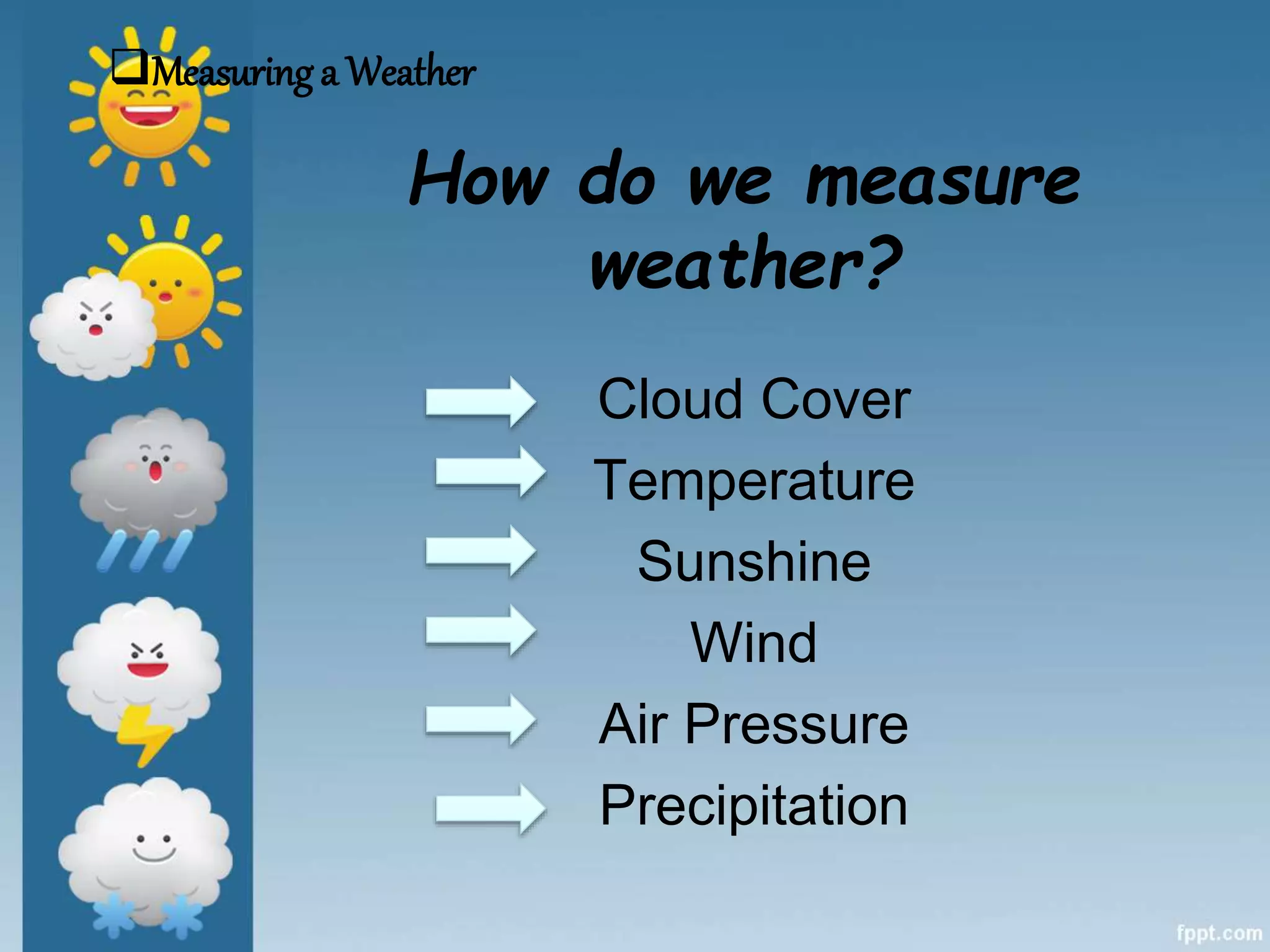
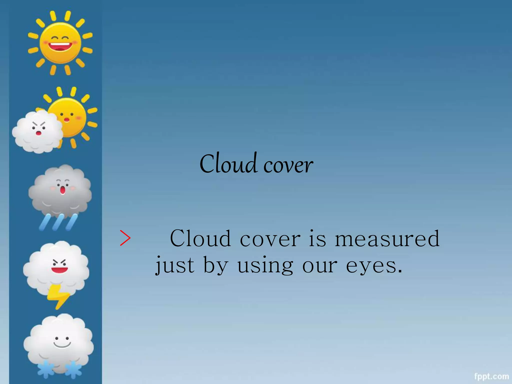
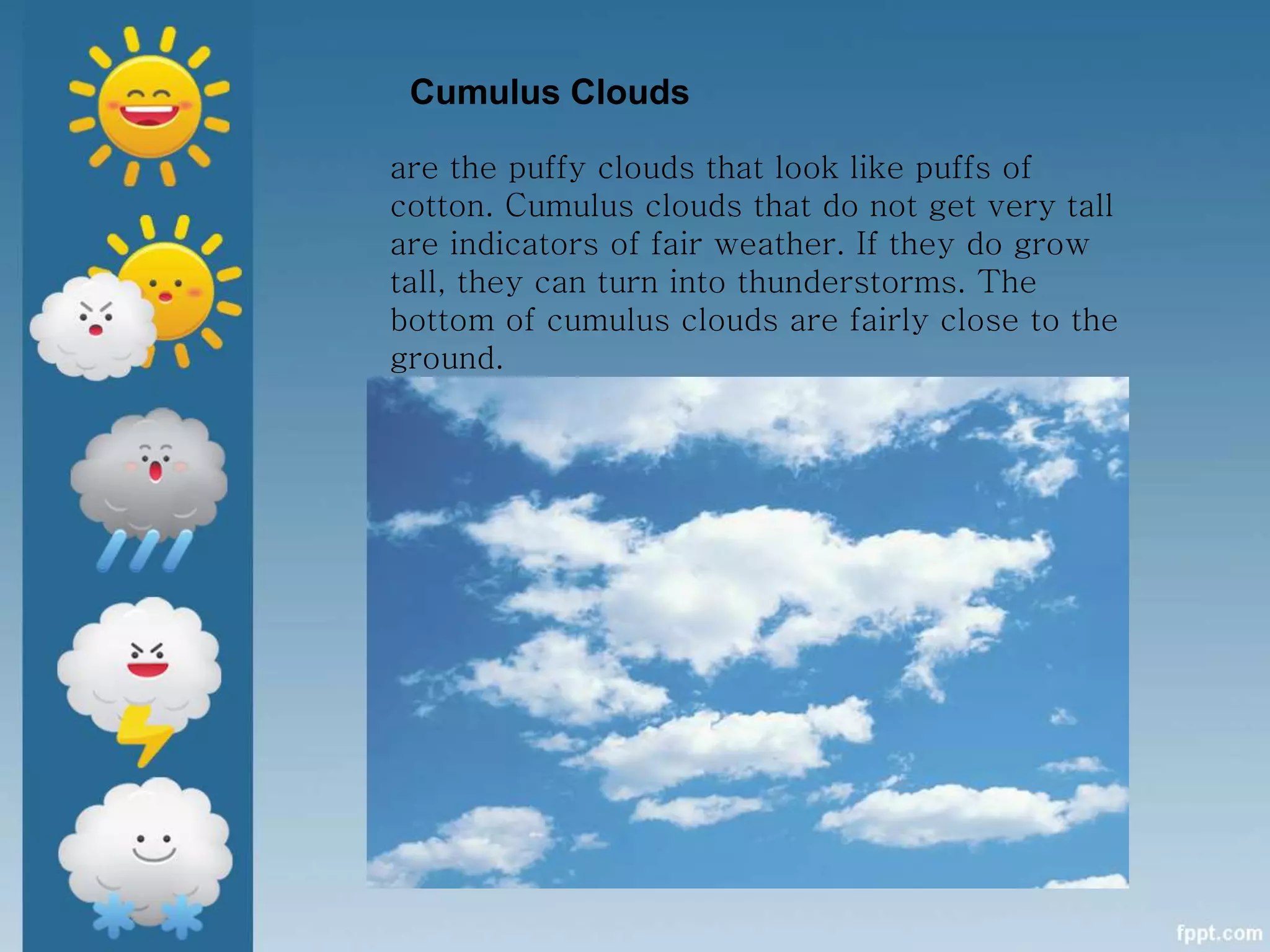
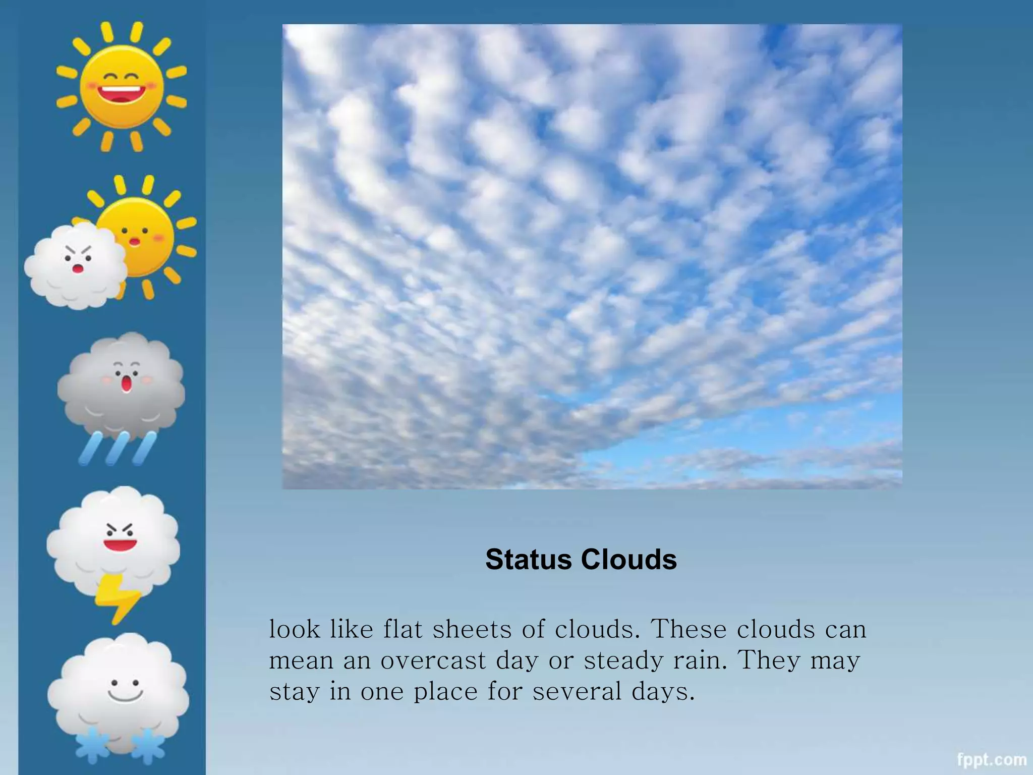
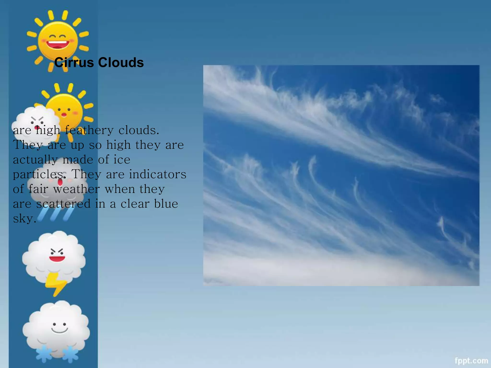
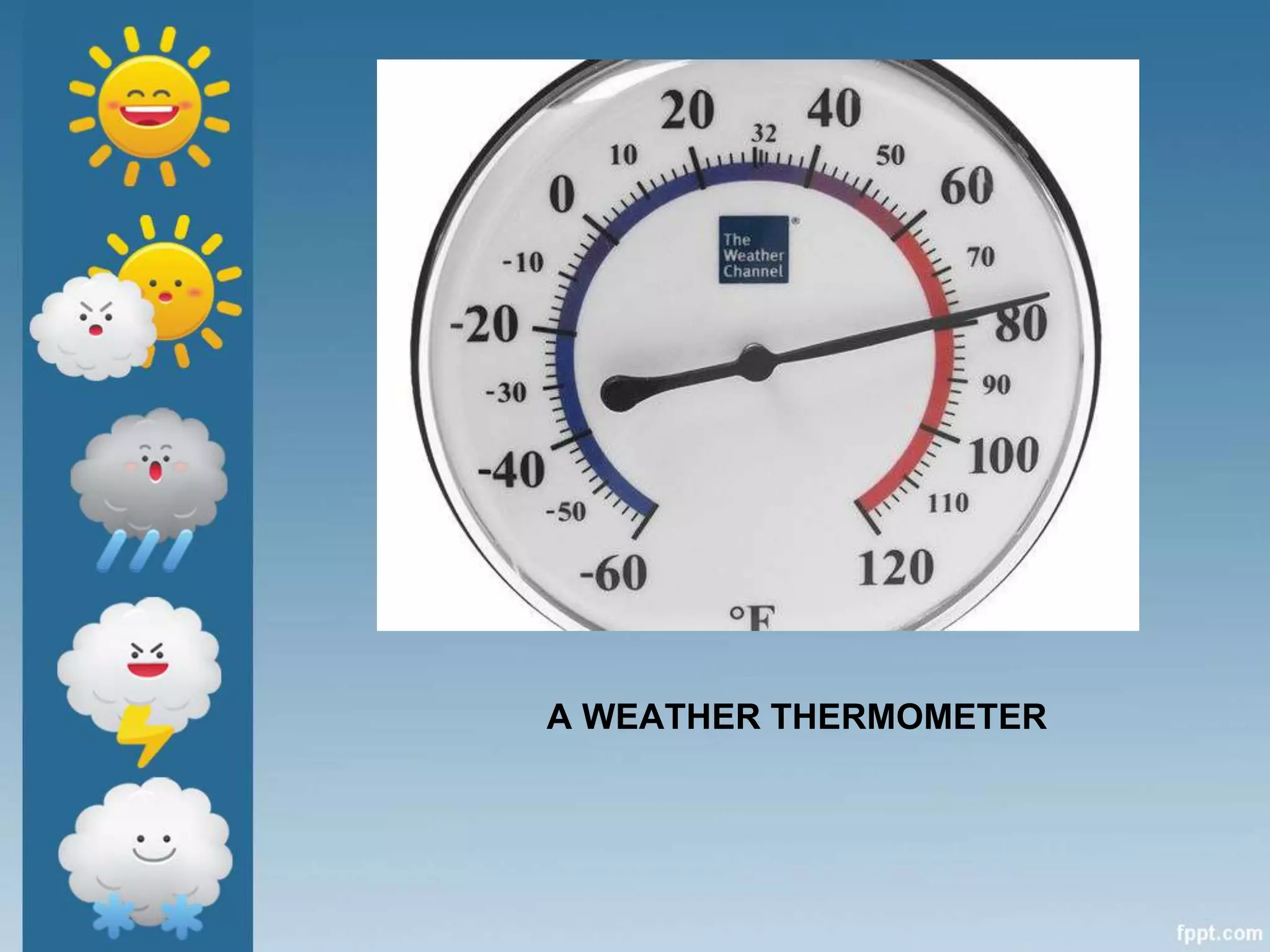
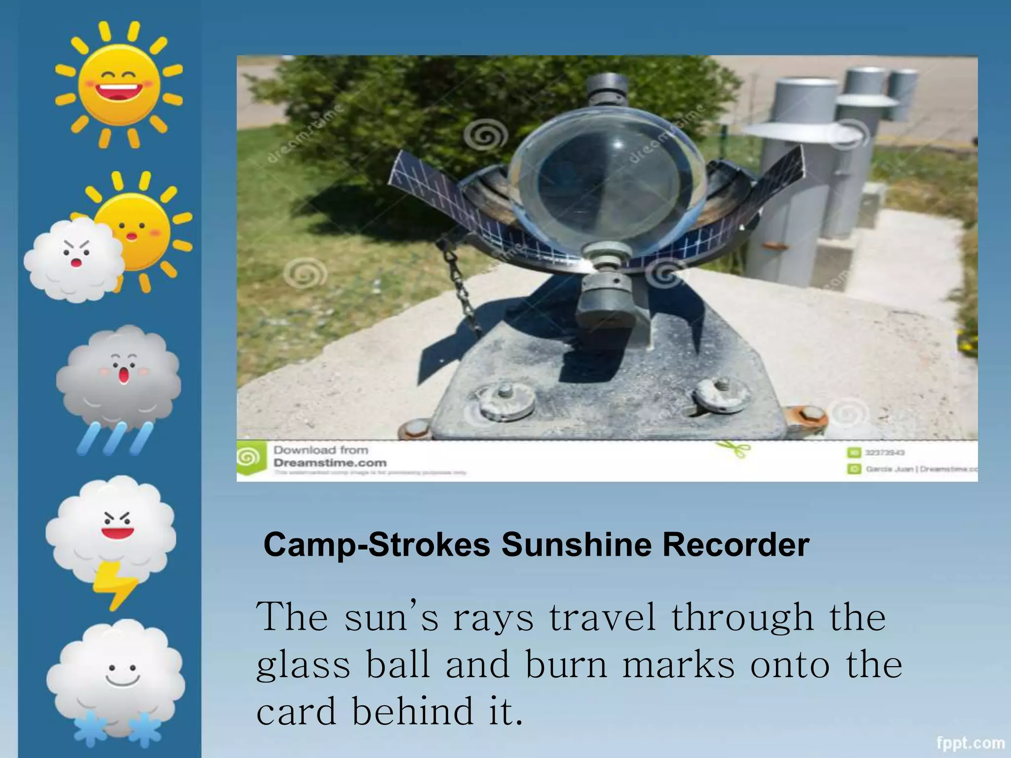
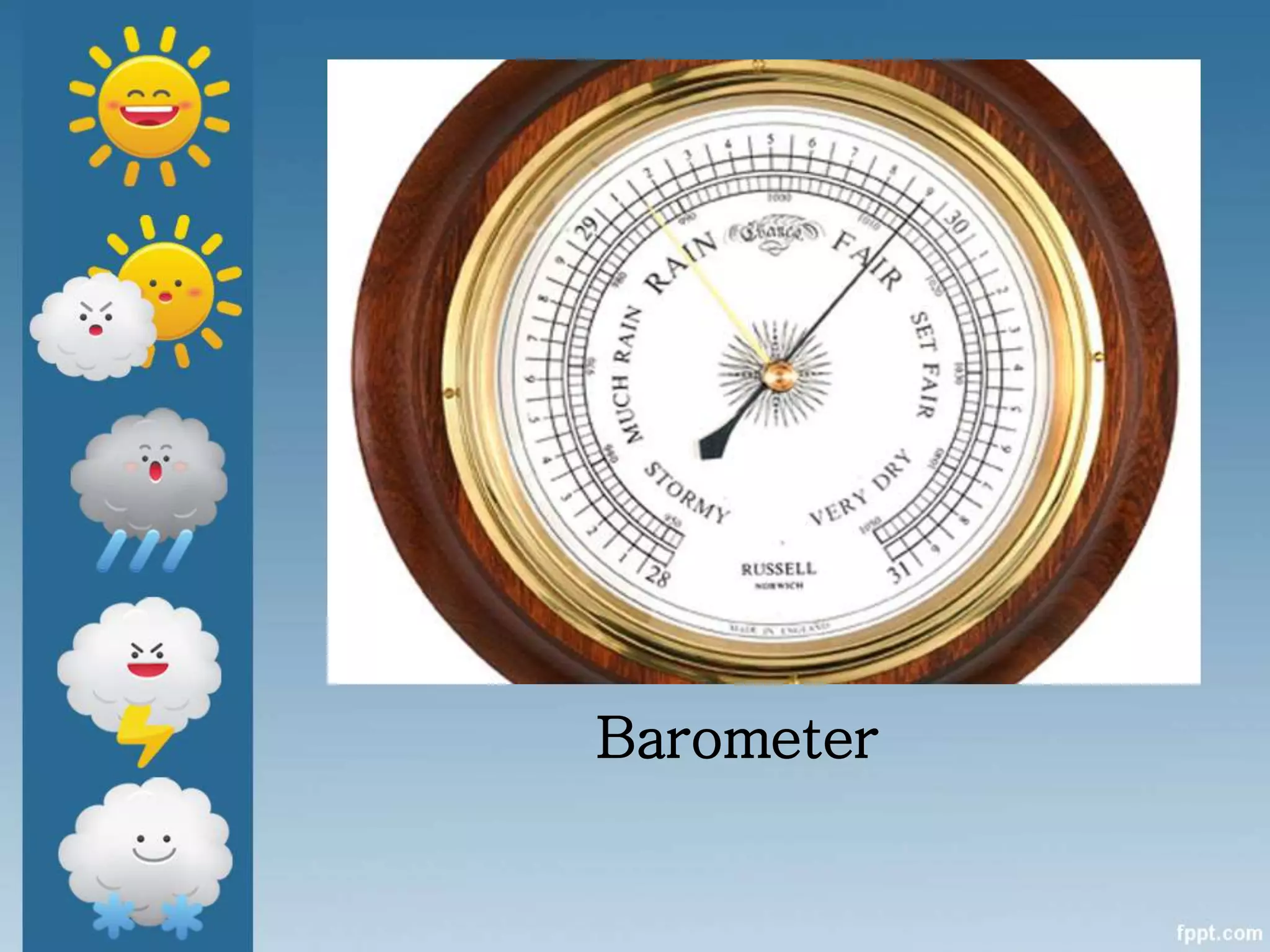
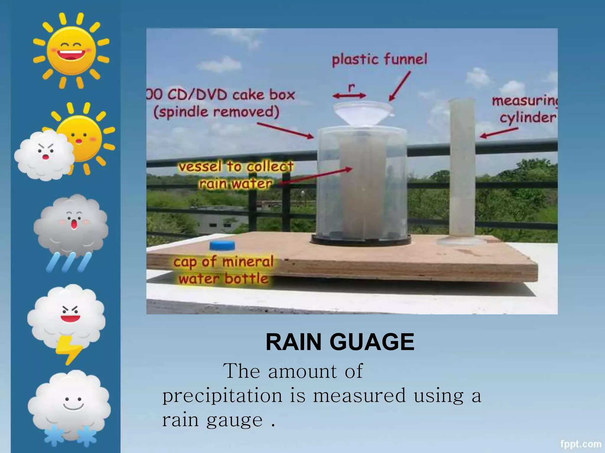
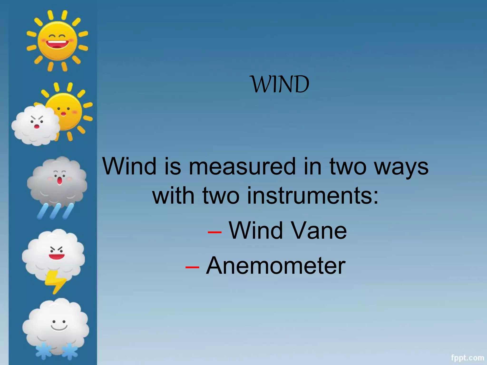
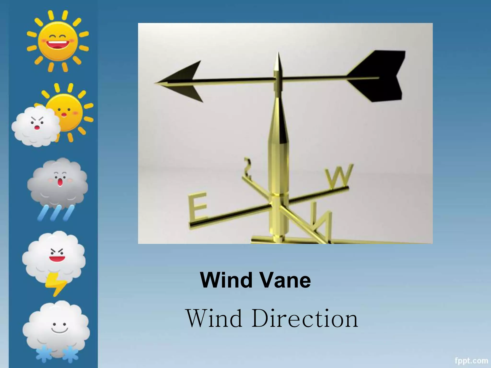
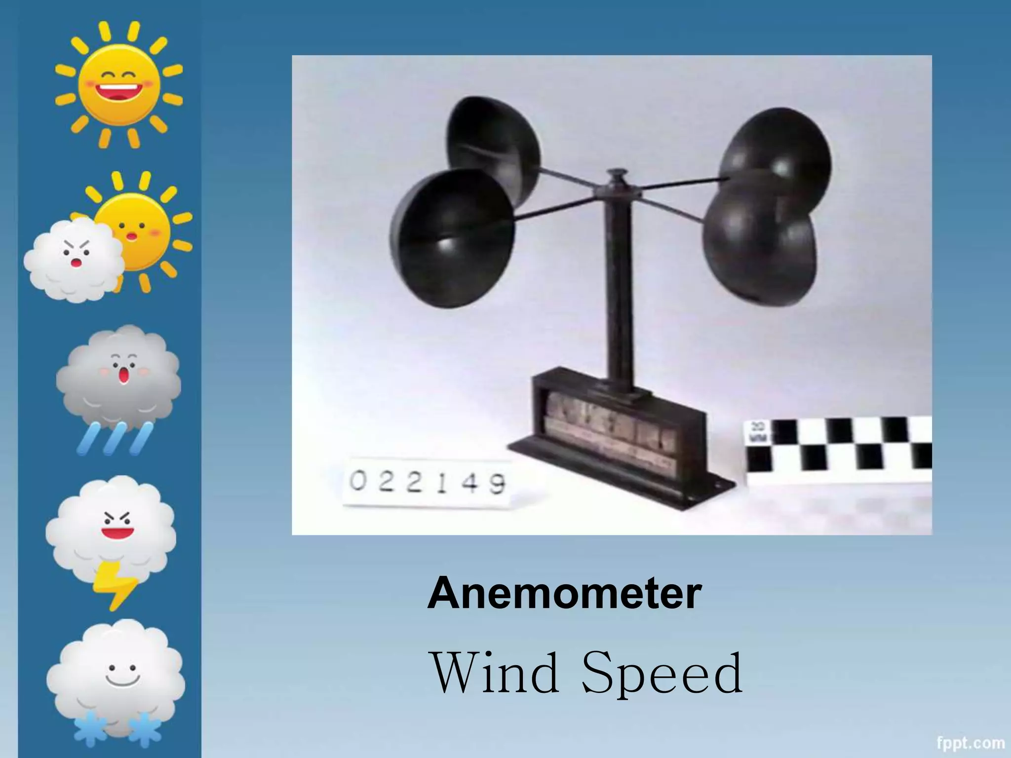
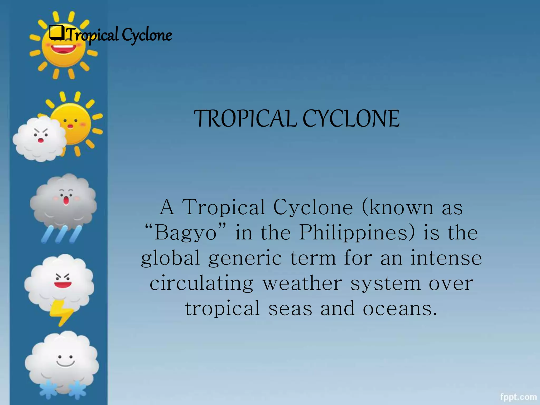
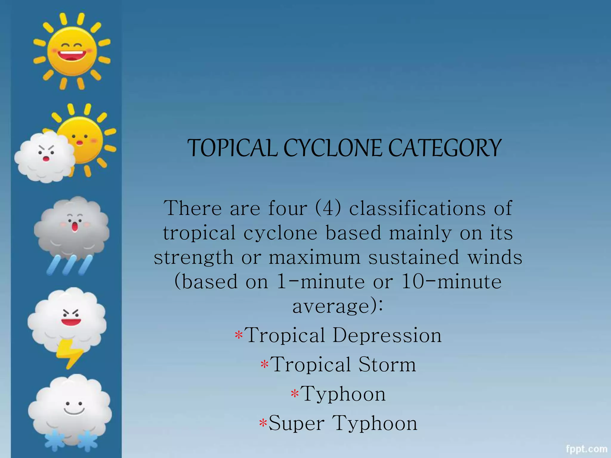
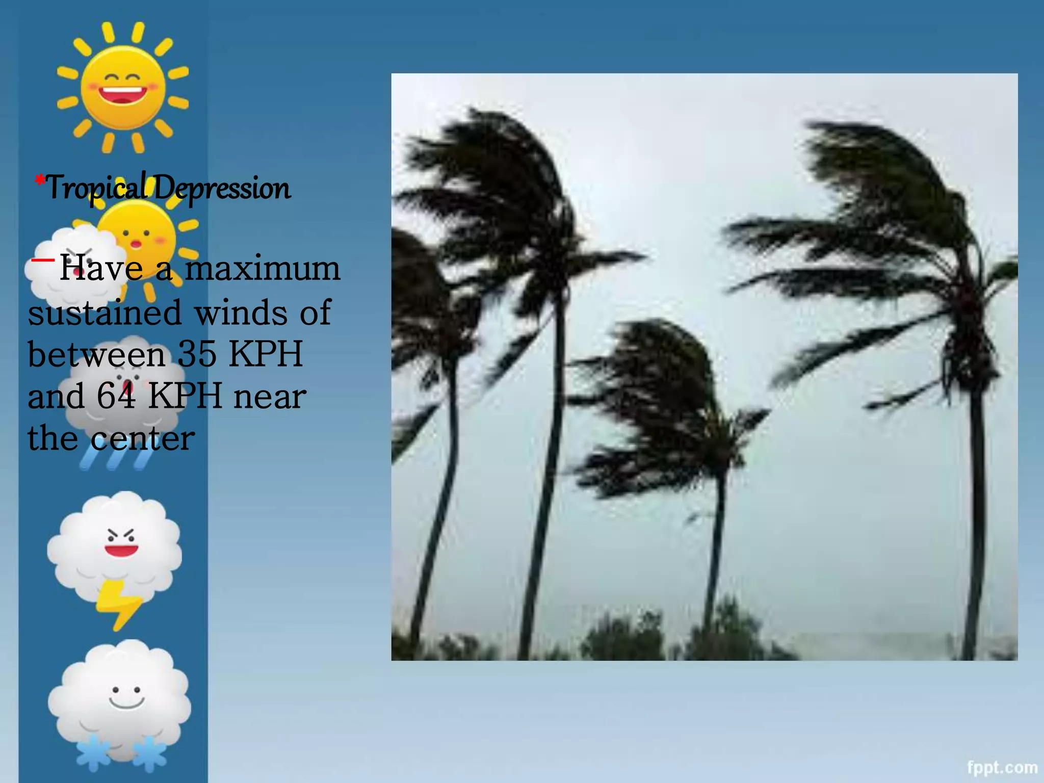
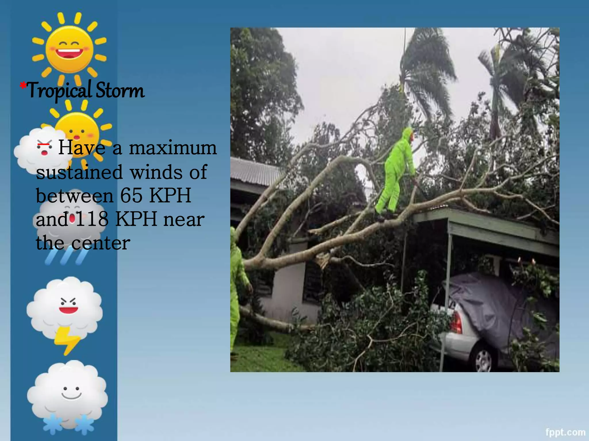
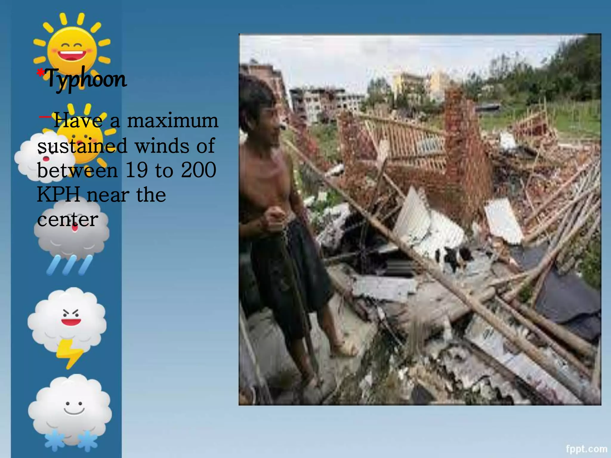
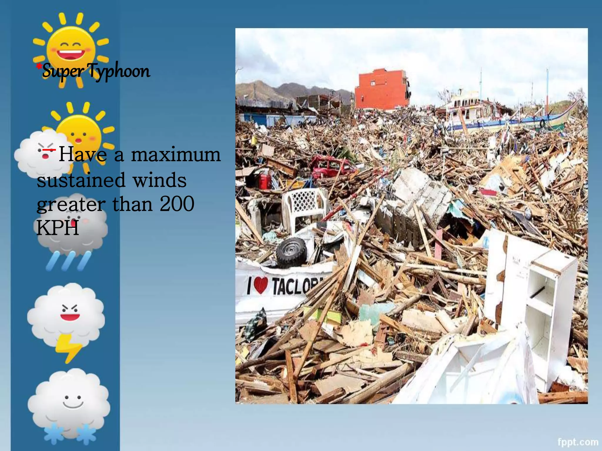
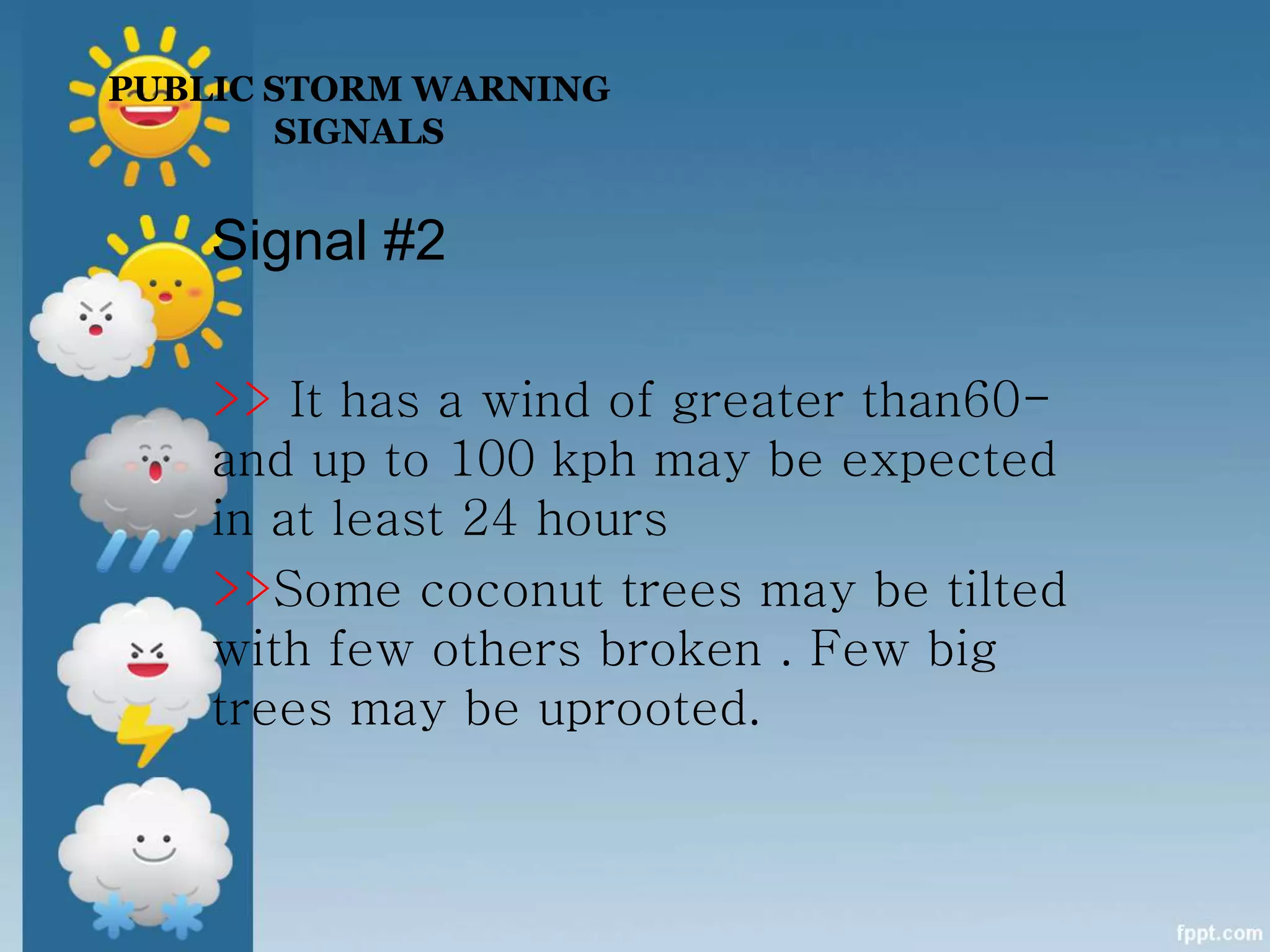
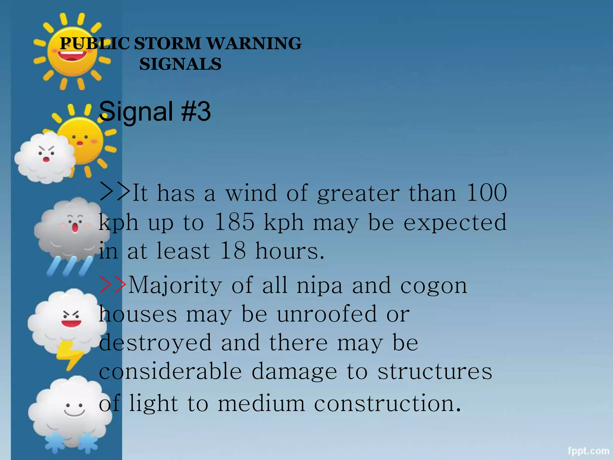
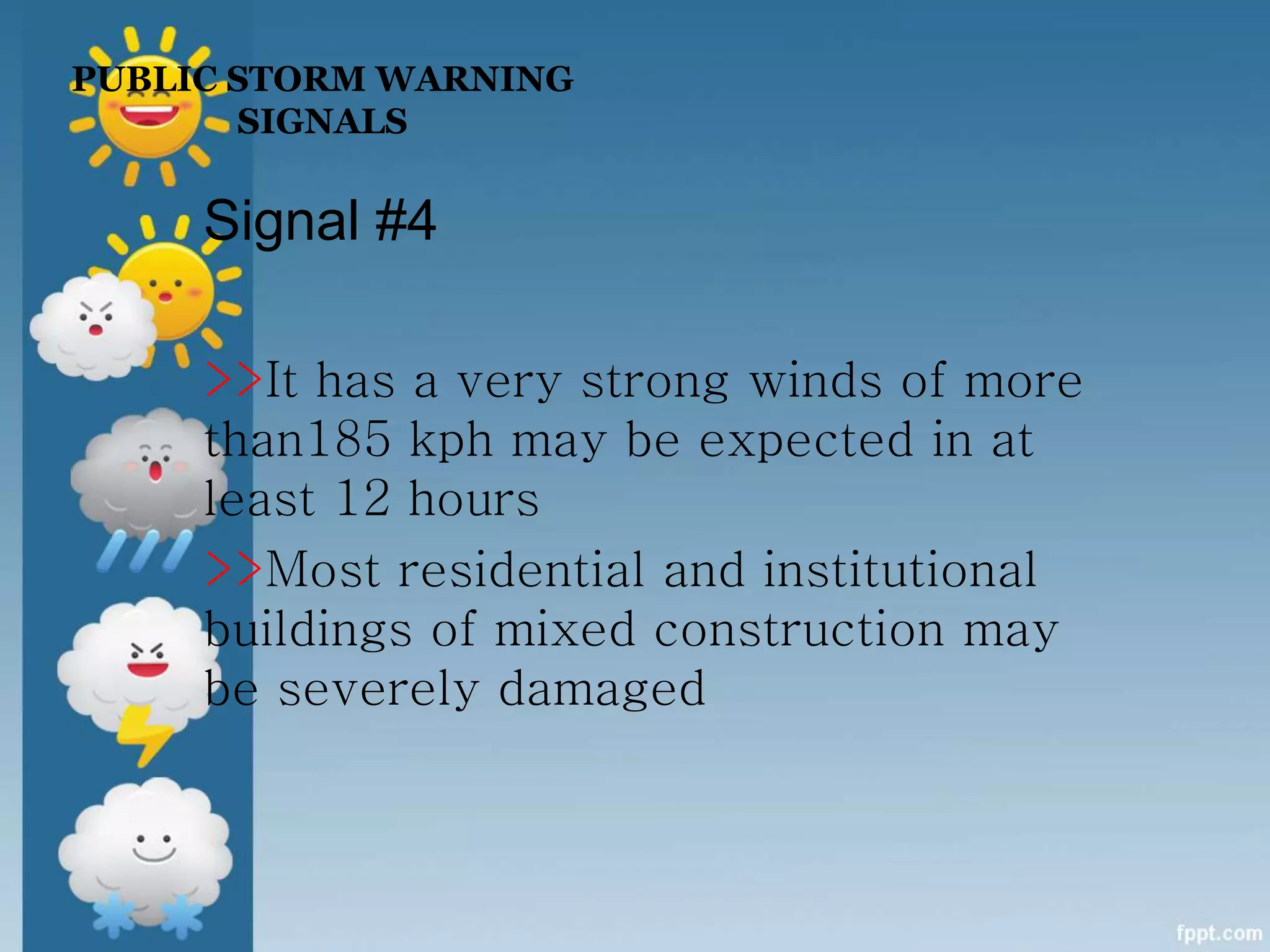
WEATHER
Motivation :
TABLE OF CONTENTS
Introduction
Weather
Climate
Measuring a Weather
Tropical Cyclone
PubicStormWarning Signals
The Sun shines more directly near the
equator bringing these areas more
warmth. However, the polar regions
are at such an angle to the Sun that
they get is little or no sunlight during
the winter, causing colder
temperatures. These differences in
temperature create a restless
movement of air and water in great
swirling currents to distribute heat
energy from the Sun across the
planet.
Introduction
When air in one region is
warmer than the surrounding
air, it becomes less dense and
begins to rise, drawing more
air in underneath. Elsewhere,
cooler denser air sinks,
pushing air outward to flow
along the surface and
complete the cycle.
What is WEATHER?
• the hour to hour, day to day
change in the atmosphere.
What is CLIMATE?
• the average weather conditions
of a place taken over a long
time.
> The difference between
weather and climate is a
measure of time.
How do we measure
weather?
Cloud Cover
Temperature
Sunshine
Wind
Air Pressure
Precipitation
Measuring a Weather
Cloud cover
> Cloud cover is measured
just by using our eyes.
Cumulus Clouds
are the puffy clouds that look like puffs of
cotton. Cumulus clouds that do not get very tall
are indicators of fair weather. If they do grow
tall, they can turn into thunderstorms. The
bottom of cumulus clouds are fairly close to the
ground.
Status Clouds
look like flat sheets of clouds. These clouds can
mean an overcast day or steady rain. They may
stay in one place for several days.
Cirrus Clouds
are high feathery clouds.
They are up so high they are
actually made of ice
particles. They are indicators
of fair weather when they
are scattered in a clear blue
sky.
TEMPERATURE
> is measured using
maximum - minimum
thermometers
A WEATHER THERMOMETER
SUNSHINE
> The total amount of sunshine in
a day is measured using a sunshine
recorder.
Camp-Strokes Sunshine Recorder
The sun’s rays travel through the
glass ball and burn marks onto the
card behind it.
AIR PRESSURE
> Air pressure is
measured using a
barometer and recorded
using a barograph .
Barometer
Precipitation
> Precipitation is any
moisture that comes from the
atmosphere
(rain, snow, hail).
RAIN GUAGE
The amount of
precipitation is measured using a
rain gauge .
WIND
Wind is measured in two ways
with two instruments:
– Wind Vane
– Anemometer
Wind Vane
Wind Direction
Anemometer
Wind Speed
TROPICAL CYCLONE
A Tropical Cyclone (known as
“Bagyo” in the Philippines) is the
global generic term for an intense
circulating weather system over
tropical seas and oceans.
Tropical Cyclone
TOPICAL CYCLONE CATEGORY
There are four (4) classifications of
tropical cyclone based mainly on its
strength or maximum sustained winds
(based on 1-minute or 10-minute
average):
*Tropical Depression
*Tropical Storm
*Typhoon
*Super Typhoon
*Tropical Depression
-Have a maximum
sustained winds of
between 35 KPH
and 64 KPH near
the center
*Tropical Storm
- Have a maximum
sustained winds of
between 65 KPH
and 118 KPH near
the center
*Typhoon
-Have a maximum
sustained winds of
between 19 to 200
KPH near the
center
*Super Typhoon
-Have a maximum
sustained winds
greater than 200
KPH
PUBLIC STORM WARNING
SIGNALS
Signal #1
>>It has a wind of 30-60 kph may
be expected in at least 36 hours or
intermittent rains may be expected
within 36 hours.
>>twigs and branches of small trees
may be broken .
PUBLIC STORM WARNING
SIGNALS
Signal #2
>> It has a wind of greater than60-
and up to 100 kph may be expected
in at least 24 hours
>>Some coconut trees may be tilted
with few others broken . Few big
trees may be uprooted.
Signal #3
>>It has a wind of greater than 100
kph up to 185 kph may be expected
in at least 18 hours.
>>Majority of all nipa and cogon
houses may be unroofed or
destroyed and there may be
considerable damage to structures
of light to medium construction.
PUBLIC STORM WARNING
SIGNALS
PUBLIC STORM WARNING
SIGNALS
Signal #4
>>It has a very strong winds of more
than185 kph may be expected in at
least 12 hours
>>Most residential and institutional
buildings of mixed construction may
be severely damaged
QUOTATION:
“Climate is what you
expect; Weather is what
you get."

My presentation (weather)

  • 1.
  • 2.
  • 3.
    TABLE OF CONTENTS Introduction Weather Climate Measuringa Weather Tropical Cyclone PubicStormWarning Signals
  • 4.
    The Sun shinesmore directly near the equator bringing these areas more warmth. However, the polar regions are at such an angle to the Sun that they get is little or no sunlight during the winter, causing colder temperatures. These differences in temperature create a restless movement of air and water in great swirling currents to distribute heat energy from the Sun across the planet. Introduction
  • 5.
    When air inone region is warmer than the surrounding air, it becomes less dense and begins to rise, drawing more air in underneath. Elsewhere, cooler denser air sinks, pushing air outward to flow along the surface and complete the cycle.
  • 6.
    What is WEATHER? •the hour to hour, day to day change in the atmosphere.
  • 7.
    What is CLIMATE? •the average weather conditions of a place taken over a long time.
  • 8.
    > The differencebetween weather and climate is a measure of time.
  • 9.
    How do wemeasure weather? Cloud Cover Temperature Sunshine Wind Air Pressure Precipitation Measuring a Weather
  • 10.
    Cloud cover > Cloudcover is measured just by using our eyes.
  • 11.
    Cumulus Clouds are thepuffy clouds that look like puffs of cotton. Cumulus clouds that do not get very tall are indicators of fair weather. If they do grow tall, they can turn into thunderstorms. The bottom of cumulus clouds are fairly close to the ground.
  • 12.
    Status Clouds look likeflat sheets of clouds. These clouds can mean an overcast day or steady rain. They may stay in one place for several days.
  • 13.
    Cirrus Clouds are highfeathery clouds. They are up so high they are actually made of ice particles. They are indicators of fair weather when they are scattered in a clear blue sky.
  • 14.
    TEMPERATURE > is measuredusing maximum - minimum thermometers
  • 15.
  • 16.
    SUNSHINE > The totalamount of sunshine in a day is measured using a sunshine recorder.
  • 17.
    Camp-Strokes Sunshine Recorder Thesun’s rays travel through the glass ball and burn marks onto the card behind it.
  • 18.
    AIR PRESSURE > Airpressure is measured using a barometer and recorded using a barograph .
  • 19.
  • 20.
    Precipitation > Precipitation isany moisture that comes from the atmosphere (rain, snow, hail).
  • 21.
    RAIN GUAGE The amountof precipitation is measured using a rain gauge .
  • 22.
    WIND Wind is measuredin two ways with two instruments: – Wind Vane – Anemometer
  • 23.
  • 24.
  • 26.
    TROPICAL CYCLONE A TropicalCyclone (known as “Bagyo” in the Philippines) is the global generic term for an intense circulating weather system over tropical seas and oceans. Tropical Cyclone
  • 27.
    TOPICAL CYCLONE CATEGORY Thereare four (4) classifications of tropical cyclone based mainly on its strength or maximum sustained winds (based on 1-minute or 10-minute average): *Tropical Depression *Tropical Storm *Typhoon *Super Typhoon
  • 28.
    *Tropical Depression -Have amaximum sustained winds of between 35 KPH and 64 KPH near the center
  • 29.
    *Tropical Storm - Havea maximum sustained winds of between 65 KPH and 118 KPH near the center
  • 30.
    *Typhoon -Have a maximum sustainedwinds of between 19 to 200 KPH near the center
  • 31.
    *Super Typhoon -Have amaximum sustained winds greater than 200 KPH
  • 32.
    PUBLIC STORM WARNING SIGNALS Signal#1 >>It has a wind of 30-60 kph may be expected in at least 36 hours or intermittent rains may be expected within 36 hours. >>twigs and branches of small trees may be broken .
  • 33.
    PUBLIC STORM WARNING SIGNALS Signal#2 >> It has a wind of greater than60- and up to 100 kph may be expected in at least 24 hours >>Some coconut trees may be tilted with few others broken . Few big trees may be uprooted.
  • 34.
    Signal #3 >>It hasa wind of greater than 100 kph up to 185 kph may be expected in at least 18 hours. >>Majority of all nipa and cogon houses may be unroofed or destroyed and there may be considerable damage to structures of light to medium construction. PUBLIC STORM WARNING SIGNALS
  • 35.
    PUBLIC STORM WARNING SIGNALS Signal#4 >>It has a very strong winds of more than185 kph may be expected in at least 12 hours >>Most residential and institutional buildings of mixed construction may be severely damaged
  • 36.
    QUOTATION: “Climate is whatyou expect; Weather is what you get."

Editor's Notes

  • #5 The atmosphere surrounding our planet Earth sustains life and affects our lives in inumerable ways. It contains life-supporting oxygen and limits the effects of radiation from the Sun. The Sun shines more directly near the equator bringing these areas more warmth. However, the polar regions are at such an angle to the Sun that they get little or no sunlight during the winter, causing colder temperatures. These differences in temperature create a restless movement of air and water in great swirling currents to distribute heat energy from the Sun across the planet. When air in one region is warmer than the surrounding air, it becomes less dense and begins to rise, drawing more air in underneath. Elsewhere, cooler denser air sinks, pushing air outward to flow along the surface and complete the cycle.