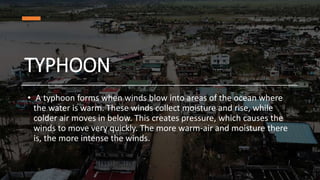
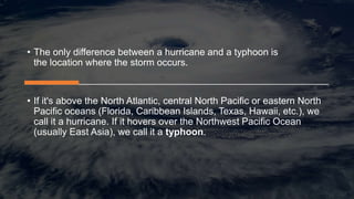
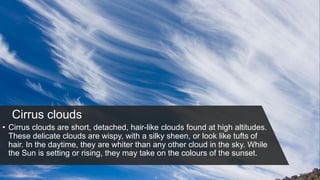
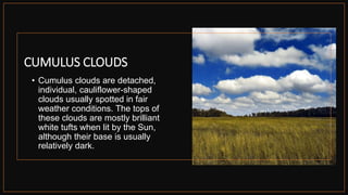
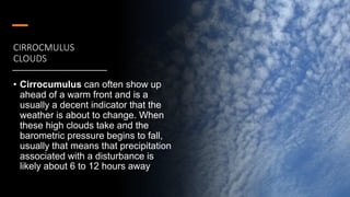
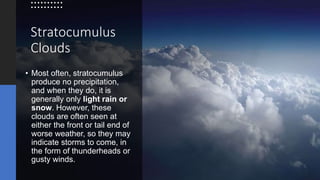
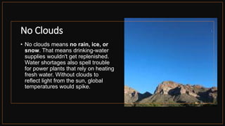
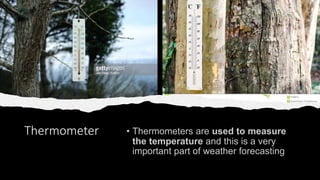
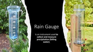
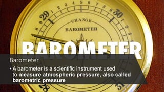
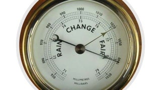
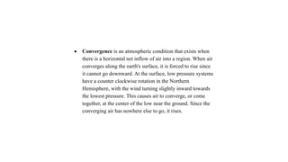
TYPHOONS AND
WARNINGS
Television
• A television has a
number of uses. It can
either entertain,
inform and educate
you. But you have to
bear in mind that not
all you see in tv shows
are all good for you.
TROPICAL
CYCLONES
• A tropical cyclone is a rapid
rotating storm originating over
tropical oceans from where it
draws the energy to develop. It has
a low pressure centre and clouds
spiraling towards the eyewall
surrounding the "eye", the central
part of the system where the
weather is normally calm and free
of clouds.
tropical cyclones
Hurricanes
• A hurricane is a type of storm called a tropical cyclone, which
forms over tropical or subtropical waters.
• Hurricanes originate in the Atlantic basin, which includes the
the Atlantic Ocean, Caribbean Sea, and Gulf of Mexico, the
eastern North Pacific Ocean, and, less frequently, the central
central North Pacific Ocean.
TYPHOON
• A typhoon forms when winds blow into areas of the ocean where
the water is warm. These winds collect moisture and rise, while
colder air moves in below. This creates pressure, which causes the
winds to move very quickly. The more warm-air and moisture there
is, the more intense the winds.
What is difference between
typhoon and hurricane?
• The only difference between a hurricane and a typhoon is
the location where the storm occurs.
• If it's above the North Atlantic, central North Pacific or eastern North
Pacific oceans (Florida, Caribbean Islands, Texas, Hawaii, etc.), we
call it a hurricane. If it hovers over the Northwest Pacific Ocean
(usually East Asia), we call it a typhoon.
Cloud Watch
Cirrus clouds
• Cirrus clouds are short, detached, hair-like clouds found at high altitudes.
These delicate clouds are wispy, with a silky sheen, or look like tufts of
hair. In the daytime, they are whiter than any other cloud in the sky. While
the Sun is setting or rising, they may take on the colours of the sunset.
CUMULUS CLOUDS
• Cumulus clouds are detached,
individual, cauliflower-shaped
clouds usually spotted in fair
weather conditions. The tops of
these clouds are mostly brilliant
white tufts when lit by the Sun,
although their base is usually
relatively dark.
CIRROCMULUS
CLOUDS
• Cirrocumulus can often show up
ahead of a warm front and is a
usually a decent indicator that the
weather is about to change. When
these high clouds take and the
barometric pressure begins to fall,
usually that means that precipitation
associated with a disturbance is
likely about 6 to 12 hours away
Stratocumulus
Clouds
• Most often, stratocumulus
produce no precipitation,
and when they do, it is
generally only light rain or
snow. However, these
clouds are often seen at
either the front or tail end of
worse weather, so they may
indicate storms to come, in
the form of thunderheads or
gusty winds.
No Clouds
• No clouds means no rain, ice, or
snow. That means drinking-water
supplies wouldn't get replenished.
Water shortages also spell trouble
for power plants that rely on heating
fresh water. Without clouds to
reflect light from the sun, global
temperatures would spike.
Nimbus Clouds
• A nimbus cloud is a cloud
that produces precipitation.
Usually, the precipitation
reaches the ground as rain,
hail, snow, or sleet. Falling
precipitation may evaporate
as virga. Since nimbus
clouds are dense with
water, they appear darker
than other clouds.
Weather Watch
ANEMOMETER
An anemometer is an
instrument that
measures wind speed.
Wind Vane
A wind vane is
an instrument used to
show the direction the
wind is blowing from
Thermometer
Rain Gauge
Is an instrument used to
collect and measure
precipitation (falling
water).
Barometer
• A barometer is a scientific instrument used
to measure atmospheric pressure, also called
barometric pressure
 Convergence is an atmospheric condition that exists when
there is a horizontal net inflow of air into a region. When air
converges along the earth's surface, it is forced to rise since
it cannot go downward. At the surface, low pressure systems
have a counter clockwise rotation in the Northern
Hemisphere, with the wind turning slightly inward towards
the lowest pressure. This causes air to converge, or come
together, at the center of the low near the ground. Since the
converging air has nowhere else to go, it rises.
Typhoons and warning signals pp........t

Typhoons and warning signals pp........t

  • 1.
  • 2.
    Television • A televisionhas a number of uses. It can either entertain, inform and educate you. But you have to bear in mind that not all you see in tv shows are all good for you.
  • 3.
    TROPICAL CYCLONES • A tropicalcyclone is a rapid rotating storm originating over tropical oceans from where it draws the energy to develop. It has a low pressure centre and clouds spiraling towards the eyewall surrounding the "eye", the central part of the system where the weather is normally calm and free of clouds.
  • 4.
  • 5.
    Hurricanes • A hurricaneis a type of storm called a tropical cyclone, which forms over tropical or subtropical waters. • Hurricanes originate in the Atlantic basin, which includes the the Atlantic Ocean, Caribbean Sea, and Gulf of Mexico, the eastern North Pacific Ocean, and, less frequently, the central central North Pacific Ocean.
  • 6.
    TYPHOON • A typhoonforms when winds blow into areas of the ocean where the water is warm. These winds collect moisture and rise, while colder air moves in below. This creates pressure, which causes the winds to move very quickly. The more warm-air and moisture there is, the more intense the winds.
  • 7.
    What is differencebetween typhoon and hurricane?
  • 8.
    • The onlydifference between a hurricane and a typhoon is the location where the storm occurs. • If it's above the North Atlantic, central North Pacific or eastern North Pacific oceans (Florida, Caribbean Islands, Texas, Hawaii, etc.), we call it a hurricane. If it hovers over the Northwest Pacific Ocean (usually East Asia), we call it a typhoon.
  • 9.
  • 10.
    Cirrus clouds • Cirrusclouds are short, detached, hair-like clouds found at high altitudes. These delicate clouds are wispy, with a silky sheen, or look like tufts of hair. In the daytime, they are whiter than any other cloud in the sky. While the Sun is setting or rising, they may take on the colours of the sunset.
  • 11.
    CUMULUS CLOUDS • Cumulusclouds are detached, individual, cauliflower-shaped clouds usually spotted in fair weather conditions. The tops of these clouds are mostly brilliant white tufts when lit by the Sun, although their base is usually relatively dark.
  • 12.
    CIRROCMULUS CLOUDS • Cirrocumulus canoften show up ahead of a warm front and is a usually a decent indicator that the weather is about to change. When these high clouds take and the barometric pressure begins to fall, usually that means that precipitation associated with a disturbance is likely about 6 to 12 hours away
  • 13.
    Stratocumulus Clouds • Most often,stratocumulus produce no precipitation, and when they do, it is generally only light rain or snow. However, these clouds are often seen at either the front or tail end of worse weather, so they may indicate storms to come, in the form of thunderheads or gusty winds.
  • 14.
    No Clouds • Noclouds means no rain, ice, or snow. That means drinking-water supplies wouldn't get replenished. Water shortages also spell trouble for power plants that rely on heating fresh water. Without clouds to reflect light from the sun, global temperatures would spike.
  • 15.
    Nimbus Clouds • Animbus cloud is a cloud that produces precipitation. Usually, the precipitation reaches the ground as rain, hail, snow, or sleet. Falling precipitation may evaporate as virga. Since nimbus clouds are dense with water, they appear darker than other clouds.
  • 16.
  • 17.
    ANEMOMETER An anemometer isan instrument that measures wind speed.
  • 18.
    Wind Vane A windvane is an instrument used to show the direction the wind is blowing from
  • 19.
  • 20.
    Rain Gauge Is aninstrument used to collect and measure precipitation (falling water).
  • 21.
    Barometer • A barometeris a scientific instrument used to measure atmospheric pressure, also called barometric pressure
  • 27.
     Convergence isan atmospheric condition that exists when there is a horizontal net inflow of air into a region. When air converges along the earth's surface, it is forced to rise since it cannot go downward. At the surface, low pressure systems have a counter clockwise rotation in the Northern Hemisphere, with the wind turning slightly inward towards the lowest pressure. This causes air to converge, or come together, at the center of the low near the ground. Since the converging air has nowhere else to go, it rises.