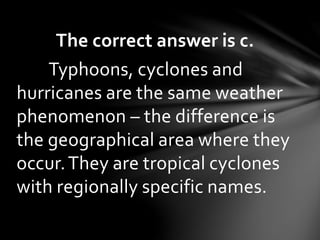
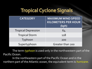
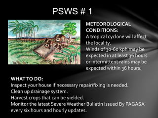
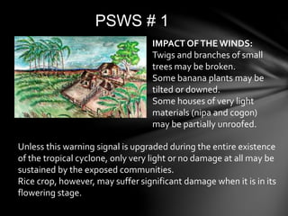
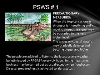
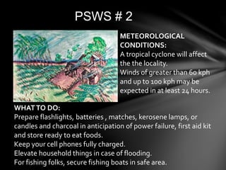
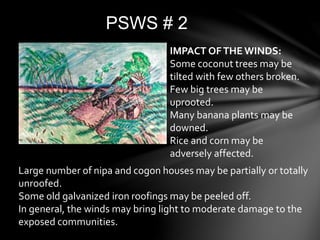
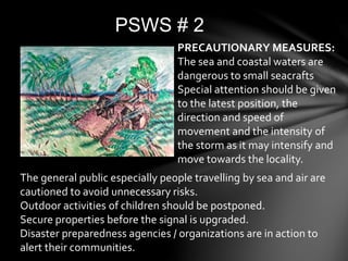
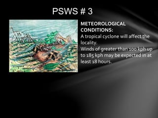
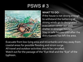
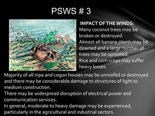
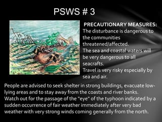
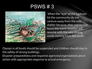
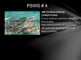
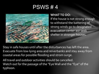
The document discusses typhoons, hurricanes, and cyclones. It explains that they are the same weather phenomenon, but are called different names depending on their geographic location. Typhoons occur in the northwest Pacific, hurricanes in the northeast Pacific and northern Atlantic, and cyclones in other areas. The document also provides details about the Philippine Atmospheric, Geophysical and Astronomical Services Administration's (PAGASA) storm warning signal system, including meteorological conditions and recommended actions for each warning level from 1 to 4.
Learning Competencies:
-explain how typhoons develop;
- infer why the Philippines is prone to typhoons;
-explain how landmasses and bodies of water affect typhoons;
Learning Competencies:
-explain how typhoons develop;
- infer why the Philippines is prone to typhoons;
-explain how landmasses and bodies of water affect typhoons;
UNDERSTANDING THE FORMATION OF TYPHOONS OR HURRICANE.pptxCathyMoronio
This presentation discussed how the typhoons or hurricances are formed and what is the difference between typhoon and hurricane.
Describe the formation of typhoon and how it is affected by landmasses and bodies of water.
Categorize tropical cyclone based on the given wind speed; and
Explain how typhoon affects people’s lives
Why is the Philippines prone to typhoons?
What conditions favor the formation of typhoons?
What are the safety measures to be done before, during, and after the a typhoon.
A2 CAMBRIDGE GEOGRAPHY: HAZARDOUS ENVIRONMENTS - HAZARDS RESULTING FROM ATMOSPHERIC DISTURBANCES. It contain case studies: Hurricane Katrina 2005, Cloud Seeding in New Zealand 1950-1970.
This gives you an insight into thunderstorms, what they are and how they occur. It also gives you some safety precautions in case you are actually stuck in one of them! It includes a small Case Study of two thunderstorms too.
How to Split Bills in the Odoo 17 POS ModuleCeline George
Bills have a main role in point of sale procedure. It will help to track sales, handling payments and giving receipts to customers. Bill splitting also has an important role in POS. For example, If some friends come together for dinner and if they want to divide the bill then it is possible by POS bill splitting. This slide will show how to split bills in odoo 17 POS.
How to Make a Field invisible in Odoo 17Celine George
It is possible to hide or invisible some fields in odoo. Commonly using “invisible” attribute in the field definition to invisible the fields. This slide will show how to make a field invisible in odoo 17.
We all have good and bad thoughts from time to time and situation to situation. We are bombarded daily with spiraling thoughts(both negative and positive) creating all-consuming feel , making us difficult to manage with associated suffering. Good thoughts are like our Mob Signal (Positive thought) amidst noise(negative thought) in the atmosphere. Negative thoughts like noise outweigh positive thoughts. These thoughts often create unwanted confusion, trouble, stress and frustration in our mind as well as chaos in our physical world. Negative thoughts are also known as “distorted thinking”.
Welcome to TechSoup New Member Orientation and Q&A (May 2024).pdfTechSoup
In this webinar you will learn how your organization can access TechSoup's wide variety of product discount and donation programs. From hardware to software, we'll give you a tour of the tools available to help your nonprofit with productivity, collaboration, financial management, donor tracking, security, and more.
Model Attribute Check Company Auto PropertyCeline George
In Odoo, the multi-company feature allows you to manage multiple companies within a single Odoo database instance. Each company can have its own configurations while still sharing common resources such as products, customers, and suppliers.
The Indian economy is classified into different sectors to simplify the analysis and understanding of economic activities. For Class 10, it's essential to grasp the sectors of the Indian economy, understand their characteristics, and recognize their importance. This guide will provide detailed notes on the Sectors of the Indian Economy Class 10, using specific long-tail keywords to enhance comprehension.
For more information, visit-www.vavaclasses.com
How to Create Map Views in the Odoo 17 ERPCeline George
The map views are useful for providing a geographical representation of data. They allow users to visualize and analyze the data in a more intuitive manner.
2024.06.01 Introducing a competency framework for languag learning materials ...Sandy Millin
http://sandymillin.wordpress.com/iateflwebinar2024
Published classroom materials form the basis of syllabuses, drive teacher professional development, and have a potentially huge influence on learners, teachers and education systems. All teachers also create their own materials, whether a few sentences on a blackboard, a highly-structured fully-realised online course, or anything in between. Despite this, the knowledge and skills needed to create effective language learning materials are rarely part of teacher training, and are mostly learnt by trial and error.
Knowledge and skills frameworks, generally called competency frameworks, for ELT teachers, trainers and managers have existed for a few years now. However, until I created one for my MA dissertation, there wasn’t one drawing together what we need to know and do to be able to effectively produce language learning materials.
This webinar will introduce you to my framework, highlighting the key competencies I identified from my research. It will also show how anybody involved in language teaching (any language, not just English!), teacher training, managing schools or developing language learning materials can benefit from using the framework.
Palestine last event orientationfvgnh .pptxRaedMohamed3
An EFL lesson about the current events in Palestine. It is intended to be for intermediate students who wish to increase their listening skills through a short lesson in power point.
Operation “Blue Star” is the only event in the history of Independent India where the state went into war with its own people. Even after about 40 years it is not clear if it was culmination of states anger over people of the region, a political game of power or start of dictatorial chapter in the democratic setup.
The people of Punjab felt alienated from main stream due to denial of their just demands during a long democratic struggle since independence. As it happen all over the word, it led to militant struggle with great loss of lives of military, police and civilian personnel. Killing of Indira Gandhi and massacre of innocent Sikhs in Delhi and other India cities was also associated with this movement.
2. Trivia Question: We hear weathercasters
talk about typhoons, hurricanes and
cyclones – so what’s the difference?
a) Typhoons are bigger than cyclones;
cyclones are bigger than hurricanes.
b) Hurricanes are stronger than
typhoons and cyclones.
c) Hurricanes, typhoons and cyclones
occur in different geographical areas.
3. The correct answer is c.
Typhoons, cyclones and
hurricanes are the same weather
phenomenon – the difference is
the geographical area where they
occur.They are tropical cyclones
with regionally specific names.
4. In 1963 by the Philippine Weather Bureau
through the use of four sets of alphabetically
arranged Filipino women nicknames ending
in “ng” that are alternately used every four
years. In 1999, the Philippine Atmospheric,
Geophysical and Astronomical Services
(PAGASA) held a nationwide search for new
generation tropical cyclone names. It was
dubbed as “Name the Bagyo Contest.”The
result of the search which was picked out
from more than 18,000 entries was 140 no-
gender-bias names that will be used until 2016
by PAGASA.
5. According to the Philippine
Atmospheric, Geophysical, and
Astronomical Services Administration
(PAGASA), about 20 tropical cyclones
enter the Philippine Area of Responsibility
each year.
8. Winds in a typhoon move in a certain
direction; they go around a central
area.
The appearance of the clouds in a
typhoon are in a spiral arrangement;
they are being blown by winds in a
counter-clockwise direction.
9. CATEGORY MAXIMUM WIND SPEED
KILOMETERS PER HOUR
(kph)
Tropical Depression 64
Tropical Storm 118
Typhoon 200
Supertyphoon Greater than 200
The term typhoon is used only in the northwestern part of the
Pacific Ocean.
In the northeastern part of the Pacific Ocean and in the
northern part of the Atlantic ocean, the equivalent term is hurricane.
10.
11.
12. Points Latutude, Longitude
A 5oN, 115oE
B 15oN, 115oE
C 21oN, 120oE
D 25oN, 120oE
E 25oN, 135oE
F 5oN, 135oE
POINTS OFTHE PAR
13. Q1. If a typhoon is located at
15oN,138oE, is it within the PAR?
Q2. How about if the typhoon is at
19oN, 117oE, is it inside the PAR?
Can you answer these questions?
14.
15. Q1. Where did the tropical cyclone
form? On land or in the ocean?
Q2. What can you say about the
temperature of the bodies of water
in the vicinity of the Philippines? Is
the water warm or cold?
Can you answer these questions?
16. Q3. In what direction did the
tropical cyclones move?
Q4. Which part of the Philippines
was hit by the four tropical
cyclones?
Can you answer these questions?
17. Q5. In the case of Agaton,Yoyong,
and Huaning, where did they die
out? Near land or in the middle of
the ocean?
Can you answer these questions?
18. Tropical cyclones need water vapor in
order to form.
Tropical cyclones require warm ocean
waters to be able to develop. (26.5oC or
greater)
Tropical cyclones generally move in a
northwest direction.
When tropical cyclones reach land, they
die out because they are cut off from the
warm ocean waters that keep them
going.
21. • The lowest air pressure is at the eye of a
tropical cyclone
• At the eye of a tropical cyclone, wind
speed is low.
• At the eyewall, the wind speed is great.
• When the eye of a tropical cyclone
passes over a certain place, it is the
winds at the eyewall that wreak a lot of
damage.
23. PSWS # 1
METEOROLOGICAL
CONDITIONS:
A tropical cyclone will affect
the locality.
Winds of 30-60 kph may be
expected in at least 36 hours
or intermittent rains may be
expected within 36 hours.
WHATTO DO:
Inspect your house if necessary repair/fixing is needed.
Clean up drainage system.
Harvest crops that can be yielded.
Monitor the latest Severe Weather Bulletin issued By PAGASA
every six hours and hourly updates.
24. PSWS # 1
Unless this warning signal is upgraded during the entire existence
of the tropical cyclone, only very light or no damage at all may be
sustained by the exposed communities.
Rice crop, however, may suffer significant damage when it is in its
flowering stage.
IMPACT OFTHE WINDS:
Twigs and branches of small
trees may be broken.
Some banana plants may be
tilted or downed.
Some houses of very light
materials (nipa and cogon)
may be partially unroofed.
25. PSWS # 1
The people are advised to listen to the latest severe weather
bulletin issued by PAGASA every six hours. In the meantime,
business may be carried out as usual except when flood occur.
Disaster preparedness is activated to alert status.
PRECAUTIONARY
MEASURES:
When the tropical cyclone is
strong or is intensifying and is
moving closer, this signal may
be upgraded to the next
higher level.
The waves on coastal waters
may gradually develop and
become bigger and higher.
26. PSWS # 2
WHATTO DO:
Prepare flashlights, batteries , matches, kerosene lamps, or
candles and charcoal in anticipation of power failure, first aid kit
and store ready to eat foods.
Keep your cell phones fully charged.
Elevate household things in case of flooding.
For fishing folks, secure fishing boats in safe area.
METEOROLOGICAL
CONDITIONS:
A tropical cyclone will affect
the the locality.
Winds of greater than 60 kph
and up to 100 kph may be
expected in at least 24 hours.
27. PSWS # 2
Large number of nipa and cogon houses may be partially or totally
unroofed.
Some old galvanized iron roofings may be peeled off.
In general, the winds may bring light to moderate damage to the
exposed communities.
IMPACT OFTHE WINDS:
Some coconut trees may be
tilted with few others broken.
Few big trees may be
uprooted.
Many banana plants may be
downed.
Rice and corn may be
adversely affected.
28. PSWS # 2
The general public especially people travelling by sea and air are
cautioned to avoid unnecessary risks.
Outdoor activities of children should be postponed.
Secure properties before the signal is upgraded.
Disaster preparedness agencies / organizations are in action to
alert their communities.
PRECAUTIONARY MEASURES:
The sea and coastal waters are
dangerous to small seacrafts
Special attention should be given
to the latest position, the
direction and speed of
movement and the intensity of
the storm as it may intensify and
move towards the locality.
29. PSWS # 3
METEOROLOGICAL
CONDITIONS:
A tropical cyclone will affect the
locality.
Winds of greater than 100 kph up
to 185 kph may be expected in at
least 18 hours.
30. PSWS # 3
WHATTO DO:
If the house is not strong enough
to withstand the battering of
strong winds go to designated
evacuation center aor seek
shelter in stronger houses.
Stay in safe houses until after the
disturbances has left the area.
Evacuate from low-lying area and reiverbanks and stay away from
coastal areas for possible flooding and strom surge.
All travel and outdoor activities should be cancelled.
Watch out for the passage of the "EyeWall and the "Eye" of the
typhoon.
31. PSWS # 3
IMPACT OFTHE WINDS:
Many coconut trees may be
broken or destroyed.
Almost all banana plants may be
downed and a large number of
trees may be uprooted.
Rice and corn crops may suffer
heavy losses.
Majority of all nipa and cogon houses may be unroofed or destroyed
and there may be considerable damage to structures of light to
medium construction.
There may be widespread disruption of electrical power and
communication services.
In general, moderate to heavy damage may be experienced,
particularly in the agricultural and industrial sectors.
32. PSWS # 3
PRECAUTIONARY MEASURES:
The disturbance is dangerous to
the communities
threatened/affected.
The sea and coastal waters will
be very dangerous to all
seacrafts.
Travel is very risky especially by
sea and air.
People are advised to seek shelter in strong buildings, evacuate low-
lying areas and to stay away from the coasts and river banks.
Watch out for the passage of the "eye" of the typhoon indicated by a
sudden occurrence of fair weather immediately after very bad
weather with very strong winds coming generally from the north.
33. PSWS # 3
When the "eye" of the typhoon
hit the community do not
venture away from the safe
shelter because after one to two
hours the worst weather will
resume with the very strong
winds coming from the south.
Classes in all levels should be suspended and children should stay in
the safety of strong buildings.
Disaster preparedness and response agencies/organizations are in
action with appropriate response to actual emergency.
34. PSWS # 4
METEOROLOGICAL
CONDITIONS:
A very intense typhoon will affect
the locality.
Very strong winds of more than
185 kph may be expected in at
least 12 hours.
35. PSWS # 4
WHATTO DO:
If the house is not strong enough
to withstand the battering of
strong winds go to designated
evacuation center aor seek
shelter in stronger houses.
Stay in safe houses until after the disturbances has left the area.
Evacuate from low-lying area and reiverbanks and stay away from
coastal areas for possible flooding and strom surge.
All travel and outdoor activities should be cancelled.
Watch out for the passage of the "Eye Wall and the "Eye" of the
typhoon.
36. PSWS # 4
IMPACT OFTHE WINDS:
Coconut plantation may suffer
extensive damage.
Many large trees may be
uprooted.
Rice and corn plantation may
suffer severe losses.
Most residential and institutional buildings of mixed
construction may be severely damaged.
Electrical power distribution and communication services may
be severely disrupted.
In the overall, damage to affected communities can be very
heavy.
37. PSWS # 4
PRECAUTIONARY MEASURES:
The situation is potentially very
destructive to the community.
All travels and outdoor activities
should be cancelled.
Evacuation to safer shelters
should have been completed
since it may be too late under this
situation.
With PSWS #4, the locality is very likely to be hit directly by
the eye of the typhoon. As the eye of the typhoon approaches,
the weather will continuously worsen with the winds
increasing to its strongest coming generally from the north.
38. PSWS # 4
Then a sudden improvement of
the weather with light winds (a
lull) will be experienced.This
means that the eye of the
typhoon is over the locality.This
improved weather may last for
one to two hours depending on
the diameter of the eye and the
speed of movement.
As the eye moves out of the locality, the worst weather
experienced before the lull will suddenly commence.This time
the very strong winds will come generally from the south.
39. PSWS # 4
The disaster coordinating
councils concerned and other
disaster response organizations
are now fully responding to
emergencies and in full readiness
to immediately respond to
possible calamity.