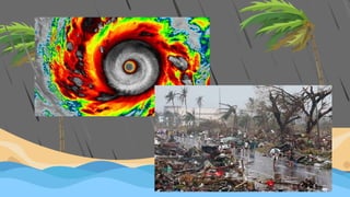
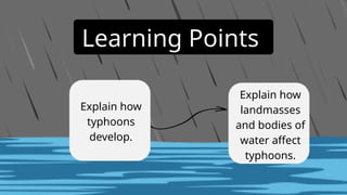
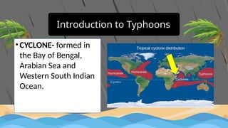
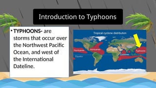
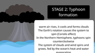
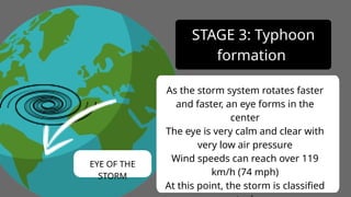
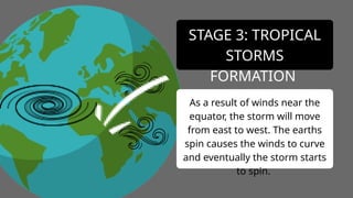
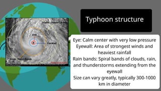
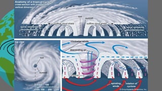
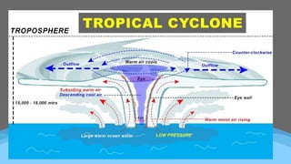
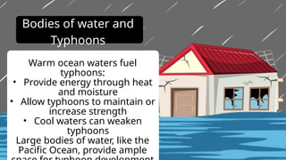
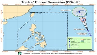
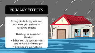
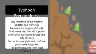
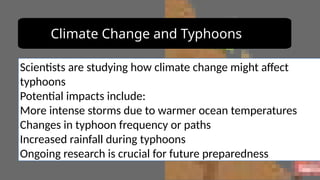
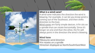
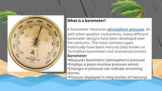
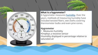
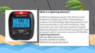
The document discusses the formation, structure, and impact of typhoons, particularly in the context of the Philippine area of responsibility, where an average of 20 typhoons enter each year. It details the stages of typhoon development, the effects of landmasses and ocean temperatures, and emphasizes the importance of preparedness and safety measures for affected communities. Additionally, it covers the naming conventions for storms in the Philippines, including a history of the naming system and the rotation of names used by PAGASA.


![PAGASA has been giving local names to storms that enter the PAR since 1963. The meaning of
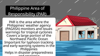
PAR is Philippine Area of Responsibility, which is one of the three domains that weather
forecasters use to monitor, analyze, and forecast tropical cyclones in the Philippines.[1]
But it wasn't until 1998 that the public was involved in naming typhoons in the Philippines. That
year, PAGASA held a “Name a Bagyo” contest that had Filipinos sending their proposed local
names for typhoons. From the nominations, a committee chose 140 Philippine typhoon names.](https://image.slidesharecdn.com/understandingtyphoon-241103150716-b8147055/85/UNDERSTANDING-TYPHOON-and-how-it-is-formed-pptx-44-320.jpg)
![Some of the handpicked 140 names now make up PAGASA's list of names for tropical cyclones.
[2] The list was divided into four sets of 25 typhoon names (each starting with A to Z) with
additional 10 auxiliary names (each starting with A to J).
PAGASA's list is a mix of male and female names, as well as gender-neutral names like Kabayan,
Tamaraw, and Zigzag.
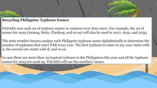
The average number of typhoons in the Philippines is 20 per year.[3] Each set of 25 typhoon
names is usually enough for one year.](https://image.slidesharecdn.com/understandingtyphoon-241103150716-b8147055/85/UNDERSTANDING-TYPHOON-and-how-it-is-formed-pptx-45-320.jpg)


![Polymer [ बहुलक ] Chemistry Notes PDF - Irfanullah Mehar - JJ Sir Chemistry.pdf](https://cdn.slidesharecdn.com/ss_thumbnails/polymerchemistrynotespdf-irfanullahmehar-jjsirchemistry-260210172118-3f9b37f7-thumbnail.jpg?width=640&height=640&fit=bounds)

