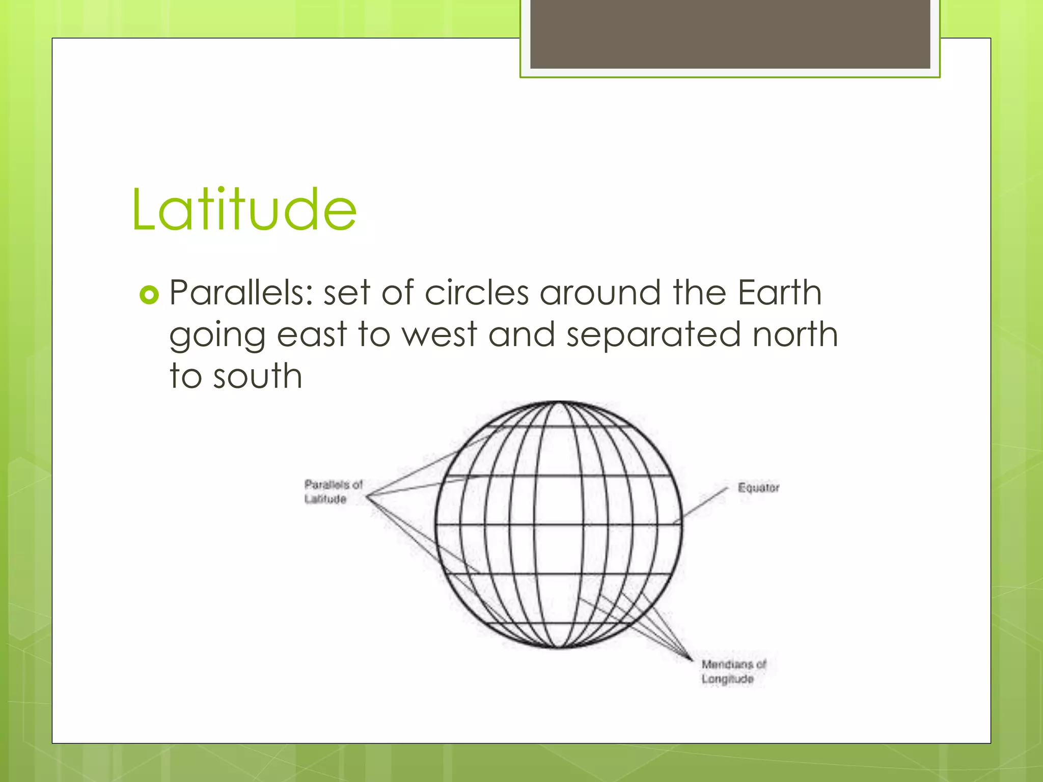
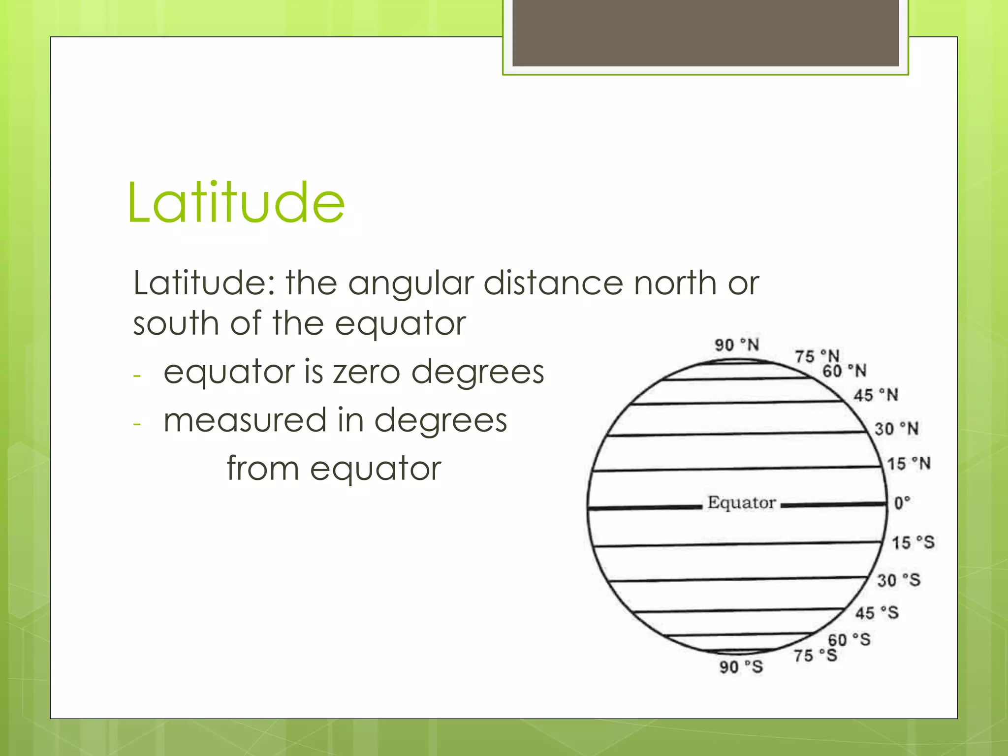
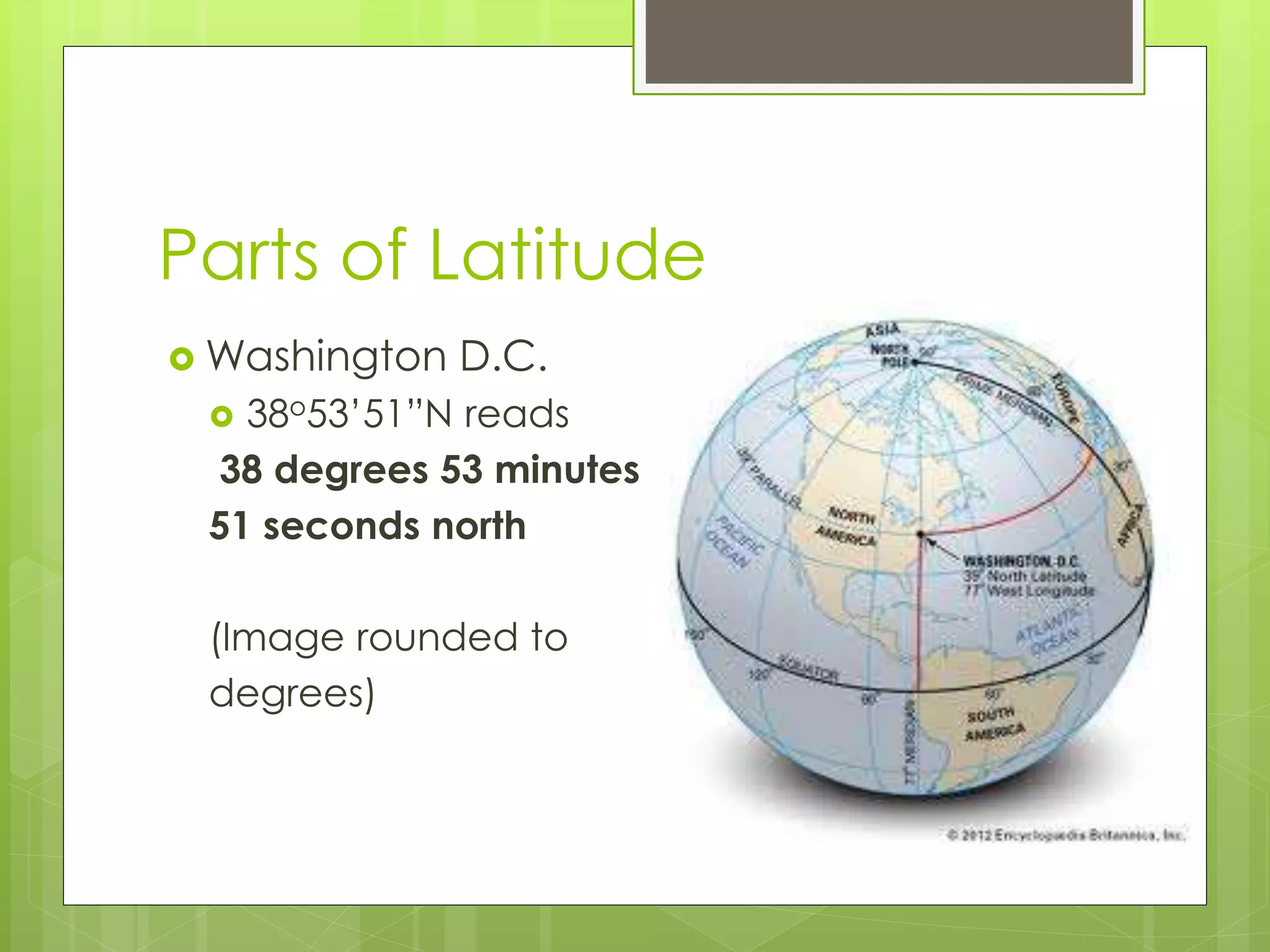
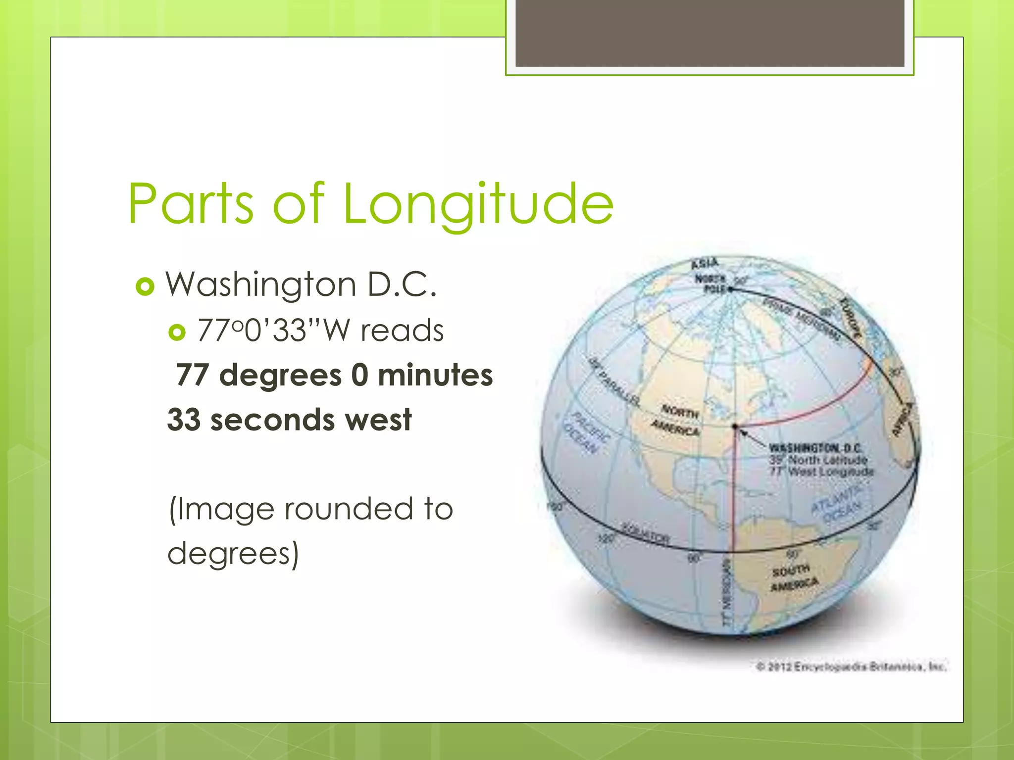
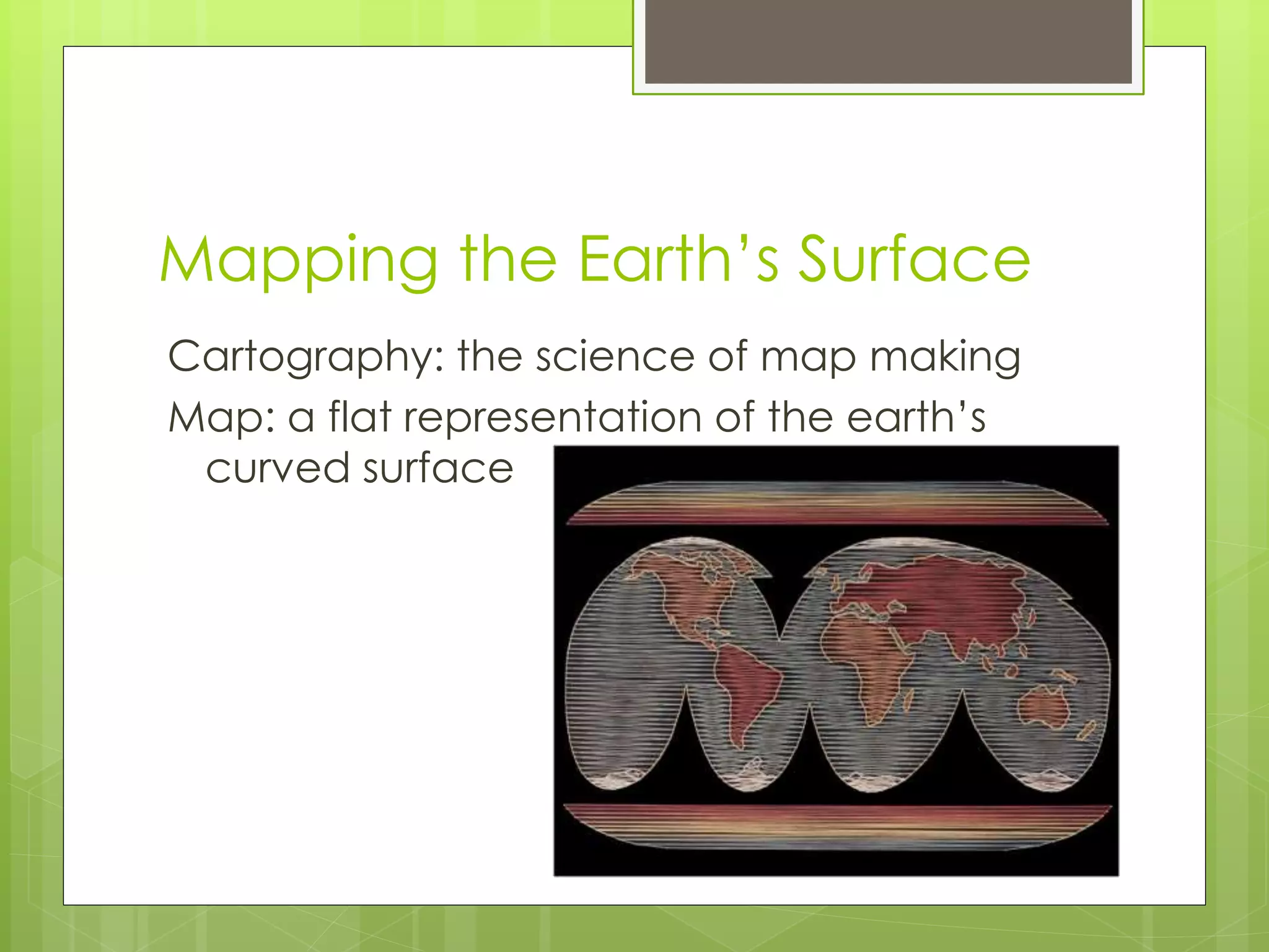
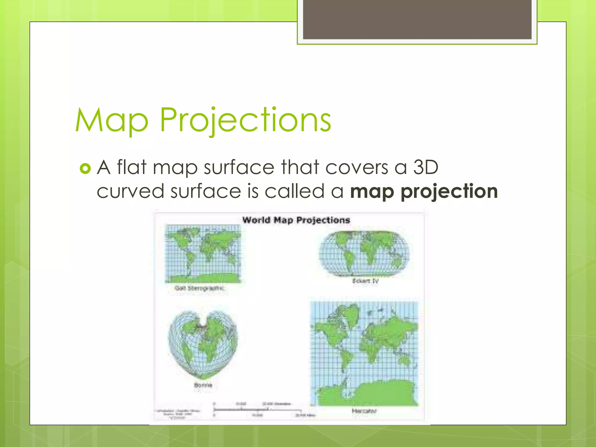
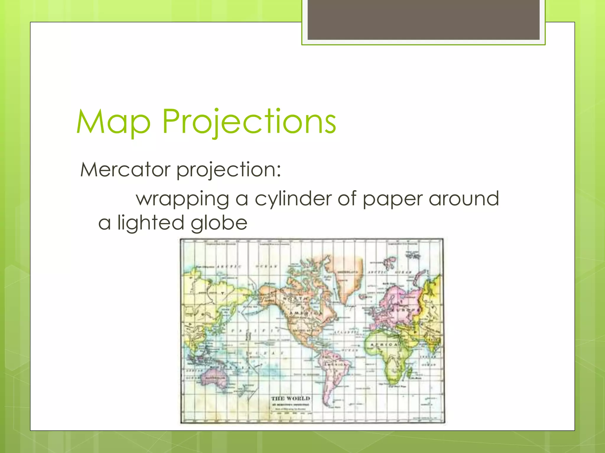
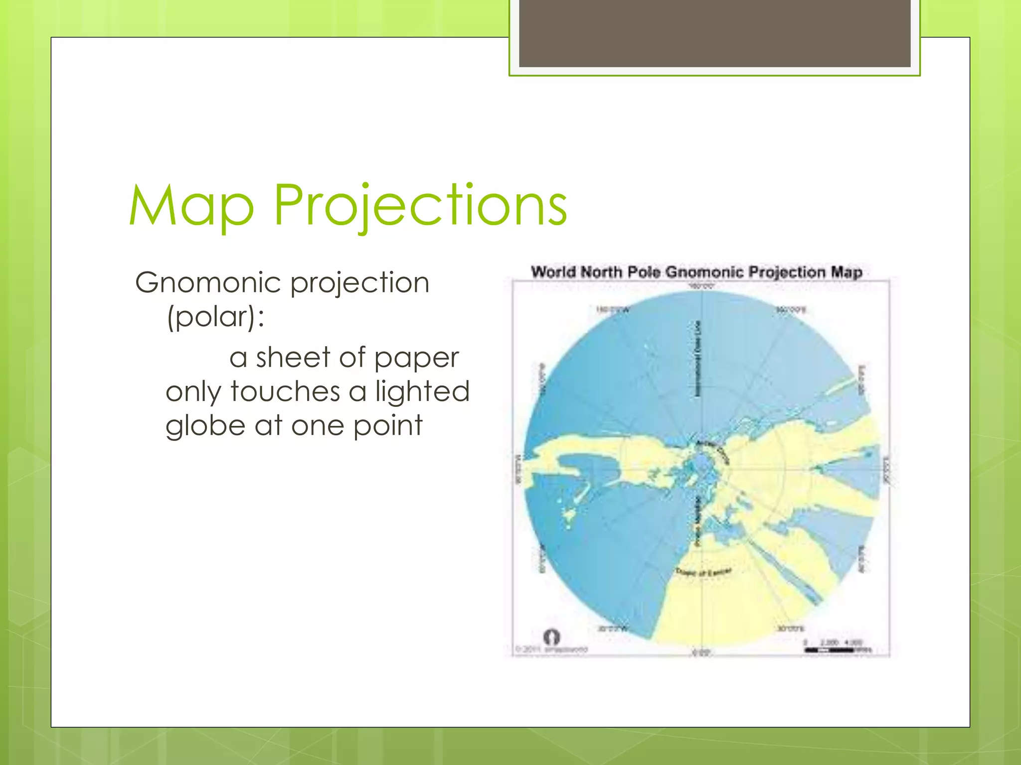
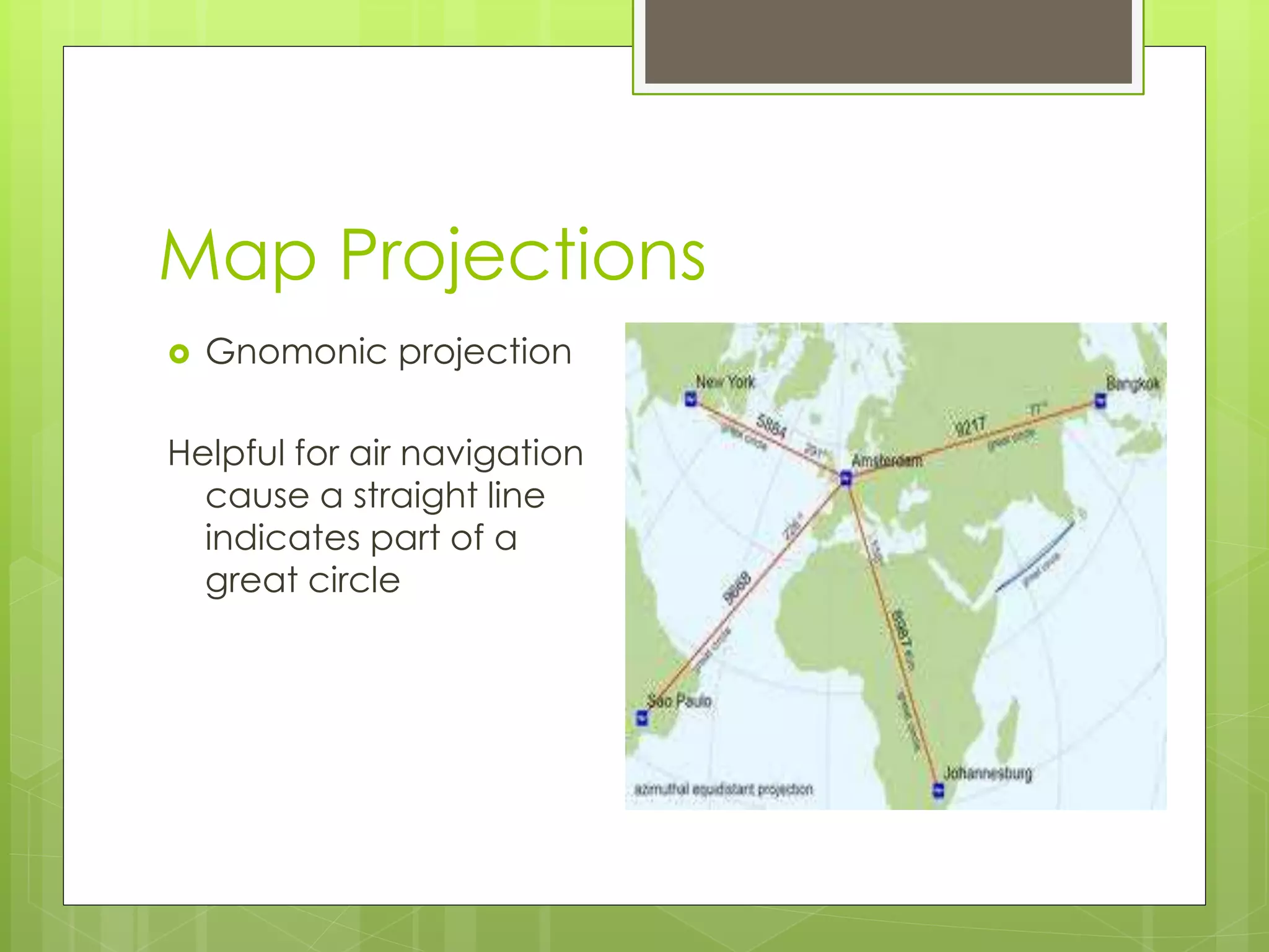
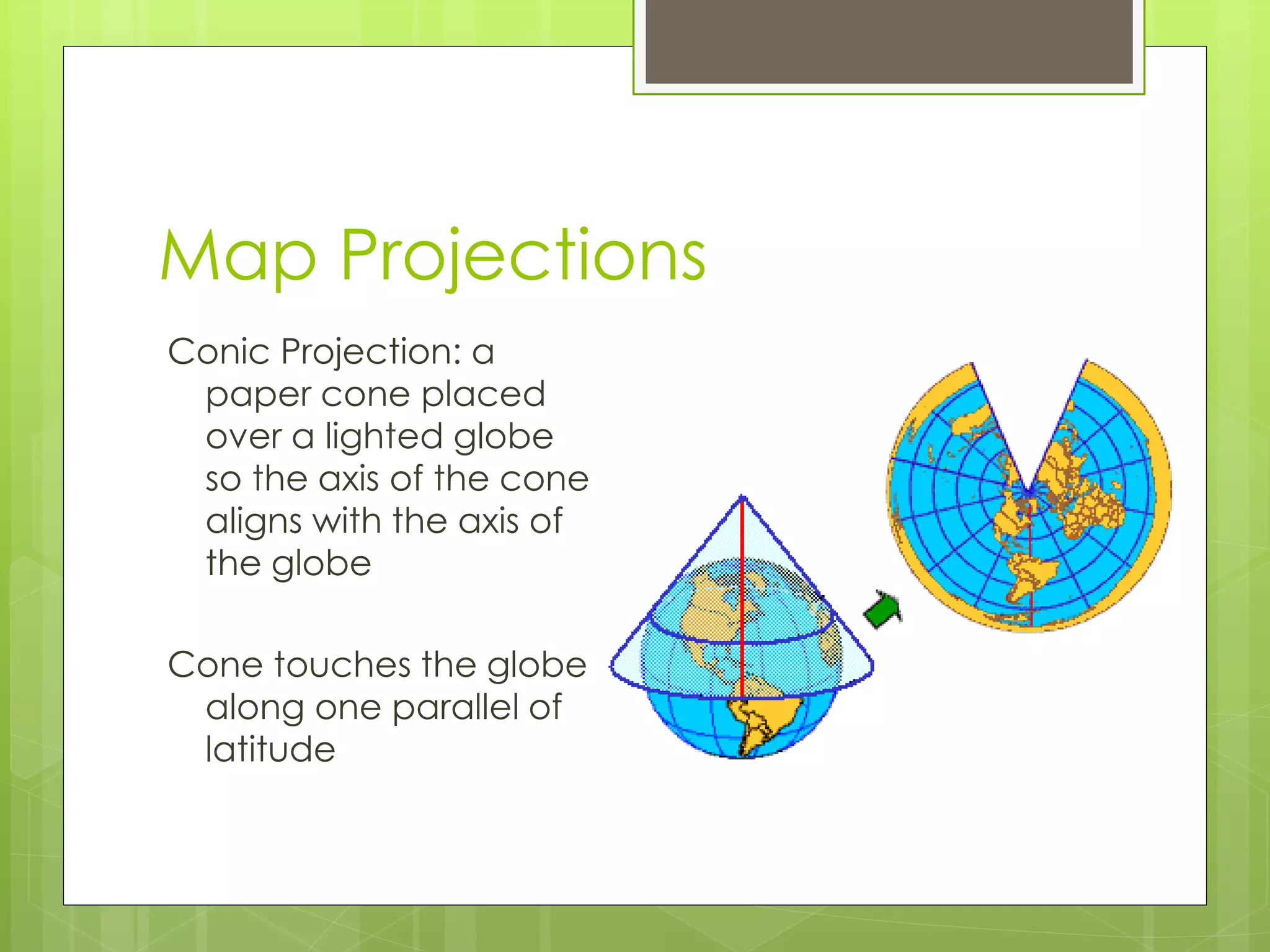
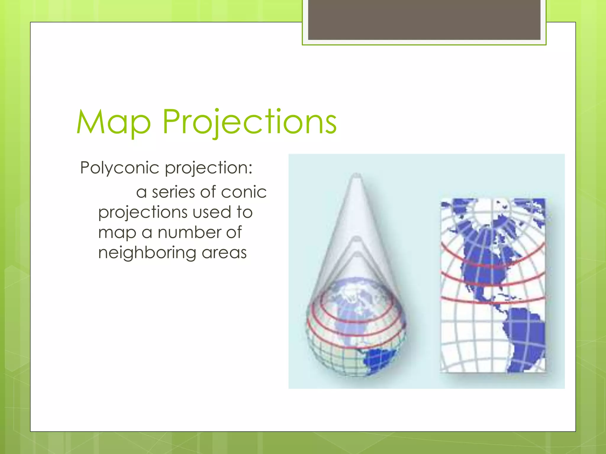
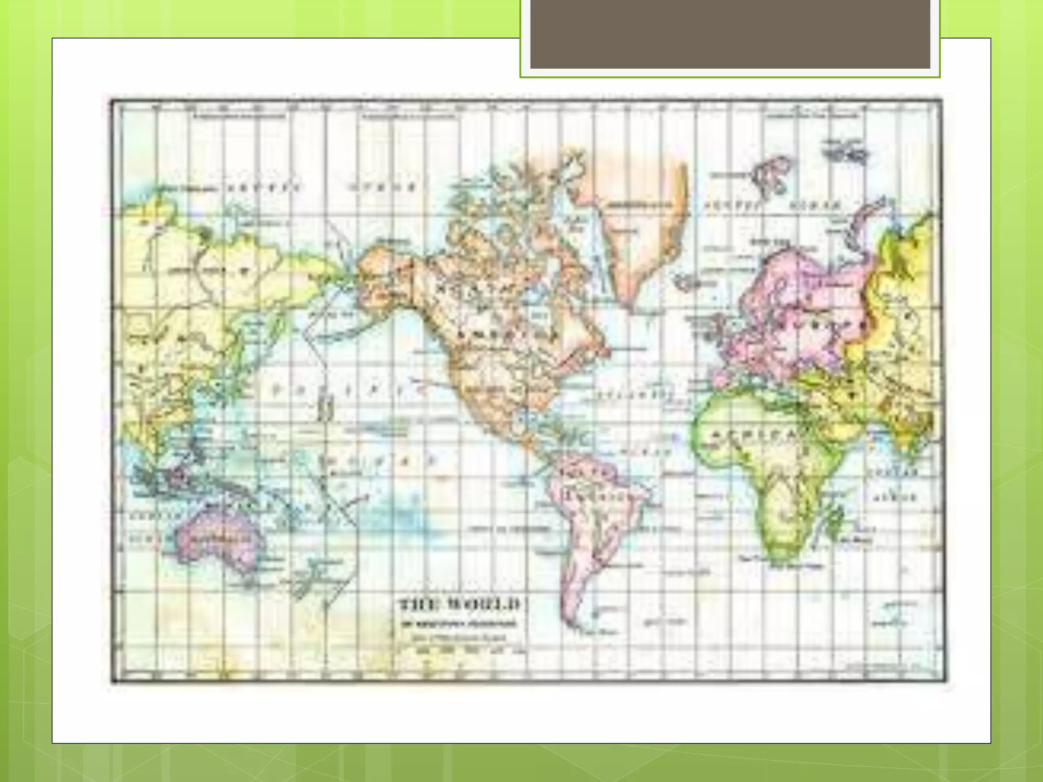
Models of the 
Earth
Finding Locations on the Earth 
 Globe: spherical representation of the 
earth’s surface 
 No corners, no top, no bottom as 
reference points 
 Use rotation of Earth on it’s axis as 
reference point 
 North and South Geographic Poles 
 Equator located halfway between poles
Latitude 
 Parallels: set of circles around the Earth 
going east to west and separated north 
to south
Latitude 
Latitude: the angular distance north or 
south of the equator 
- equator is zero degrees 
- measured in degrees 
from equator
Parts of Latitude 
 0o to 90o from equator to North pole – 
labeled N 
 0o to 90o from equator to South pole – 
labeled S 
 Each degree broken into 60 parts called 
minutes
Parts of Latitude 
 Degrees symbol = o 
 Example: 45o says 45 degrees 
 Minutes symbol = ‘ 
 Example: 30’ says 30 minutes 
 Seconds symbol = “ 
 Example 23” says 23 seconds
Parts of Latitude 
Washington D.C. 
 38o53’51”N reads 
38 degrees 53 minutes 
51 seconds north 
(Image rounded to 
degrees)
Longitude 
 Meridians: intersections to determine east-west 
locations on latitude 
 Measured in degrees, minutes, and 
seconds too 
 Prime meridian agreed to be 0o – runs 
through Greenwich, England
Longitude 
Longitude: the angular distance east or 
west of the prime meridian 
- prime meridian is zero degrees 
- - measured in degrees 
from prime meridian
Parts of Longitude 
 0o to 180o east of prime meridian – 
labeled E 
 0o to 180o west of prime meridian – 
labeled W 
 Distance between degrees depends on 
location on Earth
Parts of Longitude 
 Degrees symbol = o 
 Example: 45o says 45 degrees 
 Minutes symbol = ‘ 
 Example: 30’ says 30 minutes 
 Seconds symbol = “ 
 Example 23” says 23 seconds
Parts of Longitude 
Washington D.C. 
 77o0’33”W reads 
77 degrees 0 minutes 
33 seconds west 
(Image rounded to 
degrees)
Great Circles 
 Great circle: any circle that divides the 
globe into halves 
 Any circle formed by two meridians on 
opposite sides of globe
Finding Direction 
 Magnetic compass: indicates direction by 
responding to earth’s natural magnetic 
properties 
 Earth’s imaginary magnet is at an angle 
to the earth’s axis of rotation
Finding Direction 
The points on the earth’s surface just above 
the poles of the imaginary magnet are 
called geomagnetic poles 
Geomagnetic and geographic poles are in 
different locations
Finding Direction 
Magnetic declination: the angle between 
the direction of the geographic pole and 
the direction which the compass points
Magnetic pole shift 
 http://www.youtube.com/watch?v=Rmc 
8U9zWN00
Finding Direction 
The geographic north pole is called true 
north.
Mapping the Earth’s Surface 
Cartography: the science of map making 
Map: a flat representation of the earth’s 
curved surface
Map Projections 
 A flat map surface that covers a 3D 
curved surface is called a map projection
Map Projections 
Mercator projection: 
wrapping a cylinder of paper around 
a lighted globe
Map Projections 
Gnomonic projection 
(polar): 
a sheet of paper 
only touches a lighted 
globe at one point
Map Projections 
 Gnomonic projection 
Helpful for air navigation 
cause a straight line 
indicates part of a 
great circle
Map Projections 
Conic Projection: a 
paper cone placed 
over a lighted globe 
so the axis of the cone 
aligns with the axis of 
the globe 
Cone touches the globe 
along one parallel of 
latitude
Map Projections 
Polyconic projection: 
a series of conic 
projections used to 
map a number of 
neighboring areas
Reading a Map 
Symbols needed to read a map 
Legend: a list of symbols and their meanings 
Direction: usually indicates north 
somewhere on map 
Scale: indicates the relationship between 
distance as shown on map and actual 
distance
Models of the Earth - Mapping

Models of the Earth - Mapping

  • 1.
  • 2.
    Finding Locations onthe Earth  Globe: spherical representation of the earth’s surface  No corners, no top, no bottom as reference points  Use rotation of Earth on it’s axis as reference point  North and South Geographic Poles  Equator located halfway between poles
  • 3.
    Latitude  Parallels:set of circles around the Earth going east to west and separated north to south
  • 4.
    Latitude Latitude: theangular distance north or south of the equator - equator is zero degrees - measured in degrees from equator
  • 5.
    Parts of Latitude  0o to 90o from equator to North pole – labeled N  0o to 90o from equator to South pole – labeled S  Each degree broken into 60 parts called minutes
  • 6.
    Parts of Latitude  Degrees symbol = o  Example: 45o says 45 degrees  Minutes symbol = ‘  Example: 30’ says 30 minutes  Seconds symbol = “  Example 23” says 23 seconds
  • 7.
    Parts of Latitude Washington D.C.  38o53’51”N reads 38 degrees 53 minutes 51 seconds north (Image rounded to degrees)
  • 8.
    Longitude  Meridians:intersections to determine east-west locations on latitude  Measured in degrees, minutes, and seconds too  Prime meridian agreed to be 0o – runs through Greenwich, England
  • 9.
    Longitude Longitude: theangular distance east or west of the prime meridian - prime meridian is zero degrees - - measured in degrees from prime meridian
  • 10.
    Parts of Longitude  0o to 180o east of prime meridian – labeled E  0o to 180o west of prime meridian – labeled W  Distance between degrees depends on location on Earth
  • 11.
    Parts of Longitude  Degrees symbol = o  Example: 45o says 45 degrees  Minutes symbol = ‘  Example: 30’ says 30 minutes  Seconds symbol = “  Example 23” says 23 seconds
  • 12.
    Parts of Longitude Washington D.C.  77o0’33”W reads 77 degrees 0 minutes 33 seconds west (Image rounded to degrees)
  • 13.
    Great Circles Great circle: any circle that divides the globe into halves  Any circle formed by two meridians on opposite sides of globe
  • 14.
    Finding Direction Magnetic compass: indicates direction by responding to earth’s natural magnetic properties  Earth’s imaginary magnet is at an angle to the earth’s axis of rotation
  • 15.
    Finding Direction Thepoints on the earth’s surface just above the poles of the imaginary magnet are called geomagnetic poles Geomagnetic and geographic poles are in different locations
  • 16.
    Finding Direction Magneticdeclination: the angle between the direction of the geographic pole and the direction which the compass points
  • 17.
    Magnetic pole shift  http://www.youtube.com/watch?v=Rmc 8U9zWN00
  • 18.
    Finding Direction Thegeographic north pole is called true north.
  • 19.
    Mapping the Earth’sSurface Cartography: the science of map making Map: a flat representation of the earth’s curved surface
  • 20.
    Map Projections A flat map surface that covers a 3D curved surface is called a map projection
  • 21.
    Map Projections Mercatorprojection: wrapping a cylinder of paper around a lighted globe
  • 22.
    Map Projections Gnomonicprojection (polar): a sheet of paper only touches a lighted globe at one point
  • 23.
    Map Projections Gnomonic projection Helpful for air navigation cause a straight line indicates part of a great circle
  • 24.
    Map Projections ConicProjection: a paper cone placed over a lighted globe so the axis of the cone aligns with the axis of the globe Cone touches the globe along one parallel of latitude
  • 25.
    Map Projections Polyconicprojection: a series of conic projections used to map a number of neighboring areas
  • 26.
    Reading a Map Symbols needed to read a map Legend: a list of symbols and their meanings Direction: usually indicates north somewhere on map Scale: indicates the relationship between distance as shown on map and actual distance

Editor's Notes

  • #20 Hard to put 3D onto 2D surface Larger the area, the larger the distortion Like an orange peel
  • #22 Disadvantages: poles distorted cause meridians suppose to come together Places far away from equator appear larger that true size cause of distortion Advantages: all compass directions appear in straight lines with 4 points on compass Latitude and longitude easily measured with a ruler cause parallels and meridians are shown clearly instead of meridians changing when moving away from equator Valuable navigation tool
  • #23 Advantages: little distortion cause only at one point great help to navigator routing air travel Disadvantages: unequal spacing between parallels a straight line drawn on these projections show a great circle and this is the shortest distance between two points on a globe