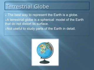
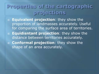
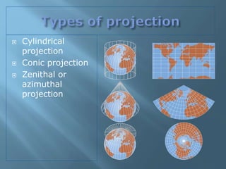
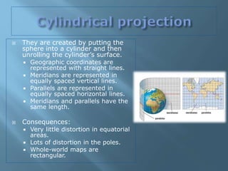
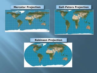
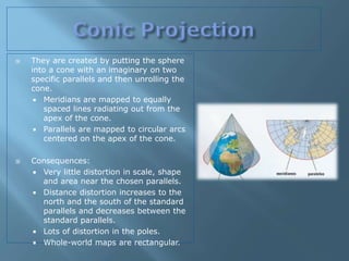
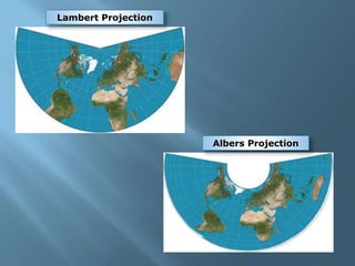
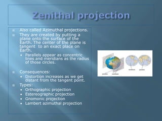
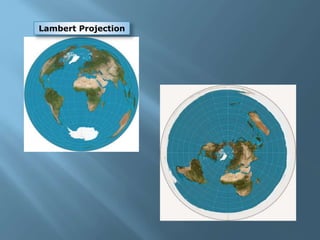
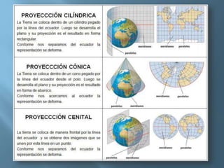
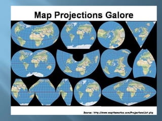
2. Terrestrial Globe
The best way to represent the Earth is a globe.
A terrestrial globe is a spherical model of the Earth
that do not distort its surface.
Not useful to study parts of the Earth in detail.
3. Represent the 3-D geoid of the Earth on a
flat surface or map.
Every projection changes the surface of the
Earth in some way. This is called distortion.
Geographers use different types of
projection depending on the purpose of the
map they want to create and their accuracy.
4.
5. Equivalent projection: they show the
proportion of landmasses accurately. Useful
for comparing the surface area of territories.
Equidisntant projection: they show the
distance between territories accurately.
Conformal projection: they show the
shape of an area accurately.
7. They are created by putting the
sphere into a cylinder and then
unrolling the cylinder’s surface.
Geographic coordinates are
represented with straight lines.
Meridians are represented in
equally spaced vertical lines.
Parallels are represented in
equally spaced horizontal lines.
Meridians and parallels have the
same length.
Consequences:
Very little distortion in equatorial
areas.
Lots of distortion in the poles.
Whole-world maps are
rectangular.
9. They are created by putting the sphere
into a cone with an imaginary on two
specific parallels and then unrolling the
cone.
Meridians are mapped to equally
spaced lines radiating out from the
apex of the cone.
Parallels are mapped to circular arcs
centered on the apex of the cone.
Consequences:
Very little distortion in scale, shape
and area near the chosen parallels.
Distance distortion increases to the
north and the south of the standard
parallels and decreases between the
standard parallels.
Lots of distortion in the poles.
Whole-world maps are rectangular.
11. Also called Azimuthal projections.
They are created by putting a
plane onto the surface of the
Earth. The center of the plane is
tangent to an exact place on
Earth.
Parallels appear as concentric
lines and meridians as the radius
of those circles.
Consequences:
Distortion increases as we get
distant from the tangent point.
Types:
Orthographic projection
Estereographic projection
Gnomonic projection
Lambert azimuthal projection