Downloaded 232 times
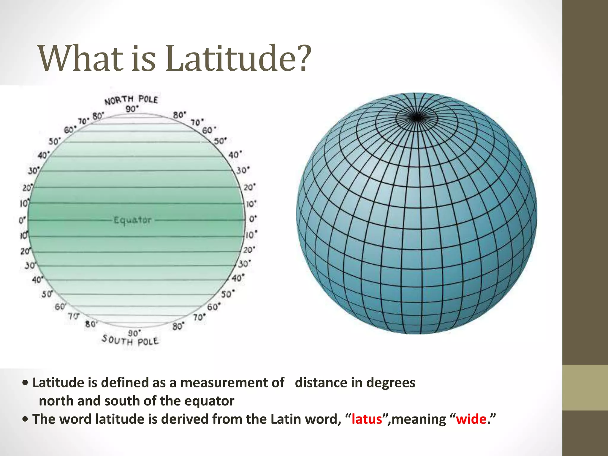
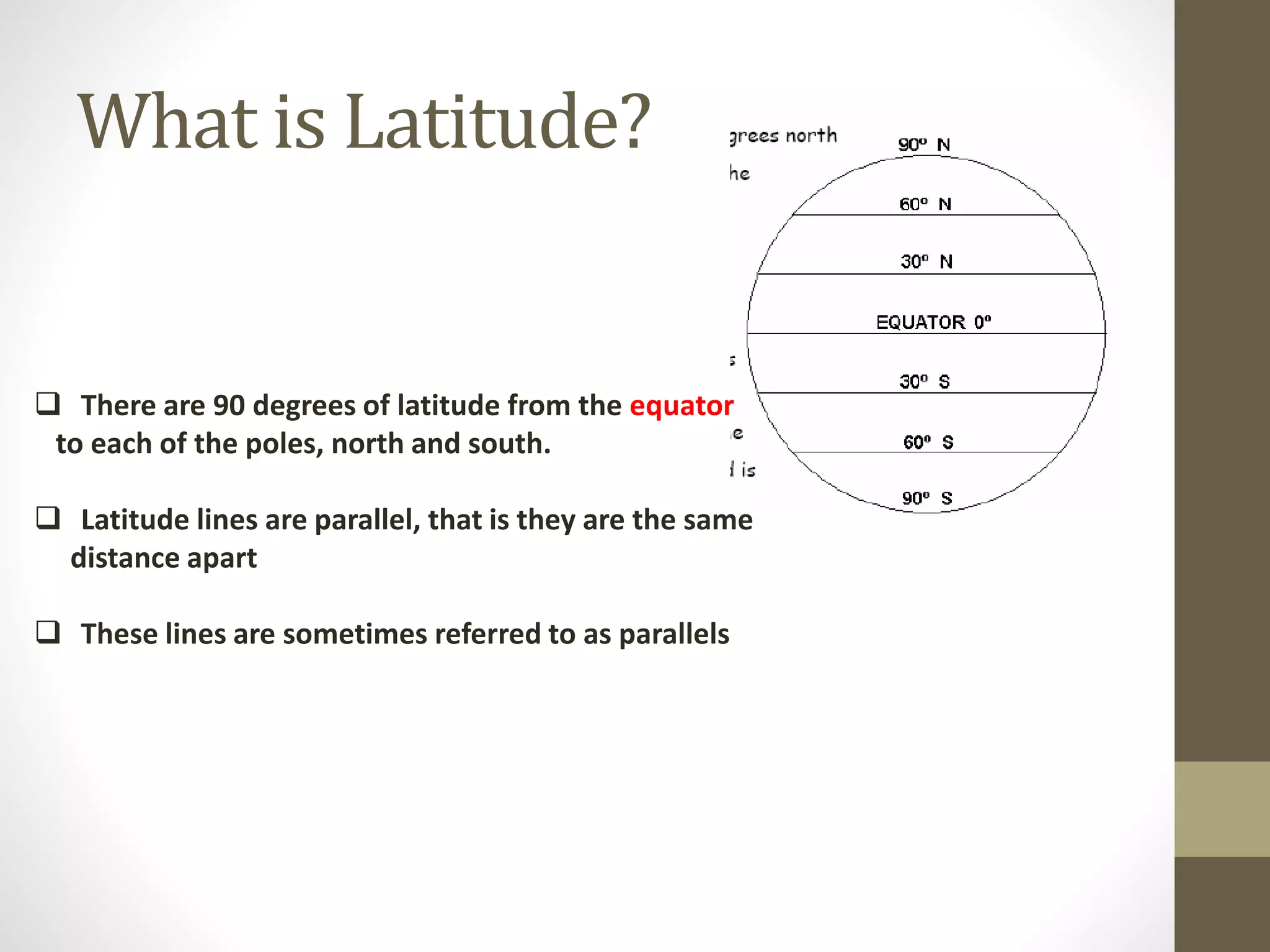
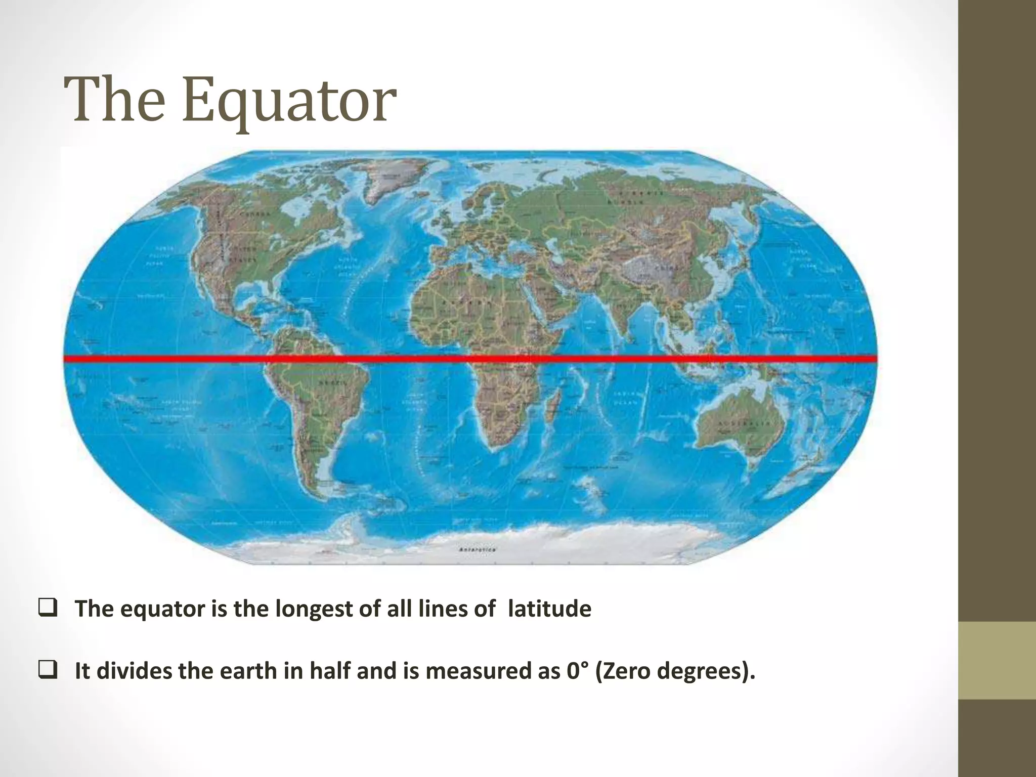
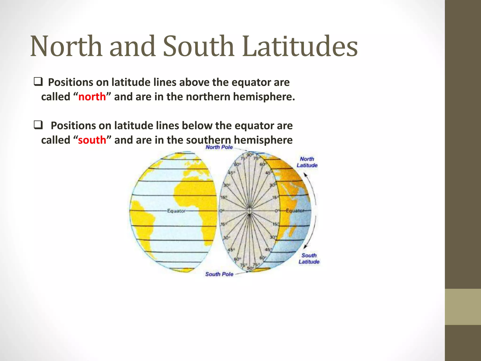
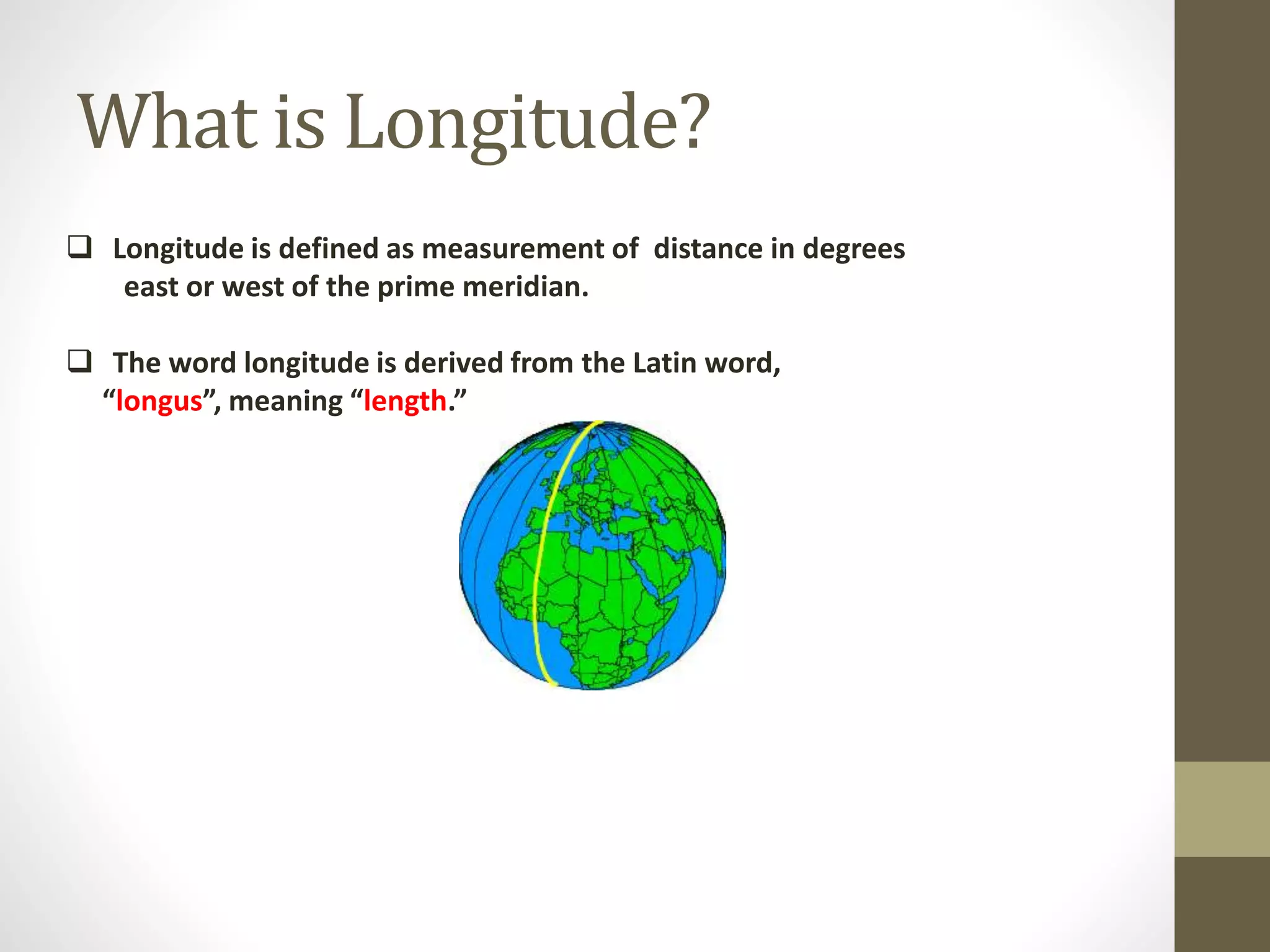
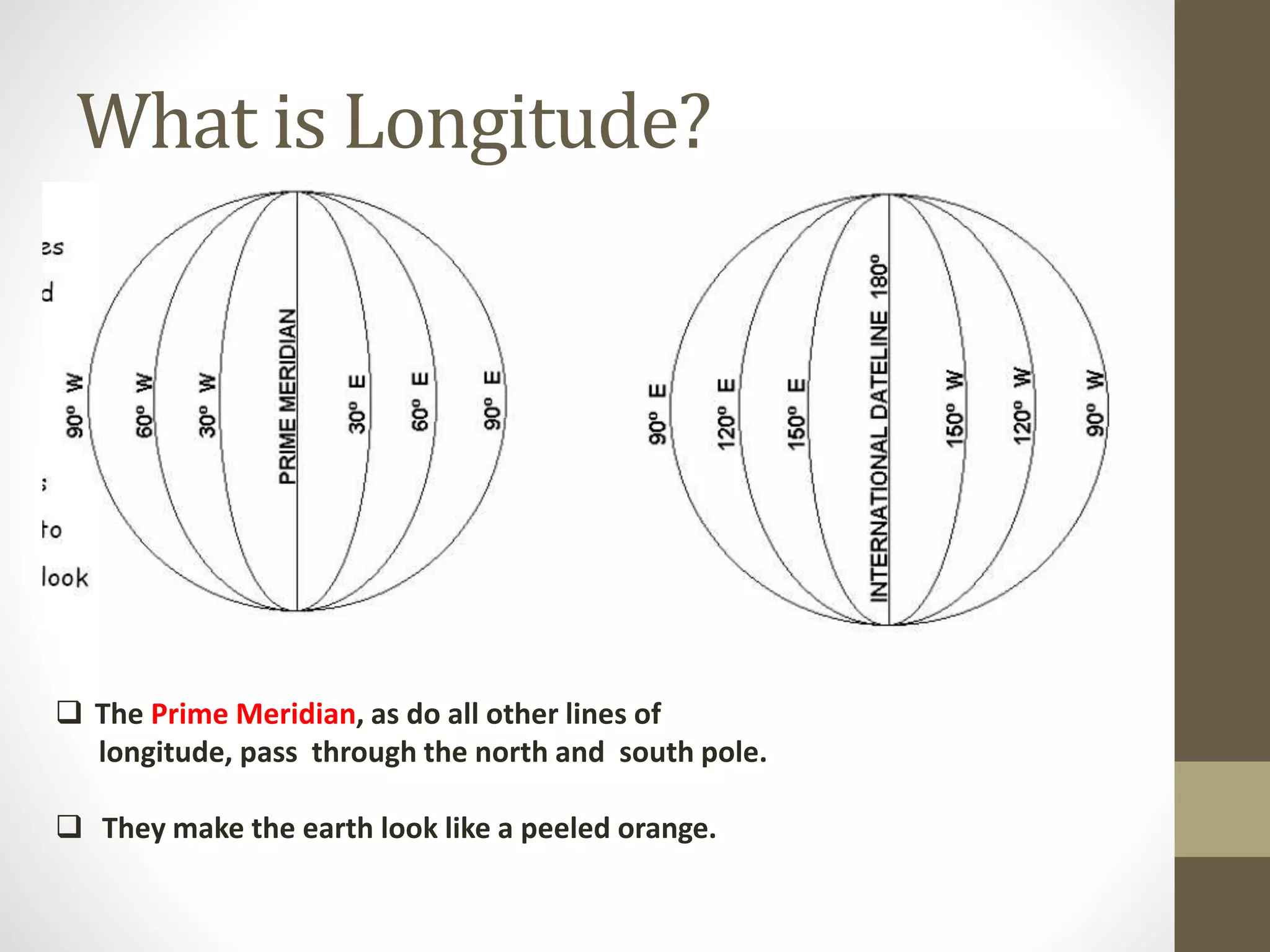
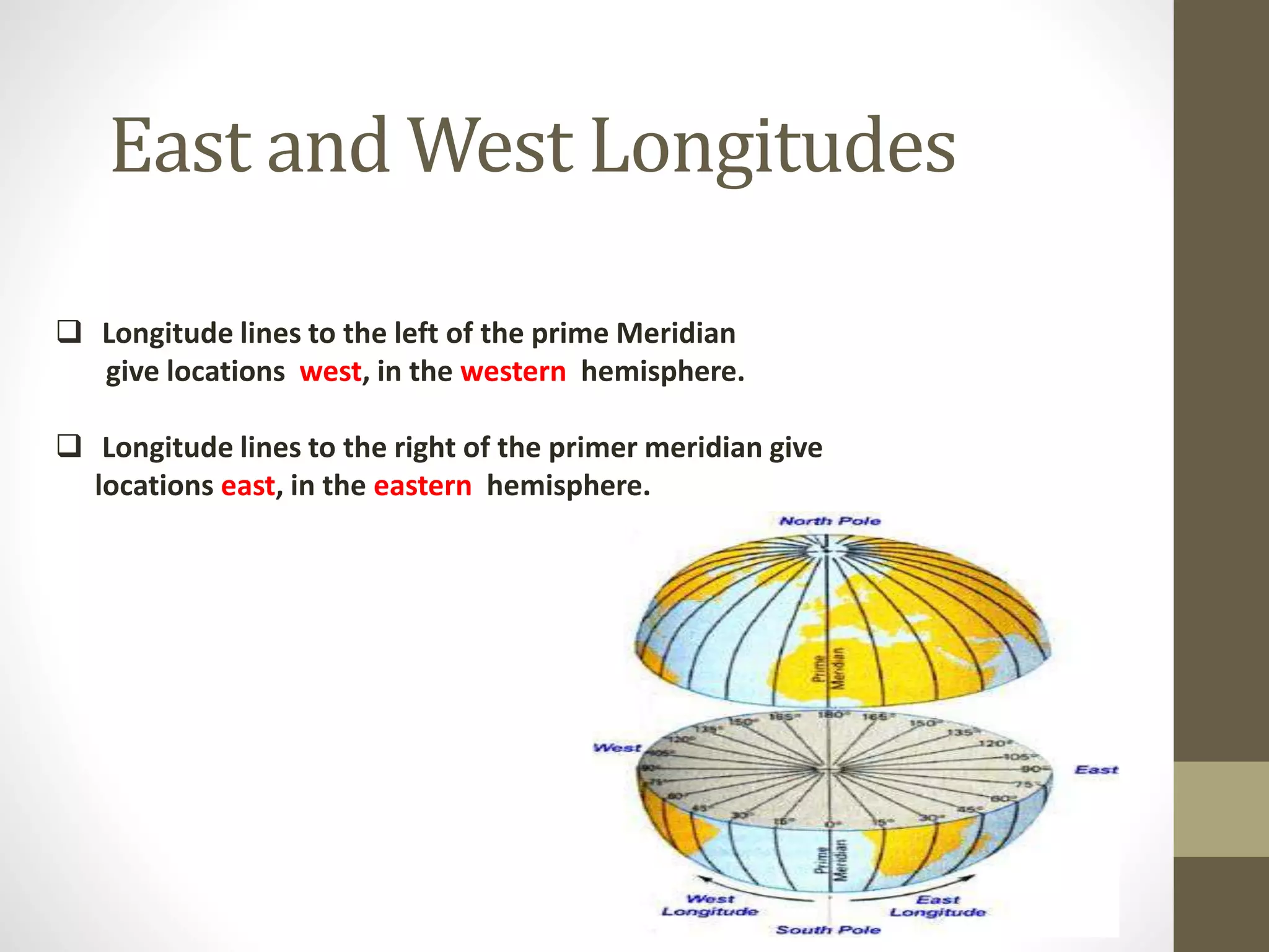
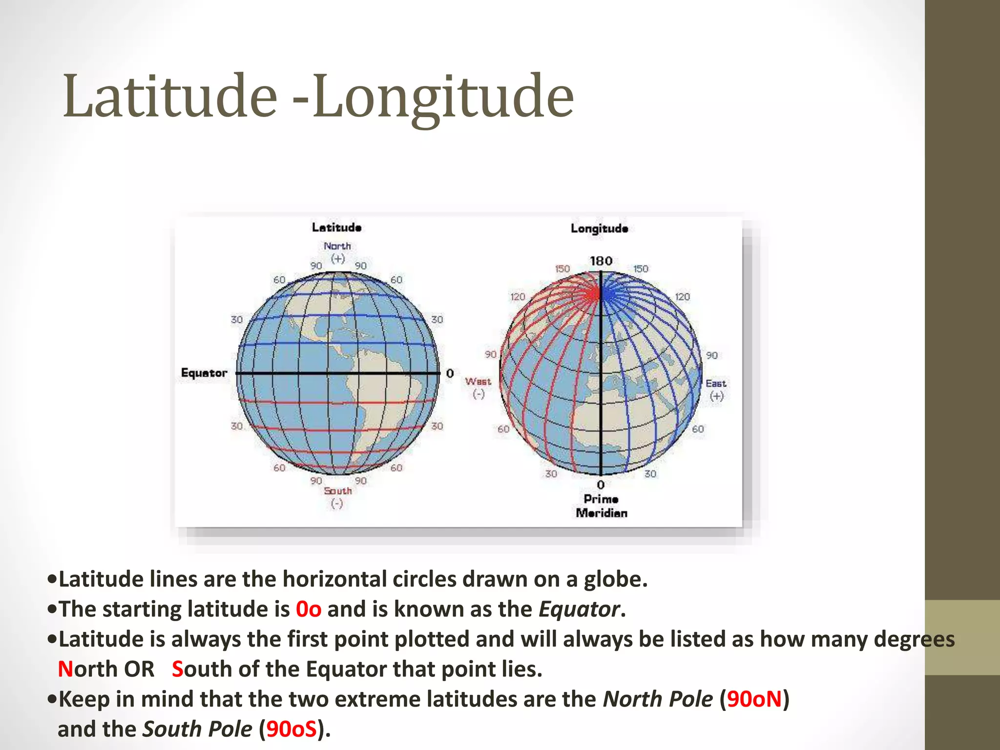
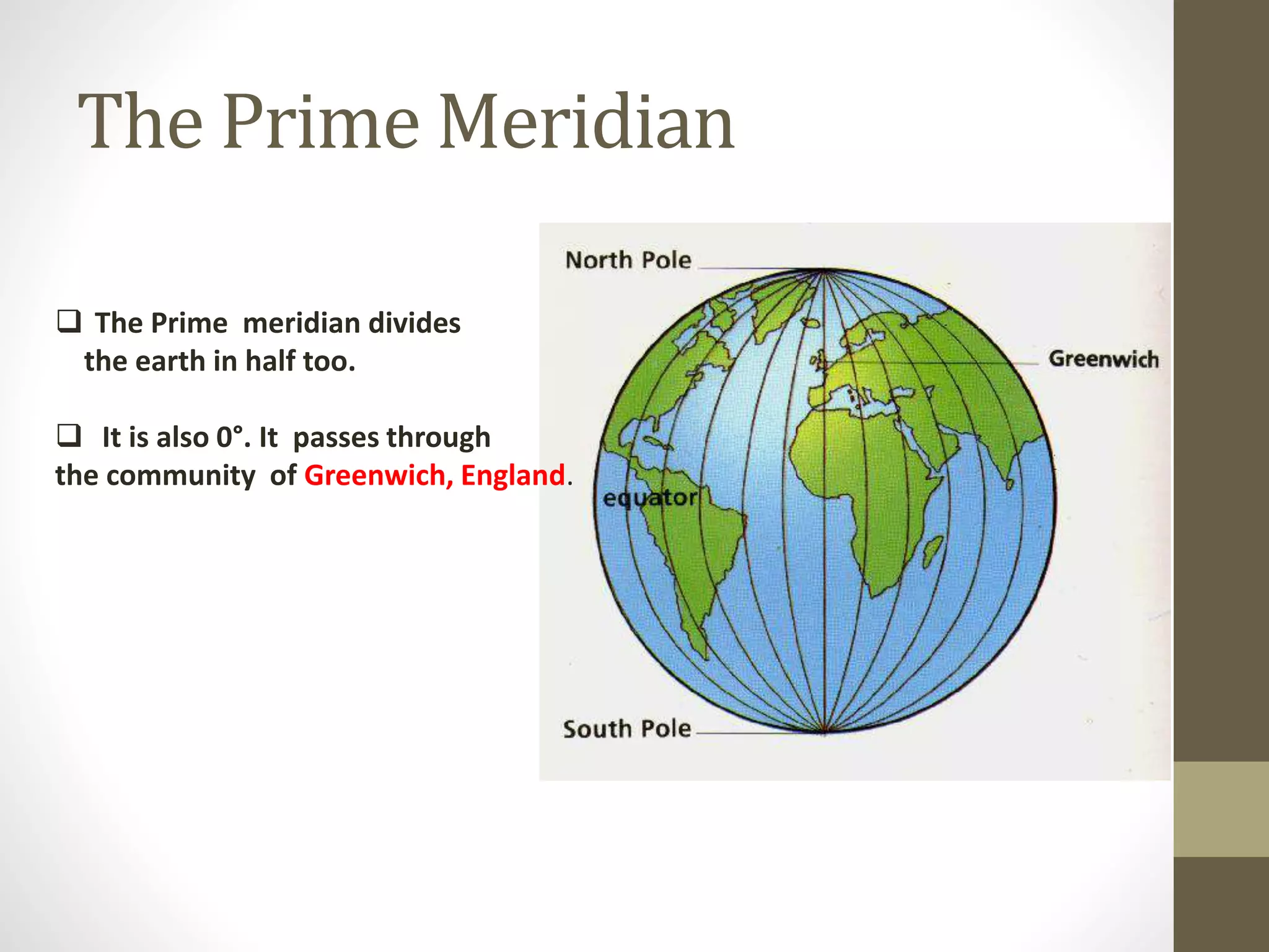
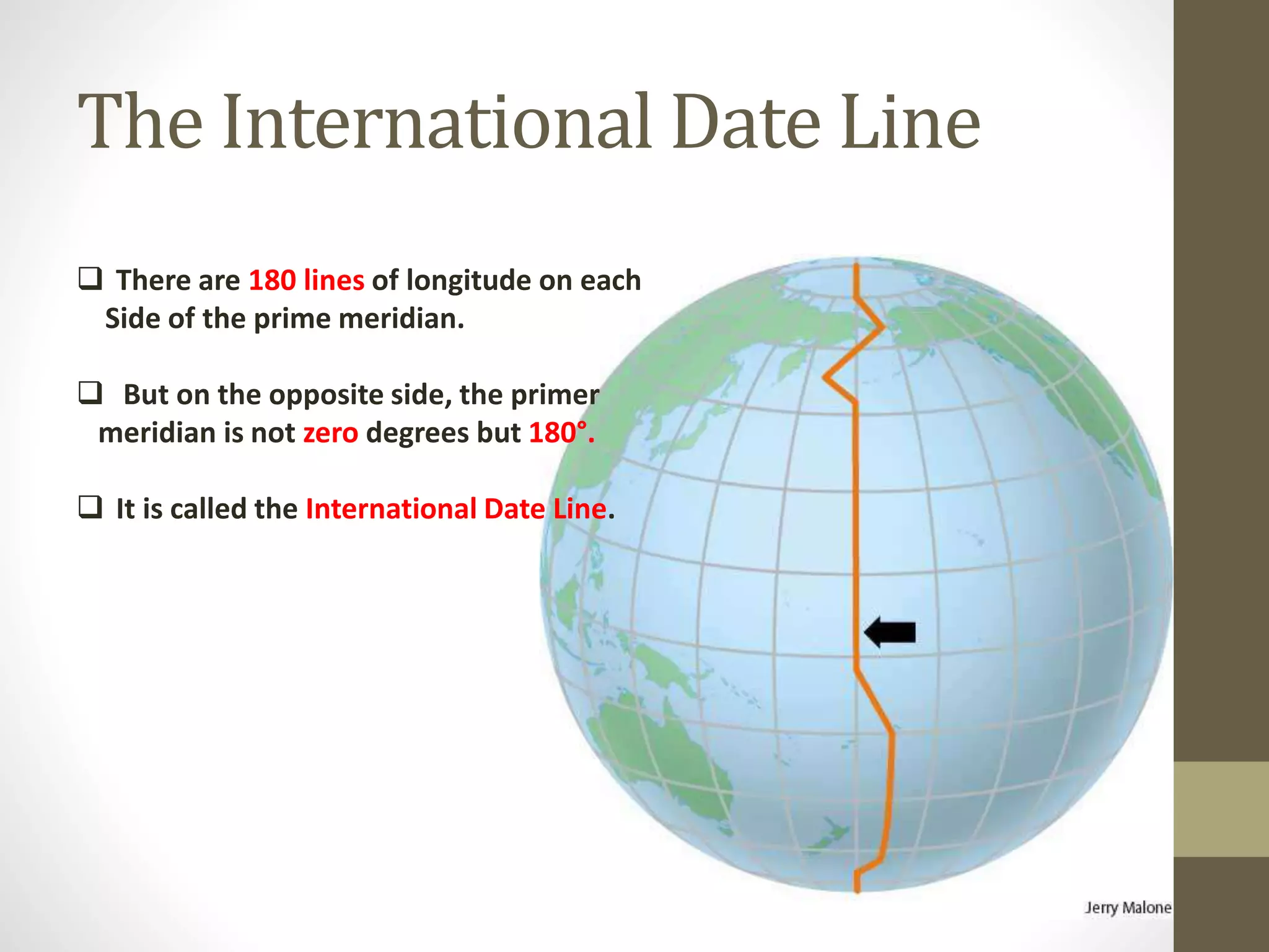
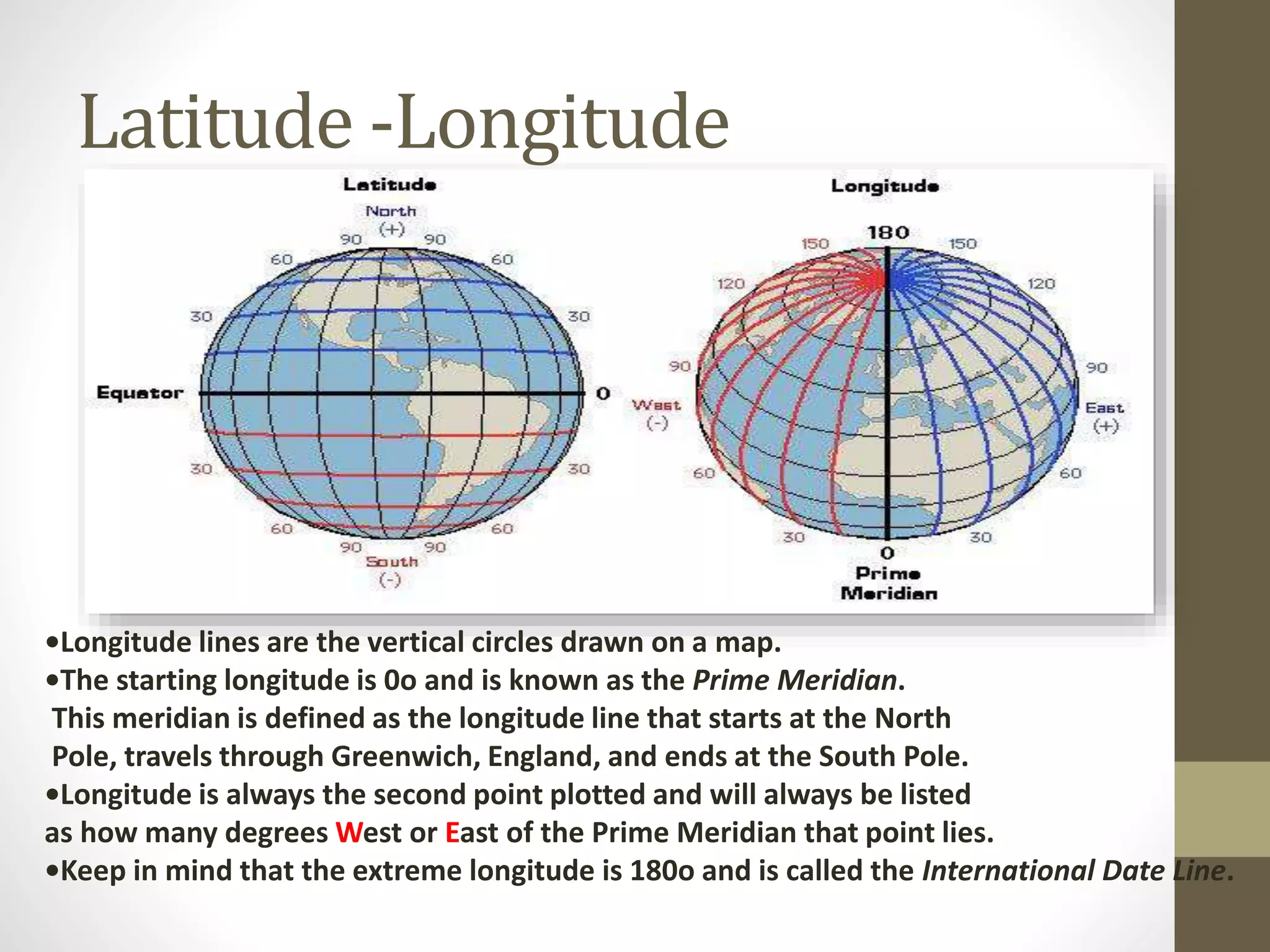
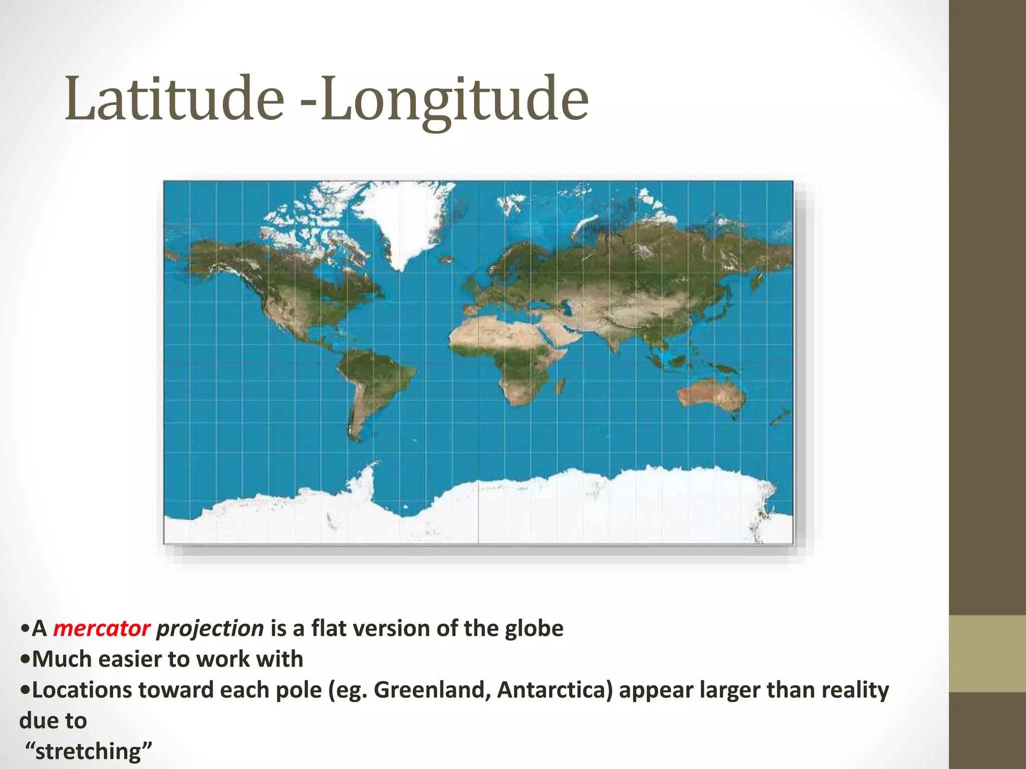
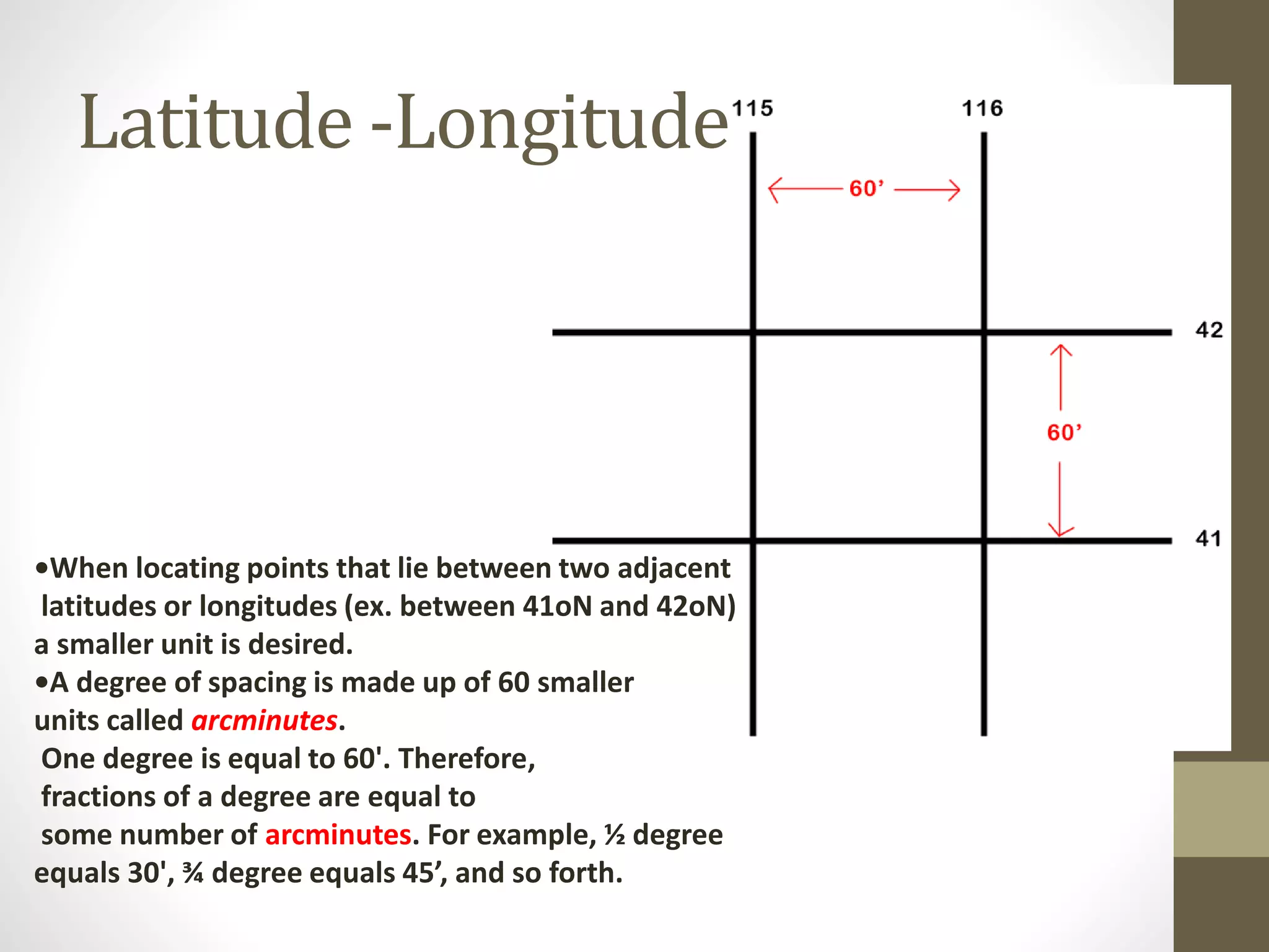
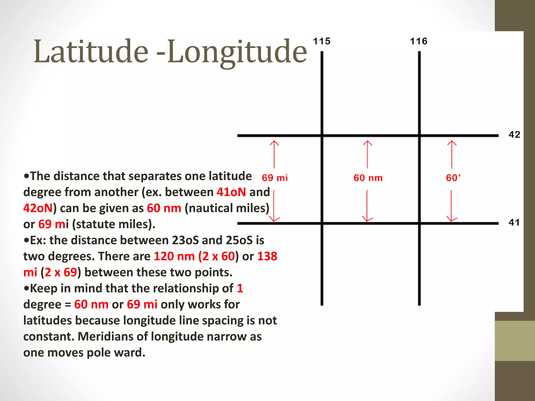
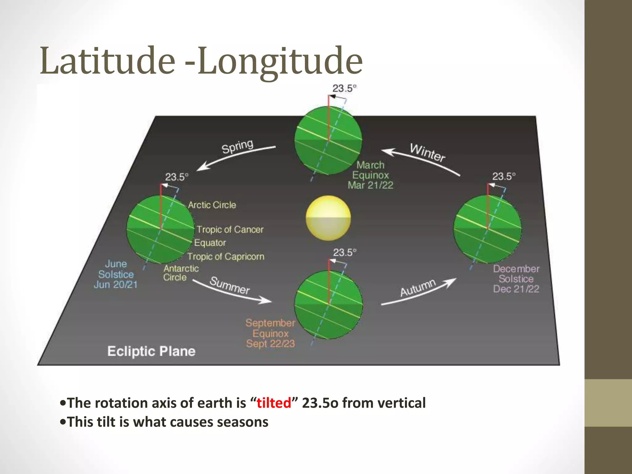
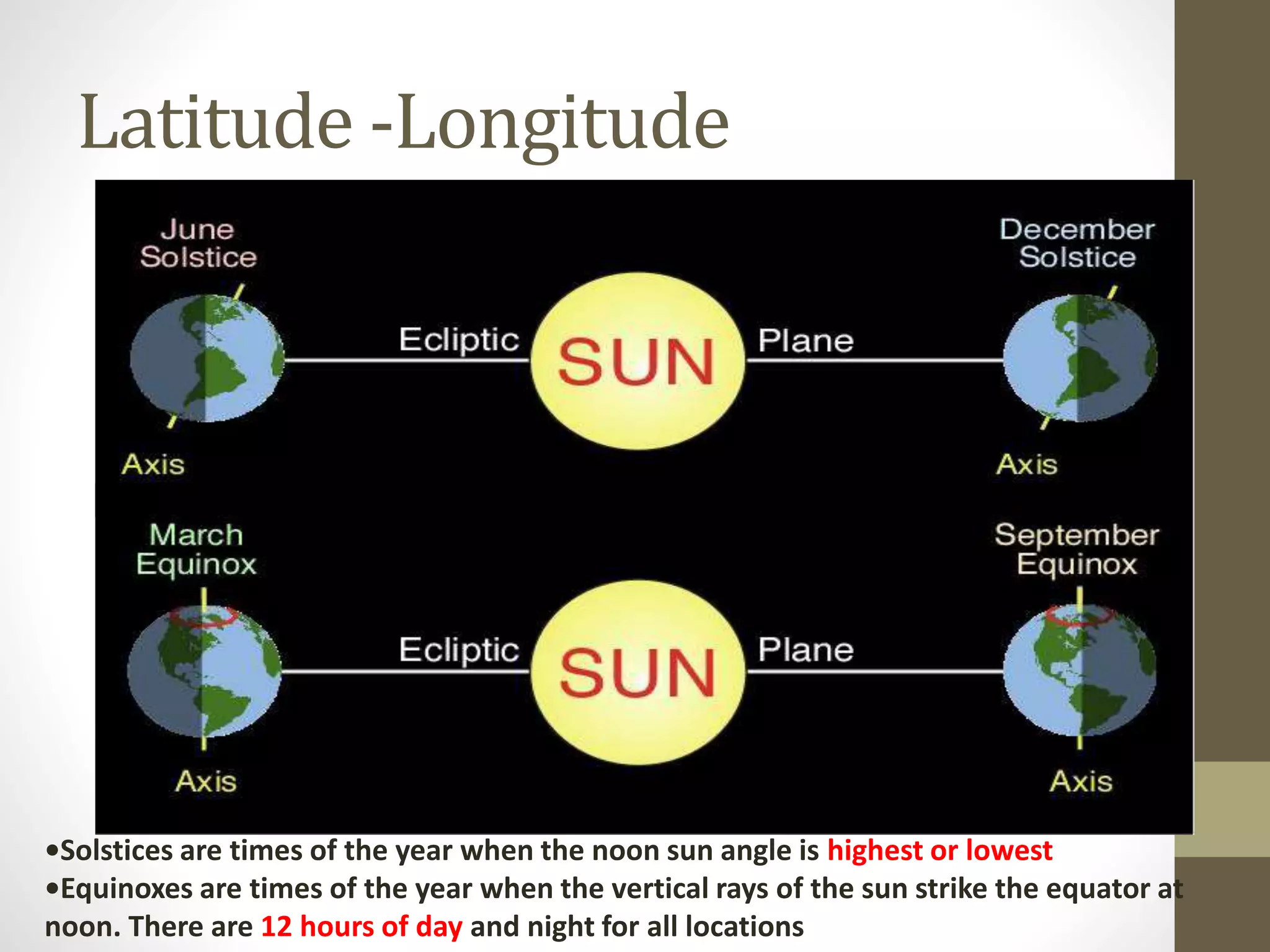
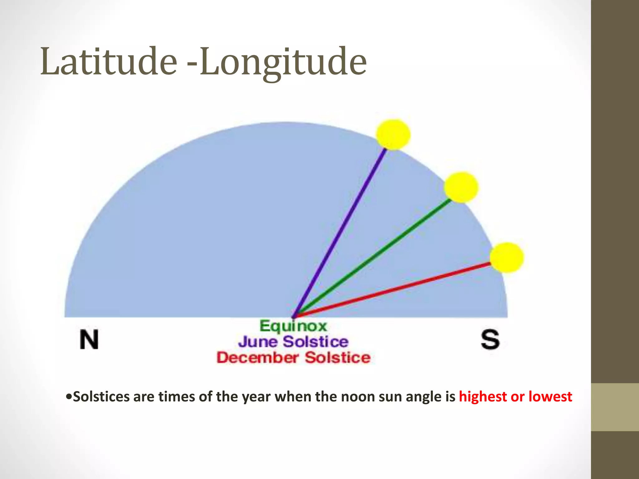
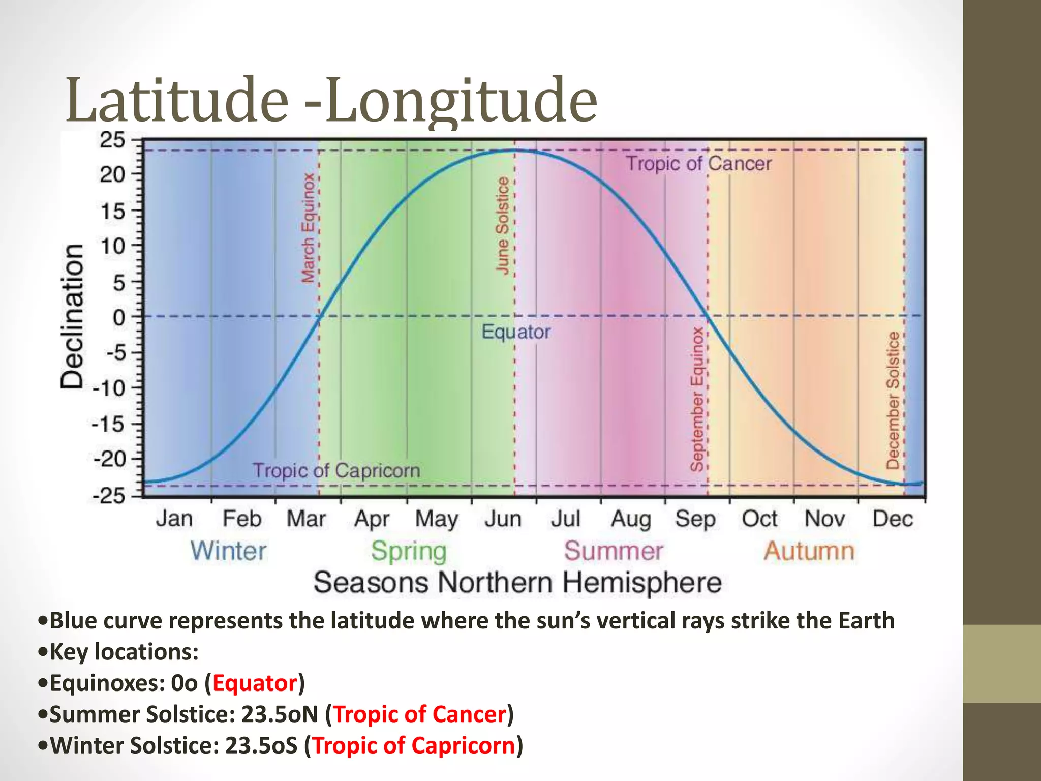

This document defines and explains key concepts related to latitude, longitude, and their use in determining locations on Earth. It discusses the prime meridian, equator, latitude, longitude, north and south latitudes, east and west longitudes, and the international date line. Latitude lines run parallel around the globe, measuring angles north and south of the equator, while longitude lines converge at the poles, measuring angles east and west of the prime meridian. Together, latitude and longitude precisely locate positions worldwide.


![Latitudes and Longitudes [Autosaved].pptx](https://cdn.slidesharecdn.com/ss_thumbnails/latitudesandlongitudesautosaved-221031193426-8f2f0591-thumbnail.jpg?width=640&height=640&fit=bounds)


