Downloaded 1,009 times

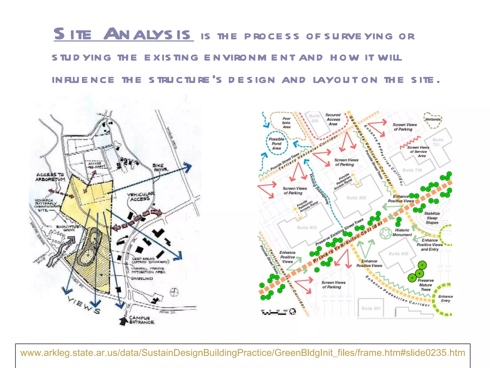
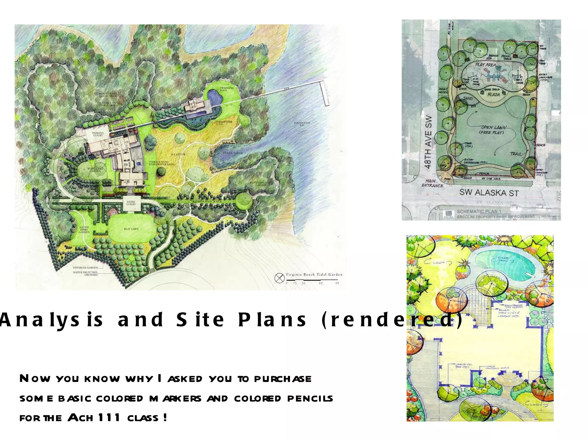


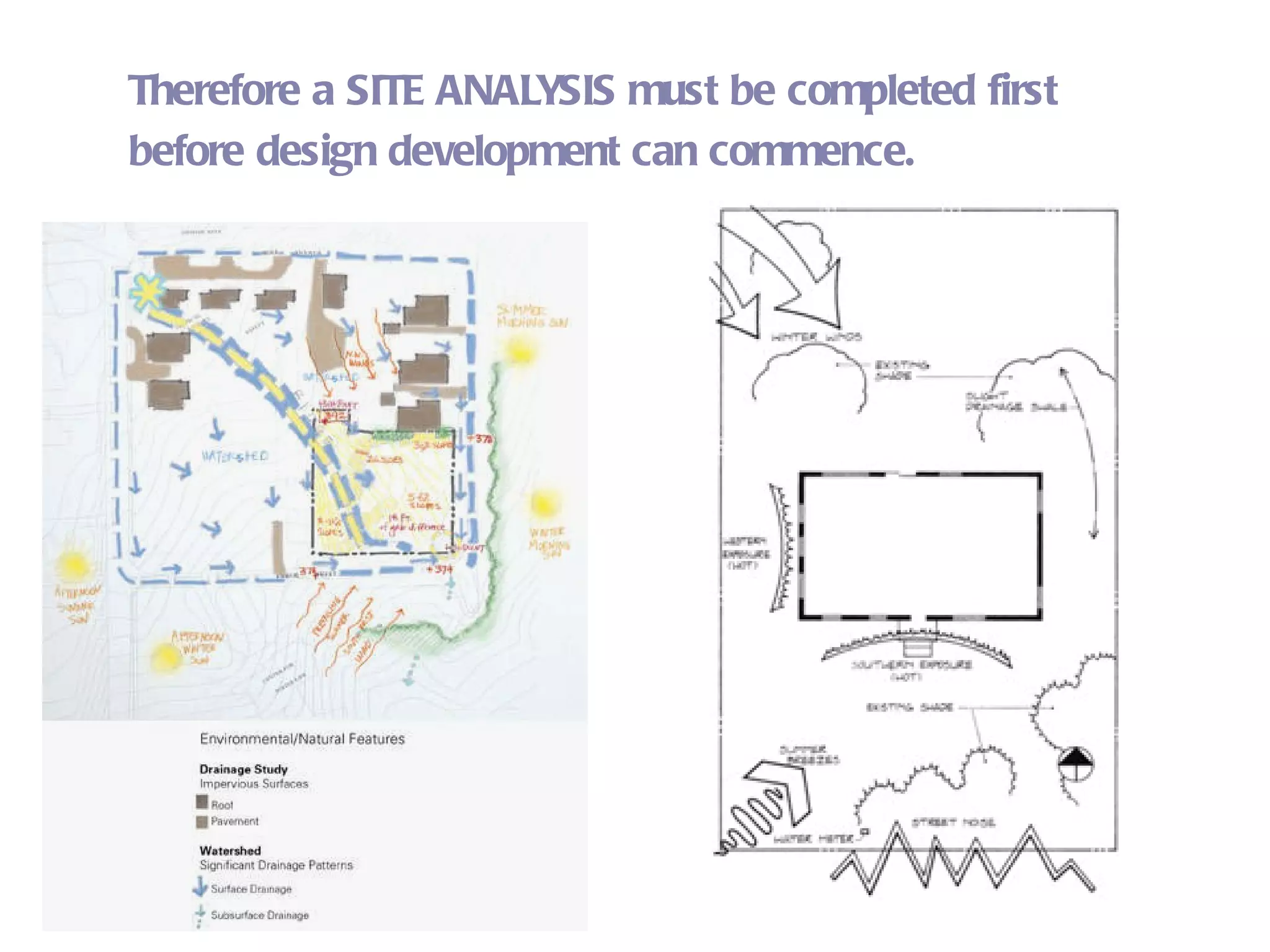

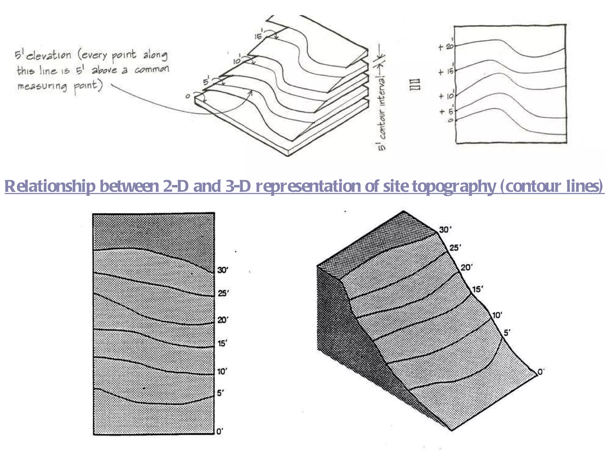

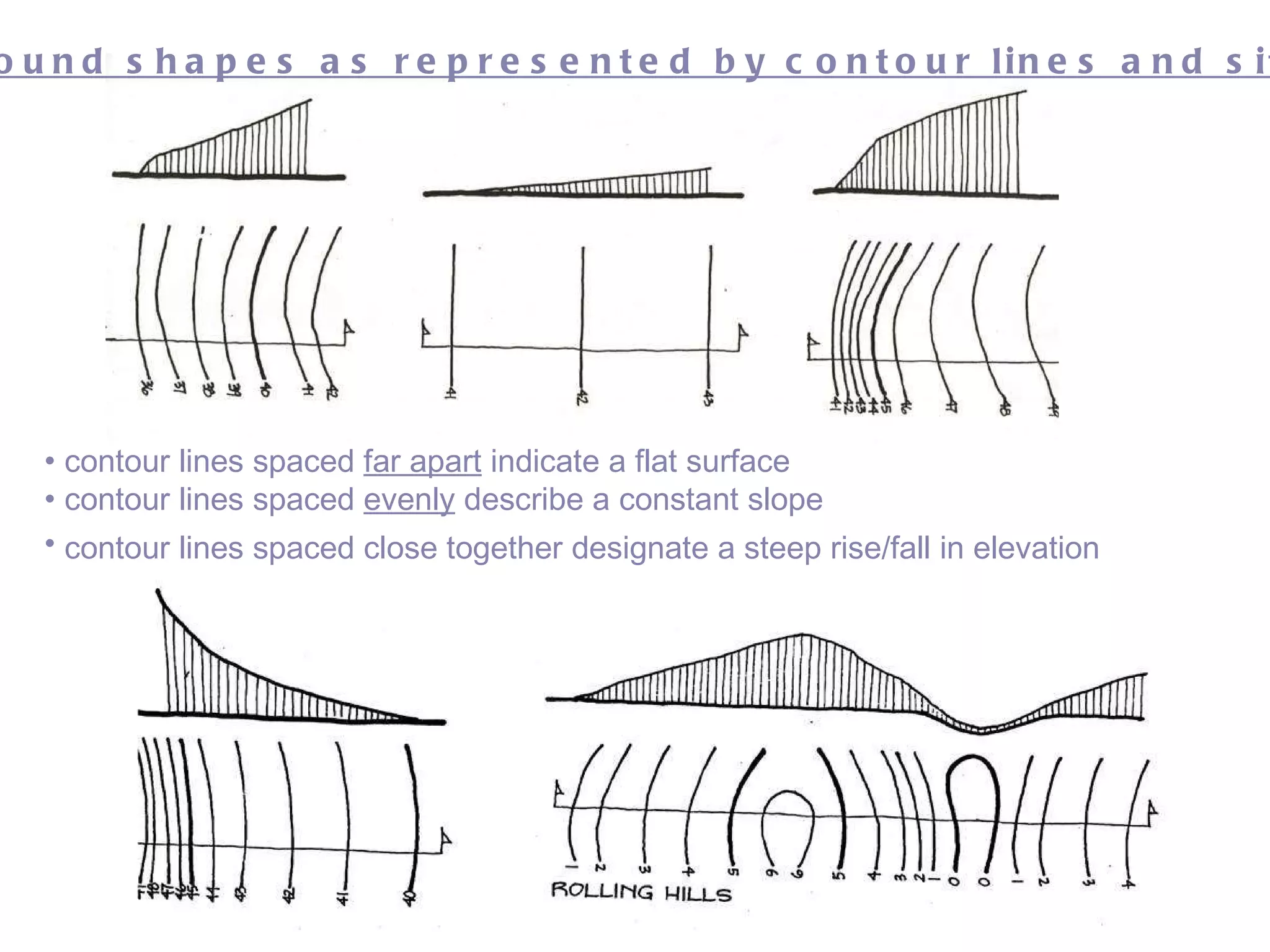


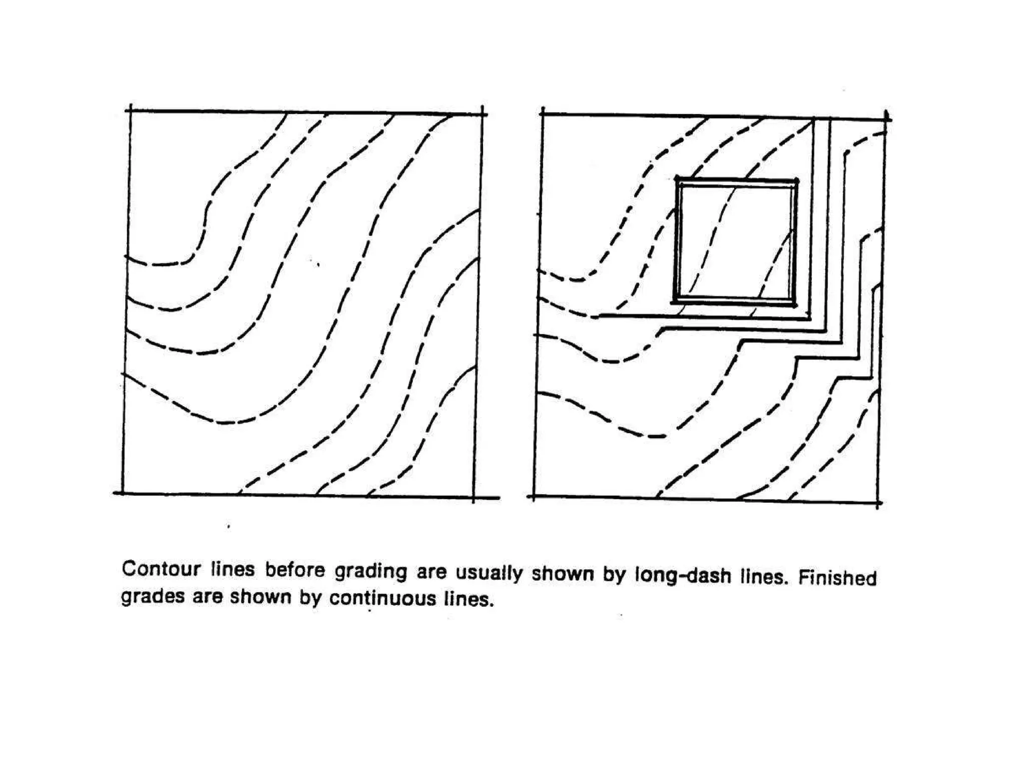


The document discusses the importance of site analysis for building design. Site analysis is the process of studying the existing environment and how it will influence a structure's design and layout. Key factors to consider in site analysis include topography, vegetation, climate, views, and regulatory requirements. Contour lines are used to represent the topography and slope of land, which greatly impacts building foundation and drainage design. Conducting a thorough site analysis is essential before beginning the design process.
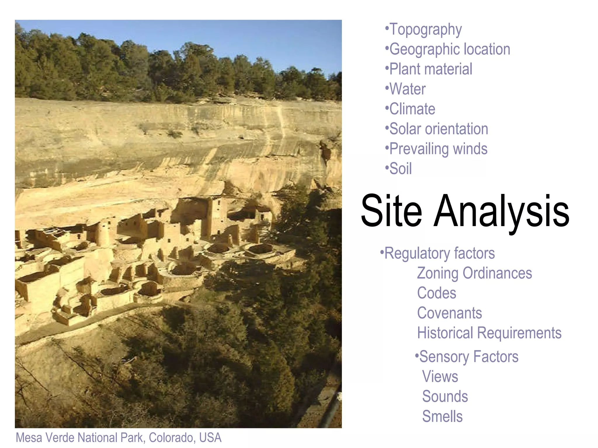
Introduction to the building site concepts using examples like Mesa Verde National Park.
Overview of site analysis, its importance, and factors like topography, climate, and regulatory requirements.
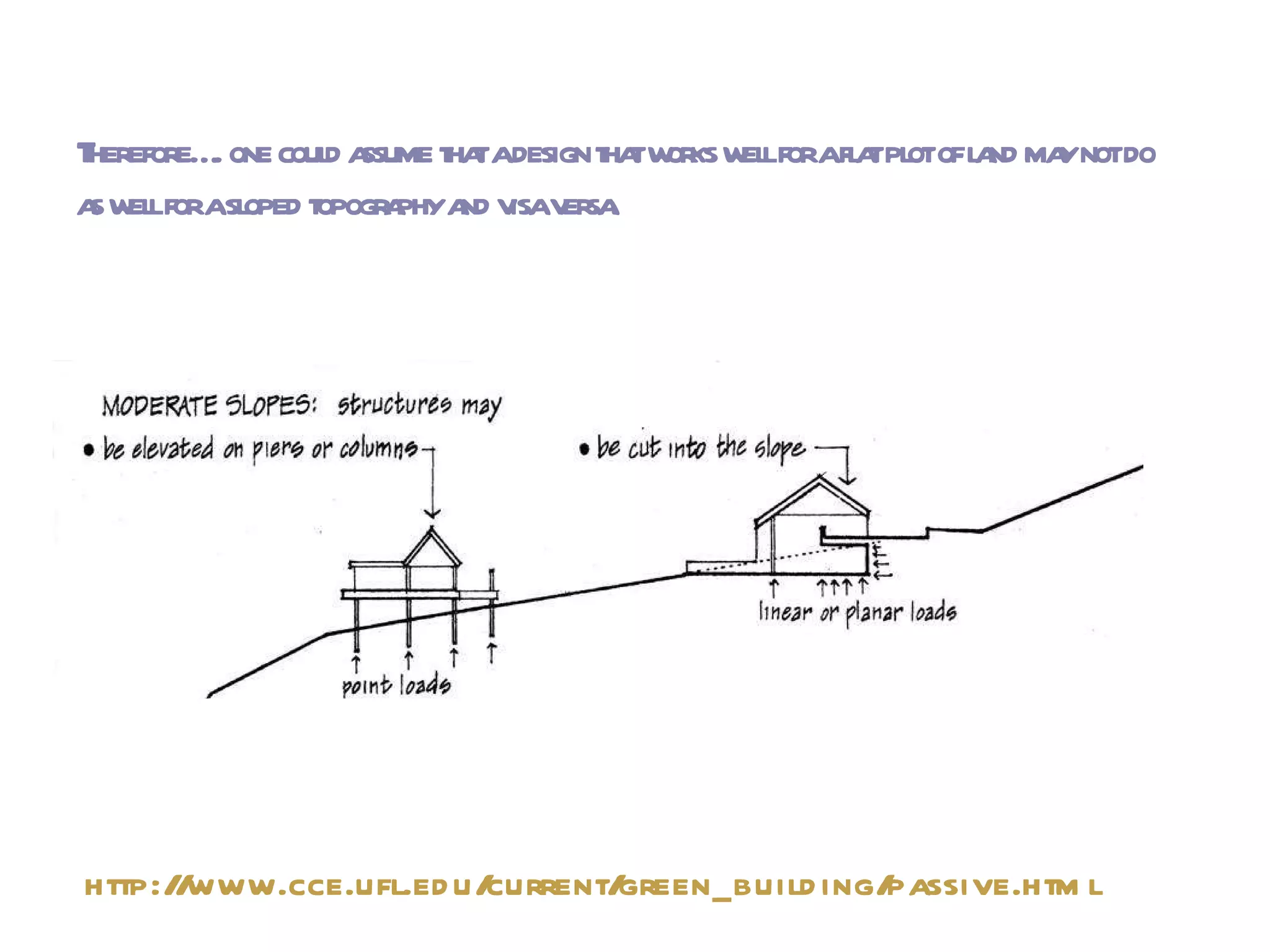
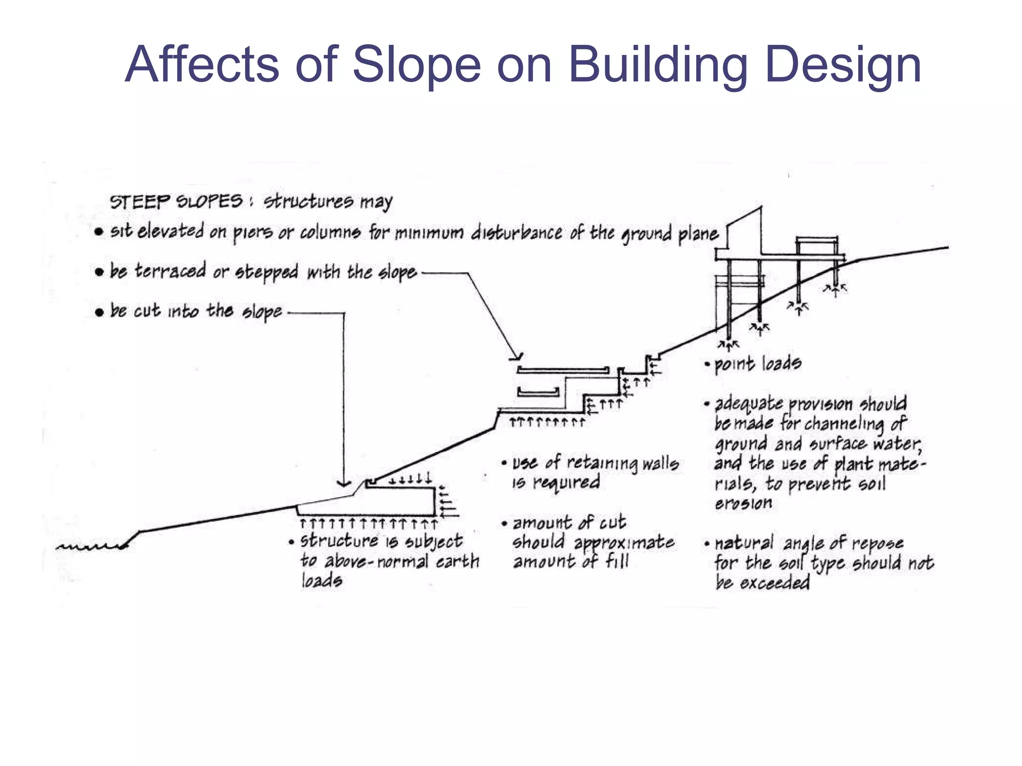
Explains how landforms affect building design and the necessity of topographic analysis before development.
Detailed explanation of contour lines, their representation of landforms, and elevation markers.
How soil type and vegetation influence building foundations and site climate.
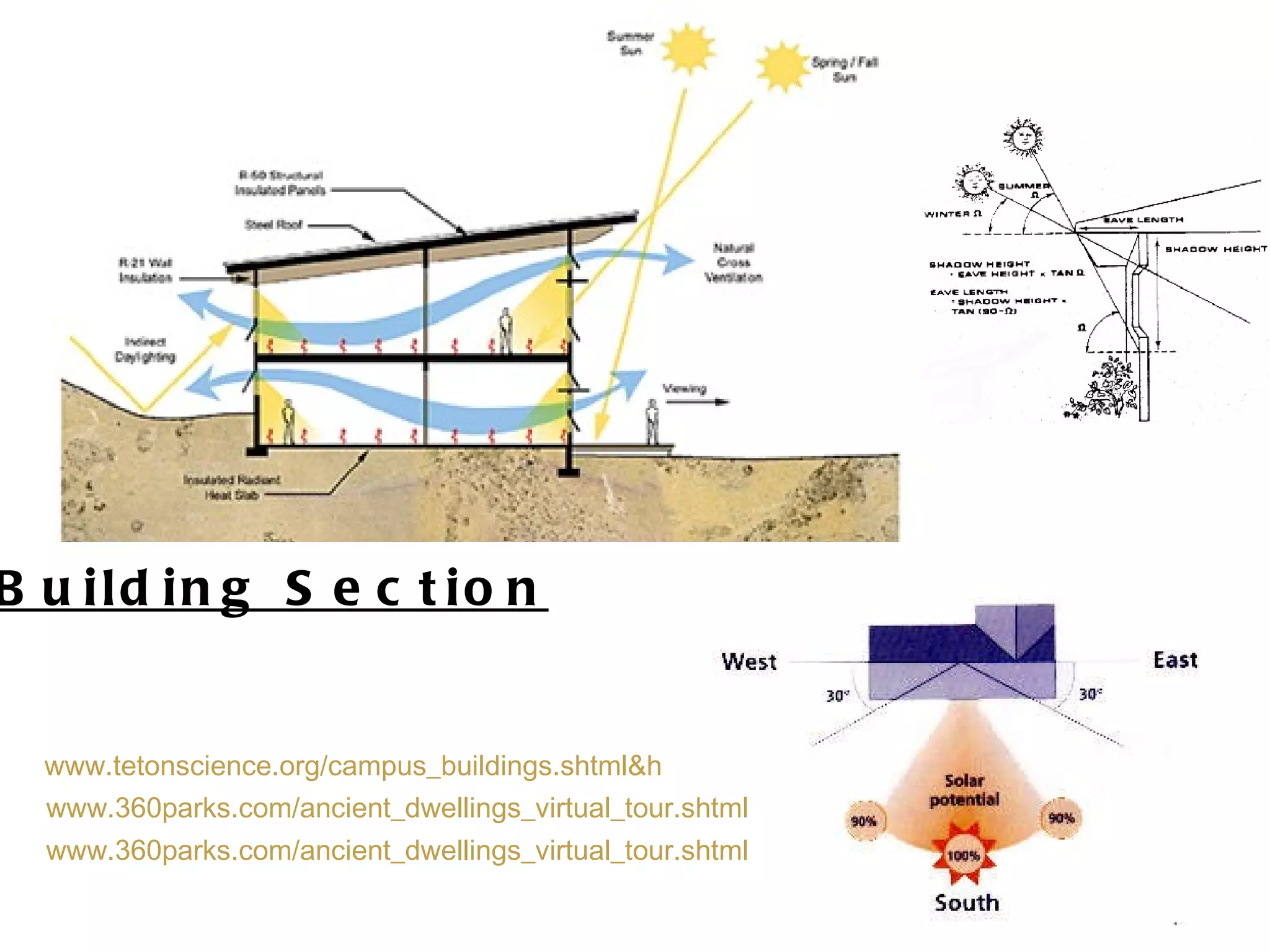
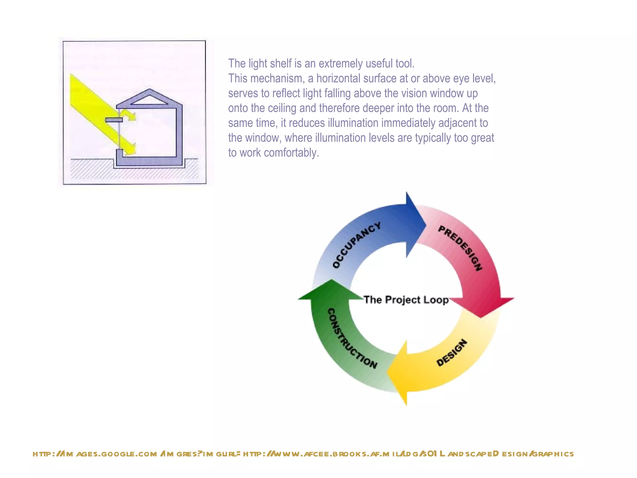
Introduction to climatic considerations in building design, focusing on light shelves for effective building illumination.