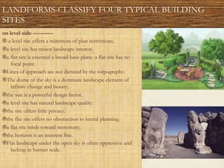
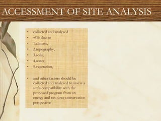
This document provides information on site analysis for landscape design. It discusses four typical building site types: hilly sites, level sites, city lots, and rural sites. For each site type, it lists key characteristics and design considerations. It also covers the goals, process, and factors to consider for site analysis, including climate, topography, soils, vegetation, man-made features, and neighboring land uses. Finally, it discusses bioclimatic design and provides strategies for different climate regions, such as using shade and evaporation in hot humid areas and promoting solar gain in cold regions.


![• Characterized by dry, hot summer temperatures [>20°C (68°F)] and mild to
cool winters [>0°C (32°F)] .
• ®Annual precipitation is low, however seasonalflash-floods may occur.
While freezing temperatures are uncommon, extreme diurnal temperature
fluctuations are typical .
• ®Site planning and design should seek to balance daily temperature
extremes by storing energy, increasing humidity, and diverting desiccating
winds
TEMPRATURE](https://image.slidesharecdn.com/l-5landscapesiteanalysis-220824045348-dffd272d/85/L-5-LANDSCAPE-site-analysis-pdf-20-320.jpg)

![• HOT HUMID REGIONS :
• ®Characterized byhot summer
temperatures [>20°C (68°F)] and
mild to cool winters [>0°C
(32'F)] .
• ®Annual precipitation and
humidity are high, with frequent
rain showers . Freezing
temperatures are uncommon, and
relatively minor diurnal
temperature fluctuations are
typical .
• ®Site planning and design should
seek to increase shade, cooling
from evaporation,andbreezes .
HOT HUMID REGIONS](https://image.slidesharecdn.com/l-5landscapesiteanalysis-220824045348-dffd272d/85/L-5-LANDSCAPE-site-analysis-pdf-22-320.jpg)

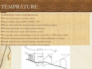
![• TEMPERATE REGIONS
• ®Characterized byhot, often humid, summers [>20'C (68°F)] and cold winters
[<0°C (32'F)] . Annual precipitation is fairly high .
• ®The region is subject to repetitive freezing/thawing action, and significant seasonal
temperature fluctuations are common.
• ®Site planning and design should seek to promote shade and evaporative cooling in
warm periods, and block winds and promote heat gain in cool periods, without
disrupting favorable summer wind pattern
TEMPRATURE](https://image.slidesharecdn.com/l-5landscapesiteanalysis-220824045348-dffd272d/85/L-5-LANDSCAPE-site-analysis-pdf-24-320.jpg)
![• COLD REGIONS:
• ®Characterized by mild summer temperatures [>10°-20o C (50°-68o F)] and very cold winters
[<0°C (32°F)] . Annual precipitation is typically low.
• ®Region is subject to extreme freezing/thawing action .
• ®Site planning and design should seek to control winter winds, and promote solar gain and
storage .
COLD REGIONS:](https://image.slidesharecdn.com/l-5landscapesiteanalysis-220824045348-dffd272d/85/L-5-LANDSCAPE-site-analysis-pdf-25-320.jpg)