Land use land cover impacts
•
3 likes•4,058 views

69th SWCS International Annual Conference “Making Waves in Conservation: Our Life on Land and Its Impact on Water” July 27-30, 2014 Lombard, IL
![Hydrological balance and
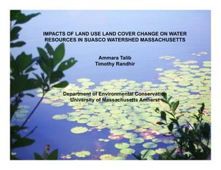
Biogeochemical processes Impacts of LULC Change
Interception
Evapotranspiration (ET)
Soil moisture
Water balance
Biogeochemical cycling of carbon,
nitrogen and other elements
Increasing runoff rate and volume
Decreasing groundwater recharge and
base flow
More intense and frequent floods
Elevated levels of sediments
Increase in concentration of nutrients
[Kosmas et al., 1997; Marshall and Randhir, 2008, and Kim
et al., 2013]](data:image/gif;base64,R0lGODlhAQABAIAAAAAAAP///yH5BAEAAAAALAAAAAABAAEAAAIBRAA7)
Recommended
Recommended
More Related Content
What's hot
What's hot (20)
Similar to Land use land cover impacts
Similar to Land use land cover impacts (20)
More from Soil and Water Conservation Society
More from Soil and Water Conservation Society (20)
Recently uploaded
Recently uploaded (20)
Land use land cover impacts
- 1. Ammara Talib M.S. Program- Water, Watersheds, and Wetlands Department of Environmental Conservation University of Massachusetts Amherst Committee Allison Roy Paula Rees Timothy Randhir IMPACTS OF LAND USE LAND COVER CHANGE ON WATER RESOURCES IN SUASCO WATERSHED MASSACHUSETTS Ammara Talib Timothy Randhir Department of Environmental Conservation University of Massachusetts Amherst
- 2. Hydrological balance and Biogeochemical processes Impacts of LULC Change Interception Evapotranspiration (ET) Soil moisture Water balance Biogeochemical cycling of carbon, nitrogen and other elements Increasing runoff rate and volume Decreasing groundwater recharge and base flow More intense and frequent floods Elevated levels of sediments Increase in concentration of nutrients [Kosmas et al., 1997; Marshall and Randhir, 2008, and Kim et al., 2013]
- 3. Changes in LAI lead to disturbance in surface energy balance Correlation between storm runoff volume and the amount of impervious cover Food availability Water access and utilization Operation of water infrastructure Global Changes on Water balance are aggravated by stressor of LULC
- 4. Sediment Loading Nutrient Loading/ Eutrophication Soil Erosion is a leading cause of sediment loading Fish Kill because of Eutrophication
- 5. Conceptual Model Phosphorus Runoff Watershed System Abiotic Biosphere Socio‐ Economics Soil Fire Light Water Air Plants Animals Population Land Use Water Quality Nitrogen Sediments Markets Water Quantity Infiltration Base Flow LULC change Pervious Impervious Policy Framework
- 6. Precipitation Base flow Evapotranspiration Snow storage Stream flow Watershed System LULC change • Pervious • Impervious Stressor Nutrients Input Time series Hydrological Simulations Total Runoff Sediments Policy Framework BMPs Infiltration Interception storage Soil storage Ground water storage ET HSPF
- 7. SuAsCo watershed Three Rivers One watershed Rowing our boat against the current, between wide meadows, we turn aside into the Assabet. A more lovely stream than this, for a mile above its junction with the Concord, has never flowed on earth. --Nathaniel Hawthorne
- 8. SuAsCo 2001 water quality assessment report
- 9. 1. Assess and calibrate baseline biophysical processes in the watershed system 2. Evaluate impacts of (LULC) change water quantity (runoff) 3. Assess the impacts of (LULC) change water quality (sediments, nitrogen and phosphorus) Fish Kill in Ben Smith impoundment on the Assabet River in Stow
- 10. HSPF Model Modeled classes 1. Forest (46%) 2. Wetlands (17%) 3. Urban (Pervious) (16%) 4. Urban (Impervious) (14%) 5. Agriculture cropland (2.5%) 6. Agriculture-pasture (1.5%) 7. Barren or mining (1.4) 8. Upland shrub land (1.2%) 9. Grassland (1.2%) 157 sub-basin with 157 streams 157 FTABLEs
- 12. Bedford Worcester WSO AP Walpole 2 Segmented watershed Represent the heterogeneity of a model segment include: (a) Rainfall or important meteorological data (b) Soil type (c) Land use conditions (d) Reach characteristics (e) Any other important physical characteristic (infiltration, overland slope, etc.)
- 14. Regression of observed data from streams in physiographic provinces Appalachian Plateau Ridge and Valley Piedmont provinces of the Mid-Atlantic Region of the United States Ftable for outlet
- 15. Observed data for 11 year (1974, 1979, 1984, 1985, 1987, 1999, 2000, 2001, 2002, 2003, and 2005) will be used for calibration 91 107 124 130 141 147 136 145 150 152 156 Reaches used for Calibration and validation
- 16. Statistical tests of model results 1)Percent flow difference [calculated as: (total model flow–total observed flow)/total observed flow] (2) Regression coefficient: R2 (3) Nash–Sutcliffe efficiency (NSE) [Nash and Sutcliffe, 1970]. T is number of days, Qt,obs is the observed streamflow at t, Qt-.obs is the average of the observed streamflow, Qt,sim is the simulated streamflow at t.
- 17. 1. Meteorological Data Meteorological inputs from January 1973 to December 2008 National Climatic Data Center (NCDC) 2. Land use/land cover data MassGIS. 0.5 meter resolution digital ortho imagery captured in April 2005 40 land use classes will be grouped into nine classes 3. Hydrography data Set MassDEP Hydrography layer surface water (lakes, ponds, and reservoirs), wetlands, bogs, flats, rivers, streams, and others. March 2010 Finer layer of Networked Hydro Centerlines captured in july 1999 and obtained from MassGIS. 4. Digital Elevation Map (DEM) Basin DEM used in grid format. A (DEM) is a grid of elevations. 5. Soils data State Soil Geographic Database (STATSGO) from Unites states department of agriculture (USDA, 1994).
- 18. LULC Scenarios Current LULC 2050 LULC 2100 LULC
- 19. Discharge Calibration at Concord R below R meadows Brook Gaging station R² = 0.7742 0 1000 2000 3000 4000 5000 6000 7000 8000 0 2000 4000 6000 8000 10000 Scatter plot Observed Vs Simulated Flow Observed Flow (Cfs) SimulatedFlow(Cfs)
- 20. R² = 0.714 0 500 1000 1500 2000 2500 3000 3500 0 500 1000 1500 2000 2500 Scattered Plot Observed Vs Simulated Observed Daily Flow (Cfs) SimulatedDailyFlow(Cfs)
- 21. Discharge Calibration at Nashoba Brook near Acton, MA R² = 0.6149 0 100 200 300 400 500 600 0 100 200 300 400 Scatter Plot Observed Vs Simulated Daily Flow Observed Daily Flow (Cfs) SimulatedDailyFlow(Cfs)
- 22. R² = 0.7502 0 500 1000 1500 2000 2500 0 500 1000 1500 2000 Scattered Plot Observed Vs Simulated Daily Flow Observed Daily Flow (Cfs) SimulatedDailyFlow(Cfs)
- 23. • Baseline simulations closely match with the observed information • LULC change will have impacts on water quality and water quantity • Information about the fate and transport of runoff, sediments and nutrients • To estimate the impacts and compare levels of stress • Information can be used in developing watershed management plans for semi urban watershed areas Anticipated Results and Management Implication
- 24. Thank You