Assessment of Ecosystem Services in a Semi-arid Agriculture-dominant Area: Framework and Case Study
•
2 likes•227 views

This document summarizes a study that developed a framework to assess ecosystem services provided by restoring flows to the San Joaquin River in California's Central Valley. The framework links an economic model of farmer water usage to a hydrological model and temperature model. Preliminary results found that restoring river flows as mandated had an estimated 8-12% impact on farmer profits. Additional flows may be needed to sufficiently cool water for salmon habitat. The study aims to understand long-term groundwater impacts and potential ecosystem benefits of restoration.
Recommended

Recommended
More Related Content
What's hot
What's hot (20)
Viewers also liked
Viewers also liked (10)
Similar to Assessment of Ecosystem Services in a Semi-arid Agriculture-dominant Area: Framework and Case Study
Similar to Assessment of Ecosystem Services in a Semi-arid Agriculture-dominant Area: Framework and Case Study (20)
More from Ramesh Dhungel
More from Ramesh Dhungel (10)
Recently uploaded
Recently uploaded (20)
Assessment of Ecosystem Services in a Semi-arid Agriculture-dominant Area: Framework and Case Study
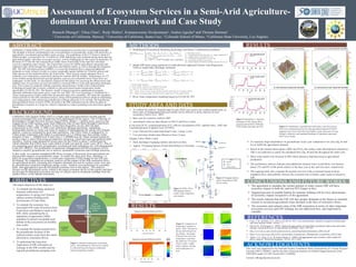
- 1. Assessment of Ecosystem Services in a Semi-Arid Agriculture- dominant Area: Framework and Case Study Ramesh Dhungel1, Yihsu Chen2, Rudy Maltos3, Kumaraswamy Sivakumaran1, Andres Aguilar4 and Thomas Harmon1 1 University of California, Merced, 2 University of California, Santa Cruz, 3 Colorado School of Mines, 4 California State University, Los Angeles ABSTRACT California’s Central Valley (CV) water crisis has increased in severity due to a prolonged drought. The drought is directly contributing to the overexploitation of groundwater, along with deficiency in agricultural, recreational and aesthetic water services. The population of the CV, home to about 6.5 million people, is projected to be 12 million by 2040. Balancing water demand among municipal use, agricultural supply, and other ecosystem services, will be challenging for this region in perpetuity. In the heart of CV lies the San Joaquin River (SJR) where Friant Dam is the main low-elevation reservoir regulating water release. The Friant Dam’s reservoir fulfills agricultural, municipal and industrial water needs through the Friant-Kern and Madera canals, as well as through the mainstem SJR. The SJR restoration project (SJRRP) is a recent development that is imposing additional demands on water releases in order to restore sustainable aquatic habitat for Chinook salmon and other species on the mainstem below the Friant Dam. These species require adequate flow to moderate river temperature, particularly during hot summer and fall months. Temperatures on CV rivers exhibit strong diurnal and seasonal patterns, and can rise to harmful levels when flows are inadequate. In this study, we developed a framework that allows for assessing the effectiveness and implied costs of ecosystem services provided by a restored SJR in a semi-arid agriculture-dominant area. This is done by explicitly linking economics-based farmers’ model with a reduced-form hydrological model that is loosely coupled to a physical-based stream-temperature model, specifically CE-QUAL-W2. The farmers’ model is based on positive mathematical program approach calibrated with twenty proxy crops for year 2005. The river-hydrology is simulated by a vector autoregression (VAR) model that incorporates daily flow variability. We study the mandated release policies by the SJR restoration project, along with hypothetical policies aimed at moderating river temperatures while enhancing groundwater recharge along the river corridor. We hypothesize that agricultural losses in terms of flow diverted to the SJR restoration can be offset by gains in groundwater resources in a long run, which is important to reduce pumping costs and insure against future. BACKGROUND California’s San Joaquin Valley (SJV) is a high-value crop agricultural corridor and the current prolonged four-year drought has been challenging for the region. The US Bureau of Reclamation’s Friant Division Service Area (FDSA), about 1.1 million acres, receives San Joaquin River (SJR) surface water from Millerton Lake (Friant Dam) through Friant-Kern and Madera Canals. The SJR below Friant Dam frequently ran dry after the dam construction in the 1940s. A 2006 court settlement changed operations, mandating hydrographs (based on water year type) in support of reintroducing the spring run Chinook salmon, a species extirpated by prior dam operations. The FDSA water is managed by 32 Friant water contractors with rights to a maximum of 2.2 million acre-feet surface water annually (Class 1 – 800000 acre-ft and Class 2-1,400000 acre-ft). Water demand unmet by surface water is often filled using groundwater extraction, which has been unregulated (until recently). Typical water demand in recent years for the FDSA is about 3 million acre-ft, which indicates that FDSA faces water deficit in both wet and dry water years (WY). This is not surprising given that the groundwater overdraft and land subsidence are well-documented in the SJV (REFS). The Sustainable Groundwater Management (SGMA) program (2014) intends to modify groundwater use to achieve sustainable extraction and recharge practices. In this work, we examine mandated SJR flows in terms of diversions from agricultural use and possible impacts on groundwater usage. To model the short term flow variations, i.e. daily for ecosystem requirements, a vector auto-regression (VAR) model for the SJR was developed. We conducted an economic analysis on the impact of the SJR restoration flows on agricultural profits, assuming that irrigation demands not met by surface water were met by groundwater extraction (implying energy costs). Analysis was performed on a monthly basis, and aggregated to provide the annual economic loss to the region. This analysis focuses on the agricultural sector, which is the major economic driver of the region, and does not account for potential ecosystem services of valued, such as incidental recharge from the surface flows, or the habitat restoration. OBJECTIVES The major objectives of the study are: To estimate the discharge needed to maintain sufficiently low temperatures in spring run Chinook salmon summer holding pools downstream of Friant Dam To estimate the economic loss associated with water diversions from Friant-Kern and Madera Canals to the SJR, while considering the a) stipulation of agreement (2006) mandates b) percent acceptable pool habitat of the ecosystems on monthly time scales To estimate the burden transferred to the groundwater because of the reduced surface water from the canals (diverted to restoration flows) To understand the long term implication of SJR restoration on recharge in the SJR corridor and the regional groundwater pumping costs METHODS Hydrological-Economical Modeling (hydrology and farmer’s optimization problem) Model SJR flows using statistical (or reduced-form) approach (Vector Auto Regression- VAR) to model daily discharge variations River water temperature modeling based on CE-QUAL-W2 STUDY AREA AND DATA RESULTS REFERENCES CONCLUSIONS AND FUTURE WORKS The agreement to mandate the certain amount of water restore SJR will have economic impact in both dry and wet WY (larger in dry) Targeted percent of suitable habitat for summer holding will be a key determinant of economic impact irrespective of the agreement The results indicate that the GW will face greater demands in the future to maintain current or increased agricultural water demand in the face of restorative flows The economic and cultural value of the SJR restoration in terms of other important ecosystem services and GW recharge are not addressed here, and important to consider To conduct the analysis, detailed analysis units (DAU) are used as the smallest spatial units, as these types of disaggregated data and models can be efficient in policy analysis in rural economics (Taylor et al., 2005). Base year for economic analysis-2005 Agricultural water use data (Based on DAUS and Proxy Crops) (Crop areas (ICA), evapotranspiration (ET), effective precipitation (EP), applied water, (AW) and evapotranspiration of applied water (ETAW)) Crop Yield and Price data (Individual Crops, County Level) Cost and return Studies data (Based on Proxy Crops) (Supply, Labor, Water, Land) Daily discharge of gauging stations and reservoir data Approx. 9 Gauging Stations (Friant Dam Release to Newman) Figure 5: Simulated vs. observed discharges in San Joaquin River gauging stations below Millerton Lake in daily time-steps for 2012 Figure 6: Contribution of groundwater and surface water diversion at DAU level estimated based on the total agricultural demand of FSDA, supplied water from Friant-Kern and Madera canals, allocation of water through contractors, and mandated discharge of stipulation agreement (DAU not to Scale) Figure 2: FDSA, DAU, SJR gauging stations, canals, water contractors, and counties Figure 3: Gauging stations below Friant Dam in SJR (Not to scale) Cole, T. M., & Wells, S. A. (2011). CE-QUAL-W2: A two-dimensional, laterally averaged, hydrodynamic and water quality model, version 3.7. Howitt, R., & Reynaud, A. (2003). Spatial disaggregation of agricultural production data using maximum entropy. European Review of Agricultural Economics, 30(3), 359-387. http://www.dca.ca.gov/cba/discipline/actions_attach/stipulatedsettlementac-2006-28.pdf https://www.opr.ca.gov/docs/2014_Sustainable_Groundwater_Management_Legislation_092914.pdf Taylor, J. E., Dyer, G. A., & Yunez-Naude, A. (2005). Disaggregated rural economy wide models for policy analysis. World Development, 33(10), 1671-1688. ACKNOWLEDGEMENTS This work was supported by the National Science Foundation Water Sustainability & Climate Program (Awards CBET-1204841), and by the Inter-American Institute for Global Change Research (IAI) CRN3038 (under US NSF Award GEO-1128040). Contact: rdhungel@ucmerced.edu • Hydrological Analysis • VAR and Groundwater Analysis • Ecological Analysis • CE-QUAL-W2 • Policy Analysis • Stipulation of Surface Water Agreement and Groundwater Regulations • Economic Analysis • Farmers Optimization Problem Maximize Profit Adopt release and groundwater policy Adjust flow from canal and reservoir Temperature Figure 1. Interaction among the economical, policy and hydrological with loosely coupled to a physical-based ecological components (stream-temperature model). RESULTS As expected, larger dependence on groundwater in dry year compared to wet year (fig. 6a and 6c) to fulfill the agricultural demand Based on the limited observations (2005 and 2012), the surface water that had been released to SJR is not sufficient to satisfy the mandated flow (fig. 6b and 6d) throughout the entire year More water needs to be diverted to SJR which otherwise had been used in agricultural production The preliminary analysis indicates that additional released water would likely cost farmers about 12% and 8% of the profit relative to the base year in dry and wet years, respectively. The ongoing study also evaluates the percent survival of the ecosystem based on these mandated flows and probably increase the economic loss if further water needs to release to SJR Figure 4. Comparison of temperature variation in pools: (left) 3.0m pool at the top and 6.0m pool at the bottom - the deeper 6.0m pool has more low temperature water than the shallower 3.0 m pool (Not to scale); (right) Daily variation: mixing and stratification in a pool.