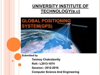
This document provides an overview of the Global Positioning System (GPS). It describes GPS as a satellite-based navigation system that uses 24 satellites to pinpoint the precise location, altitude, and time. It explains how GPS works by transmitting signals from the space segment satellites to receivers in the user segment. The signals allow receivers to calculate their position by determining the time difference of signals arriving from multiple satellites. The document outlines the key components of GPS including the signals, position determination process, receiver components, applications such as navigation, and future developments for GPS technology.
The Global Positioning System (GPS), originally Navstar GPS, is a satellite-based radionavigation system owned by the United States government and operated by the United States Space Force.
It is one of the global navigation satellite systems (GNSS) that provides geolocation and time information to a GPS receiver anywhere on or near the Earth where there is an unobstructed line of sight to four or more GPS satellites.
Obstacles such as mountains and buildings block the relatively weak GPS signals.
This content introduces the Global Navigation Satellite System (GNSS), its example, earth observation orbit types, coordinate systems, GNSS time system, converting height (ellipsoidal, geoid, orthometric heights) and various GNSS applications.
Global positioning system and its mathematical form.
By Mustahsan Khan _ BS(physics-Nanotechnology) (International Islamic University Islamabad) Pakistan.
La felicitat manca a la societat d'avui dia, vivim en un món amb crisis de felicitat, aquí tenim unes pautes i uns consells per ser més feliços i per mirar la vida des de un punt de vista més optimista.
GPS helps us identify exact location of a place/feature in the globe. Now-a-days we can carry out survey, enter data and process data. GPS is very helpful in soil survey
Global Positioning System (GPS) is the only system today able to show one’s own position on the earth any time in any weather, anywhere. This paper addresses this satellite based navigation system at length. The different segments of GPS viz. space segment, control segment, user segment are discussed. In addition, how this amazing system GPS works, is clearly described. The various errors that degrade the performance of GPS are also included. DIFFERENTIAL GPS, which is used to improve the accuracy of measurements, is also studied. The need, working and implementation of DGPS are discussed at length. Finally, the paper ends with advanced application of GPS.
Event Management System Vb Net Project Report.pdfKamal Acharya
In present era, the scopes of information technology growing with a very fast .We do not see any are untouched from this industry. The scope of information technology has become wider includes: Business and industry. Household Business, Communication, Education, Entertainment, Science, Medicine, Engineering, Distance Learning, Weather Forecasting. Carrier Searching and so on.
My project named “Event Management System” is software that store and maintained all events coordinated in college. It also helpful to print related reports. My project will help to record the events coordinated by faculties with their Name, Event subject, date & details in an efficient & effective ways.
In my system we have to make a system by which a user can record all events coordinated by a particular faculty. In our proposed system some more featured are added which differs it from the existing system such as security.
Sachpazis:Terzaghi Bearing Capacity Estimation in simple terms with Calculati...Dr.Costas Sachpazis
Terzaghi's soil bearing capacity theory, developed by Karl Terzaghi, is a fundamental principle in geotechnical engineering used to determine the bearing capacity of shallow foundations. This theory provides a method to calculate the ultimate bearing capacity of soil, which is the maximum load per unit area that the soil can support without undergoing shear failure. The Calculation HTML Code included.
Overview of the fundamental roles in Hydropower generation and the components involved in wider Electrical Engineering.
This paper presents the design and construction of hydroelectric dams from the hydrologist’s survey of the valley before construction, all aspects and involved disciplines, fluid dynamics, structural engineering, generation and mains frequency regulation to the very transmission of power through the network in the United Kingdom.
Author: Robbie Edward Sayers
Collaborators and co editors: Charlie Sims and Connor Healey.
(C) 2024 Robbie E. Sayers
Quality defects in TMT Bars, Possible causes and Potential Solutions.PrashantGoswami42
Maintaining high-quality standards in the production of TMT bars is crucial for ensuring structural integrity in construction. Addressing common defects through careful monitoring, standardized processes, and advanced technology can significantly improve the quality of TMT bars. Continuous training and adherence to quality control measures will also play a pivotal role in minimizing these defects.
Courier management system project report.pdfKamal Acharya
It is now-a-days very important for the people to send or receive articles like imported furniture, electronic items, gifts, business goods and the like. People depend vastly on different transport systems which mostly use the manual way of receiving and delivering the articles. There is no way to track the articles till they are received and there is no way to let the customer know what happened in transit, once he booked some articles. In such a situation, we need a system which completely computerizes the cargo activities including time to time tracking of the articles sent. This need is fulfilled by Courier Management System software which is online software for the cargo management people that enables them to receive the goods from a source and send them to a required destination and track their status from time to time.
Immunizing Image Classifiers Against Localized Adversary Attacksgerogepatton
This paper addresses the vulnerability of deep learning models, particularly convolutional neural networks
(CNN)s, to adversarial attacks and presents a proactive training technique designed to counter them. We
introduce a novel volumization algorithm, which transforms 2D images into 3D volumetric representations.
When combined with 3D convolution and deep curriculum learning optimization (CLO), itsignificantly improves
the immunity of models against localized universal attacks by up to 40%. We evaluate our proposed approach
using contemporary CNN architectures and the modified Canadian Institute for Advanced Research (CIFAR-10
and CIFAR-100) and ImageNet Large Scale Visual Recognition Challenge (ILSVRC12) datasets, showcasing
accuracy improvements over previous techniques. The results indicate that the combination of the volumetric
input and curriculum learning holds significant promise for mitigating adversarial attacks without necessitating
adversary training.
Explore the innovative world of trenchless pipe repair with our comprehensive guide, "The Benefits and Techniques of Trenchless Pipe Repair." This document delves into the modern methods of repairing underground pipes without the need for extensive excavation, highlighting the numerous advantages and the latest techniques used in the industry.
Learn about the cost savings, reduced environmental impact, and minimal disruption associated with trenchless technology. Discover detailed explanations of popular techniques such as pipe bursting, cured-in-place pipe (CIPP) lining, and directional drilling. Understand how these methods can be applied to various types of infrastructure, from residential plumbing to large-scale municipal systems.
Ideal for homeowners, contractors, engineers, and anyone interested in modern plumbing solutions, this guide provides valuable insights into why trenchless pipe repair is becoming the preferred choice for pipe rehabilitation. Stay informed about the latest advancements and best practices in the field.
Welcome to WIPAC Monthly the magazine brought to you by the LinkedIn Group Water Industry Process Automation & Control.
In this month's edition, along with this month's industry news to celebrate the 13 years since the group was created we have articles including
A case study of the used of Advanced Process Control at the Wastewater Treatment works at Lleida in Spain
A look back on an article on smart wastewater networks in order to see how the industry has measured up in the interim around the adoption of Digital Transformation in the Water Industry.
2. Content.
What is GPS (global positioning system).
How does GPS works?
GPS signals
Position determination
Block diagram of GPS receiver
Types of GPS systems
Applications of GPS
Future scope of GPS system
Conclusion
Reference
3. What is GPS (Global Positioning System)
GPS (Global Positioning system) is a type of GNSS(Global
Navigation Satellite System).
It is a "constellation" of 24 well-spaced satellites that orbit the
Earth and make it possible for people with ground receivers to
pinpoint their geographic location.
It allows small electronic receiver to determine the latitude
longitude and altitude of a point.
Receivers Calculated the precise time as well as position, which
can be used as a reference for scientific experiments.
4. How does GPS Works?
GPS system consist of three pieces
Space Segment.
Control Segment.
User Segment.
The US Air force maintain these Segments.
Space Segment are the satellites that transmit the position
information.
Control Segment are the ground stations that are used to control the
satellites and update the information.
The User segment are the receiver that you purchased.
5. GPS Signals
GPS satellites transmit two radio signals.
The signals are mark as L1 and L2.
A Civilian GPS uses the L1 signal frequency (1575.42 MHz)
in the UHF band.
While the L2 frequency (1227.60 MHz) is used to measure the
ionospheric delay by Precise Positioning Service (PPS)
equipped receivers.
All these signals travel by line of sight.
The GPS signal contains three different bits of information
which are a pseudo random code, almanac data and ephemeris
data.
6. Position Determination
GPS satellite continually transmits messages containing the time the
message was sent. These signals travel at the speed of light through
outer space, and slightly slower through the atmosphere.
7. Useful form of these equations is in term of the
; n=1,2,3,4
Where
x, y, z = receiver’s coordinates
tc = time correction for the GPS receiver’s clock
n = satellite’s number
ttn = signal transmitted time for each satellite
trn = signal received time for each satellite
c = speed of light (3 x 10⁸ m/s)
This mean, when there is four satellite used, there will be
four equation needed for the calculation.
The accuracy in this technique is about 1-5 meters.
9. Types of GPS systems
1. Street navigation systems (SAT-NAV)
2. Sports GPS systems and watches
3. PDA based systems
4. Phones with GPS
5. For kids too
10. Applications of GPS
The applications of the global positioning system fall into five
categories:
• Location
• Navigation
• Timing
• Mapping
• Tracking
11. Future scope of GPS System
1. GPS controlling Car (Without Driver)
2. In Defense For Accurate result for attack to enemy.
3. Shopping Cart.
4. Facilities for visually impaired.
5. More advanced Bi-function.
6. The virtual cable.
12. Conclusion
GPS is a fantastic tool of the 21st century offering many functions:
However, received information is not always reliable, and it would have
been interesting to see in which cases it is not. Furthermore, the space
segment is completely controlled by the American Army which enables
them to completely remove the satellite cover in certain countries in the
event of a war…
The future of GPS appears to be virtually unlimited; technological
fantasies abound. The system provides a novel, unique, and instantly
available address for every square yard on the surface of the planet–a new
international standard for locations and distances. To the computers of the
world, at least, our locations may be defined not by a street address, a city,
and a state, but by a longitude and latitude. With the GPS location of
services stored with phone numbers in computerized.
13. Reference
1. https://www.google.co.in/ For Search the topic and image.
2. National Research Council (U.S.). Committee on the Future
of the Global Positioning System; National Academy of
Public Administration (1995). The global positioning
system: a shared national asset: recommendations for
technical improvements and enhancements. National
Academies Press. p. 16. ISBN 0-309-05283-1. Retrieved
August 16, 2013.,
//books.google.com/books?id= FAHk65slfY4C&pg=PA16
3. https://gps2008.wordpress.com/ for topic GPS
4. https://en.wikipedia.org/wiki/Global_Positioning_System
5. www.gps.gov
6. http://www.slideshare.net