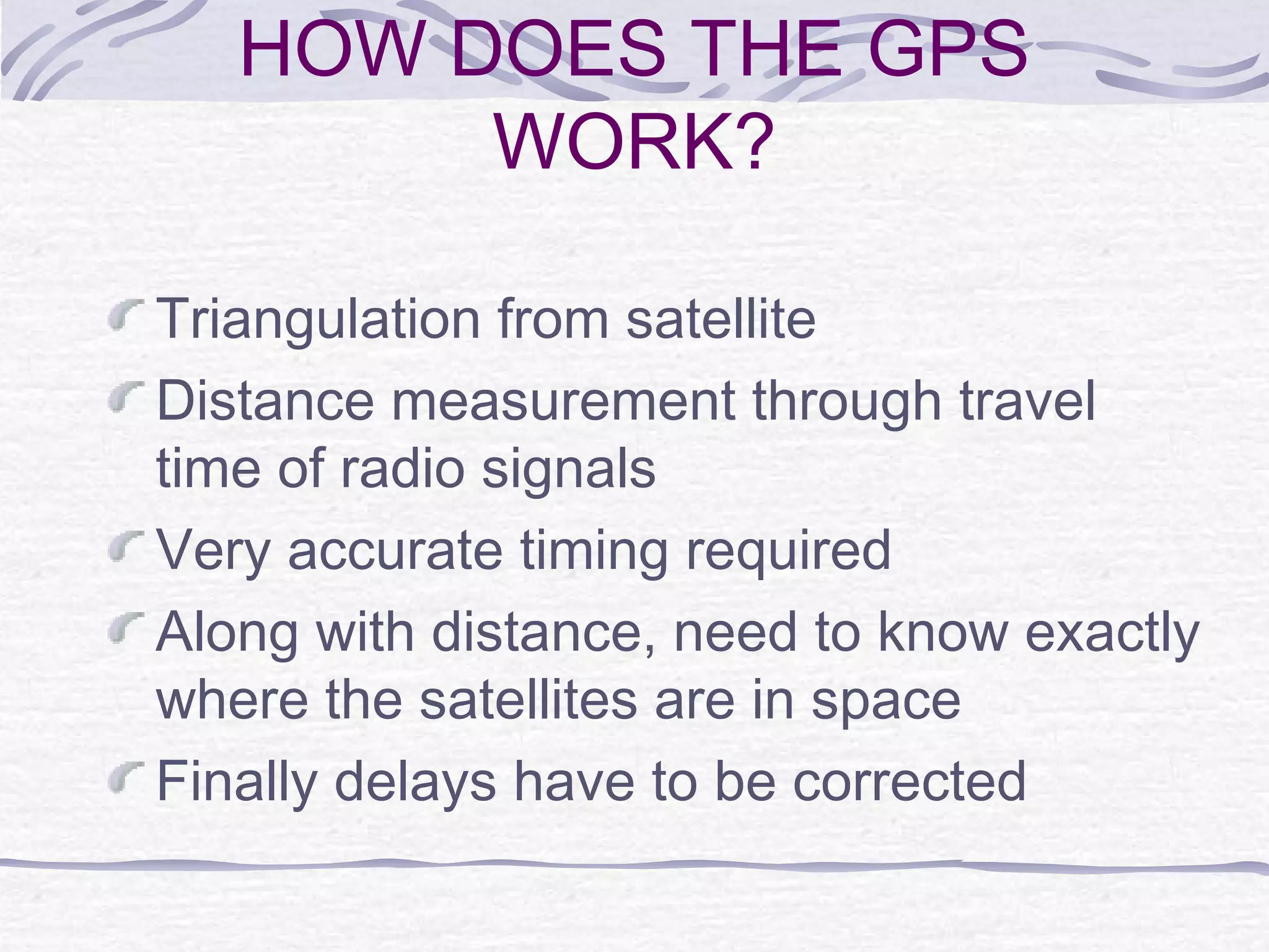
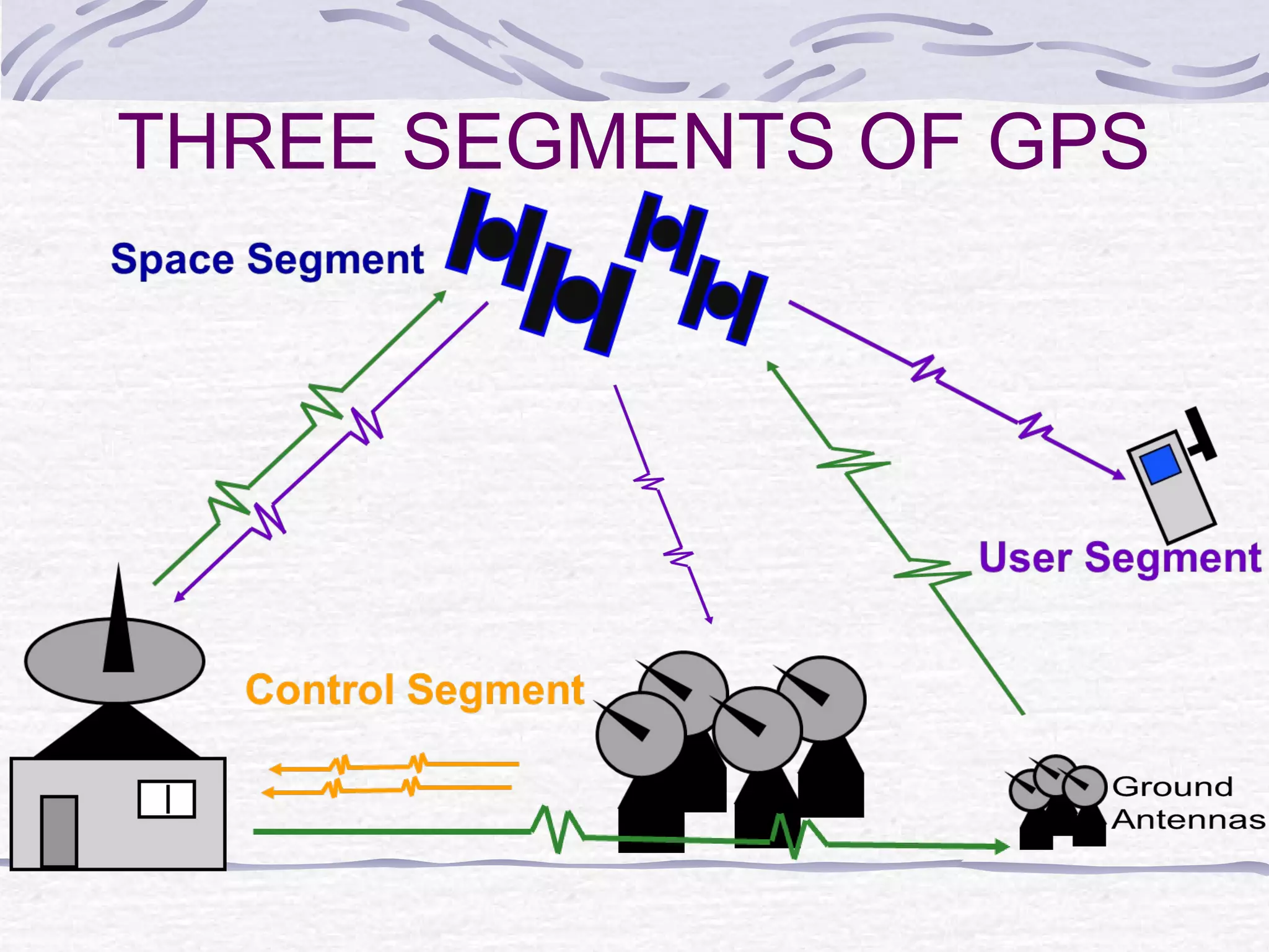
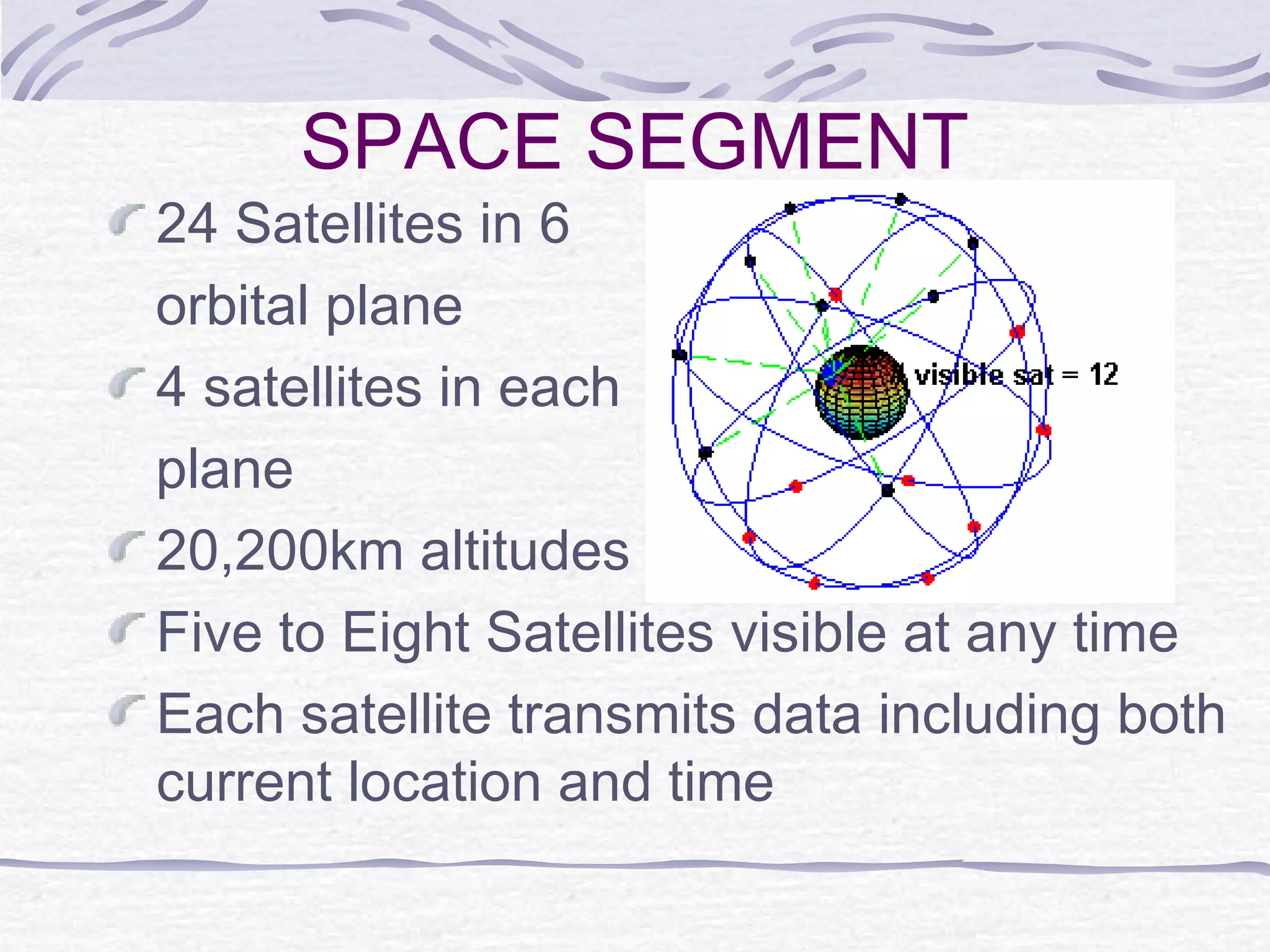
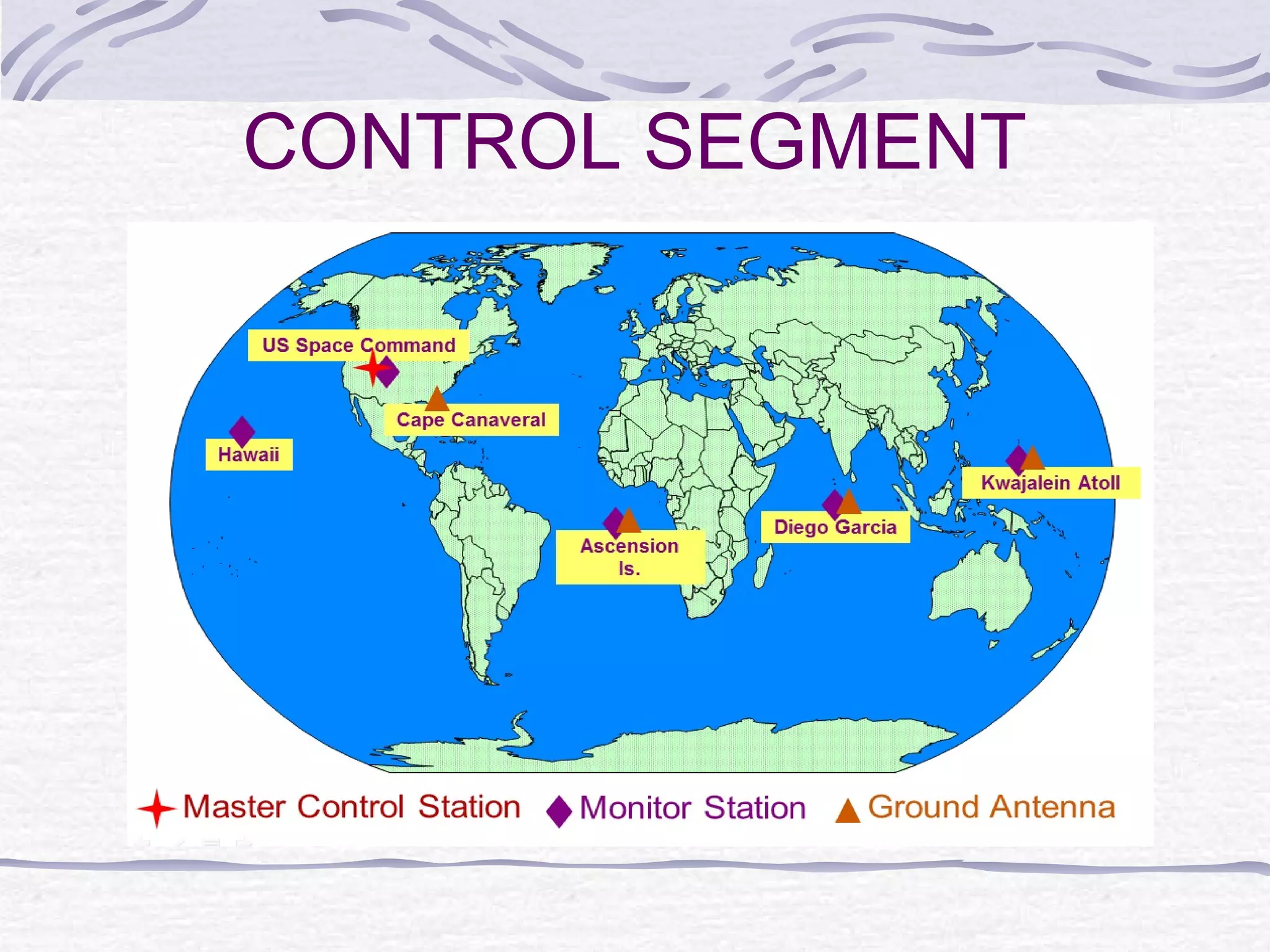
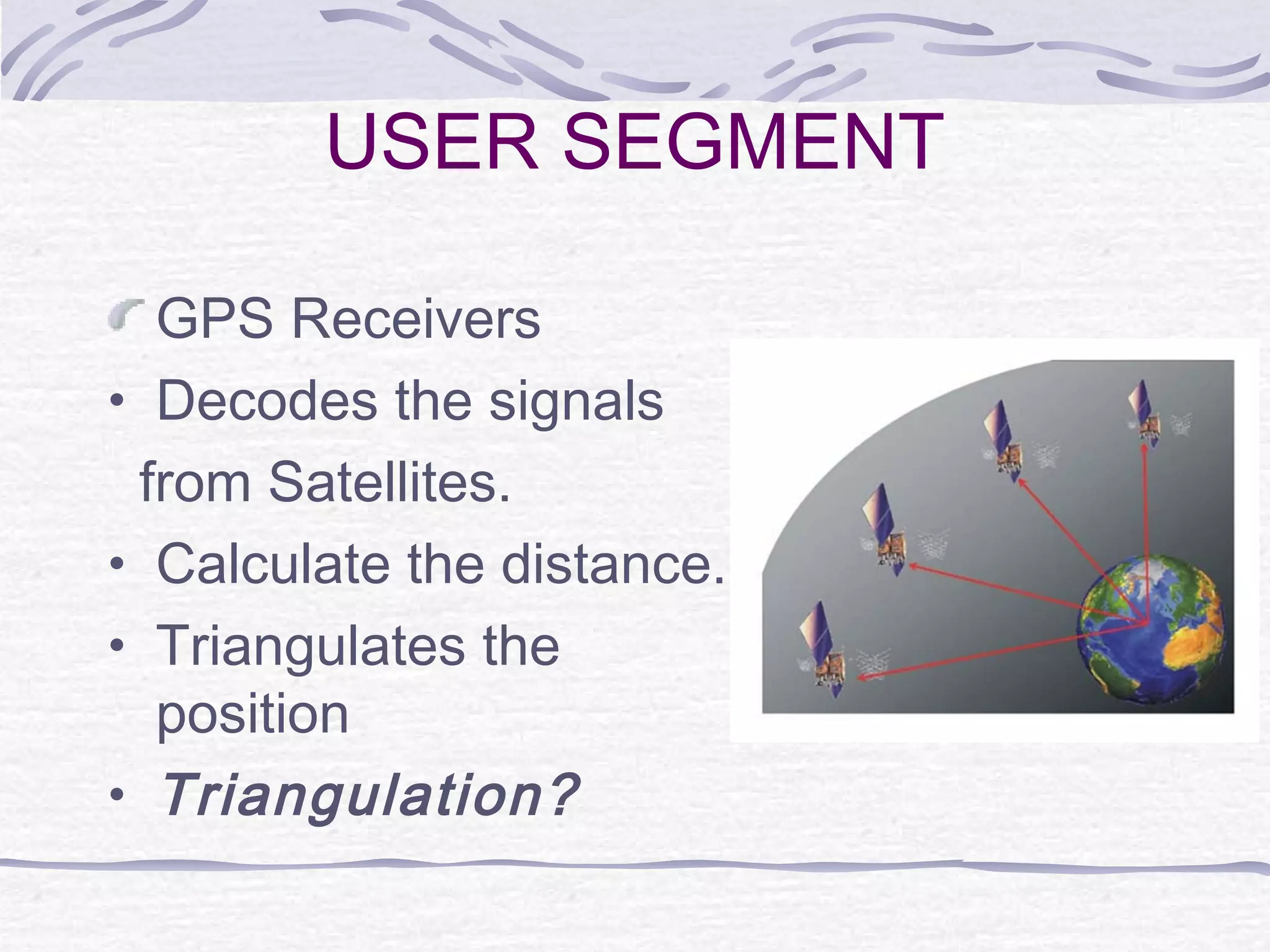
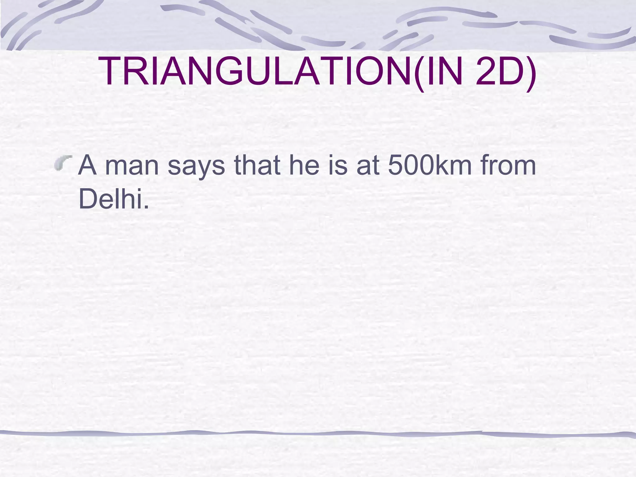
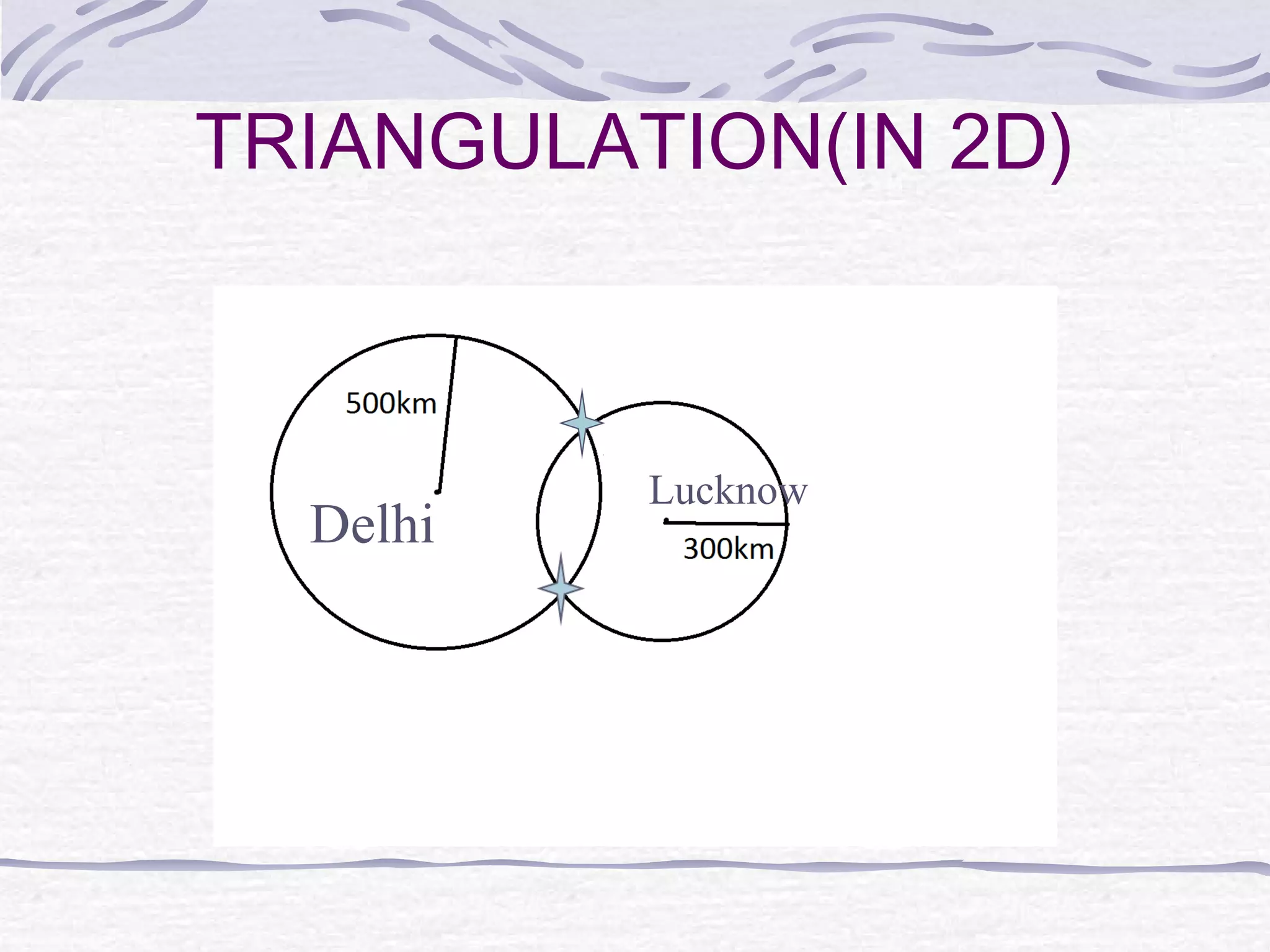
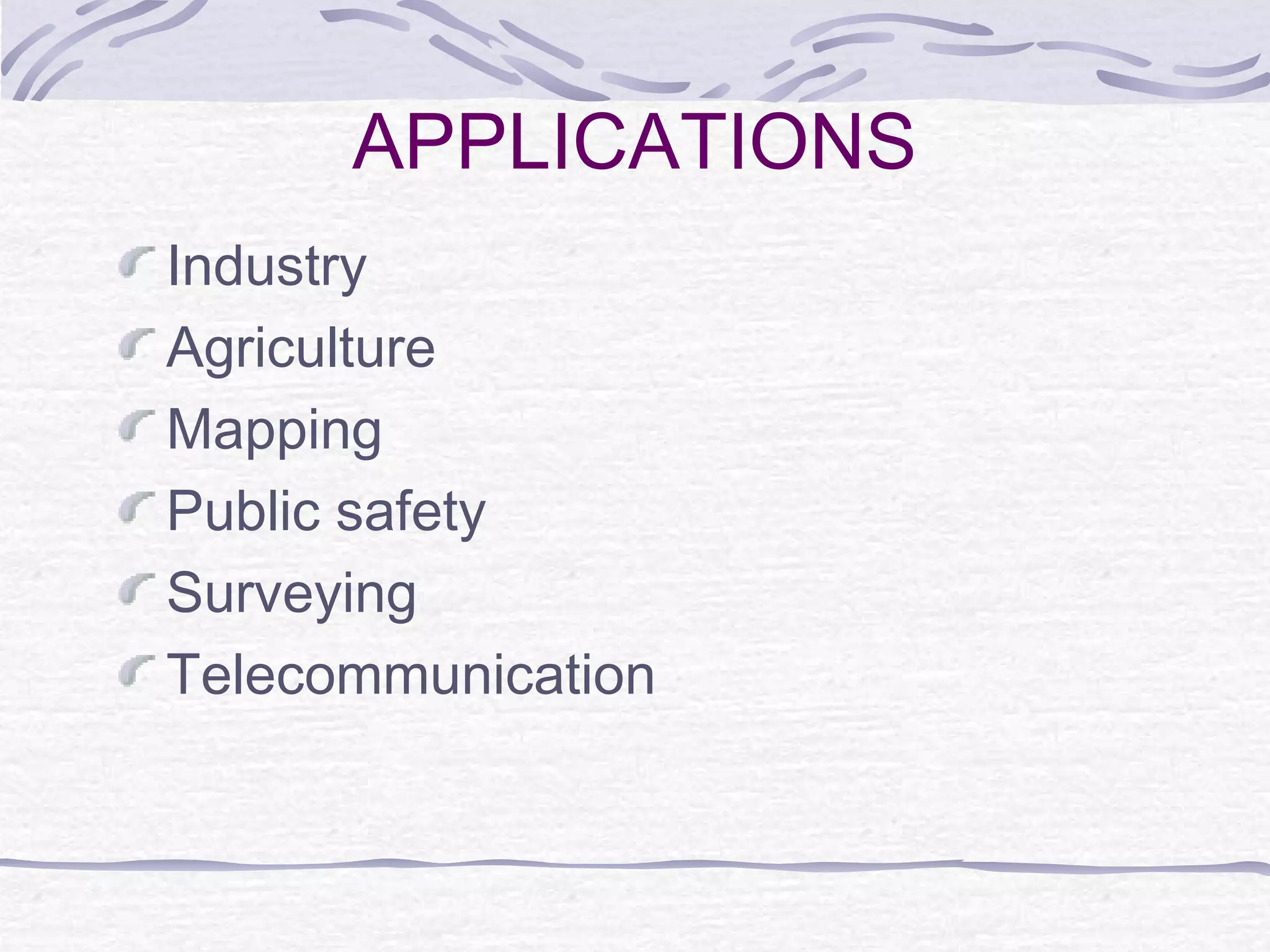
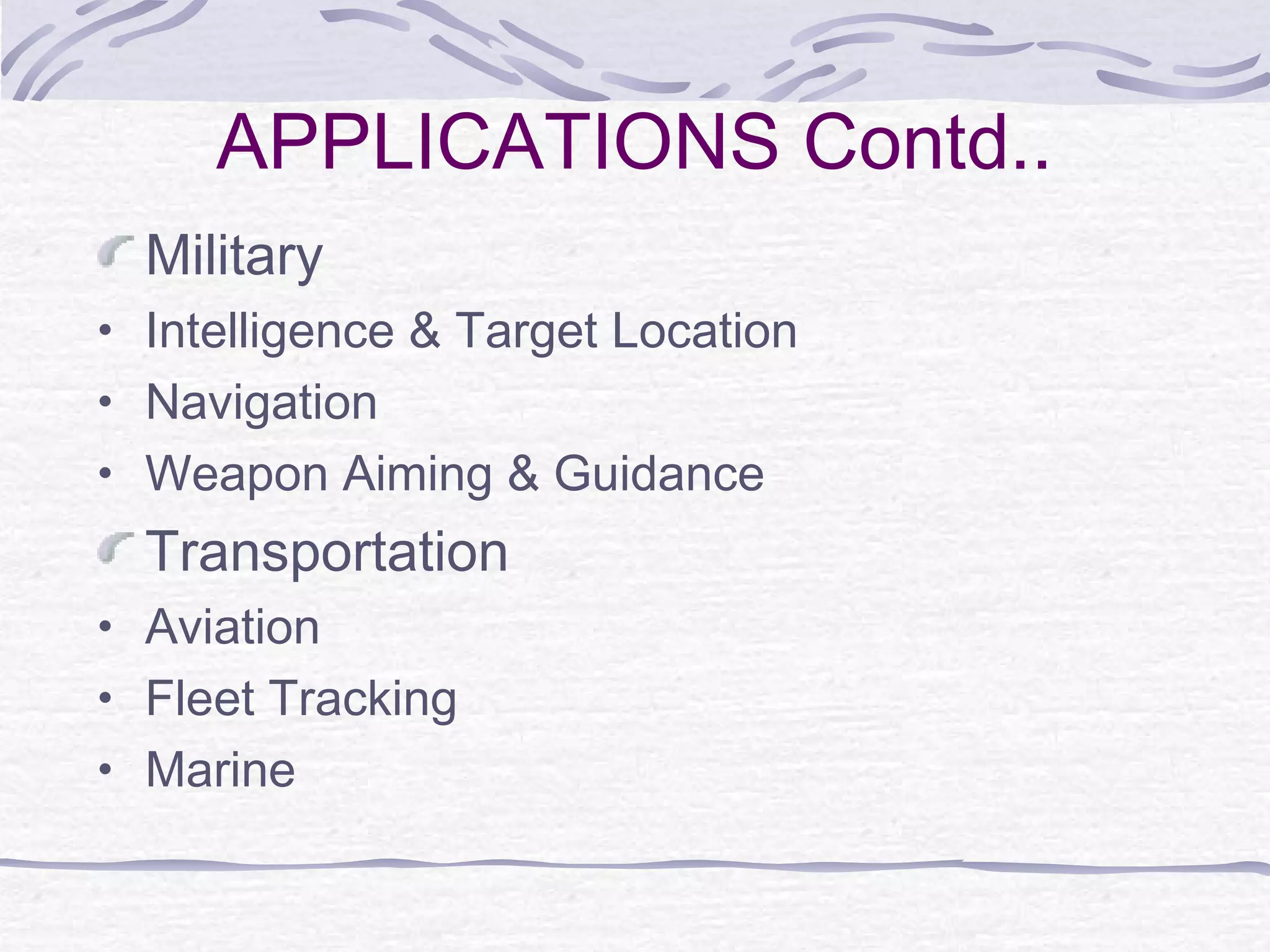
Global Positioning
System
Presented by:
Sushant Maurya
ECE/27/2013
CONTENTS
Introduction
History
Need of GPS
How does the GPS work?
Factors that affect the GPS
Applications
Future Scope
Conclusion
References
INTRODUCTION
The Global Positioning System(GPS) is
a satellite-based navigation system
made up of a network of 24 satellites
placed into orbit by the U.S. Department
of Defence that continuously transmit
coded information, which makes it
possible to precisely identify locations
on earth.
HISTORY
In the old time, people have used Stars
and moon to get positions so that they
can travel..
NEED OF GPS
Where am I? Where am I going? Where
are you? What is the best way to get
there? When will I get there?
GPS technology can answer all these
questions.
WHERE IT CAME FROM
Funded and Controlled by U.S. DOD
Originally Designed for the Military
1978 First Block of Satellites launched
1989 Second Block of Satellites launched
1995 Fully Operational
Korean Flight 007 Crashed(1983)–
President Ronald Regan guaranteed all
GPS signals would be available to the world
HOW DOES THE GPS
WORK?
Triangulation from satellite
Distance measurement through travel
time of radio signals
Very accurate timing required
Along with distance, need to know exactly
where the satellites are in space
Finally delays have to be corrected
THREE SEGMENTS OF GPS
SPACE SEGMENT
24 Satellites in 6
orbital plane
4 satellites in each
plane
20,200km altitudes
Five to Eight Satellites visible at any time
Each satellite transmits data including both
current location and time
CONTROL SEGMENT
USER SEGMENT
GPS Receivers
• Decodes the signals
from Satellites.
• Calculate the distance.
• Triangulates the
position
• Triangulation?
CALCULATING DISTANCE
Velocity x Time = Distance
Radio waves travel at the speed of light, roughly
3,00,000km per second (kmps)
If it took 0.06 seconds to receive a signal
transmitted by a satellite floating directly
overhead, use this formula to find your distance
from the satellite.
3,00,000kmps x 0.06 seconds = 18,000km
TRIANGULATION(IN 2D)
A man says that he is at 500km from
Delhi.
TRIANGULATION(IN 2D)
Delhi
TRIANGULATION(IN 2D)
A man says that he is at 500km from
Delhi.
Again he says, he is at 300km from
Lucknow.
TRIANGULATION(IN 2D)
Delhi
Lucknow
TRIANGULATION(IN 2D)
A man says that he is at 500km from
Delhi.
Again he says, he is at 300km from
Lucknow.
He again says that he is 400km away
from Jaipur.
TRIANGULATION(IN 2D)
Delhi Lucknow
Jaipur
TRIANGULATION(IN 3D)
For 3D , we need at least 4 known
points or 4 satellites.
TRIANGULATION(IN 3D)
1 satellite
TRIANGULATION(IN 3D)
2 satellites
TRIANGULATION(IN 3D)
3 satellites
TRIANGULATION(IN 3D)
4 satellites
Standard Positioning System
• Data Transmitted on L1(1575.42 MHz)
Frequency
• For civil users
• Accuracy is degraded
Precise Positioning System
• Data Transmitted on L1(1575.42 MHz)
and L2(1227.60 MHz) Frequencies
• For Military users
• Highly Accurate
Modes of Operation
HA=100m
VA=156m
TA=340ns
HA=22m
VA=27.7m
TA=200ns
FACTORS THAT AFFECT
GPS
Clock Error
Relativity Error
Multipath - reflection of GPS signals near the
antennae
Ionosphere - change in the travel time of the signal
Troposphere - change in the travel time of the signal
 Satellite Geometry - general distribution of the
satellites
 Satellite Health - Availability of Signal
Radio Frequency (RF) Interference
MULTIPATH
Sometimes the
signals bounce
off things before
they hit the
receivers.
Sources of Signal Interference
Earth’s Atmosphere
Solid Structures
Metal Electro-magnetic Fields
SATELLITE GEOMETRY
When the satellites are all in the same part
of the sky, readings will be less accurate.
PDOP-Position Dilution of Precision
CLOCK ERROR
Time of the satellites and receivers must be
synchronized.
GPS satellites use Atomic Clocks.
Most of the GPS receivers do not use Atomic
clock because of expense.
So we get error in time , so error in position.
RELATIVE ERROR
According to Special Relativity-
on-board atomic clocks on the satellites
should fall behind clocks on the ground
by about 7 microseconds per day
because of the slower ticking rate due
to the time dilation effect of their
relative motion.
Means satellite clock=T-7us
RELATIVE ERROR Contd.
According to General Relativity-clocks
closer to a massive object will seem to tick
more slowly than those located further away.
A calculation using General Relativity
predicts that the clocks in each GPS satellite
should get ahead of ground-based clocks by
45 microseconds per day.
Means satellite clock=T+45us
On combining both. Time =T+45-7=T+38us.
RELATIVE ERROR Contd.
38us means error of 11 km per day
To overcome this error , satellite clock is
corrected generally after 2-4 hour.
APPLICATIONS
Industry
Agriculture
Mapping
Public safety
Surveying
Telecommunication
APPLICATIONS Contd..
Military
• Intelligence & Target Location
• Navigation
• Weapon Aiming & Guidance
Transportation
• Aviation
• Fleet Tracking
• Marine
WORLD WORK ON
NAVIGATION
GPS –by United States
GLONASS -by Russian
GALILEO-by European Union
Compass –by China
IRNSS(Indian Regional Navigation Satellite
System)-by INDIA
Indian Regional Navigation Satellite
System
Total satellites 7
First launch 1 July 2013
Last launch 28 April 2016
Orbital height 36,000 km
Precision 10 m (public) 0.1 m
(encrypted)
Coverage -Regional (up to 1,500 km from
borders)
COMPARISION OF ORBITS
REFERENCES
GPS primer “A Student
Guide”(Aerospace Corporation)
www.trimble.com
An Introduction – Global Positioning
system S. K. Upadhyaya, G. S.
Pettygrove, J.W. Oliveira, B. R. Jahn1
GPS Guide for Beginners(GARMIN
Corporation)
Global positioning system ppt

Global positioning system ppt

  • 1.
  • 2.
    CONTENTS Introduction History Need of GPS Howdoes the GPS work? Factors that affect the GPS Applications Future Scope Conclusion References
  • 3.
    INTRODUCTION The Global PositioningSystem(GPS) is a satellite-based navigation system made up of a network of 24 satellites placed into orbit by the U.S. Department of Defence that continuously transmit coded information, which makes it possible to precisely identify locations on earth.
  • 4.
    HISTORY In the oldtime, people have used Stars and moon to get positions so that they can travel..
  • 5.
    NEED OF GPS Wheream I? Where am I going? Where are you? What is the best way to get there? When will I get there? GPS technology can answer all these questions.
  • 6.
    WHERE IT CAMEFROM Funded and Controlled by U.S. DOD Originally Designed for the Military 1978 First Block of Satellites launched 1989 Second Block of Satellites launched 1995 Fully Operational Korean Flight 007 Crashed(1983)– President Ronald Regan guaranteed all GPS signals would be available to the world
  • 7.
    HOW DOES THEGPS WORK? Triangulation from satellite Distance measurement through travel time of radio signals Very accurate timing required Along with distance, need to know exactly where the satellites are in space Finally delays have to be corrected
  • 8.
  • 9.
    SPACE SEGMENT 24 Satellitesin 6 orbital plane 4 satellites in each plane 20,200km altitudes Five to Eight Satellites visible at any time Each satellite transmits data including both current location and time
  • 10.
  • 11.
    USER SEGMENT GPS Receivers •Decodes the signals from Satellites. • Calculate the distance. • Triangulates the position • Triangulation?
  • 12.
    CALCULATING DISTANCE Velocity xTime = Distance Radio waves travel at the speed of light, roughly 3,00,000km per second (kmps) If it took 0.06 seconds to receive a signal transmitted by a satellite floating directly overhead, use this formula to find your distance from the satellite. 3,00,000kmps x 0.06 seconds = 18,000km
  • 13.
    TRIANGULATION(IN 2D) A mansays that he is at 500km from Delhi.
  • 14.
  • 15.
    TRIANGULATION(IN 2D) A mansays that he is at 500km from Delhi. Again he says, he is at 300km from Lucknow.
  • 16.
  • 17.
    TRIANGULATION(IN 2D) A mansays that he is at 500km from Delhi. Again he says, he is at 300km from Lucknow. He again says that he is 400km away from Jaipur.
  • 18.
  • 19.
    TRIANGULATION(IN 3D) For 3D, we need at least 4 known points or 4 satellites.
  • 20.
  • 21.
  • 22.
  • 23.
  • 24.
    Standard Positioning System •Data Transmitted on L1(1575.42 MHz) Frequency • For civil users • Accuracy is degraded Precise Positioning System • Data Transmitted on L1(1575.42 MHz) and L2(1227.60 MHz) Frequencies • For Military users • Highly Accurate Modes of Operation HA=100m VA=156m TA=340ns HA=22m VA=27.7m TA=200ns
  • 25.
    FACTORS THAT AFFECT GPS ClockError Relativity Error Multipath - reflection of GPS signals near the antennae Ionosphere - change in the travel time of the signal Troposphere - change in the travel time of the signal  Satellite Geometry - general distribution of the satellites  Satellite Health - Availability of Signal Radio Frequency (RF) Interference
  • 26.
    MULTIPATH Sometimes the signals bounce offthings before they hit the receivers.
  • 27.
    Sources of SignalInterference Earth’s Atmosphere Solid Structures Metal Electro-magnetic Fields
  • 28.
    SATELLITE GEOMETRY When thesatellites are all in the same part of the sky, readings will be less accurate. PDOP-Position Dilution of Precision
  • 29.
    CLOCK ERROR Time ofthe satellites and receivers must be synchronized. GPS satellites use Atomic Clocks. Most of the GPS receivers do not use Atomic clock because of expense. So we get error in time , so error in position.
  • 30.
    RELATIVE ERROR According toSpecial Relativity- on-board atomic clocks on the satellites should fall behind clocks on the ground by about 7 microseconds per day because of the slower ticking rate due to the time dilation effect of their relative motion. Means satellite clock=T-7us
  • 31.
    RELATIVE ERROR Contd. Accordingto General Relativity-clocks closer to a massive object will seem to tick more slowly than those located further away. A calculation using General Relativity predicts that the clocks in each GPS satellite should get ahead of ground-based clocks by 45 microseconds per day. Means satellite clock=T+45us On combining both. Time =T+45-7=T+38us.
  • 32.
    RELATIVE ERROR Contd. 38usmeans error of 11 km per day To overcome this error , satellite clock is corrected generally after 2-4 hour.
  • 33.
  • 34.
    APPLICATIONS Contd.. Military • Intelligence& Target Location • Navigation • Weapon Aiming & Guidance Transportation • Aviation • Fleet Tracking • Marine
  • 35.
    WORLD WORK ON NAVIGATION GPS–by United States GLONASS -by Russian GALILEO-by European Union Compass –by China IRNSS(Indian Regional Navigation Satellite System)-by INDIA
  • 36.
    Indian Regional NavigationSatellite System Total satellites 7 First launch 1 July 2013 Last launch 28 April 2016 Orbital height 36,000 km Precision 10 m (public) 0.1 m (encrypted) Coverage -Regional (up to 1,500 km from borders)
  • 37.
  • 38.
    REFERENCES GPS primer “AStudent Guide”(Aerospace Corporation) www.trimble.com An Introduction – Global Positioning system S. K. Upadhyaya, G. S. Pettygrove, J.W. Oliveira, B. R. Jahn1 GPS Guide for Beginners(GARMIN Corporation)