Download to read offline
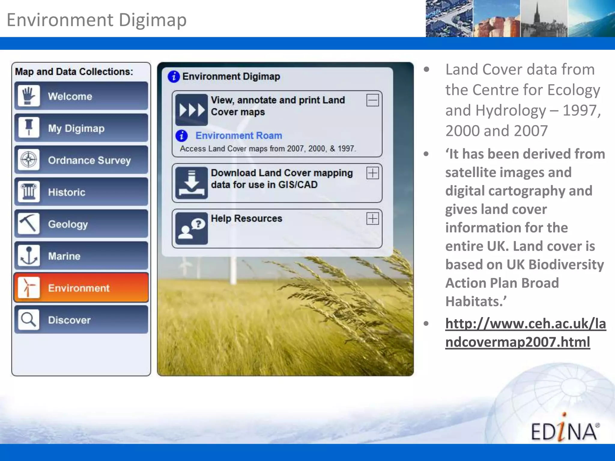
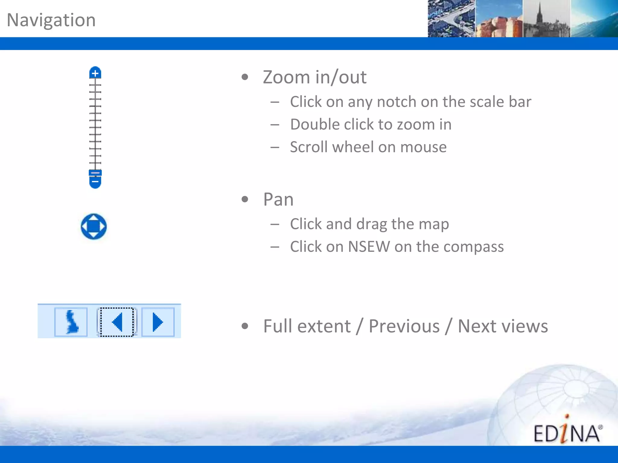
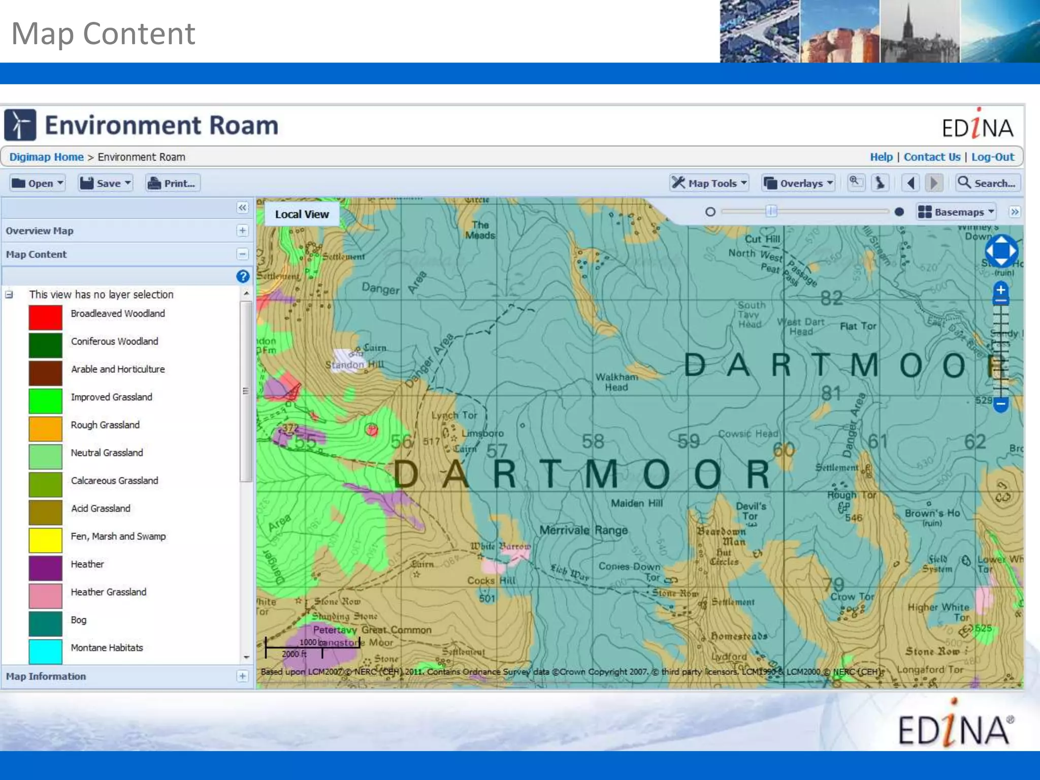
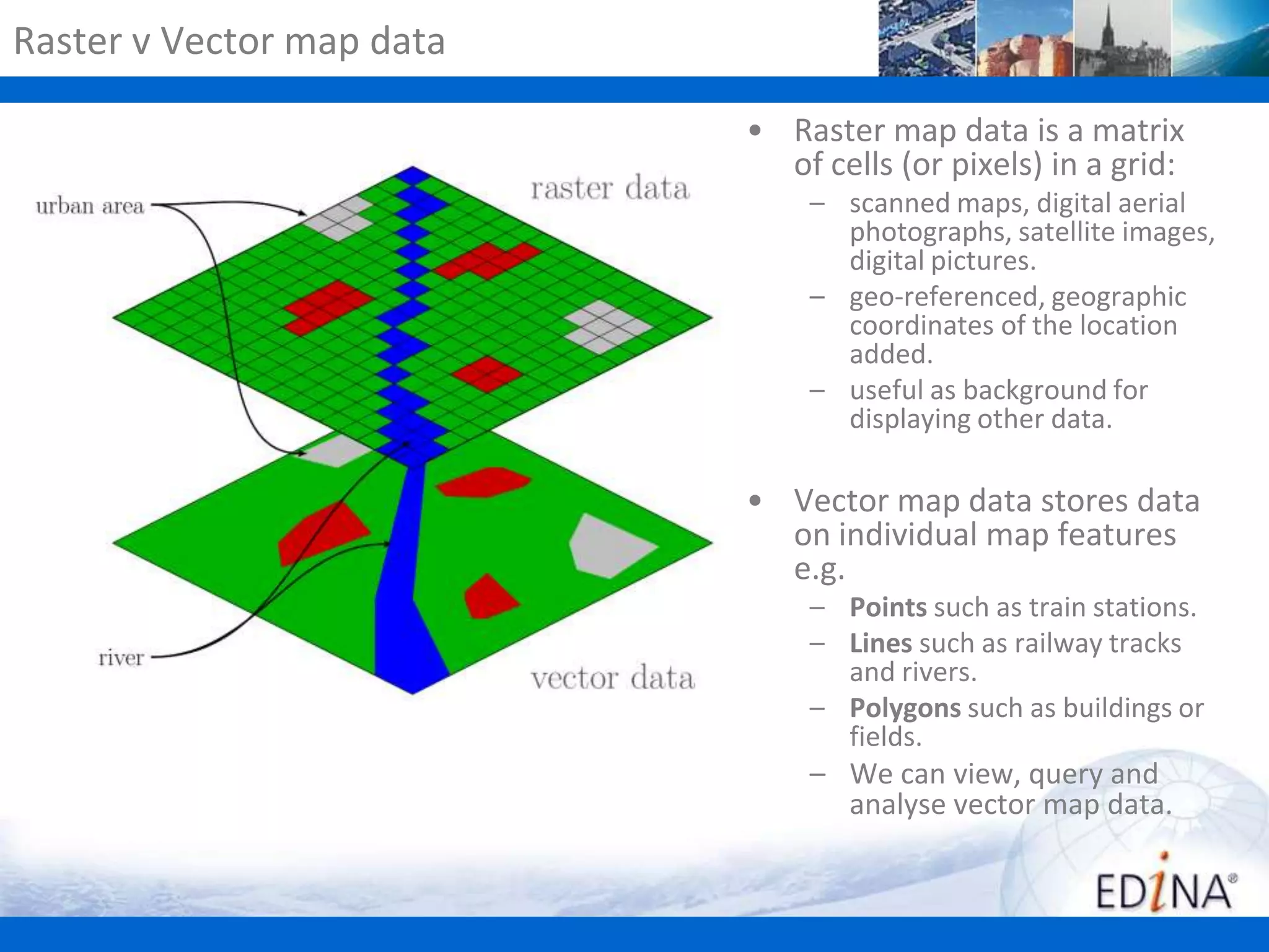
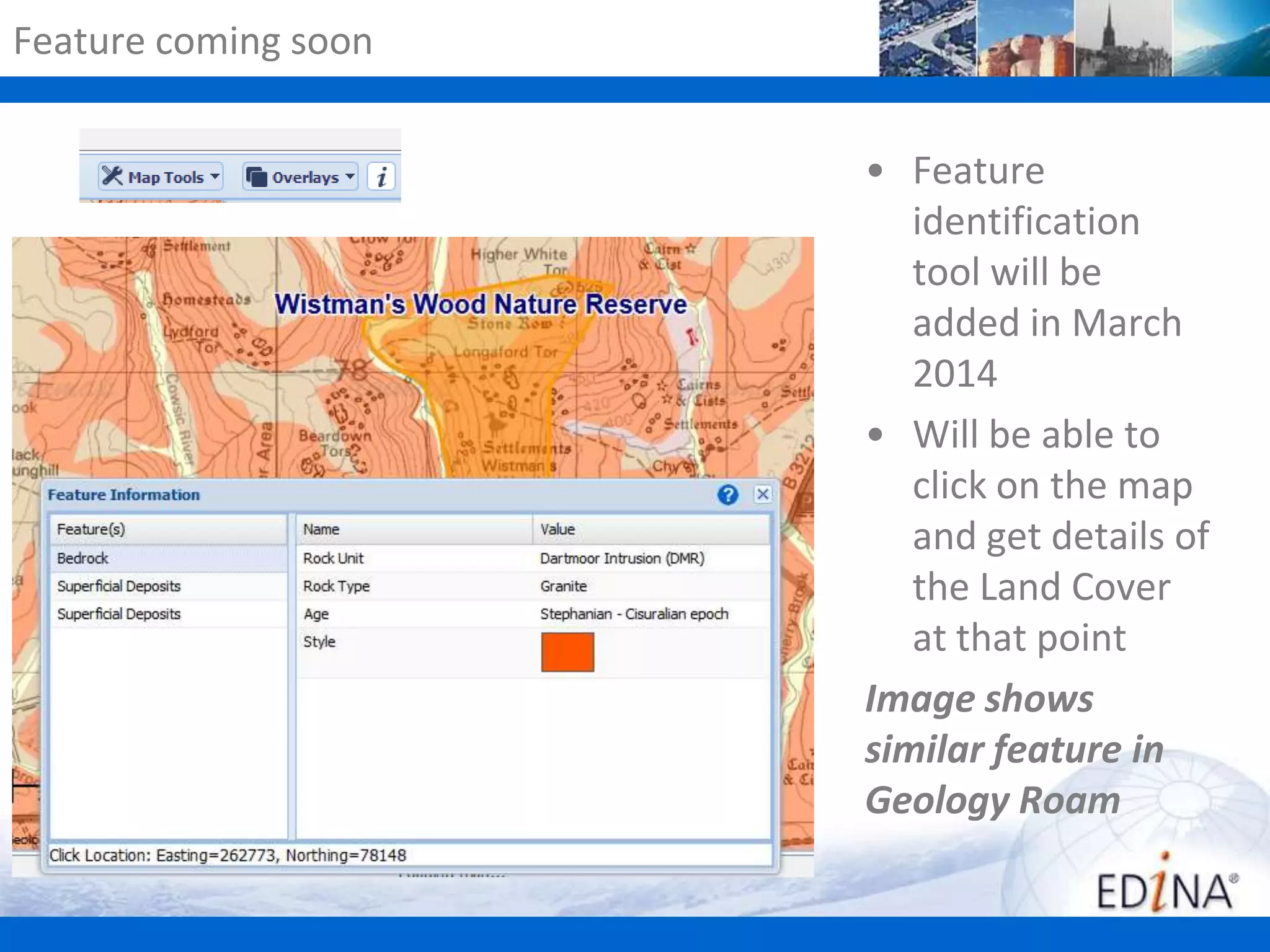
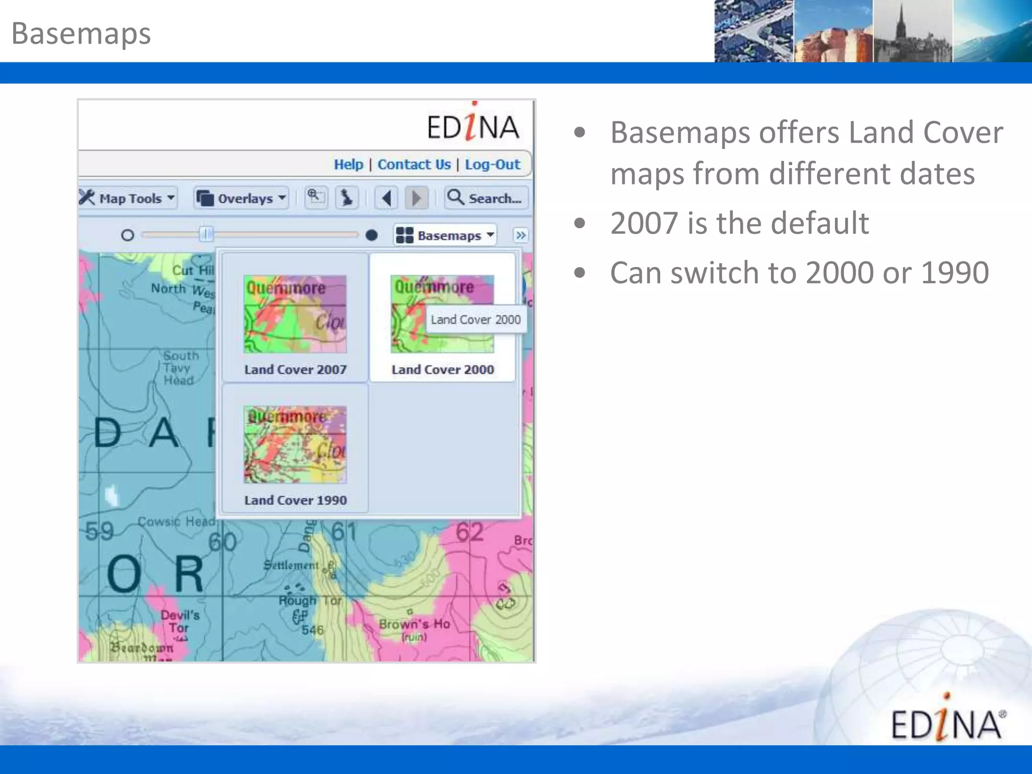
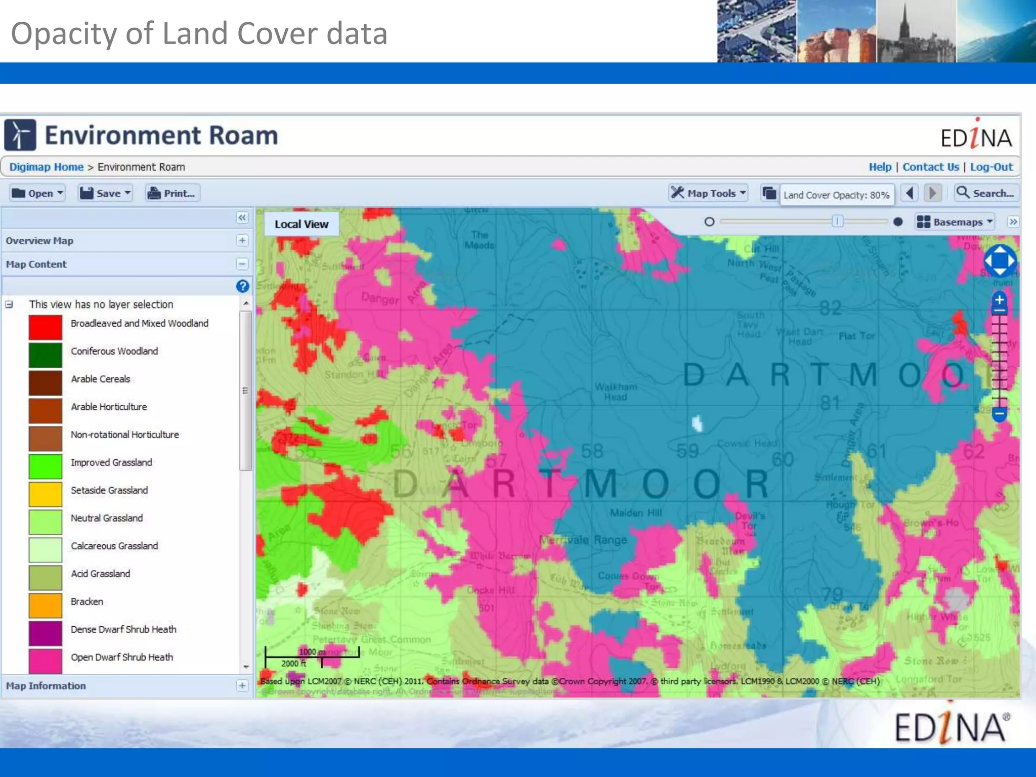

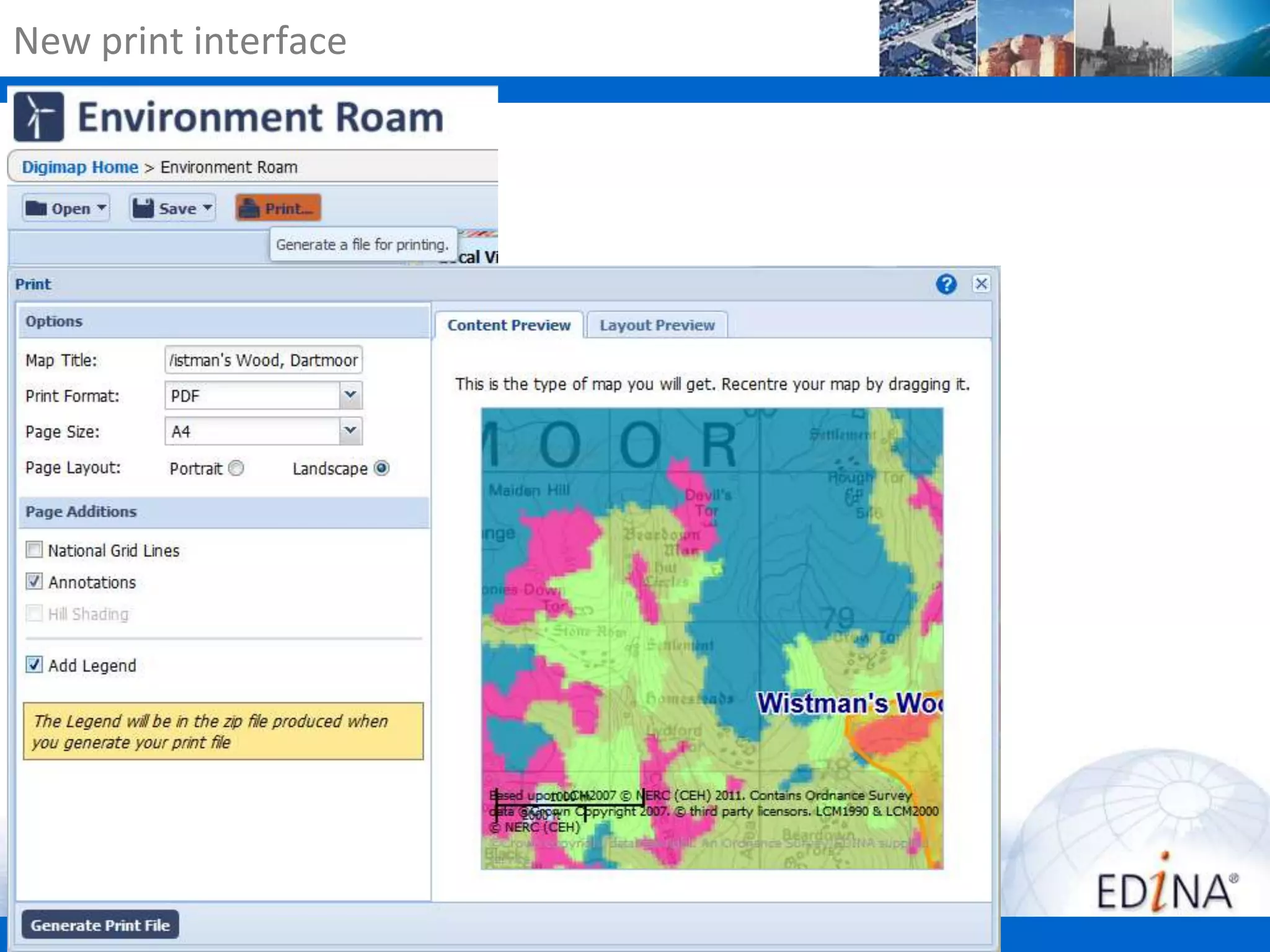
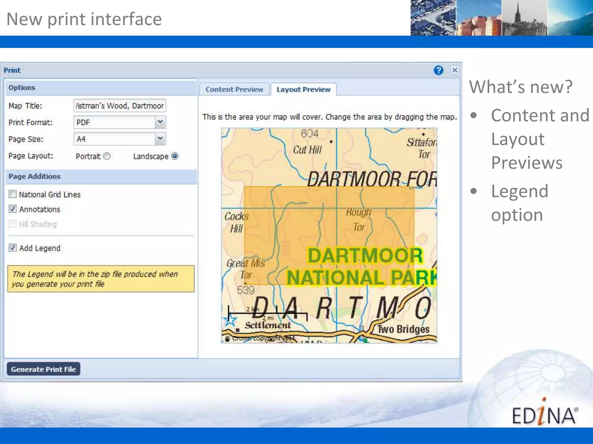
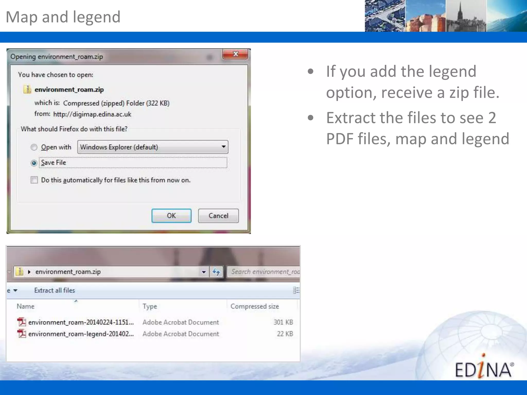
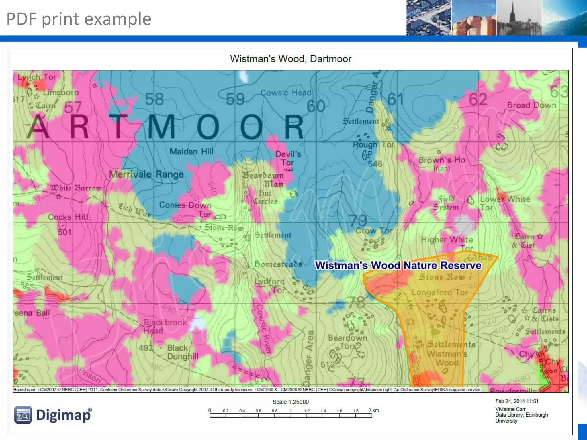


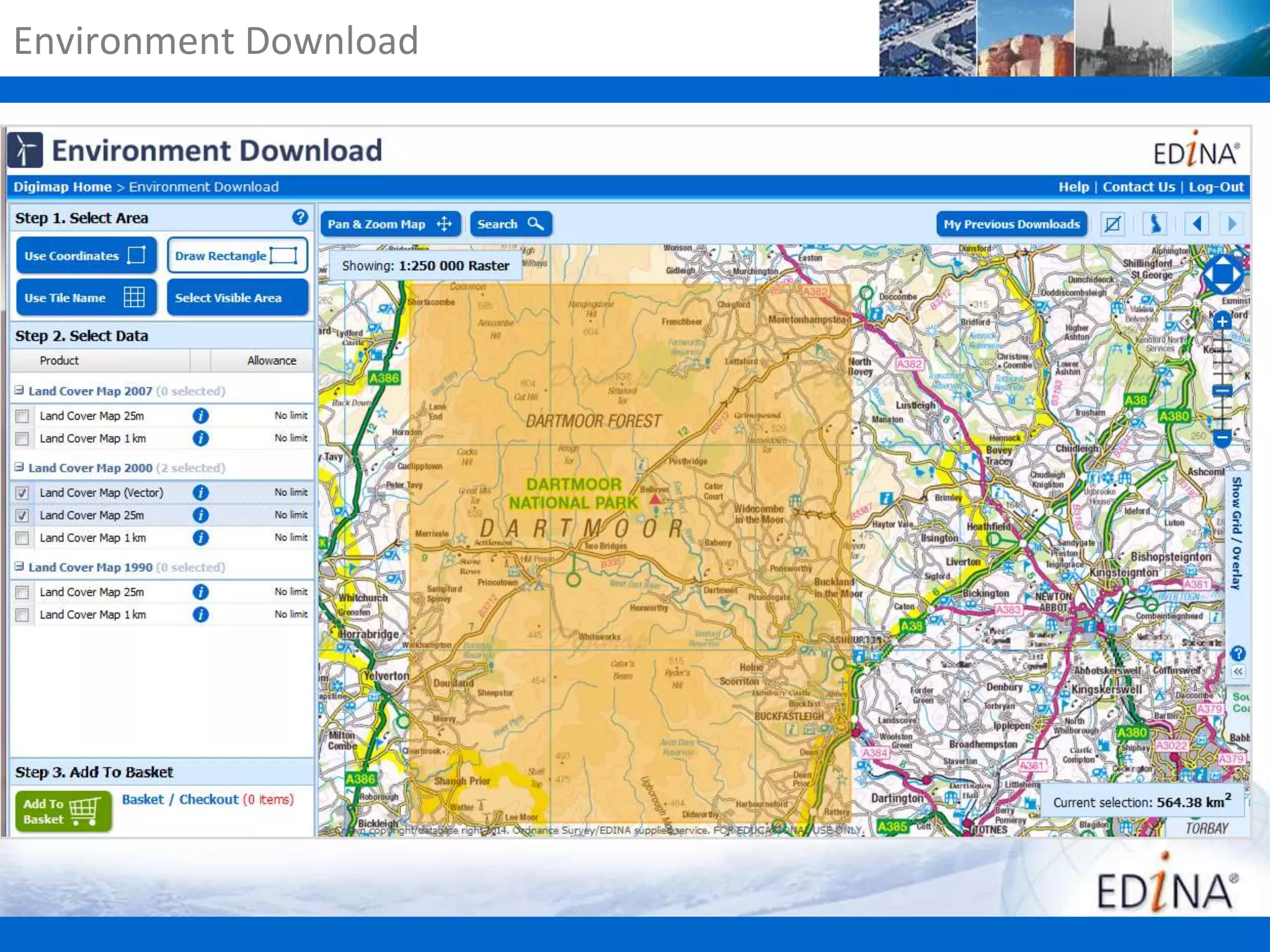
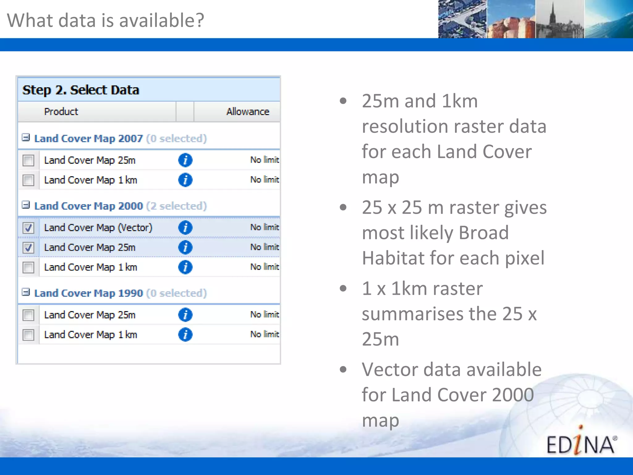
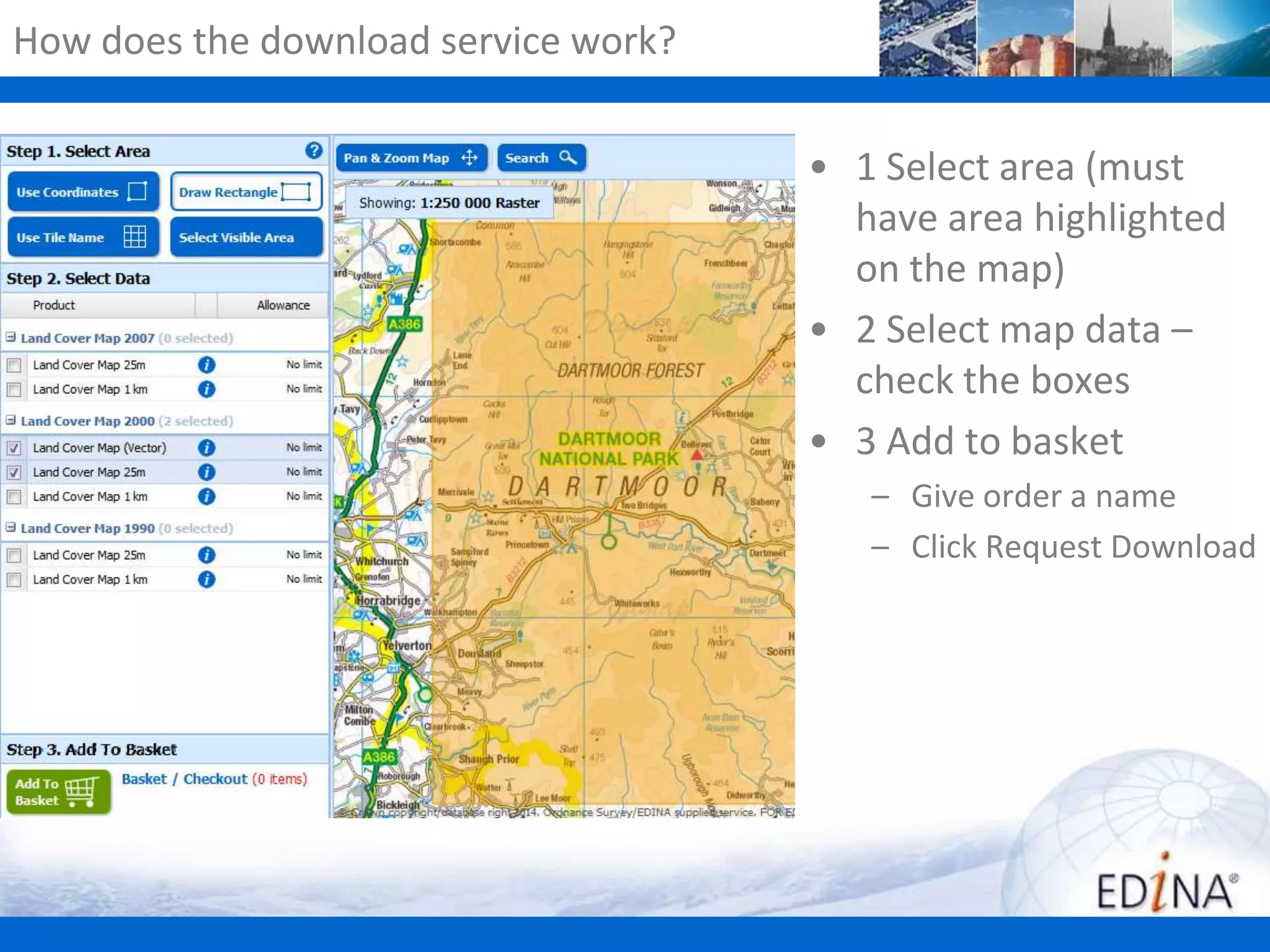
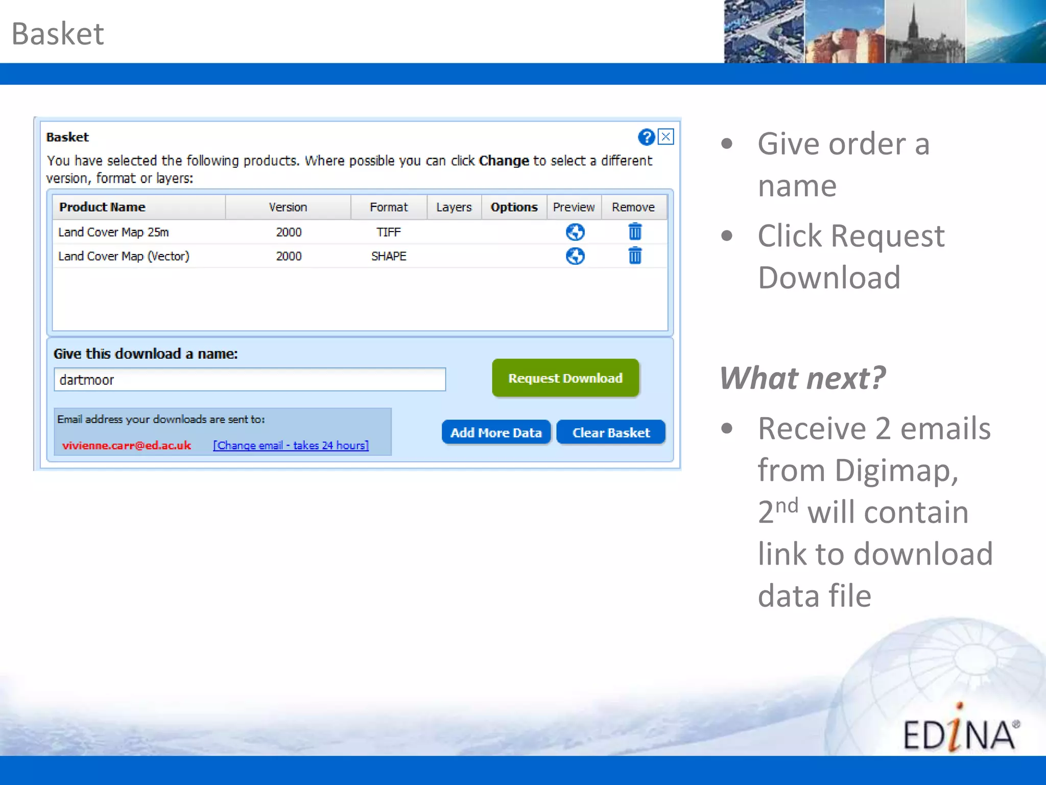

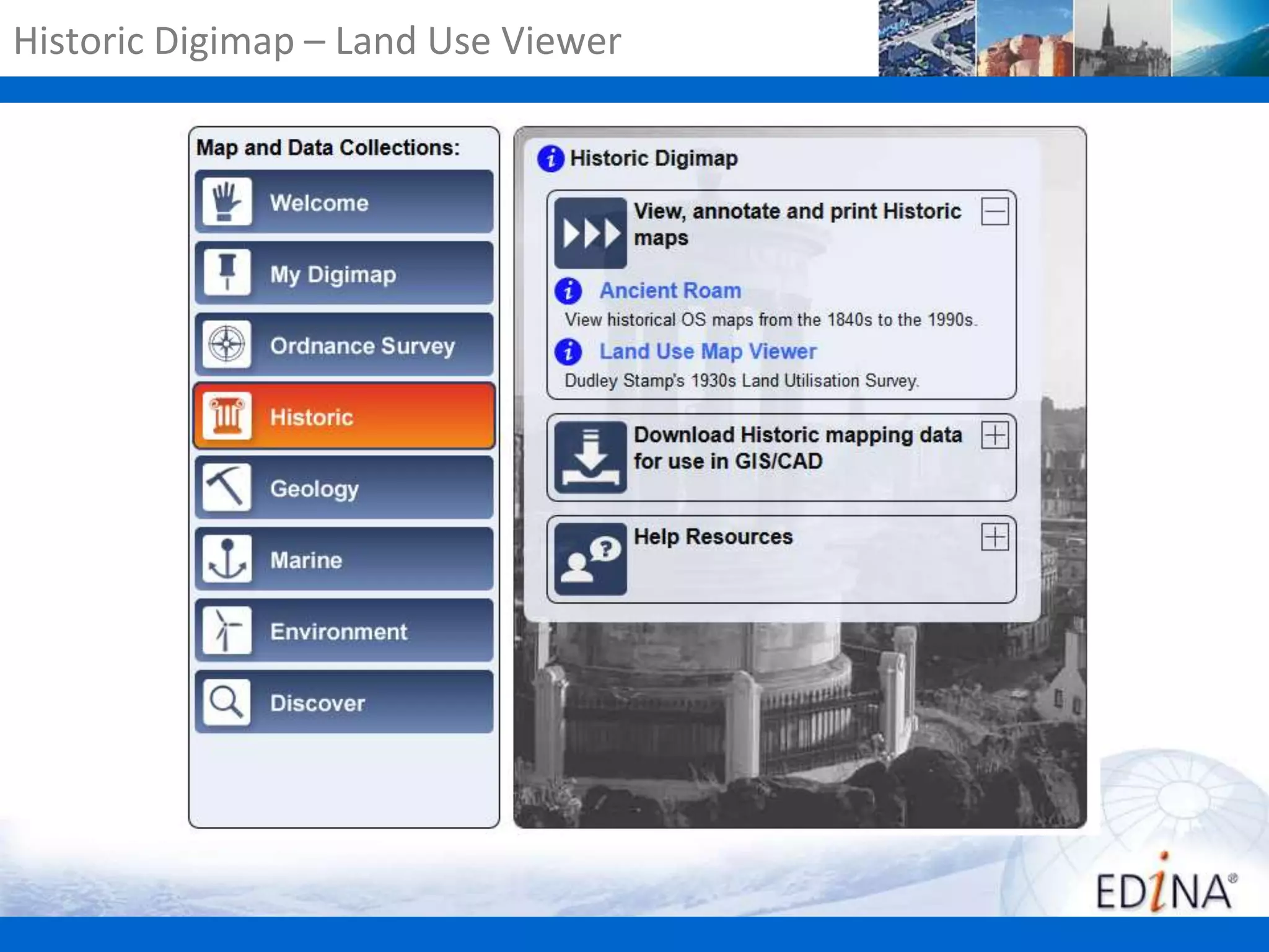
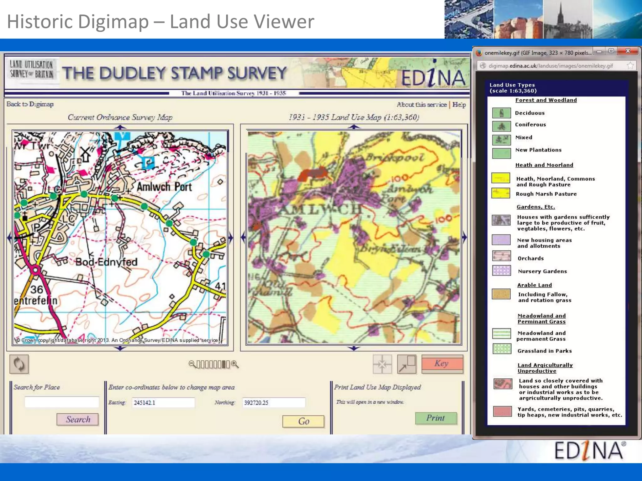


The document provides an overview of the Digimap service, focusing on land cover data from the Centre for Ecology and Hydrology and its various features, including data downloading options, map customization tools, and the upcoming feature identification tool. It discusses different map data types, such as raster and vector data, methods for importing and annotating maps, and resources for training workshops. Additionally, it lists other useful data sources and provides contact information for user support.