Download to read offline


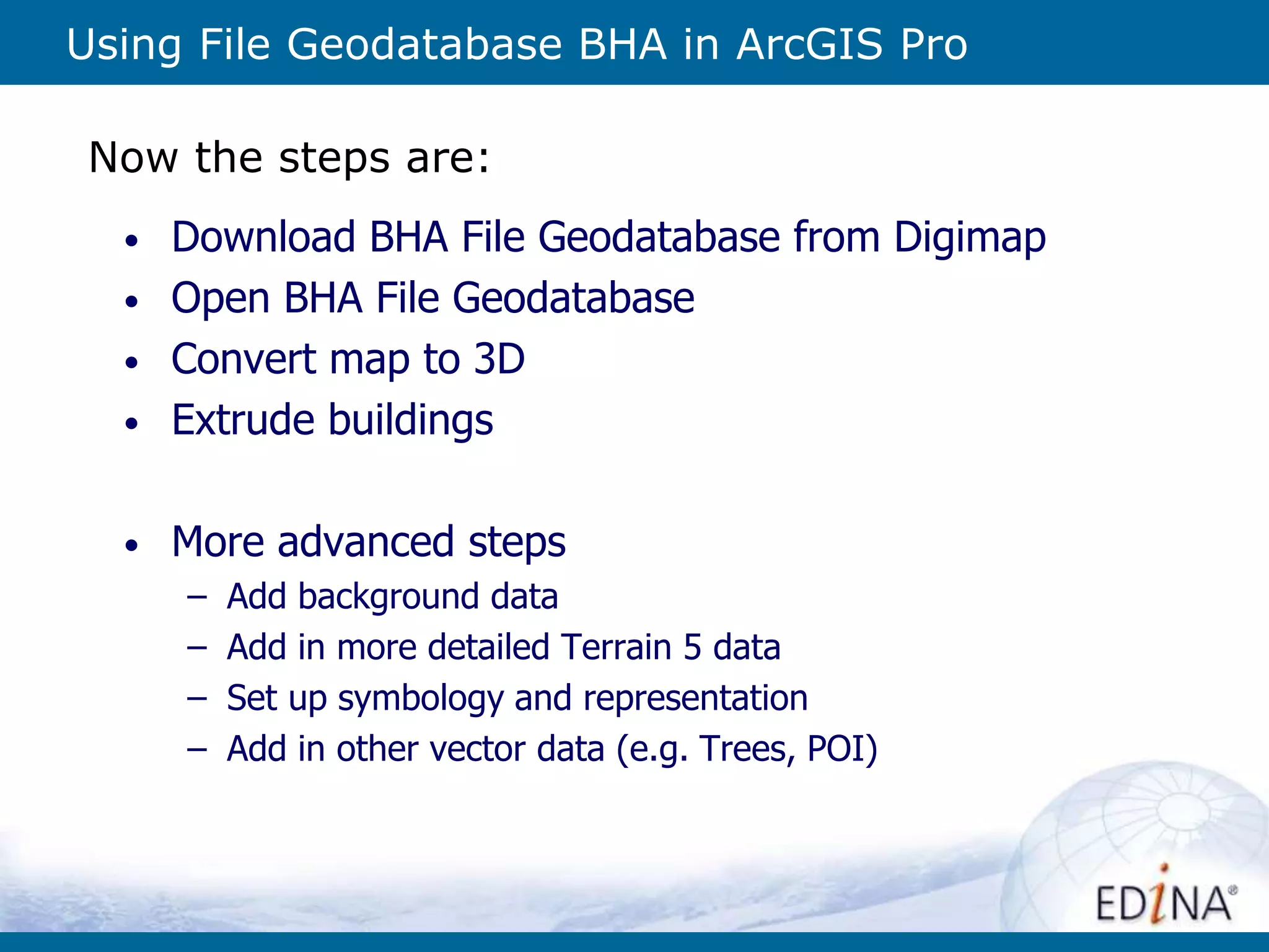
![Extrude to 3D
1. Set the Ground
Extrude the building to Max Height using attribute [relhmax]](https://image.slidesharecdn.com/bhadigimaparcgispro-150605092823-lva1-app6892/75/Using-OS-Building-Height-Attribute-data-from-Digimap-in-ArcGIS-Pro-16-2048.jpg)
![Use Procedural Rules
Can either use ones that come with ArcGIS Pro
or import ones from City Engine
• Using built in
“International
Building”
Procedural
Rule
• Set
[TotalHeight]
to be
calculated
from the
[relhmax]
attribute
• Building
type set to
“Office”](https://image.slidesharecdn.com/bhadigimaparcgispro-150605092823-lva1-app6892/75/Using-OS-Building-Height-Attribute-data-from-Digimap-in-ArcGIS-Pro-20-2048.jpg)
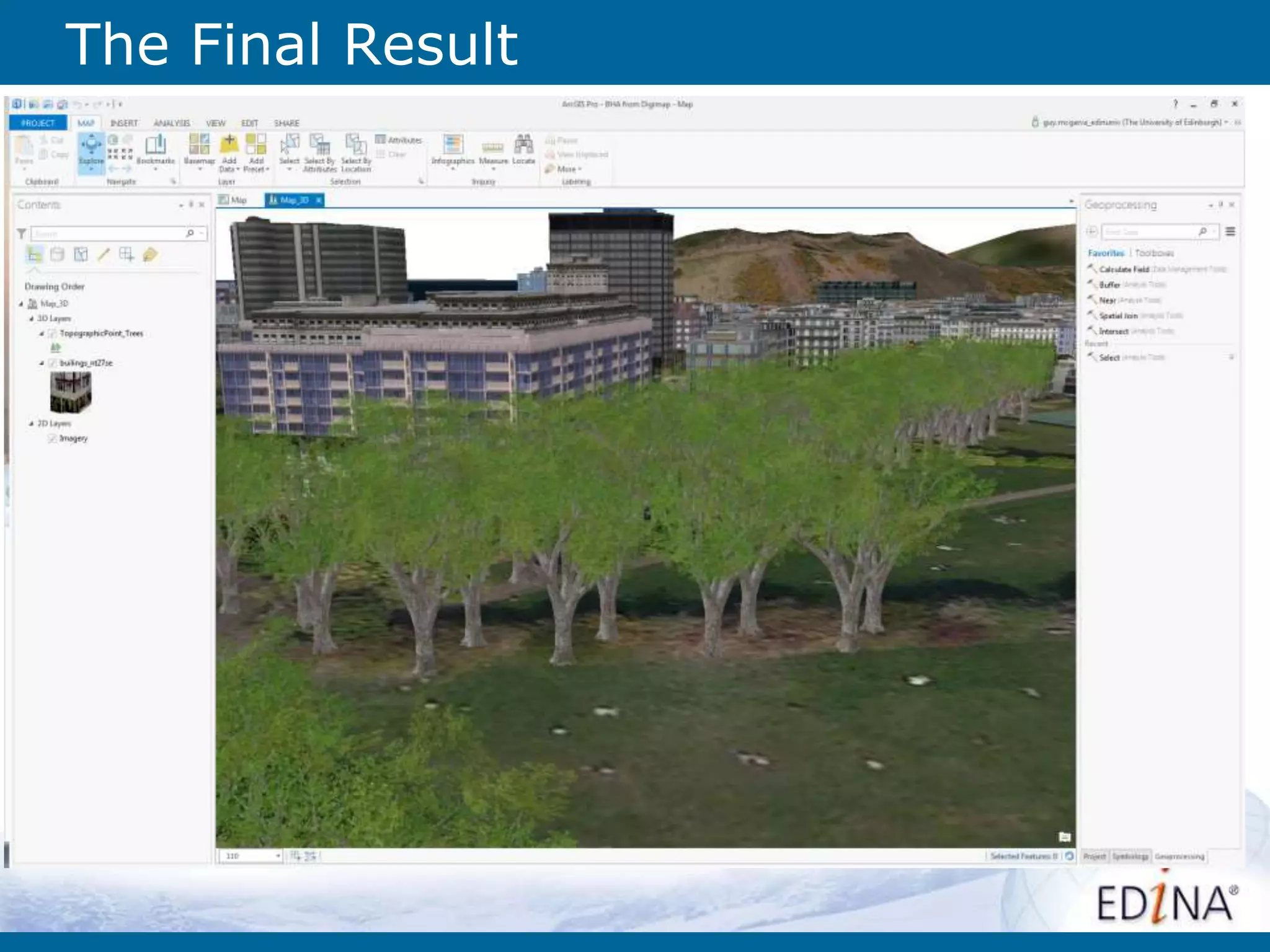

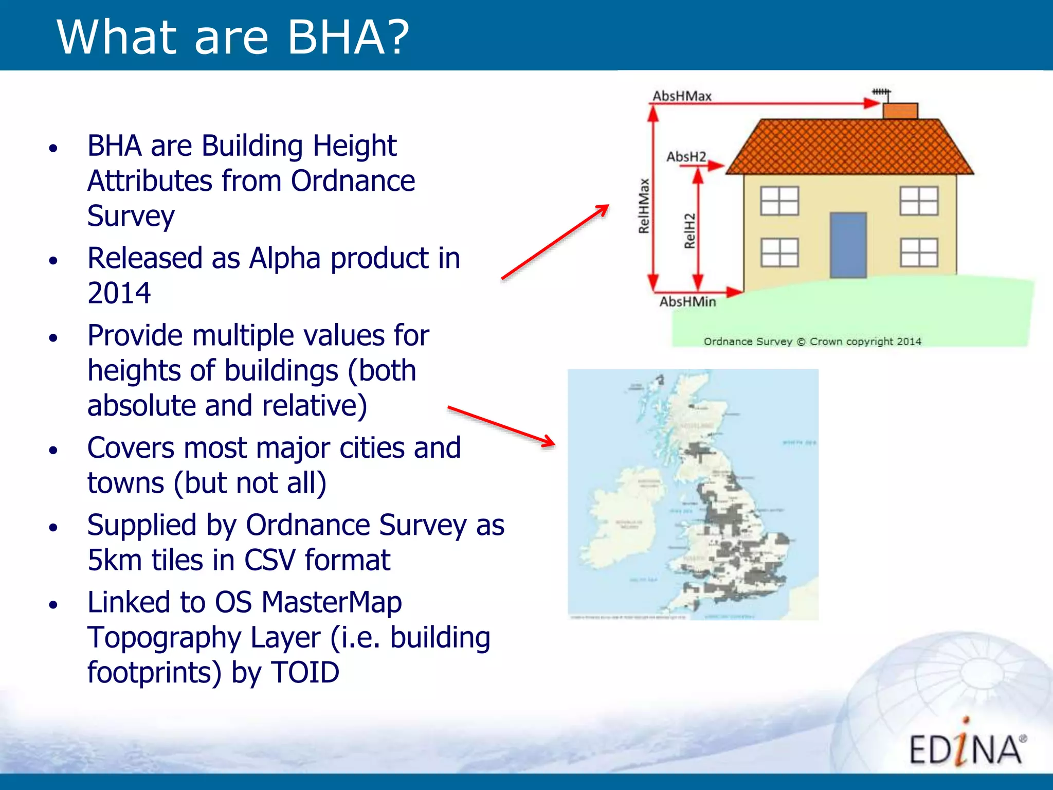
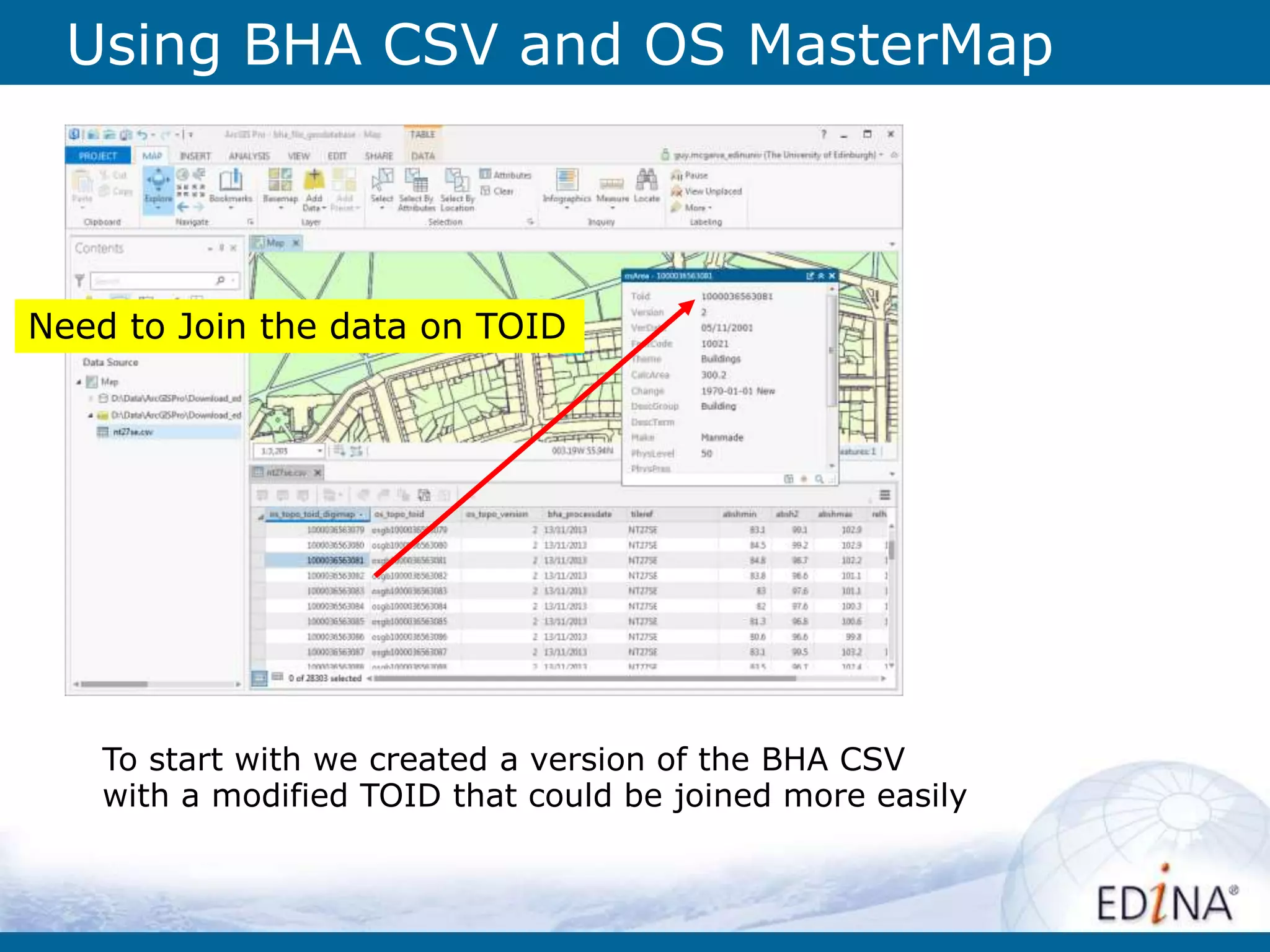
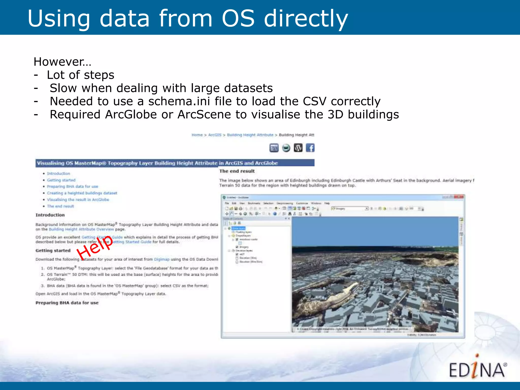
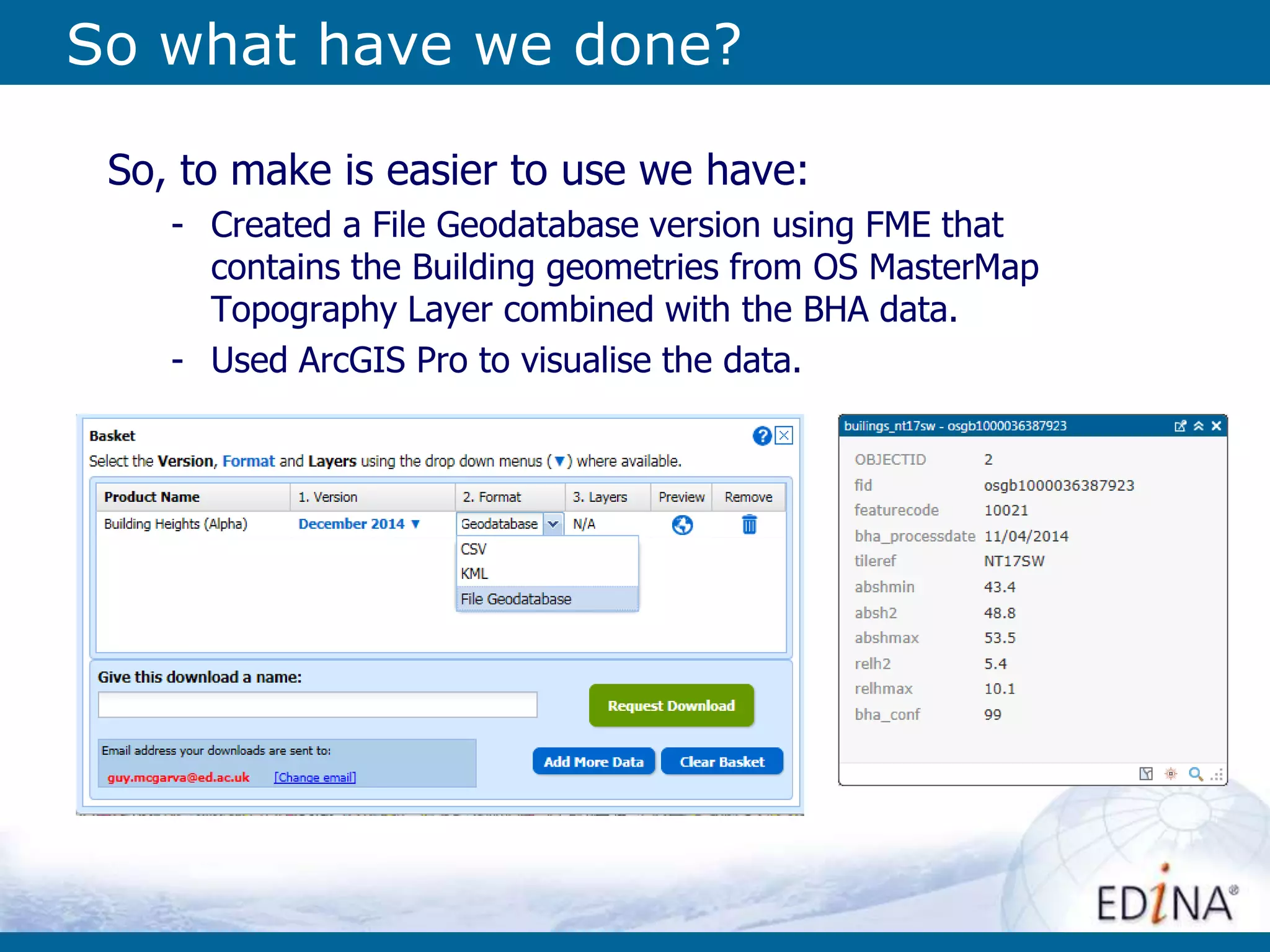
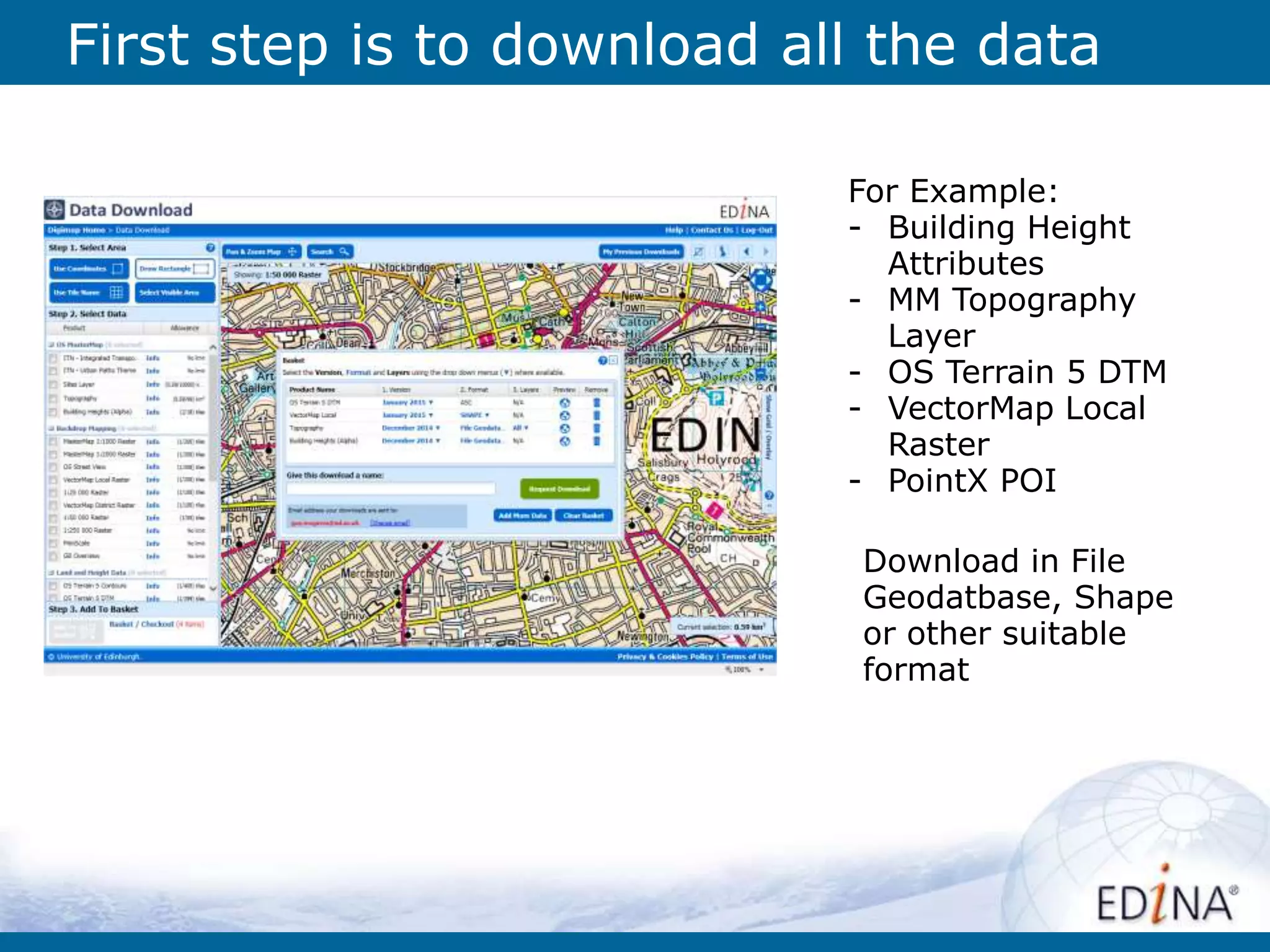
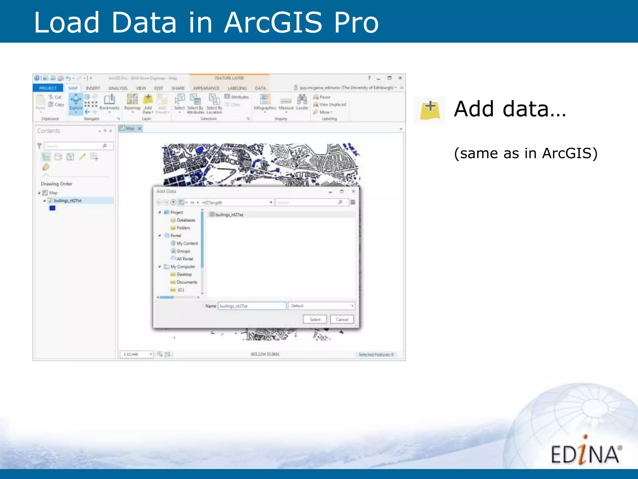
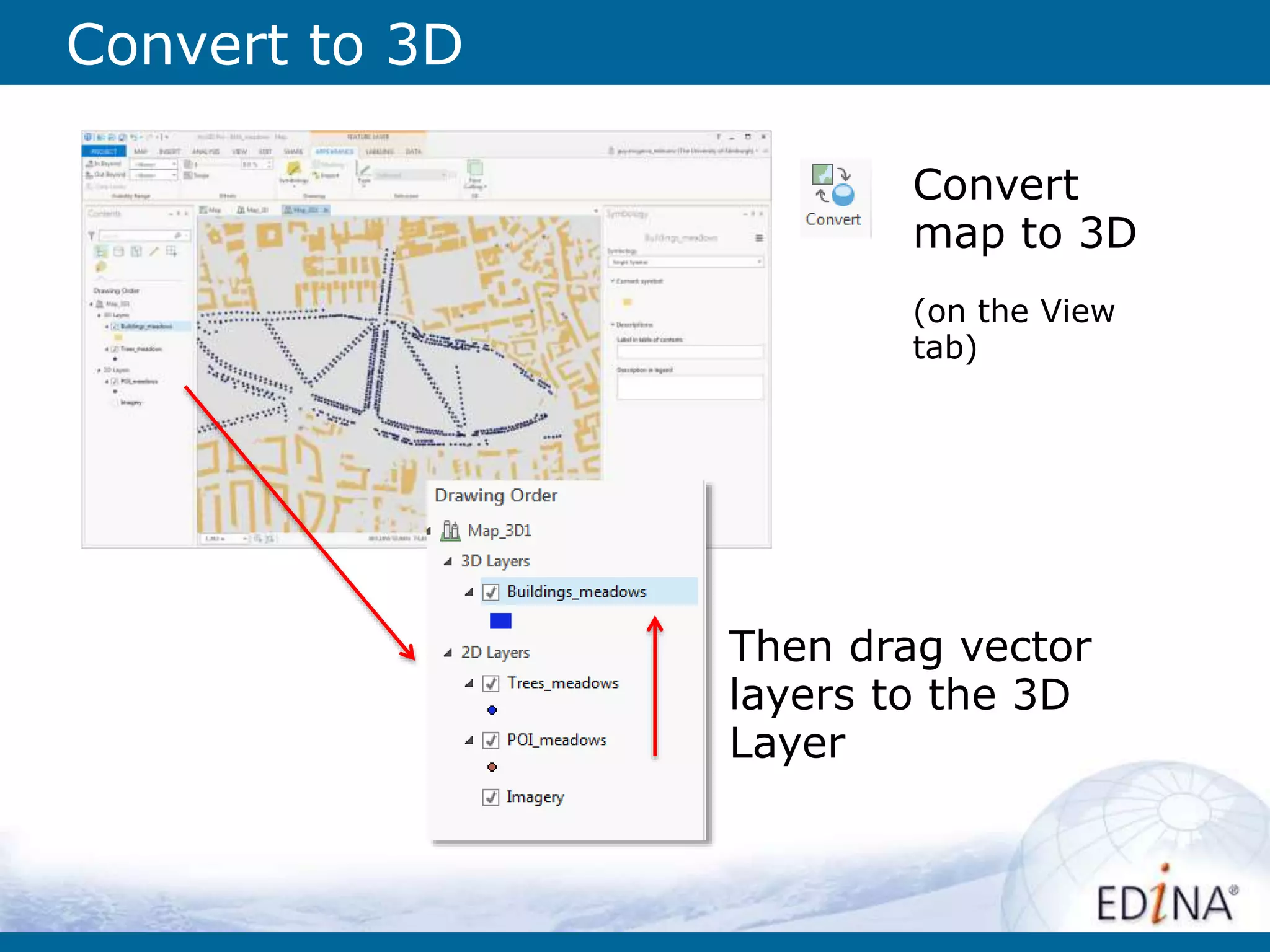
The document provides an overview of the Digimap service, which offers access to various mapping and data resources for UK higher education, including building height attributes (BHA) from the Ordnance Survey. It explains how to use these resources in ArcGIS Pro, including downloading data, converting maps to 3D, and visualizing building heights along with other geospatial data. Additionally, it highlights the support available through EDINA for users needing assistance with Digimap.


