Download to read offline


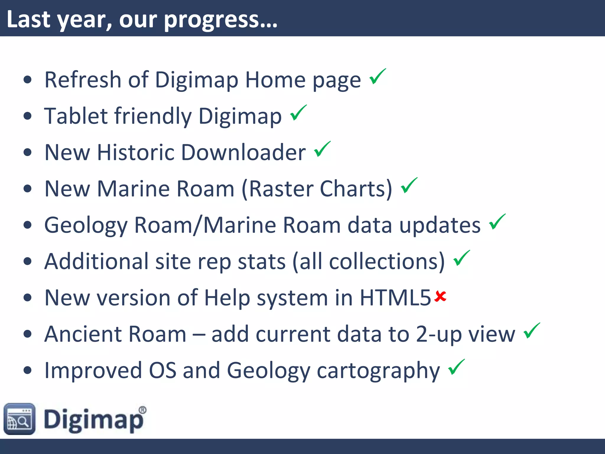
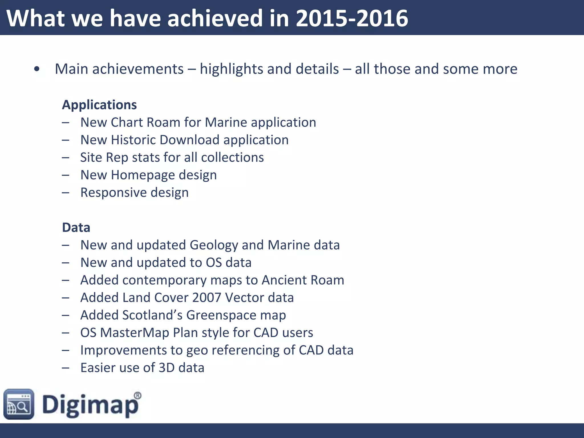


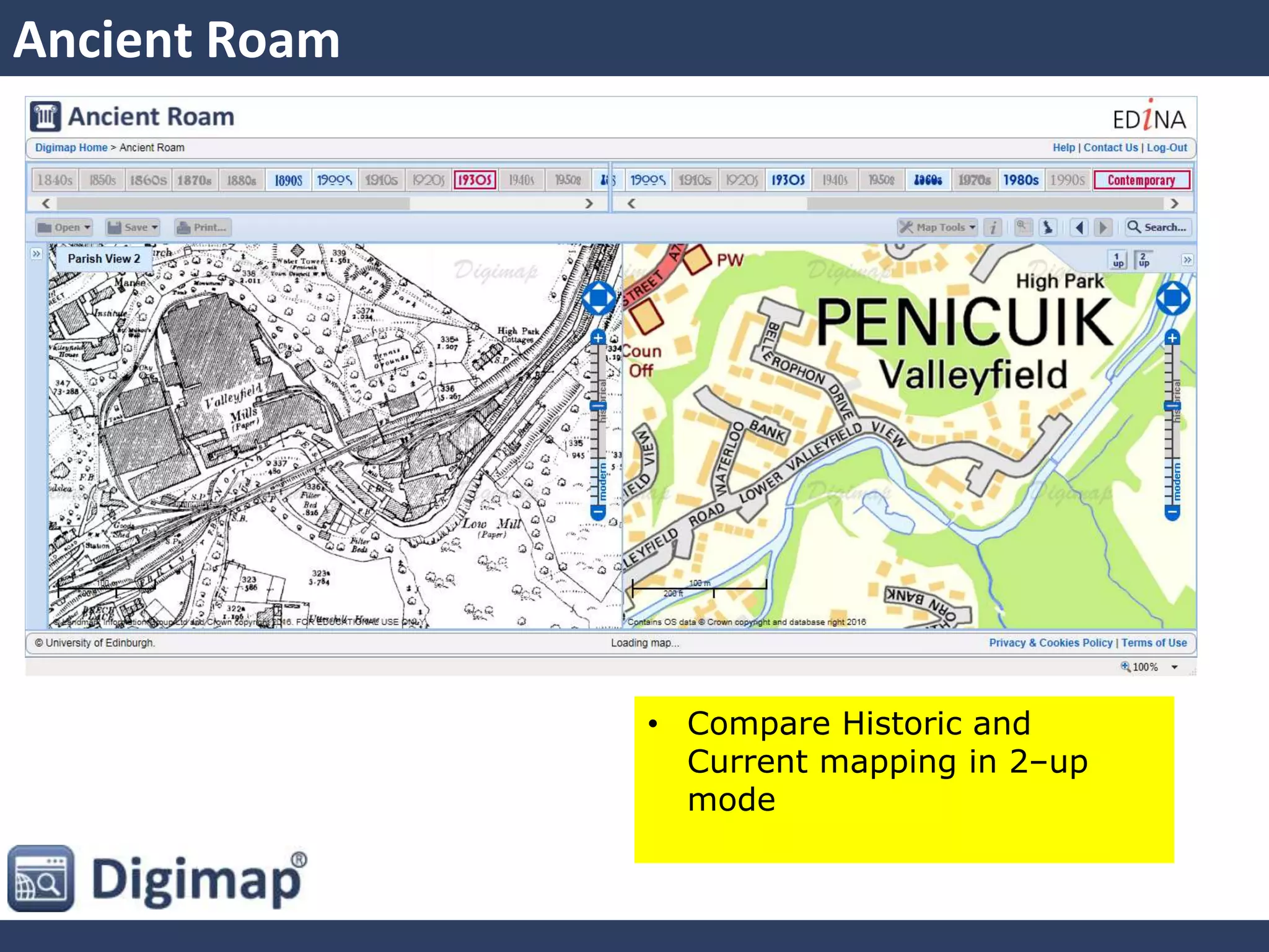
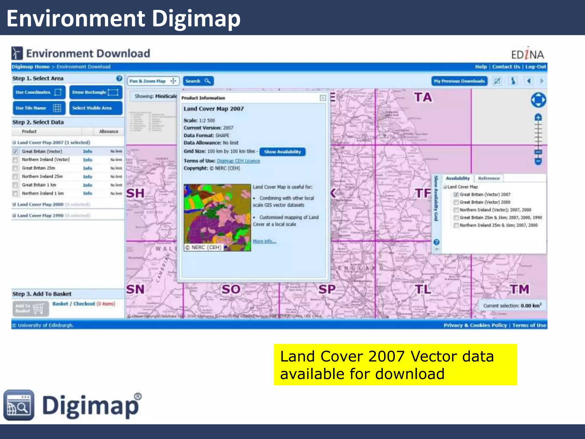

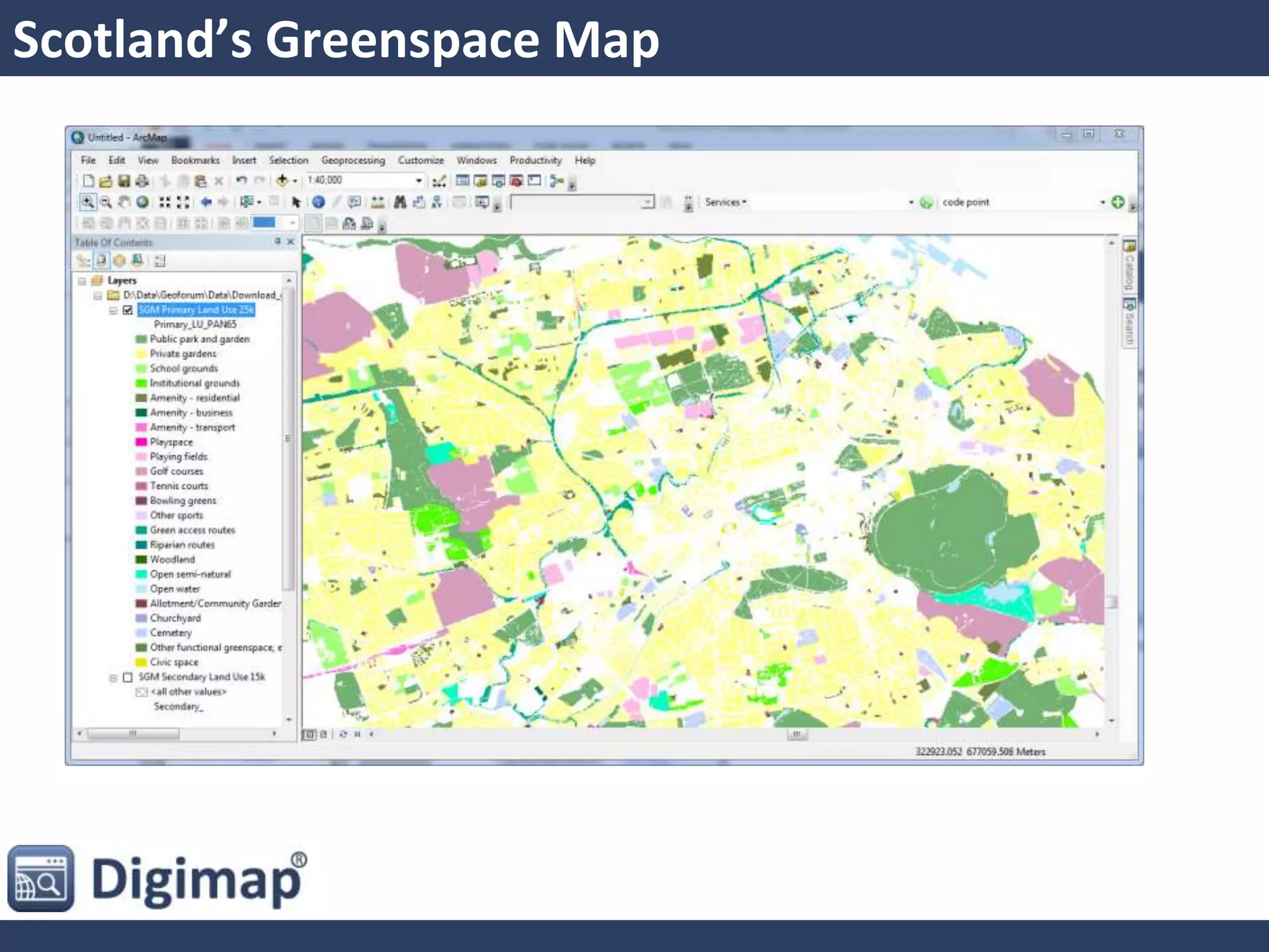
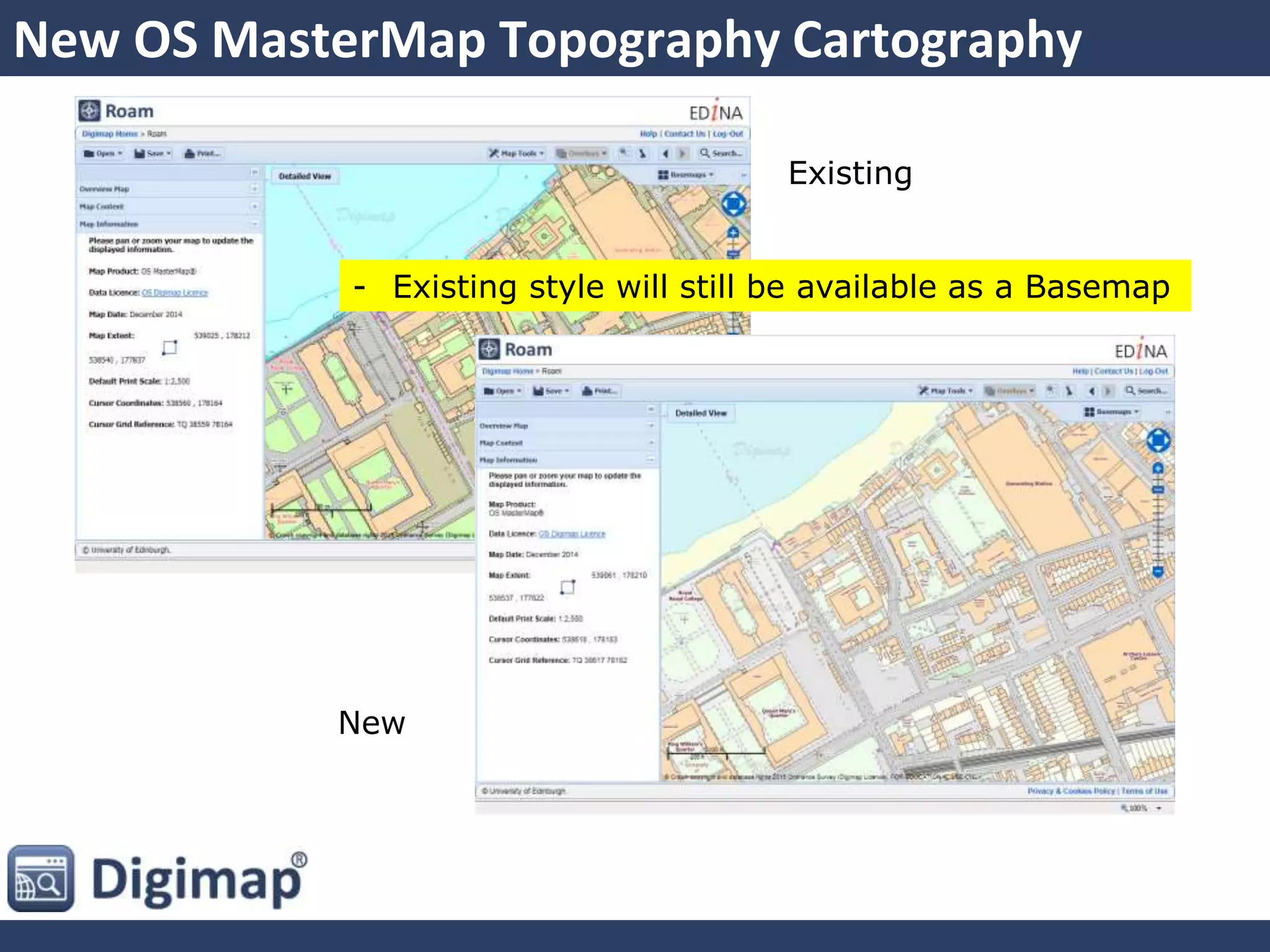


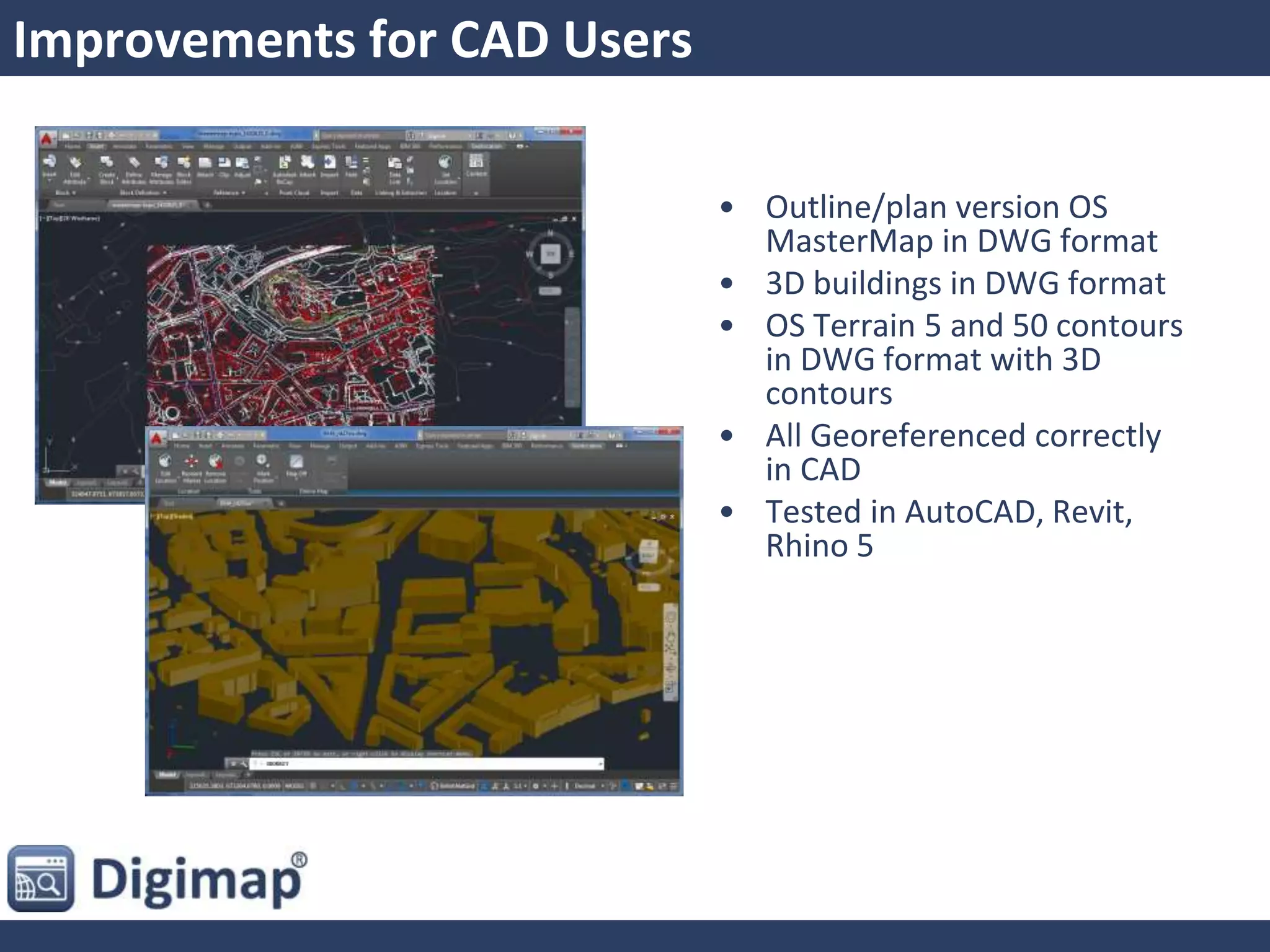


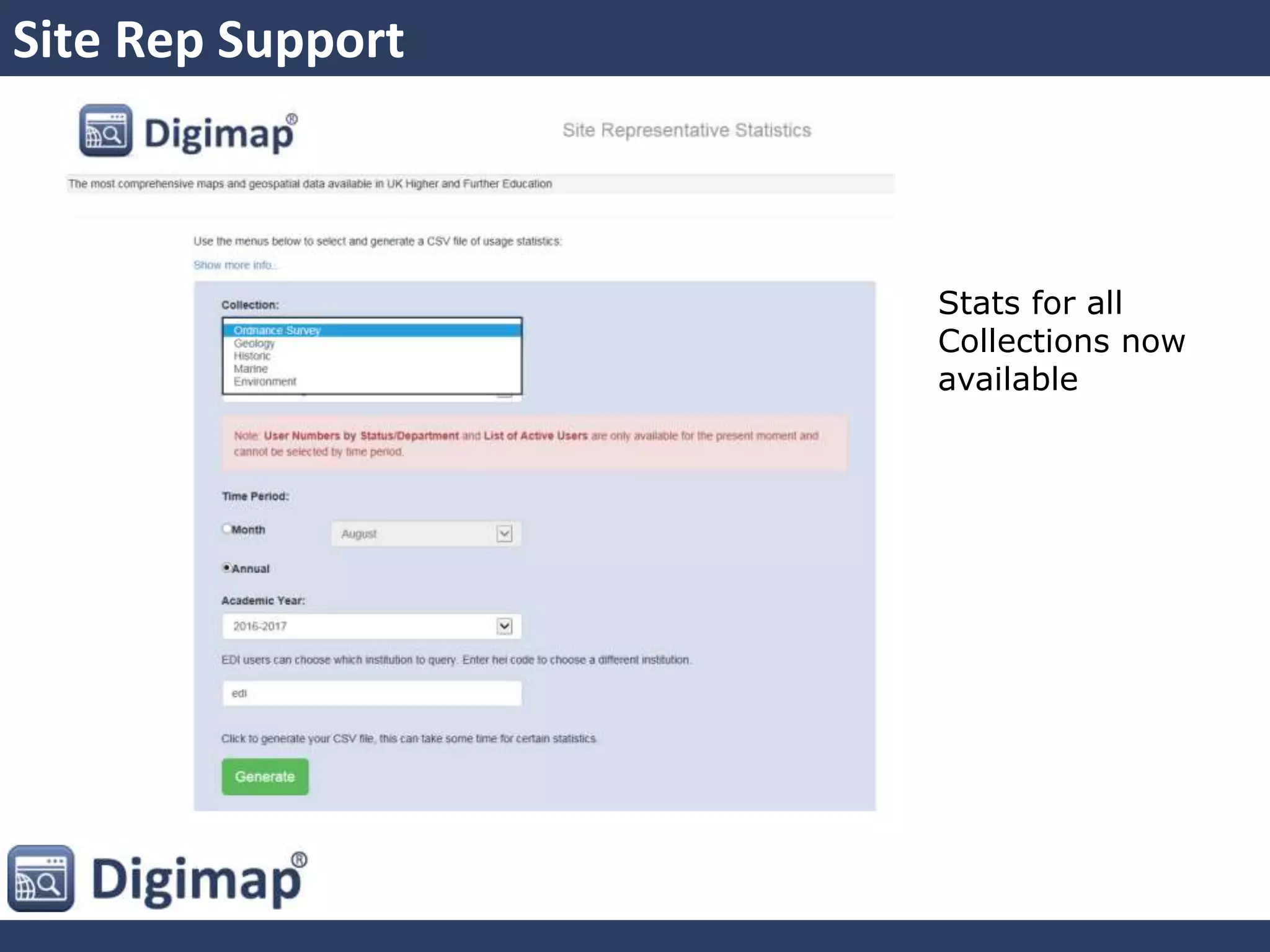
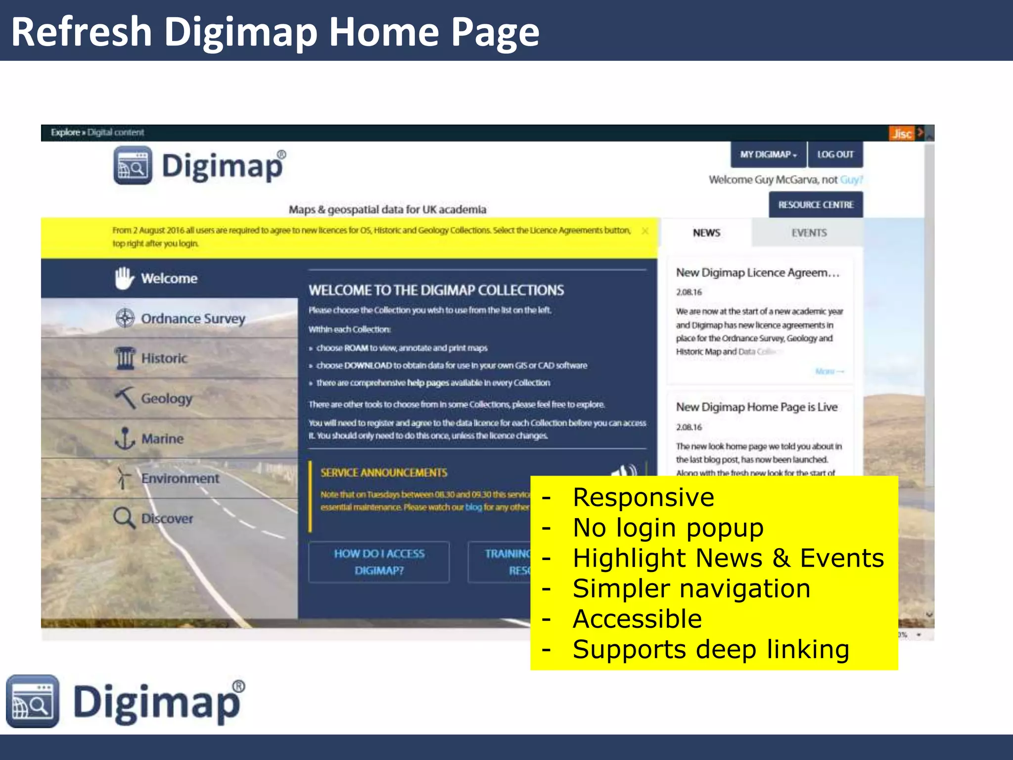


This document summarizes new and enhanced features in Digimap services from 2015-2016. Key updates include a refreshed homepage, responsive design for tablets, a new historic downloader application, marine chart roam with updated data, additions to ancient roam, land cover vector data, and improvements to geology, marine, and OS data. Usability and performance enhancements were also made, such as improved geo-referencing, easier use of 3D data, and a more reliable backend system. Feedback from users helped inform priority quality improvements.


