Download to read offline
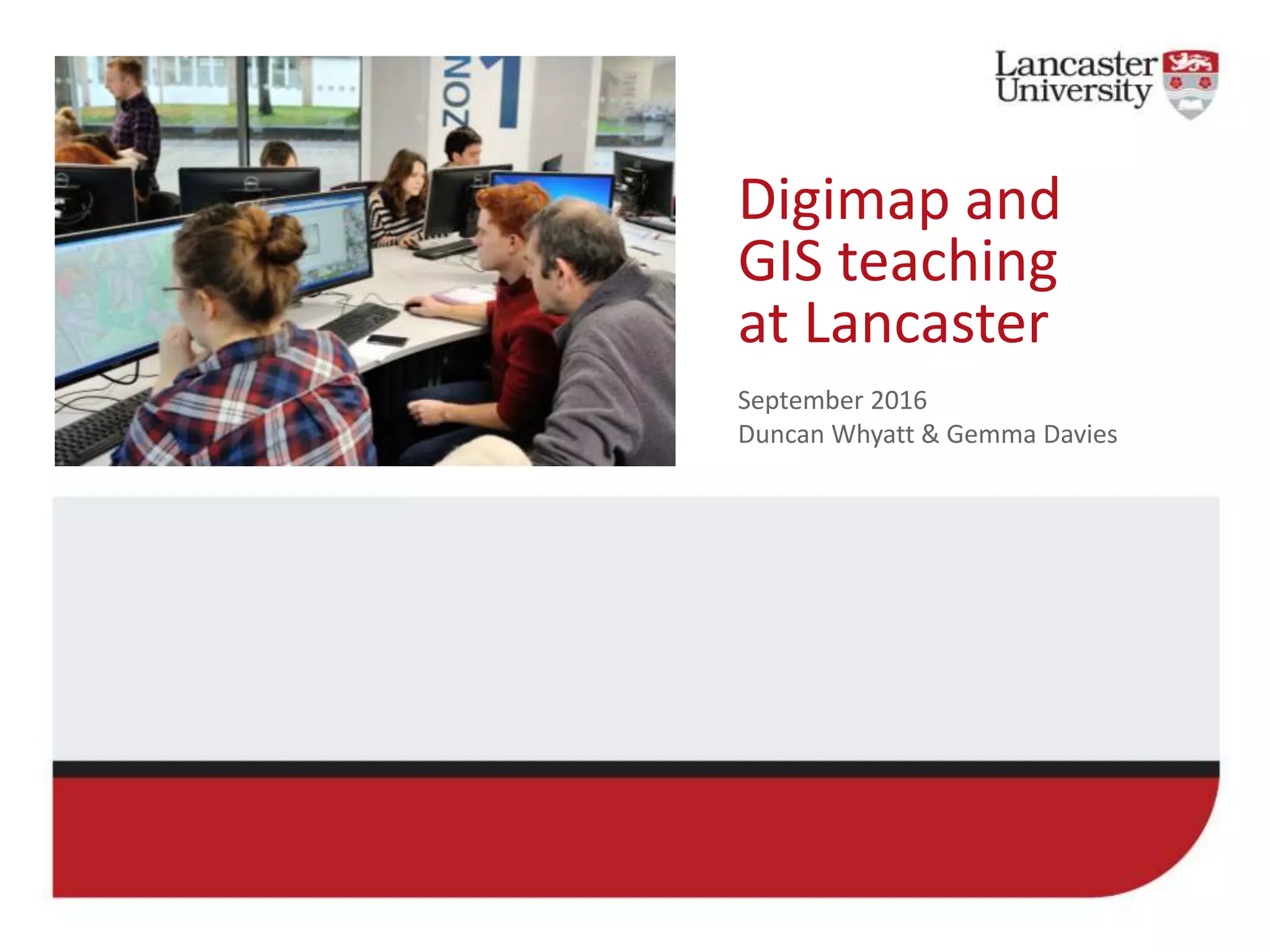
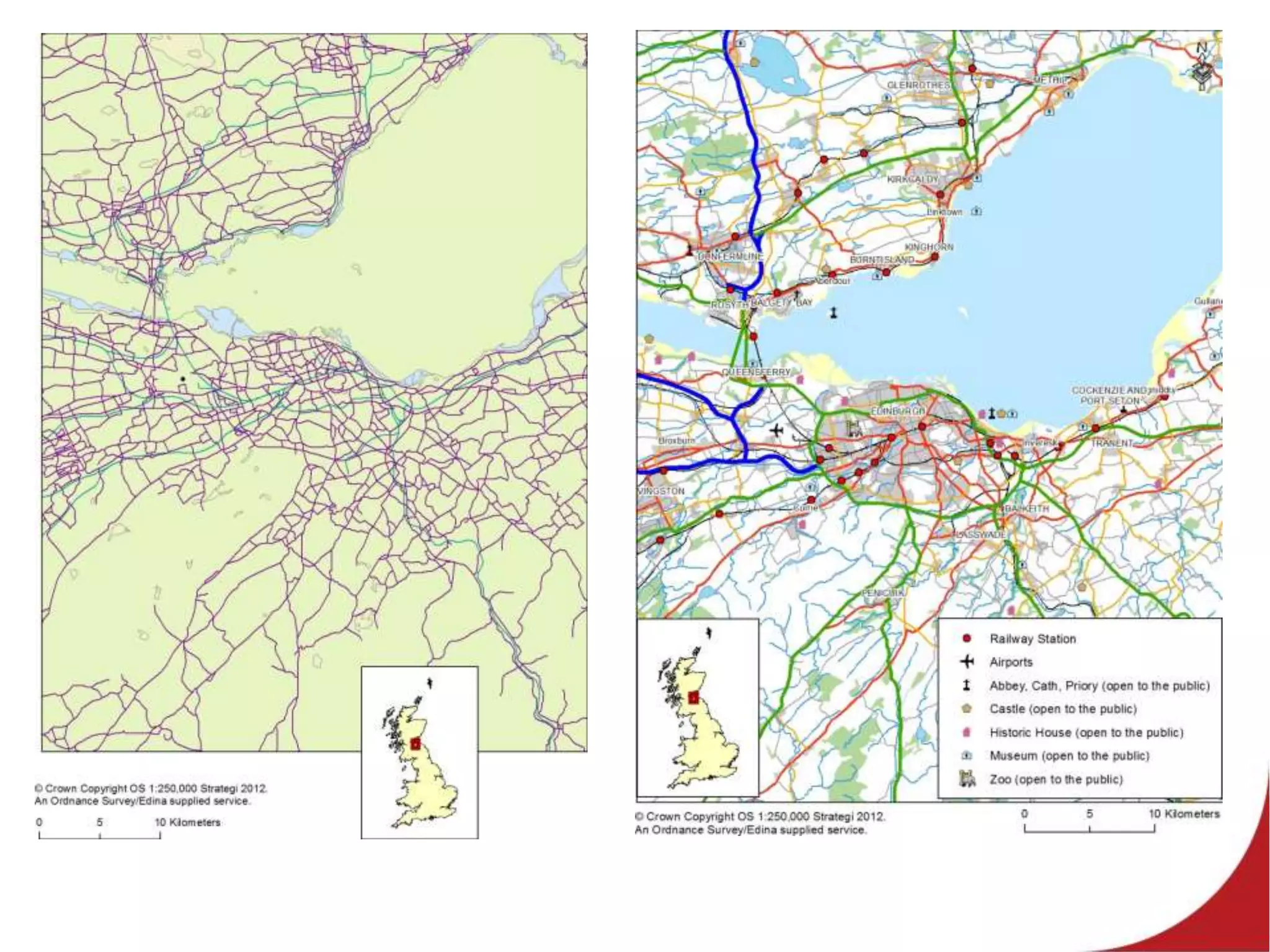
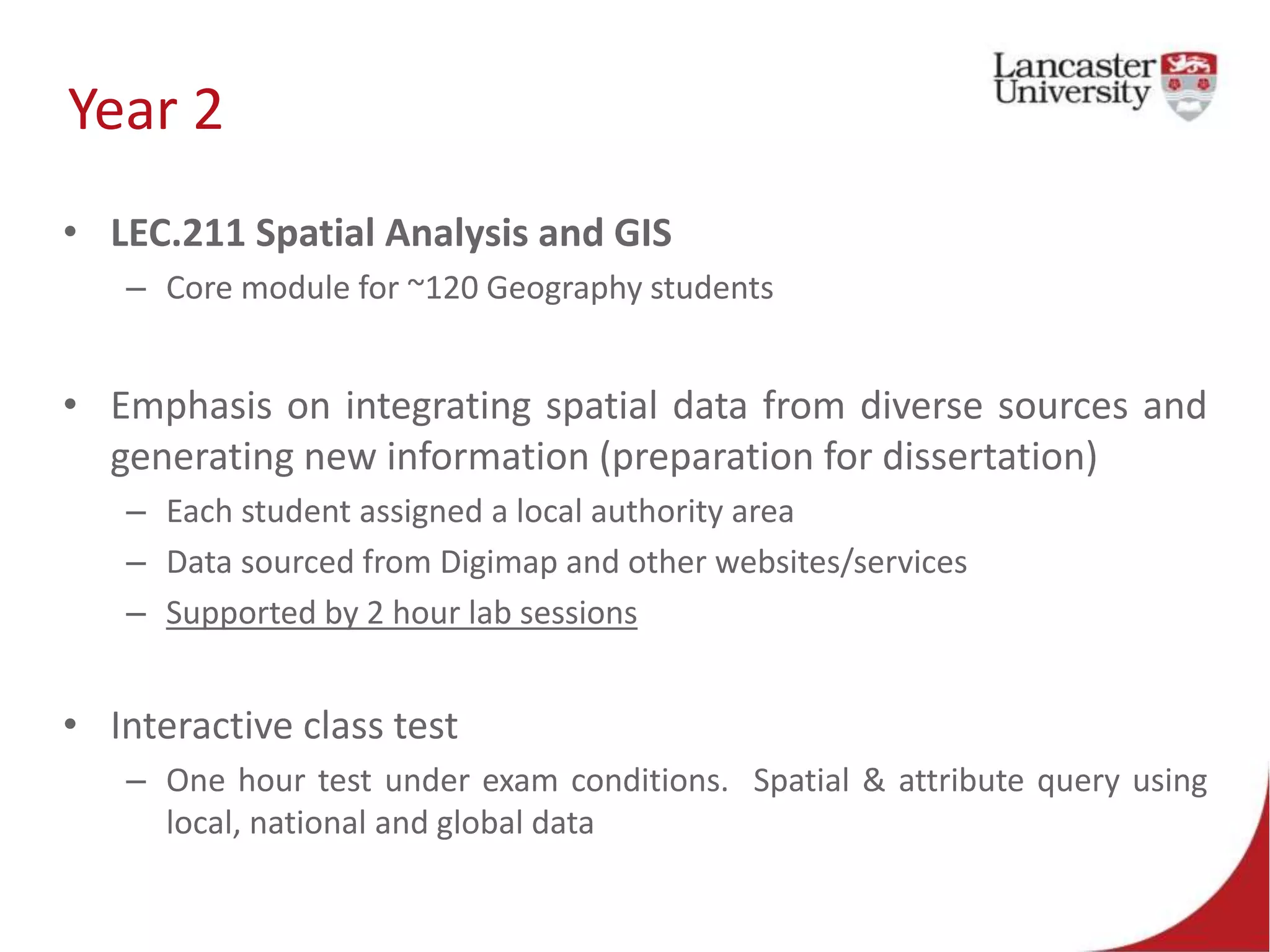
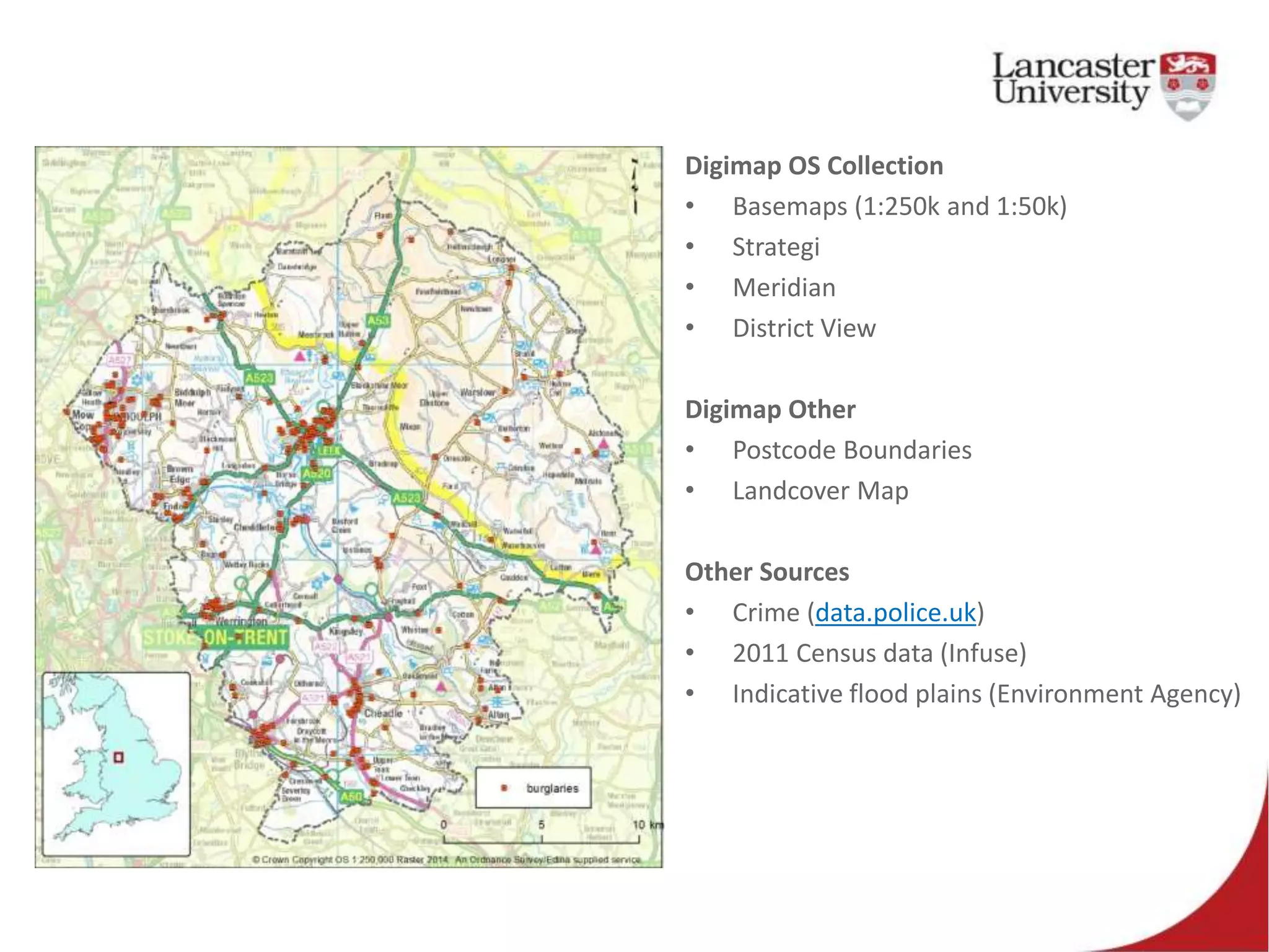
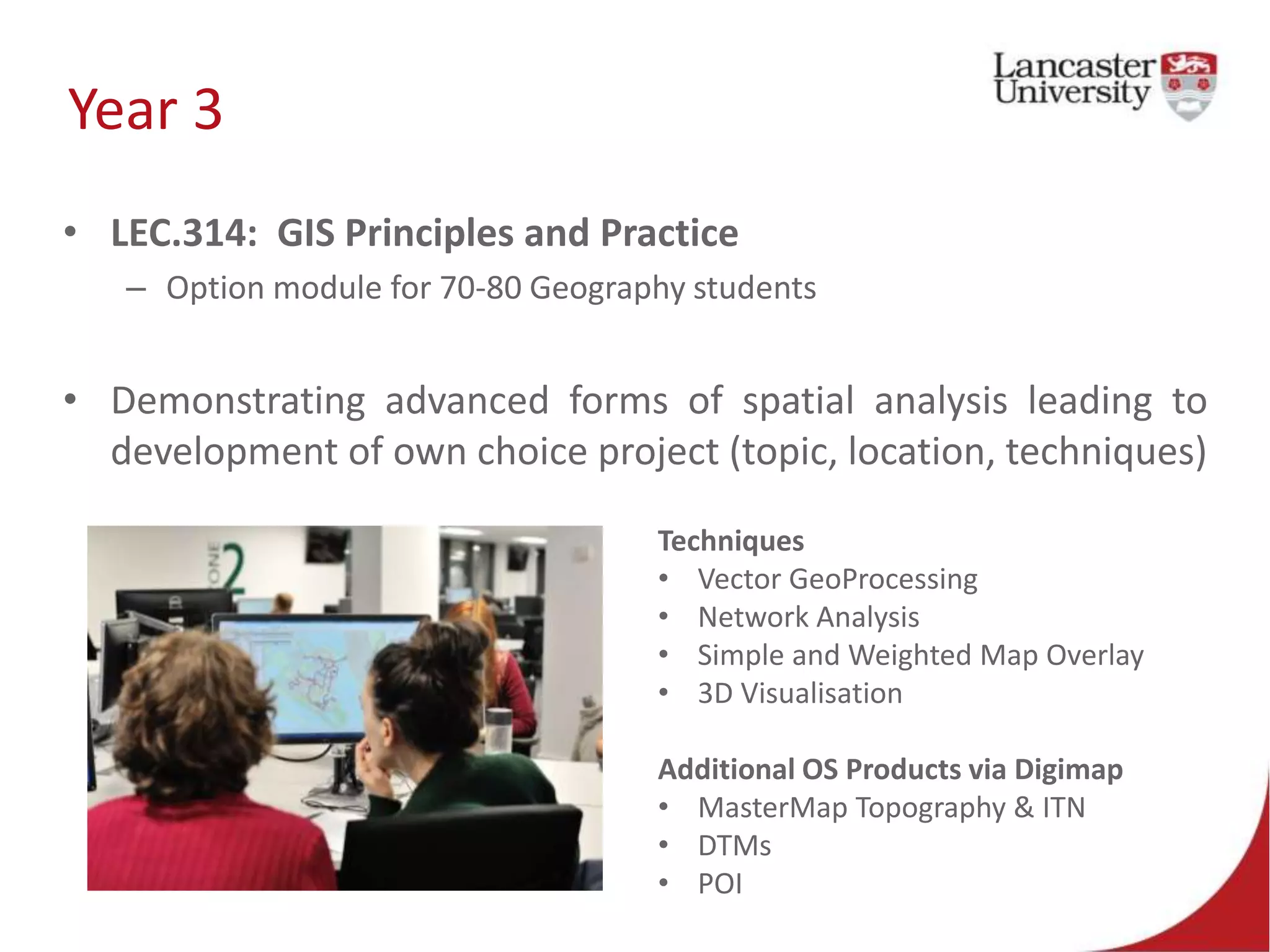
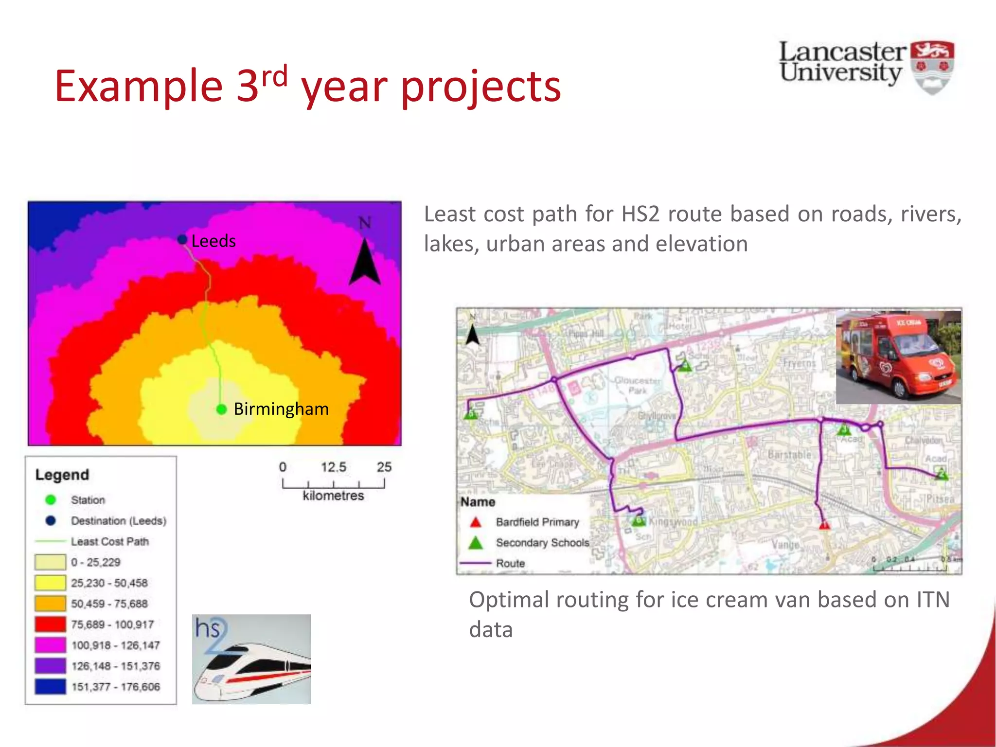
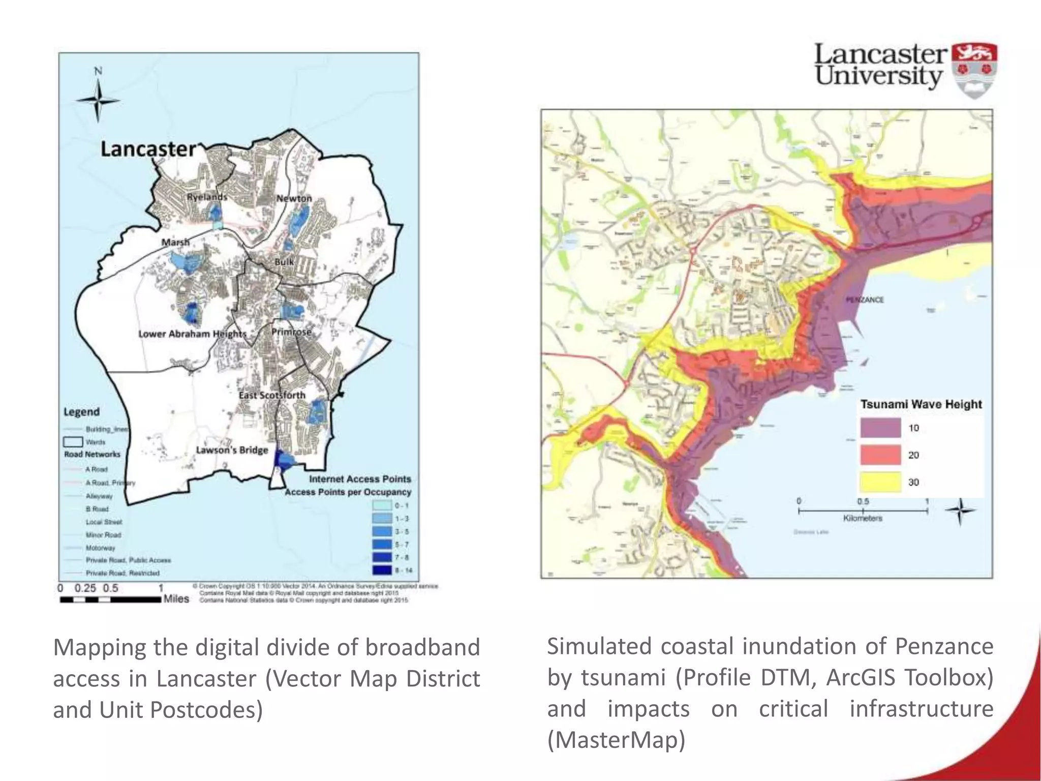

The document discusses the evolution of GIS and Digimap teaching at Lancaster University from 2001 to the present, highlighting the challenges and advancements in data access and usage. It outlines various courses offered to undergraduate students, incorporating diverse geospatial analysis techniques while emphasizing the integration of data from Digimap and other sources. The Digimap service has significantly supported GIS education for 15 years, yet the increasing availability of data from multiple sources presents a challenge to maintain its relevance.


