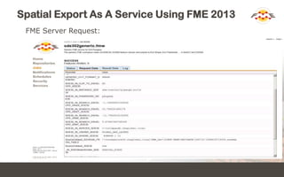
SlideShare a Scribd company logo
1 of 15
CONNECT. TRANSFORM. AUTOMATE.
Tor Nielsen, IHS
Spatial Export As A Service Using FME 2013
At IHS we have developed a Generalized Spatial Export
Service that allows end users to export spatial content
directly from an Esri ArcSDE database as if the Esri's
ArcGIS 10 Map Server were the data source.
Spatial Export As A Service Using FME 2013
ArcGIS 10.x map server root folder:
 INTL_BASINS
 INTL_CULTURE
 INTL_EP
 US_BASE
 Utility
Spatial Export As A Service Using FME 2013
The US_BASE map server folder:
 US_BASE/Production (MapServer)
 US_BASE/Well_Activity(MapServer)
 US_BASE/Well_Bore_Stick (MapServer)
 US_BASE/Well_Bottom_Hole (MapServer)
 US_BASE/Well_Surface (MapServer)
Spatial Export As A Service Using FME 2013
The US_BASE/Well_Activity map service:
Well Activity - Overview (0)
 Permits (Yesterday) (1)
 Permits (2 - 7 Days) (2)
 Permits (7 - 30 Days) (3)
 Permits (30 - 180 Days) (4)
 Permits - All Active (5)
 Abandoned Locations (6)
 Current Drilling (7)
 Completions - This Month (8)
 Activity - Last 6 months (9)
 Activity - All (10)
Well Activity - Detail (11)
 Permits (Yesterday) (12)
 Permits (2 - 7 Days) (13)
 Permits (7 - 30 Days) (14)
 Permits (30 - 180 Days) (15)
 Permits - All Active (16)
 Abandoned Locations (17)
 Current Drilling (18)
 Completions - This Month (19)
 Activity - Last 6 months (20)
 Activity - All (21)
Spatial Export As A Service Using FME 2013
WELL_ACTIVITY (feature class()
Spatial Export As A Service Using FME 2013
The reality:
 One ArcSDE feature class may feed one or many map services’ map
layers – all potentially different mainly as a consequence of having
different definition queries associated.
The requirements:
 Every single map layer in every single map service should be made
spatially exportable honoring its definition query e.g.
 Map layer #1: select * from <feature class> where flag = ‘red’
 Map layer #2: select * from <feature class> where flag = ‘green’
 Map layer #3: select * from <feature class> where flag = ‘blue’
 Etc.
 Not to utilize ArcGIS Sever in the solution
 Utilize FME 2013
Spatial Export As A Service Using FME 2013
IHS Spatial Export Service
Trusted Client (Enerdeq) Version
FME OUTPUT
FOLDER
FME Server
(unsecured)
IHS Browser
Applications
(secured access via AC)
Trusted client request
Email notifications
Spatial Output File(s)
IHS Spatial Data Store
SPATIAL EXPORT SERVICE
(unsecured request manager)
Request status of job
Spatial Export Request
Spatial Export
configuration
ArcGIS Server
(map service meta data)
layer definitions
including their defQrys
and application specific
attribute lists
June 11. 2013 - Tor Nielsen, IHS, Denver, CO
JOB STATUS SERVICE
FME request
GET FILE SERVICE
Spatial Export As A Service Using FME 2013
Configuration database (I):
Spatial Export As A Service Using FME 2013
Configuration database (II):
Spatial Export As A Service Using FME 2013
FME Workbench Document:
Spatial Export As A Service Using FME 2013
Spatial Export Request (REST post)
{
"RequestId":"icses-demo-0000011",
"UserName":"Tor.Nielsen@ihs.com",
"UserEmailAddress":"Tor.Nielsen@ihs.com",
"IhsApplication":"ENERDEQ",
"MapLayerId":"Enerdeq/EnerdeqLayers/MapServer/11",
"MapLayerDescription":"Well Activity",
"OutputObjectName":"WellActivity",
"ClipOption":"NO",
"OutputFormat":"GEODATABASE_FILE",
"OutputCoordinateSystemCode":"LL-WGS84",
"UserDefinitionQuery":"(act_code in ('A','B','E'))",
"EnvelopeMaxX" : "-70.0",
"EnvelopeMaxY" : "50.9",
"EnvelopeMinX" : "-140.9",
"EnvelopeMinY" : "25.1",
"SearchOrder":"ATTRIBUTE_FIRST"
}
Spatial Export As A Service Using FME 2013
FME Server Request:
Spatial Export As A Service Using FME 2013
Get results:
 http://v-vwc2tpanap16.ihsglobal.local/icsesFmeStatus/api/status?jobId=10
 http://v-vwc2spanap18.ihsglobal.local/icsesFmeGetFile/api/getfile?jobId=10
Thank You!
 Questions?
 For more information:
 Tor.Nielsen@ihs.com
 IHS – www.ihs.com

More Related Content

What's hot

The Many Uses of FME at PNM
The Many Uses of FME at PNMThe Many Uses of FME at PNM
The Many Uses of FME at PNMSafe Software
 
Km lconversionprograms
Km lconversionprogramsKm lconversionprograms
Km lconversionprogramsWilly Ortega
 
03 sajjad ali -qgis working with raster
03 sajjad ali -qgis working with raster03 sajjad ali -qgis working with raster
03 sajjad ali -qgis working with rasterTOUSEEF3347
 
Use FME To Efficiently Create National-Scale Vector Contours From High-Resolu...
Use FME To Efficiently Create National-Scale Vector Contours From High-Resolu...Use FME To Efficiently Create National-Scale Vector Contours From High-Resolu...
Use FME To Efficiently Create National-Scale Vector Contours From High-Resolu...Safe Software
 
2013 Mission First Track, Dominating the High Ground - A Spatial Odyssey by R...
2013 Mission First Track, Dominating the High Ground - A Spatial Odyssey by R...2013 Mission First Track, Dominating the High Ground - A Spatial Odyssey by R...
2013 Mission First Track, Dominating the High Ground - A Spatial Odyssey by R...GIS in the Rockies
 
Using network segments in the spatial representation of travel time isochrones
Using network segments in the spatial representation of travel time isochronesUsing network segments in the spatial representation of travel time isochrones
Using network segments in the spatial representation of travel time isochronesnacis_slides
 
ArcGIS Extensions
ArcGIS ExtensionsArcGIS Extensions
ArcGIS ExtensionsEsri
 
Thompson & Alexander Dock Survey
Thompson & Alexander Dock SurveyThompson & Alexander Dock Survey
Thompson & Alexander Dock SurveyCiara MacManus
 
Real Property Management at DND using FME
Real Property Management at DND using FMEReal Property Management at DND using FME
Real Property Management at DND using FMESafe Software
 
Ronalao termpresent
Ronalao termpresentRonalao termpresent
Ronalao termpresentElma Belitz
 
Introduction to fusion tables2
Introduction to fusion tables2Introduction to fusion tables2
Introduction to fusion tables2dfggis
 
FME Spatial Querying in a CAD-Driven GIS
FME Spatial Querying in a CAD-Driven GISFME Spatial Querying in a CAD-Driven GIS
FME Spatial Querying in a CAD-Driven GISSafe Software
 
City of Roseville Case Study
City of Roseville Case StudyCity of Roseville Case Study
City of Roseville Case Studyjeffhobbs
 
MCE GeoProcessing Services for ADM(IE): Self Validation of Spatial Data Input...
MCE GeoProcessing Services for ADM(IE): Self Validation of Spatial Data Input...MCE GeoProcessing Services for ADM(IE): Self Validation of Spatial Data Input...
MCE GeoProcessing Services for ADM(IE): Self Validation of Spatial Data Input...Safe Software
 
Integrating CAD and GIS Data at Mineta San Jose International Airport
Integrating CAD and GIS Data at Mineta San Jose International AirportIntegrating CAD and GIS Data at Mineta San Jose International Airport
Integrating CAD and GIS Data at Mineta San Jose International Airportjeffhobbs
 
An End User Perspective on Implementing Oracle in the Engineering Environment
An End User Perspective on Implementing Oracle in the Engineering EnvironmentAn End User Perspective on Implementing Oracle in the Engineering Environment
An End User Perspective on Implementing Oracle in the Engineering Environmentjeffhobbs
 
Esriuk_track8_edinburgh_arc_gis_pro
Esriuk_track8_edinburgh_arc_gis_proEsriuk_track8_edinburgh_arc_gis_pro
Esriuk_track8_edinburgh_arc_gis_proEsri UK
 

What's hot (20)

The Many Uses of FME at PNM
The Many Uses of FME at PNMThe Many Uses of FME at PNM
The Many Uses of FME at PNM
 
Km lconversionprograms
Km lconversionprogramsKm lconversionprograms
Km lconversionprograms
 
03 sajjad ali -qgis working with raster
03 sajjad ali -qgis working with raster03 sajjad ali -qgis working with raster
03 sajjad ali -qgis working with raster
 
Use FME To Efficiently Create National-Scale Vector Contours From High-Resolu...
Use FME To Efficiently Create National-Scale Vector Contours From High-Resolu...Use FME To Efficiently Create National-Scale Vector Contours From High-Resolu...
Use FME To Efficiently Create National-Scale Vector Contours From High-Resolu...
 
2013 Mission First Track, Dominating the High Ground - A Spatial Odyssey by R...
2013 Mission First Track, Dominating the High Ground - A Spatial Odyssey by R...2013 Mission First Track, Dominating the High Ground - A Spatial Odyssey by R...
2013 Mission First Track, Dominating the High Ground - A Spatial Odyssey by R...
 
Using network segments in the spatial representation of travel time isochrones
Using network segments in the spatial representation of travel time isochronesUsing network segments in the spatial representation of travel time isochrones
Using network segments in the spatial representation of travel time isochrones
 
ArcGIS Extensions
ArcGIS ExtensionsArcGIS Extensions
ArcGIS Extensions
 
Thompson & Alexander Dock Survey
Thompson & Alexander Dock SurveyThompson & Alexander Dock Survey
Thompson & Alexander Dock Survey
 
Real Property Management at DND using FME
Real Property Management at DND using FMEReal Property Management at DND using FME
Real Property Management at DND using FME
 
Map Reduce
Map ReduceMap Reduce
Map Reduce
 
Ronalao termpresent
Ronalao termpresentRonalao termpresent
Ronalao termpresent
 
Introduction to fusion tables2
Introduction to fusion tables2Introduction to fusion tables2
Introduction to fusion tables2
 
FME Spatial Querying in a CAD-Driven GIS
FME Spatial Querying in a CAD-Driven GISFME Spatial Querying in a CAD-Driven GIS
FME Spatial Querying in a CAD-Driven GIS
 
HDF-EOS Development Status and Maintenance Support
HDF-EOS Development Status and Maintenance SupportHDF-EOS Development Status and Maintenance Support
HDF-EOS Development Status and Maintenance Support
 
City of Roseville Case Study
City of Roseville Case StudyCity of Roseville Case Study
City of Roseville Case Study
 
MCE GeoProcessing Services for ADM(IE): Self Validation of Spatial Data Input...
MCE GeoProcessing Services for ADM(IE): Self Validation of Spatial Data Input...MCE GeoProcessing Services for ADM(IE): Self Validation of Spatial Data Input...
MCE GeoProcessing Services for ADM(IE): Self Validation of Spatial Data Input...
 
Integrating CAD and GIS Data at Mineta San Jose International Airport
Integrating CAD and GIS Data at Mineta San Jose International AirportIntegrating CAD and GIS Data at Mineta San Jose International Airport
Integrating CAD and GIS Data at Mineta San Jose International Airport
 
An End User Perspective on Implementing Oracle in the Engineering Environment
An End User Perspective on Implementing Oracle in the Engineering EnvironmentAn End User Perspective on Implementing Oracle in the Engineering Environment
An End User Perspective on Implementing Oracle in the Engineering Environment
 
Esriuk_track8_edinburgh_arc_gis_pro
Esriuk_track8_edinburgh_arc_gis_proEsriuk_track8_edinburgh_arc_gis_pro
Esriuk_track8_edinburgh_arc_gis_pro
 
Global mapper
Global mapperGlobal mapper
Global mapper
 

Similar to FME 2013 Based Spatial Export As A Service

Reporting Summary Information of Spatial Datasets and Non-Compliance Issues U...
Reporting Summary Information of Spatial Datasets and Non-Compliance Issues U...Reporting Summary Information of Spatial Datasets and Non-Compliance Issues U...
Reporting Summary Information of Spatial Datasets and Non-Compliance Issues U...Safe Software
 
Arcgis server-functionality-matrix
Arcgis server-functionality-matrixArcgis server-functionality-matrix
Arcgis server-functionality-matrixEsri
 
ArcGIS 10.2 for Server Functionality Matrix
ArcGIS 10.2 for Server Functionality MatrixArcGIS 10.2 for Server Functionality Matrix
ArcGIS 10.2 for Server Functionality MatrixEsri
 
dokumen.tips_mapinfo-training-slides190807.ppt
dokumen.tips_mapinfo-training-slides190807.pptdokumen.tips_mapinfo-training-slides190807.ppt
dokumen.tips_mapinfo-training-slides190807.pptJooJnior72
 
232422261 mapinfo-training-slides-190807
232422261 mapinfo-training-slides-190807232422261 mapinfo-training-slides-190807
232422261 mapinfo-training-slides-190807Arwan Priatna
 
FME = Features Made Easy
FME = Features Made EasyFME = Features Made Easy
FME = Features Made EasySafe Software
 
Infor eam v11.3 gis integratie (6 juni 2017)
Infor eam v11.3   gis integratie (6 juni 2017)Infor eam v11.3   gis integratie (6 juni 2017)
Infor eam v11.3 gis integratie (6 juni 2017)Dazler Consultancy
 
Overview of MassGIS Web Mapping Services
Overview of MassGIS Web Mapping ServicesOverview of MassGIS Web Mapping Services
Overview of MassGIS Web Mapping Servicesaleda_freeman
 
GIS software
GIS softwareGIS software
GIS softwareSwetha A
 
Introduction toarcgis editorforosm
Introduction toarcgis editorforosmIntroduction toarcgis editorforosm
Introduction toarcgis editorforosmTaichi Furuhashi
 
Concepts and Methods of Embedding Statistical Data into Maps
Concepts and Methods of Embedding Statistical Data into MapsConcepts and Methods of Embedding Statistical Data into Maps
Concepts and Methods of Embedding Statistical Data into MapsMohammad Liton Hossain
 
ArcGIS 10.1 for Server Functionality Matrix
ArcGIS 10.1 for Server Functionality MatrixArcGIS 10.1 for Server Functionality Matrix
ArcGIS 10.1 for Server Functionality MatrixEsri
 
IntraMaps - User Group - November 2010 - Hansen Integration
IntraMaps - User Group - November 2010 - Hansen IntegrationIntraMaps - User Group - November 2010 - Hansen Integration
IntraMaps - User Group - November 2010 - Hansen IntegrationDavid Hair
 
Strategies for Integrating Utility System Operational Data into ArcGIS Server...
Strategies for Integrating Utility System Operational Data into ArcGIS Server...Strategies for Integrating Utility System Operational Data into ArcGIS Server...
Strategies for Integrating Utility System Operational Data into ArcGIS Server...True North Geographic Technologies
 
ESRI EUC 2007 - Web-based Water Information System Using GIS in Turkey
ESRI EUC 2007 - Web-based Water Information System Using GIS in TurkeyESRI EUC 2007 - Web-based Water Information System Using GIS in Turkey
ESRI EUC 2007 - Web-based Water Information System Using GIS in Turkeymetalalp
 
What's Coming At ArcGIS 10.1 - CSRA GIS User Group Meeting
What's Coming At ArcGIS 10.1 - CSRA GIS User Group MeetingWhat's Coming At ArcGIS 10.1 - CSRA GIS User Group Meeting
What's Coming At ArcGIS 10.1 - CSRA GIS User Group MeetingJim Tochterman
 

Similar to FME 2013 Based Spatial Export As A Service (20)

Reporting Summary Information of Spatial Datasets and Non-Compliance Issues U...
Reporting Summary Information of Spatial Datasets and Non-Compliance Issues U...Reporting Summary Information of Spatial Datasets and Non-Compliance Issues U...
Reporting Summary Information of Spatial Datasets and Non-Compliance Issues U...
 
Arcgis server-functionality-matrix
Arcgis server-functionality-matrixArcgis server-functionality-matrix
Arcgis server-functionality-matrix
 
ArcGIS 10.2 for Server Functionality Matrix
ArcGIS 10.2 for Server Functionality MatrixArcGIS 10.2 for Server Functionality Matrix
ArcGIS 10.2 for Server Functionality Matrix
 
dokumen.tips_mapinfo-training-slides190807.ppt
dokumen.tips_mapinfo-training-slides190807.pptdokumen.tips_mapinfo-training-slides190807.ppt
dokumen.tips_mapinfo-training-slides190807.ppt
 
232422261 mapinfo-training-slides-190807
232422261 mapinfo-training-slides-190807232422261 mapinfo-training-slides-190807
232422261 mapinfo-training-slides-190807
 
FME = Features Made Easy
FME = Features Made EasyFME = Features Made Easy
FME = Features Made Easy
 
Infor eam v11.3 gis integratie (6 juni 2017)
Infor eam v11.3   gis integratie (6 juni 2017)Infor eam v11.3   gis integratie (6 juni 2017)
Infor eam v11.3 gis integratie (6 juni 2017)
 
Overview of MassGIS Web Mapping Services
Overview of MassGIS Web Mapping ServicesOverview of MassGIS Web Mapping Services
Overview of MassGIS Web Mapping Services
 
GIS software
GIS softwareGIS software
GIS software
 
Curriculum_Vitae
Curriculum_VitaeCurriculum_Vitae
Curriculum_Vitae
 
Introduction toarcgis editorforosm
Introduction toarcgis editorforosmIntroduction toarcgis editorforosm
Introduction toarcgis editorforosm
 
Concepts and Methods of Embedding Statistical Data into Maps
Concepts and Methods of Embedding Statistical Data into MapsConcepts and Methods of Embedding Statistical Data into Maps
Concepts and Methods of Embedding Statistical Data into Maps
 
ArcGIS 10.1 for Server Functionality Matrix
ArcGIS 10.1 for Server Functionality MatrixArcGIS 10.1 for Server Functionality Matrix
ArcGIS 10.1 for Server Functionality Matrix
 
QGIS training class 1
QGIS training class 1QGIS training class 1
QGIS training class 1
 
IntraMaps - User Group - November 2010 - Hansen Integration
IntraMaps - User Group - November 2010 - Hansen IntegrationIntraMaps - User Group - November 2010 - Hansen Integration
IntraMaps - User Group - November 2010 - Hansen Integration
 
Strategies for Integrating Utility System Operational Data into ArcGIS Server...
Strategies for Integrating Utility System Operational Data into ArcGIS Server...Strategies for Integrating Utility System Operational Data into ArcGIS Server...
Strategies for Integrating Utility System Operational Data into ArcGIS Server...
 
Collector for ArcGIS
Collector for ArcGISCollector for ArcGIS
Collector for ArcGIS
 
ESRI EUC 2007 - Web-based Water Information System Using GIS in Turkey
ESRI EUC 2007 - Web-based Water Information System Using GIS in TurkeyESRI EUC 2007 - Web-based Water Information System Using GIS in Turkey
ESRI EUC 2007 - Web-based Water Information System Using GIS in Turkey
 
What's Coming At ArcGIS 10.1 - CSRA GIS User Group Meeting
What's Coming At ArcGIS 10.1 - CSRA GIS User Group MeetingWhat's Coming At ArcGIS 10.1 - CSRA GIS User Group Meeting
What's Coming At ArcGIS 10.1 - CSRA GIS User Group Meeting
 
Phnom penh mapping meetup #15
Phnom penh mapping meetup #15Phnom penh mapping meetup #15
Phnom penh mapping meetup #15
 

More from Safe Software

Cloud Frontiers: A Deep Dive into Serverless Spatial Data and FME
Cloud Frontiers:  A Deep Dive into Serverless Spatial Data and FMECloud Frontiers:  A Deep Dive into Serverless Spatial Data and FME
Cloud Frontiers: A Deep Dive into Serverless Spatial Data and FMESafe Software
 
Cloud Frontiers: A Deep Dive into Serverless Spatial Data and FME
Cloud Frontiers:  A Deep Dive into Serverless Spatial Data and FMECloud Frontiers:  A Deep Dive into Serverless Spatial Data and FME
Cloud Frontiers: A Deep Dive into Serverless Spatial Data and FMESafe Software
 
From Event to Action: Accelerate Your Decision Making with Real-Time Automation
From Event to Action: Accelerate Your Decision Making with Real-Time AutomationFrom Event to Action: Accelerate Your Decision Making with Real-Time Automation
From Event to Action: Accelerate Your Decision Making with Real-Time AutomationSafe Software
 
From Event to Action: Accelerate Your Decision Making with Real-Time Automation
From Event to Action:  Accelerate Your Decision Making with Real-Time AutomationFrom Event to Action:  Accelerate Your Decision Making with Real-Time Automation
From Event to Action: Accelerate Your Decision Making with Real-Time AutomationSafe Software
 
Beyond Boundaries: Leveraging No-Code Solutions for Industry Innovation
Beyond Boundaries: Leveraging No-Code Solutions for Industry InnovationBeyond Boundaries: Leveraging No-Code Solutions for Industry Innovation
Beyond Boundaries: Leveraging No-Code Solutions for Industry InnovationSafe Software
 
Powering Real-Time Decisions with Continuous Data Streams
Powering Real-Time Decisions with Continuous Data StreamsPowering Real-Time Decisions with Continuous Data Streams
Powering Real-Time Decisions with Continuous Data StreamsSafe Software
 
The Critical Role of Spatial Data in Today's Data Ecosystem
The Critical Role of Spatial Data in Today's Data EcosystemThe Critical Role of Spatial Data in Today's Data Ecosystem
The Critical Role of Spatial Data in Today's Data EcosystemSafe Software
 
Cloud Revolution: Exploring the New Wave of Serverless Spatial Data
Cloud Revolution: Exploring the New Wave of Serverless Spatial DataCloud Revolution: Exploring the New Wave of Serverless Spatial Data
Cloud Revolution: Exploring the New Wave of Serverless Spatial DataSafe Software
 
Igniting Next Level Productivity with AI-Infused Data Integration Workflows
Igniting Next Level Productivity with AI-Infused Data Integration WorkflowsIgniting Next Level Productivity with AI-Infused Data Integration Workflows
Igniting Next Level Productivity with AI-Infused Data Integration WorkflowsSafe Software
 
The Zero-ETL Approach: Enhancing Data Agility and Insight
The Zero-ETL Approach: Enhancing Data Agility and InsightThe Zero-ETL Approach: Enhancing Data Agility and Insight
The Zero-ETL Approach: Enhancing Data Agility and InsightSafe Software
 
Mastering MicroStation DGN: How to Integrate CAD and GIS
Mastering MicroStation DGN: How to Integrate CAD and GISMastering MicroStation DGN: How to Integrate CAD and GIS
Mastering MicroStation DGN: How to Integrate CAD and GISSafe Software
 
Geospatial Synergy: Amplifying Efficiency with FME & Esri
Geospatial Synergy: Amplifying Efficiency with FME & EsriGeospatial Synergy: Amplifying Efficiency with FME & Esri
Geospatial Synergy: Amplifying Efficiency with FME & EsriSafe Software
 
Introducing the New FME Community Webinar - Feb 21, 2024 (2).pdf
Introducing the New FME Community Webinar - Feb 21, 2024 (2).pdfIntroducing the New FME Community Webinar - Feb 21, 2024 (2).pdf
Introducing the New FME Community Webinar - Feb 21, 2024 (2).pdfSafe Software
 
Breaking Barriers & Leveraging the Latest Developments in AI Technology
Breaking Barriers & Leveraging the Latest Developments in AI TechnologyBreaking Barriers & Leveraging the Latest Developments in AI Technology
Breaking Barriers & Leveraging the Latest Developments in AI TechnologySafe Software
 
Best Practices to Navigating Data and Application Integration for the Enterpr...
Best Practices to Navigating Data and Application Integration for the Enterpr...Best Practices to Navigating Data and Application Integration for the Enterpr...
Best Practices to Navigating Data and Application Integration for the Enterpr...Safe Software
 
Cloud Revolution: Exploring the New Wave of Serverless Spatial Data
Cloud Revolution: Exploring the New Wave of Serverless Spatial DataCloud Revolution: Exploring the New Wave of Serverless Spatial Data
Cloud Revolution: Exploring the New Wave of Serverless Spatial DataSafe Software
 
New Year's Fireside Chat with Safe Software’s Founders
New Year's Fireside Chat with Safe Software’s FoundersNew Year's Fireside Chat with Safe Software’s Founders
New Year's Fireside Chat with Safe Software’s FoundersSafe Software
 
Taking Off with FME: Elevating Airport Operations to New Heights
Taking Off with FME: Elevating Airport Operations to New HeightsTaking Off with FME: Elevating Airport Operations to New Heights
Taking Off with FME: Elevating Airport Operations to New HeightsSafe Software
 
Initiating and Advancing Your Strategic GIS Governance Strategy
Initiating and Advancing Your Strategic GIS Governance StrategyInitiating and Advancing Your Strategic GIS Governance Strategy
Initiating and Advancing Your Strategic GIS Governance StrategySafe Software
 
Igniting Next Level Productivity with AI-Infused Data Integration Workflows
Igniting Next Level Productivity with AI-Infused Data Integration Workflows Igniting Next Level Productivity with AI-Infused Data Integration Workflows
Igniting Next Level Productivity with AI-Infused Data Integration Workflows Safe Software
 

More from Safe Software (20)

Cloud Frontiers: A Deep Dive into Serverless Spatial Data and FME
Cloud Frontiers:  A Deep Dive into Serverless Spatial Data and FMECloud Frontiers:  A Deep Dive into Serverless Spatial Data and FME
Cloud Frontiers: A Deep Dive into Serverless Spatial Data and FME
 
Cloud Frontiers: A Deep Dive into Serverless Spatial Data and FME
Cloud Frontiers:  A Deep Dive into Serverless Spatial Data and FMECloud Frontiers:  A Deep Dive into Serverless Spatial Data and FME
Cloud Frontiers: A Deep Dive into Serverless Spatial Data and FME
 
From Event to Action: Accelerate Your Decision Making with Real-Time Automation
From Event to Action: Accelerate Your Decision Making with Real-Time AutomationFrom Event to Action: Accelerate Your Decision Making with Real-Time Automation
From Event to Action: Accelerate Your Decision Making with Real-Time Automation
 
From Event to Action: Accelerate Your Decision Making with Real-Time Automation
From Event to Action:  Accelerate Your Decision Making with Real-Time AutomationFrom Event to Action:  Accelerate Your Decision Making with Real-Time Automation
From Event to Action: Accelerate Your Decision Making with Real-Time Automation
 
Beyond Boundaries: Leveraging No-Code Solutions for Industry Innovation
Beyond Boundaries: Leveraging No-Code Solutions for Industry InnovationBeyond Boundaries: Leveraging No-Code Solutions for Industry Innovation
Beyond Boundaries: Leveraging No-Code Solutions for Industry Innovation
 
Powering Real-Time Decisions with Continuous Data Streams
Powering Real-Time Decisions with Continuous Data StreamsPowering Real-Time Decisions with Continuous Data Streams
Powering Real-Time Decisions with Continuous Data Streams
 
The Critical Role of Spatial Data in Today's Data Ecosystem
The Critical Role of Spatial Data in Today's Data EcosystemThe Critical Role of Spatial Data in Today's Data Ecosystem
The Critical Role of Spatial Data in Today's Data Ecosystem
 
Cloud Revolution: Exploring the New Wave of Serverless Spatial Data
Cloud Revolution: Exploring the New Wave of Serverless Spatial DataCloud Revolution: Exploring the New Wave of Serverless Spatial Data
Cloud Revolution: Exploring the New Wave of Serverless Spatial Data
 
Igniting Next Level Productivity with AI-Infused Data Integration Workflows
Igniting Next Level Productivity with AI-Infused Data Integration WorkflowsIgniting Next Level Productivity with AI-Infused Data Integration Workflows
Igniting Next Level Productivity with AI-Infused Data Integration Workflows
 
The Zero-ETL Approach: Enhancing Data Agility and Insight
The Zero-ETL Approach: Enhancing Data Agility and InsightThe Zero-ETL Approach: Enhancing Data Agility and Insight
The Zero-ETL Approach: Enhancing Data Agility and Insight
 
Mastering MicroStation DGN: How to Integrate CAD and GIS
Mastering MicroStation DGN: How to Integrate CAD and GISMastering MicroStation DGN: How to Integrate CAD and GIS
Mastering MicroStation DGN: How to Integrate CAD and GIS
 
Geospatial Synergy: Amplifying Efficiency with FME & Esri
Geospatial Synergy: Amplifying Efficiency with FME & EsriGeospatial Synergy: Amplifying Efficiency with FME & Esri
Geospatial Synergy: Amplifying Efficiency with FME & Esri
 
Introducing the New FME Community Webinar - Feb 21, 2024 (2).pdf
Introducing the New FME Community Webinar - Feb 21, 2024 (2).pdfIntroducing the New FME Community Webinar - Feb 21, 2024 (2).pdf
Introducing the New FME Community Webinar - Feb 21, 2024 (2).pdf
 
Breaking Barriers & Leveraging the Latest Developments in AI Technology
Breaking Barriers & Leveraging the Latest Developments in AI TechnologyBreaking Barriers & Leveraging the Latest Developments in AI Technology
Breaking Barriers & Leveraging the Latest Developments in AI Technology
 
Best Practices to Navigating Data and Application Integration for the Enterpr...
Best Practices to Navigating Data and Application Integration for the Enterpr...Best Practices to Navigating Data and Application Integration for the Enterpr...
Best Practices to Navigating Data and Application Integration for the Enterpr...
 
Cloud Revolution: Exploring the New Wave of Serverless Spatial Data
Cloud Revolution: Exploring the New Wave of Serverless Spatial DataCloud Revolution: Exploring the New Wave of Serverless Spatial Data
Cloud Revolution: Exploring the New Wave of Serverless Spatial Data
 
New Year's Fireside Chat with Safe Software’s Founders
New Year's Fireside Chat with Safe Software’s FoundersNew Year's Fireside Chat with Safe Software’s Founders
New Year's Fireside Chat with Safe Software’s Founders
 
Taking Off with FME: Elevating Airport Operations to New Heights
Taking Off with FME: Elevating Airport Operations to New HeightsTaking Off with FME: Elevating Airport Operations to New Heights
Taking Off with FME: Elevating Airport Operations to New Heights
 
Initiating and Advancing Your Strategic GIS Governance Strategy
Initiating and Advancing Your Strategic GIS Governance StrategyInitiating and Advancing Your Strategic GIS Governance Strategy
Initiating and Advancing Your Strategic GIS Governance Strategy
 
Igniting Next Level Productivity with AI-Infused Data Integration Workflows
Igniting Next Level Productivity with AI-Infused Data Integration Workflows Igniting Next Level Productivity with AI-Infused Data Integration Workflows
Igniting Next Level Productivity with AI-Infused Data Integration Workflows
 

Recently uploaded

Strategies for Landing an Oracle DBA Job as a Fresher
Strategies for Landing an Oracle DBA Job as a FresherStrategies for Landing an Oracle DBA Job as a Fresher
Strategies for Landing an Oracle DBA Job as a FresherRemote DBA Services
 
Apidays Singapore 2024 - Scalable LLM APIs for AI and Generative AI Applicati...
Apidays Singapore 2024 - Scalable LLM APIs for AI and Generative AI Applicati...Apidays Singapore 2024 - Scalable LLM APIs for AI and Generative AI Applicati...
Apidays Singapore 2024 - Scalable LLM APIs for AI and Generative AI Applicati...apidays
 
Apidays Singapore 2024 - Modernizing Securities Finance by Madhu Subbu
Apidays Singapore 2024 - Modernizing Securities Finance by Madhu SubbuApidays Singapore 2024 - Modernizing Securities Finance by Madhu Subbu
Apidays Singapore 2024 - Modernizing Securities Finance by Madhu Subbuapidays
 
AWS Community Day CPH - Three problems of Terraform
AWS Community Day CPH - Three problems of TerraformAWS Community Day CPH - Three problems of Terraform
AWS Community Day CPH - Three problems of TerraformAndrey Devyatkin
 
A Beginners Guide to Building a RAG App Using Open Source Milvus
A Beginners Guide to Building a RAG App Using Open Source MilvusA Beginners Guide to Building a RAG App Using Open Source Milvus
A Beginners Guide to Building a RAG App Using Open Source MilvusZilliz
 
Apidays Singapore 2024 - Building Digital Trust in a Digital Economy by Veron...
Apidays Singapore 2024 - Building Digital Trust in a Digital Economy by Veron...Apidays Singapore 2024 - Building Digital Trust in a Digital Economy by Veron...
Apidays Singapore 2024 - Building Digital Trust in a Digital Economy by Veron...apidays
 
AXA XL - Insurer Innovation Award Americas 2024
AXA XL - Insurer Innovation Award Americas 2024AXA XL - Insurer Innovation Award Americas 2024
AXA XL - Insurer Innovation Award Americas 2024The Digital Insurer
 
Polkadot JAM Slides - Token2049 - By Dr. Gavin Wood
Polkadot JAM Slides - Token2049 - By Dr. Gavin WoodPolkadot JAM Slides - Token2049 - By Dr. Gavin Wood
Polkadot JAM Slides - Token2049 - By Dr. Gavin WoodJuan lago vázquez
 
MINDCTI Revenue Release Quarter One 2024
MINDCTI Revenue Release Quarter One 2024MINDCTI Revenue Release Quarter One 2024
MINDCTI Revenue Release Quarter One 2024MIND CTI
 
DBX First Quarter 2024 Investor Presentation
DBX First Quarter 2024 Investor PresentationDBX First Quarter 2024 Investor Presentation
DBX First Quarter 2024 Investor PresentationDropbox
 
Mastering MySQL Database Architecture: Deep Dive into MySQL Shell and MySQL R...
Mastering MySQL Database Architecture: Deep Dive into MySQL Shell and MySQL R...Mastering MySQL Database Architecture: Deep Dive into MySQL Shell and MySQL R...
Mastering MySQL Database Architecture: Deep Dive into MySQL Shell and MySQL R...Miguel Araújo
 
Why Teams call analytics are critical to your entire business
Why Teams call analytics are critical to your entire businessWhy Teams call analytics are critical to your entire business
Why Teams call analytics are critical to your entire businesspanagenda
 
Boost Fertility New Invention Ups Success Rates.pdf
Boost Fertility New Invention Ups Success Rates.pdfBoost Fertility New Invention Ups Success Rates.pdf
Boost Fertility New Invention Ups Success Rates.pdfsudhanshuwaghmare1
 
ProductAnonymous-April2024-WinProductDiscovery-MelissaKlemke
ProductAnonymous-April2024-WinProductDiscovery-MelissaKlemkeProductAnonymous-April2024-WinProductDiscovery-MelissaKlemke
ProductAnonymous-April2024-WinProductDiscovery-MelissaKlemkeProduct Anonymous
 
Axa Assurance Maroc - Insurer Innovation Award 2024
Axa Assurance Maroc - Insurer Innovation Award 2024Axa Assurance Maroc - Insurer Innovation Award 2024
Axa Assurance Maroc - Insurer Innovation Award 2024The Digital Insurer
 
How to Troubleshoot Apps for the Modern Connected Worker
How to Troubleshoot Apps for the Modern Connected WorkerHow to Troubleshoot Apps for the Modern Connected Worker
How to Troubleshoot Apps for the Modern Connected WorkerThousandEyes
 
presentation ICT roal in 21st century education
presentation ICT roal in 21st century educationpresentation ICT roal in 21st century education
presentation ICT roal in 21st century educationjfdjdjcjdnsjd
 
Artificial Intelligence Chap.5 : Uncertainty
Artificial Intelligence Chap.5 : UncertaintyArtificial Intelligence Chap.5 : Uncertainty
Artificial Intelligence Chap.5 : UncertaintyKhushali Kathiriya
 
"I see eyes in my soup": How Delivery Hero implemented the safety system for ...
"I see eyes in my soup": How Delivery Hero implemented the safety system for ..."I see eyes in my soup": How Delivery Hero implemented the safety system for ...
"I see eyes in my soup": How Delivery Hero implemented the safety system for ...Zilliz
 

Recently uploaded (20)

Strategies for Landing an Oracle DBA Job as a Fresher
Strategies for Landing an Oracle DBA Job as a FresherStrategies for Landing an Oracle DBA Job as a Fresher
Strategies for Landing an Oracle DBA Job as a Fresher
 
Apidays Singapore 2024 - Scalable LLM APIs for AI and Generative AI Applicati...
Apidays Singapore 2024 - Scalable LLM APIs for AI and Generative AI Applicati...Apidays Singapore 2024 - Scalable LLM APIs for AI and Generative AI Applicati...
Apidays Singapore 2024 - Scalable LLM APIs for AI and Generative AI Applicati...
 
Apidays Singapore 2024 - Modernizing Securities Finance by Madhu Subbu
Apidays Singapore 2024 - Modernizing Securities Finance by Madhu SubbuApidays Singapore 2024 - Modernizing Securities Finance by Madhu Subbu
Apidays Singapore 2024 - Modernizing Securities Finance by Madhu Subbu
 
AWS Community Day CPH - Three problems of Terraform
AWS Community Day CPH - Three problems of TerraformAWS Community Day CPH - Three problems of Terraform
AWS Community Day CPH - Three problems of Terraform
 
A Beginners Guide to Building a RAG App Using Open Source Milvus
A Beginners Guide to Building a RAG App Using Open Source MilvusA Beginners Guide to Building a RAG App Using Open Source Milvus
A Beginners Guide to Building a RAG App Using Open Source Milvus
 
+971581248768>> SAFE AND ORIGINAL ABORTION PILLS FOR SALE IN DUBAI AND ABUDHA...
+971581248768>> SAFE AND ORIGINAL ABORTION PILLS FOR SALE IN DUBAI AND ABUDHA...+971581248768>> SAFE AND ORIGINAL ABORTION PILLS FOR SALE IN DUBAI AND ABUDHA...
+971581248768>> SAFE AND ORIGINAL ABORTION PILLS FOR SALE IN DUBAI AND ABUDHA...
 
Apidays Singapore 2024 - Building Digital Trust in a Digital Economy by Veron...
Apidays Singapore 2024 - Building Digital Trust in a Digital Economy by Veron...Apidays Singapore 2024 - Building Digital Trust in a Digital Economy by Veron...
Apidays Singapore 2024 - Building Digital Trust in a Digital Economy by Veron...
 
AXA XL - Insurer Innovation Award Americas 2024
AXA XL - Insurer Innovation Award Americas 2024AXA XL - Insurer Innovation Award Americas 2024
AXA XL - Insurer Innovation Award Americas 2024
 
Polkadot JAM Slides - Token2049 - By Dr. Gavin Wood
Polkadot JAM Slides - Token2049 - By Dr. Gavin WoodPolkadot JAM Slides - Token2049 - By Dr. Gavin Wood
Polkadot JAM Slides - Token2049 - By Dr. Gavin Wood
 
MINDCTI Revenue Release Quarter One 2024
MINDCTI Revenue Release Quarter One 2024MINDCTI Revenue Release Quarter One 2024
MINDCTI Revenue Release Quarter One 2024
 
DBX First Quarter 2024 Investor Presentation
DBX First Quarter 2024 Investor PresentationDBX First Quarter 2024 Investor Presentation
DBX First Quarter 2024 Investor Presentation
 
Mastering MySQL Database Architecture: Deep Dive into MySQL Shell and MySQL R...
Mastering MySQL Database Architecture: Deep Dive into MySQL Shell and MySQL R...Mastering MySQL Database Architecture: Deep Dive into MySQL Shell and MySQL R...
Mastering MySQL Database Architecture: Deep Dive into MySQL Shell and MySQL R...
 
Why Teams call analytics are critical to your entire business
Why Teams call analytics are critical to your entire businessWhy Teams call analytics are critical to your entire business
Why Teams call analytics are critical to your entire business
 
Boost Fertility New Invention Ups Success Rates.pdf
Boost Fertility New Invention Ups Success Rates.pdfBoost Fertility New Invention Ups Success Rates.pdf
Boost Fertility New Invention Ups Success Rates.pdf
 
ProductAnonymous-April2024-WinProductDiscovery-MelissaKlemke
ProductAnonymous-April2024-WinProductDiscovery-MelissaKlemkeProductAnonymous-April2024-WinProductDiscovery-MelissaKlemke
ProductAnonymous-April2024-WinProductDiscovery-MelissaKlemke
 
Axa Assurance Maroc - Insurer Innovation Award 2024
Axa Assurance Maroc - Insurer Innovation Award 2024Axa Assurance Maroc - Insurer Innovation Award 2024
Axa Assurance Maroc - Insurer Innovation Award 2024
 
How to Troubleshoot Apps for the Modern Connected Worker
How to Troubleshoot Apps for the Modern Connected WorkerHow to Troubleshoot Apps for the Modern Connected Worker
How to Troubleshoot Apps for the Modern Connected Worker
 
presentation ICT roal in 21st century education
presentation ICT roal in 21st century educationpresentation ICT roal in 21st century education
presentation ICT roal in 21st century education
 
Artificial Intelligence Chap.5 : Uncertainty
Artificial Intelligence Chap.5 : UncertaintyArtificial Intelligence Chap.5 : Uncertainty
Artificial Intelligence Chap.5 : Uncertainty
 
"I see eyes in my soup": How Delivery Hero implemented the safety system for ...
"I see eyes in my soup": How Delivery Hero implemented the safety system for ..."I see eyes in my soup": How Delivery Hero implemented the safety system for ...
"I see eyes in my soup": How Delivery Hero implemented the safety system for ...
 

FME 2013 Based Spatial Export As A Service

  • 2. Spatial Export As A Service Using FME 2013 At IHS we have developed a Generalized Spatial Export Service that allows end users to export spatial content directly from an Esri ArcSDE database as if the Esri's ArcGIS 10 Map Server were the data source.
  • 3. Spatial Export As A Service Using FME 2013 ArcGIS 10.x map server root folder:  INTL_BASINS  INTL_CULTURE  INTL_EP  US_BASE  Utility
  • 4. Spatial Export As A Service Using FME 2013 The US_BASE map server folder:  US_BASE/Production (MapServer)  US_BASE/Well_Activity(MapServer)  US_BASE/Well_Bore_Stick (MapServer)  US_BASE/Well_Bottom_Hole (MapServer)  US_BASE/Well_Surface (MapServer)
  • 5. Spatial Export As A Service Using FME 2013 The US_BASE/Well_Activity map service: Well Activity - Overview (0)  Permits (Yesterday) (1)  Permits (2 - 7 Days) (2)  Permits (7 - 30 Days) (3)  Permits (30 - 180 Days) (4)  Permits - All Active (5)  Abandoned Locations (6)  Current Drilling (7)  Completions - This Month (8)  Activity - Last 6 months (9)  Activity - All (10) Well Activity - Detail (11)  Permits (Yesterday) (12)  Permits (2 - 7 Days) (13)  Permits (7 - 30 Days) (14)  Permits (30 - 180 Days) (15)  Permits - All Active (16)  Abandoned Locations (17)  Current Drilling (18)  Completions - This Month (19)  Activity - Last 6 months (20)  Activity - All (21)
  • 6. Spatial Export As A Service Using FME 2013 WELL_ACTIVITY (feature class()
  • 7. Spatial Export As A Service Using FME 2013 The reality:  One ArcSDE feature class may feed one or many map services’ map layers – all potentially different mainly as a consequence of having different definition queries associated. The requirements:  Every single map layer in every single map service should be made spatially exportable honoring its definition query e.g.  Map layer #1: select * from <feature class> where flag = ‘red’  Map layer #2: select * from <feature class> where flag = ‘green’  Map layer #3: select * from <feature class> where flag = ‘blue’  Etc.  Not to utilize ArcGIS Sever in the solution  Utilize FME 2013
  • 8. Spatial Export As A Service Using FME 2013 IHS Spatial Export Service Trusted Client (Enerdeq) Version FME OUTPUT FOLDER FME Server (unsecured) IHS Browser Applications (secured access via AC) Trusted client request Email notifications Spatial Output File(s) IHS Spatial Data Store SPATIAL EXPORT SERVICE (unsecured request manager) Request status of job Spatial Export Request Spatial Export configuration ArcGIS Server (map service meta data) layer definitions including their defQrys and application specific attribute lists June 11. 2013 - Tor Nielsen, IHS, Denver, CO JOB STATUS SERVICE FME request GET FILE SERVICE
  • 9. Spatial Export As A Service Using FME 2013 Configuration database (I):
  • 10. Spatial Export As A Service Using FME 2013 Configuration database (II):
  • 11. Spatial Export As A Service Using FME 2013 FME Workbench Document:
  • 12. Spatial Export As A Service Using FME 2013 Spatial Export Request (REST post) { "RequestId":"icses-demo-0000011", "UserName":"Tor.Nielsen@ihs.com", "UserEmailAddress":"Tor.Nielsen@ihs.com", "IhsApplication":"ENERDEQ", "MapLayerId":"Enerdeq/EnerdeqLayers/MapServer/11", "MapLayerDescription":"Well Activity", "OutputObjectName":"WellActivity", "ClipOption":"NO", "OutputFormat":"GEODATABASE_FILE", "OutputCoordinateSystemCode":"LL-WGS84", "UserDefinitionQuery":"(act_code in ('A','B','E'))", "EnvelopeMaxX" : "-70.0", "EnvelopeMaxY" : "50.9", "EnvelopeMinX" : "-140.9", "EnvelopeMinY" : "25.1", "SearchOrder":"ATTRIBUTE_FIRST" }
  • 13. Spatial Export As A Service Using FME 2013 FME Server Request:
  • 14. Spatial Export As A Service Using FME 2013 Get results:  http://v-vwc2tpanap16.ihsglobal.local/icsesFmeStatus/api/status?jobId=10  http://v-vwc2spanap18.ihsglobal.local/icsesFmeGetFile/api/getfile?jobId=10
  • 15. Thank You!  Questions?  For more information:  Tor.Nielsen@ihs.com  IHS – www.ihs.com