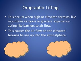
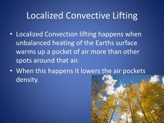
Cloud Formation
Adiabatic Temperature Changes and
Expansion and Cooling.
• Adiabatic Temperature Changes are changes in
temperature that happen even if heat is not
added into the atmosphere.
• There are two different types of adiabatic rates
there is the dry adiabatic rate and the wet
adiabatic rate.
• The dry adiabatic rate is the rate of cooling or
heating unsaturated air.
The wet adiabatic rate is the rate that is slower than
the dry adiabatic rate
Orographic Lifting
• This occurs when high or elevated terrains like
mountains canyons or glaciers experience
acting like barriers to air flow.
• This causes the air flow on the elevated
terrains to rise up into the atmostphere.
Frontal wedging
• Frontal wedging occurs at the front of a cloud
or storm cloud odd dense air rises and acts
like a barrier over which warmer less dense air
rises through the cloud.
Convergence
• Convergence is air that lifts and results from
lower air and flows together.
Localized Convective Lifting
• Localized Convection lifting happens when
unbalanced heating of the Earths surface
warms up a pocket of air more than other
spots around that air.
• When this happens it lowers the air pockets
density.
Stability
• The moist and stable conditions happen when
air temperature actually increases with height
called a temperature inversion.
Condensation
• Condensation happens when the air above
the ground has tiny pieces of matter which is
called condensation nuclei serve as surfaces
for water vapor condensation.
Types of Clouds
• There are 3 Types of clouds One of them is
the Cirrus cloud these clouds look like white
curls of hair they are so thin They can occur as
patches or as a veil like sheet.
• Cumulus clouds are clouds rounded surfaces
and have flat bases
• Stratus clouds are clouds that look like bed
sheets covering the sky because they take up
all the sky.
High Clouds
• 3 cloud types make up the family of high clouds
cirrus, cirrostratus, and cirrocumulus.
• High clouds are clouds that are not likely to produce
precipitation and they are in higher elevation then
all the other clouds. And look like they have spots
on them or spotty clouds.
Middle clouds
• The Middle clouds form in the middle range
of the atmosphere and they are called
Altocumulus clouds
• These clouds are much more dense and thick
• The Middle clouds have a white grayish sheet
sort of look to them. Some times they can
produce snow drizzle or maybe rain.
Low Clouds
• Low clouds are the clouds we see the most. Like
many other clouds these clouds frequently tend to
cover the whole sky
• These clouds form from air that rises up and forces
itself up causing this cloud to form.
• Different types of Low clouds are Cumulo nimbus
clouds
Clouds of Vertical Development
• Some clouds do not fit into any one of the three height
categories mentioned. Such clouds have their bases in
the low height range but often extend upward into the
middle or high altitudes. They all are related to one
another and are associated with unstable air
• Although cumulus clouds are often connected with fair
weather they may grow dramatically undre the proper
circumstances. Once upward movement is triggered,
acceleration is powerful and clouds with great vertical
range form. The end result often is a cumulonimbus
cloud that may produce rain showers or a
thunderstorm
Fog
• Fog is a misty looking cloud generaly formed
over moist places such as lakes rivers streams
seas or swamps.
• It is mostly

Cloud formation

  • 1.
  • 2.
    Adiabatic Temperature Changesand Expansion and Cooling. • Adiabatic Temperature Changes are changes in temperature that happen even if heat is not added into the atmosphere. • There are two different types of adiabatic rates there is the dry adiabatic rate and the wet adiabatic rate. • The dry adiabatic rate is the rate of cooling or heating unsaturated air. The wet adiabatic rate is the rate that is slower than the dry adiabatic rate
  • 3.
    Orographic Lifting • Thisoccurs when high or elevated terrains like mountains canyons or glaciers experience acting like barriers to air flow. • This causes the air flow on the elevated terrains to rise up into the atmostphere.
  • 4.
    Frontal wedging • Frontalwedging occurs at the front of a cloud or storm cloud odd dense air rises and acts like a barrier over which warmer less dense air rises through the cloud.
  • 5.
    Convergence • Convergence isair that lifts and results from lower air and flows together.
  • 6.
    Localized Convective Lifting •Localized Convection lifting happens when unbalanced heating of the Earths surface warms up a pocket of air more than other spots around that air. • When this happens it lowers the air pockets density.
  • 7.
    Stability • The moistand stable conditions happen when air temperature actually increases with height called a temperature inversion.
  • 8.
    Condensation • Condensation happenswhen the air above the ground has tiny pieces of matter which is called condensation nuclei serve as surfaces for water vapor condensation.
  • 9.
    Types of Clouds •There are 3 Types of clouds One of them is the Cirrus cloud these clouds look like white curls of hair they are so thin They can occur as patches or as a veil like sheet. • Cumulus clouds are clouds rounded surfaces and have flat bases • Stratus clouds are clouds that look like bed sheets covering the sky because they take up all the sky.
  • 10.
    High Clouds • 3cloud types make up the family of high clouds cirrus, cirrostratus, and cirrocumulus. • High clouds are clouds that are not likely to produce precipitation and they are in higher elevation then all the other clouds. And look like they have spots on them or spotty clouds.
  • 11.
    Middle clouds • TheMiddle clouds form in the middle range of the atmosphere and they are called Altocumulus clouds • These clouds are much more dense and thick • The Middle clouds have a white grayish sheet sort of look to them. Some times they can produce snow drizzle or maybe rain.
  • 12.
    Low Clouds • Lowclouds are the clouds we see the most. Like many other clouds these clouds frequently tend to cover the whole sky • These clouds form from air that rises up and forces itself up causing this cloud to form. • Different types of Low clouds are Cumulo nimbus clouds
  • 13.
    Clouds of VerticalDevelopment • Some clouds do not fit into any one of the three height categories mentioned. Such clouds have their bases in the low height range but often extend upward into the middle or high altitudes. They all are related to one another and are associated with unstable air • Although cumulus clouds are often connected with fair weather they may grow dramatically undre the proper circumstances. Once upward movement is triggered, acceleration is powerful and clouds with great vertical range form. The end result often is a cumulonimbus cloud that may produce rain showers or a thunderstorm
  • 14.
    Fog • Fog isa misty looking cloud generaly formed over moist places such as lakes rivers streams seas or swamps. • It is mostly