Download to read offline
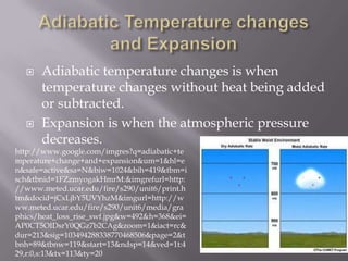
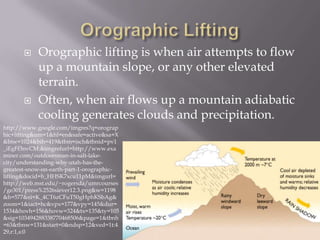
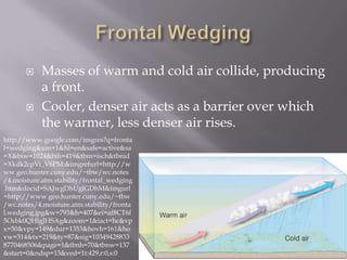
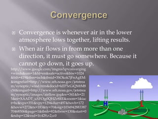
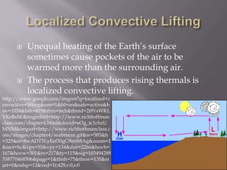

This document summarizes several key atmospheric processes: 1. Adiabatic temperature changes occur when temperature changes without heat being added or subtracted, such as during atmospheric expansion. 2. Orographic lifting occurs when air flows up a mountain slope, often generating clouds and precipitation through adiabatic cooling. 3. The collision of warm and cold air masses produces fronts where cooler, denser air acts as a barrier over which warmer air rises. 4. Several processes like convergence, localized convection, and the Bergeron process involve the lifting and rising of air, sometimes resulting in cloud formation.


