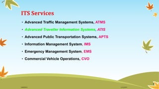
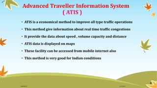
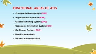
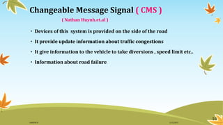
WELCOME
1
ADVANCED TRAVELLER INFORMATION SYSTEM
( A T I S )
Submitted by Asst. Prof.Ms.Archana Rajesh
Ganesh S . J
Reg No : 12428019 GUIDE
S 7 Civil , RIET
2
WHAT IS ITS ?????????
WHAT IS ATIS ???
3
( www.indianexpress.com )
Fig 1 . Traffic jam at Mumbai
Fig 2 . Traffic jam at Kochi Fig 3 . Traffic jam at Mexico
Fig 4 . Accident at Delhi
Fig 5 . Road accident
4
11/2/2015GANESH SJ
According to the studies
• 1.24 million death per each year
• 3287 death per day
• More than 12 hr traffic block in major city
• To avoid these
• Intelligent Transportation System ( ITS ) created
• First starting in US in 1995
( www.indianexpress.com)
5
11/2/2015GANESH SJ
INTELLIGENT TRANSPORTATION SYSTEM
( I T S )
• ITS is a world wide initiative to improve the transportation
system
• It’s aim is to manage vehicles , passengers and routes , etc…..
• It is used to improve safety , vehicle wear , transportation time
and reduce fuel cost
• It enhance quality of environment
6
11/2/2015GANESH SJ
ITS Services
• Advanced Traffic Management Systems, ATMS
• Advanced Traveller Information Systems, ATIS
• Advanced Public Transportation Systems, APTS
• Information Management System, IMS
• Emergency Management System, EMS
• Commercial Vehicle Operations, CVO
7
11/2/2015GANESH SJ
Advanced Traveller Information System
( ATIS )
• ATIS is a economical method to improve all type traffic operations
• This method give information about real time traffic congestions
• It provide the data about speed , volume capacity and distance
• ATIS data is displayed on maps
• These facility can be accessed from mobile internet also
• This method is very good for Indian conditions
8
11/2/2015GANESH SJ
FUNCTIONAL AREAS OF ATIS
• Changeable Message Sign (CMS)
• Highway Advisory Radio (HAR)
• Global Positioning System (GPS)
• Geographic Information System ( GIS )
• Car Display System ( CDS )
• Best Route Analysis
• Wireless Communications
9
11/2/2015GANESH SJ
10
Changeable Message Signal ( CMS )
( Nathan Huynh.et.al )
• Devices of this system is provided on the side of the road
• It provide update information about traffic congestions
• It give information to the vehicle to take diversions , speed limit etc..
• Information about road failure
11/2/2015GANESH SJ
Fig 6. Changeable Message Signal In Germany ( www.samsclub.com )
11
11/2/2015GANESH SJ
Highway Advisory Ratio ( HAR )
• Airport authority of US was first created this
• Information is transmitted through small road side transmitters
• AM/FM methods are used for data transmission
• It provide warnings , advisories and direction to the drivers
• Each message is less than one minute duration
12
11/2/2015GANESH SJ
Fig 7. Highway Advisory Ratio (www.samsclub.com)
13
11/2/2015GANESH SJ
Global Positioning System ( GPS )
• This is a common method used for traffic studies
• Cell phone linked positioning operation
• High frequency signal is used for data transmission
Fig 8. Global Positioning System ( www.ustraffic.com )
14
11/2/2015GANESH SJ
Working procedure of GPS
• Operation of GPS is done by 24 satellites ( Rotating twice a day )
• GPS receivers by triangulation method finding location of vehicle
• Based on the obtained data location is plotted in map
• GPS can open at any lighting and weather conditions
Fig 9. GPS Analysis Display ( www.ustraffic.com )
15
11/2/2015GANESH SJ
Geographic Information System ( GIS )
• Main functional area of ATIS
• Providing location based information of bus and train
• Give data about Shortest Path , Closet Facilities and City Bus Routes
• Shortest path always help to reach the destination in short time
• Closet Facilities will reduce the cost of transportation
• City Bus Routes is help to find the path way of each bus in a city
16
11/2/2015GANESH SJ
Fig 10. GIS working system ( www.ustraffic.com )
17
11/2/2015GANESH SJ
Car Display System ( CDS )
• It is a programmable display system with a LED screen (11.4 × 8.4 cm)
• Speaker provision is provided for listening audio information
• Digitized human word at a rate of 150 words/ min audio information
18
11/2/2015GANESH SJ
Fig 11. Car Display System ( www.autoscope.com )
19
11/2/2015GANESH SJ
Best Route Analysis
• Used to provide best travelling pathway for travelers
• Give pre-trip and en-route information
• Most of the given information are from past experience
• Feed back facilities provided to improve the data distribution
20
11/2/2015GANESH SJ
Wireless Communication System
• Combined with ATIS base server
• Information passed to users through PCD
• Collected information is stored at specified location
• For a location there will be a processing unit
21
11/2/2015GANESH SJ
Fig 12. Wireless Communication System ( www.ustraffic.com )
22
11/2/2015GANESH SJ
DATA COLLECTION TECHNIQUES
• Point Sensors
• Area Sensors
23
11/2/2015GANESH SJ
Point Sensors
• Point sensors are placed at specified point
• Range of this sensor is very small
• Each location there is controlling point placed
• These points are sending the information to users
24
11/2/2015GANESH SJ
Point Sensors
• Inductive Loops
• Video Image Detectors
• Piezo Sensors
• Radar Method
• Laser Beam
• Closed Circuit System
25
11/2/2015GANESH SJ
Inductive Loops
Fig 13. Inductive Loops ( www.ustraffic.com )
26
11/2/2015GANESH SJ
Inductive Loops
• Small slots are crated by copper wire in road
• Current is passed through this loops
• During movement of vehicle electromagnetic induction occur
• Difference is collected by single/dual loop detectors
• Used at highway segment and intersections
• It is help for counting vehicle number
27
11/2/2015GANESH SJ
Video Image Detectors
• Best method for data collection
• Help for calculating traffic volume
• It can focused to a point
• When a vehicle enter the target area camera ON ,
when it move out detectors will automatic OFF
28
11/2/2015GANESH SJ
Video Image Detectors
Fig 14. Video Image Detectors ( www.autoscope.com )
29
11/2/2015GANESH SJ
Piezo Sensors
• A piezo electric material is laid in small slots of the road
• During motion a physical pressure created by each vehicle
• Electric voltage induced due to the pressure
Fig 15. Piezo Sensors ( www.calameo.com )
30
11/2/2015GANESH SJ
Radar Method
• Road divided into small zones
• A sensor post placed at side of the road
• Source on the post emit micro wave energy
• Detectors are placed at the side of the road for catching the ray
• Vehicle identification done by variation on frequency
31
11/2/2015GANESH SJ
Fig 16. Radar Sensors ( www.neouromorphs.com )
32
11/2/2015GANESH SJ
Laser Beams
• By scanning is done from both side of the road
Fig 17. Laser Beams ( www.msqueen.com )
33
11/2/2015GANESH SJ
Closed Circuit System
• Live snaps of the road taken and send to control room
• Very is to identify the traffic jam
Fig 18. Closed Circuit System ( www.minagarmic.com )
34
11/2/2015GANESH SJ
Area Sensors
• Counting traffic condition for a large area
• Count data for long time
• It can also calculate vehicle at parking place
35
11/2/2015GANESH SJ
Area Sensors
• Radio Triangulation
• Wireless Receiver Tags
• License Plate Readers
• Smart Card Method
36
11/2/2015GANESH SJ
Radio Triangulation
• Transmitter on each vehicle send information about location
• Receiver on each location catch the information
• Time difference of the signal help to calculate distance
37
11/2/2015GANESH SJ
Wireless Receiver Tag
• Unique identification number given to each vehicle
• Trackers placed on the side of the road
• During motion trackers identify the vehicle
38
11/2/2015GANESH SJ
License Plate Readers
• This system has a red light camera
• Movement of the vehicle captured at target area
• Speed calculation
• By time difference distance calculation
39
11/2/2015GANESH SJ
Smart Card Method
• Smart card is given to each driver
• Details of the card connected to group of system
• Recording payment details
• By payment data vehicle identification done
40
11/2/2015GANESH SJ
ADVANTAGES OF ATIS
• ATIS reduce traffic congestions
• ATIS provide immediate hazard warning
• ATIS give information about road condition
• Provide information to user at right time
• Error free software
41
11/2/2015GANESH SJ
DISADVANTAGES OF ATIS
• Cost of implementation of ATIS is very high
• Setting receiver stations on car very difficult
• Lac for finding power source
• Data storing need high capacity electronic device
42
11/2/2015GANESH SJ
ATIS IN WORLD
• Most of the developed countries are using this method
• HAR ratio is using in Japan, Italy and US
• Canada and UK using full techniques of ATIS
• Automatic warning system is the first ATIS service in Railway
(England ) - 1999
•
43
11/2/2015GANESH SJ
Automatic Warning System ( AWS )
• AWS providing signal to train 185m before stopping point
• Controlling of train done by electromagnetic method
• Major parts – Control box, Connection valves, Indicators on cabin
and a locomotive part
• Need 12V – 40V for normal use
• AWS provide speed restriction signals also
44
11/2/2015GANESH SJ
Fig 19. Automatic Warning Signals ( www.minagarnic.com )
45
11/2/2015GANESH SJ
Working of AWS
• A sound bell created at driver’s cabin when message received
• AWS provide sound bell until the driver applying break
• If the driver fail to apply break the train will stop within 6 seconds
• Electromagnetic method used for it
46
11/2/2015GANESH SJ
Fig 20. British AWS Inductor ( www.calameo.com )
47
11/2/2015GANESH SJ
ATIS IN INDIA
Case study-ATIS in Chandigarh
( Dhanunjaya Reddi .et.al)
• Chandigarh is the only place in India where ATIS installed (2010)
• GIS is the platform for this
• Arc GIS10 software used for controlling all the operation
• It can store the data of 5000 major and minor roads
• 300 ATMs,150 Hospitals, 170 Schools and colleges
48
11/2/2015GANESH SJ
SUMMARY
• ATIS is very useful to overcome the traffic congestion problem
• Automatic working will save National Income
• Initial setting cost of ATIS is very high
• Traffic problem in India can easy to solve by this
• Lac of land consumption is the major problem
• I think Installing ATIS at Trivandrum and Vyttila Ernakulam
help to solve traffic problem
49
11/2/2015GANESH SJ
REFERENCE
• David Levinson,(2003), “The value of advanced traveler information systems for
route choice”, Journal on Transportation Research Part C 11, PP-38-42.
• Dhanunjaya Reddy, Praveen Kumar, Varun Singh,(2013), “Transactions on
transportation systems”, Journal on ATIS, Vol 6, PP-26-32.
• Kadiyali L.R, “Traffic Engineering and Transportation planning”, Eighth edition,
Khanna Publishers, Delhi. PP-886-889.
• Nathan Huynh, Yi-Chang Chiu, (2007), “Location configuration design for Dynamic
Message Signs under stochastic incident and ATIS scenarios”, Journal on new
methods of Transportation Part C 15 , PP- 33–50.
• www.autoscope.com - Accessed on 14/8/2015
50
11/2/2015GANESH SJ
REFERENCE
• www.calameo.com - Accessed on 14/8/2015
• www.ieee.com - Accessed on 14/8/2015
• www.manoramaonline.com - Accessed on 14/8/2015
• www.minagarnic.com - Accessed on 14/8/2015
• www.msqueen.com - Accessed on 14/8/2015
51
11/2/2015GANESH SJ
REFERENCE
• www.neouromorphs.com - Accessed on 14/8/2015
• www.samsclub.com - Accessed on 14/8/2015
• www.ustraffic.com - Accessed on 14/8/2015
• www.indianexpress.com – Accessed on 14/8/2015
52
11/2/2015GANESH SJ
THANK YOU………
53
QUESTIONS……..
54
11/2/2015GANESH SJ

ADVANCED TRAVELLER INFORMATION SYSTEM

  • 1.
  • 2.
    ADVANCED TRAVELLER INFORMATIONSYSTEM ( A T I S ) Submitted by Asst. Prof.Ms.Archana Rajesh Ganesh S . J Reg No : 12428019 GUIDE S 7 Civil , RIET 2
  • 3.
    WHAT IS ITS????????? WHAT IS ATIS ??? 3
  • 4.
    ( www.indianexpress.com ) Fig1 . Traffic jam at Mumbai Fig 2 . Traffic jam at Kochi Fig 3 . Traffic jam at Mexico Fig 4 . Accident at Delhi Fig 5 . Road accident 4 11/2/2015GANESH SJ
  • 5.
    According to thestudies • 1.24 million death per each year • 3287 death per day • More than 12 hr traffic block in major city • To avoid these • Intelligent Transportation System ( ITS ) created • First starting in US in 1995 ( www.indianexpress.com) 5 11/2/2015GANESH SJ
  • 6.
    INTELLIGENT TRANSPORTATION SYSTEM (I T S ) • ITS is a world wide initiative to improve the transportation system • It’s aim is to manage vehicles , passengers and routes , etc….. • It is used to improve safety , vehicle wear , transportation time and reduce fuel cost • It enhance quality of environment 6 11/2/2015GANESH SJ
  • 7.
    ITS Services • AdvancedTraffic Management Systems, ATMS • Advanced Traveller Information Systems, ATIS • Advanced Public Transportation Systems, APTS • Information Management System, IMS • Emergency Management System, EMS • Commercial Vehicle Operations, CVO 7 11/2/2015GANESH SJ
  • 8.
    Advanced Traveller InformationSystem ( ATIS ) • ATIS is a economical method to improve all type traffic operations • This method give information about real time traffic congestions • It provide the data about speed , volume capacity and distance • ATIS data is displayed on maps • These facility can be accessed from mobile internet also • This method is very good for Indian conditions 8 11/2/2015GANESH SJ
  • 9.
    FUNCTIONAL AREAS OFATIS • Changeable Message Sign (CMS) • Highway Advisory Radio (HAR) • Global Positioning System (GPS) • Geographic Information System ( GIS ) • Car Display System ( CDS ) • Best Route Analysis • Wireless Communications 9 11/2/2015GANESH SJ
  • 10.
    10 Changeable Message Signal( CMS ) ( Nathan Huynh.et.al ) • Devices of this system is provided on the side of the road • It provide update information about traffic congestions • It give information to the vehicle to take diversions , speed limit etc.. • Information about road failure 11/2/2015GANESH SJ
  • 11.
    Fig 6. ChangeableMessage Signal In Germany ( www.samsclub.com ) 11 11/2/2015GANESH SJ
  • 12.
    Highway Advisory Ratio( HAR ) • Airport authority of US was first created this • Information is transmitted through small road side transmitters • AM/FM methods are used for data transmission • It provide warnings , advisories and direction to the drivers • Each message is less than one minute duration 12 11/2/2015GANESH SJ
  • 13.
    Fig 7. HighwayAdvisory Ratio (www.samsclub.com) 13 11/2/2015GANESH SJ
  • 14.
    Global Positioning System( GPS ) • This is a common method used for traffic studies • Cell phone linked positioning operation • High frequency signal is used for data transmission Fig 8. Global Positioning System ( www.ustraffic.com ) 14 11/2/2015GANESH SJ
  • 15.
    Working procedure ofGPS • Operation of GPS is done by 24 satellites ( Rotating twice a day ) • GPS receivers by triangulation method finding location of vehicle • Based on the obtained data location is plotted in map • GPS can open at any lighting and weather conditions Fig 9. GPS Analysis Display ( www.ustraffic.com ) 15 11/2/2015GANESH SJ
  • 16.
    Geographic Information System( GIS ) • Main functional area of ATIS • Providing location based information of bus and train • Give data about Shortest Path , Closet Facilities and City Bus Routes • Shortest path always help to reach the destination in short time • Closet Facilities will reduce the cost of transportation • City Bus Routes is help to find the path way of each bus in a city 16 11/2/2015GANESH SJ
  • 17.
    Fig 10. GISworking system ( www.ustraffic.com ) 17 11/2/2015GANESH SJ
  • 18.
    Car Display System( CDS ) • It is a programmable display system with a LED screen (11.4 × 8.4 cm) • Speaker provision is provided for listening audio information • Digitized human word at a rate of 150 words/ min audio information 18 11/2/2015GANESH SJ
  • 19.
    Fig 11. CarDisplay System ( www.autoscope.com ) 19 11/2/2015GANESH SJ
  • 20.
    Best Route Analysis •Used to provide best travelling pathway for travelers • Give pre-trip and en-route information • Most of the given information are from past experience • Feed back facilities provided to improve the data distribution 20 11/2/2015GANESH SJ
  • 21.
    Wireless Communication System •Combined with ATIS base server • Information passed to users through PCD • Collected information is stored at specified location • For a location there will be a processing unit 21 11/2/2015GANESH SJ
  • 22.
    Fig 12. WirelessCommunication System ( www.ustraffic.com ) 22 11/2/2015GANESH SJ
  • 23.
    DATA COLLECTION TECHNIQUES •Point Sensors • Area Sensors 23 11/2/2015GANESH SJ
  • 24.
    Point Sensors • Pointsensors are placed at specified point • Range of this sensor is very small • Each location there is controlling point placed • These points are sending the information to users 24 11/2/2015GANESH SJ
  • 25.
    Point Sensors • InductiveLoops • Video Image Detectors • Piezo Sensors • Radar Method • Laser Beam • Closed Circuit System 25 11/2/2015GANESH SJ
  • 26.
    Inductive Loops Fig 13.Inductive Loops ( www.ustraffic.com ) 26 11/2/2015GANESH SJ
  • 27.
    Inductive Loops • Smallslots are crated by copper wire in road • Current is passed through this loops • During movement of vehicle electromagnetic induction occur • Difference is collected by single/dual loop detectors • Used at highway segment and intersections • It is help for counting vehicle number 27 11/2/2015GANESH SJ
  • 28.
    Video Image Detectors •Best method for data collection • Help for calculating traffic volume • It can focused to a point • When a vehicle enter the target area camera ON , when it move out detectors will automatic OFF 28 11/2/2015GANESH SJ
  • 29.
    Video Image Detectors Fig14. Video Image Detectors ( www.autoscope.com ) 29 11/2/2015GANESH SJ
  • 30.
    Piezo Sensors • Apiezo electric material is laid in small slots of the road • During motion a physical pressure created by each vehicle • Electric voltage induced due to the pressure Fig 15. Piezo Sensors ( www.calameo.com ) 30 11/2/2015GANESH SJ
  • 31.
    Radar Method • Roaddivided into small zones • A sensor post placed at side of the road • Source on the post emit micro wave energy • Detectors are placed at the side of the road for catching the ray • Vehicle identification done by variation on frequency 31 11/2/2015GANESH SJ
  • 32.
    Fig 16. RadarSensors ( www.neouromorphs.com ) 32 11/2/2015GANESH SJ
  • 33.
    Laser Beams • Byscanning is done from both side of the road Fig 17. Laser Beams ( www.msqueen.com ) 33 11/2/2015GANESH SJ
  • 34.
    Closed Circuit System •Live snaps of the road taken and send to control room • Very is to identify the traffic jam Fig 18. Closed Circuit System ( www.minagarmic.com ) 34 11/2/2015GANESH SJ
  • 35.
    Area Sensors • Countingtraffic condition for a large area • Count data for long time • It can also calculate vehicle at parking place 35 11/2/2015GANESH SJ
  • 36.
    Area Sensors • RadioTriangulation • Wireless Receiver Tags • License Plate Readers • Smart Card Method 36 11/2/2015GANESH SJ
  • 37.
    Radio Triangulation • Transmitteron each vehicle send information about location • Receiver on each location catch the information • Time difference of the signal help to calculate distance 37 11/2/2015GANESH SJ
  • 38.
    Wireless Receiver Tag •Unique identification number given to each vehicle • Trackers placed on the side of the road • During motion trackers identify the vehicle 38 11/2/2015GANESH SJ
  • 39.
    License Plate Readers •This system has a red light camera • Movement of the vehicle captured at target area • Speed calculation • By time difference distance calculation 39 11/2/2015GANESH SJ
  • 40.
    Smart Card Method •Smart card is given to each driver • Details of the card connected to group of system • Recording payment details • By payment data vehicle identification done 40 11/2/2015GANESH SJ
  • 41.
    ADVANTAGES OF ATIS •ATIS reduce traffic congestions • ATIS provide immediate hazard warning • ATIS give information about road condition • Provide information to user at right time • Error free software 41 11/2/2015GANESH SJ
  • 42.
    DISADVANTAGES OF ATIS •Cost of implementation of ATIS is very high • Setting receiver stations on car very difficult • Lac for finding power source • Data storing need high capacity electronic device 42 11/2/2015GANESH SJ
  • 43.
    ATIS IN WORLD •Most of the developed countries are using this method • HAR ratio is using in Japan, Italy and US • Canada and UK using full techniques of ATIS • Automatic warning system is the first ATIS service in Railway (England ) - 1999 • 43 11/2/2015GANESH SJ
  • 44.
    Automatic Warning System( AWS ) • AWS providing signal to train 185m before stopping point • Controlling of train done by electromagnetic method • Major parts – Control box, Connection valves, Indicators on cabin and a locomotive part • Need 12V – 40V for normal use • AWS provide speed restriction signals also 44 11/2/2015GANESH SJ
  • 45.
    Fig 19. AutomaticWarning Signals ( www.minagarnic.com ) 45 11/2/2015GANESH SJ
  • 46.
    Working of AWS •A sound bell created at driver’s cabin when message received • AWS provide sound bell until the driver applying break • If the driver fail to apply break the train will stop within 6 seconds • Electromagnetic method used for it 46 11/2/2015GANESH SJ
  • 47.
    Fig 20. BritishAWS Inductor ( www.calameo.com ) 47 11/2/2015GANESH SJ
  • 48.
    ATIS IN INDIA Casestudy-ATIS in Chandigarh ( Dhanunjaya Reddi .et.al) • Chandigarh is the only place in India where ATIS installed (2010) • GIS is the platform for this • Arc GIS10 software used for controlling all the operation • It can store the data of 5000 major and minor roads • 300 ATMs,150 Hospitals, 170 Schools and colleges 48 11/2/2015GANESH SJ
  • 49.
    SUMMARY • ATIS isvery useful to overcome the traffic congestion problem • Automatic working will save National Income • Initial setting cost of ATIS is very high • Traffic problem in India can easy to solve by this • Lac of land consumption is the major problem • I think Installing ATIS at Trivandrum and Vyttila Ernakulam help to solve traffic problem 49 11/2/2015GANESH SJ
  • 50.
    REFERENCE • David Levinson,(2003),“The value of advanced traveler information systems for route choice”, Journal on Transportation Research Part C 11, PP-38-42. • Dhanunjaya Reddy, Praveen Kumar, Varun Singh,(2013), “Transactions on transportation systems”, Journal on ATIS, Vol 6, PP-26-32. • Kadiyali L.R, “Traffic Engineering and Transportation planning”, Eighth edition, Khanna Publishers, Delhi. PP-886-889. • Nathan Huynh, Yi-Chang Chiu, (2007), “Location configuration design for Dynamic Message Signs under stochastic incident and ATIS scenarios”, Journal on new methods of Transportation Part C 15 , PP- 33–50. • www.autoscope.com - Accessed on 14/8/2015 50 11/2/2015GANESH SJ
  • 51.
    REFERENCE • www.calameo.com -Accessed on 14/8/2015 • www.ieee.com - Accessed on 14/8/2015 • www.manoramaonline.com - Accessed on 14/8/2015 • www.minagarnic.com - Accessed on 14/8/2015 • www.msqueen.com - Accessed on 14/8/2015 51 11/2/2015GANESH SJ
  • 52.
    REFERENCE • www.neouromorphs.com -Accessed on 14/8/2015 • www.samsclub.com - Accessed on 14/8/2015 • www.ustraffic.com - Accessed on 14/8/2015 • www.indianexpress.com – Accessed on 14/8/2015 52 11/2/2015GANESH SJ
  • 53.
  • 54.