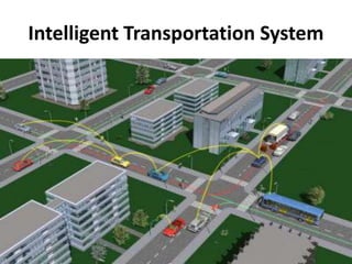
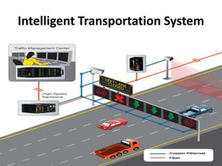
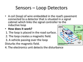
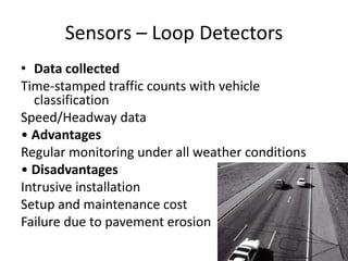
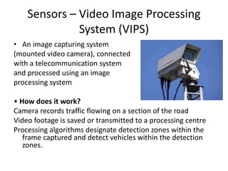
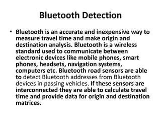
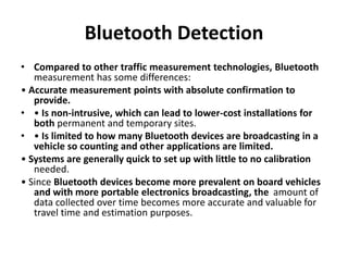
Intelligent transportation systems use technology to improve transportation safety, mobility, and efficiency. They help reduce congestion and optimize existing infrastructure through tools like traffic signal control, automatic incident detection, variable message signs, and integrated traveler information. Sensors are a key component, including loop detectors embedded in roadways, video cameras, Bluetooth and audio detectors, and pneumatic tubes. Together these systems provide benefits like improved safety, reduced emissions, and more reliable travel.
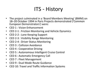
![ITS - History
• Feasibility Phase (1980-1995) – Led by Europe,
US and Japan In Europe, 19 countries established
the PROMETHEUS (Program for European Traffic
with Efficiency and Unprecedented Safety)
project.
• It received €749,000,000 in funding from
the EUREKA member states,[1] and defined the
state of the art of autonomous vehicles.
Numerous universities and car manufacturers
participated in this Pan-European project.](https://image.slidesharecdn.com/ist-240406073400-f627a24e/85/Intelligent-Transportation-Systems-pptx-9-320.jpg)
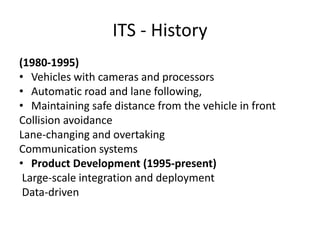
![ITS - History
• Under a steering committee were three projects on
industrial research and four on basic research.[2]
Industrial research
• PRO-CAR : Driver assistance by computer systems
• PRO-NET : Vehicle-to-vehicle communication
• PRO-ROAD : Vehicle-to-environment communication
Basic Research
• PRO-ART : Methods and systems of artificial intelligence
• PRO-CHIP: Custom hardware for intelligent processing in
vehicles
• PRO-COM : Methods and standards for communication
• PRO-GEN : Traffic scenario for new assessment and
introduction of new systems](https://image.slidesharecdn.com/ist-240406073400-f627a24e/85/Intelligent-Transportation-Systems-pptx-10-320.jpg)


![Intelligent transport system (its) [autosaved]](https://cdn.slidesharecdn.com/ss_thumbnails/intelligenttransportsystemitsautosaved-180424014548-thumbnail.jpg?width=640&height=640&fit=bounds)


