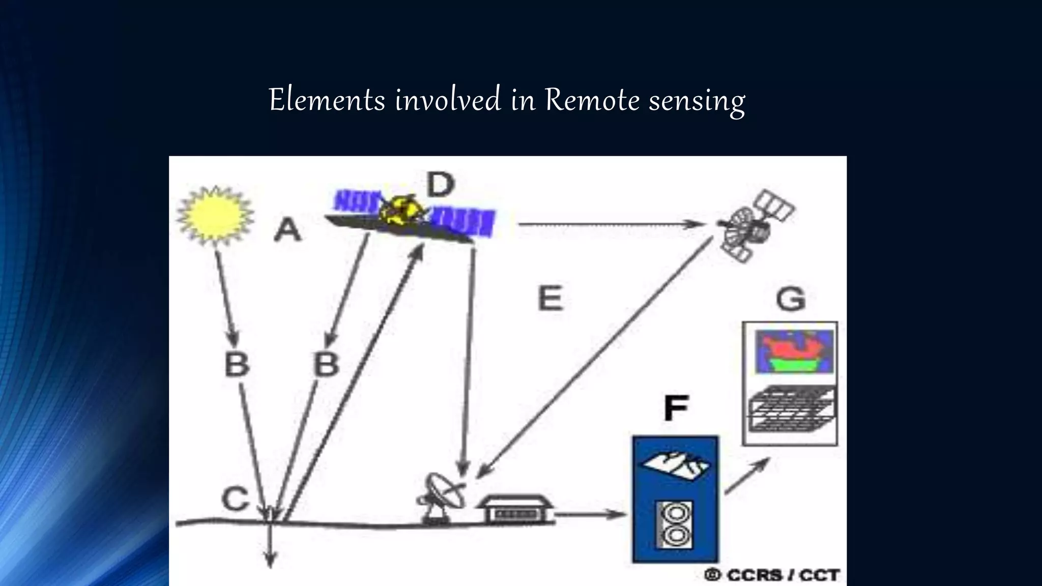
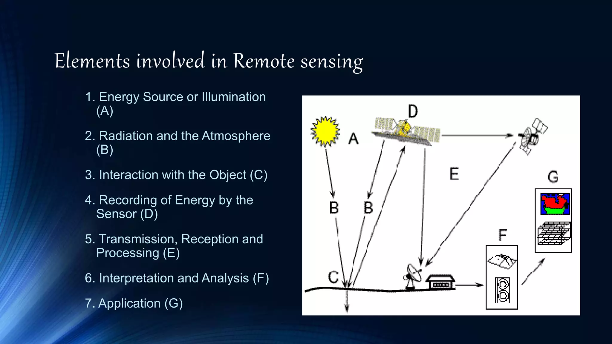
Remote Sensing and application
PRESENTED BY
HARSHITH GOWDA R
SURESH D
SUNIL
Akash deepkale
CHANDRAKANTH
BHARGAVAGIRI
• .
Remote sensing is defined as the technique of obtaining
information about objects through the analysis of data
collected by special instruments that are not in physical
contact with the objects of investigation.
Collection of information about an object without coming
into physical contact.
The information needs a physical carrier to travel from the
objects/events to the sensors through an intervening
medium.
The electromagnetic radiation is normally used as an
information carrier in remote sensing.
The output of a remote sensing system is usually
an image representing the scene being observed.
Remote Sensing?
Remote Sensing Google mapping
Weather forecasting
History of Remote Sensing?
History
• The technology of modern remote sensing began
with the invention of the camera more than 150
years ago.
• The idea and practice of looking down at the
Earth's surface emerged in the 1840s when pictures
were taken from cameras secured to tethered
balloons for purposes of topographic mapping.
• Satellite remote sensing can be traced to the early
days of the space age (both Russian and American
programs) and actually began as a dual approach to
imaging surfaces using several types of sensors
from spacecraft.
• The term "remote sensing," first used in the United
States in the 1950s by Ms. Evelyn Pruitt of the
U.S.
Elements involved in Remote sensing
1. Energy Source or Illumination
(A)
2. Radiation and the Atmosphere
(B)
3. Interaction with the Object (C)
4. Recording of Energy by the
Sensor (D)
5. Transmission, Reception and
Processing (E)
6. Interpretation and Analysis (F)
7. Application (G)
Remote Sensing Sensors
Active Remote Sensors :-
Active remote sensing uses an artificial source
for energy.
For example the satellite itself can send a pulse
of energy which can interact with the target.
In active remote sensing, humans can control
the nature (wavelength, power, duration) of the
source energy. Active remote sensing can be
carried out during day and night and in all weather
conditions.
Remote Sensing Sensors
Passive remote sensing:-
Passive remote sensing depends on a natural
source to provide energy.
For example sun is the most powerful and
commonly used source of energy for passive
remote sensing.
The satellite sensor in this case records primarily
the radiation that is reflected from the target.
Ground-based platforms: ground, vehicles and/or
towers => up to 50 m
Airborne platforms: airplanes, helicopters, high-
altitude aircrafts, balloons => up to 50 km
Space borne: rockets, satellites, shuttle => from about
100 km to 36000 km
1. Space shuttle: 250-300 km
2. Space station: 300-400 km
3. Low-level satellites: 700-1500 km
4. High-level satellites: about 36000 km
Platforms used for Remote Sensing
Applications of Remote sensing
Meteorology
Profiling of atmospheric temp. and water vapor
Measuring wind velocity
Oceanography
Measurements of sea surface temperature
Mapping ocean currents
Glaciology
Mapping motion of sea ice and ice sheets
Determining the navigability of the sea
Geology
Identification of rock types
Location of geological faults and anomalies
Agriculture
Monitoring the extend and type of vegetation
Mapping soil types
Hydrology
Assessing water resources
Forecasting melt water run-off from snow
Disaster control
Warning of sand and dust storms, flooding
Monitoring of pollution
Applications of Remote sensing
THANK YOU

remote sensing

  • 1.
    Remote Sensing andapplication PRESENTED BY HARSHITH GOWDA R SURESH D SUNIL Akash deepkale CHANDRAKANTH BHARGAVAGIRI
  • 2.
    • . Remote sensingis defined as the technique of obtaining information about objects through the analysis of data collected by special instruments that are not in physical contact with the objects of investigation. Collection of information about an object without coming into physical contact. The information needs a physical carrier to travel from the objects/events to the sensors through an intervening medium. The electromagnetic radiation is normally used as an information carrier in remote sensing. The output of a remote sensing system is usually an image representing the scene being observed. Remote Sensing?
  • 3.
    Remote Sensing Googlemapping Weather forecasting
  • 4.
  • 5.
    History • The technologyof modern remote sensing began with the invention of the camera more than 150 years ago. • The idea and practice of looking down at the Earth's surface emerged in the 1840s when pictures were taken from cameras secured to tethered balloons for purposes of topographic mapping. • Satellite remote sensing can be traced to the early days of the space age (both Russian and American programs) and actually began as a dual approach to imaging surfaces using several types of sensors from spacecraft. • The term "remote sensing," first used in the United States in the 1950s by Ms. Evelyn Pruitt of the U.S.
  • 6.
    Elements involved inRemote sensing
  • 7.
    Elements involved inRemote sensing 1. Energy Source or Illumination (A) 2. Radiation and the Atmosphere (B) 3. Interaction with the Object (C) 4. Recording of Energy by the Sensor (D) 5. Transmission, Reception and Processing (E) 6. Interpretation and Analysis (F) 7. Application (G)
  • 8.
  • 9.
    Active Remote Sensors:- Active remote sensing uses an artificial source for energy. For example the satellite itself can send a pulse of energy which can interact with the target. In active remote sensing, humans can control the nature (wavelength, power, duration) of the source energy. Active remote sensing can be carried out during day and night and in all weather conditions. Remote Sensing Sensors
  • 10.
    Passive remote sensing:- Passiveremote sensing depends on a natural source to provide energy. For example sun is the most powerful and commonly used source of energy for passive remote sensing. The satellite sensor in this case records primarily the radiation that is reflected from the target.
  • 11.
    Ground-based platforms: ground,vehicles and/or towers => up to 50 m Airborne platforms: airplanes, helicopters, high- altitude aircrafts, balloons => up to 50 km Space borne: rockets, satellites, shuttle => from about 100 km to 36000 km 1. Space shuttle: 250-300 km 2. Space station: 300-400 km 3. Low-level satellites: 700-1500 km 4. High-level satellites: about 36000 km Platforms used for Remote Sensing
  • 12.
    Applications of Remotesensing Meteorology Profiling of atmospheric temp. and water vapor Measuring wind velocity Oceanography Measurements of sea surface temperature Mapping ocean currents Glaciology Mapping motion of sea ice and ice sheets Determining the navigability of the sea Geology Identification of rock types Location of geological faults and anomalies
  • 13.
    Agriculture Monitoring the extendand type of vegetation Mapping soil types Hydrology Assessing water resources Forecasting melt water run-off from snow Disaster control Warning of sand and dust storms, flooding Monitoring of pollution Applications of Remote sensing
  • 14.