


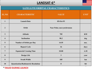
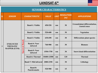
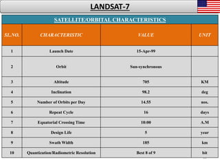

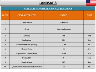


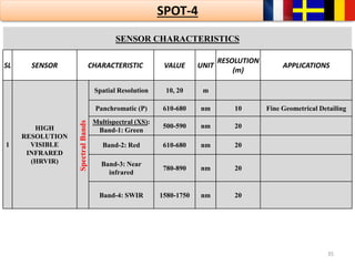
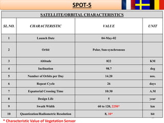
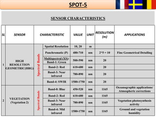
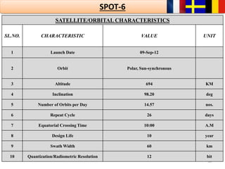
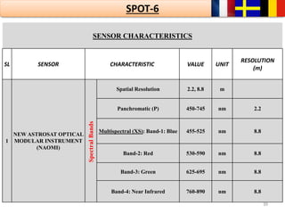

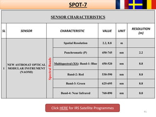


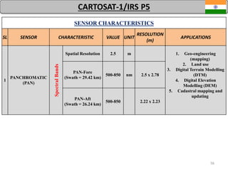
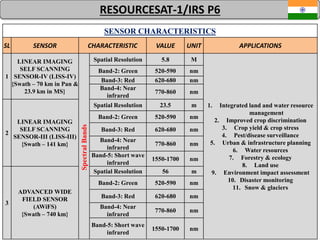
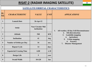
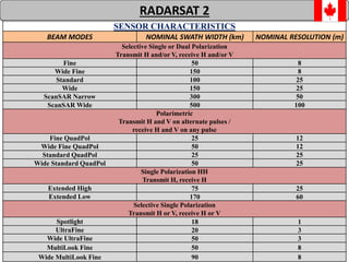
![64
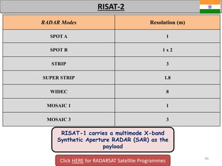
RISAT-1
Imaging
Modes
HRS FRS-1 FRS-2 MRS CRS
Swath (km) 10 x 10 25 25 115 223
Polarization
Single, Dual,
Circular
Single, Dual,
Circular
Quad,
Circular
Single, Dual,
Circular
Single, Dual,
Circular
Resolution
[azimuth range
x slant (m)]
1 x 1 3 x 2 9 x 4 21-23 x 8 41-55 x 8
RISAT-1 IS OPERATED IN THE FOLLOWING MODES IN DIFFERENT
POLARIZATIONS:-
HRS – High Resolution SPOT Light
FRS – Fine Resolution StripMap
MRS – Medium Resolution Scan SAR
CRS – Coarse Resolution Scan SAR
RISAT-1 carries a
multimode C-band
Synthetic Aperture
RADAR (SAR) as the
payload](https://image.slidesharecdn.com/remotesensingsatelliteswithsensors-150921145614-lva1-app6891/85/Remote-sensing-satellites-with-sensors-57-320.jpg)


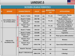
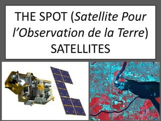
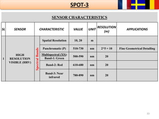
The document provides information on the Landsat satellite program, including details on Landsat 1-8 such as orbital characteristics, sensors, and resolutions. It launched between 1972-2013 with improved sensors over time. The Landsat satellites are used for applications like mapping land cover, monitoring vegetation and coastal zones. The document also summarizes the SPOT satellite program with details on SPOT 1-4 launched between 1986-1998.


