Downloaded 161 times
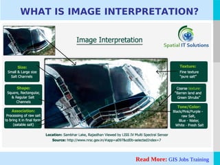
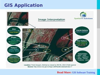

The document discusses image interpretation in geospatial training, highlighting its critical tasks such as detection, identification, measurement, and problem-solving related to remote sensed objects. It explains the attributes that guide interpretation, including location, size, shape, shadow, tone/color, texture, pattern, height/depth, and site/situation/association. The document emphasizes the importance of these factors in effectively understanding and analyzing geospatial data.


