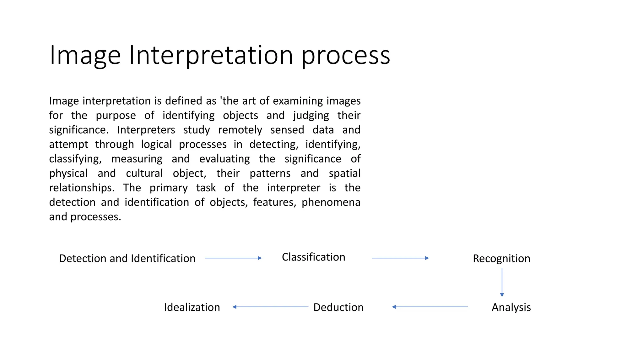
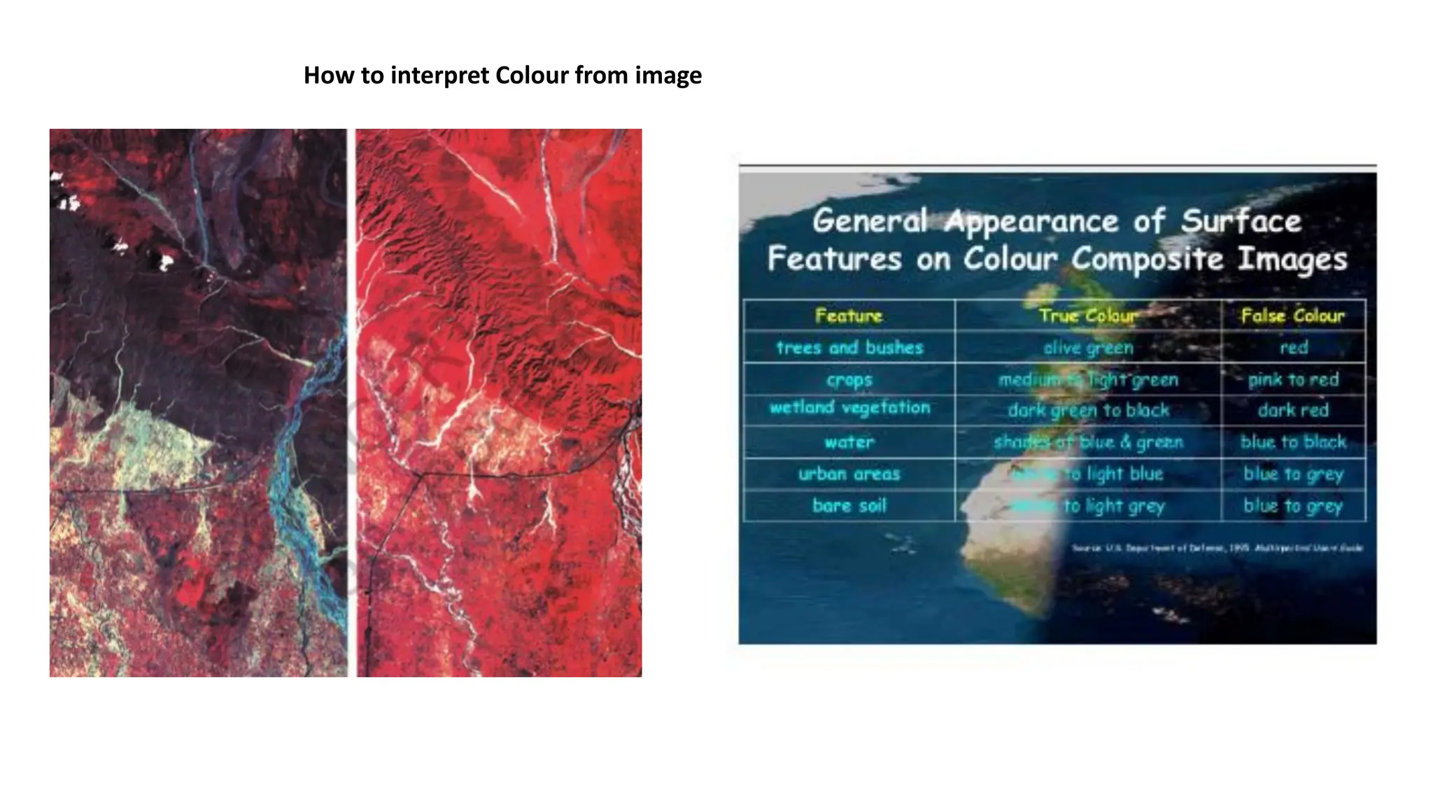
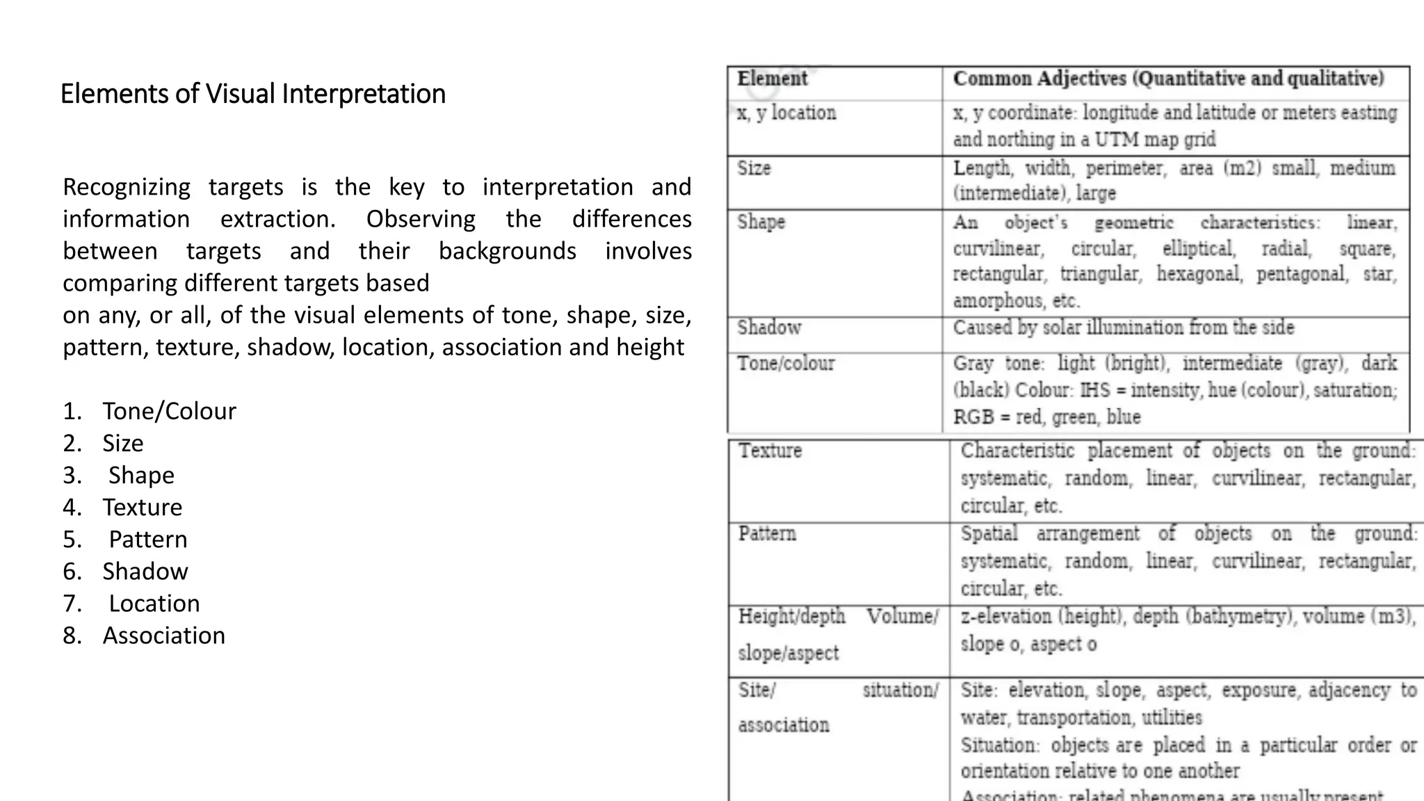
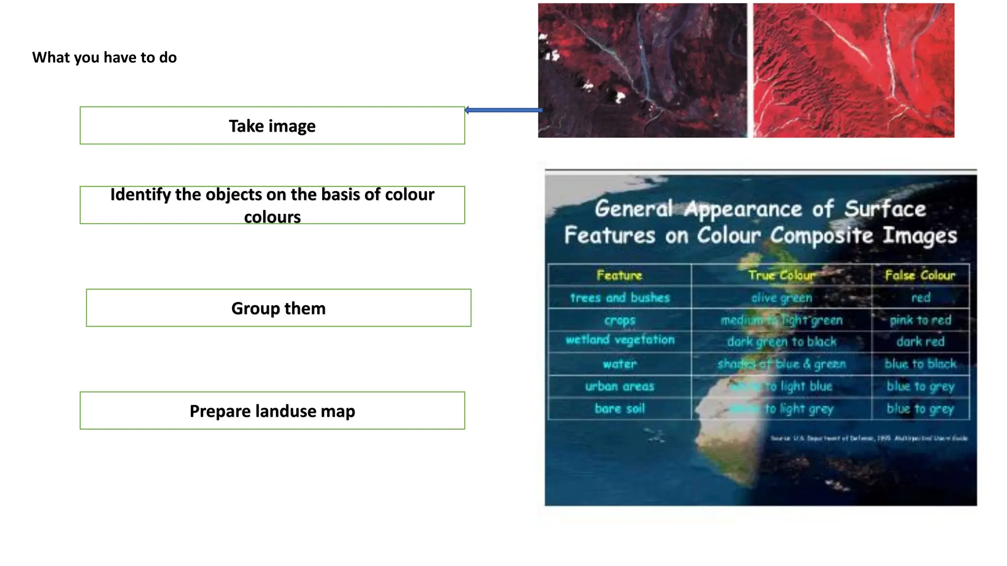
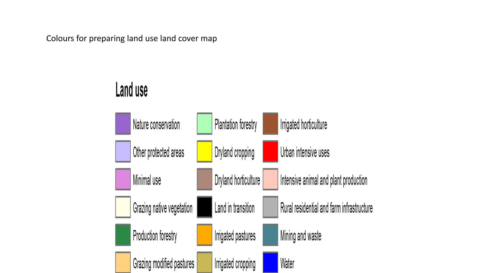
The document outlines the process of visual interpretation of satellite imagery and aerial photography, emphasizing the identification and evaluation of objects, features, and their spatial relationships. Key principles such as tone, size, shape, and texture are essential for interpreters in analyzing remotely sensed data. The guide also highlights the importance of comparing targets to their backgrounds for effective image analysis.