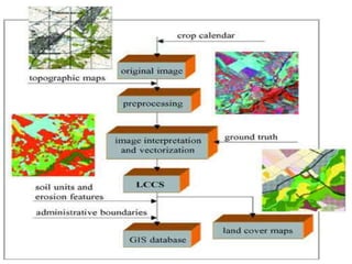
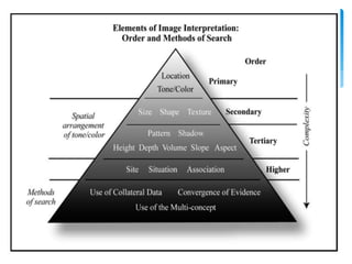
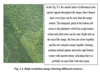
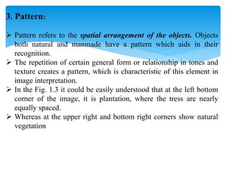
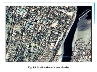
This document discusses image interpretation from aerial and satellite imagery. It defines image interpretation as examining images to identify objects and understand their significance based on location. An interpreter studies remote sensing data to detect, identify, measure and evaluate environmental and cultural features. The key elements of visual interpretation discussed are tone, texture, pattern, size, shape, shadow, association and site location. Generating thematic maps involves transferring interpreted information to a base map. Factors influencing image quality include sensor characteristics, season/time of day, atmosphere, resolution and image motion.