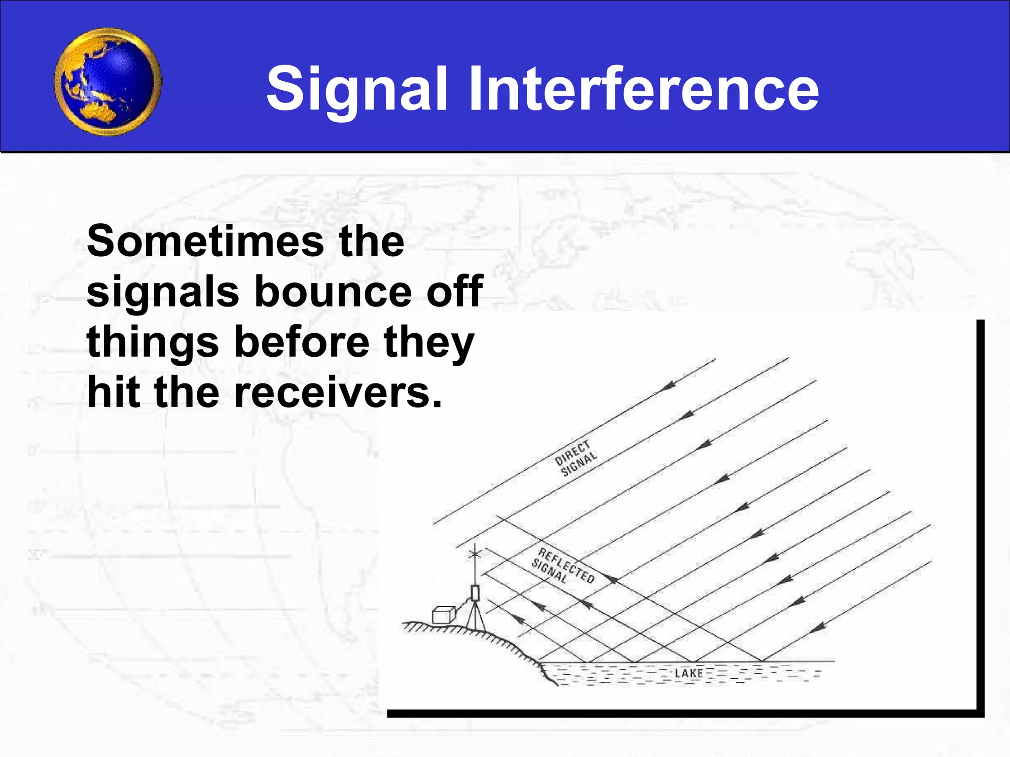
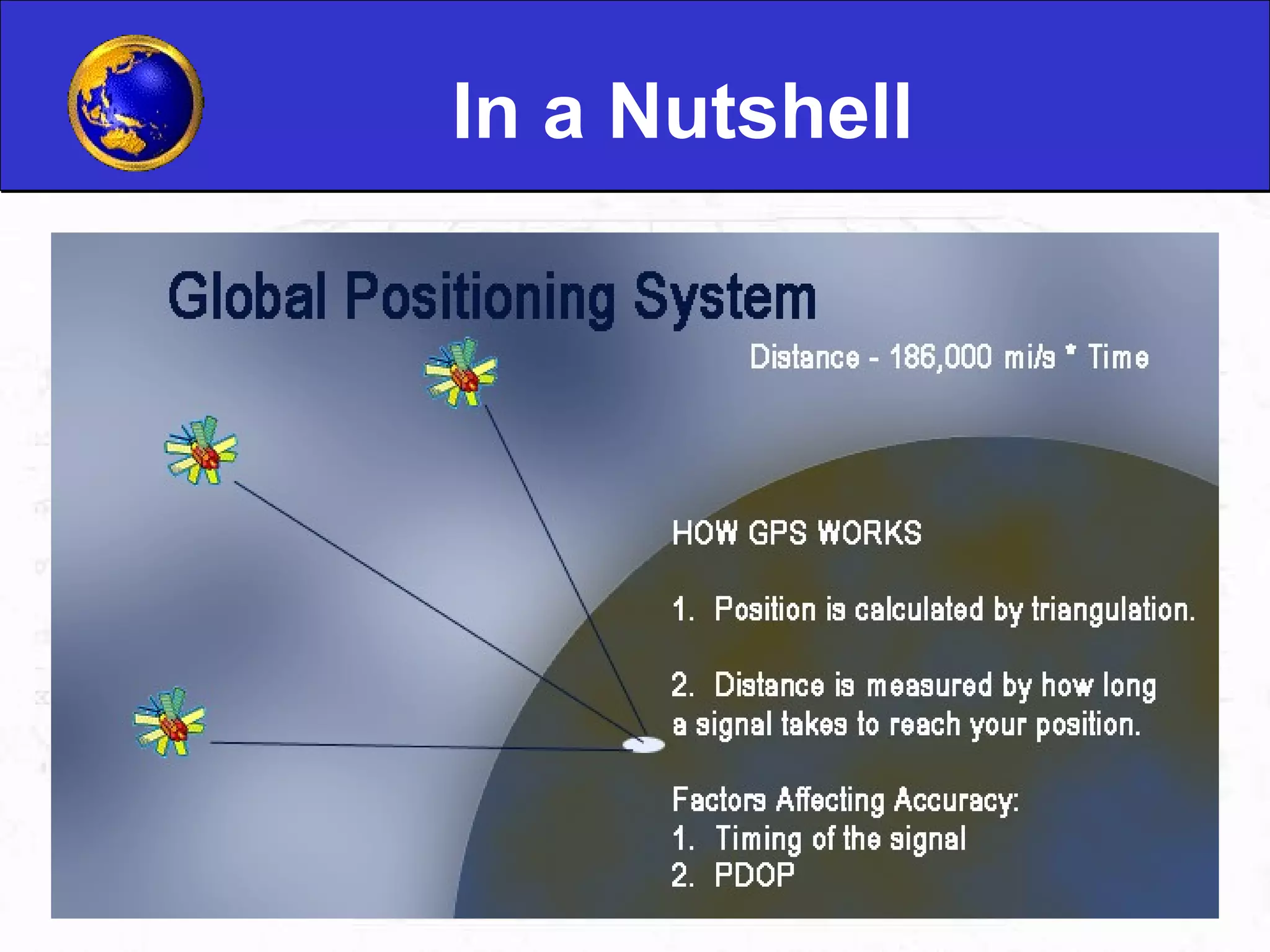
GPS uses a network of satellites and receivers to calculate the precise location of a person or object anywhere on Earth. It works by measuring the time it takes signals from at least 3 satellites to reach a GPS receiver, allowing the receiver to triangulate its position using geometry. While satellites carry atomic clocks for precision, most receivers use less accurate clocks, which can impact location calculation accuracy. Obstructions and signal interference may also introduce errors.
GPS is a global positioning system comprising satellites, receivers, and software. Satellites provide navigation signals for determining precise locations.
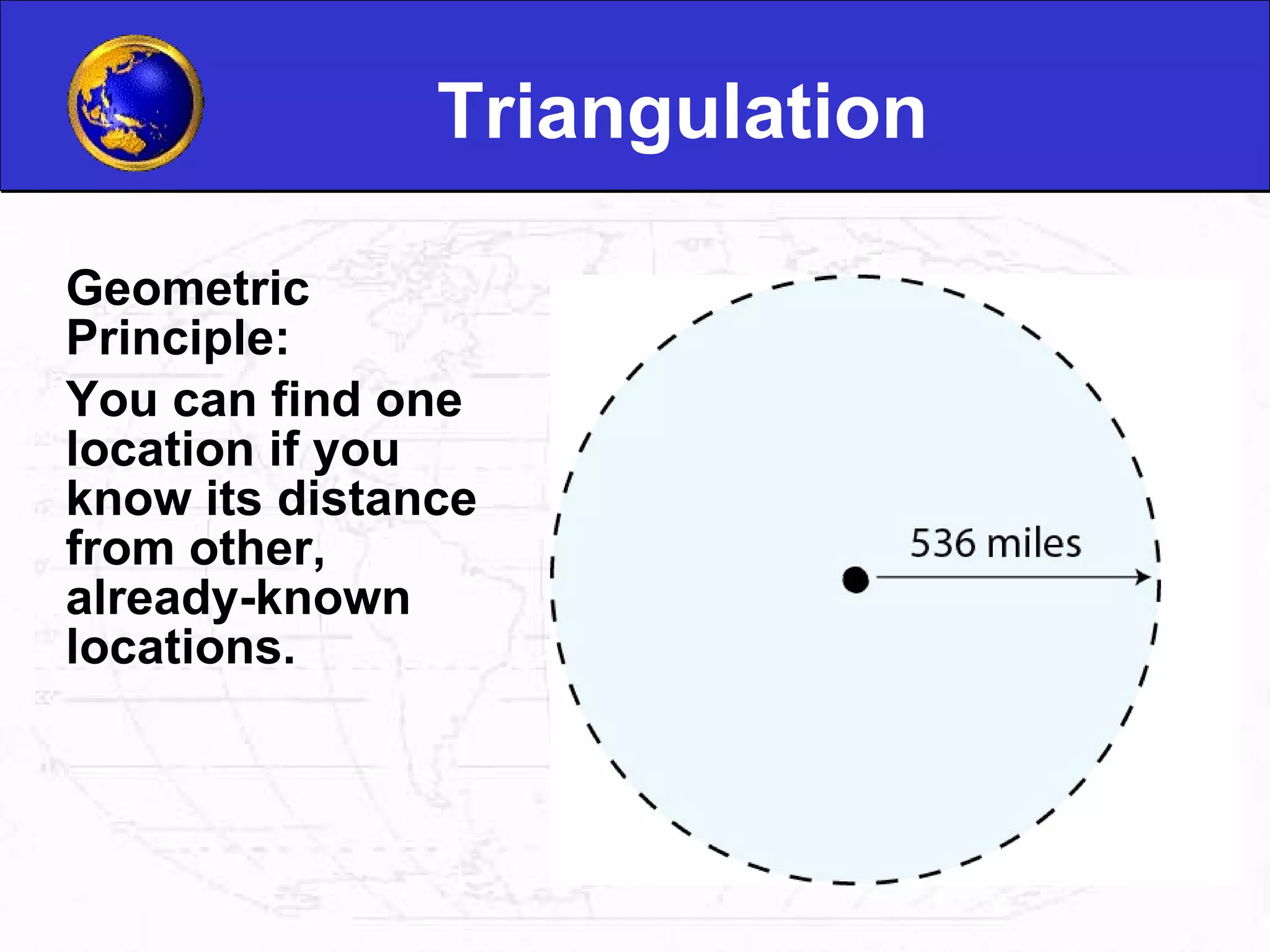
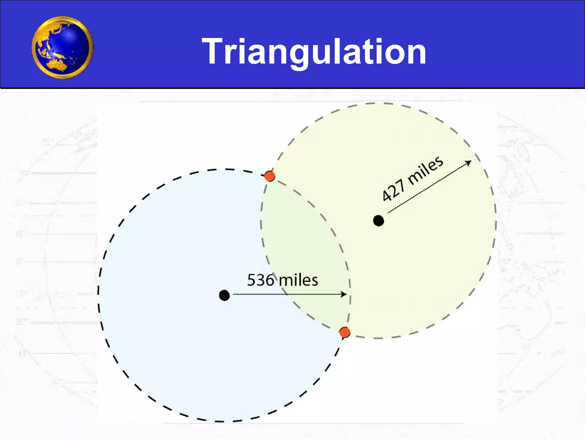
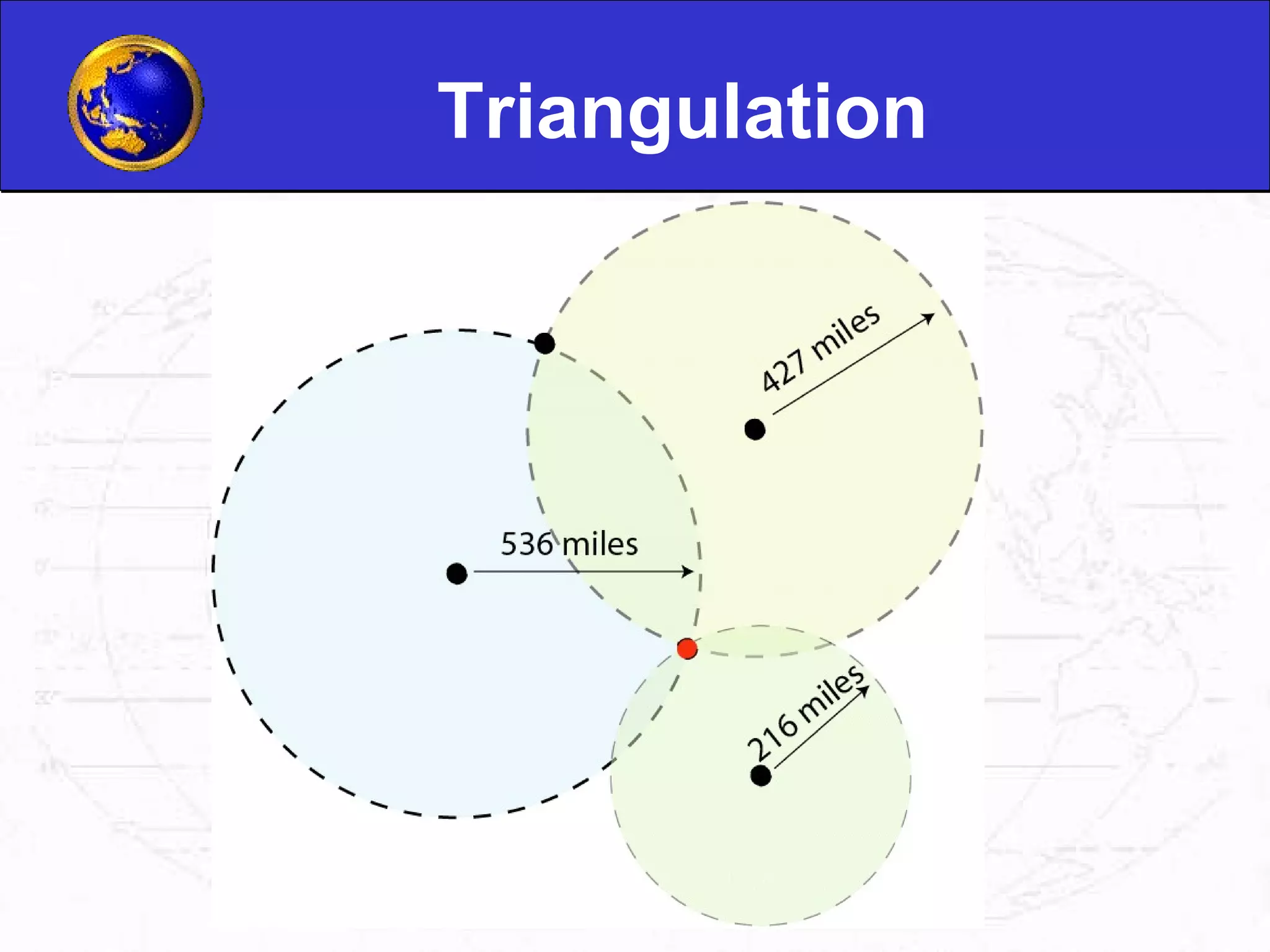
GPS receivers utilize signals from satellites to calculate distances. Triangulation enables accurate location determination using known distances.
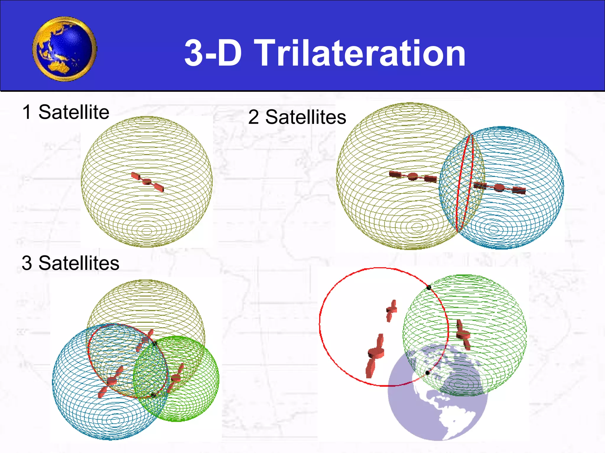
3-D trilateration enhances accuracy in GPS location. Atomic clocks ensure precise timing. Signal interference and refraction can affect transmission.
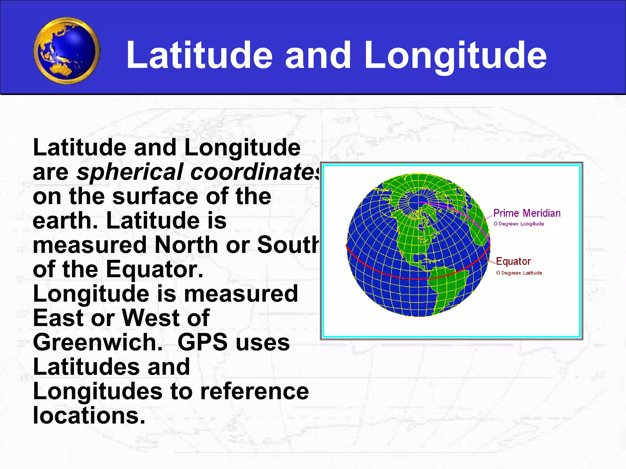
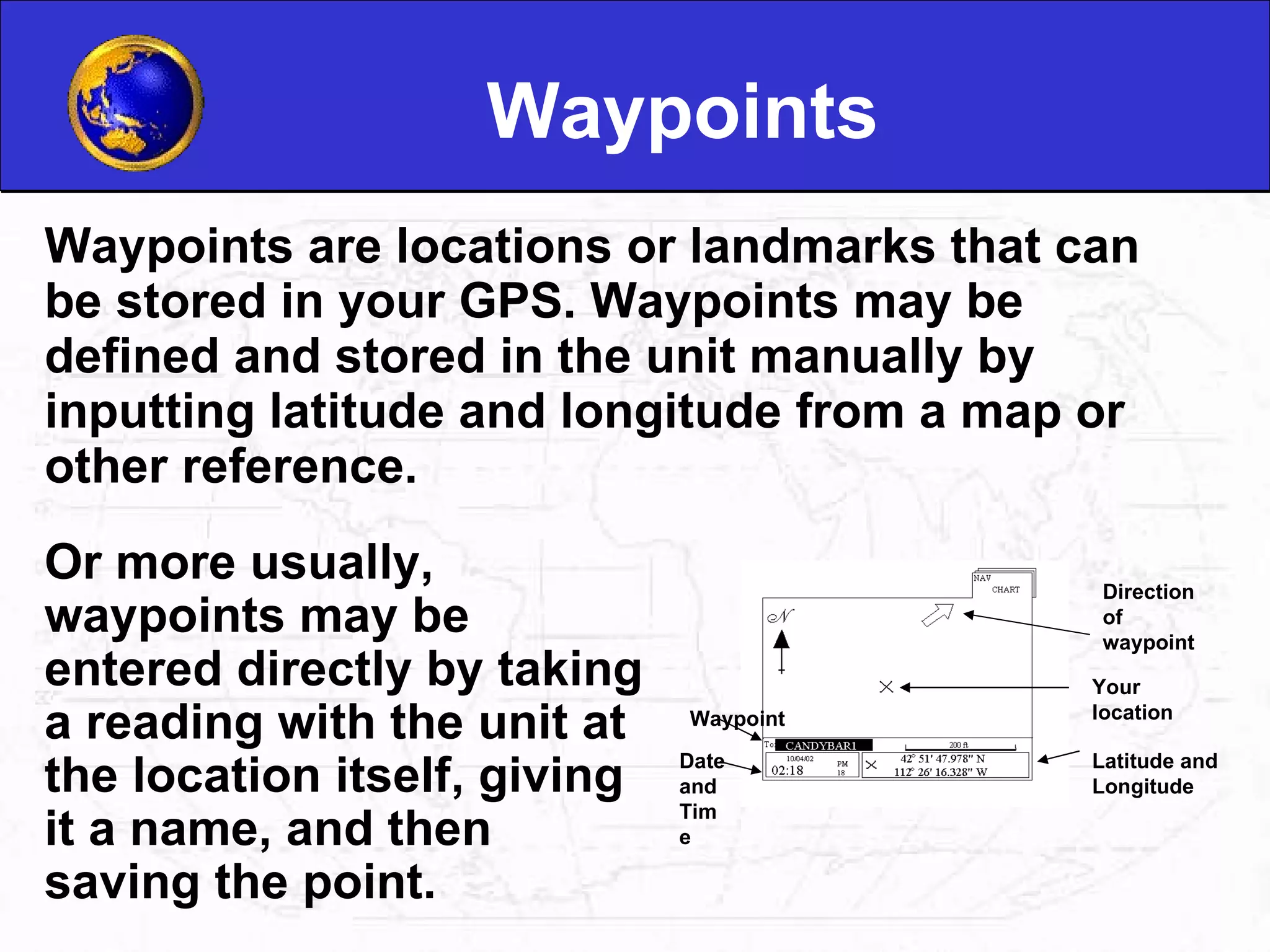
Latitude and longitude are coordinates for earth location. Waypoints are landmarks stored in GPS devices, aiding navigation.
GPS is used by police, emergency services, firefighters, map makers, and in scientific research.
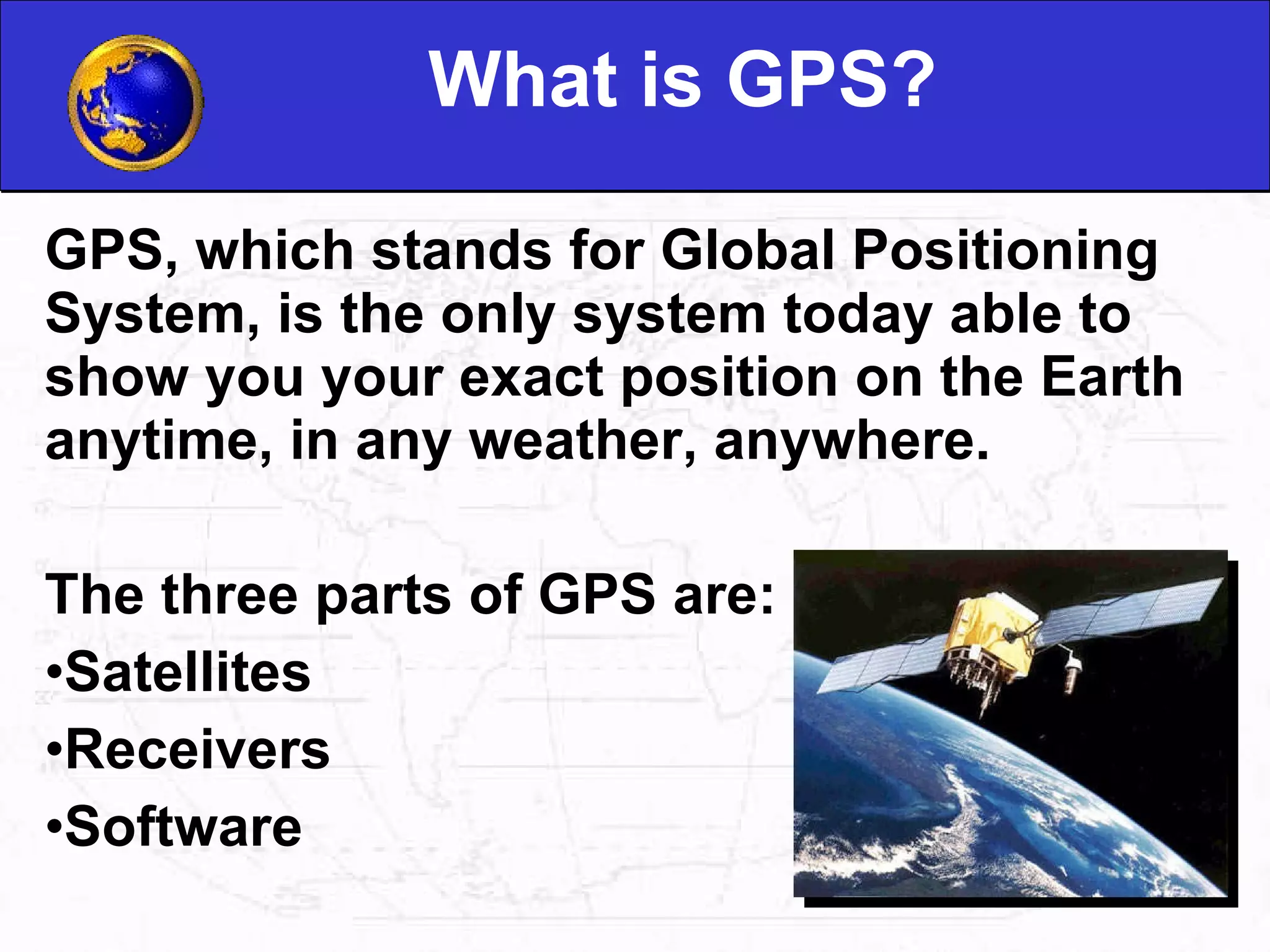
What is GPS?GPS, which stands for Global Positioning System, is the only system today able to show you your exact position on the Earth anytime, in any weather, anywhere. The three parts of GPS are: Satellites Receivers Software
2.
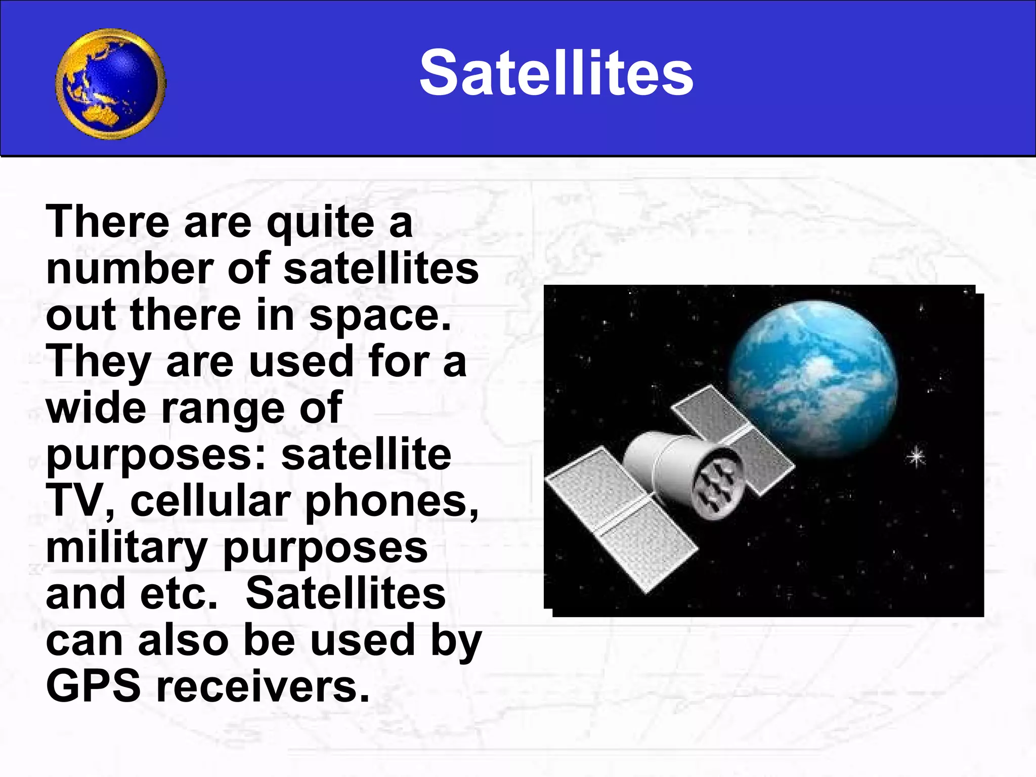
Satellites There arequite a number of satellites out there in space. They are used for a wide range of purposes: satellite TV, cellular phones, military purposes and etc. Satellites can also be used by GPS receivers.
3.
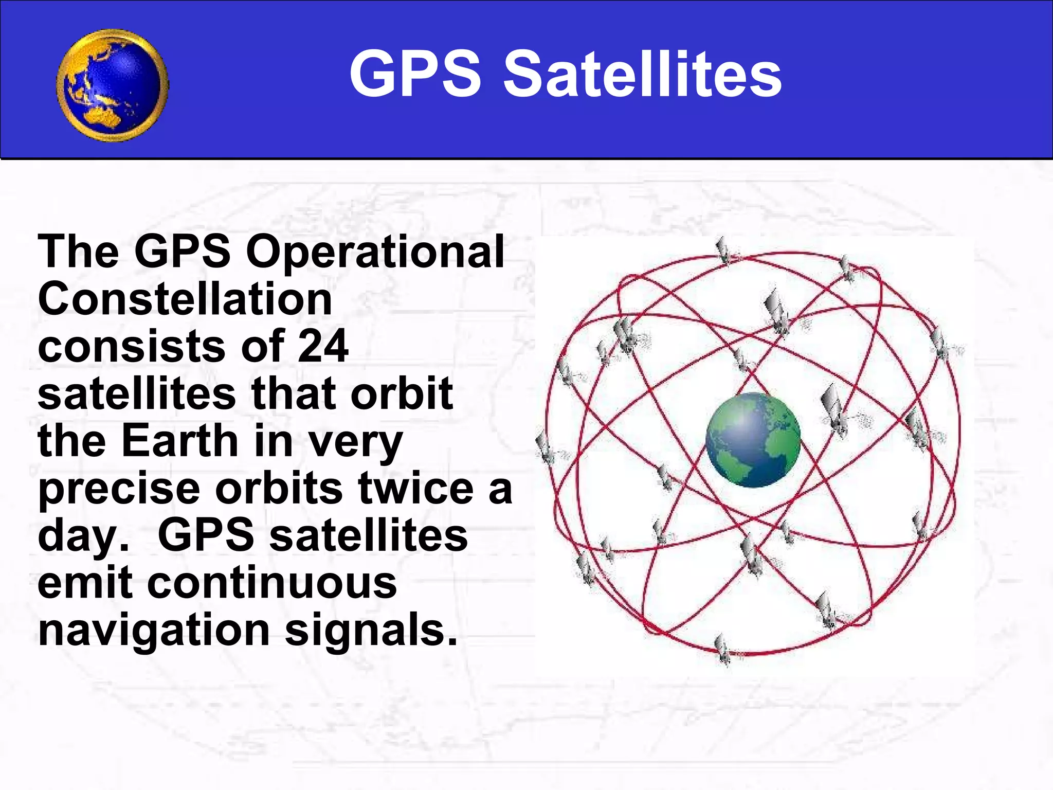
GPS Satellites TheGPS Operational Constellation consists of 24 satellites that orbit the Earth in very precise orbits twice a day. GPS satellites emit continuous navigation signals.
4.
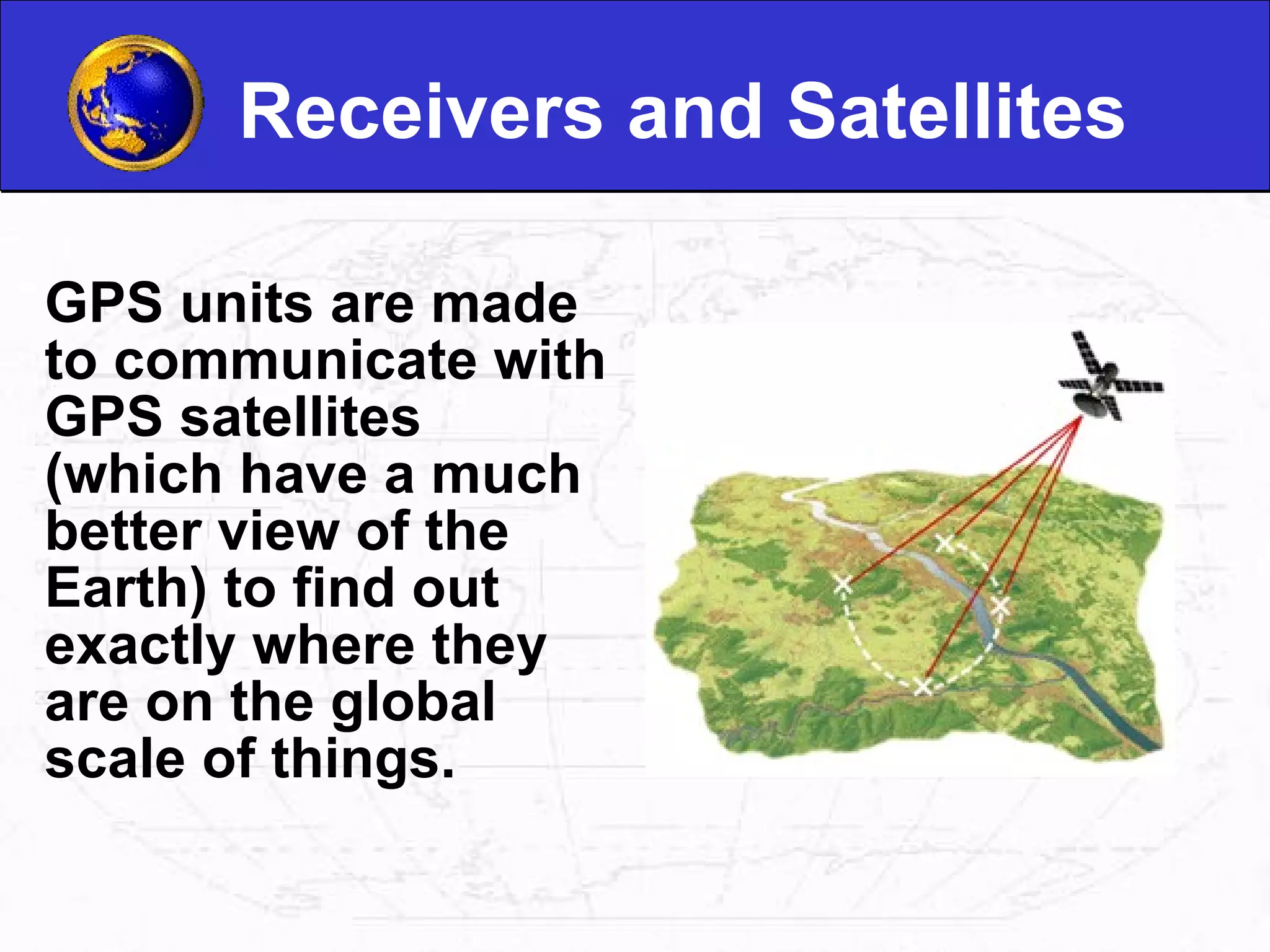
Receivers and SatellitesGPS units are made to communicate with GPS satellites (which have a much better view of the Earth) to find out exactly where they are on the global scale of things.
5.
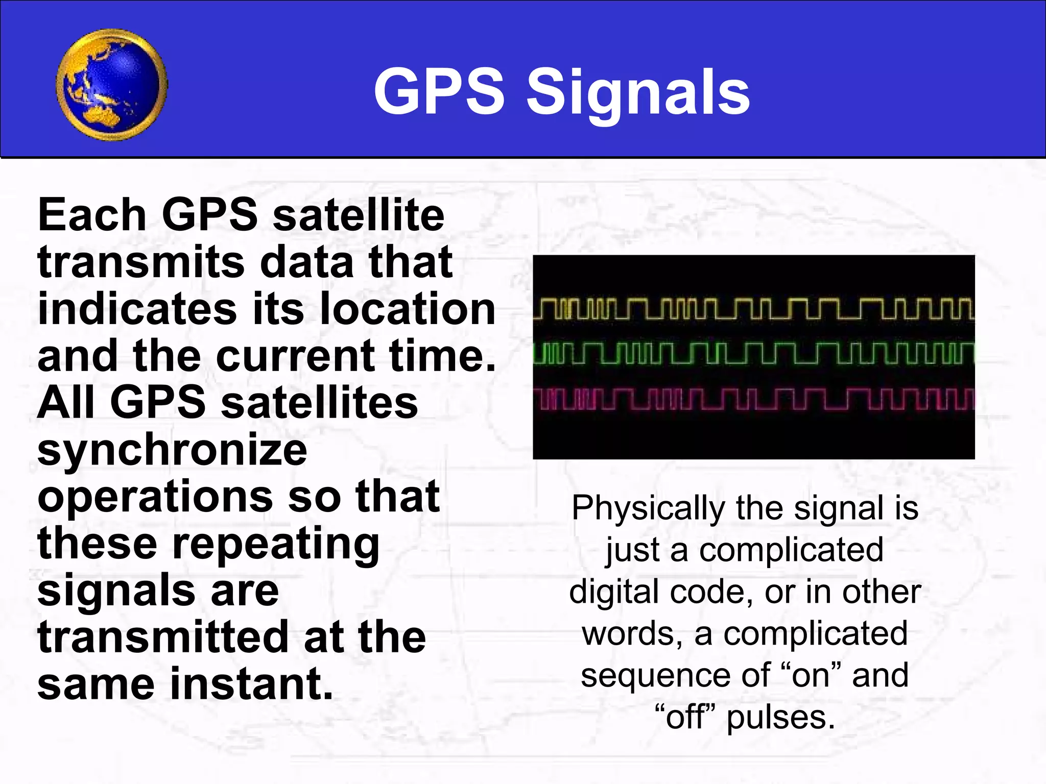
GPS Signals EachGPS satellite transmits data that indicates its location and the current time. All GPS satellites synchronize operations so that these repeating signals are transmitted at the same instant. Physically the signal is just a complicated digital code, or in other words, a complicated sequence of “on” and “off” pulses.
6.
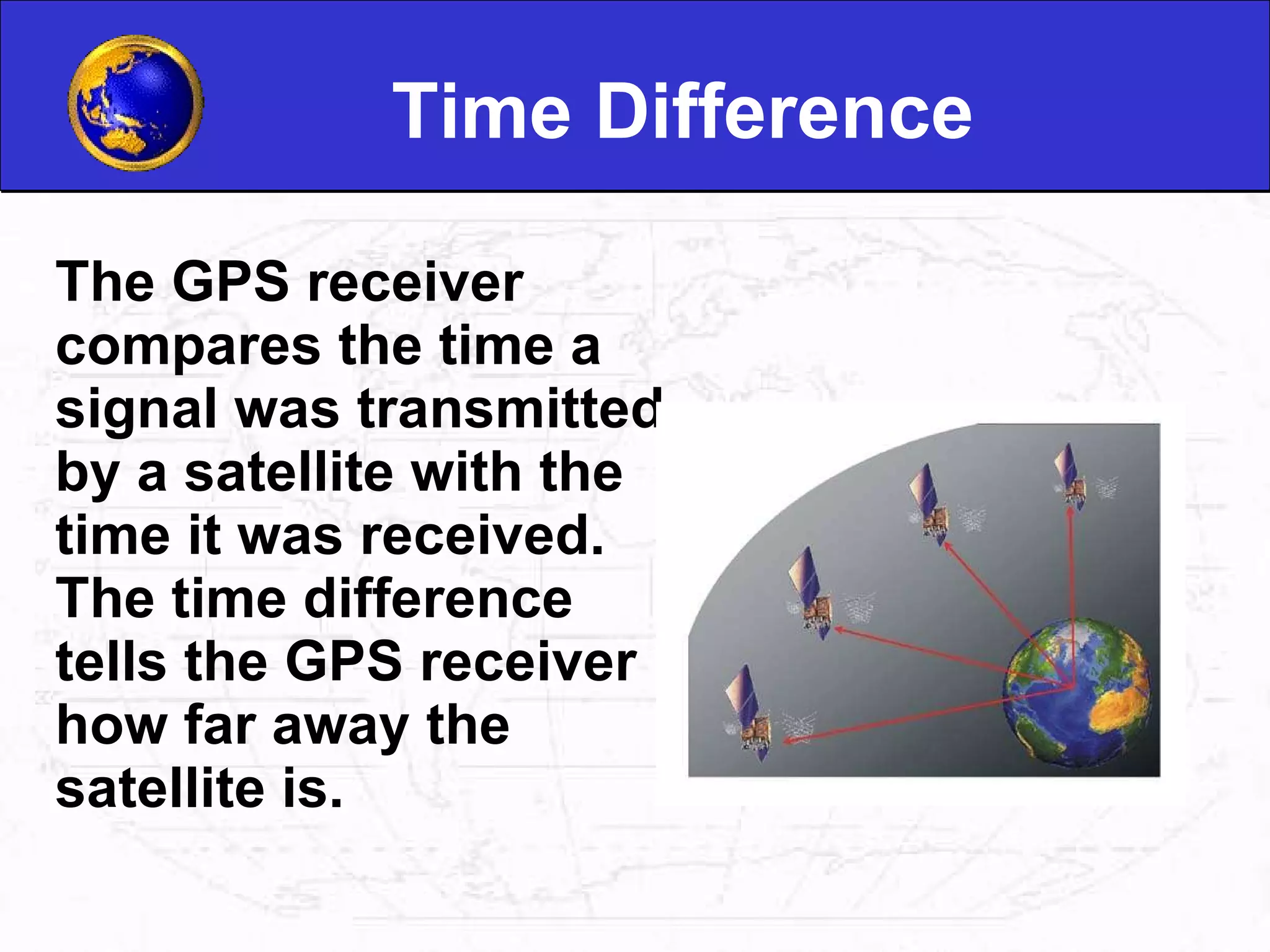
Time Difference TheGPS receiver compares the time a signal was transmitted by a satellite with the time it was received. The time difference tells the GPS receiver how far away the satellite is.
7.
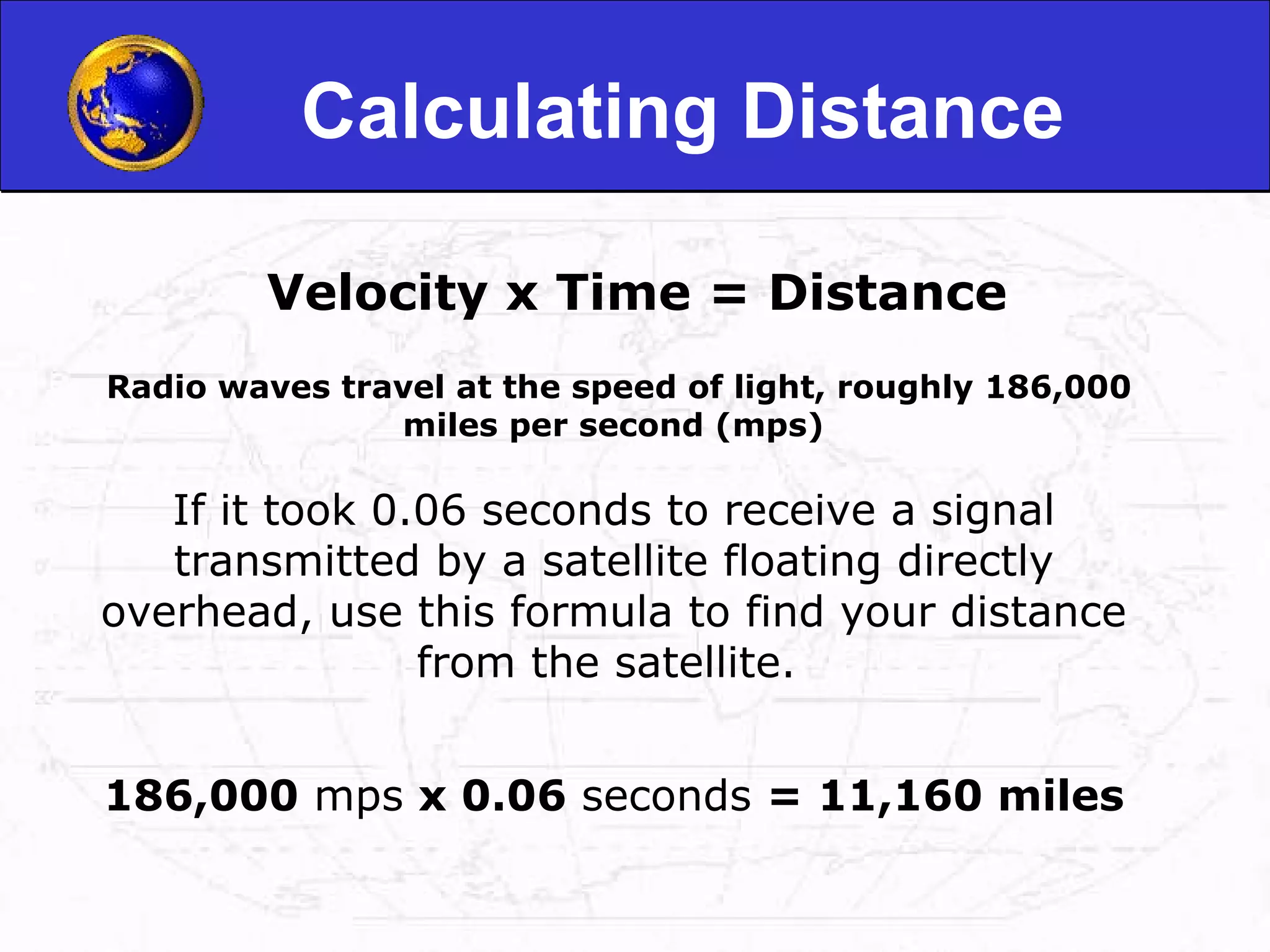
Calculating Distance Velocityx Time = Distance Radio waves travel at the speed of light, roughly 186,000 miles per second (mps) If it took 0.06 seconds to receive a signal transmitted by a satellite floating directly overhead, use this formula to find your distance from the satellite. 186,000 mps x 0.06 seconds = 11,160 miles
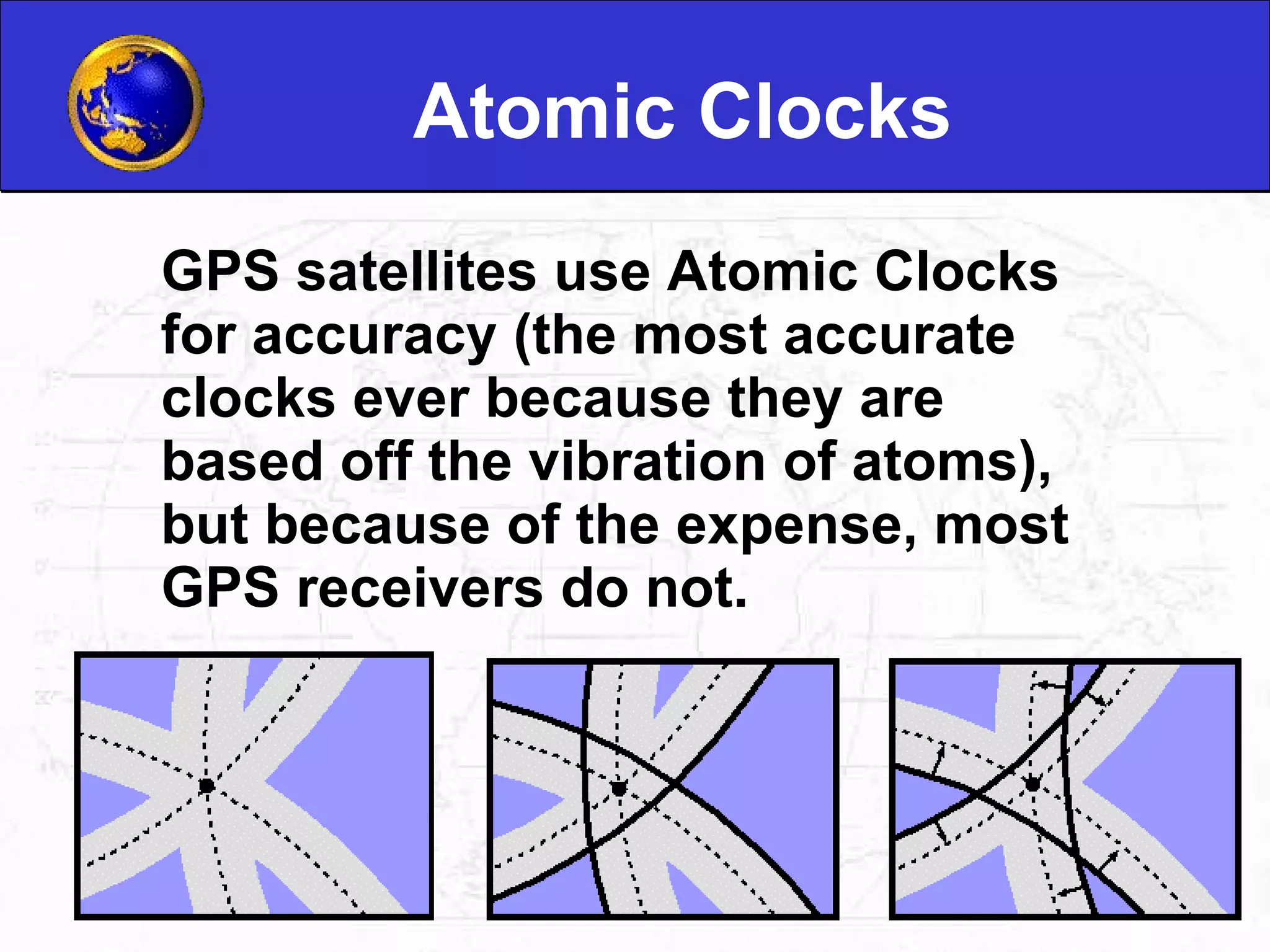
Atomic Clocks GPSsatellites use Atomic Clocks for accuracy (the most accurate clocks ever because they are based off the vibration of atoms), but because of the expense, most GPS receivers do not.
13.
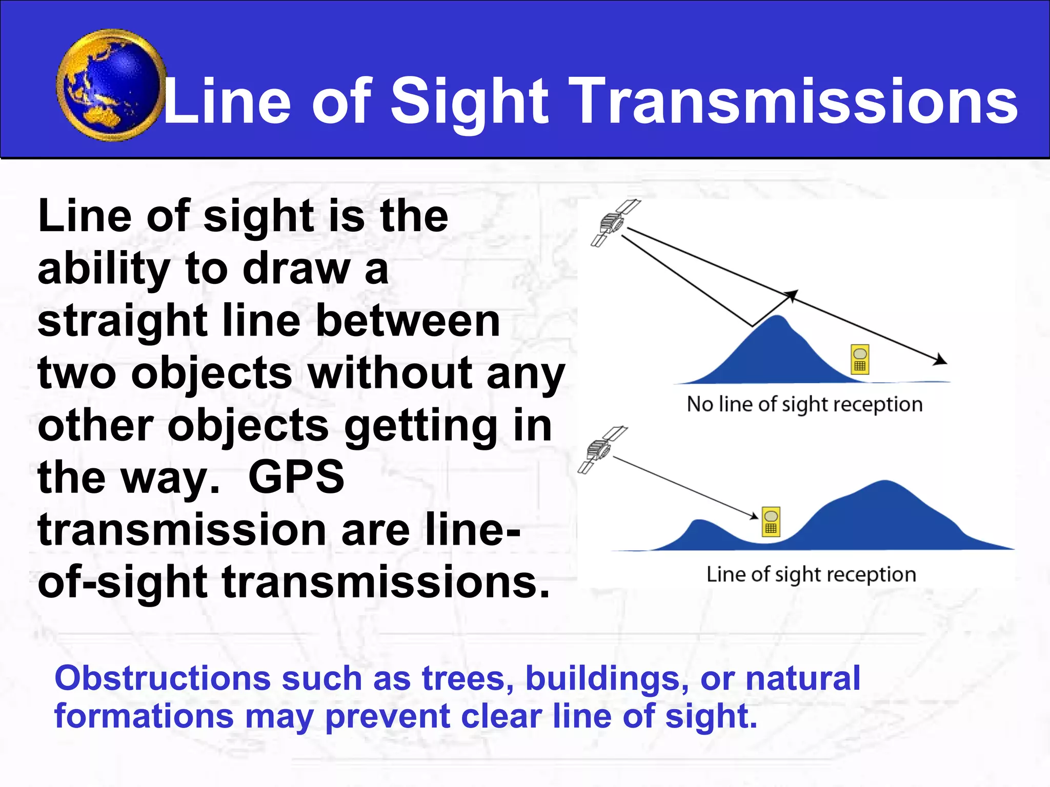
Line of SightTransmissions Line of sight is the ability to draw a straight line between two objects without any other objects getting in the way. GPS transmission are line-of-sight transmissions. Obstructions such as trees, buildings, or natural formations may prevent clear line of sight.
14.
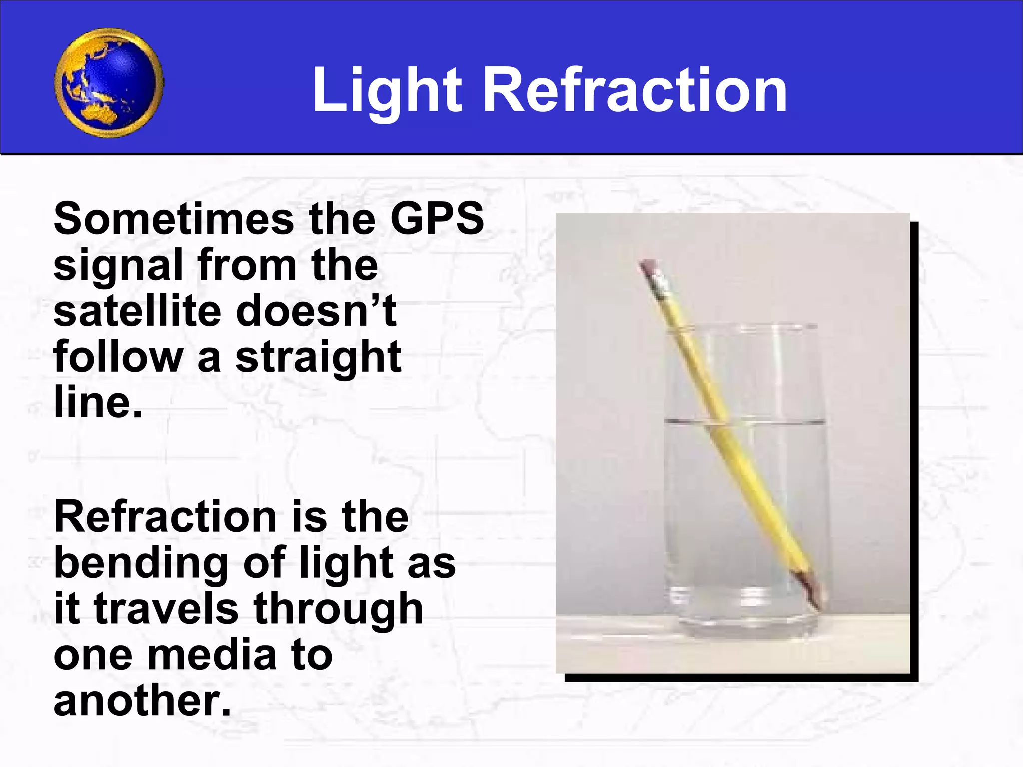
Light Refraction Sometimesthe GPS signal from the satellite doesn’t follow a straight line. Refraction is the bending of light as it travels through one media to another.
15.
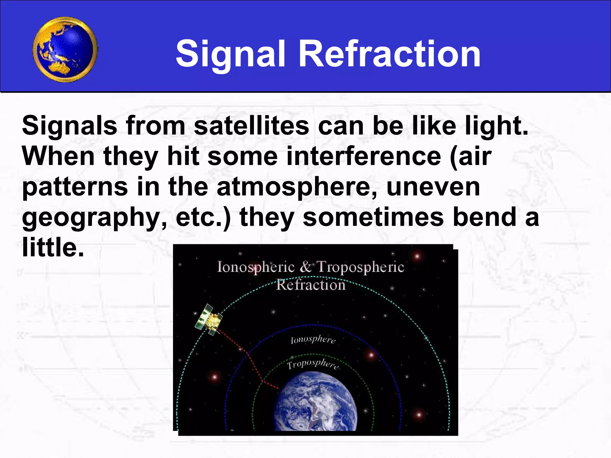
Signal Refraction Signalsfrom satellites can be like light. When they hit some interference (air patterns in the atmosphere, uneven geography, etc.) they sometimes bend a little.
Latitude and LongitudeLatitude and Longitude are spherical coordinates on the surface of the earth. Latitude is measured North or South of the Equator. Longitude is measured East or West of Greenwich. GPS uses Latitudes and Longitudes to reference locations.
19.
Waypoints Waypoints arelocations or landmarks that can be stored in your GPS. Waypoints may be defined and stored in the unit manually by inputting latitude and longitude from a map or other reference. Or more usually, waypoints may be entered directly by taking a reading with the unit at the location itself, giving it a name, and then saving the point. Latitude and Longitude Your location Direction of waypoint Date and Time Waypoint
20.
GPS Uses Policeand Emergency Medical Services Firefighters Map makers Science
Editor's Notes
#6 Signal chosen because: The complex pattern ensures that the receiver does not accidentally synchronize up to some other signal or so the receiver won’t accidentally pick up another satellite’s signal
#13 the dashed lines show the actual intersection point, and the gray bands indicate the area of uncertainty. the solid lines indicate where the GPS receiver "thinks" the spheres are located. Because of errors in the receiver's internal clock, these spheres do not intersect at one point. The GPS receiver must change the size of the spheres until the intersection point is determined. The relative size of each sphere has already been calculated, so if the size of one sphere is changed, the other spheres must be adjusted by exactly the same amount .


![Introduction to gps [compatibility mode]](https://cdn.slidesharecdn.com/ss_thumbnails/introductiontogpscompatibilitymode-131231040925-phpapp01-thumbnail.jpg?width=640&height=640&fit=bounds)


