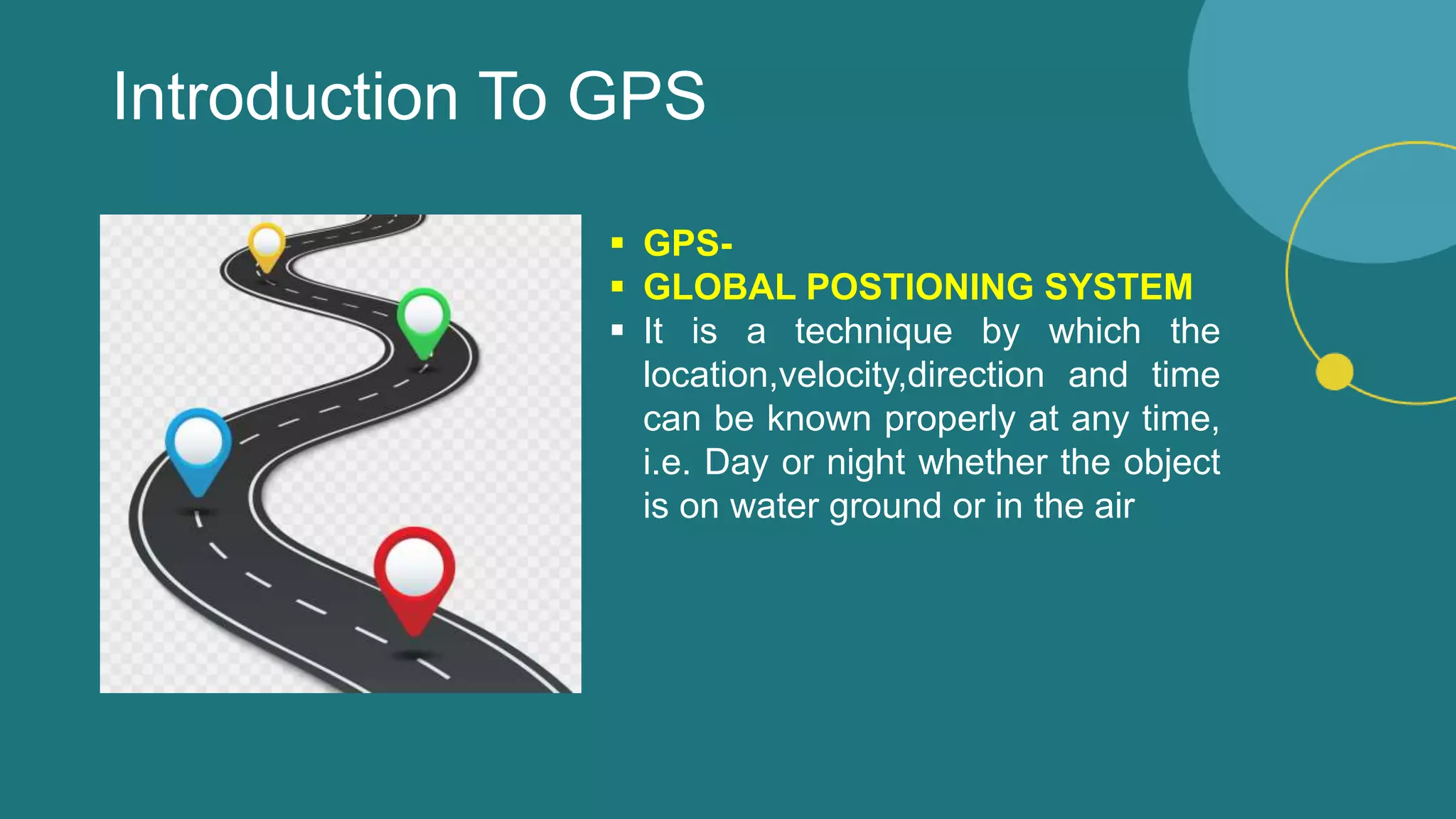
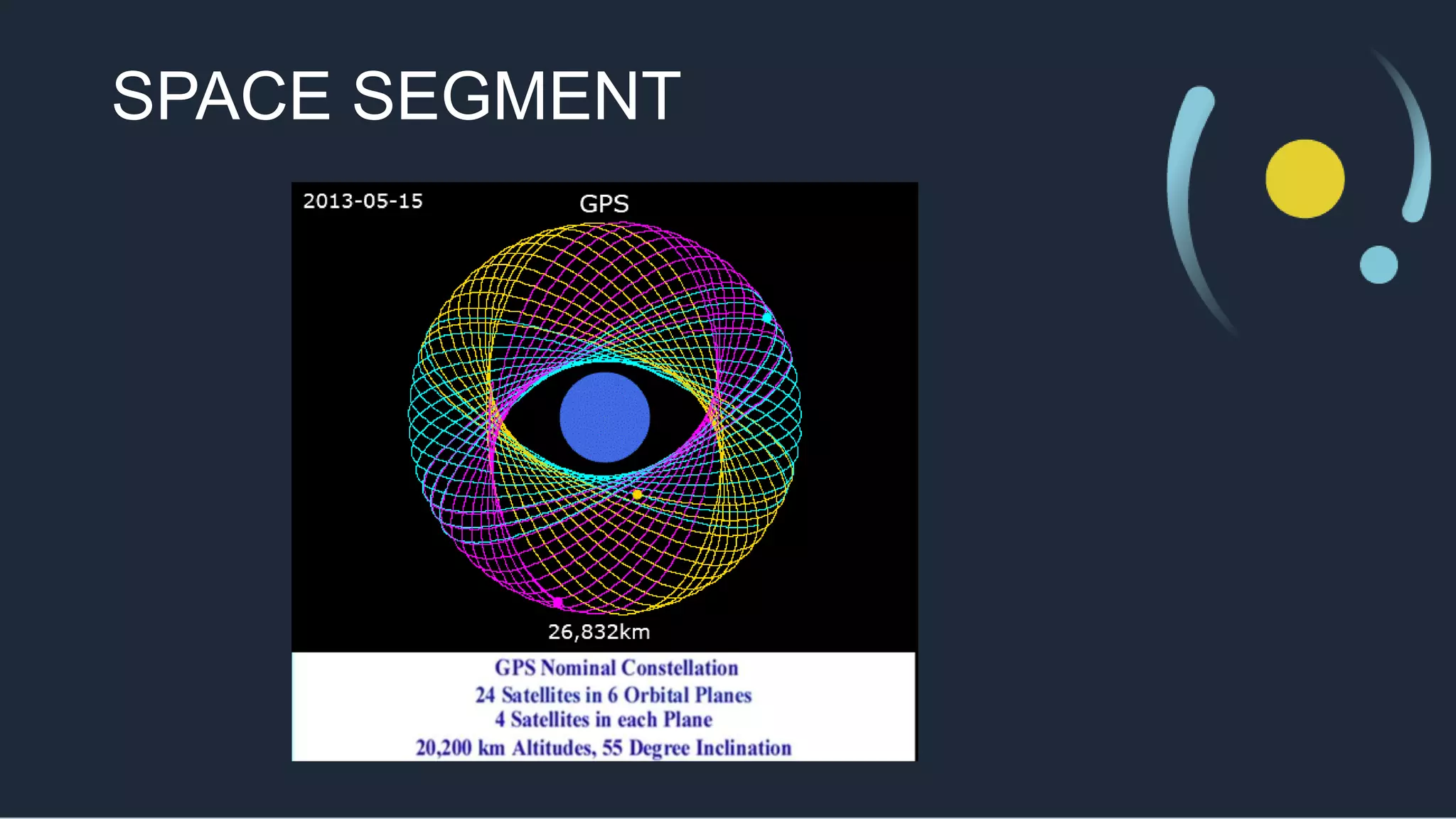
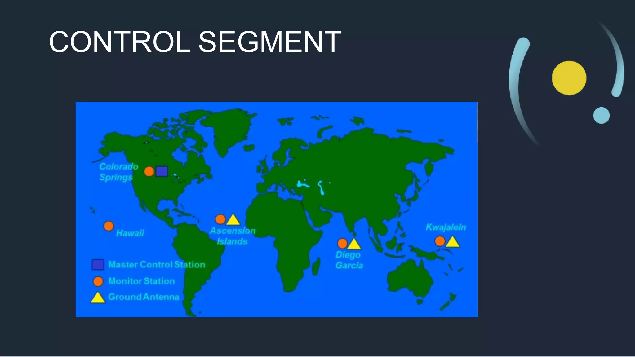
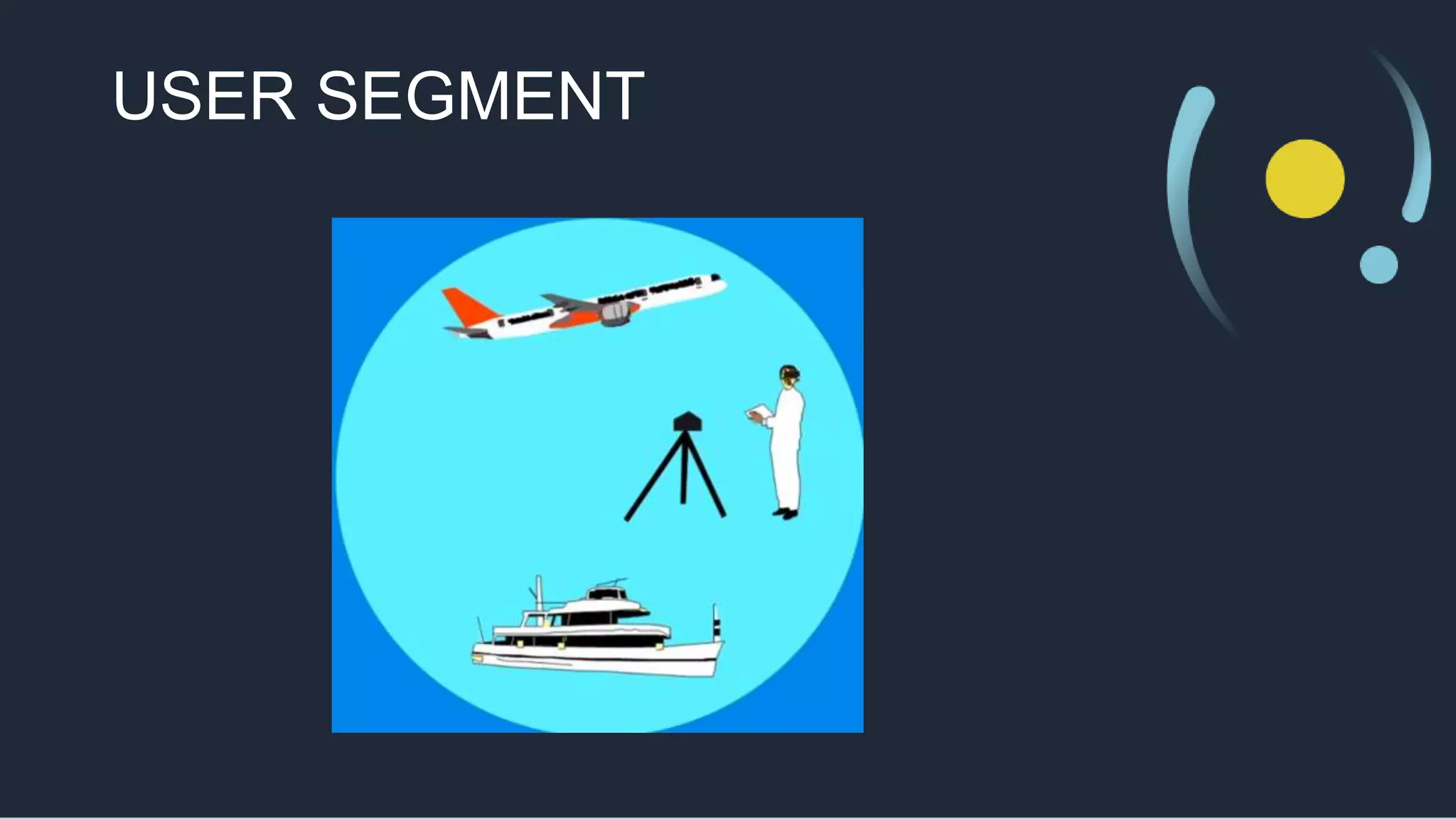
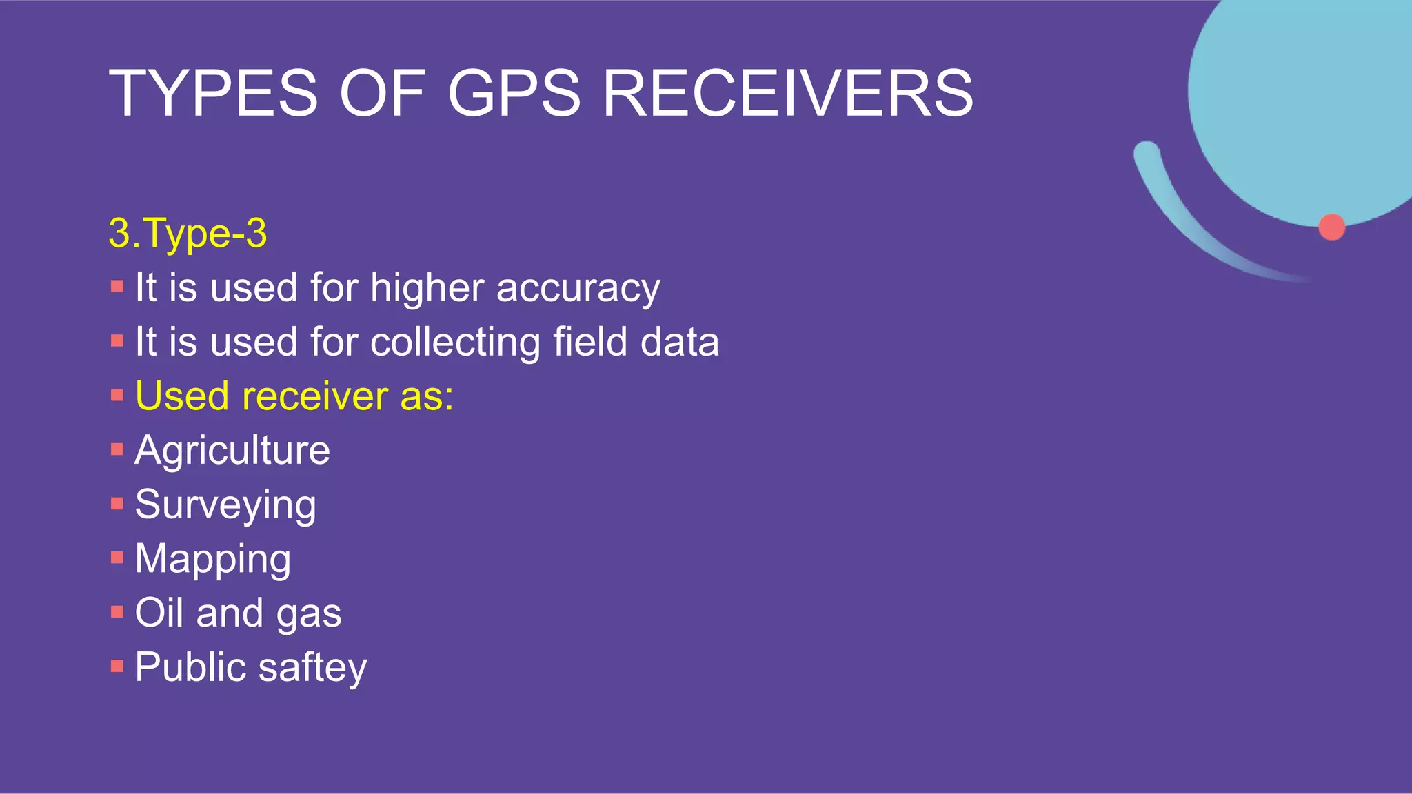
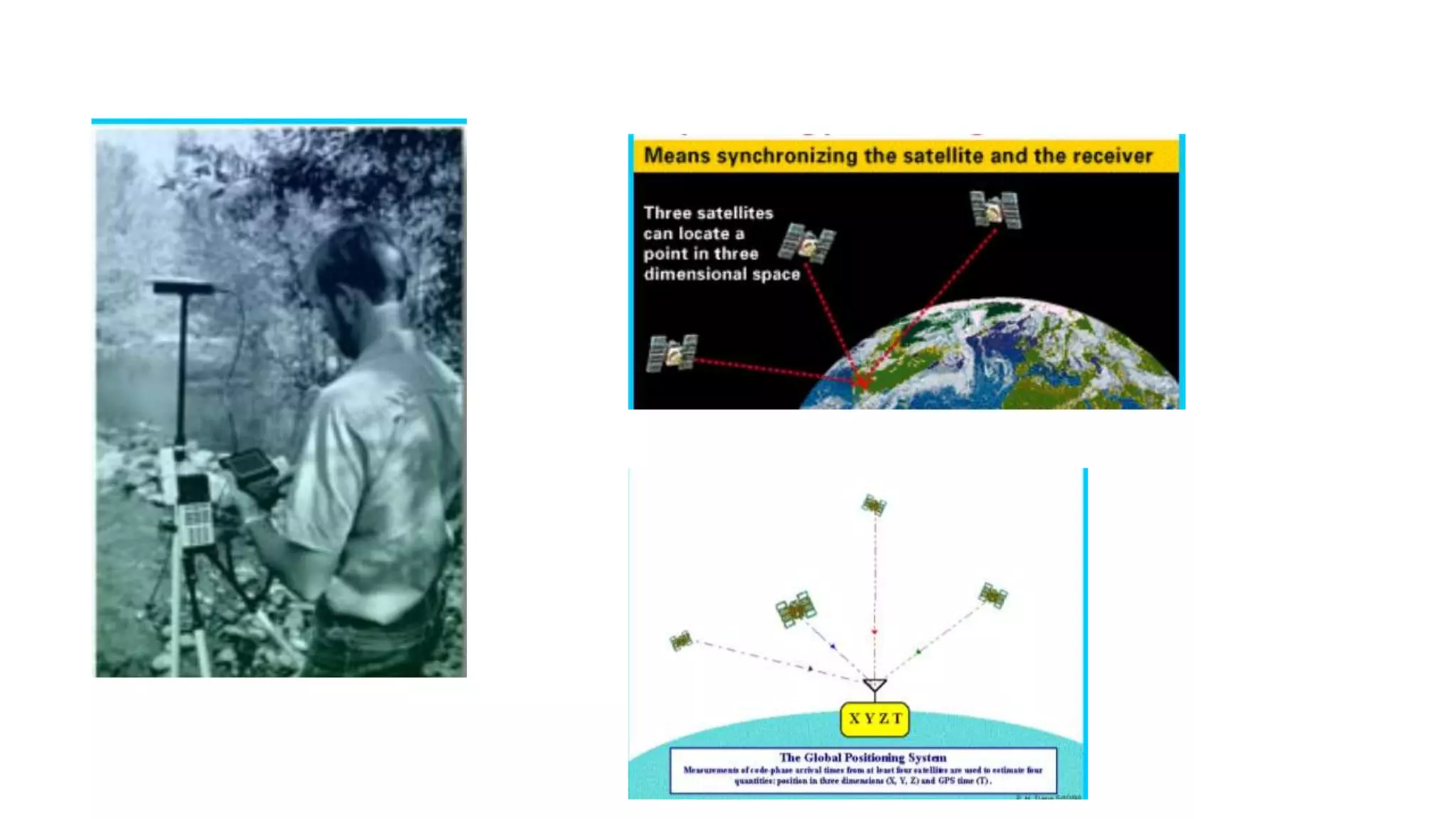
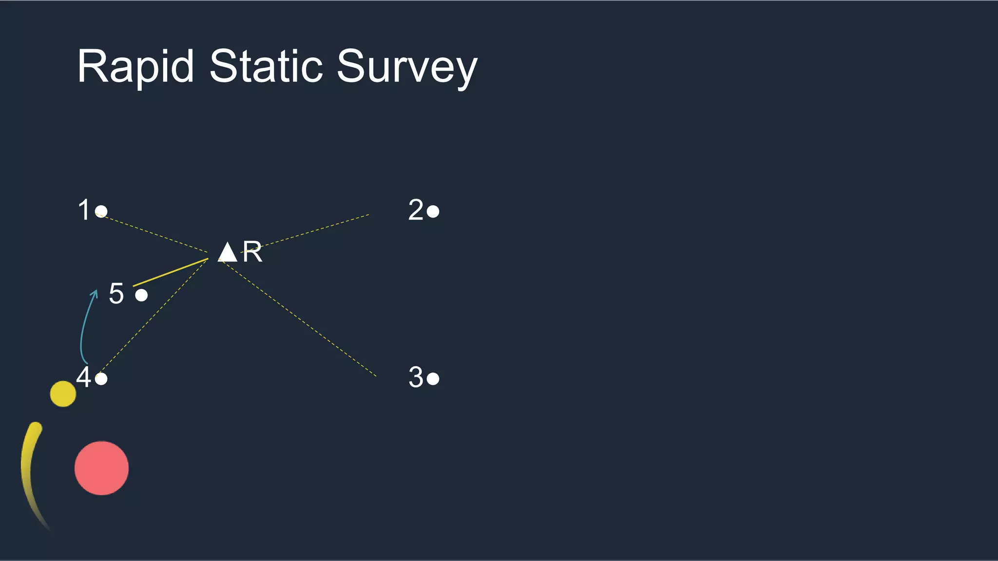
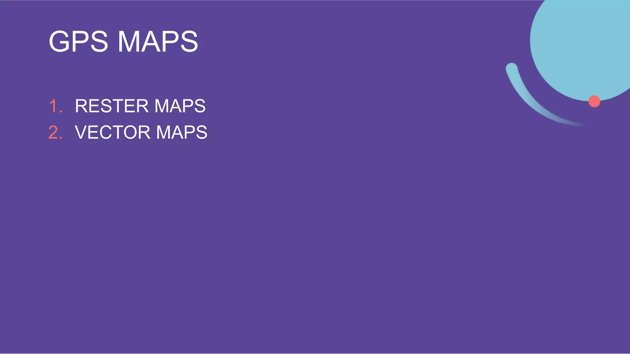
The document discusses Global Positioning System (GPS). It describes GPS as a system that uses satellites to provide location and time information to receivers on Earth. The system has three segments: space (the satellites), control (ground stations that monitor the satellites), and user (people with GPS receivers). Some key uses of GPS include navigation, tracking, and mapping. The document outlines different types of GPS receivers and surveying techniques, such as static and rapid static surveys. It also briefly discusses GPS maps.
This content introduces the Global Navigation Satellite System (GNSS), its example, earth observation orbit types, coordinate systems, GNSS time system, converting height (ellipsoidal, geoid, orthometric heights) and various GNSS applications.
A Comprehending overview of how a GPS (global positioning system) works with a set of satellites ready to provide precision status on location to base station (cell) of user.
#Share the Knowledge
The Global Positioning System (GPS), originally Navstar GPS, is a satellite-based radionavigation system owned by the United States government and operated by the United States Space Force.
It is one of the global navigation satellite systems (GNSS) that provides geolocation and time information to a GPS receiver anywhere on or near the Earth where there is an unobstructed line of sight to four or more GPS satellites.
Obstacles such as mountains and buildings block the relatively weak GPS signals.
It depicts the basic information about GPS technology and its various uses in engineering and other fields. May be useful for students of engineering and for presentation.
GPS technology
Google maps
Navigation satellite base
This communicates directly with a control centre through a mobile network, whether General Packet Radio Service (GPRS) or 4G
Global Positioning System (GPS) is a satellite based navigation system that can provide people who use it with their exact position on Earth, tell them how to get to another location, how fast they are moving, where they have been, how far they have gone, what time it is. GPS was originally designed to help the U.S. military with finding the accurate location of their soldiers, vehicles, planes and ships around the world. Now, GPS is used in cellular phones, navigation and map making.
Space segmentsGPS satellites fly in medium Earth orbit (MEO) at an altitude of approximately 20,200 km (12,550 miles). Each satellite circles the Earth twice a day.The satellites in the GPS constellation are arranged into six equally-spaced orbital planes surrounding the Earth. Each plane contains four "slots" occupied by baseline satellites. This 24-slot arrangement ensures users can view at least four satellites from virtually any point on the planet.
The control segment
The control segment of the GPS system consists of a worldwide network of tracking stations.
The master control station (MCS) located in the United States at Colorado Springs, Colorado.
The primary task of the operational control segment is tracking the GPS satellites in order to determine and predict satellite locations, system integrity, behavior of the satellite atomic clocks, atmospheric data, the satellite almanac, and other considerations.
The User segment
The user segment includes all military and civilian users. With a GPS receiver connected to a GPS antenna, a user can receive the GPS signals, which can be used to determine his or her position anywhere in the world. GPS is currently available to all users worldwide at no direct charge.
How it work?When a GPS receiver is first turned on, it downloads orbit information from all the satellites called an almanac.Once this information is downloaded, it is stored in the receiver’s memory for future use. The GPS receiver calculates the distance from each satellite to the receiver by using the distance formula: distance = velocity x time.The receiver determines position by using triangulation. When it receives signals from at least three satellites the receiver should be able to calculate its approximate position (a 2D position). The receiver needs at least four or more satellites to calculate a more accurate 3D position. The position can be reported in latitude/longitude.
The two GPS codes are;-
Coarse acquisition (or C/A-code)
Precision (or P-code).
The C/A-code is modulated onto the L1 carrier only, while the P-code is modulated onto both the L1 and the L2 carriers. This modulation is called biphase modulation, because the carrier phase is shifted by 180° when the code value changes from zero to one or from one to zero.
Source of GPS error
Satellite clock errors: Caused by slight discrepancies in each satellite’s four atomic clocks. Errors are monitored and corrected by the Master Control Station.
Orbit errors:Satellite orbits.
The Presentation on "Global Positioning System" gives an insight on the segment of GPS, how the positioning system works, its advantages and disadvantages, applications and new innovations in the field.
Disclaimer: None of the information in the above Presentation is authored by me. They references for the information used is the internet, news articles and books.
Industrial Training at Shahjalal Fertilizer Company Limited (SFCL)MdTanvirMahtab2
This presentation is about the working procedure of Shahjalal Fertilizer Company Limited (SFCL). A Govt. owned Company of Bangladesh Chemical Industries Corporation under Ministry of Industries.
NO1 Uk best vashikaran specialist in delhi vashikaran baba near me online vas...Amil Baba Dawood bangali
Contact with Dawood Bhai Just call on +92322-6382012 and we'll help you. We'll solve all your problems within 12 to 24 hours and with 101% guarantee and with astrology systematic. If you want to take any personal or professional advice then also you can call us on +92322-6382012 , ONLINE LOVE PROBLEM & Other all types of Daily Life Problem's.Then CALL or WHATSAPP us on +92322-6382012 and Get all these problems solutions here by Amil Baba DAWOOD BANGALI
#vashikaranspecialist #astrologer #palmistry #amliyaat #taweez #manpasandshadi #horoscope #spiritual #lovelife #lovespell #marriagespell#aamilbabainpakistan #amilbabainkarachi #powerfullblackmagicspell #kalajadumantarspecialist #realamilbaba #AmilbabainPakistan #astrologerincanada #astrologerindubai #lovespellsmaster #kalajaduspecialist #lovespellsthatwork #aamilbabainlahore#blackmagicformarriage #aamilbaba #kalajadu #kalailam #taweez #wazifaexpert #jadumantar #vashikaranspecialist #astrologer #palmistry #amliyaat #taweez #manpasandshadi #horoscope #spiritual #lovelife #lovespell #marriagespell#aamilbabainpakistan #amilbabainkarachi #powerfullblackmagicspell #kalajadumantarspecialist #realamilbaba #AmilbabainPakistan #astrologerincanada #astrologerindubai #lovespellsmaster #kalajaduspecialist #lovespellsthatwork #aamilbabainlahore #blackmagicforlove #blackmagicformarriage #aamilbaba #kalajadu #kalailam #taweez #wazifaexpert #jadumantar #vashikaranspecialist #astrologer #palmistry #amliyaat #taweez #manpasandshadi #horoscope #spiritual #lovelife #lovespell #marriagespell#aamilbabainpakistan #amilbabainkarachi #powerfullblackmagicspell #kalajadumantarspecialist #realamilbaba #AmilbabainPakistan #astrologerincanada #astrologerindubai #lovespellsmaster #kalajaduspecialist #lovespellsthatwork #aamilbabainlahore #Amilbabainuk #amilbabainspain #amilbabaindubai #Amilbabainnorway #amilbabainkrachi #amilbabainlahore #amilbabaingujranwalan #amilbabainislamabad
Courier management system project report.pdfKamal Acharya
It is now-a-days very important for the people to send or receive articles like imported furniture, electronic items, gifts, business goods and the like. People depend vastly on different transport systems which mostly use the manual way of receiving and delivering the articles. There is no way to track the articles till they are received and there is no way to let the customer know what happened in transit, once he booked some articles. In such a situation, we need a system which completely computerizes the cargo activities including time to time tracking of the articles sent. This need is fulfilled by Courier Management System software which is online software for the cargo management people that enables them to receive the goods from a source and send them to a required destination and track their status from time to time.
Explore the innovative world of trenchless pipe repair with our comprehensive guide, "The Benefits and Techniques of Trenchless Pipe Repair." This document delves into the modern methods of repairing underground pipes without the need for extensive excavation, highlighting the numerous advantages and the latest techniques used in the industry.
Learn about the cost savings, reduced environmental impact, and minimal disruption associated with trenchless technology. Discover detailed explanations of popular techniques such as pipe bursting, cured-in-place pipe (CIPP) lining, and directional drilling. Understand how these methods can be applied to various types of infrastructure, from residential plumbing to large-scale municipal systems.
Ideal for homeowners, contractors, engineers, and anyone interested in modern plumbing solutions, this guide provides valuable insights into why trenchless pipe repair is becoming the preferred choice for pipe rehabilitation. Stay informed about the latest advancements and best practices in the field.
Forklift Classes Overview by Intella PartsIntella Parts
Discover the different forklift classes and their specific applications. Learn how to choose the right forklift for your needs to ensure safety, efficiency, and compliance in your operations.
For more technical information, visit our website https://intellaparts.com
Water scarcity is the lack of fresh water resources to meet the standard water demand. There are two type of water scarcity. One is physical. The other is economic water scarcity.
Welcome to WIPAC Monthly the magazine brought to you by the LinkedIn Group Water Industry Process Automation & Control.
In this month's edition, along with this month's industry news to celebrate the 13 years since the group was created we have articles including
A case study of the used of Advanced Process Control at the Wastewater Treatment works at Lleida in Spain
A look back on an article on smart wastewater networks in order to see how the industry has measured up in the interim around the adoption of Digital Transformation in the Water Industry.
2. FLOW OF THE CHAPTER
INTRODUCTION TO GPS (GLOBAL POSITIONING SYSTEM)
Segments of GPS or its Structure
Advantages of GPS
Uses/Application of GPS
GPS Receivers
GPS Measuring Techniques
GPS Maps
4. Introduction To GPS
GPS-
GLOBAL POSTIONING SYSTEM
It is a technique by which the
location,velocity,direction and time
can be known properly at any time,
i.e. Day or night whether the object
is on water ground or in the air
8. What is GPS?
GPS was invented the United States Department of Défense
Its actual name is NAVSTAR (Navigation system with time and run & fully
operational in 1904 & invented by Roger L Easton
The GPS system consists of 24 satellites (now 32) placed in near Circular orbits
arranged in 6 orbital planes at 55 degree inclination to equator at 20,200 km
height and 26600 km orbital radius
The Period of revolution is 12 hours so that at least 4 satellites are available for
observations at any time throughout the year anywhere on the world.
These 24 satellites form the Space Segment of GPS uses ground stations as well
as receivers. GPS is the only system today that can show exact position on the
earth anytime. In any weather conditions and anywhere.
9. What is GPS?
As of June 2020, 75 Global Positioning System navigation satellites have
been launched, 31 of which are operational, 9 in reserve, 3 being tested,
30 have been retired and 2 were lost at launch.
The constellation requires a minimum of 24 operational satellites, and the
official target count is 33. The GPS receiver needs 4 satellites to work out
your position in 3-dimensions
12. SPACE SEGMENT
GPS operational satellites are minimum 24 (now 32)
placed near circular orbits at 55 degree of inclination to
equator at height at 20,200 km height and 26600 km orbital
radius.
The period of revolution is 12 hours so at least 4 satellites are
available for observation anytime through out the year
This 24 satellites form the space segment
14. CONTROL SEGMENT
The control segment controls on the ground tracks and
Maintains the satellite in the space
Control segment consists of :
i. Master Control station
ii. Alternate master control station
iii. 4-Ground antennas
iv. 6-Monitor station
16. USER SEGMENT
The user segment is composed of hundreds of thousands of
U.S. and allied military users and tens of millions of civil,
commercial and scientific users of the standard positioning service.
In general, GPS receivers are composed of an antenna, tuned to the
frequencies transmitted by the satellites, receivers – Producers.
They may also include a display for providing location and speed
information to the user.
A receiver is often described by its number of channels, this signifies
how many satellites it can monitor simultaneously originally limited to
four to five, this has progressively increased over the years so that,
receivers have about 12 channels.
17. ADVANTAGES OF GPS
The most popular advantages of a GPS tracking device is when it is
used as a vehicle navigator.
If your car or boat has a GPS tracking device, you will be able to
determine exact location, speed, direction and time.
GPS tracking device when embedded as a feature of your mobile
phones,palm tops or personal digital assistants, can be used for
finding direction and distance.
3 GPS is useful for finding location of any object lying on the ground.
on the sea surface or in the air at any time in any weather conditions.
GPS works on day and night for 24 hours continuously.
GPS works even if the points are not intervisible.
18. ADVANTAGES OF GPS
Man power requirement is less
Time required for determining position of object is very less
Accuracy level of GPS is about 10mm
All weather operation is possible
By pressing PANIC Button user can get accident, high-jacking
information etc.
If GPS installed in vehicle you can track your vehicle from
anywhere any time (also if it is stolen)
19. USES OF GPS / APPLICATION
OF GPS
Location
Navigation
Tracking
Mapping and surveying
Timing
20. GPS Receivers
It is composed of antenna turned to the frequencies transmitted
by satellites, receivers-Producers and highly stable clock
It also includes display
It also include speed of user & Location of user.
Wide range of GPS receivers are available in market which can
be fitted in phone, wrist watch, car etc
It can be also fitted in ships, aeroplanes etc.
21. TYPES OF GPS RECEIVERS
1.Type-1
No display on screen
It is called as Rs.232 Recivers or GPS mice
It can be connected in Computer by means of cable, or Bluetooth in
order to visualize actual position of GPS receiver
2.Type-2
It contains display on screen information like – Speed, direction ,
time,etc
Here computer is integrated with GPS Reciver
Used in aeroplanes,ship,electro compass,Barometer, etc
22. TYPES OF GPS RECEIVERS
3.Type-3
It is used for higher accuracy
It is used for collecting field data
Used receiver as:
Agriculture
Surveying
Mapping
Oil and gas
Public saftey
23. TYPES OF GPS RECEIVERS
4.Type-4
It is used in Cars
This system can be transferred from one to another vehicle
In built maps are only used
5.Type-5
It is used in form of small chips
Fitted in ca or hand of child
Used for tracking car
Sometimes fitted in body of animals for their study
24. GPS Measuring Techniques
Static survey
Rapid Static Survey
Kinematic Survey
Real time Kinematic Survey
25. Static survey
This technique of GPS surveying is completed using two or
more receivers simultaneously collecting data from the same
satellites. This is used to establish highly accurate horizontal
and vertical control over long baselines
26.
27. Static survey
In Rapid static survey a reference point is chosen and one or
more rovers operate with respect to it
Used for :
Network densification
Establishing local control network
High rate of accuracy
Used more than 20 km
40. GPS MAPS
Androids by GPS
Three types of android maps
1. Street Maps
Showing city , location, Name of streets and road for navigation
2.Topographic Maps
Showing location of Hills, rivers, forests etc
3. Aerial Photography
In military operations
Shows exactly what happens in environment