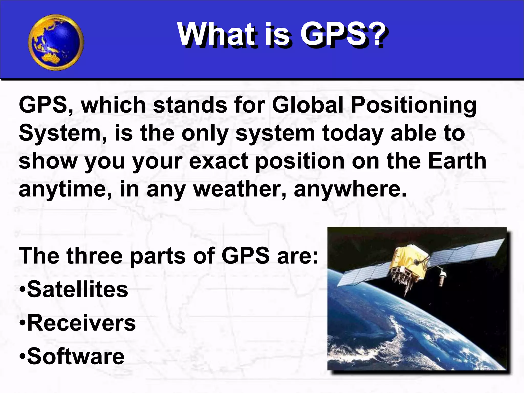
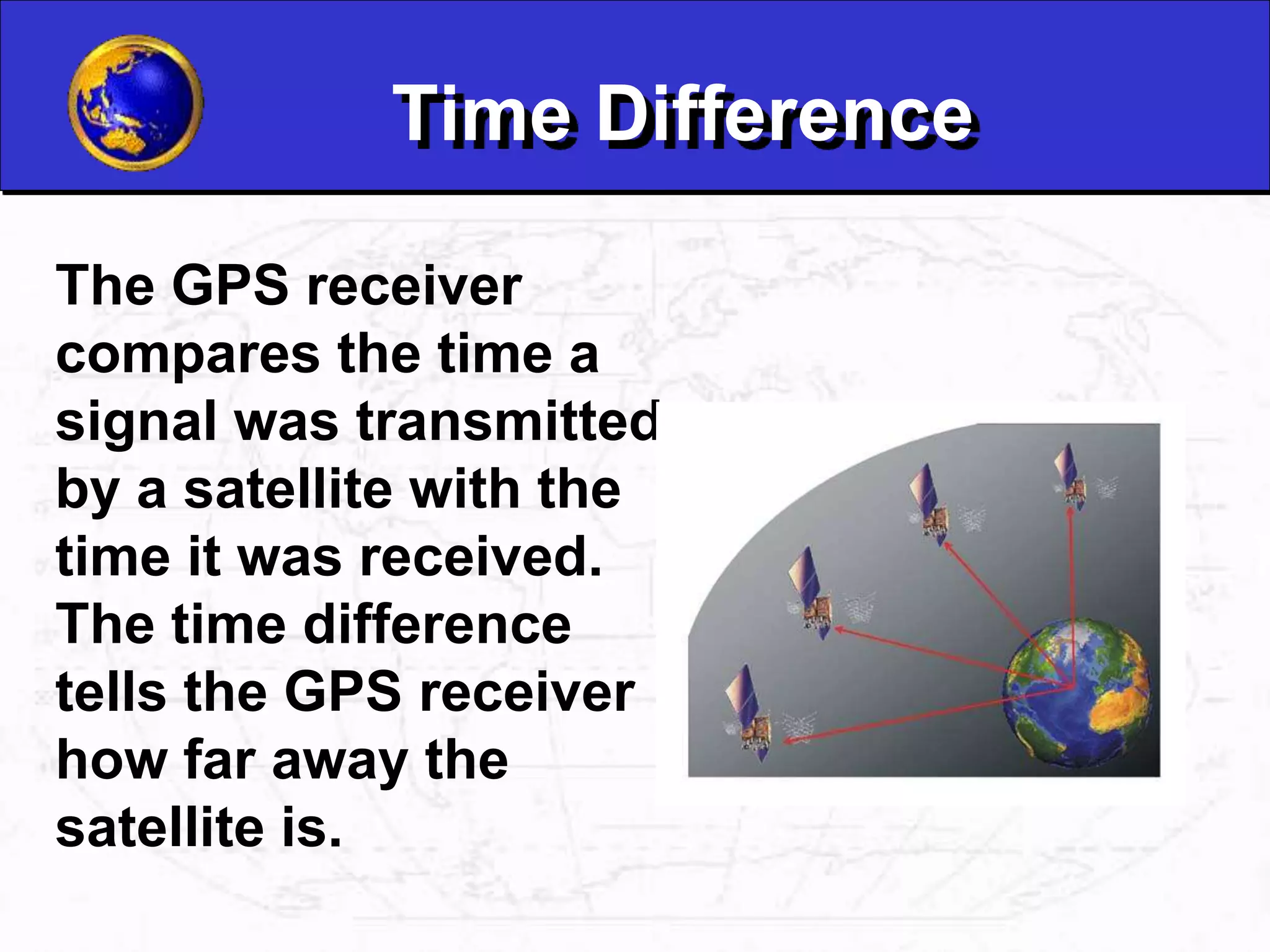
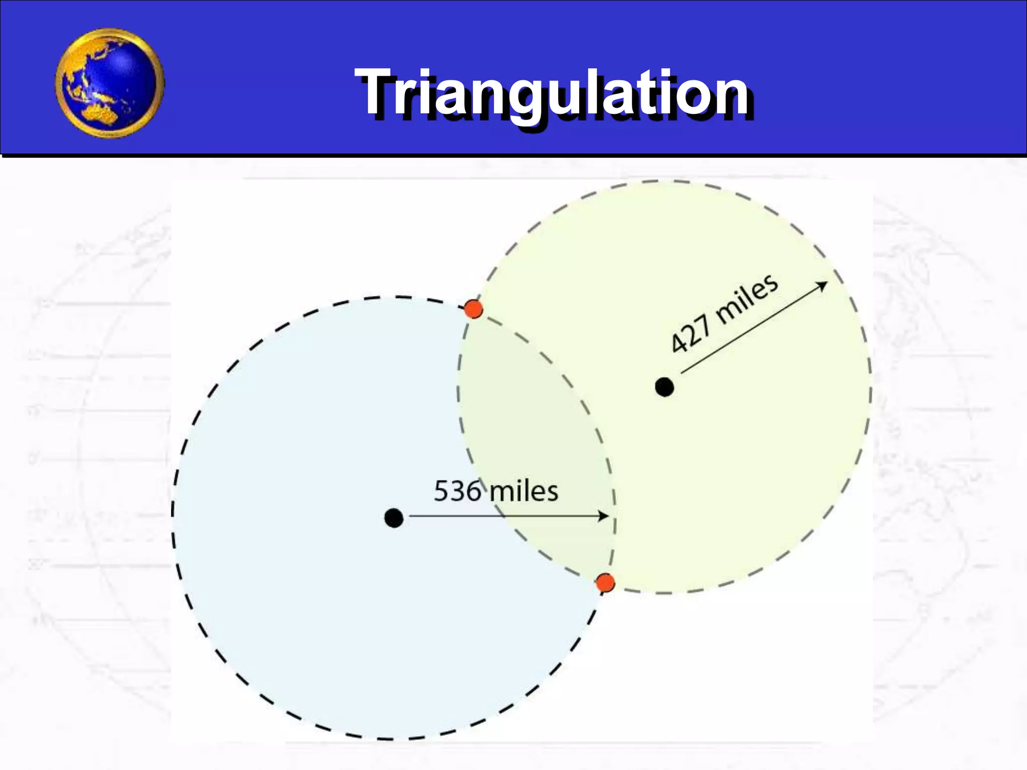
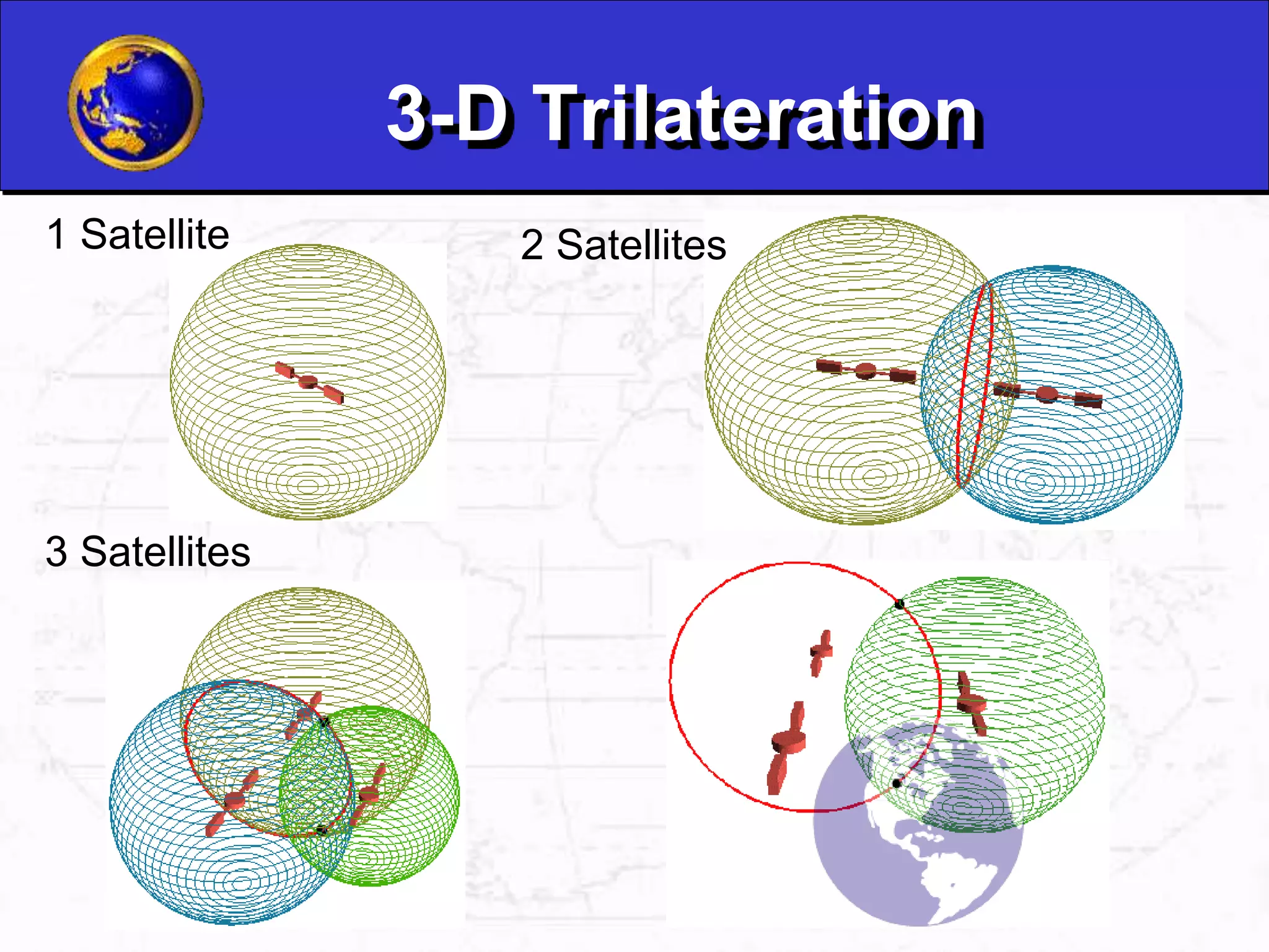
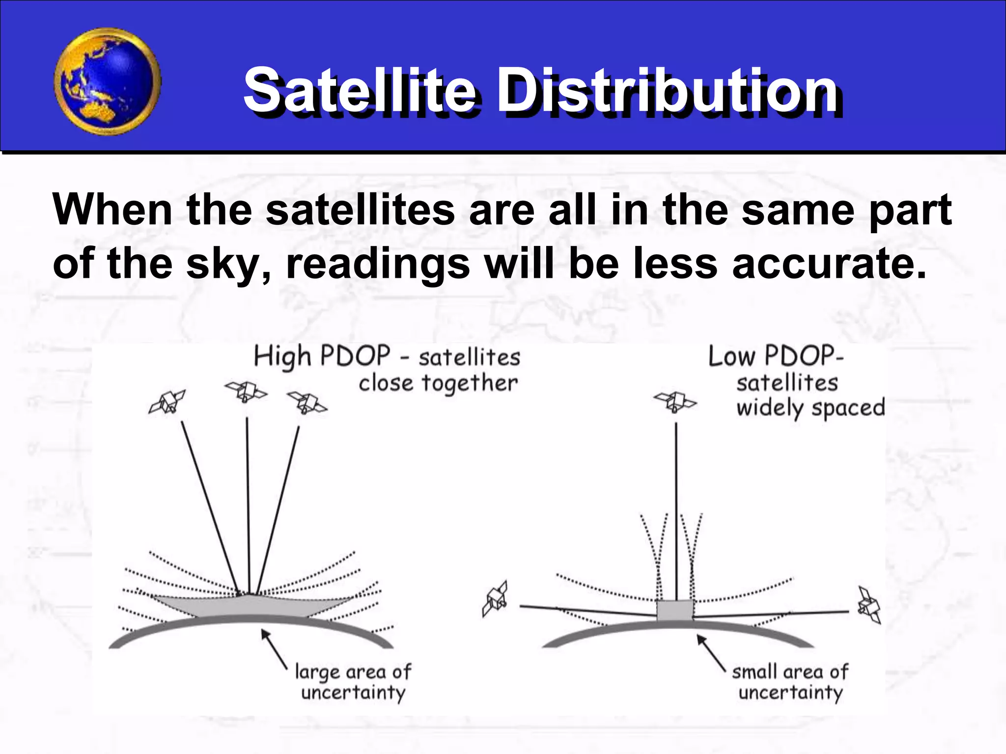
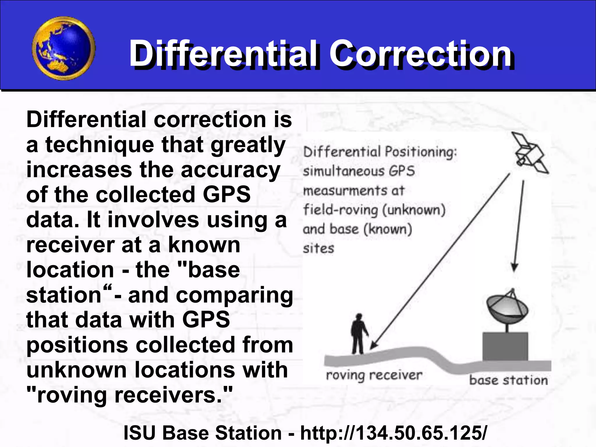
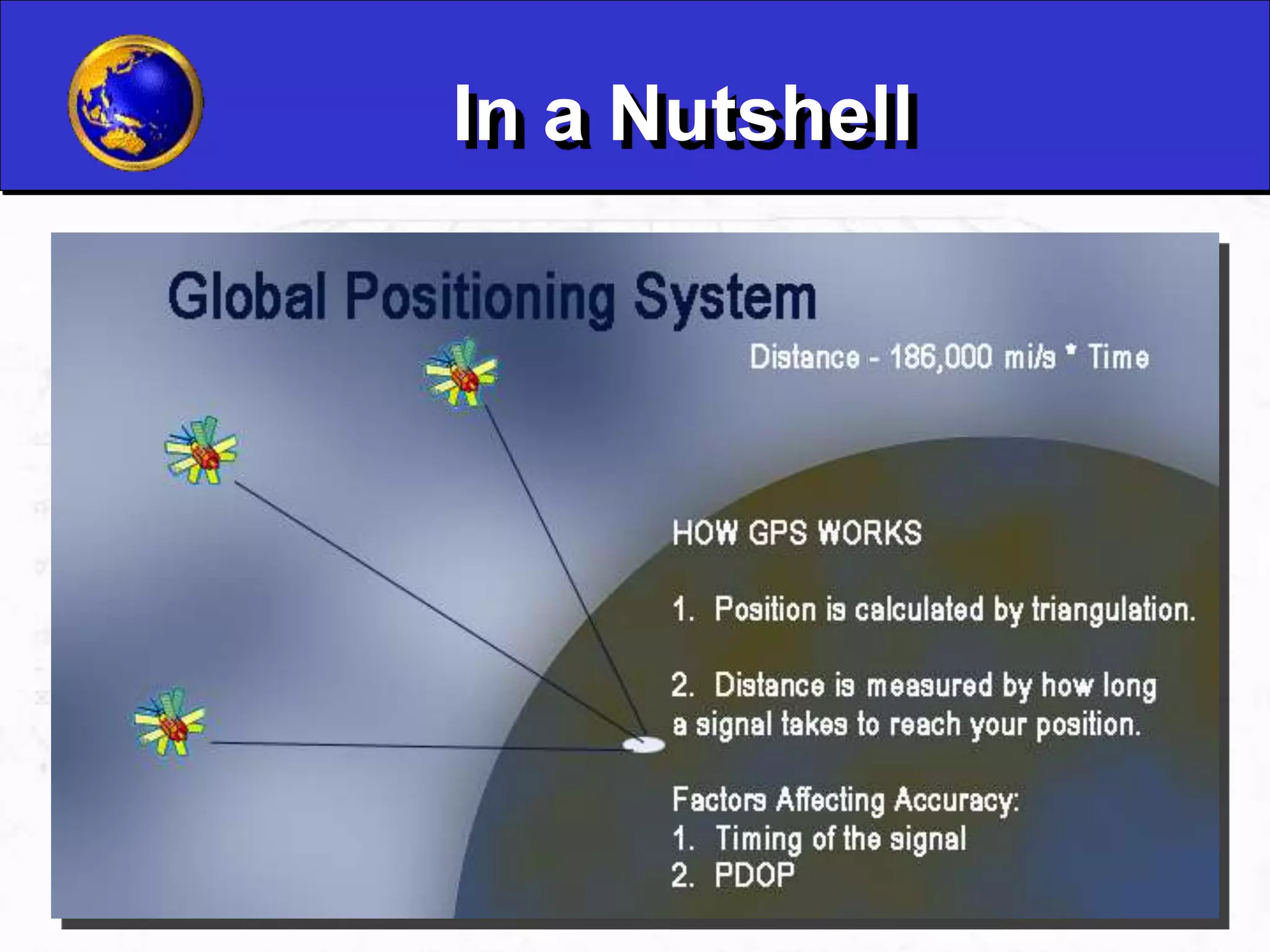
What is GPS?
GPS, which stands for Global Positioning
System, is the only system today able to
show you your exact position on the Earth
anytime, in any weather, anywhere.
The three parts of GPS are:
•Satellites
•Receivers
•Software
Satellites
There are quite a
number of satellites
out there in space.
They are used for a
wide range of
purposes: satellite
TV, cellular phones,
military purposes
and etc. Satellites
can also be used by
GPS receivers.
GPS Satellites
The GPS Operational
Constellation
consists of 24
satellites that orbit
the Earth in very
precise orbits twice a
day. GPS satellites
emit continuous
navigation signals.
Receivers and Satellites
GPS units are made
to communicate with
GPS satellites
(which have a much
better view of the
Earth) to find out
exactly where they
are on the global
scale of things.
GPS Signals
Each GPS satellite
transmits data that
indicates its location
and the current time.
All GPS satellites
synchronize
operations so that
these repeating
signals are
transmitted at the
same instant.
Physically the signal is
just a complicated
digital code, or in other
words, a complicated
sequence of “on” and
“off” pulses.
Time Difference
The GPS receiver
compares the time a
signal was transmitted
by a satellite with the
time it was received.
The time difference
tells the GPS receiver
how far away the
satellite is.
Calculating Distance
Velocity x Time = Distance
Radio waves travel at the speed of light, roughly 186,000
miles per second (mps)
If it took 0.06 seconds to receive a signal
transmitted by a satellite floating directly
overhead, use this formula to find your distance
from the satellite.
186,000 mps x 0.06 seconds = 11,160 miles
Triangulation
Geometric
Principle:
You can find one
location if you
know its distance
from other,
already-known
locations.
Triangulation
Triangulation
3-D Trilateration
1 Satellite 2 Satellites
3 Satellites
Atomic Clocks
GPS satellites use Atomic Clocks
for accuracy, but because of the
expense, most GPS receivers do
not.
Line of Sight Transmissions
Line of sight is the
ability to draw a
straight line between
two objects without any
other objects getting in
the way. GPS
transmission are line-
of-sight transmissions.
Obstructions such as trees, buildings, or natural
formations may prevent clear line of sight.
Light Refraction
Sometimes the GPS
signal from the
satellite doesn’t
follow a straight line.
Refraction is the
bending of light as
it travels through
one media to
another.
Signal Refraction
Signals from satellites can be like light.
When they hit some interference (air patterns
in the atmosphere, uneven geography, etc.)
they sometimes bend a little.
Signal Interference
Sometimes the
signals bounce off
things before they
hit the receivers.
Satellite Distribution
When the satellites are all in the same part
of the sky, readings will be less accurate.
PDOP
All of this
combines to make
the signal less
accurate, and
gives it what we
call a high “PDOP.”
PDOP = Positional Dilution of Precision
11,000 miles
11,000 miles
11,000 miles
11,000 miles
•A PDOP of <4 is excellent
•A PDOP of 4-8 is good
•A PDOP of >8 is poor
Differential Correction
Differential correction is
a technique that greatly
increases the accuracy
of the collected GPS
data. It involves using a
receiver at a known
location - the "base
station“- and comparing
that data with GPS
positions collected from
unknown locations with
"roving receivers."
ISU Base Station - http://134.50.65.125/
Postprocessing / Real-time
Before
After
In a Nutshell
Latitude and Longitude
are spherical
coordinates on the
surface of the earth.
Latitude is measured
North or South of the
Equator. Longitude is
measured East or West
of Greenwich. GPS uses
Latitudes and
Longitudes to reference
locations.
Waypoints
Waypoints are locations or landmarks that can
be stored in your GPS. Waypoints may be
defined and stored in the unit manually by
inputting latitude and longitude from a map or
other reference.
Latitude and
Longitude
Your
location
Direction
of
waypoint
Date
and
Tim
e
Waypoint
Or more usually,
waypoints may be
entered directly by
taking a reading with the
unit at the location itself,
giving it a name, and
then saving the point.
Data Dictionary
GPS units collect data
in:
– Points
– Lines
– Areas
These are called
features.
A data dictionary is a
means by which we
collect specific
information about a
data feature.

GPS-1.ppt

  • 1.
    What is GPS? GPS,which stands for Global Positioning System, is the only system today able to show you your exact position on the Earth anytime, in any weather, anywhere. The three parts of GPS are: •Satellites •Receivers •Software
  • 2.
    Satellites There are quitea number of satellites out there in space. They are used for a wide range of purposes: satellite TV, cellular phones, military purposes and etc. Satellites can also be used by GPS receivers.
  • 3.
    GPS Satellites The GPSOperational Constellation consists of 24 satellites that orbit the Earth in very precise orbits twice a day. GPS satellites emit continuous navigation signals.
  • 4.
    Receivers and Satellites GPSunits are made to communicate with GPS satellites (which have a much better view of the Earth) to find out exactly where they are on the global scale of things.
  • 5.
    GPS Signals Each GPSsatellite transmits data that indicates its location and the current time. All GPS satellites synchronize operations so that these repeating signals are transmitted at the same instant. Physically the signal is just a complicated digital code, or in other words, a complicated sequence of “on” and “off” pulses.
  • 6.
    Time Difference The GPSreceiver compares the time a signal was transmitted by a satellite with the time it was received. The time difference tells the GPS receiver how far away the satellite is.
  • 7.
    Calculating Distance Velocity xTime = Distance Radio waves travel at the speed of light, roughly 186,000 miles per second (mps) If it took 0.06 seconds to receive a signal transmitted by a satellite floating directly overhead, use this formula to find your distance from the satellite. 186,000 mps x 0.06 seconds = 11,160 miles
  • 8.
    Triangulation Geometric Principle: You can findone location if you know its distance from other, already-known locations.
  • 9.
  • 10.
  • 11.
    3-D Trilateration 1 Satellite2 Satellites 3 Satellites
  • 12.
    Atomic Clocks GPS satellitesuse Atomic Clocks for accuracy, but because of the expense, most GPS receivers do not.
  • 13.
    Line of SightTransmissions Line of sight is the ability to draw a straight line between two objects without any other objects getting in the way. GPS transmission are line- of-sight transmissions. Obstructions such as trees, buildings, or natural formations may prevent clear line of sight.
  • 14.
    Light Refraction Sometimes theGPS signal from the satellite doesn’t follow a straight line. Refraction is the bending of light as it travels through one media to another.
  • 15.
    Signal Refraction Signals fromsatellites can be like light. When they hit some interference (air patterns in the atmosphere, uneven geography, etc.) they sometimes bend a little.
  • 16.
    Signal Interference Sometimes the signalsbounce off things before they hit the receivers.
  • 17.
    Satellite Distribution When thesatellites are all in the same part of the sky, readings will be less accurate.
  • 18.
    PDOP All of this combinesto make the signal less accurate, and gives it what we call a high “PDOP.” PDOP = Positional Dilution of Precision 11,000 miles 11,000 miles 11,000 miles 11,000 miles •A PDOP of <4 is excellent •A PDOP of 4-8 is good •A PDOP of >8 is poor
  • 19.
    Differential Correction Differential correctionis a technique that greatly increases the accuracy of the collected GPS data. It involves using a receiver at a known location - the "base station“- and comparing that data with GPS positions collected from unknown locations with "roving receivers." ISU Base Station - http://134.50.65.125/
  • 20.
  • 21.
  • 22.
    Latitude and Longitude Latitudeand Longitude are spherical coordinates on the surface of the earth. Latitude is measured North or South of the Equator. Longitude is measured East or West of Greenwich. GPS uses Latitudes and Longitudes to reference locations.
  • 23.
    Waypoints Waypoints are locationsor landmarks that can be stored in your GPS. Waypoints may be defined and stored in the unit manually by inputting latitude and longitude from a map or other reference. Latitude and Longitude Your location Direction of waypoint Date and Tim e Waypoint Or more usually, waypoints may be entered directly by taking a reading with the unit at the location itself, giving it a name, and then saving the point.
  • 24.
    Data Dictionary GPS unitscollect data in: – Points – Lines – Areas These are called features. A data dictionary is a means by which we collect specific information about a data feature.