1.introduction to contours
•Download as PPT, PDF•
0 likes•741 views
The document discusses topographic maps and contour lines. It defines a topographic map as a map that shows both horizontal and vertical control to accurately depict ground surfaces and elevation. Contours are imaginary lines on the map that connect points of equal elevation. The spacing between contours is called the contour interval and depends on factors like terrain, map scale, and purpose. Drawing contours is known as contouring. Examples of contours include shorelines and contour lines on a topographic map help indicate changes in elevation.
Report
Share
Report
Share

Recommended
Levelling
Levelling is a surveying technique used to determine relative elevations of points above or below a datum. The principle is to obtain a horizontal line of sight and measure vertical distances of points from this line. The objective is to find the elevation of given points with respect to an assumed reference line called the datum. Common types of levelling include differential, fly, profile, precise, check, reciprocal, trigonometric, barometric and stadia levelling. Errors in levelling can be due to personal or instrumental factors. Levelling has various uses including preparing contour maps, determining altitudes, and preparing layouts for water distribution and engineering projects.
Levelling
1. Levelling is used to determine relative heights and elevations of points and establish points at required elevations. It involves using instruments like levels and staffs.
2. There are different types of levels (dumpy, tilting, wye, automatic) and staffs (self-reading, target). Precise levelling is done to establish permanent benchmarks.
3. Adjustments must be made to level instruments during setup and permanently. Methods like differential, profile and cross levelling are used depending on the task. Reciprocal levelling involves backsight-foresight exchange to check for errors.
Distance Measurement & Chain Surveying
Distance Measurement & Chain Surveying
Contents
• Introduction About Surveying
.
• Primary Division Of Surveying • Classification Of Surveying • Distance Measurement And Chain Surveying • Principle Of Surveying • Types Of Tapes Based On The Materials Used • Erecting And Dropping A Perpendicular • Obstacle In Chain Survey • Types Of Errors • Corrections of Tape • Off –Sets • Ranging • Conclusion . • Homework And Next Lecture . • References.
-Definition of Surveying.
Types of Surveying
1. Plane Surveying
2. Geodetic Survey
3. Cadastral surveying
4. Aerial Surveying
5. Hydro graphic Surveying (Hydro-Survey)
6. Topographical Survey
7. Engineering Survey.
Primary division of Surveying
Reconnaissance.
• This is preliminary survey of the land to be surveyed. It may be either
1-Ground reconnaissance 2- Aerial reconnaissance survey.
Objectives of Reconnaissance
1. To ascertain the possibility of building or constructing route or track through the area.
Classification of Surveying:
1- Classification based on the instruments used:
A. Chain Surveying.
B. Compass Surveying.
C. Theodolite Surveying.
D. Tachometric Surveying .
E. Trigonometric Surveying.
F. Total station and GPS.
G. Photogrammetric and Aerial Surveying.
H. Plan Table .
2- According to the method used:
i. Traversing .
ii. Triangulation .
iii. Tacheometric.
iv. Trigonometric.
3- According to the Purpose of surveying:
i. Engineering survey.
ii. Military survey.
iii. Geological survey .
iv. Topographical survey
Chain and Tape Survey
-Length& Distance Measurements.
-Distance Measurement and Chain Surveying.
• In general there are two methods:
1- Direct methods of measuring lengths
2- Indirect methods of measuring distances.
There are two kinds of measurements used in plane surveying.
*Linear measurements
*Angular measurements
-Instruments used in Chain Surveying.
Types of tapes based on the materials used.
.......
.
.
.
.
.
.
.
.
.
.
Asst. Prof. Salar K.Hussein
Mr. Kamal Y.Abdullah
Asst.Lecturer. Dilveen H. Omar
Erbil Polytechnic University
Technical Engineering College
Civil Engineering Department
surveying- lecture notes for engineers
Course Contents:
Introduction; Linear measurements; Analysis and adjustment of measurements, Survey methods: coordinate systems, bearings, horizontal control, traversing, triangulation, detail surveying; Orientation and position; Areas and volumes; Setting out; Curve ranging; Global Positioning system (GPS); Photogrammetry.
Contouring
1. Contours are imaginary lines on a map that connect points of equal elevation. Contour maps show these lines, representing the topography of the land.
2. There are two main methods for creating contour maps - direct and indirect. The direct method involves precisely surveying points along contour lines in the field. The indirect method takes spot elevations across an area and interpolates the contour lines.
3. Common techniques for indirect contouring include dividing the area into squares and taking elevation readings at each corner, taking cross-sections of long strips, and using a tacheometer which can measure horizontal distances and elevations from a single station.
Theodolite
All the details of survey instrument Theodolite about its applications in day today world, advantages and disadvantages.
Levelling
Element Of Civil Engineering subject as per GTU syllabus 1st sem carry out all content. also usefull for general idea about civil branch.
Theodolite survey
The document provides information about theodolites. It begins with an introduction stating that a theodolite is used to measure horizontal and vertical angles more precisely than a magnetic compass. It then discusses the main parts of a theodolite including the horizontal circle, vertical circle, telescope, and levels. The document also covers the history of theodolites from their early origins to modern electronic versions. It describes how to operate a transit vernier theodolite including terms like centering, transiting, swinging the telescope, and changing face. Finally, it discusses the permanent and temporary adjustments needed to ensure accurate theodolite measurements.
Contouring
1) Contour lines on a map connect points of equal elevation and represent the topography of the land.
2) Contour surveys are conducted at the start of engineering projects to select suitable sites, locate alignments to minimize earthworks, and understand the terrain.
3) Contours are located either directly by tracing lines in the field or indirectly by taking spot levels and interpolating lines on the map. Indirect methods using cross-sections or tacheometry are more efficient for large areas.
Introduction to surveying, ranging and chaining
This presentation contains the complete introduction of surveying. It also includes all the instrucments used in linear measurement and the terms related to Ranging and Chaining
Contouring
This document discusses contouring and contour maps. It defines a contour line as a line connecting points of equal elevation. The vertical distance between consecutive contours is called the contour interval, which depends on factors like the nature of the ground and the map scale. Contour maps show the topography of an area and can be used for engineering projects, route selection, and estimating earthworks. Methods of plotting contours include direct methods using levels or hand levels, and indirect methods like gridding, cross-sectioning, and radial lines. Characteristics of contours provide information about the landscape.
LEVELING AND CONTOURING
Leveling is a surveying technique used to determine differences in elevation between points. It involves measuring vertical distances between a fixed benchmark and other points using a leveling instrument, leveling rod, and trigonometric leveling. There are two main methods for leveling - the height of instrument method and rise and fall method. Leveling is used to establish elevations, construct contour maps, and determine cut/fill volumes for engineering projects.
1.1 Linear measurement original: Chaining & Ranging
This presentation cover only chain surveying using chain and tape, and required instruments. it also covers methods of ranging.
Types of level
This document discusses different types of levels used in surveying and engineering projects. It describes dumpy levels, tilting levels, automatic levels, and digital levels. Dumpy levels have a rigidly fixed telescope but are simple and stable. Tilting levels allow the telescope to be tilted for precise work. Automatic levels have a compensator to keep the line of sight horizontal. Digital levels determine heights and distances digitally with high accuracy up to 100 meters. Leveling is important for engineering projects to determine relative elevations of points.
Levelling
1) Levelling is the process of determining the relative elevations of points on or near the earth's surface. It is important for engineering projects to determine elevations along alignments.
2) Levelling is used to prepare contour maps, determine altitudes, and create longitudinal and cross sections needed for projects.
3) Key terms include bench mark, datum, reduced level, line of collimation, and height of instrument. Different types of levelling include simple, differential, fly, longitudinal, and cross-sectional levelling.
INTRODUCTION TO SURVEYING
Definition of Surveying
Objects of Surveying
Uses of Surveying
Primary Divisions of Surveying
Principles of Surveying
List of Classification of Surveying
Definitions : Plan and Map, scales :Plain Scale and Diagonal Scale,
levelling and contouring
Leveling is a surveying technique used to determine differences in elevation between points. It involves measuring vertical angles and distances to establish spot elevations across an area. There are two main methods - direct and indirect. Direct contouring involves marking points along contour lines in the field, while indirect contouring uses spot elevations from which contours are interpolated on a map. Common techniques include using a level, staff, and plane table or theodolite to obtain elevations and positions of points, which are then contoured. Leveling is important for engineering projects to design facilities and earthworks efficiently based on terrain.
Surveying
What is surveying?
Classification and principle of surveying
Linear measurement chain surveying
Errors in chain and tape
Compass surveying
Contouring in "Survey & Levelling".
This document discusses contouring in surveying. It defines contouring as determining elevation points on the ground and mapping points of equal elevation. Contour lines connect points of the same elevation. The difference between adjacent contour lines is the contour interval. Contour lines are continuous, parallel, and form U-shapes for ridges and V-shapes for valleys. Closely spaced contours indicate steep slopes while widely spaced contours indicate gentler slopes. Hachures are used to depict hills and depressions. Data collection ensures sufficient points to define terrain features and records both location and elevation. There are direct and indirect methods for contouring - direct is most accurate but indirect is faster for hilly areas.
Total Station surveying
What is a Total Station?
Capability of a Total Station
Important Operations of Total Station
Uses of Total Station
Advantages of Using Total Stations
Applications
Module 1 tacheometry
MODULE CONSIST OF ALL THE RELEVANT CONTENTS REGARDING THE TACHEOMETRY AS PER THE SYLLABI OF DBATU, LONERE FOR SYBTECH CIVIL ENGINEERING
Contouring - Surveying...for civil Engineering and Architecture..
Contouring - Surveying...for civil Engineering and Architecture students. It contains all the syllabus according to Pokhara University, Nepal
---By Assistant Professor. Pramesh Hada
Nepal Engineering College
CHangunarayan, Bhaktapur
traversing of survey
The document discusses different types of traverses and methods for conducting traverse surveys. It describes two types of traverses: open traverses that begin and end at points of known and unknown positions, and closed traverses that begin and end at points of known positions, including closed-loop traverses that begin and end at the same point. It also outlines four methods for determining directions during traversing: chain angle method, free needle method, fast needle method, and measuring angles between lines. Finally, it discusses instruments used for measuring angles like compasses and theodolites, and defines different types of bearings including true, magnetic, and arbitrary bearings.
Ranging 170811123447
1) Ranging is the process of locating intermediate points along a survey line to ensure measurements are taken along a straight line. It must be done before chaining.
2) There are two methods of ranging: direct ranging uses observations from end stations to position intermediate rods in a straight line. Reciprocal ranging is used when end stations are not visible to each another.
3) A line ranger is an optical instrument that allows one person to position a point along a line by viewing the reflections of ranging rods in its prisms.
Leveling
Levelling, Level surface mean sea level (msl) ,level line- ,horizontal plane- ,horizontal line- ,plumb line ,mean sea level (msl) ,bench mark ,height of instrument (hi)
surveying instruments
This document discusses surveying instruments used in civil engineering. It describes various tools like chains for measuring distance, clinometers for measuring inclined angles, planimeters for measuring irregular areas, and compasses for determining directions. Additional instruments mentioned include ranging rods, reflector prisms, auto levels, staff rods, theodolites, total stations, tripods, pegs, scales, plan tables, and plumb bobs. Each tool has a specific purpose in surveying applications.
Tacheometric surveying ppt
Tacheometric surveying uses a tacheometer to determine horizontal and vertical distances through angular measurements. A tacheometer is a theodolite fitted with stadia hairs and an anallatic lens. The tacheometric formula relates the staff intercept, focal length, stadia interval and additive constant to calculate horizontal distances. Methods include stadia, fixed/movable hair, and non-stadia techniques. Determining the tacheometer constant involves measuring distances and staff intervals at stations to solve equations. Errors arise from incorrect stadia intervals or graduations. Tacheometric surveying provides distances in rough terrain but with less precision than other methods.
Chain survey_Surveying, Civil Engineering
Metric Chain : It Consists of galvanized mild steel wire of 4mm diameter known as link.
It is available in 20m, 30m, 50m length which consists of 100 links.
Gunter’s Chain : A 66 feet long chain consists of 100 links, each of 0.66 feet, it is known as Gunter’s chain.
This chain is suitable for taking length in miles.
Engineer’s Chain : A 100 feet long chain consisting of 100 links each of 1 feet is known as engineer’s chain.
This chain is used to measure length in feet and area in sq.yard.
Revenue Chain : it is 33 feet long chain consisting of 16 links.
This chain is used for distance measurements in feet & inches for smaller areas.
8.Charts
This document provides information about basic concepts related to charts used for aviation purposes. It discusses key terms like maps, charts, projections and distortions that occur when representing the spherical Earth on a flat surface. It also describes different types of projections including plane, conical, cylindrical and their characteristics. Specific projections like Mercator and Lambert Conformal are explained in more detail.
UNit no 1 Contouring.pptx
Contour lines on a map represent points of equal elevation and indicate the terrain's shape and elevation. A contour map uses contour lines to depict the landform of an area. The process of producing contour lines by determining elevation points is called contouring. Contouring can be done directly by measuring points along contour lines or indirectly by taking spot elevations and interpolating between them. The contour interval, or elevation difference between contour lines, depends on factors like terrain, map scale, and purpose of the survey. Common contour intervals range from 0.2m to 25m. Contour characteristics provide information about terrain features like hills, valleys, ridges, and slopes.
More Related Content
What's hot
Contouring
1) Contour lines on a map connect points of equal elevation and represent the topography of the land.
2) Contour surveys are conducted at the start of engineering projects to select suitable sites, locate alignments to minimize earthworks, and understand the terrain.
3) Contours are located either directly by tracing lines in the field or indirectly by taking spot levels and interpolating lines on the map. Indirect methods using cross-sections or tacheometry are more efficient for large areas.
Introduction to surveying, ranging and chaining
This presentation contains the complete introduction of surveying. It also includes all the instrucments used in linear measurement and the terms related to Ranging and Chaining
Contouring
This document discusses contouring and contour maps. It defines a contour line as a line connecting points of equal elevation. The vertical distance between consecutive contours is called the contour interval, which depends on factors like the nature of the ground and the map scale. Contour maps show the topography of an area and can be used for engineering projects, route selection, and estimating earthworks. Methods of plotting contours include direct methods using levels or hand levels, and indirect methods like gridding, cross-sectioning, and radial lines. Characteristics of contours provide information about the landscape.
LEVELING AND CONTOURING
Leveling is a surveying technique used to determine differences in elevation between points. It involves measuring vertical distances between a fixed benchmark and other points using a leveling instrument, leveling rod, and trigonometric leveling. There are two main methods for leveling - the height of instrument method and rise and fall method. Leveling is used to establish elevations, construct contour maps, and determine cut/fill volumes for engineering projects.
1.1 Linear measurement original: Chaining & Ranging
This presentation cover only chain surveying using chain and tape, and required instruments. it also covers methods of ranging.
Types of level
This document discusses different types of levels used in surveying and engineering projects. It describes dumpy levels, tilting levels, automatic levels, and digital levels. Dumpy levels have a rigidly fixed telescope but are simple and stable. Tilting levels allow the telescope to be tilted for precise work. Automatic levels have a compensator to keep the line of sight horizontal. Digital levels determine heights and distances digitally with high accuracy up to 100 meters. Leveling is important for engineering projects to determine relative elevations of points.
Levelling
1) Levelling is the process of determining the relative elevations of points on or near the earth's surface. It is important for engineering projects to determine elevations along alignments.
2) Levelling is used to prepare contour maps, determine altitudes, and create longitudinal and cross sections needed for projects.
3) Key terms include bench mark, datum, reduced level, line of collimation, and height of instrument. Different types of levelling include simple, differential, fly, longitudinal, and cross-sectional levelling.
INTRODUCTION TO SURVEYING
Definition of Surveying
Objects of Surveying
Uses of Surveying
Primary Divisions of Surveying
Principles of Surveying
List of Classification of Surveying
Definitions : Plan and Map, scales :Plain Scale and Diagonal Scale,
levelling and contouring
Leveling is a surveying technique used to determine differences in elevation between points. It involves measuring vertical angles and distances to establish spot elevations across an area. There are two main methods - direct and indirect. Direct contouring involves marking points along contour lines in the field, while indirect contouring uses spot elevations from which contours are interpolated on a map. Common techniques include using a level, staff, and plane table or theodolite to obtain elevations and positions of points, which are then contoured. Leveling is important for engineering projects to design facilities and earthworks efficiently based on terrain.
Surveying
What is surveying?
Classification and principle of surveying
Linear measurement chain surveying
Errors in chain and tape
Compass surveying
Contouring in "Survey & Levelling".
This document discusses contouring in surveying. It defines contouring as determining elevation points on the ground and mapping points of equal elevation. Contour lines connect points of the same elevation. The difference between adjacent contour lines is the contour interval. Contour lines are continuous, parallel, and form U-shapes for ridges and V-shapes for valleys. Closely spaced contours indicate steep slopes while widely spaced contours indicate gentler slopes. Hachures are used to depict hills and depressions. Data collection ensures sufficient points to define terrain features and records both location and elevation. There are direct and indirect methods for contouring - direct is most accurate but indirect is faster for hilly areas.
Total Station surveying
What is a Total Station?
Capability of a Total Station
Important Operations of Total Station
Uses of Total Station
Advantages of Using Total Stations
Applications
Module 1 tacheometry
MODULE CONSIST OF ALL THE RELEVANT CONTENTS REGARDING THE TACHEOMETRY AS PER THE SYLLABI OF DBATU, LONERE FOR SYBTECH CIVIL ENGINEERING
Contouring - Surveying...for civil Engineering and Architecture..
Contouring - Surveying...for civil Engineering and Architecture students. It contains all the syllabus according to Pokhara University, Nepal
---By Assistant Professor. Pramesh Hada
Nepal Engineering College
CHangunarayan, Bhaktapur
traversing of survey
The document discusses different types of traverses and methods for conducting traverse surveys. It describes two types of traverses: open traverses that begin and end at points of known and unknown positions, and closed traverses that begin and end at points of known positions, including closed-loop traverses that begin and end at the same point. It also outlines four methods for determining directions during traversing: chain angle method, free needle method, fast needle method, and measuring angles between lines. Finally, it discusses instruments used for measuring angles like compasses and theodolites, and defines different types of bearings including true, magnetic, and arbitrary bearings.
Ranging 170811123447
1) Ranging is the process of locating intermediate points along a survey line to ensure measurements are taken along a straight line. It must be done before chaining.
2) There are two methods of ranging: direct ranging uses observations from end stations to position intermediate rods in a straight line. Reciprocal ranging is used when end stations are not visible to each another.
3) A line ranger is an optical instrument that allows one person to position a point along a line by viewing the reflections of ranging rods in its prisms.
Leveling
Levelling, Level surface mean sea level (msl) ,level line- ,horizontal plane- ,horizontal line- ,plumb line ,mean sea level (msl) ,bench mark ,height of instrument (hi)
surveying instruments
This document discusses surveying instruments used in civil engineering. It describes various tools like chains for measuring distance, clinometers for measuring inclined angles, planimeters for measuring irregular areas, and compasses for determining directions. Additional instruments mentioned include ranging rods, reflector prisms, auto levels, staff rods, theodolites, total stations, tripods, pegs, scales, plan tables, and plumb bobs. Each tool has a specific purpose in surveying applications.
Tacheometric surveying ppt
Tacheometric surveying uses a tacheometer to determine horizontal and vertical distances through angular measurements. A tacheometer is a theodolite fitted with stadia hairs and an anallatic lens. The tacheometric formula relates the staff intercept, focal length, stadia interval and additive constant to calculate horizontal distances. Methods include stadia, fixed/movable hair, and non-stadia techniques. Determining the tacheometer constant involves measuring distances and staff intervals at stations to solve equations. Errors arise from incorrect stadia intervals or graduations. Tacheometric surveying provides distances in rough terrain but with less precision than other methods.
Chain survey_Surveying, Civil Engineering
Metric Chain : It Consists of galvanized mild steel wire of 4mm diameter known as link.
It is available in 20m, 30m, 50m length which consists of 100 links.
Gunter’s Chain : A 66 feet long chain consists of 100 links, each of 0.66 feet, it is known as Gunter’s chain.
This chain is suitable for taking length in miles.
Engineer’s Chain : A 100 feet long chain consisting of 100 links each of 1 feet is known as engineer’s chain.
This chain is used to measure length in feet and area in sq.yard.
Revenue Chain : it is 33 feet long chain consisting of 16 links.
This chain is used for distance measurements in feet & inches for smaller areas.
What's hot (20)
1.1 Linear measurement original: Chaining & Ranging
1.1 Linear measurement original: Chaining & Ranging
Contouring - Surveying...for civil Engineering and Architecture..
Contouring - Surveying...for civil Engineering and Architecture..
Similar to 1.introduction to contours
8.Charts
This document provides information about basic concepts related to charts used for aviation purposes. It discusses key terms like maps, charts, projections and distortions that occur when representing the spherical Earth on a flat surface. It also describes different types of projections including plane, conical, cylindrical and their characteristics. Specific projections like Mercator and Lambert Conformal are explained in more detail.
UNit no 1 Contouring.pptx
Contour lines on a map represent points of equal elevation and indicate the terrain's shape and elevation. A contour map uses contour lines to depict the landform of an area. The process of producing contour lines by determining elevation points is called contouring. Contouring can be done directly by measuring points along contour lines or indirectly by taking spot elevations and interpolating between them. The contour interval, or elevation difference between contour lines, depends on factors like terrain, map scale, and purpose of the survey. Common contour intervals range from 0.2m to 25m. Contour characteristics provide information about terrain features like hills, valleys, ridges, and slopes.
contouring Surveying of Civil Engineering.pptx
Contouring is the process of preparing contour maps by joining points of equal elevation. Contours are imaginary lines connecting points of the same altitude. The vertical distance between consecutive contours is the contour interval, which depends on factors like terrain steepness and map scale. Indirect contouring methods like grid, cross-sectional, and tachometric are less expensive and time-consuming than direct methods for large areas. Characteristics of contours provide information about the terrain's features and slopes.
levelling and surveying presentation in civil
This document provides an introduction to the topic of levelling for a surveying class. It defines levelling as determining the relative heights of points on the earth's surface. The key purposes of levelling are listed as calculating depths for construction projects and establishing elevation controls. Important terms are also defined, including datum, reduced level, level surface, and station. Objectives, definitions, examples, and a quiz are provided to help students understand the basic concepts of levelling.
Contour lines by sk
Contour lines connect points of equal elevation and are used to represent three-dimensional terrain on two-dimensional maps. There are several key characteristics of contour lines:
1. Contour lines are continuous and either close upon themselves or extend from the edge of the map. Their spacing and shape indicate features like valleys, ridges, and slopes.
2. To accurately define landforms like hills and ditches, sufficient data points must be collected to represent their shape, location, and elevation changes.
3. Elevations between data points are determined through interpolation, using proportional distance calculations. Contour lines are drawn to connect interpolated points of equal elevation.
contourlines-161212065738.pdf
Contour lines are lines connecting points of equal elevation on a map. They allow elevation information to be represented visually. Key characteristics of contour lines include:
- Contour lines are continuous and either close upon themselves or extend from the map boundary.
- They are generally parallel unless passing through cliffs or overhangs.
- Valleys are indicated by V-shaped lines pointing uphill and ridges by U-shaped lines pointing downhill.
- Closely spaced lines indicate steep slopes while widely spaced lines indicate gentle slopes.
- Closed contours indicate hills or depressions.
Proper interpolation between surveyed elevation points is required to accurately draw contour lines. This involves calculating proportional distances based on the elevation difference between points
ContourLines (4).ppt
This document provides information about contour lines and how to interpret elevation data from topographic maps. It defines contour lines as lines connecting points of equal elevation. It describes how to determine elevations and slopes between contours using interpolation formulas. It also lists 11 characteristics of contour lines such as how V-shapes indicate valleys and U-shapes indicate ridges. The document discusses appropriate contour intervals for different map scales and terrain. It explains that collecting elevation data requires defining objects and gathering location and elevation for each station. It also describes different methods for interpolating elevation between stations including estimation, calculation, and calculation with measurement.
ContourLines.ppt
This document provides information about contour lines and how to interpret elevation data from topographic maps. It defines contour lines as lines connecting points of equal elevation. It describes how to determine elevation, slope, and characteristics of contour lines such as valleys, ridges, hills and depressions. It also discusses best practices for collecting elevation data in the field and interpolating elevation between data points to draw contour lines on a map.
Brief ContourLines power point for surveying engineering
This document provides information about contour lines and how to interpret elevation data from topographic maps. It defines contour lines as lines connecting points of equal elevation. It describes how to determine elevations and slopes between contours using interpolation formulas. It also lists 11 characteristics of contour lines such as how V-shapes indicate valleys and U-shapes indicate ridges. The document discusses appropriate contour intervals for different map scales and terrain. It explains that collecting elevation data requires defining objects and gathering location and elevation for each station. It also describes different methods for interpolating elevation between stations including estimation, calculation, and calculation with measurement.
Contouring
The document provides information on contouring and contour maps. It defines a contour as an imaginary line joining points of equal elevation. Contour maps show contour lines and provide information on surface altitudes and relative positions. The process of tracing contour lines is called contouring. Contour surveys are conducted for engineering projects to select sites, locate alignments, and minimize earthworks. The constant vertical distance between contours is the contour interval, while the horizontal distance varies based on slope. Contour interpolation involves proportionally spacing contours between plotted ground points based on assumed uniform slopes.
contouring-180417110533.pdf
1. Contours are imaginary lines on a map that connect points of equal elevation. Contour maps show these lines, representing the topography of the land.
2. There are two main methods for creating contour maps - direct and indirect. The direct method involves precisely surveying points along contour lines in the field. The indirect method takes spot elevations across an area and interpolates the contour lines.
3. Common indirect techniques include surveying on a grid, along cross-sections, or using a tacheometer to measure multiple points from instrument stations. Spot elevations are plotted and contour lines drawn in between based on the terrain. The indirect method is faster but less precise than the direct method.
surveying contouring
Contour lines on a map connect points of equal elevation above sea level. They show the shape and features of the land. There are two main methods for creating contour maps - direct and indirect. The direct method precisely traces contours in the field but is slow. The indirect method takes spot elevations across an area and interpolates the contour lines, making it faster but less precise. Common indirect techniques include surveying on a grid, along cross-sections, or using a tacheometer along radial lines. Contour maps provide topographic information for engineering projects.
m1vrhqoqsoxyptiol1b4-signature-7f20760b9f97167ae74c1ef33fe58a16817ef3afaab94a...
Contour lines on a map represent imaginary lines connecting points of equal elevation. The contour interval is the vertical distance between contour lines, and depends on factors like the terrain and map scale. Contour maps depict the shape of the land through the spacing and patterns of contour lines. Closely-spaced lines indicate steep slopes, while widely-spaced lines show flatter areas. Contour maps are useful for engineering projects to determine suitable sites, locate infrastructure alignments, and estimate earthworks and reservoir capacities.
Contouring
Contour lines on a topographic map represent points of equal elevation and can be used to interpret the three-dimensional shape of the land. There are direct and indirect methods for creating contour maps. The direct method traces contours on the ground while the indirect method interpolates contours between surveyed elevation points. When drawing contours, all adjacent elevation points must be considered to determine the correct path for the contour line to follow while avoiding violations of the rules governing contour characteristics. Contour maps have various uses including drawing cross sections, determining visibility between points, and planning infrastructure routes that account for terrain.
2.characteristics of countours
This document contains a lecture on contour mapping given by Mohd Salman Ahmed, a lecturer in civil engineering at Ahmed's Institute of Excellence. The lecture discusses the characteristics of contours, how to read contour plans, and how to interpret information from contour maps. Key points covered include that contours have the same elevation, spacing depends on slope, closed contours indicate hills or depressions, and contours cannot cross except at overhanging cliffs. The document provides examples and a short quiz to assess understanding.
contouring.pptx
This document discusses contour lines and contour mapping. It defines a contour line as an imaginary line connecting points of equal elevation. Contour maps show contour lines and provide information about altitudes and terrain. The process of tracing contour lines on the earth's surface is called contouring. Contour surveys are conducted for engineering projects to select suitable sites, determine earthwork volumes, and plan alignments. Common contour intervals range from 0.2-5m for detailed work to 10-25m for general topographic maps, depending on the terrain and map scale. Contours are interpolated between known elevation points using graphical or arithmetic methods.
Ce6304 surveying 1 contour (iv unit) lecture ppt notes
This document discusses contour mapping and surveying techniques. It contains:
1) Definitions of key terms like contour, contour line, contour map, and contour interval.
2) Descriptions of the direct and indirect methods for locating contours in the field. The direct method involves directly tracing and marking contour points, while the indirect method involves taking spot levels and interpolating the contours.
3) Characteristics used to identify topographic features like hills, depressions, ridges, and valleys from the pattern of contour lines on a map.
Contour maps: preparation and understanding.
The theme behind preparation of contour maps, various projections of topographical features, the processor making them and methods used in their making.
CET205 Module 1 Contouring.pdf
This document discusses contouring and contour maps. It defines a contour as an imaginary line joining points of equal elevation. A contour map shows these lines and provides information about altitudes and relative positions of surface features. The process of tracing contour lines is called contouring. Key terms are defined, like contour interval and horizontal equivalent. Contouring is used for site selection, canal alignment, determining ground conditions, and reservoir/earthwork capacity. Characteristics of contours are described, like indicating slopes, hills, depressions, ridges and valleys. Direct and indirect contouring methods are outlined, including spot levels, cross sections, and tacheometry.
Similar to 1.introduction to contours (20)
Brief ContourLines power point for surveying engineering
Brief ContourLines power point for surveying engineering
m1vrhqoqsoxyptiol1b4-signature-7f20760b9f97167ae74c1ef33fe58a16817ef3afaab94a...
m1vrhqoqsoxyptiol1b4-signature-7f20760b9f97167ae74c1ef33fe58a16817ef3afaab94a...
Ce6304 surveying 1 contour (iv unit) lecture ppt notes
Ce6304 surveying 1 contour (iv unit) lecture ppt notes
Recently uploaded
বাংলাদেশ অর্থনৈতিক সমীক্ষা (Economic Review) ২০২৪ UJS App.pdf
বাংলাদেশের অর্থনৈতিক সমীক্ষা ২০২৪ [Bangladesh Economic Review 2024 Bangla.pdf] কম্পিউটার , ট্যাব ও স্মার্ট ফোন ভার্সন সহ সম্পূর্ণ বাংলা ই-বুক বা pdf বই " সুচিপত্র ...বুকমার্ক মেনু 🔖 ও হাইপার লিংক মেনু 📝👆 যুক্ত ..
আমাদের সবার জন্য খুব খুব গুরুত্বপূর্ণ একটি বই ..বিসিএস, ব্যাংক, ইউনিভার্সিটি ভর্তি ও যে কোন প্রতিযোগিতা মূলক পরীক্ষার জন্য এর খুব ইম্পরট্যান্ট একটি বিষয় ...তাছাড়া বাংলাদেশের সাম্প্রতিক যে কোন ডাটা বা তথ্য এই বইতে পাবেন ...
তাই একজন নাগরিক হিসাবে এই তথ্য গুলো আপনার জানা প্রয়োজন ...।
বিসিএস ও ব্যাংক এর লিখিত পরীক্ষা ...+এছাড়া মাধ্যমিক ও উচ্চমাধ্যমিকের স্টুডেন্টদের জন্য অনেক কাজে আসবে ...
How to Fix the Import Error in the Odoo 17
An import error occurs when a program fails to import a module or library, disrupting its execution. In languages like Python, this issue arises when the specified module cannot be found or accessed, hindering the program's functionality. Resolving import errors is crucial for maintaining smooth software operation and uninterrupted development processes.
DRUGS AND ITS classification slide share
Any substance (other than food) that is used to prevent, diagnose, treat, or relieve symptoms of a
disease or abnormal condition
CACJapan - GROUP Presentation 1- Wk 4.pdf
Macroeconomics- Movie Location
This will be used as part of your Personal Professional Portfolio once graded.
Objective:
Prepare a presentation or a paper using research, basic comparative analysis, data organization and application of economic information. You will make an informed assessment of an economic climate outside of the United States to accomplish an entertainment industry objective.
Executive Directors Chat Leveraging AI for Diversity, Equity, and Inclusion
Let’s explore the intersection of technology and equity in the final session of our DEI series. Discover how AI tools, like ChatGPT, can be used to support and enhance your nonprofit's DEI initiatives. Participants will gain insights into practical AI applications and get tips for leveraging technology to advance their DEI goals.
Types of Herbal Cosmetics its standardization.
Physiology and chemistry of skin and pigmentation, hairs, scalp, lips and nail, Cleansing cream, Lotions, Face powders, Face packs, Lipsticks, Bath products, soaps and baby product,
Preparation and standardization of the following : Tonic, Bleaches, Dentifrices and Mouth washes & Tooth Pastes, Cosmetics for Nails.
ANATOMY AND BIOMECHANICS OF HIP JOINT.pdf
it describes the bony anatomy including the femoral head , acetabulum, labrum . also discusses the capsule , ligaments . muscle that act on the hip joint and the range of motion are outlined. factors affecting hip joint stability and weight transmission through the joint are summarized.
How to Manage Your Lost Opportunities in Odoo 17 CRM
Odoo 17 CRM allows us to track why we lose sales opportunities with "Lost Reasons." This helps analyze our sales process and identify areas for improvement. Here's how to configure lost reasons in Odoo 17 CRM
Digital Artifact 1 - 10VCD Environments Unit
Digital Artifact 1 - 10VCD Environments Unit - NGV Pavilion Concept Design
Azure Interview Questions and Answers PDF By ScholarHat
Azure Interview Questions and Answers PDF By ScholarHat
RPMS TEMPLATE FOR SCHOOL YEAR 2023-2024 FOR TEACHER 1 TO TEACHER 3
RPMS Template 2023-2024 by: Irene S. Rueco
The History of Stoke Newington Street Names
Presented at the Stoke Newington Literary Festival on 9th June 2024
www.StokeNewingtonHistory.com
Introduction to AI for Nonprofits with Tapp Network
Dive into the world of AI! Experts Jon Hill and Tareq Monaur will guide you through AI's role in enhancing nonprofit websites and basic marketing strategies, making it easy to understand and apply.
Recently uploaded (20)
বাংলাদেশ অর্থনৈতিক সমীক্ষা (Economic Review) ২০২৪ UJS App.pdf
বাংলাদেশ অর্থনৈতিক সমীক্ষা (Economic Review) ২০২৪ UJS App.pdf
Executive Directors Chat Leveraging AI for Diversity, Equity, and Inclusion
Executive Directors Chat Leveraging AI for Diversity, Equity, and Inclusion
Film vocab for eal 3 students: Australia the movie
Film vocab for eal 3 students: Australia the movie
How to Manage Your Lost Opportunities in Odoo 17 CRM
How to Manage Your Lost Opportunities in Odoo 17 CRM
Digital Artefact 1 - Tiny Home Environmental Design
Digital Artefact 1 - Tiny Home Environmental Design
Azure Interview Questions and Answers PDF By ScholarHat
Azure Interview Questions and Answers PDF By ScholarHat
RPMS TEMPLATE FOR SCHOOL YEAR 2023-2024 FOR TEACHER 1 TO TEACHER 3
RPMS TEMPLATE FOR SCHOOL YEAR 2023-2024 FOR TEACHER 1 TO TEACHER 3
Introduction to AI for Nonprofits with Tapp Network
Introduction to AI for Nonprofits with Tapp Network
1.introduction to contours
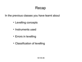
- 1. Recap In the previous classes you have learnt about • Levelling concepts • Instruments used • Errors in levelling • Classification of levelling 9C105.96
- 2. Objectives On completion of this presentation, you will be able to know • Topographic maps • What is contour ? • Examples for contours • Contour interval • Horizontal equivalent 9C105.96
- 3. Topographic map • Topographic maps have horizontal control and vertical control • Points are represented horizontally and vertically • Topographic maps give correct picture of surface of ground • Topographic map give altitude of points 9C105.96
- 4. Topographic map Fig 1 9C105.96
- 5. Topographic map Fig 2 9C105.96
- 6. Contour • On level surface all points are of same elevation • Contour is intersection of level surface and ground surface • Contour is an imaginary line passing through points of same elevation 9C105.96
- 7. Contour • The process of locating contours is called contouring • Contour line represent altitude on maps Fig. 3 Contouring 9C105.96
- 8. Examples of Contour • Shore line of water surface of still pond Fig. 4 Pond view 9C105.96
- 9. Examples of Contours Shore line of water surface in a depression Fig. 5 Depression 9C105.96
- 10. Contour Interval • The difference of elevation between two consecutive contours • Contour interval=5 Fig. 6 Contour interval 9C105.96
- 11. Contour Interval (contd.) • It depends on nature of the ground • It depends on time & expense of field and office work • When contour interval is small the time and expenditure is more 9C105.96
- 12. Contour Interval (contd.) • It depends on purpose &extent of survey • Contour interval may be small when detailed information is required • It will be large when area of survey is vast • It depends on scale of the map 9C105.96
- 13. Contour Interval (contd.) • For building sites 0.25 to 0.50 m • For reservoirs, town planning schemes 0.5 to 2m • Location surveys 2 to 3m 9C105.96
- 14. Horizontal Equivalent The horizontal distance between any two consecutive contours It depends on nature of ground It depends on steepness of country 9C105.96
- 15. Summary We have discussed Topographic maps Level surface Contour line Contouring Contour interval Horizontal equivalent 9C105.96
- 16. Quiz 1. A line passing through the points of same elevation is called A.Vertical line B.Horizontal line C.Contour line D.Perimeter Ans: C 9C105.96
- 17. 2. A surface on which all points are of equal elevation is called A.Level surface B.Concave surface C.Convex surface D.Horizontal surface Ans: A Quiz (contd.) 9C105.96
- 18. 3. The following is example for level surface A.Water surface in a river B.Water surface in a stream C.Water surface in a still lake D.Water surface in a reservoir Ans: C Quiz (contd.) 9C105.96
- 19. Frequently asked questions 1. What is a topographic map? 2. Define level surface and contour ? 3. Differentiate between contour interval and horizontal equivalent ? 9C105.96
- 20. Than Q 9C105.96