Downloaded 67 times


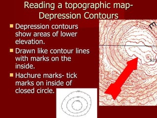
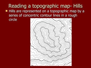
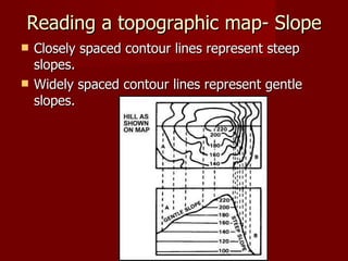
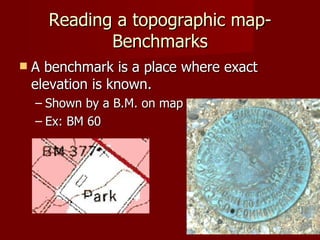


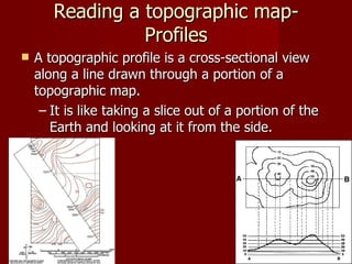


This document provides an overview of topographic maps, including what they are, how to read them, and what information they convey. It explains that topographic maps use contour lines to represent elevation and relief of the land, with closer lines indicating steeper slopes. They also use colors, labels, and other symbols to indicate features like bodies of water, vegetation, roads, and points of precise elevation measurement. The document offers a brief primer on important elements like contour intervals, index contours, how streams and depressions are depicted, and how to determine slope and elevation from the map lines and markings.


