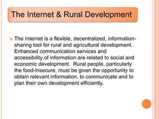
SlideShare a Scribd company logo
The Internet
and
Rural Development


     Presented by:

     ENGR. JOHN A. LIWANAG
     Masters in Management Engineering
     Information & Communication Technology in Industry
     2nd Semester 2011-2012

     PANGASINAN STATE UNIVERSITY
     Graduate School
     Urdaneta City, Panagasinan
The Internet & Rural Development

   The Internet is a flexible, decentralized, information-
    sharing tool for rural and agricultural development.
    Enhanced communication services and
    accessibility of information are related to social and
    economic development. Rural people, particularly
    the food-insecure, must be given the opportunity to
    obtain relevant information, to communicate and to
    plan their own development efficiently.
The First Mile of Connectivity

   This term expresses a more equitable and far less
    urban-centric view of the challenge of providing
    everyone with the option of connecting themselves
    to the rest of the world.

   Rural communities were often referred to as being
    at the “last mile of connectivity” which carries a lot
    of negative connotations creating the perspective of
    an urbanite looking down at the rural margins.
The First Mile of Connectivity

   If rural communities are the “first mile,” then the real
    challenge for enhancing rural connectivity lies with
    the urban-centered governments, businesses and
    agencies that have for so long ignored or placated
    the desires of rural people to get connected to the
    rest of the world.
A New Era of Accessibility: or Is It?

   Accessibility has always been important to a lot of
    people. Individual access refers to one’s ability to
    reach or obtain something desirable, and in the
    non-virtual world achieving access – often even
    access to information – requires physical mobility.
    In both physical and virtual access, one must know
    of the existence of a destination that will meet one’s
    needs, be aware of how such a destination might
    be found, and be able to reach the destination.
Rural Radio in the Philippines

   Among many rural folks, radio broadcast media is
    considered their “window to the world.” It has the
    ability to reach people who are impoverished, ill and
    isolated, as well as minorities who have tended to
    be ignored and neglected. Radio can cut across
    geographic and cultural boundaries, as well.
Rural Radio in the Philippines

   Radio provides the needed reach, frequency, and
    access to rural and remote areas, making it a
    promising, appropriate and powerful tool for
    education. In addition, ownership and patronage
    among poor households are relatively high
    compared to other media forms, particularly in rural
    settings.
Lessons of Participatory Communication and
Training to Rural Telecenters


   The provision of access to ICTs by rural communities in
    developing countries is likely to go through telecenters.
    The purpose of these considerations is to ensure that this
    development is as effective, efficient, sustainable and
    equitable as possible, so that the promise of the
    technology becomes a reality – a tool in the hands of
    rural people.
Lessons of Participatory Communication
and Training to Rural Telecenters


   Telecenters may employ a number of types of ICTs
    and offer services such as access to telephones
    and    fax    machines,     photocopiers,   printing
    equipments, e-mail, the Internet and electronic
    networking. Telecenters are also a venue in which
    new ICTs, such as the Internet, can interface with
    conventional ICTs (print, radio and video).
Overview of Geographic Information
System


What is Geographic Information?

• Sometimes referred to as Spatial Information;

• Data that involves an aspect of location on the Earth's
  surface or near-surface, which is converted to a form
  that is meaningful to a user; and

• Built up from facts about the geographic world
Overview of Geographic Information
System


Why is it so important?

• Almost all our activities and decisions involve a
  geographic component; and

• It helps us better understand the world around.
Overview of Geographic Information
System


Geographic Information Systems (GIS)

 “... a system of hardware, software, and procedures
 designed to support the capture, management,
 manipulation, analysis, modeling, and display of
 spatially referenced data for solving complex
 planning     and     management      problems.”   --
 Rhind(1989)
Overview of Geographic Information
System


In simpler terms, GIS is
a set of computer-
based systems for
managing geographic
data and using these
data to solve real-world
spatial problems.
Overview of Geographic Information
System
Why is GIS important?
 GIS is a special class of
  information systems that
  keep track not only of
  events, activities and      Almost everything that
  things, but also of where   happens,        happens
  these events, activities    somewhere.      Knowing
  and things happen or        where         something
  exist; and                  happens    is    critically
                              important.
                                   Longley, Goodchild, Maguire & Rhind
   GIS is about finding
    patterns in data and
    solving      real-world
    problems.
Overview of Geographic Information
System

Questions GIS can answer


   Location:What is at………….?

   Condition:Where is it………….?

   Trends:What has changed since…………..?

   Patterns:What spatial patterns exists………?

   Modelling:What if……………..?
Overview of Geographic Information
System

Traditional method:                        GIS:

   overlaying thematic maps manually         can take maps from different
    to choose areas of coinciding              sources and register them easily
    constraints and opportunities.
                                               and is consistent in its analysis of
   compilation of facilities data
    manually and drafting on large             multiple layers of map data.
    scale street map bases.                   faster than manual methods of
   difficulties with the manual overlay       analysis, allowing the flexibility to
    method include registering maps            try alternate variables in analysis
    which may be published at different
    scales or projections.
   the more layers of maps included
    in the analysis and the more
    complex they are, the more the
    likelihood of human error entering
    the analysis and the longer the
    process takes.
Overview of Geographic Information System


                             GIS
                             provides
                             ease of
                             registering
                             and
                             analyzing
                             multiple
                             map layers.
5 Components of GIS
GIS Components


   Hardware
       –consists of the computer system on which the
        GIS software will run.
       –Made up of a configuration of core and
        peripheral equipment used for acquisition,
        storage, analysis, and display of geographic
        information.
       –The computer forms the backbone of the GIS
        hardware, the heart of which is the Central
        Processing Unit (CPU).
GIS Components


   Software
        –provides the functions and tools needed to
         store, analyze, and display geographic
         information.
        –Examples are ArcView, MapInfo, ARC/Info,
         AutoCAD Map, etc.
        –Can range from a simple package designed
         for a single PC to a major industrial-level
         workhorse for an entire group of networked
         computers.
GIS Components


   Data
        –The core of GIS
         –May be geographic or tabular/attribute
          data
         –Attribute data are additional information
          that describe the characteristics of
          spatial data.
GIS Components


People
–GIS users range from technical specialists who
 design and maintain the system to those who use it
 to help them perform their everyday work.
–Can be classified into three categories:
      •Viewers
      •General users
      •GIS specialists
GIS Components


Method
–a successful GIS operates according to a well-
 designed plan and business rules, which are the
 models and operating practices unique to each
 organization.
–various techniques used for map creation and
 further usage for any project.
THANK YOU!

             SOURCES:


    UNIVERSITY OF THE PHILIPPINES
TRAINING CENTER FOR APPLIED GEODESY
        AND PHOTOGRAMMETRY
        DILIMAN, QUEZON CITY

More Related Content

What's hot

Farm accounting
Farm accountingFarm accounting
Farm accounting
shivamga18
 

What's hot (20)

Introduction to GIS
Introduction to GISIntroduction to GIS
Introduction to GIS
 
Fundamentals of Business Research & Report
Fundamentals of Business Research & ReportFundamentals of Business Research & Report
Fundamentals of Business Research & Report
 
Project design and research methods in gis
Project  design and research methods in gisProject  design and research methods in gis
Project design and research methods in gis
 
Use of E-commerce In Agriculture Sector:scope And Challenges.
 Use of E-commerce In Agriculture Sector:scope And Challenges.  Use of E-commerce In Agriculture Sector:scope And Challenges.
Use of E-commerce In Agriculture Sector:scope And Challenges.
 
Introduction to mobile data collection
Introduction to mobile data collectionIntroduction to mobile data collection
Introduction to mobile data collection
 
Ict role in agriculture
Ict role in agricultureIct role in agriculture
Ict role in agriculture
 
Developing entrepreneurship through processing and value addition
Developing entrepreneurship through processing and value additionDeveloping entrepreneurship through processing and value addition
Developing entrepreneurship through processing and value addition
 
Quality and value of information & Information overload
Quality and value of information & Information overloadQuality and value of information & Information overload
Quality and value of information & Information overload
 
GIS presentation
GIS presentationGIS presentation
GIS presentation
 
Role of information technology in Agriculture
Role of information technology in AgricultureRole of information technology in Agriculture
Role of information technology in Agriculture
 
Farm accounting
Farm accountingFarm accounting
Farm accounting
 
types of qualitative research
types of qualitative researchtypes of qualitative research
types of qualitative research
 
Agricultural Information System
Agricultural Information SystemAgricultural Information System
Agricultural Information System
 
Participative Rural Appraisal,Tools,Techniques Requirements, Scope,Risks, by...
Participative Rural Appraisal,Tools,Techniques  Requirements, Scope,Risks, by...Participative Rural Appraisal,Tools,Techniques  Requirements, Scope,Risks, by...
Participative Rural Appraisal,Tools,Techniques Requirements, Scope,Risks, by...
 
social science research methodology 1
 social science research methodology 1 social science research methodology 1
social science research methodology 1
 
Role of mass media in agriculture
Role of mass media in agricultureRole of mass media in agriculture
Role of mass media in agriculture
 
Resource mobilization
Resource mobilizationResource mobilization
Resource mobilization
 
Focus group
Focus groupFocus group
Focus group
 
GEOGRAPHICAL INFORMATION SYSTEM (GIS)
GEOGRAPHICAL INFORMATION SYSTEM (GIS)GEOGRAPHICAL INFORMATION SYSTEM (GIS)
GEOGRAPHICAL INFORMATION SYSTEM (GIS)
 
agriculture ppt
 agriculture ppt agriculture ppt
agriculture ppt
 

Viewers also liked

Introduction DM 211 Project Development and Management
Introduction DM 211 Project Development and ManagementIntroduction DM 211 Project Development and Management
Introduction DM 211 Project Development and Management
Jo Balucanag - Bitonio
 

Viewers also liked (14)

Common Findings in the Inspection of Cooperatives (Region 1)
Common Findings in the Inspection of Cooperatives (Region 1)Common Findings in the Inspection of Cooperatives (Region 1)
Common Findings in the Inspection of Cooperatives (Region 1)
 
PDEA lectures on Philippine's War on Drug
PDEA lectures on Philippine's War on DrugPDEA lectures on Philippine's War on Drug
PDEA lectures on Philippine's War on Drug
 
2016 RCDC-I Accomplishment Report
2016 RCDC-I Accomplishment Report2016 RCDC-I Accomplishment Report
2016 RCDC-I Accomplishment Report
 
Mapping of Enterprise Development Support Programs for Agriculture Cooperatives
Mapping of Enterprise Development Support Programs for Agriculture CooperativesMapping of Enterprise Development Support Programs for Agriculture Cooperatives
Mapping of Enterprise Development Support Programs for Agriculture Cooperatives
 
CMC Message and Update
CMC Message and UpdateCMC Message and Update
CMC Message and Update
 
Introduction DM 211 Project Development and Management
Introduction DM 211 Project Development and ManagementIntroduction DM 211 Project Development and Management
Introduction DM 211 Project Development and Management
 
The Role of Local Government in Development
The Role of Local Government in DevelopmentThe Role of Local Government in Development
The Role of Local Government in Development
 
ICT: The organization and Work Part 2
ICT: The organization and Work Part 2ICT: The organization and Work Part 2
ICT: The organization and Work Part 2
 
Role of NGO
Role of NGORole of NGO
Role of NGO
 
The Changing Definitions of Public Administration
The Changing Definitions of Public AdministrationThe Changing Definitions of Public Administration
The Changing Definitions of Public Administration
 
Orientation and Physical Working Conditions
Orientation and Physical  Working ConditionsOrientation and Physical  Working Conditions
Orientation and Physical Working Conditions
 
Execution of Public law
Execution of Public lawExecution of Public law
Execution of Public law
 
Methods of Research
Methods of Research Methods of Research
Methods of Research
 
Voluntary sector management
Voluntary sector managementVoluntary sector management
Voluntary sector management
 

Similar to The Internet and Rural Development

Learning assignment on geographic information system
Learning assignment on geographic information systemLearning assignment on geographic information system
Learning assignment on geographic information system
Muhammad Tahir Mehmood
 
Spatial Data Infrastructure (SDI) Is An Information...
Spatial Data Infrastructure (SDI) Is An Information...Spatial Data Infrastructure (SDI) Is An Information...
Spatial Data Infrastructure (SDI) Is An Information...
Stacey Wilson
 
Introduction to GIS.ppt
Introduction to GIS.pptIntroduction to GIS.ppt
Introduction to GIS.ppt
HDaas1
 

Similar to The Internet and Rural Development (20)

Gis
GisGis
Gis
 
FINAL 31,12,10
FINAL 31,12,10FINAL 31,12,10
FINAL 31,12,10
 
Learning assignment on geographic information system
Learning assignment on geographic information systemLearning assignment on geographic information system
Learning assignment on geographic information system
 
TYBSC IT PGIS Unit I Chapter I- Introduction to Geographic Information Systems
TYBSC IT PGIS Unit I  Chapter I- Introduction to Geographic Information SystemsTYBSC IT PGIS Unit I  Chapter I- Introduction to Geographic Information Systems
TYBSC IT PGIS Unit I Chapter I- Introduction to Geographic Information Systems
 
intro to gis
intro to gisintro to gis
intro to gis
 
ICT and Disaster Management
ICT and Disaster ManagementICT and Disaster Management
ICT and Disaster Management
 
Spatial Data Infrastructure (SDI) Is An Information...
Spatial Data Infrastructure (SDI) Is An Information...Spatial Data Infrastructure (SDI) Is An Information...
Spatial Data Infrastructure (SDI) Is An Information...
 
29
2929
29
 
Introduction to GIS.ppt
Introduction to GIS.pptIntroduction to GIS.ppt
Introduction to GIS.ppt
 
Gis
GisGis
Gis
 
Intro of geographic info system
Intro of geographic info systemIntro of geographic info system
Intro of geographic info system
 
GIS for geophysics.pptx
GIS for geophysics.pptxGIS for geophysics.pptx
GIS for geophysics.pptx
 
Seminar Presenatation on Gegraphic Information System
Seminar Presenatation on Gegraphic Information SystemSeminar Presenatation on Gegraphic Information System
Seminar Presenatation on Gegraphic Information System
 
Fundamentals of gis
Fundamentals of gisFundamentals of gis
Fundamentals of gis
 
Introduction to Geographic Information System.pptx
Introduction to Geographic Information System.pptxIntroduction to Geographic Information System.pptx
Introduction to Geographic Information System.pptx
 
introduction to GIS
introduction to GIS introduction to GIS
introduction to GIS
 
Geographical information system
Geographical information systemGeographical information system
Geographical information system
 
Principles of GIS unit 1
Principles of GIS unit 1Principles of GIS unit 1
Principles of GIS unit 1
 
Geographic Information System - Swisstrack GPS Erfahrungen
Geographic Information System - Swisstrack GPS ErfahrungenGeographic Information System - Swisstrack GPS Erfahrungen
Geographic Information System - Swisstrack GPS Erfahrungen
 
IEEE SIGHT Bombay section webinar talk on GIS & Remote Sensing-Introduction t...
IEEE SIGHT Bombay section webinar talk on GIS & Remote Sensing-Introduction t...IEEE SIGHT Bombay section webinar talk on GIS & Remote Sensing-Introduction t...
IEEE SIGHT Bombay section webinar talk on GIS & Remote Sensing-Introduction t...
 

More from Jo Balucanag - Bitonio

More from Jo Balucanag - Bitonio (20)

Defining Urban, Urbanization & Urbanism
Defining Urban, Urbanization &  UrbanismDefining Urban, Urbanization &  Urbanism
Defining Urban, Urbanization & Urbanism
 
Lecture on Rural Development Feb 24.pptx
Lecture on Rural Development Feb 24.pptxLecture on Rural Development Feb 24.pptx
Lecture on Rural Development Feb 24.pptx
 
Lecture Presentation on Project Proposal
Lecture Presentation on Project ProposalLecture Presentation on Project Proposal
Lecture Presentation on Project Proposal
 
MPA Lecture on Stakeholder Analysis.pptx
MPA Lecture on Stakeholder Analysis.pptxMPA Lecture on Stakeholder Analysis.pptx
MPA Lecture on Stakeholder Analysis.pptx
 
LEC DEVELOPMENT ISSUES AND CONCERNS.pptx
LEC DEVELOPMENT ISSUES AND CONCERNS.pptxLEC DEVELOPMENT ISSUES AND CONCERNS.pptx
LEC DEVELOPMENT ISSUES AND CONCERNS.pptx
 
Human beings Cause & Consequence of Devt
Human beings Cause & Consequence of DevtHuman beings Cause & Consequence of Devt
Human beings Cause & Consequence of Devt
 
MPA 211: Lecture on WORK ETHICS. pptx
MPA 211:  Lecture  on  WORK ETHICS. pptxMPA 211:  Lecture  on  WORK ETHICS. pptx
MPA 211: Lecture on WORK ETHICS. pptx
 
MPA 212 Lec Training and Development.pdf
MPA 212 Lec Training and Development.pdfMPA 212 Lec Training and Development.pdf
MPA 212 Lec Training and Development.pdf
 
MPA 213 : LECTURE ON SOCIAL-DEVELOPMENT.
MPA 213 : LECTURE ON SOCIAL-DEVELOPMENT.MPA 213 : LECTURE ON SOCIAL-DEVELOPMENT.
MPA 213 : LECTURE ON SOCIAL-DEVELOPMENT.
 
Urban & Metro Admin and Governancges.pdf
Urban & Metro Admin and Governancges.pdfUrban & Metro Admin and Governancges.pdf
Urban & Metro Admin and Governancges.pdf
 
MPA 210 Lecture : Planning & Budgeting
MPA 210  Lecture :  Planning & BudgetingMPA 210  Lecture :  Planning & Budgeting
MPA 210 Lecture : Planning & Budgeting
 
SPMS LECTURE :PERFORMANCE AND EVALUATION
SPMS LECTURE :PERFORMANCE AND EVALUATIONSPMS LECTURE :PERFORMANCE AND EVALUATION
SPMS LECTURE :PERFORMANCE AND EVALUATION
 
Lecture Maintenance & Development of HR.
Lecture Maintenance & Development of HR.Lecture Maintenance & Development of HR.
Lecture Maintenance & Development of HR.
 
Job Analysis, Job Design and Evaluation
Job Analysis, Job Design and  EvaluationJob Analysis, Job Design and  Evaluation
Job Analysis, Job Design and Evaluation
 
MPA 212 Lecture :COPING WITH STRESS.pptx
MPA 212 Lecture :COPING WITH STRESS.pptxMPA 212 Lecture :COPING WITH STRESS.pptx
MPA 212 Lecture :COPING WITH STRESS.pptx
 
MPA 212 Lecture : COACHING AND MENTORING
MPA 212 Lecture : COACHING AND MENTORINGMPA 212 Lecture : COACHING AND MENTORING
MPA 212 Lecture : COACHING AND MENTORING
 
Lec Volatility, Uncertainty, Complexity
Lec  Volatility, Uncertainty, ComplexityLec  Volatility, Uncertainty, Complexity
Lec Volatility, Uncertainty, Complexity
 
HRMD Lec Managing Ethically and Globally
HRMD Lec Managing Ethically and GloballyHRMD Lec Managing Ethically and Globally
HRMD Lec Managing Ethically and Globally
 
Lec : Human Resources - Self Confidence
Lec :  Human Resources - Self ConfidenceLec :  Human Resources - Self Confidence
Lec : Human Resources - Self Confidence
 
Lecture : Adaptive Organizational Design
Lecture : Adaptive Organizational DesignLecture : Adaptive Organizational Design
Lecture : Adaptive Organizational Design
 

Recently uploaded

Industrial Training Report- AKTU Industrial Training Report
Industrial Training Report- AKTU Industrial Training ReportIndustrial Training Report- AKTU Industrial Training Report
Industrial Training Report- AKTU Industrial Training Report
Avinash Rai
 

Recently uploaded (20)

Benefits and Challenges of Using Open Educational Resources
Benefits and Challenges of Using Open Educational ResourcesBenefits and Challenges of Using Open Educational Resources
Benefits and Challenges of Using Open Educational Resources
 
aaaaaaaaaaaaaaaaaaaaaaaaaaaaaaaaaaaaaaaaaaaaaaaaaaaaaaa
aaaaaaaaaaaaaaaaaaaaaaaaaaaaaaaaaaaaaaaaaaaaaaaaaaaaaaaaaaaaaaaaaaaaaaaaaaaaaaaaaaaaaaaaaaaaaaaaaaaaaaaaaaaaaa
aaaaaaaaaaaaaaaaaaaaaaaaaaaaaaaaaaaaaaaaaaaaaaaaaaaaaaa
 
slides CapTechTalks Webinar May 2024 Alexander Perry.pptx
slides CapTechTalks Webinar May 2024 Alexander Perry.pptxslides CapTechTalks Webinar May 2024 Alexander Perry.pptx
slides CapTechTalks Webinar May 2024 Alexander Perry.pptx
 
The Benefits and Challenges of Open Educational Resources
The Benefits and Challenges of Open Educational ResourcesThe Benefits and Challenges of Open Educational Resources
The Benefits and Challenges of Open Educational Resources
 
The impact of social media on mental health and well-being has been a topic o...
The impact of social media on mental health and well-being has been a topic o...The impact of social media on mental health and well-being has been a topic o...
The impact of social media on mental health and well-being has been a topic o...
 
Industrial Training Report- AKTU Industrial Training Report
Industrial Training Report- AKTU Industrial Training ReportIndustrial Training Report- AKTU Industrial Training Report
Industrial Training Report- AKTU Industrial Training Report
 
Gyanartha SciBizTech Quiz slideshare.pptx
Gyanartha SciBizTech Quiz slideshare.pptxGyanartha SciBizTech Quiz slideshare.pptx
Gyanartha SciBizTech Quiz slideshare.pptx
 
50 ĐỀ LUYỆN THI IOE LỚP 9 - NĂM HỌC 2022-2023 (CÓ LINK HÌNH, FILE AUDIO VÀ ĐÁ...
50 ĐỀ LUYỆN THI IOE LỚP 9 - NĂM HỌC 2022-2023 (CÓ LINK HÌNH, FILE AUDIO VÀ ĐÁ...50 ĐỀ LUYỆN THI IOE LỚP 9 - NĂM HỌC 2022-2023 (CÓ LINK HÌNH, FILE AUDIO VÀ ĐÁ...
50 ĐỀ LUYỆN THI IOE LỚP 9 - NĂM HỌC 2022-2023 (CÓ LINK HÌNH, FILE AUDIO VÀ ĐÁ...
 
2024_Student Session 2_ Set Plan Preparation.pptx
2024_Student Session 2_ Set Plan Preparation.pptx2024_Student Session 2_ Set Plan Preparation.pptx
2024_Student Session 2_ Set Plan Preparation.pptx
 
Basic Civil Engg Notes_Chapter-6_Environment Pollution & Engineering
Basic Civil Engg Notes_Chapter-6_Environment Pollution & EngineeringBasic Civil Engg Notes_Chapter-6_Environment Pollution & Engineering
Basic Civil Engg Notes_Chapter-6_Environment Pollution & Engineering
 
Keeping Your Information Safe with Centralized Security Services
Keeping Your Information Safe with Centralized Security ServicesKeeping Your Information Safe with Centralized Security Services
Keeping Your Information Safe with Centralized Security Services
 
Danh sách HSG Bộ môn cấp trường - Cấp THPT.pdf
Danh sách HSG Bộ môn cấp trường - Cấp THPT.pdfDanh sách HSG Bộ môn cấp trường - Cấp THPT.pdf
Danh sách HSG Bộ môn cấp trường - Cấp THPT.pdf
 
Open Educational Resources Primer PowerPoint
Open Educational Resources Primer PowerPointOpen Educational Resources Primer PowerPoint
Open Educational Resources Primer PowerPoint
 
GIÁO ÁN DẠY THÊM (KẾ HOẠCH BÀI BUỔI 2) - TIẾNG ANH 8 GLOBAL SUCCESS (2 CỘT) N...
GIÁO ÁN DẠY THÊM (KẾ HOẠCH BÀI BUỔI 2) - TIẾNG ANH 8 GLOBAL SUCCESS (2 CỘT) N...GIÁO ÁN DẠY THÊM (KẾ HOẠCH BÀI BUỔI 2) - TIẾNG ANH 8 GLOBAL SUCCESS (2 CỘT) N...
GIÁO ÁN DẠY THÊM (KẾ HOẠCH BÀI BUỔI 2) - TIẾNG ANH 8 GLOBAL SUCCESS (2 CỘT) N...
 
Phrasal Verbs.XXXXXXXXXXXXXXXXXXXXXXXXXX
Phrasal Verbs.XXXXXXXXXXXXXXXXXXXXXXXXXXPhrasal Verbs.XXXXXXXXXXXXXXXXXXXXXXXXXX
Phrasal Verbs.XXXXXXXXXXXXXXXXXXXXXXXXXX
 
Basic Civil Engineering Notes of Chapter-6, Topic- Ecosystem, Biodiversity G...
Basic Civil Engineering Notes of Chapter-6,  Topic- Ecosystem, Biodiversity G...Basic Civil Engineering Notes of Chapter-6,  Topic- Ecosystem, Biodiversity G...
Basic Civil Engineering Notes of Chapter-6, Topic- Ecosystem, Biodiversity G...
 
How to the fix Attribute Error in odoo 17
How to the fix Attribute Error in odoo 17How to the fix Attribute Error in odoo 17
How to the fix Attribute Error in odoo 17
 
Basic_QTL_Marker-assisted_Selection_Sourabh.ppt
Basic_QTL_Marker-assisted_Selection_Sourabh.pptBasic_QTL_Marker-assisted_Selection_Sourabh.ppt
Basic_QTL_Marker-assisted_Selection_Sourabh.ppt
 
The Last Leaf, a short story by O. Henry
The Last Leaf, a short story by O. HenryThe Last Leaf, a short story by O. Henry
The Last Leaf, a short story by O. Henry
 
The Art Pastor's Guide to Sabbath | Steve Thomason
The Art Pastor's Guide to Sabbath | Steve ThomasonThe Art Pastor's Guide to Sabbath | Steve Thomason
The Art Pastor's Guide to Sabbath | Steve Thomason
 

The Internet and Rural Development

  • 1. The Internet and Rural Development Presented by: ENGR. JOHN A. LIWANAG Masters in Management Engineering Information & Communication Technology in Industry 2nd Semester 2011-2012 PANGASINAN STATE UNIVERSITY Graduate School Urdaneta City, Panagasinan
  • 2. The Internet & Rural Development  The Internet is a flexible, decentralized, information- sharing tool for rural and agricultural development. Enhanced communication services and accessibility of information are related to social and economic development. Rural people, particularly the food-insecure, must be given the opportunity to obtain relevant information, to communicate and to plan their own development efficiently.
  • 3. The First Mile of Connectivity  This term expresses a more equitable and far less urban-centric view of the challenge of providing everyone with the option of connecting themselves to the rest of the world.  Rural communities were often referred to as being at the “last mile of connectivity” which carries a lot of negative connotations creating the perspective of an urbanite looking down at the rural margins.
  • 4. The First Mile of Connectivity  If rural communities are the “first mile,” then the real challenge for enhancing rural connectivity lies with the urban-centered governments, businesses and agencies that have for so long ignored or placated the desires of rural people to get connected to the rest of the world.
  • 5. A New Era of Accessibility: or Is It?  Accessibility has always been important to a lot of people. Individual access refers to one’s ability to reach or obtain something desirable, and in the non-virtual world achieving access – often even access to information – requires physical mobility. In both physical and virtual access, one must know of the existence of a destination that will meet one’s needs, be aware of how such a destination might be found, and be able to reach the destination.
  • 6. Rural Radio in the Philippines  Among many rural folks, radio broadcast media is considered their “window to the world.” It has the ability to reach people who are impoverished, ill and isolated, as well as minorities who have tended to be ignored and neglected. Radio can cut across geographic and cultural boundaries, as well.
  • 7. Rural Radio in the Philippines  Radio provides the needed reach, frequency, and access to rural and remote areas, making it a promising, appropriate and powerful tool for education. In addition, ownership and patronage among poor households are relatively high compared to other media forms, particularly in rural settings.
  • 8. Lessons of Participatory Communication and Training to Rural Telecenters  The provision of access to ICTs by rural communities in developing countries is likely to go through telecenters. The purpose of these considerations is to ensure that this development is as effective, efficient, sustainable and equitable as possible, so that the promise of the technology becomes a reality – a tool in the hands of rural people.
  • 9. Lessons of Participatory Communication and Training to Rural Telecenters  Telecenters may employ a number of types of ICTs and offer services such as access to telephones and fax machines, photocopiers, printing equipments, e-mail, the Internet and electronic networking. Telecenters are also a venue in which new ICTs, such as the Internet, can interface with conventional ICTs (print, radio and video).
  • 10. Overview of Geographic Information System What is Geographic Information? • Sometimes referred to as Spatial Information; • Data that involves an aspect of location on the Earth's surface or near-surface, which is converted to a form that is meaningful to a user; and • Built up from facts about the geographic world
  • 11. Overview of Geographic Information System Why is it so important? • Almost all our activities and decisions involve a geographic component; and • It helps us better understand the world around.
  • 12. Overview of Geographic Information System Geographic Information Systems (GIS) “... a system of hardware, software, and procedures designed to support the capture, management, manipulation, analysis, modeling, and display of spatially referenced data for solving complex planning and management problems.” -- Rhind(1989)
  • 13. Overview of Geographic Information System In simpler terms, GIS is a set of computer- based systems for managing geographic data and using these data to solve real-world spatial problems.
  • 14. Overview of Geographic Information System Why is GIS important?  GIS is a special class of information systems that keep track not only of events, activities and Almost everything that things, but also of where happens, happens these events, activities somewhere. Knowing and things happen or where something exist; and happens is critically important. Longley, Goodchild, Maguire & Rhind  GIS is about finding patterns in data and solving real-world problems.
  • 15. Overview of Geographic Information System Questions GIS can answer  Location:What is at………….?  Condition:Where is it………….?  Trends:What has changed since…………..?  Patterns:What spatial patterns exists………?  Modelling:What if……………..?
  • 16. Overview of Geographic Information System Traditional method: GIS:  overlaying thematic maps manually  can take maps from different to choose areas of coinciding sources and register them easily constraints and opportunities. and is consistent in its analysis of  compilation of facilities data manually and drafting on large multiple layers of map data. scale street map bases.  faster than manual methods of  difficulties with the manual overlay analysis, allowing the flexibility to method include registering maps try alternate variables in analysis which may be published at different scales or projections.  the more layers of maps included in the analysis and the more complex they are, the more the likelihood of human error entering the analysis and the longer the process takes.
  • 17. Overview of Geographic Information System GIS provides ease of registering and analyzing multiple map layers.
  • 19. GIS Components  Hardware –consists of the computer system on which the GIS software will run. –Made up of a configuration of core and peripheral equipment used for acquisition, storage, analysis, and display of geographic information. –The computer forms the backbone of the GIS hardware, the heart of which is the Central Processing Unit (CPU).
  • 20. GIS Components  Software –provides the functions and tools needed to store, analyze, and display geographic information. –Examples are ArcView, MapInfo, ARC/Info, AutoCAD Map, etc. –Can range from a simple package designed for a single PC to a major industrial-level workhorse for an entire group of networked computers.
  • 21. GIS Components  Data –The core of GIS –May be geographic or tabular/attribute data –Attribute data are additional information that describe the characteristics of spatial data.
  • 22. GIS Components People –GIS users range from technical specialists who design and maintain the system to those who use it to help them perform their everyday work. –Can be classified into three categories: •Viewers •General users •GIS specialists
  • 23. GIS Components Method –a successful GIS operates according to a well- designed plan and business rules, which are the models and operating practices unique to each organization. –various techniques used for map creation and further usage for any project.
  • 24.
  • 25.
  • 26.
  • 27.
  • 28. THANK YOU! SOURCES: UNIVERSITY OF THE PHILIPPINES TRAINING CENTER FOR APPLIED GEODESY AND PHOTOGRAMMETRY DILIMAN, QUEZON CITY