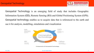
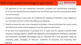
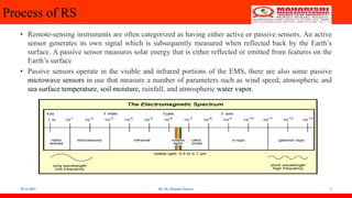
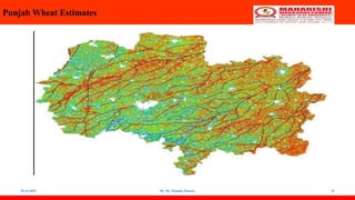
The document discusses geospatial technology and its applications in agriculture. Geospatial technology includes geographic information systems (GIS), remote sensing (RS), and global positioning systems (GPS). GIS allows large datasets to be analyzed and visualized spatially. Remote sensing uses sensors to acquire data about Earth from satellites and aircraft. GPS provides location data that can be integrated into GIS. Together, these technologies are used for applications like precision agriculture, crop monitoring, and resource management.