Download to read offline
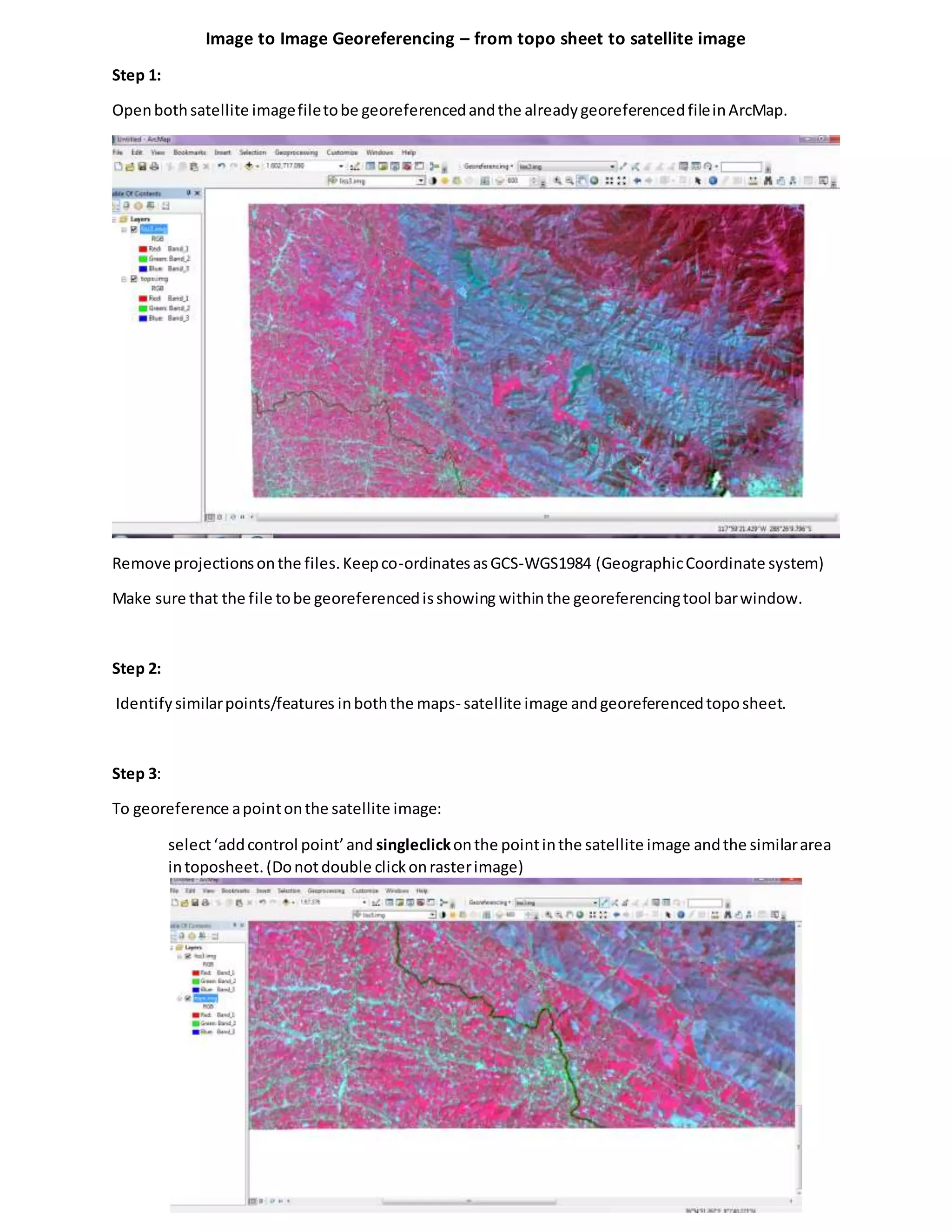
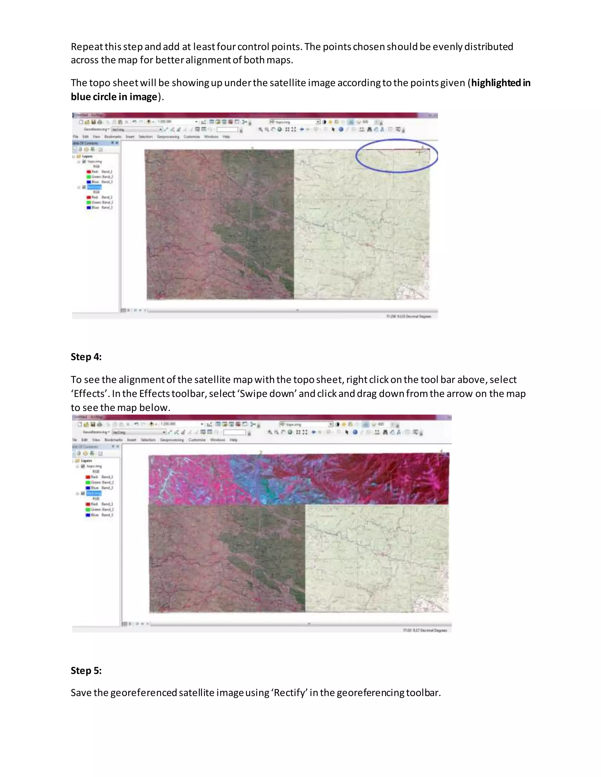


This document outlines the steps for georeferencing a satellite image using a topo sheet in ArcMap. It includes instructions on how to remove projections, identify control points, and ensure proper alignment between the maps. Finally, it covers how to save the georeferenced image.