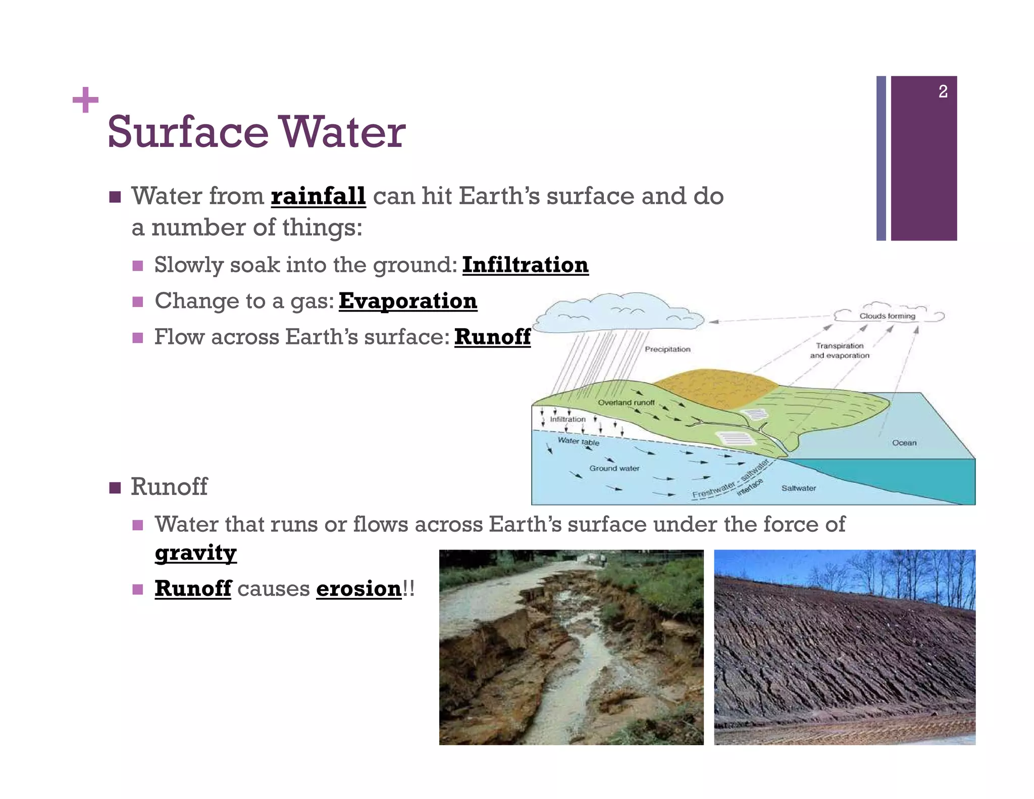
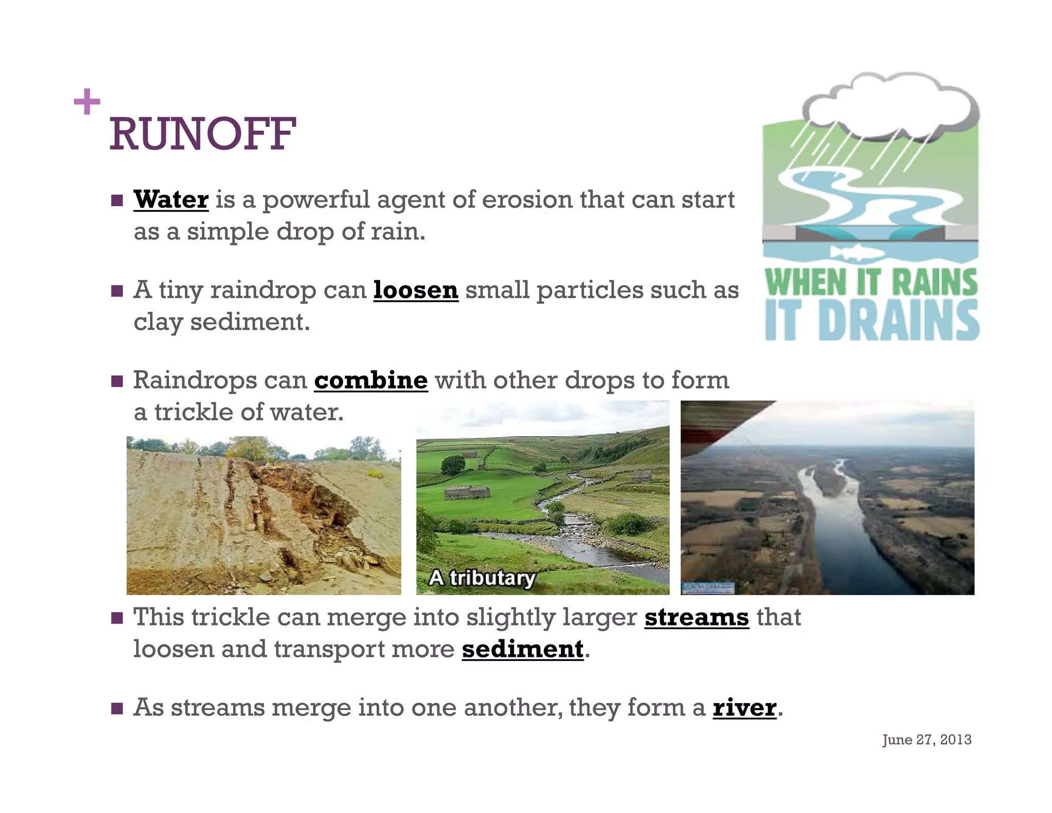
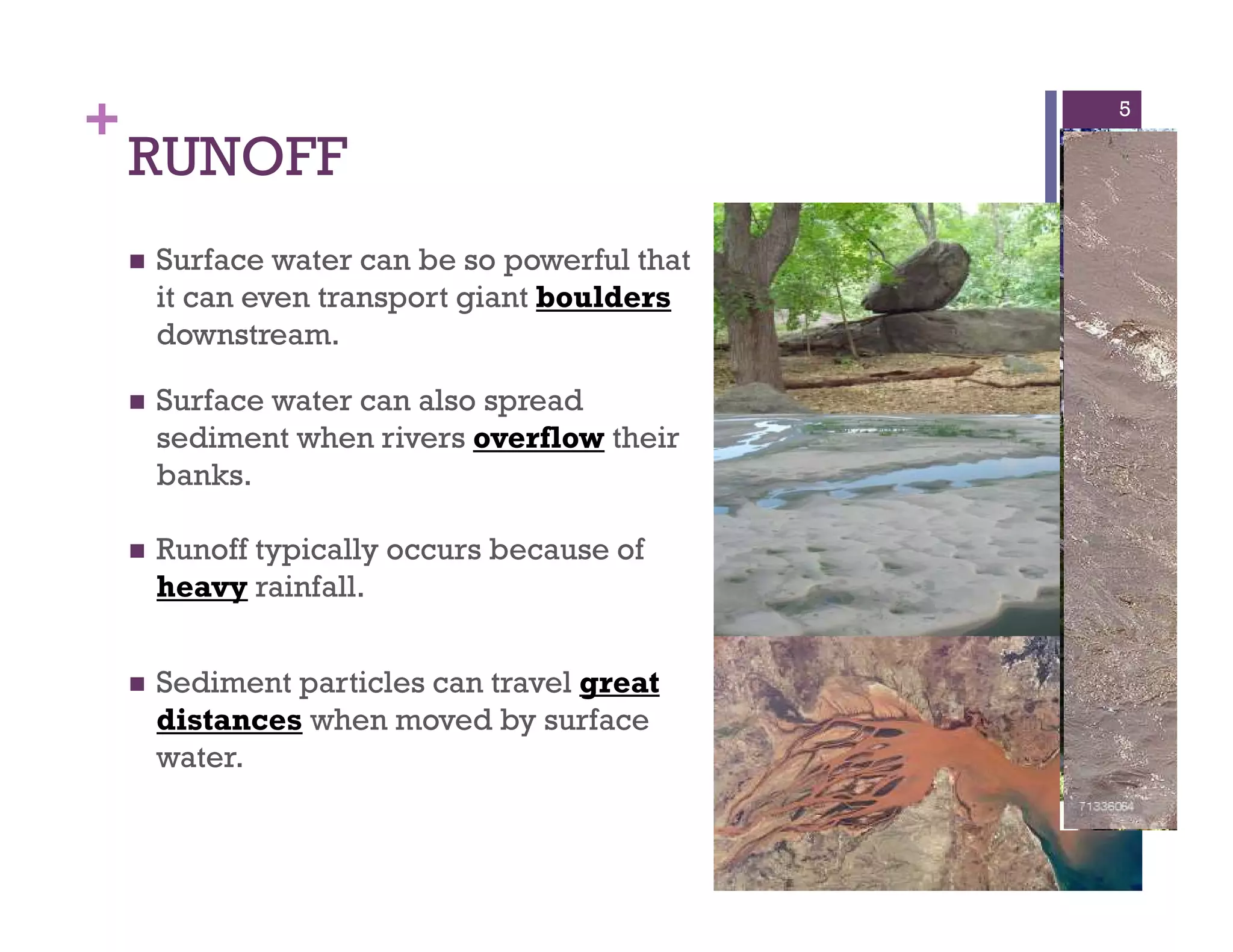
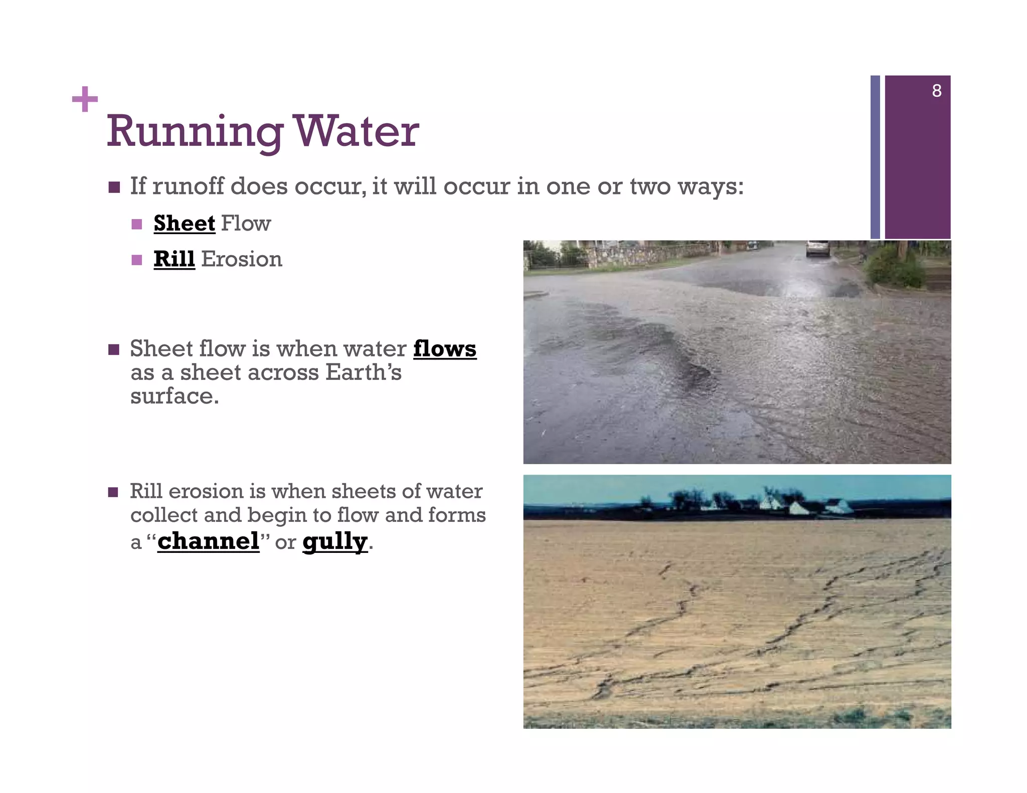
1) Surface water runoff from rainfall can erode soil particles and transport sediment, forming streams that can merge into rivers.
2) As rivers flow, they erode soft rock layers like sandstone and may change course, eroding harder rocks like granite over long periods.
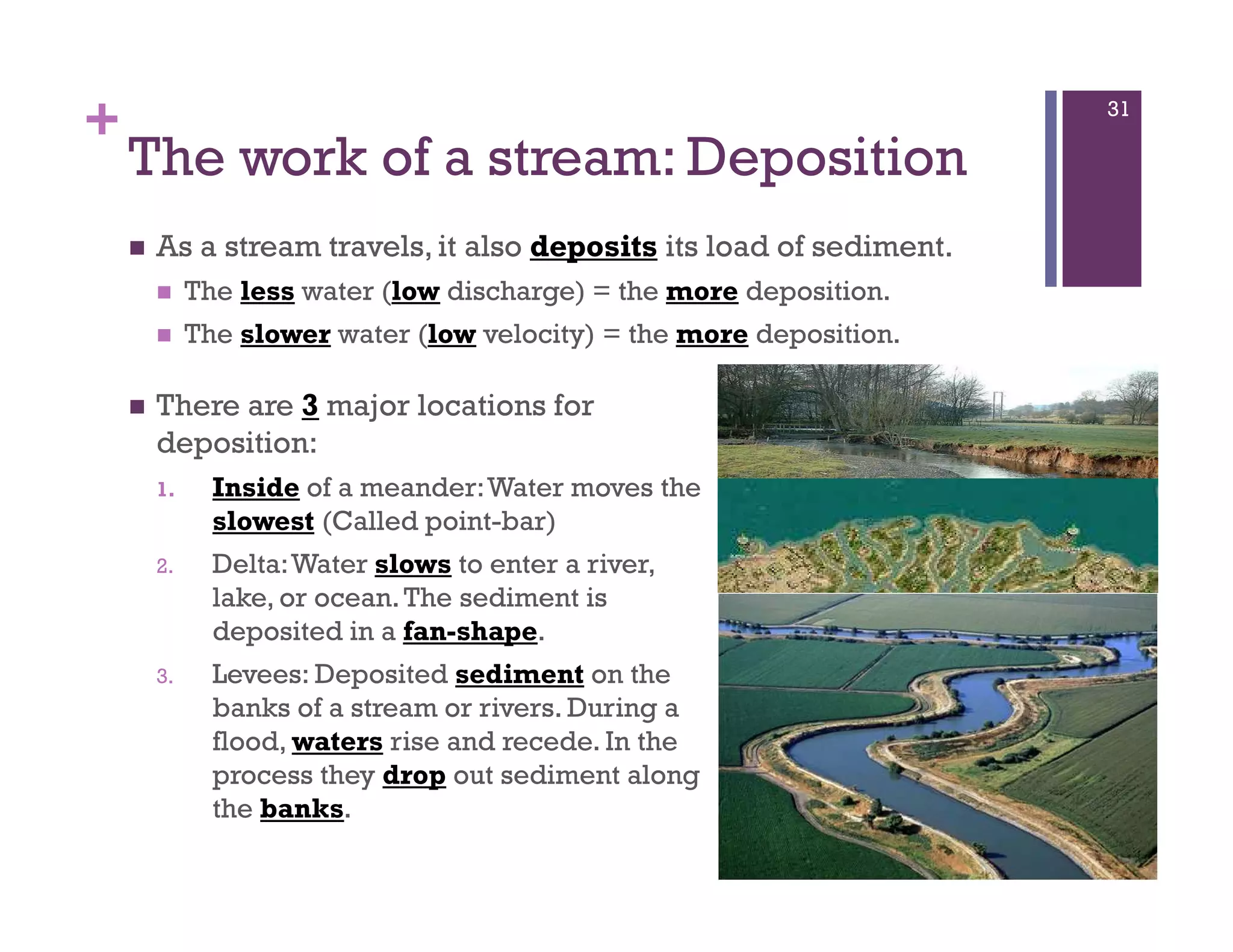
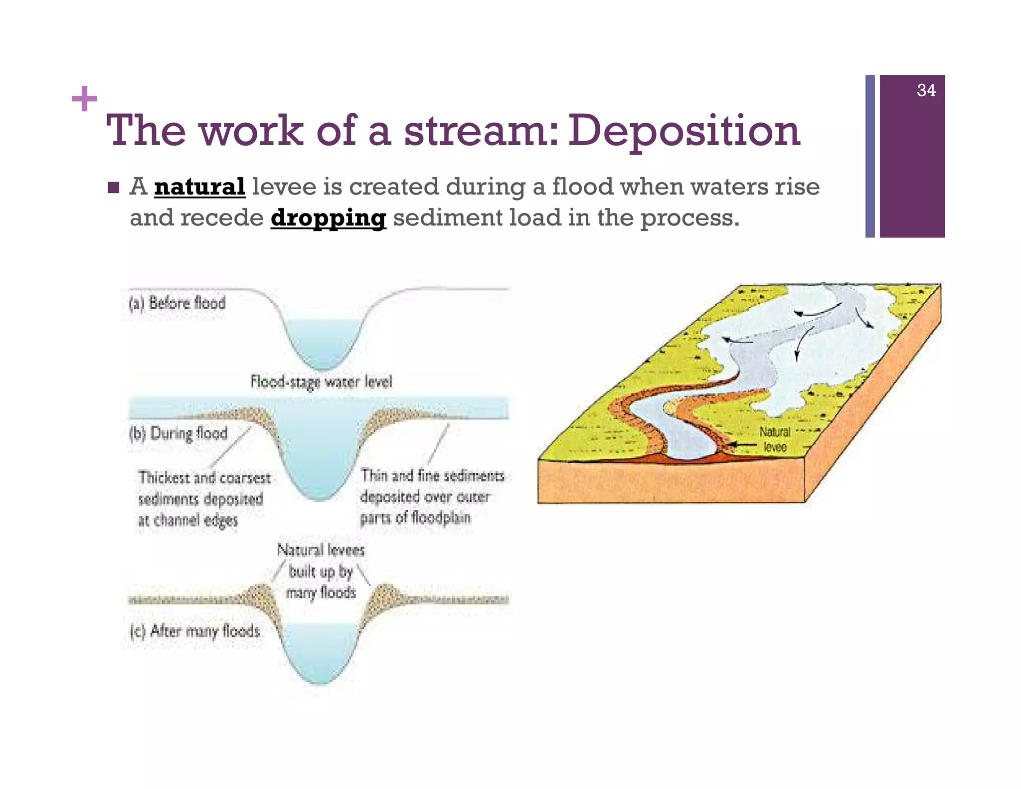
3) Sediment is deposited when water slows, such as when flowing into basins or encountering obstacles, gradually accumulating to form sedimentary rock.