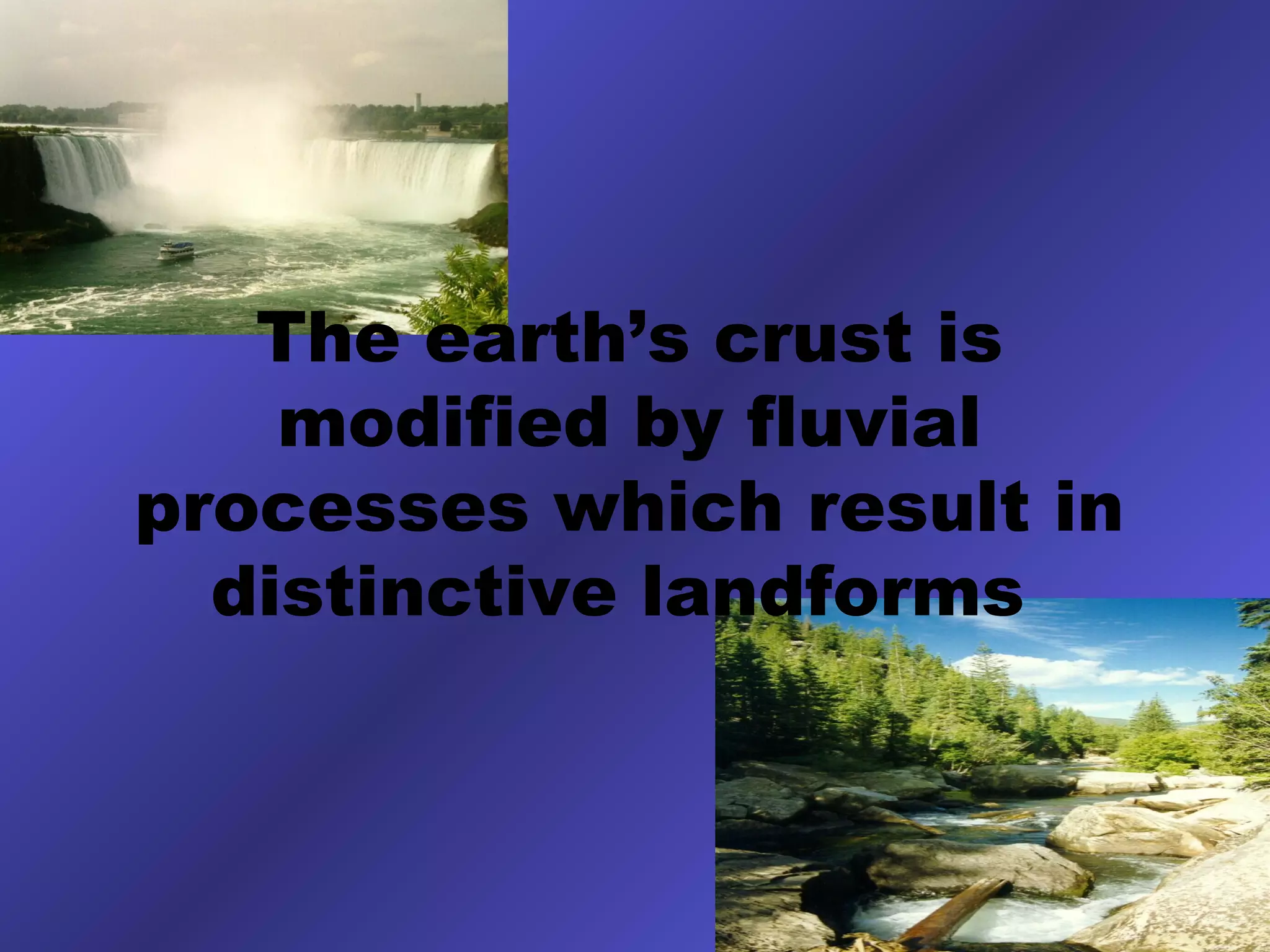
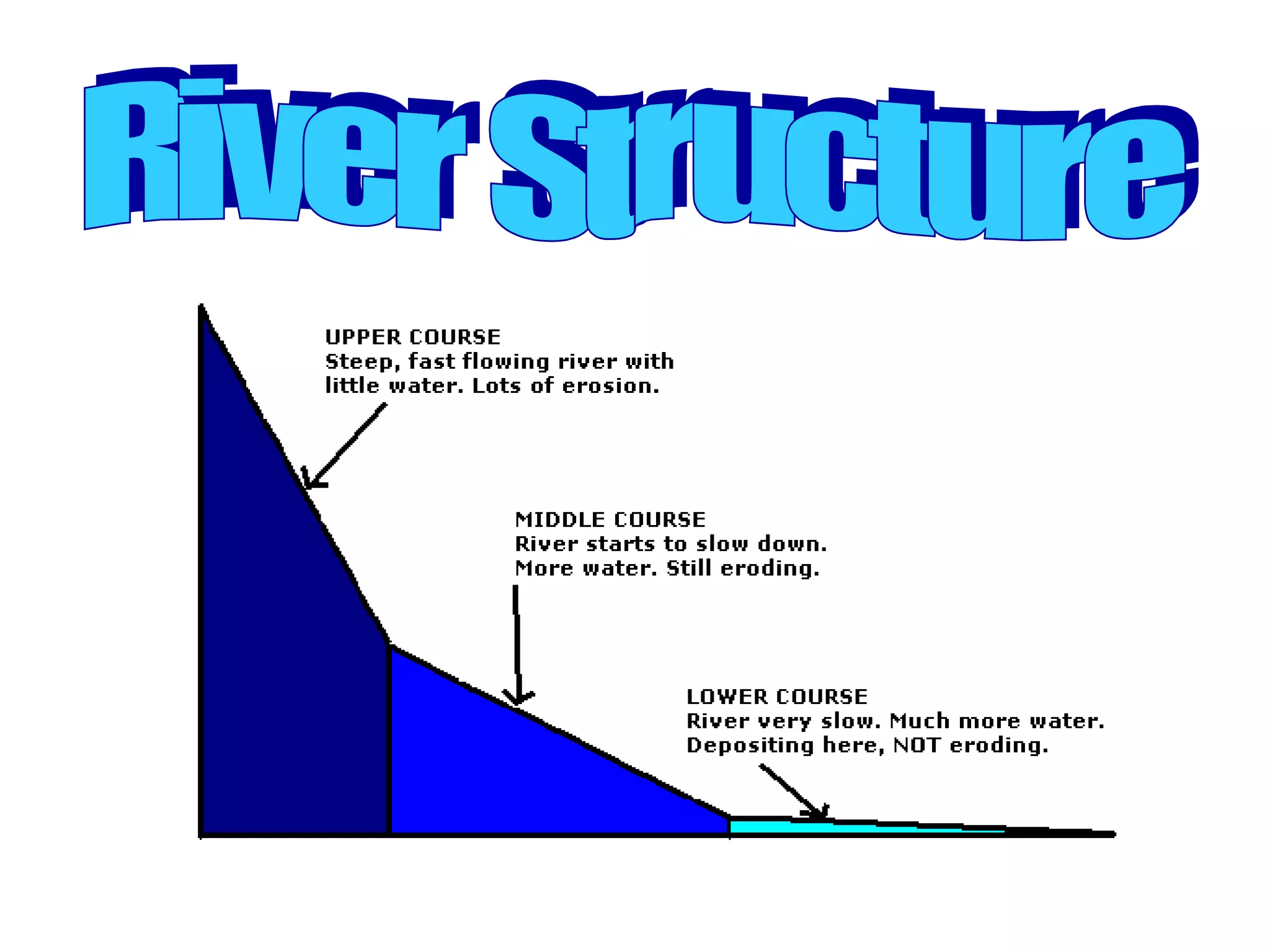
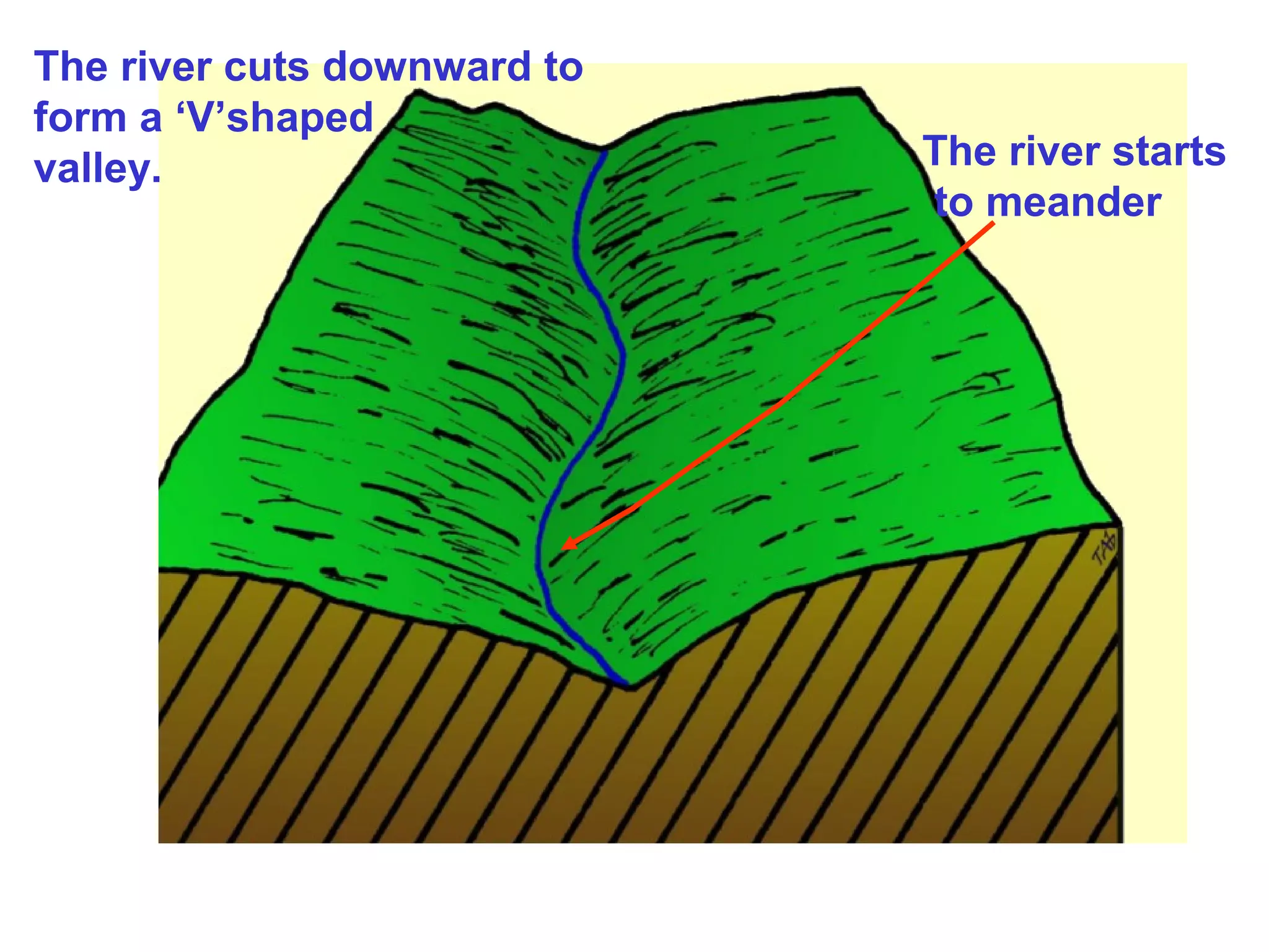
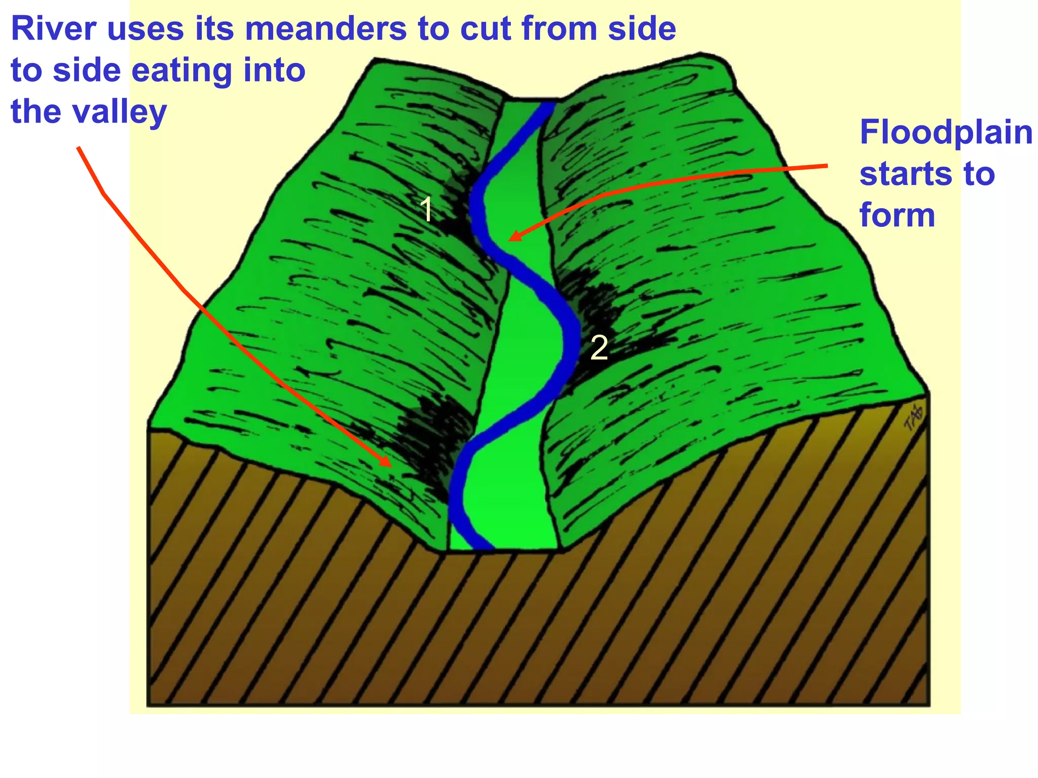
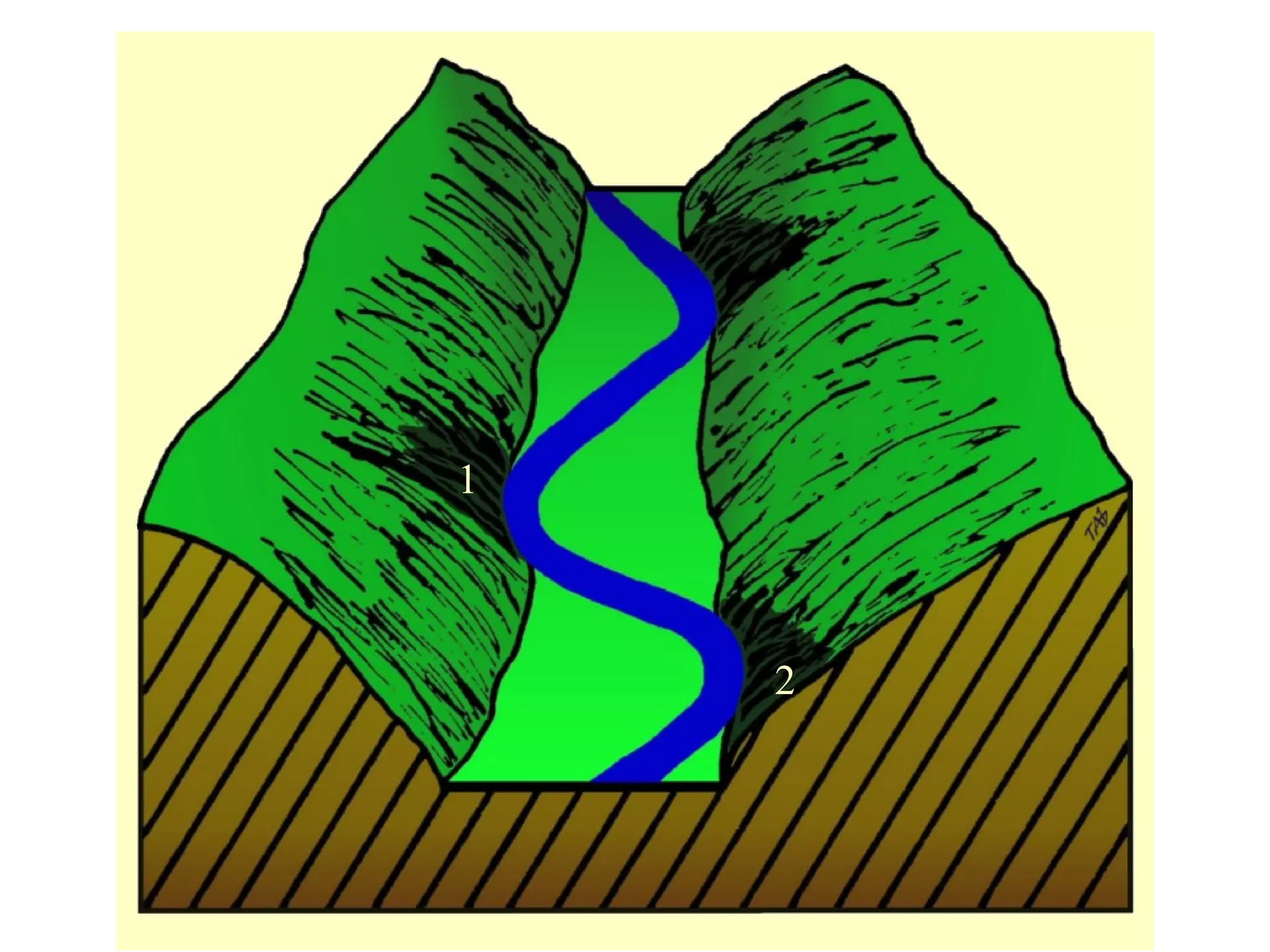
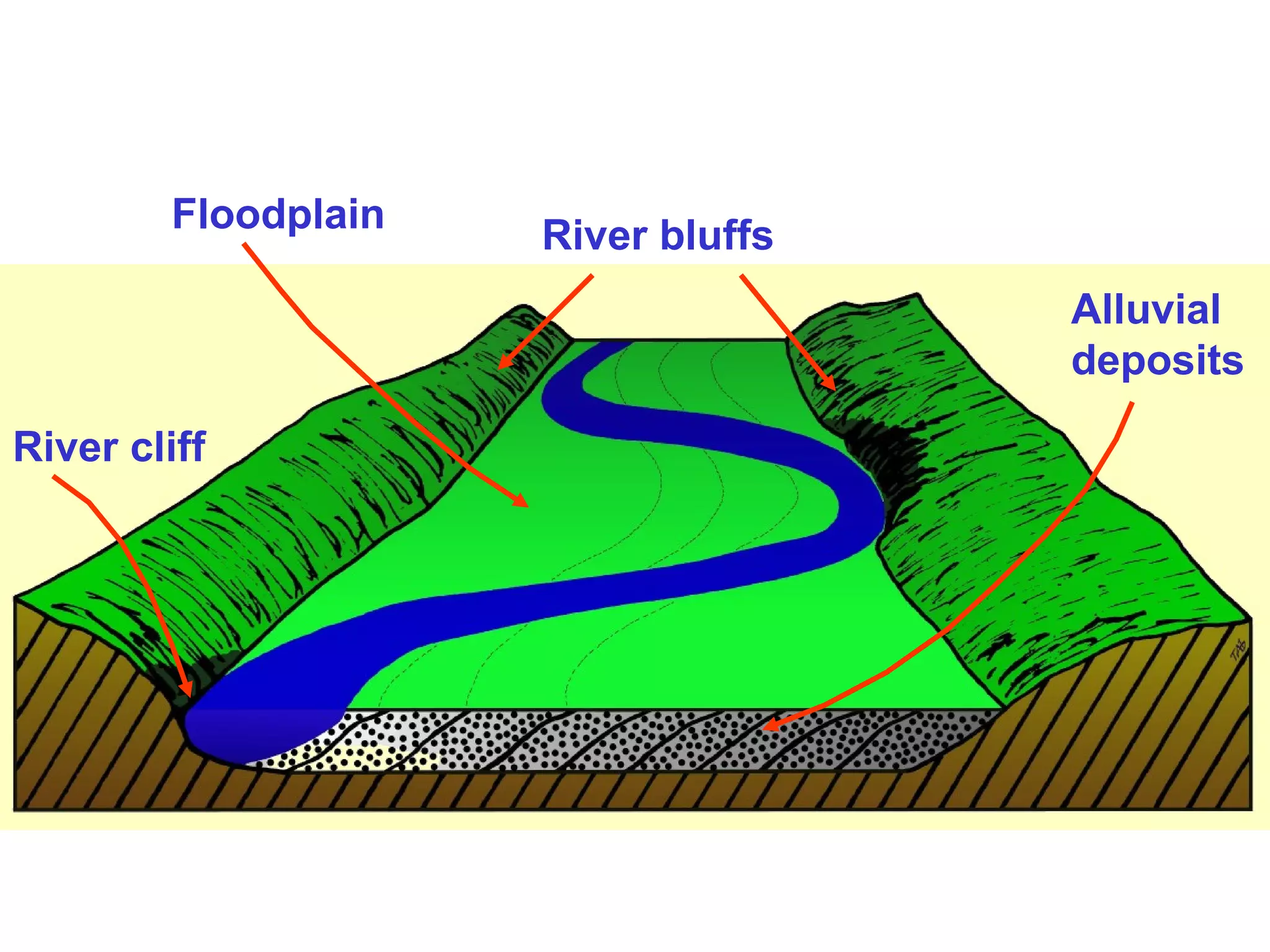
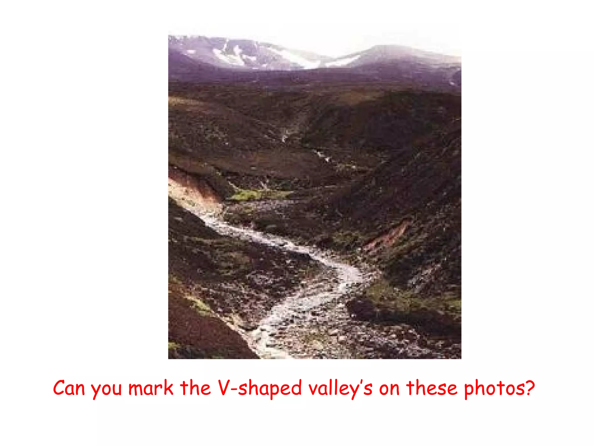
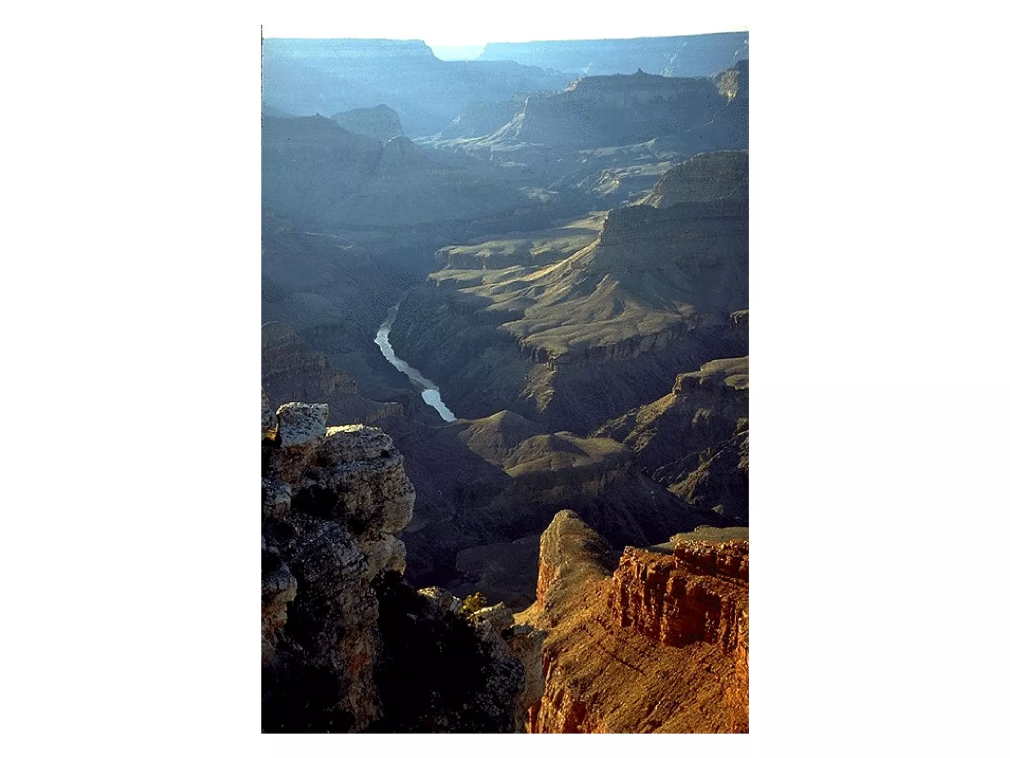
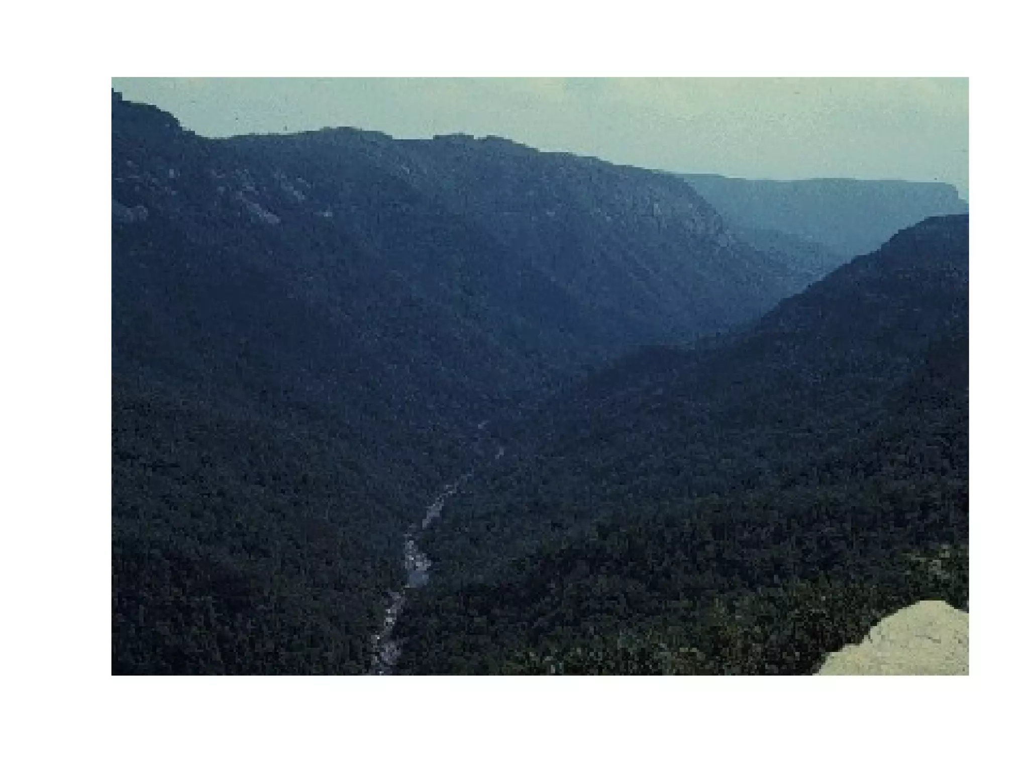
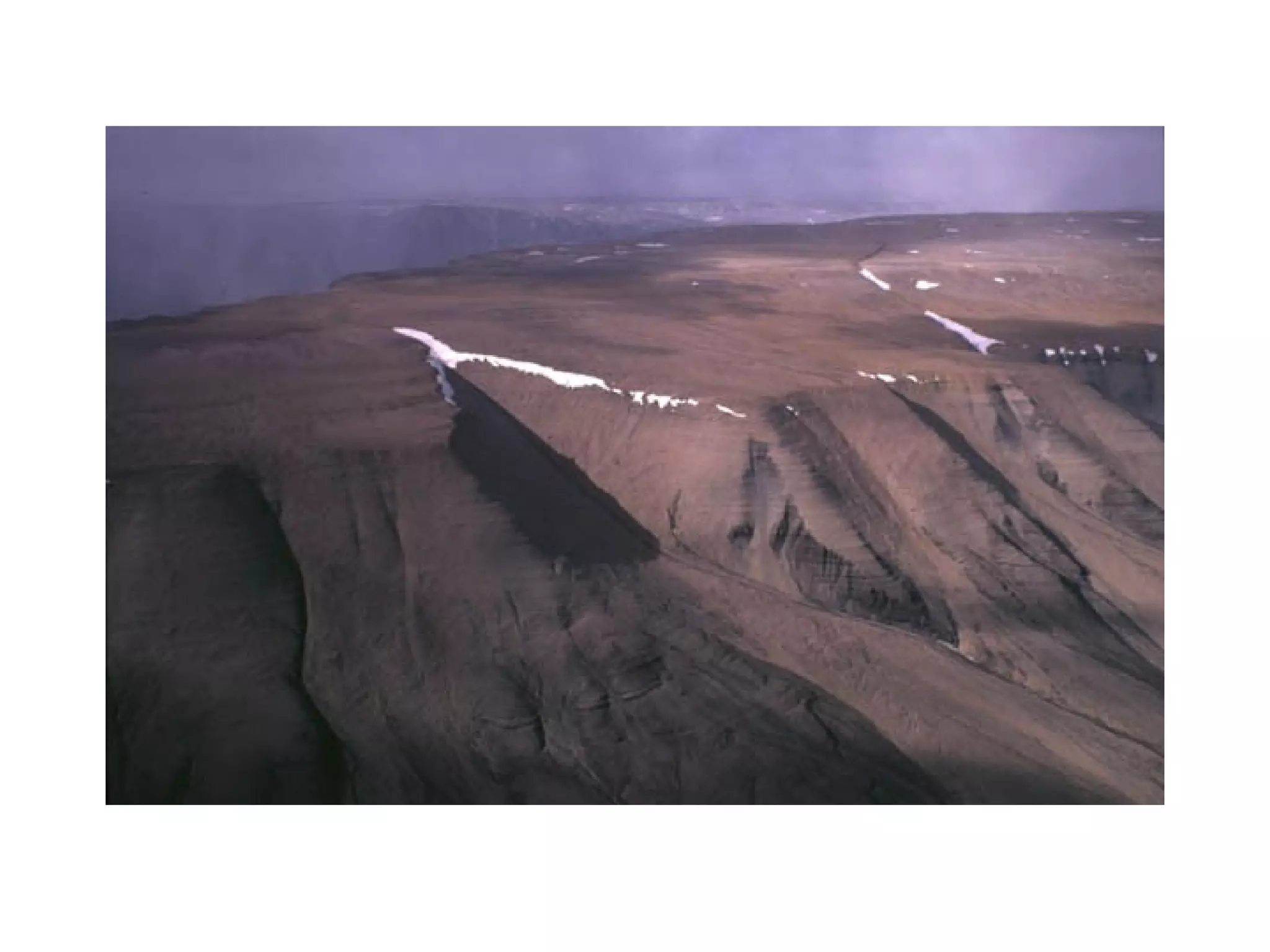
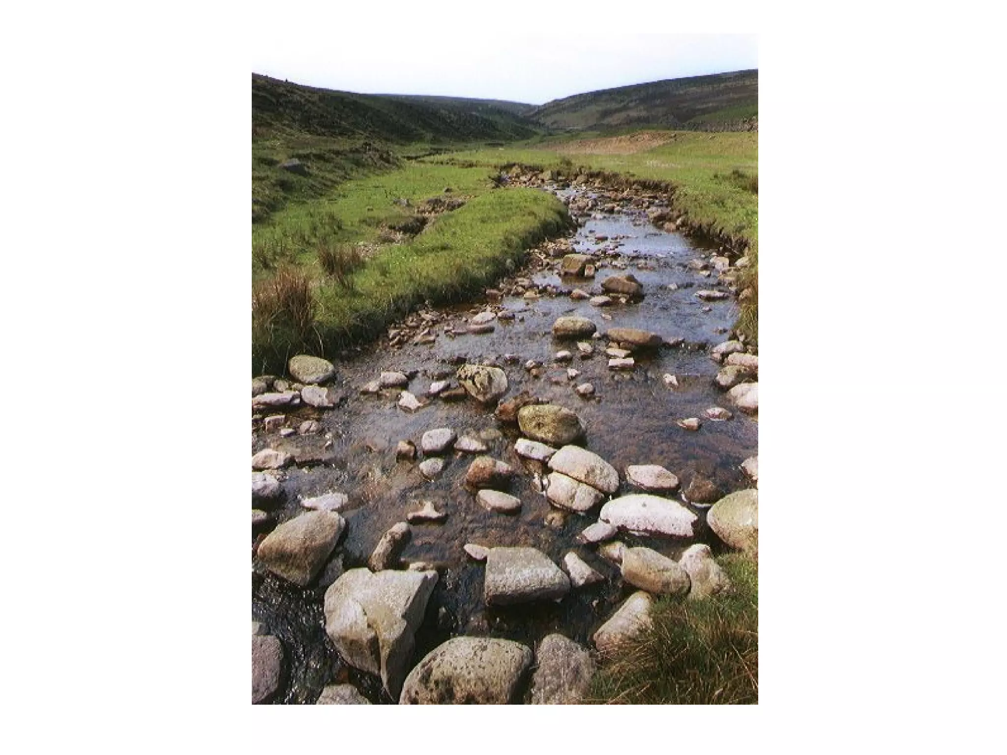
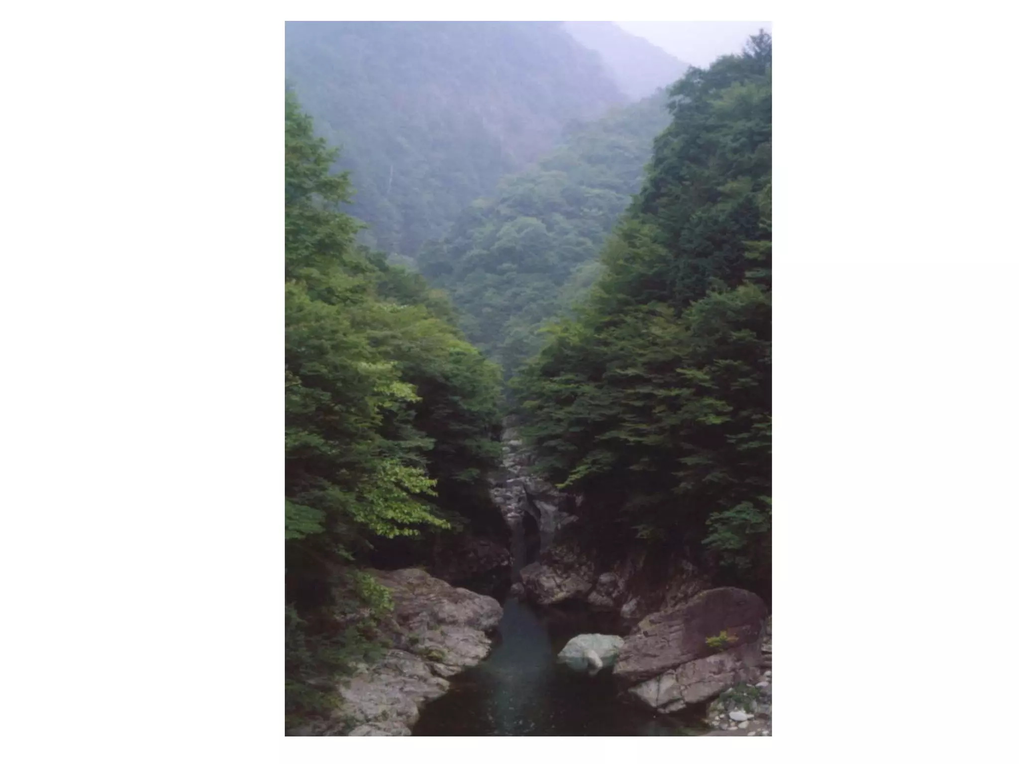
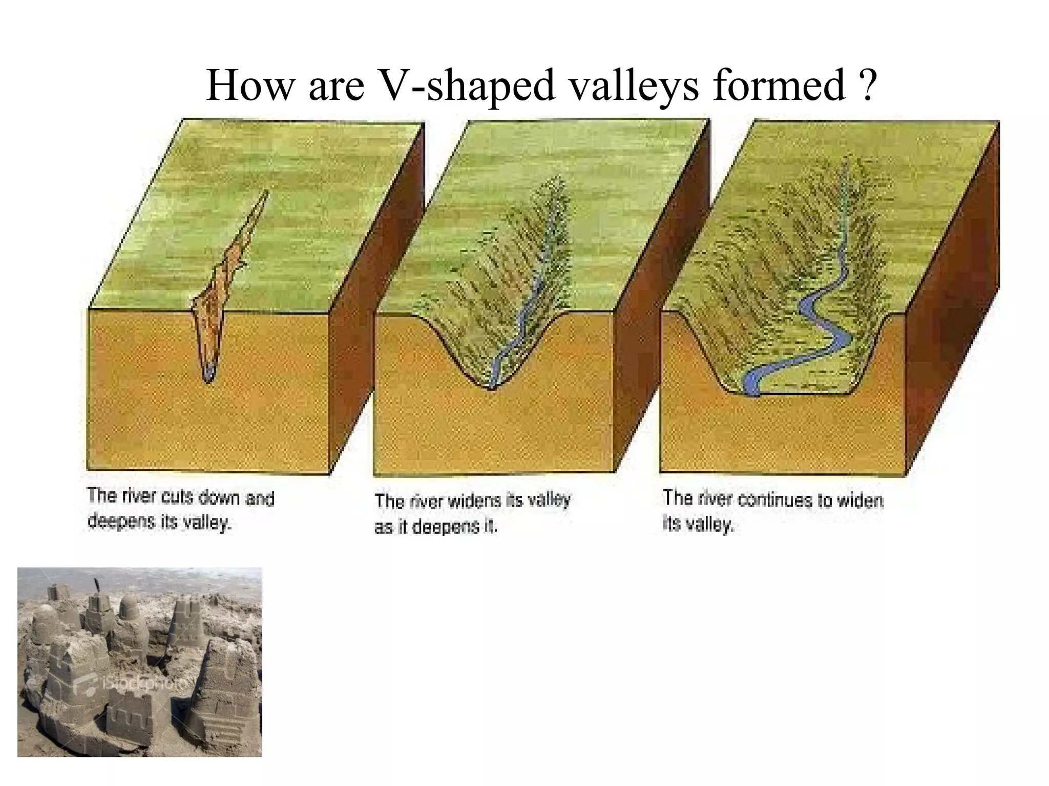
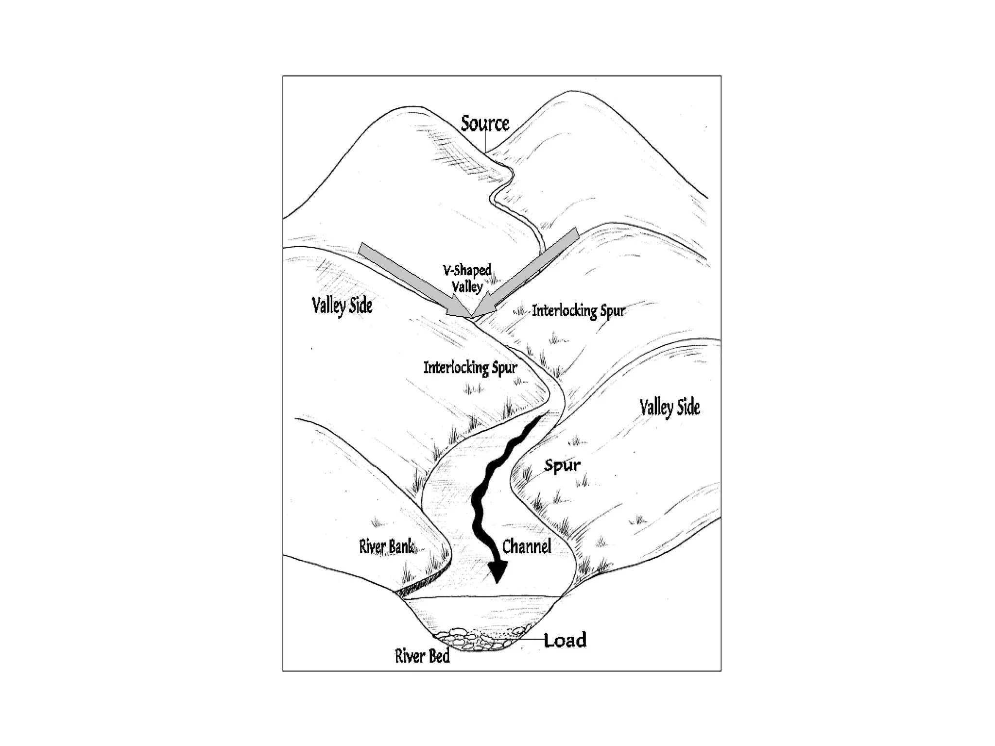
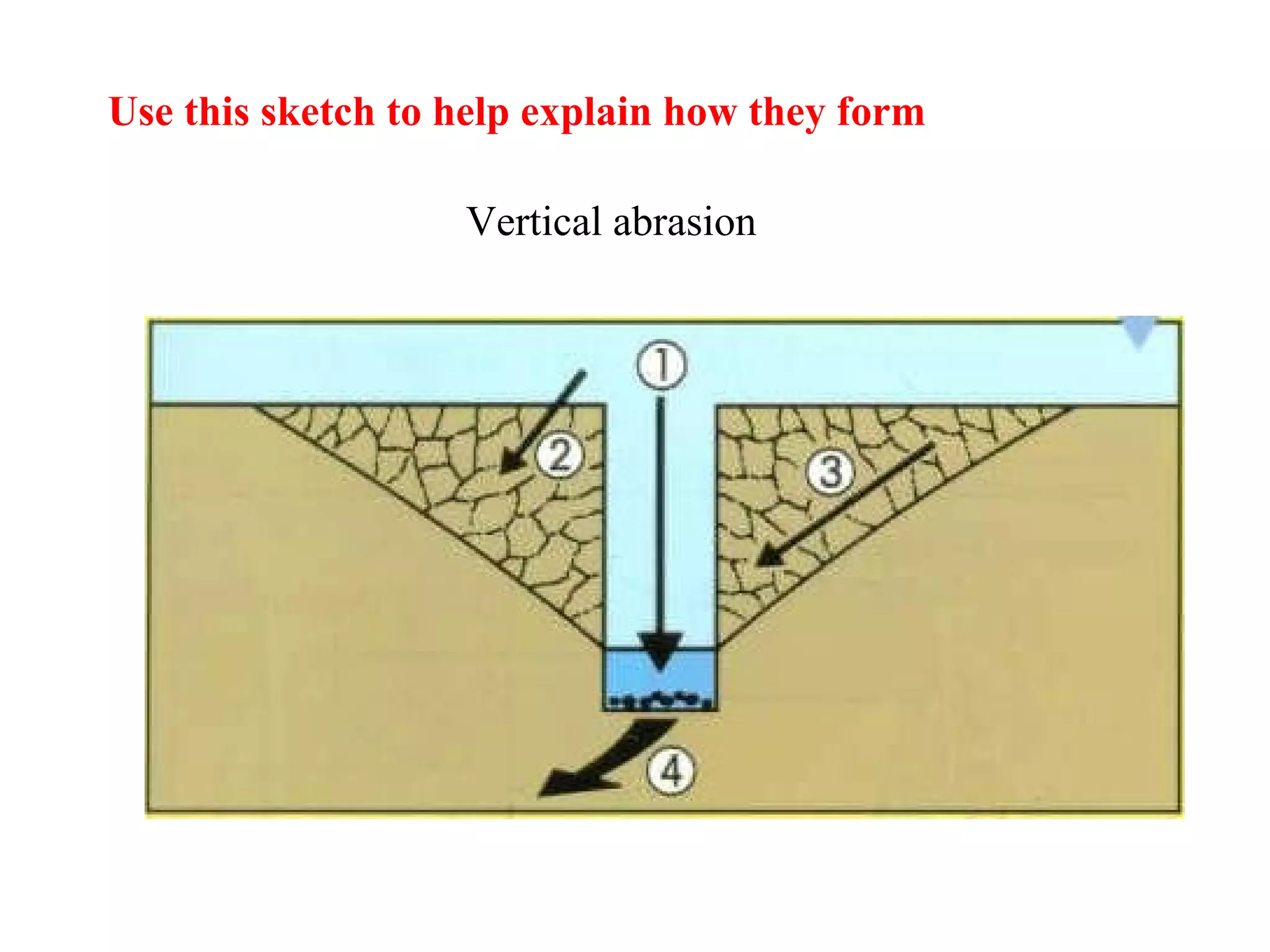
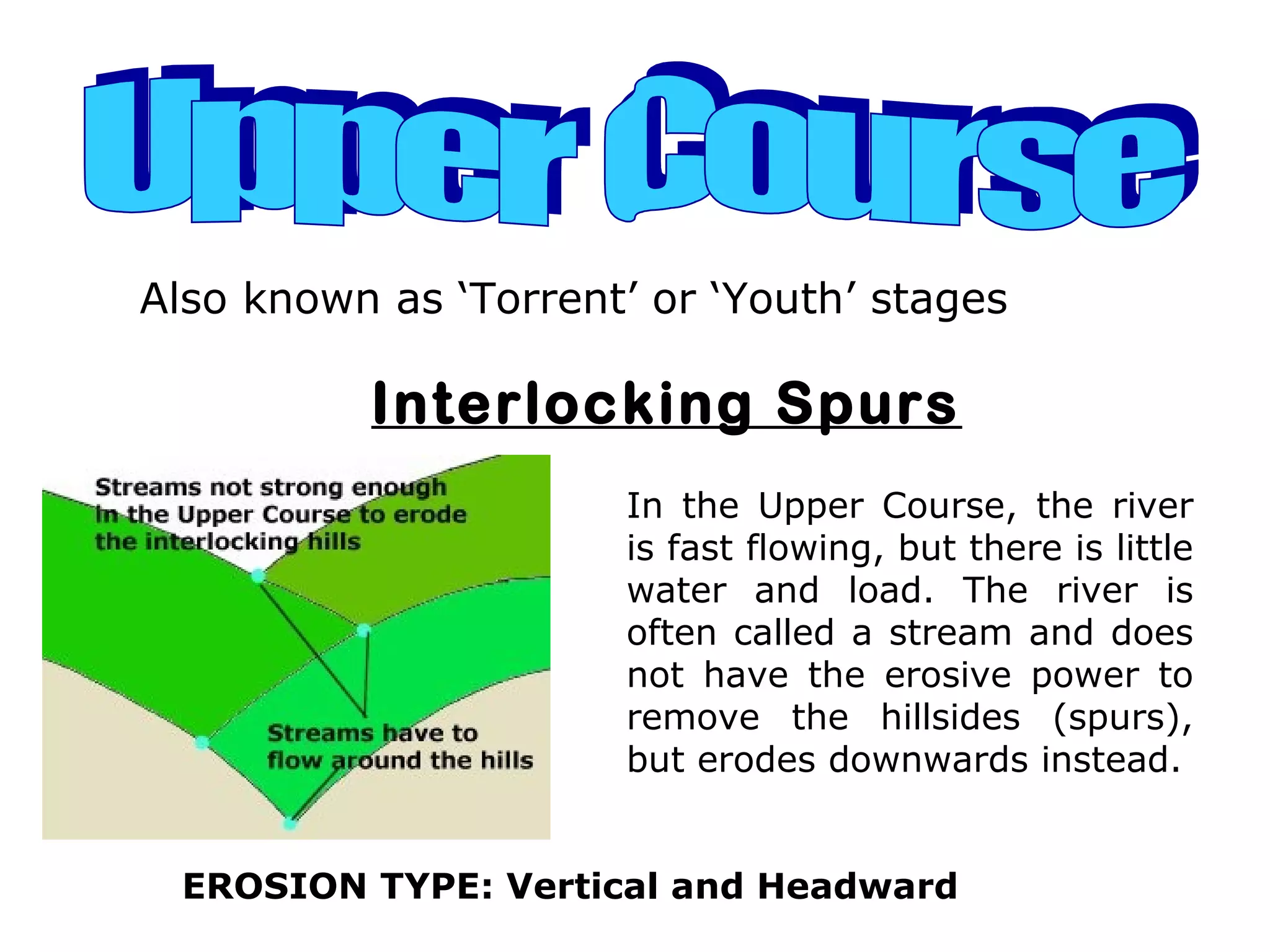
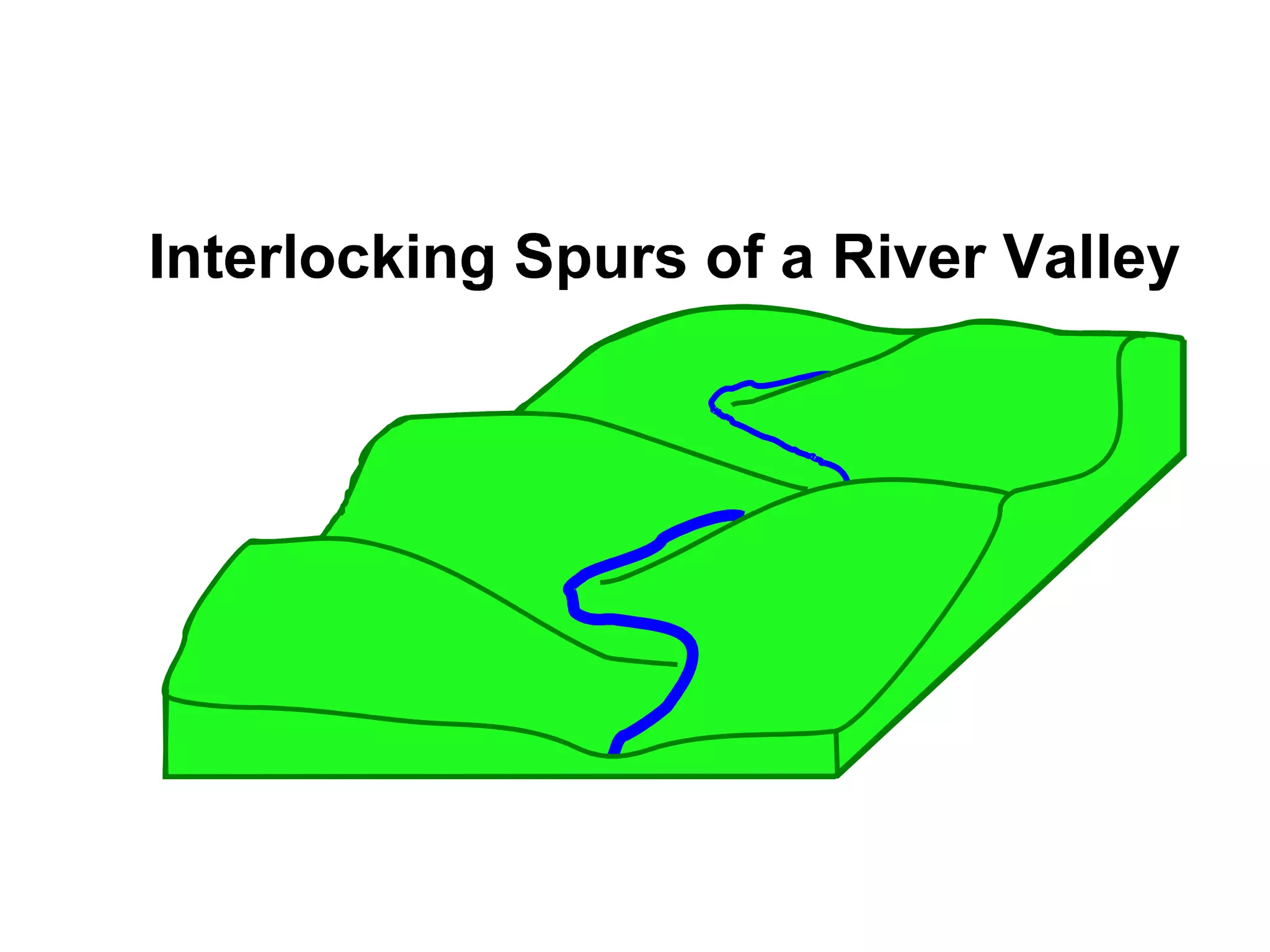
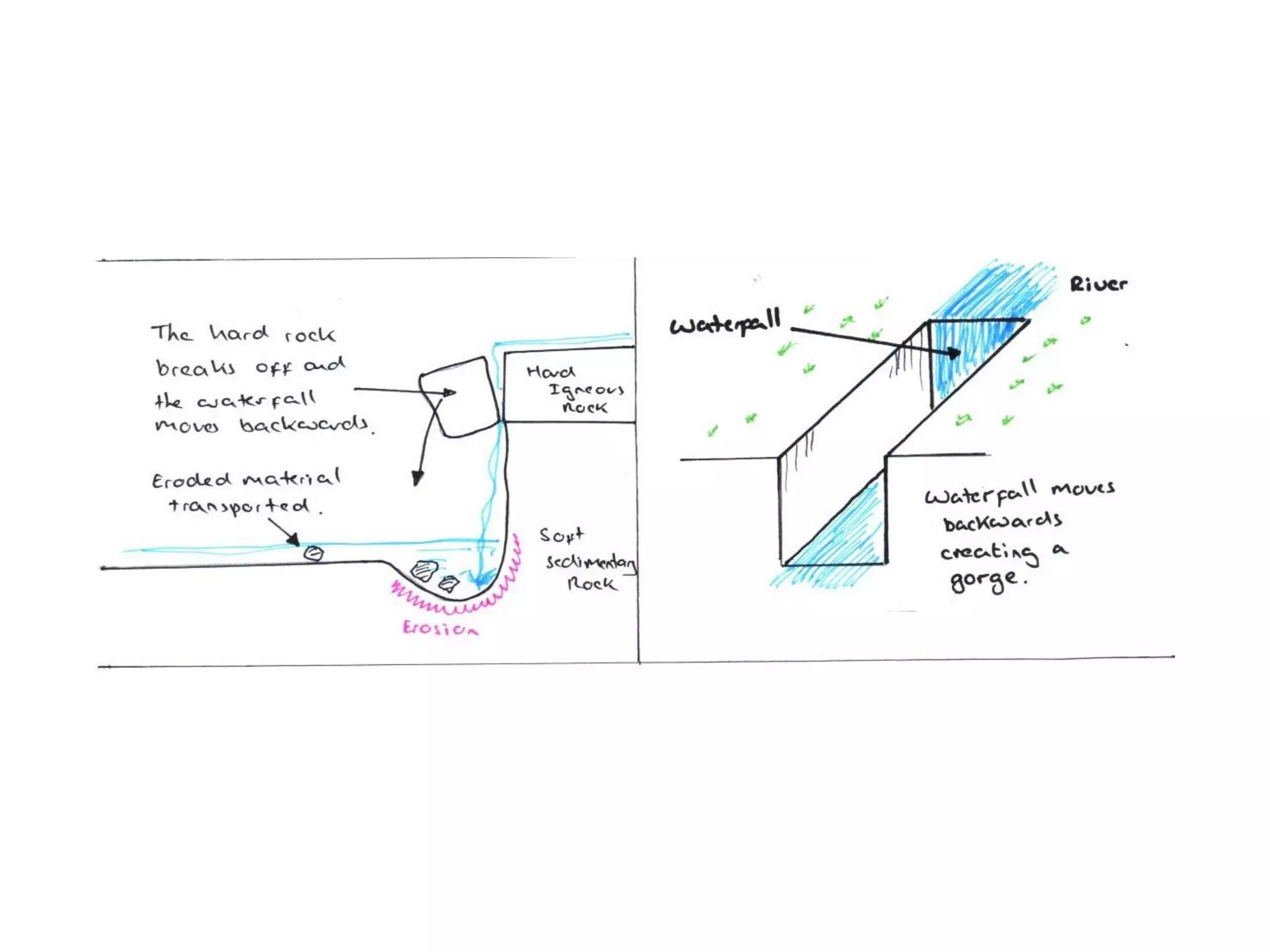
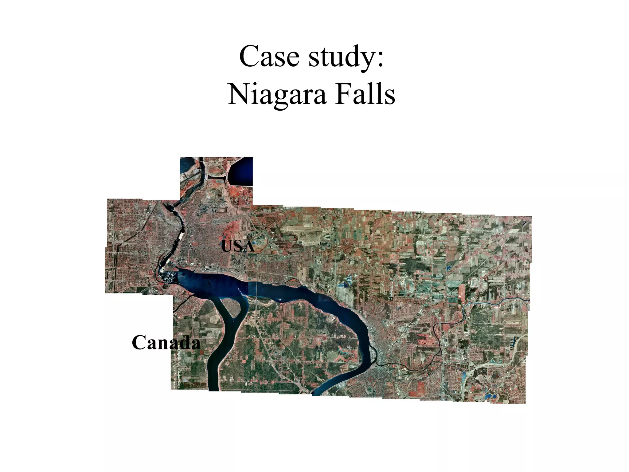
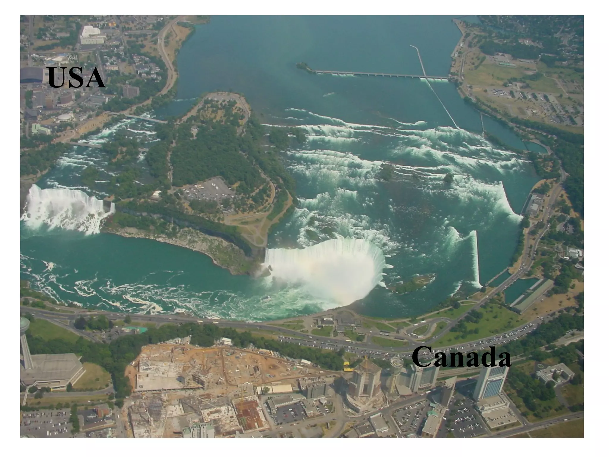
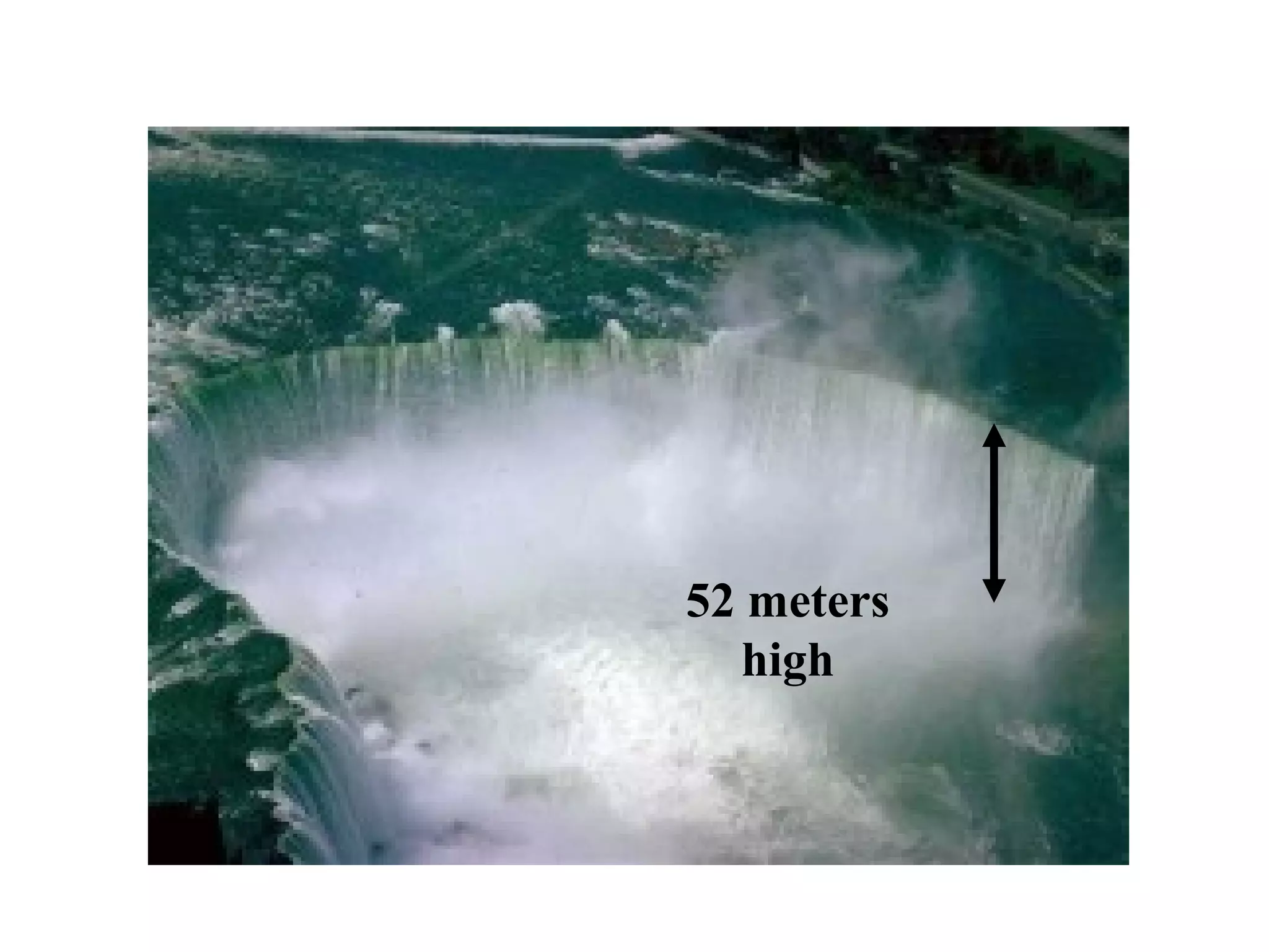
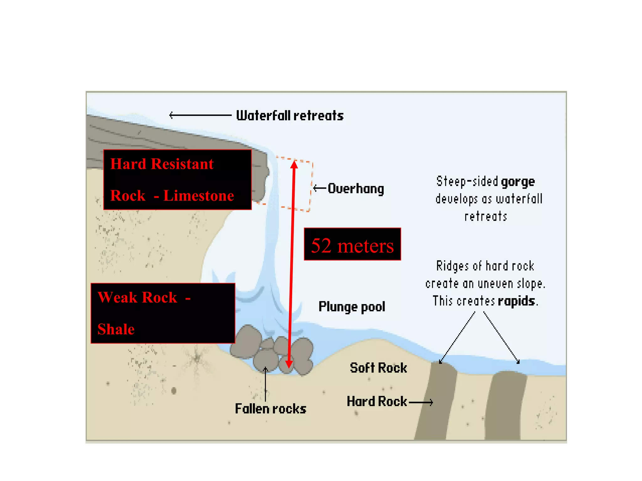
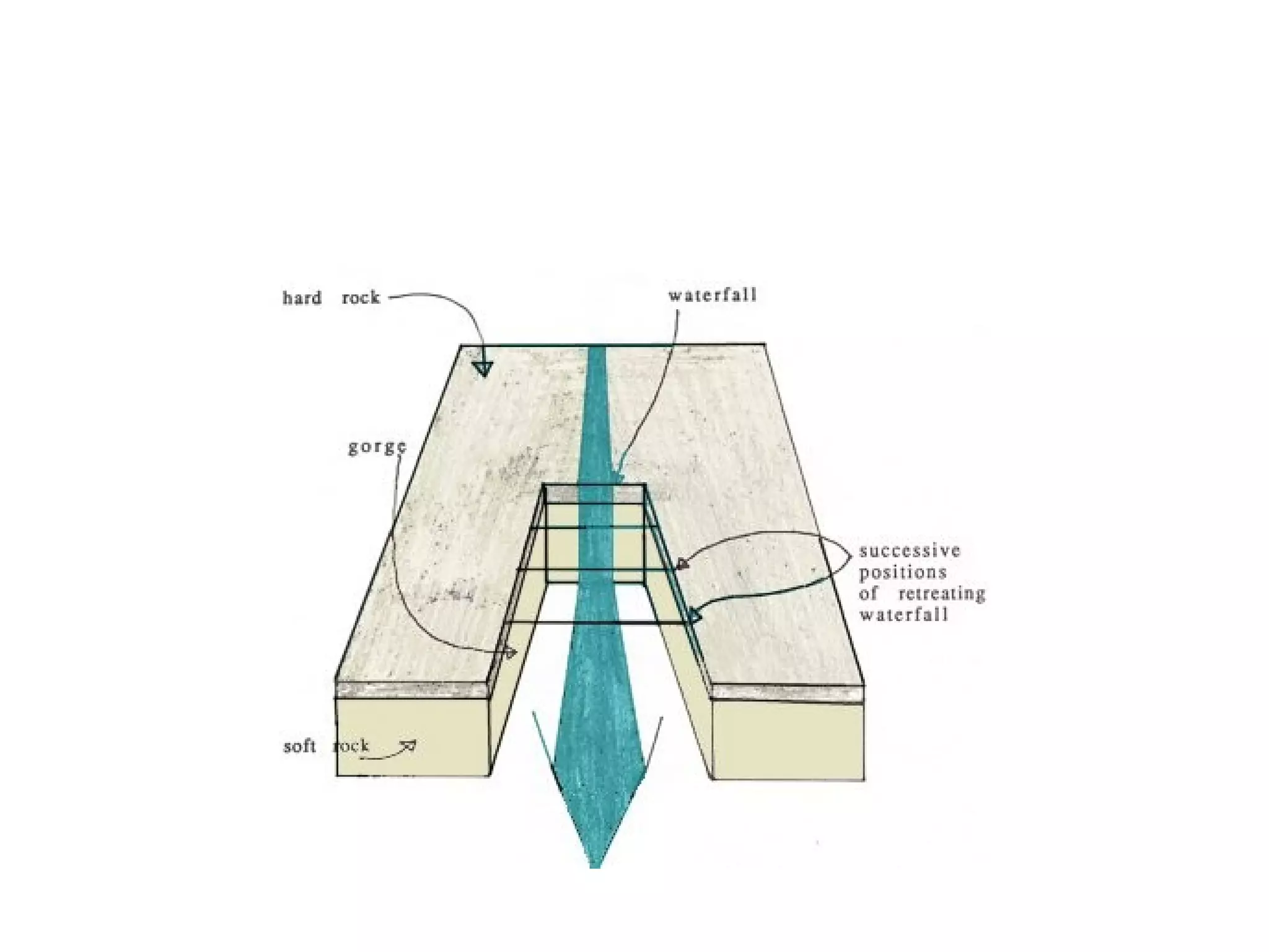
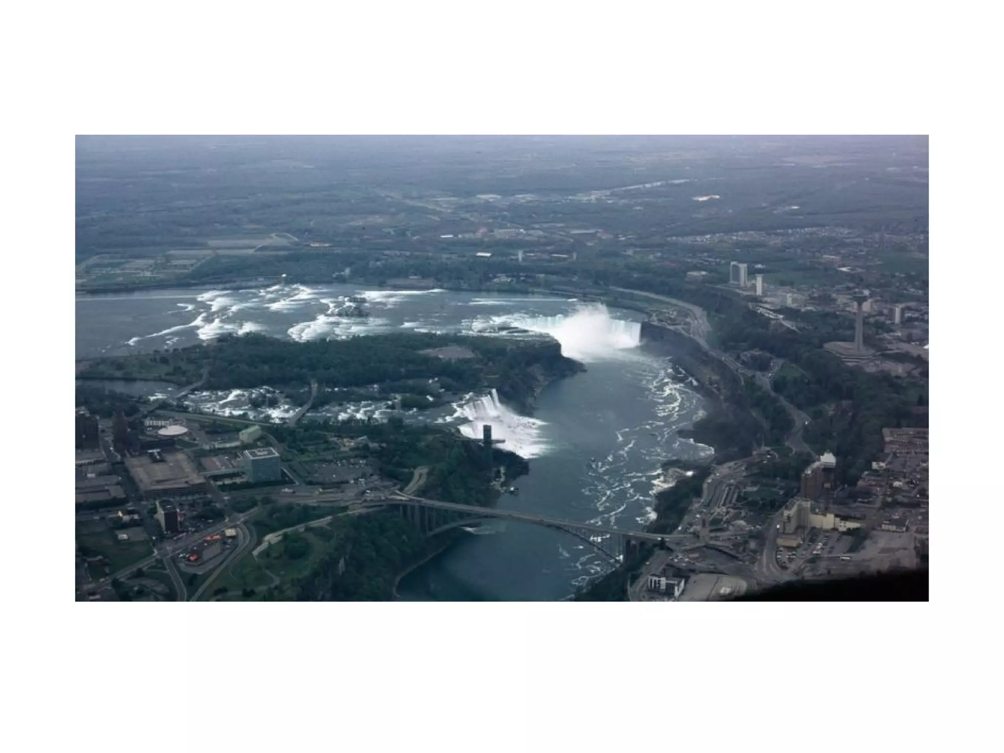
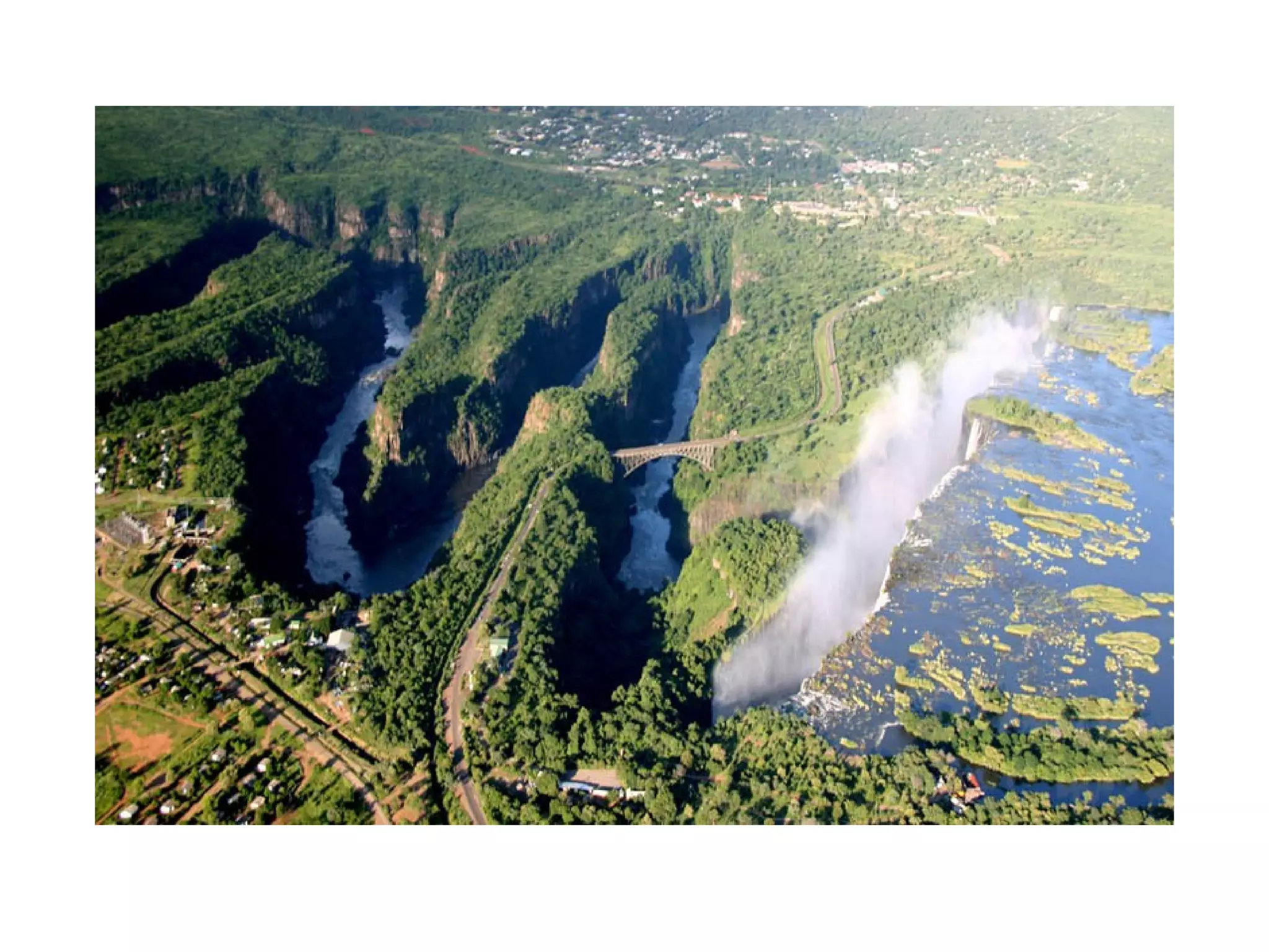
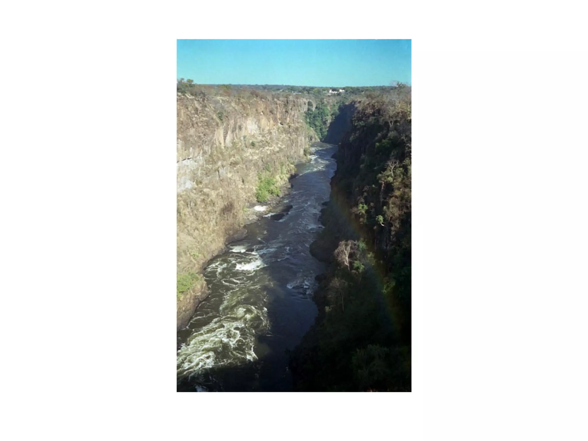
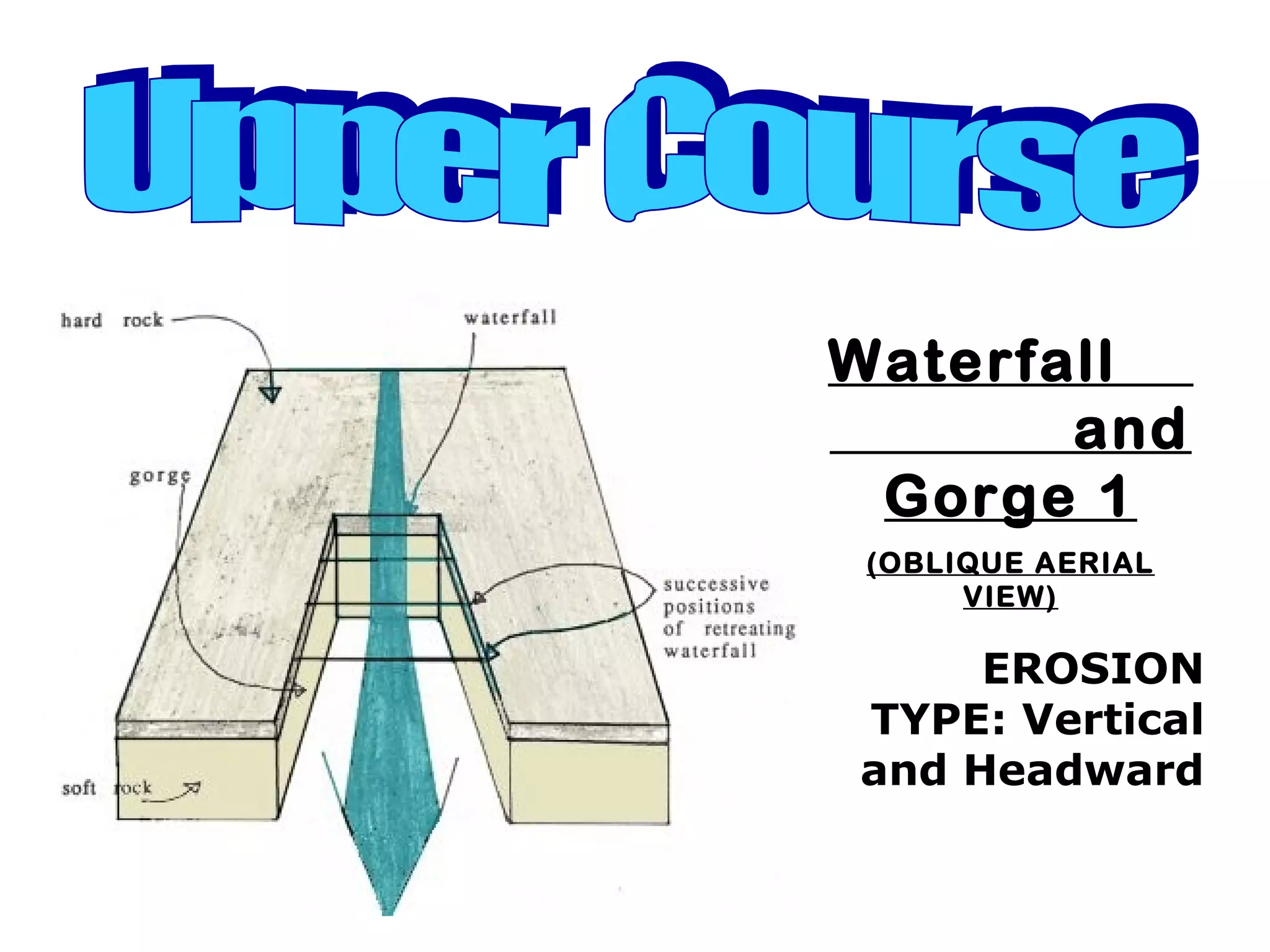
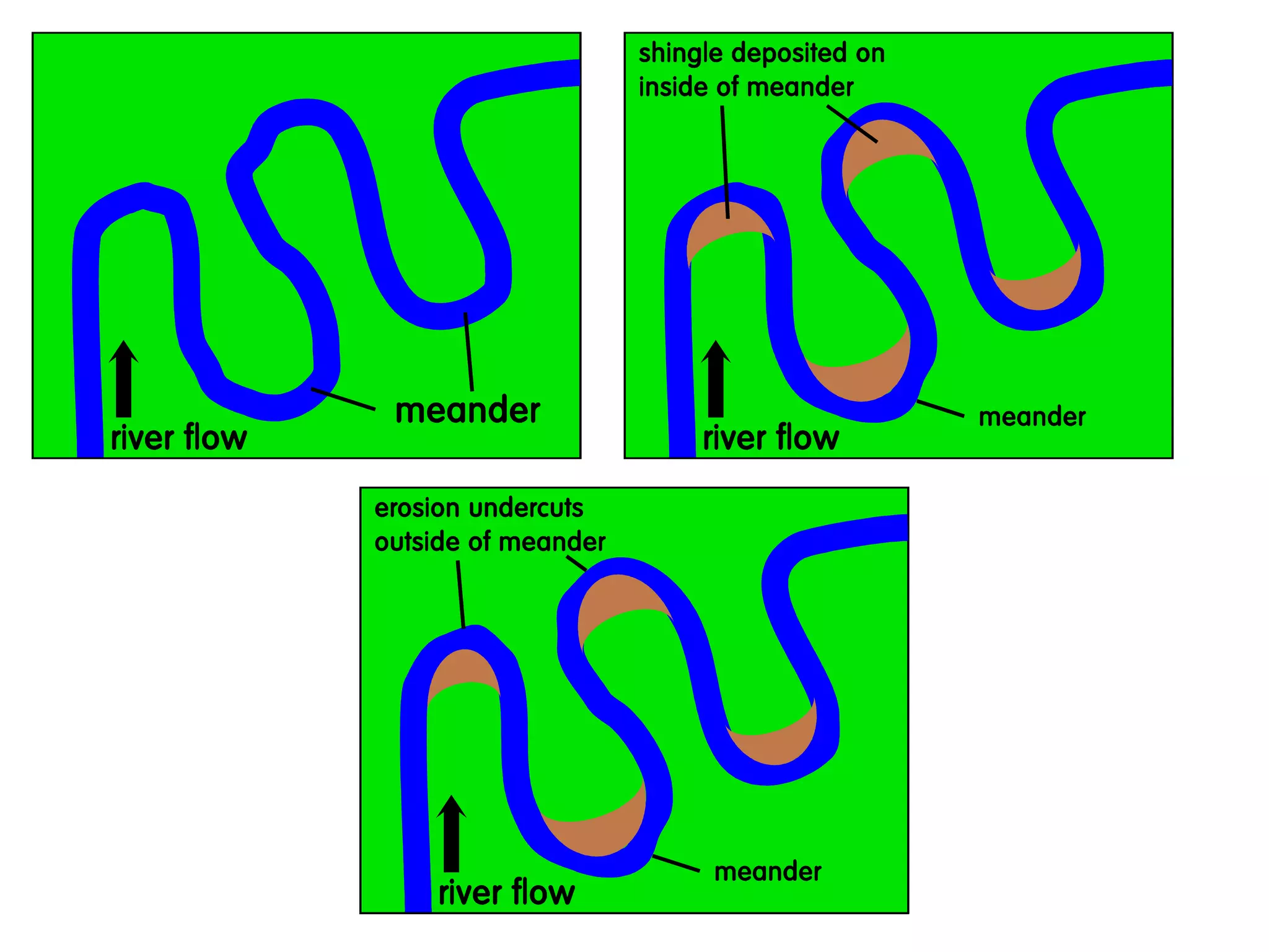
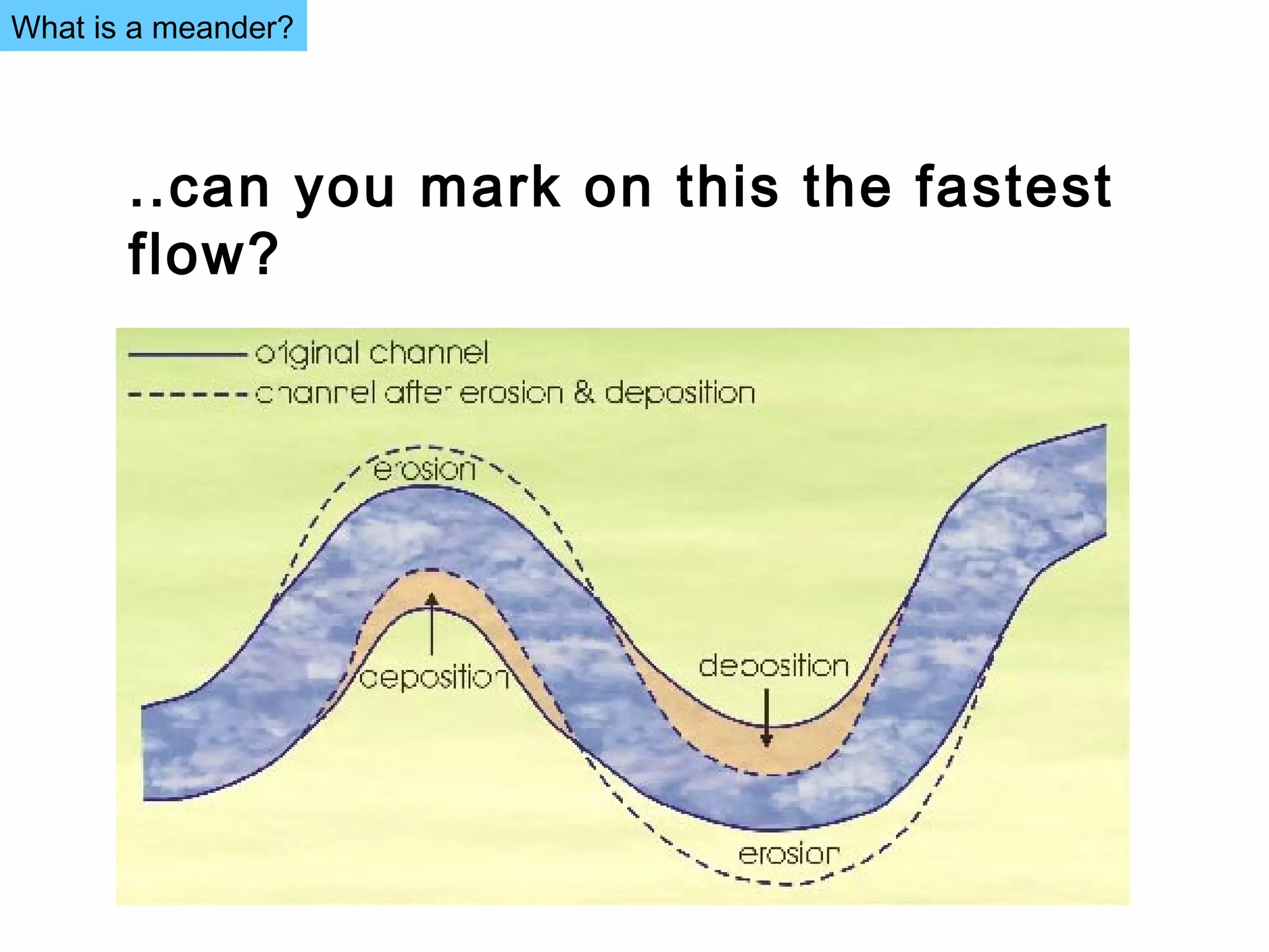
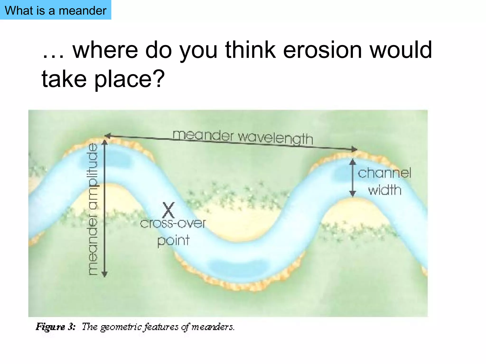
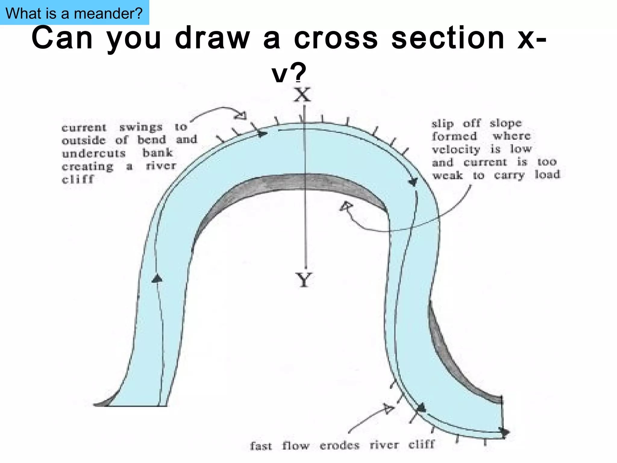
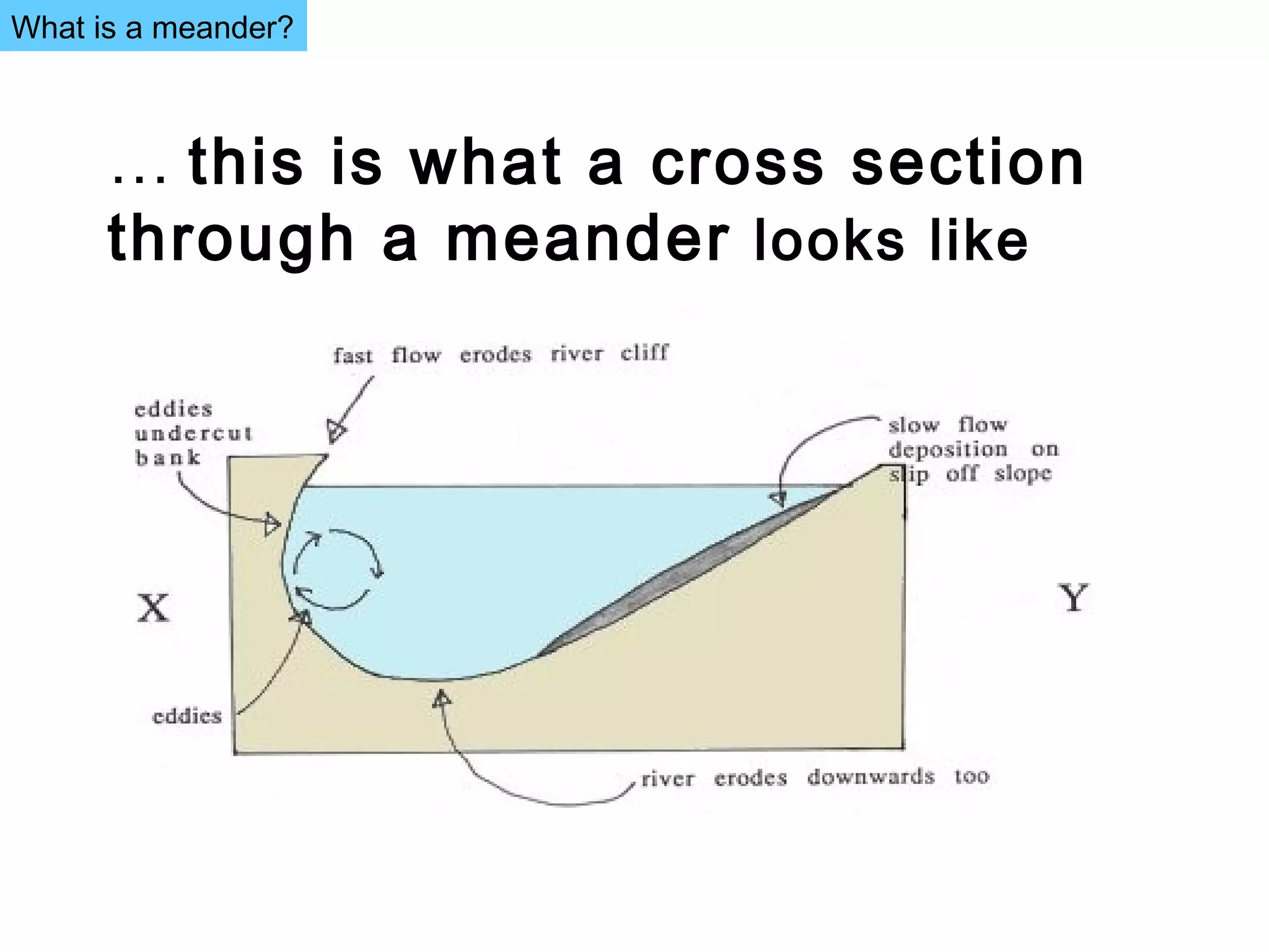
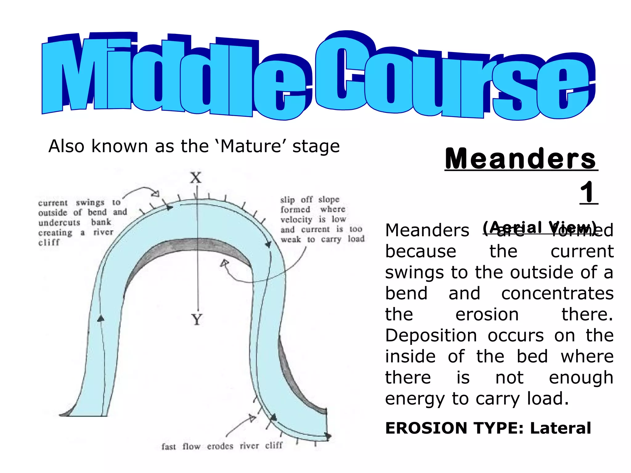
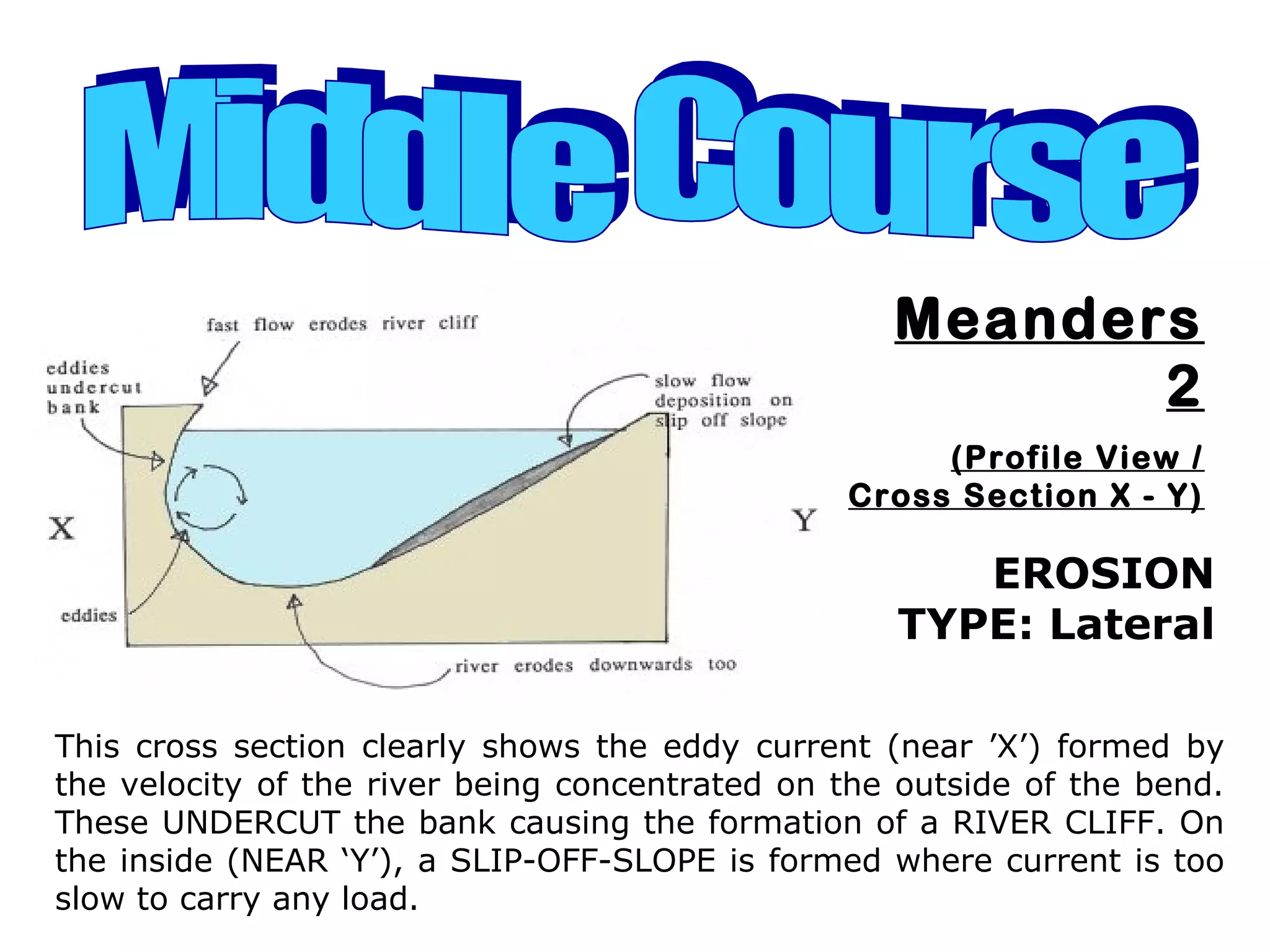
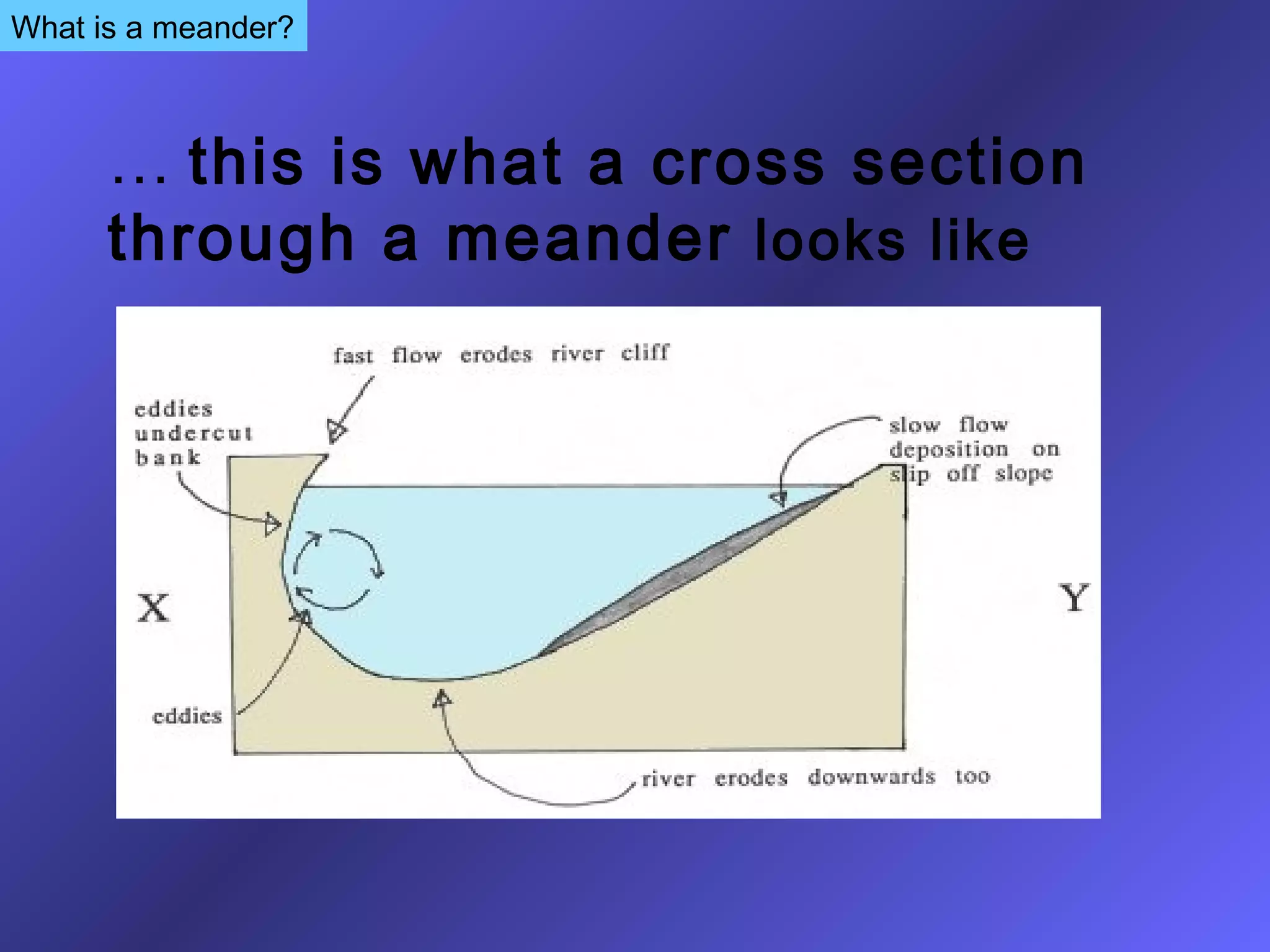
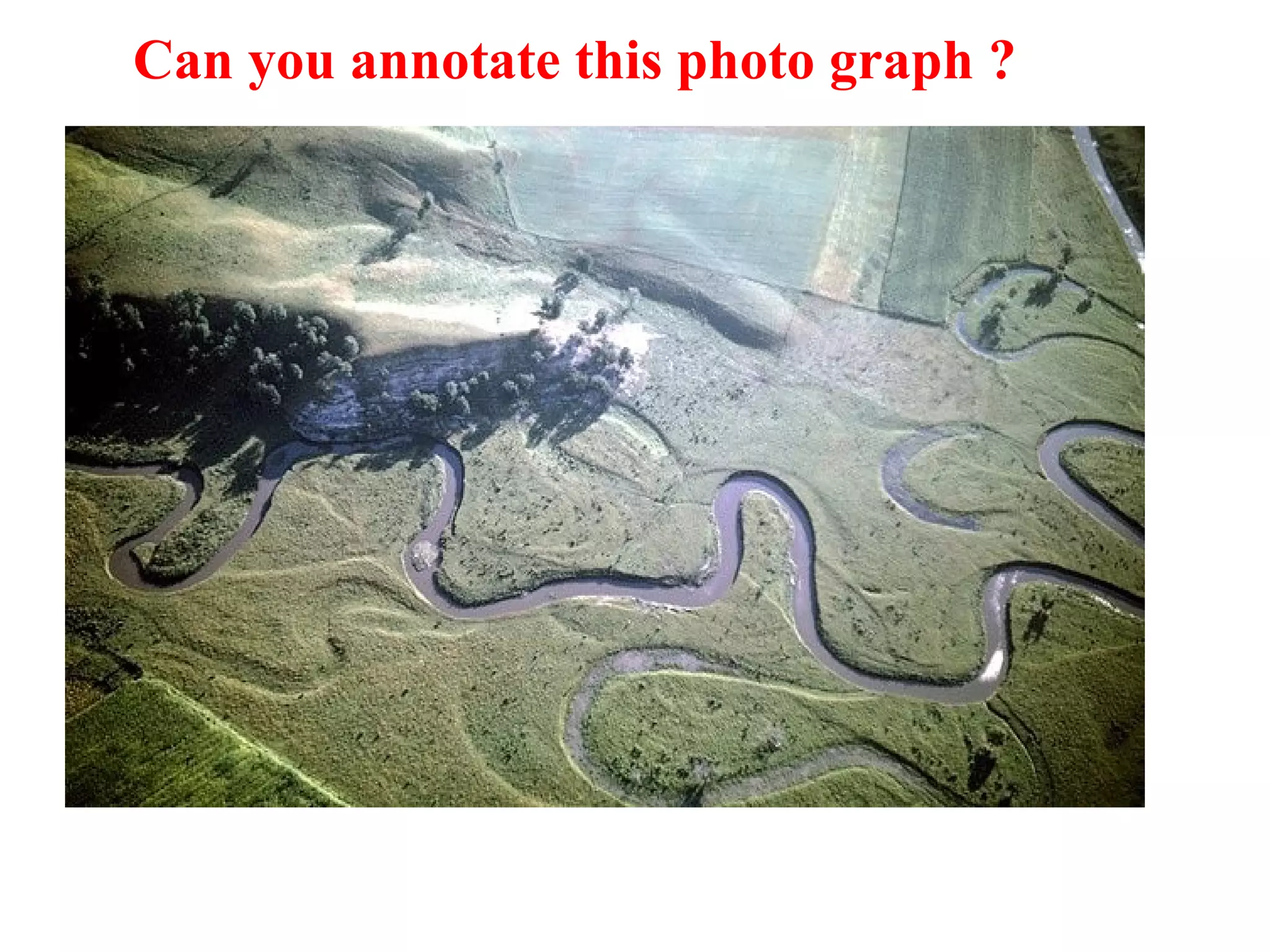
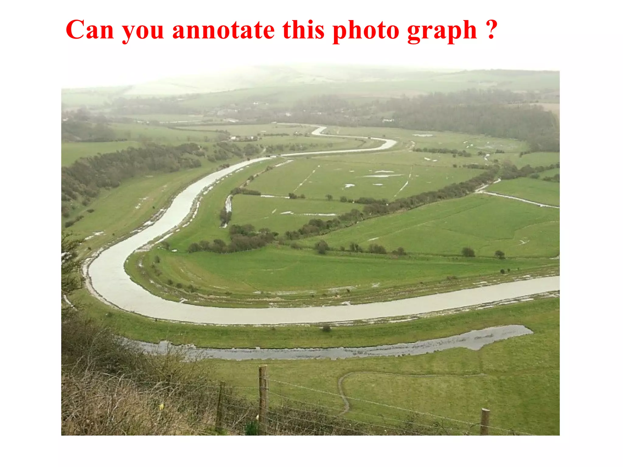
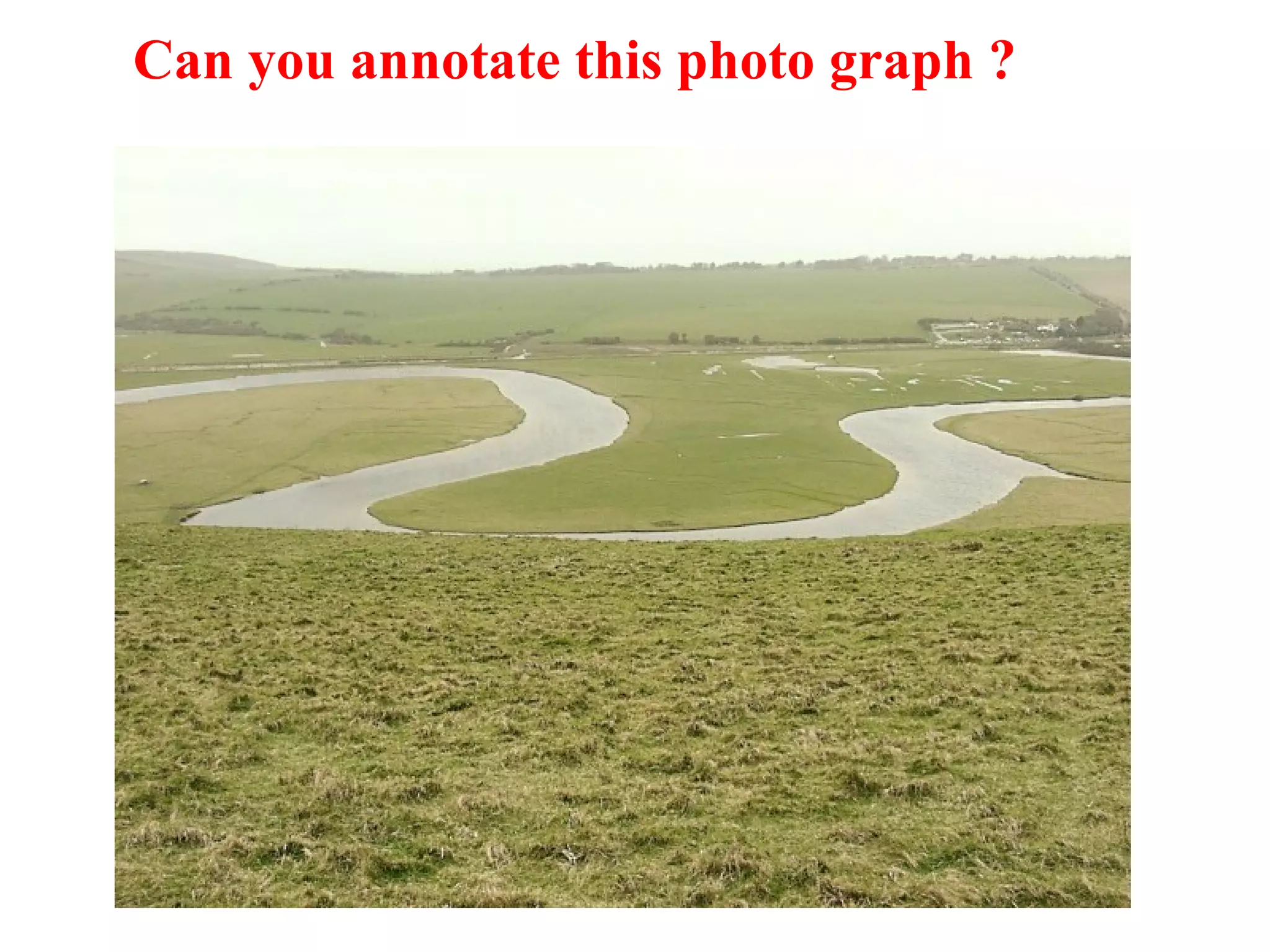
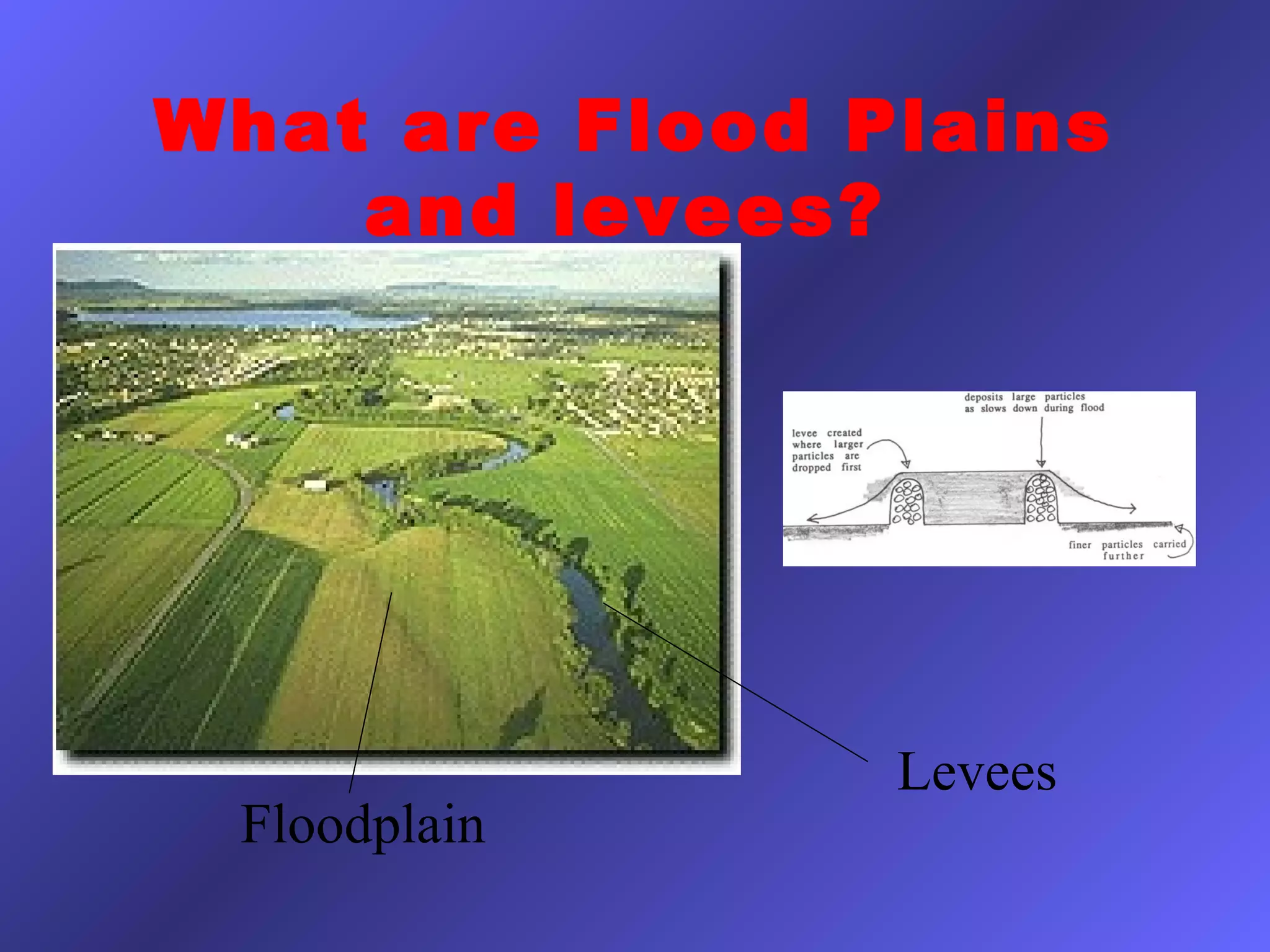
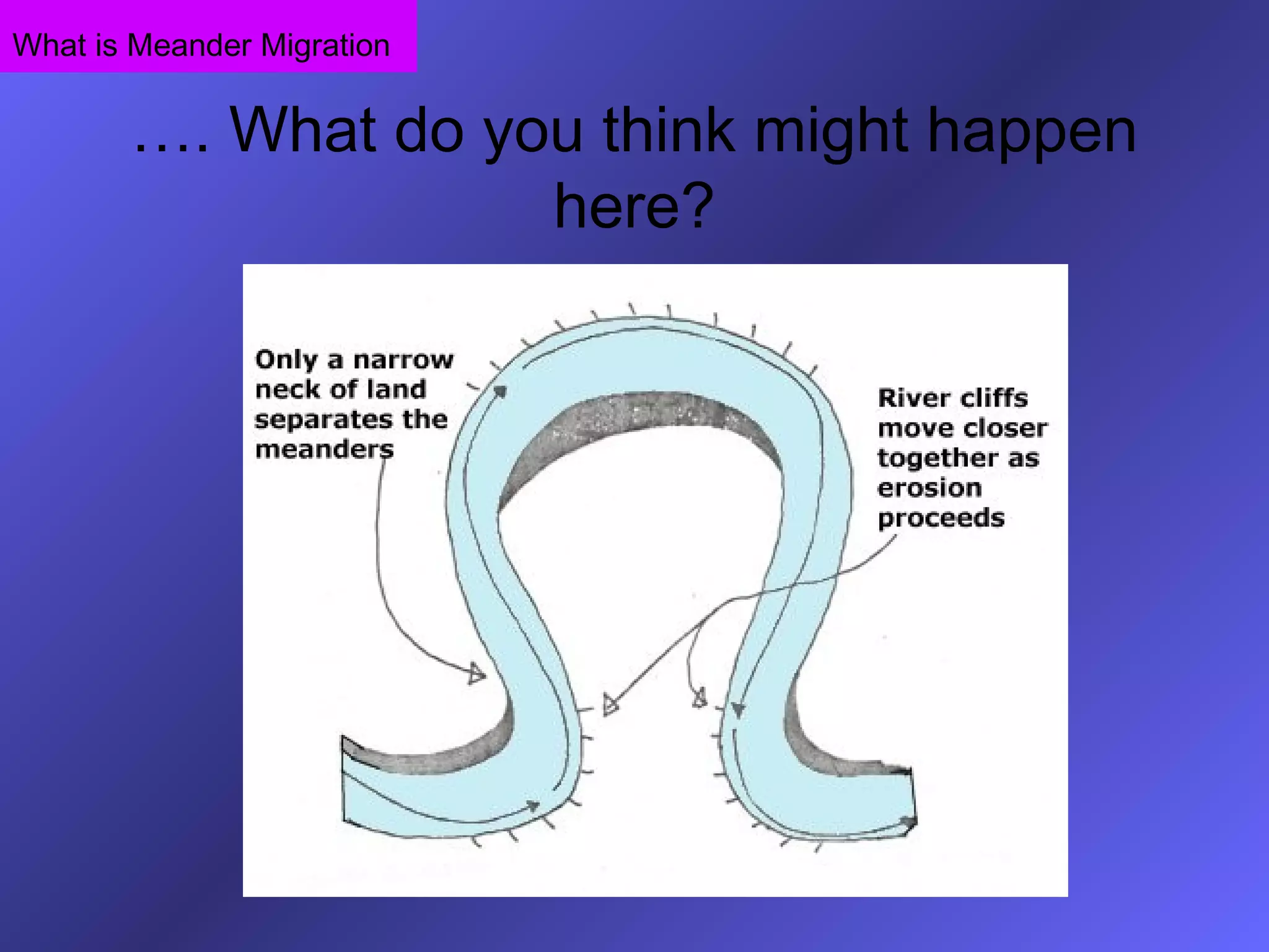
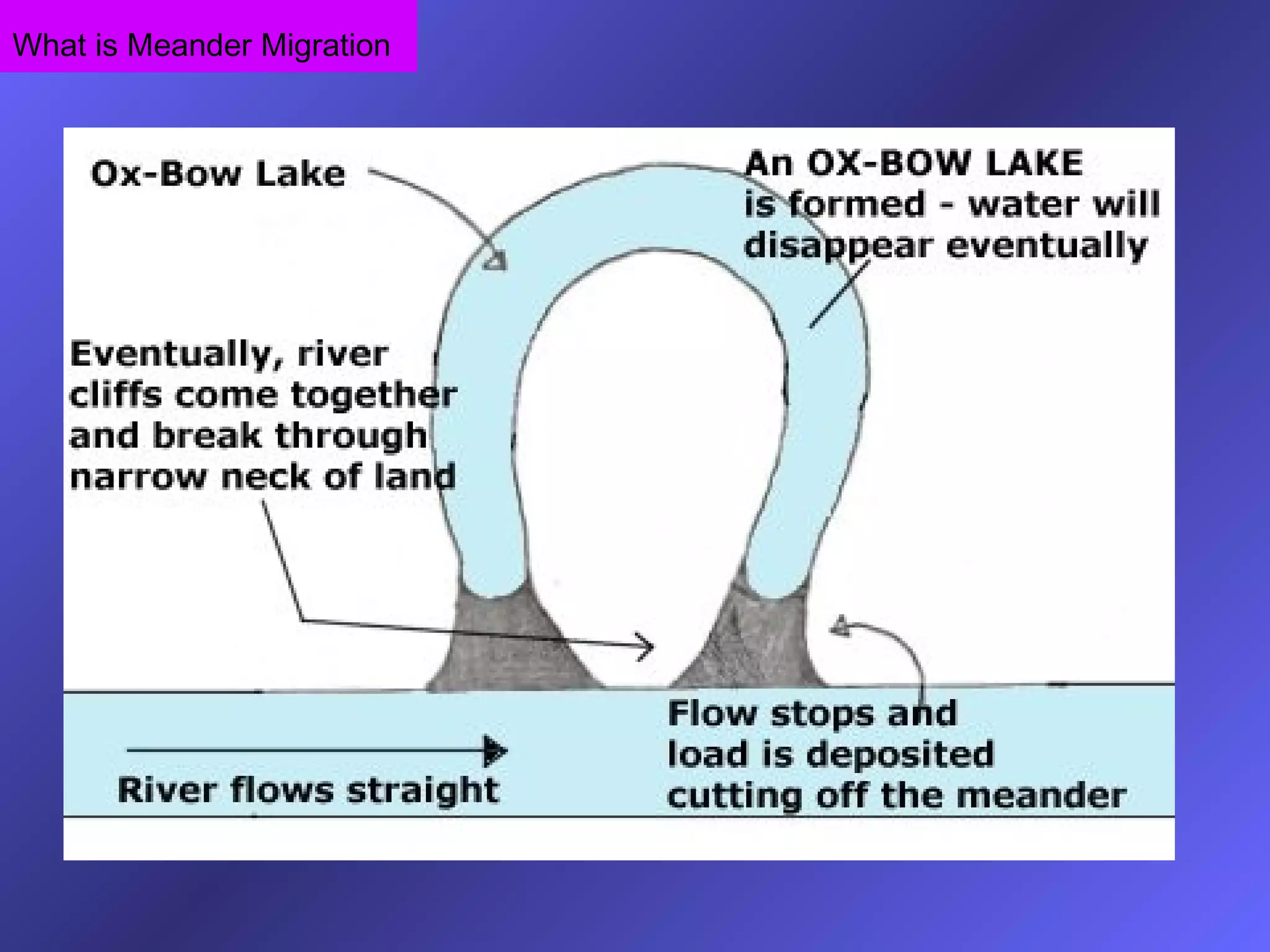
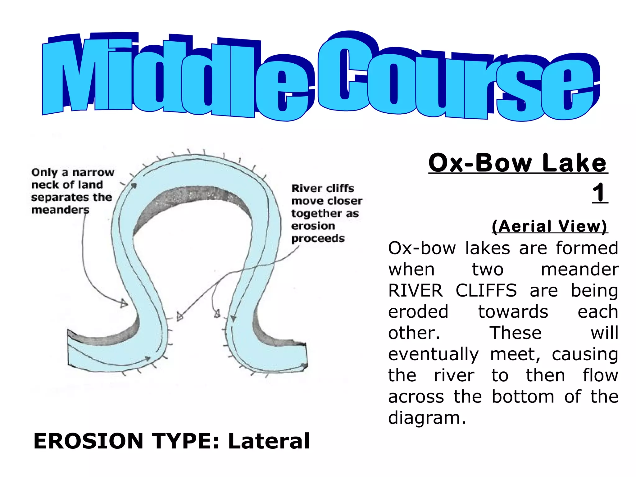
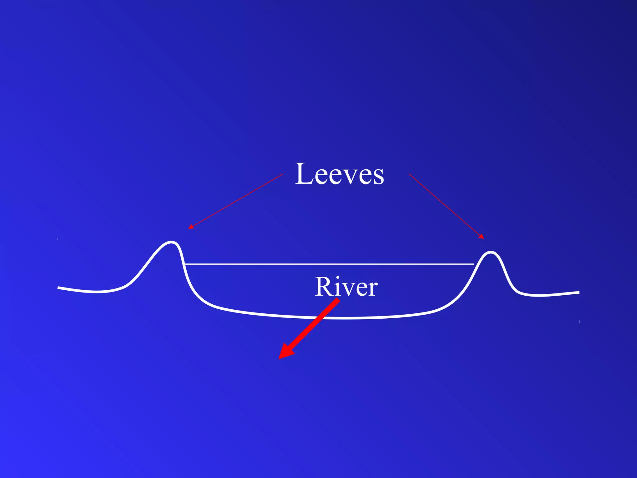
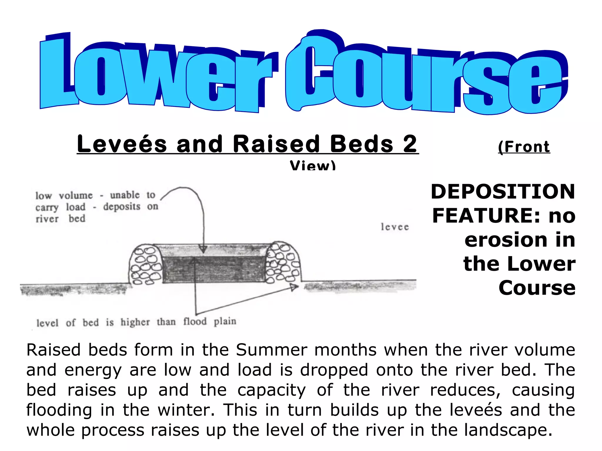
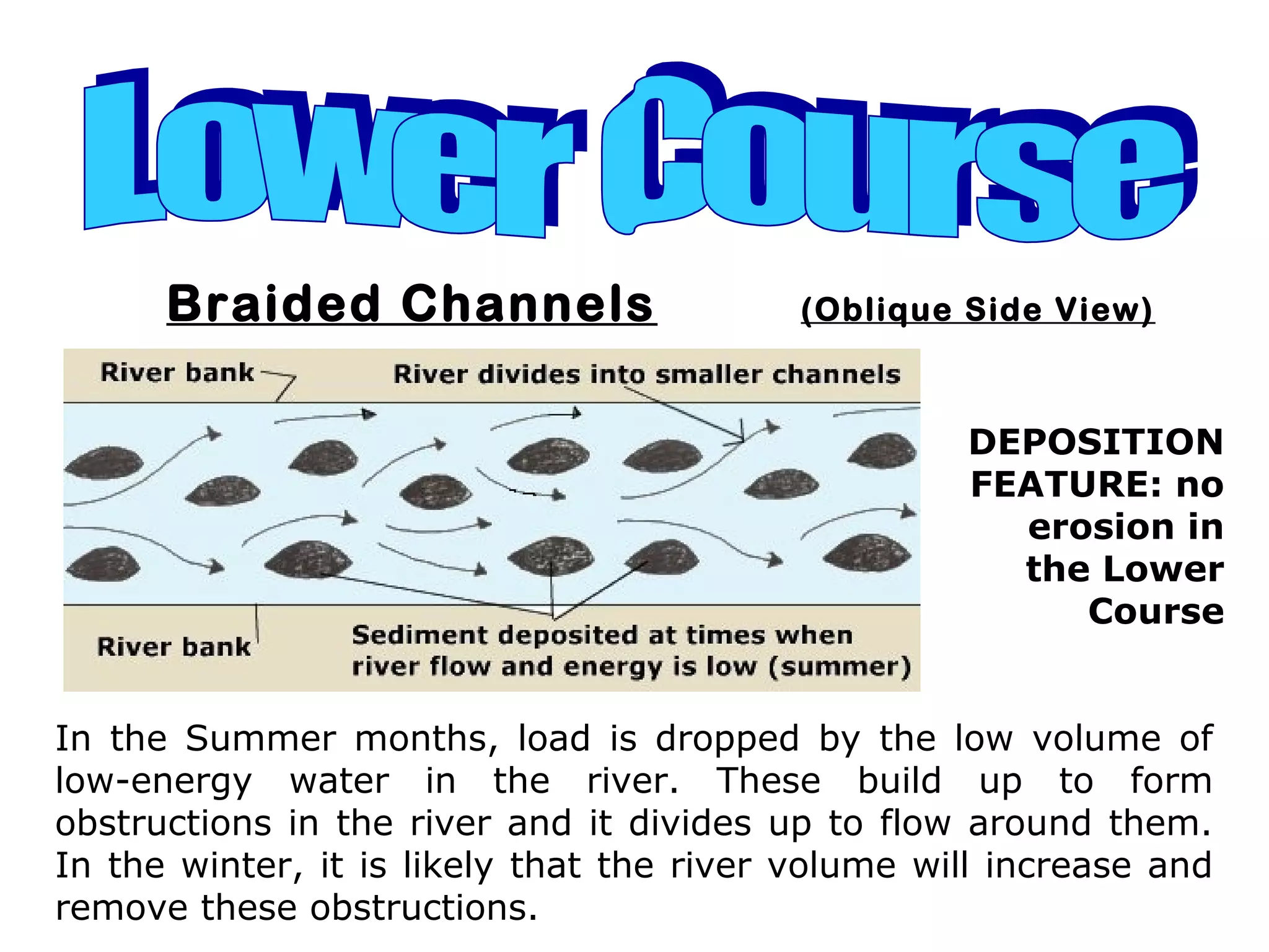
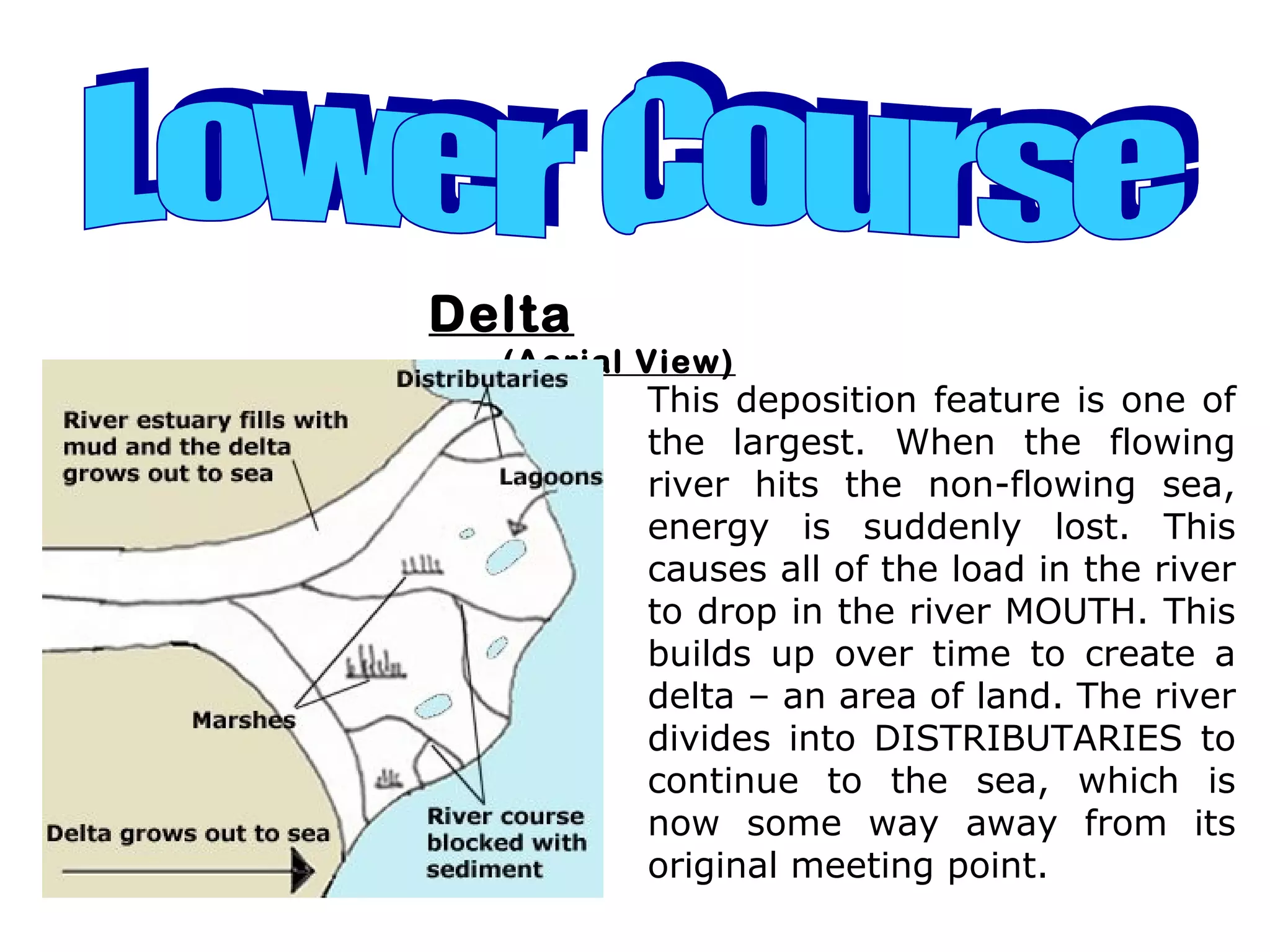
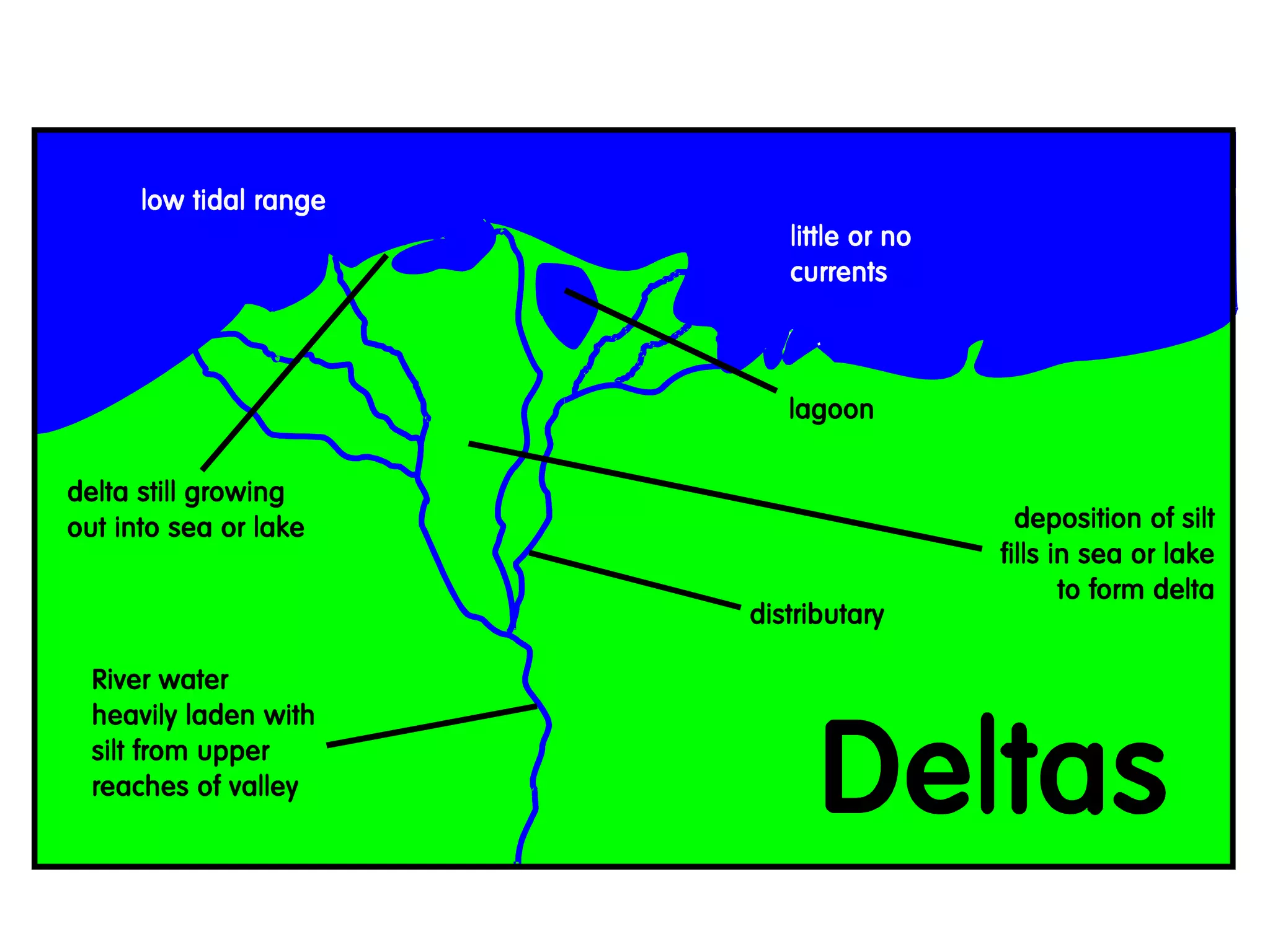
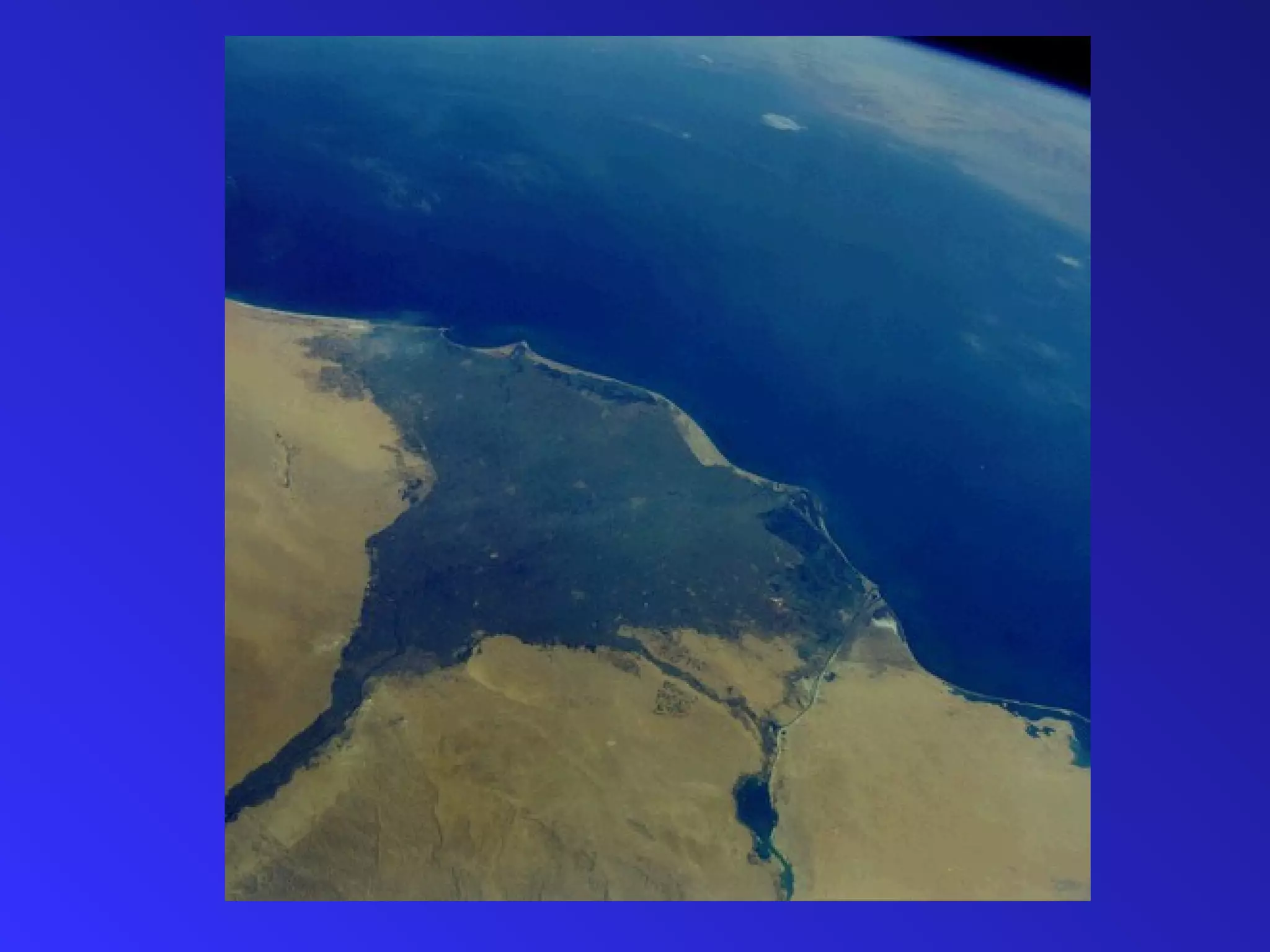
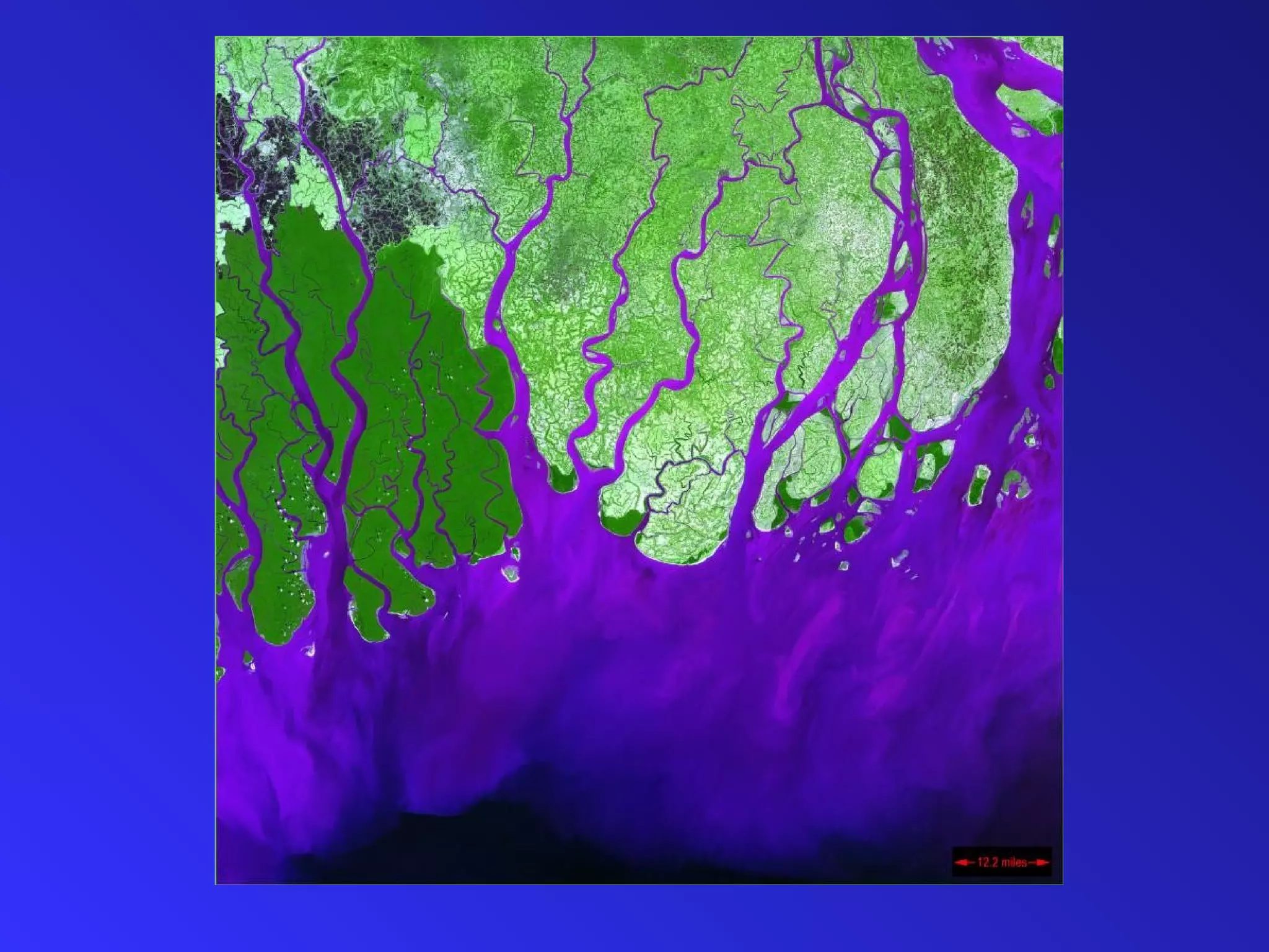
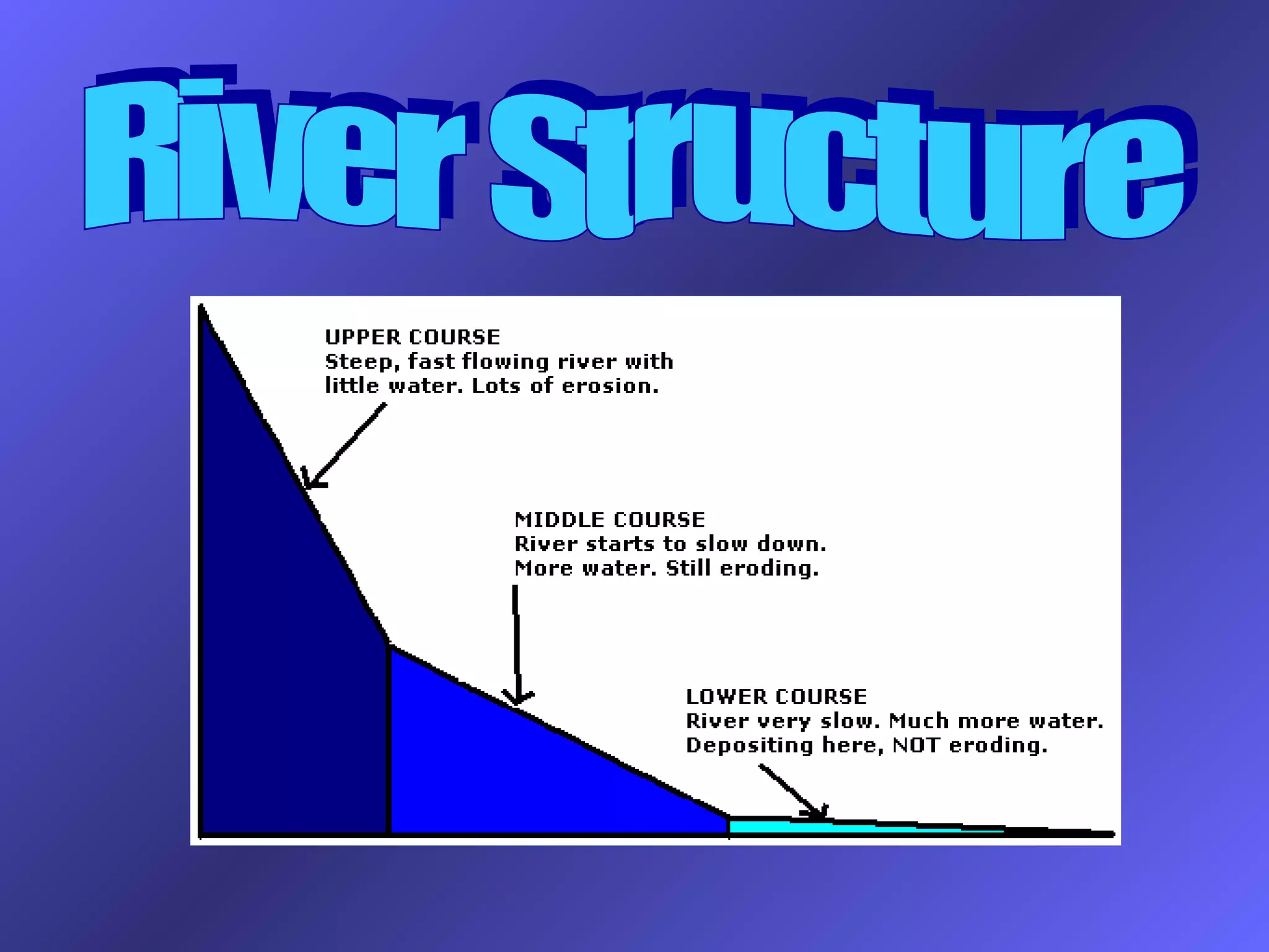
River landscapes and processes
Geography CCEA GCSE 2009
The earth’s crust is
modified by fluvial
processes which result in
distinctive landforms
Stages in theStages in the
Development of aDevelopment of a
River ValleyRiver Valley
The river cuts downward to
form a ‘V’shaped
valley. The river starts
to meander
What happens next?What happens next?
River uses its meanders to cut from side
to side eating into
the valley
Floodplain
starts to
form1
2
What happens next?What happens next?
1
2
What happens next?What happens next?
Floodplain
River bluffs
River cliff
Alluvial
deposits
River Processes
A river process is something that happens in the river. The
main processes in the river are
Erosion - where parts of the river bed and bank get eroded /
removed from the landscape
Transportation - where the eroded material is carried from
one place to another through the river system
Deposition - where the river load becomes too heavy for the
river to carry and is dumped down / deposited.
A river can erode material from
its bed and banks in 4 main ways
• Abrasion – Moving water throws particles it is
carrying against the bed and banks of the river
which dislodges more material
• Hydraulic Action - The sheer force of the water
pounding into the bed and banks can dislodge
material
• Attrition - Particles being carried downstream
knock against each other, wearing each other
down. This results in smaller, rounder particles as
you move downstream
Use your text book to see if you can find the 4th type!
Methods of Erosion
• Abrasion –
• Hydraulic Action -
• Attrition -
• Solution-
Methods of Transportation
• Rivers transport material in 4 main ways
• Solution - Some minerals (particularly in
limestone areas) dissolve easily in water and are
not visible to the naked eye
• Suspension – As the speed or velocity of a river
increases, it is able to pick up and carry larger and
larger particles in its flow. Where particles are
carried along in the flow and are not in contact
with the river bed, they are said to be travelling in
suspension.
Methods of Transportation
• Saltation - Heavier particles may not be
held in the flow all the time but may be
bounced along the bed
• Traction - The heaviest particles are
rolled along the bed. Such particles may
only be moved when the river has a large
volume of water in it
Methods of Transportation
• Solution -
• Suspension-
• Saltation -
• Traction -
solution
River Features
• Rivers are eroding, transporting and
depositing constantly within the drainage
basin system.
• The river can be divided into 3 sections –
Upper Course at the Source, Middle Course
and Lower Course at the Mouth of the river.
The river displays different characterisitics
at each section
How to take notes on each of the River
Features!
Course: Upper / Middle / Lower
Feature: Eg Waterfall
Diagram to illustrate: (make sure that this is labelled!)
Notes to explain how the feature happens:
Example of this feature:
Make sure that you take a new page for each new feature!
The V - Shaped Valley
Can you mark the V-shaped valley’s on these photos?
• http://www.school-portal.co.uk/GroupDownloadF
How are V-shaped valleys formed ?
• Why does it erode downwards?
• How does it erode downwards?
Use this sketch to help explain how they form
Vertical abrasion
Also known as ‘Torrent’ or ‘Youth’ stages
Interlocking Spurs
In the Upper Course, the river
is fast flowing, but there is little
water and load. The river is
often called a stream and does
not have the erosive power to
remove the hillsides (spurs),
but erodes downwards instead.
EROSION TYPE: Vertical and Headward
Waterfalls and Gorges
1. Draw the stages in the formation of a waterfall
2. Explain in as much detail what is happening at 3
3. What is happening here? (see next slide)
Waterfall formation flash
USA
Canada
Case study:
Niagara Falls
Canada
USA
Canada Horseshoe
750 meters
52 meters
high
American Bridal Falls
330 meters
Both falls…the falls help to produce HEP
The falls erode back at a rate of 1.5 meters
a year
Frozen Falls
20 million visit the falls every year
Visitors !!!
The Falls were stopped in 1969 to see if debris could be removed to improve the look !!
Hard Resistant
Rock - Limestone
Weak Rock -
Shale
52 meters
Gorges
(Upper & Middle Course)
Case study: Niagara Falls (USA and
Canada)
• http://www.school-portal.co.uk/GroupDownloadFile.asp?file=55026&Groupid=12426
Waterfall
and
Gorge 1
(OBLIQUE AERIAL
VIEW)
EROSION
TYPE: Vertical
and Headward
Waterfall
and
Gorge 2
(PROFILE VIEW)
EROSION
TYPE: Vertical
and Headward
Use the Niagara Falls Pictures
PowerPoint
Notes to be taken from Page 10 from
the Green Connections books
Meanders
1. Can you mark the
fastest flow on this?
2. What type of erosion do you
think is happening?
..can you mark on this the fastest
flow?
What is a meander?
… where do you think erosion would
take place?
What is a meander
Can you draw a cross section x-
y?
What is a meander?
… this is what a cross section
through a meander looks like
What is a meander?
Meanders are formed
because the current
swings to the outside of a
bend and concentrates
the erosion there.
Deposition occurs on the
inside of the bed where
there is not enough
energy to carry load.
EROSION TYPE: Lateral
Also known as the ‘Mature’ stage
Meanders
1
(Aerial View)
Meanders
2
(Profile View /
Cross Section X - Y)
EROSION
TYPE: Lateral
This cross section clearly shows the eddy current (near ’X’) formed by
the velocity of the river being concentrated on the outside of the bend.
These UNDERCUT the bank causing the formation of a RIVER CLIFF. On
the inside (NEAR ‘Y’), a SLIP-OFF-SLOPE is formed where current is too
slow to carry any load.
… this is what a cross section
through a meander looks like
What is a meander?
Ox- Bow Lakes
(Middle Course)
Can you annotate this photo graph ?
What are Flood Plains
and levees?
•
Floodplain
Levees
…. What do you think might happen
here?
What is Meander Migration
Ox-Bow Lake
1
(Aerial View)
EROSION TYPE: Lateral
Ox-bow lakes are formed
when two meander
RIVER CLIFFS are being
eroded towards each
other. These will
eventually meet, causing
the river to then flow
across the bottom of the
diagram.
Ox-Bow Lake 2 (Aerial View)
Levees
Leeves
River
Leveés and Raised Beds 1 (Front
View)
DEPOSITION
FEATURE: no
erosion in
the Lower
Course
Leveés are formed when rivers flood. The river water
overflows the banks of the river and immediately slows
down due to friction with the FLOODPLAIN. This drops the
larger particles first, building up a raised river bank called a
LEVEÉ.
Leveés and Raised Beds 2 (Front
View)
DEPOSITION
FEATURE: no
erosion in
the Lower
Course
Raised beds form in the Summer months when the river volume
and energy are low and load is dropped onto the river bed. The
bed raises up and the capacity of the river reduces, causing
flooding in the winter. This in turn builds up the leveés and the
whole process raises up the level of the river in the landscape.
Braided Channels (Oblique Side View)
DEPOSITION
FEATURE: no
erosion in
the Lower
Course
In the Summer months, load is dropped by the low volume of
low-energy water in the river. These build up to form
obstructions in the river and it divides up to flow around them.
In the winter, it is likely that the river volume will increase and
remove these obstructions.
Deltas
Delta
(Aerial View)
This deposition feature is one of
the largest. When the flowing
river hits the non-flowing sea,
energy is suddenly lost. This
causes all of the load in the river
to drop in the river MOUTH. This
builds up over time to create a
delta – an area of land. The river
divides into DISTRIBUTARIES to
continue to the sea, which is
now some way away from its
original meeting point.
Can you work out what the river is trying to do by using this diagram?

Ccea river landscapes and processes final

  • 1.
    River landscapes andprocesses Geography CCEA GCSE 2009
  • 2.
    The earth’s crustis modified by fluvial processes which result in distinctive landforms
  • 4.
    Stages in theStagesin the Development of aDevelopment of a River ValleyRiver Valley
  • 5.
    The river cutsdownward to form a ‘V’shaped valley. The river starts to meander
  • 6.
  • 7.
    River uses itsmeanders to cut from side to side eating into the valley Floodplain starts to form1 2
  • 8.
  • 9.
  • 10.
  • 11.
  • 12.
    River Processes A riverprocess is something that happens in the river. The main processes in the river are Erosion - where parts of the river bed and bank get eroded / removed from the landscape Transportation - where the eroded material is carried from one place to another through the river system Deposition - where the river load becomes too heavy for the river to carry and is dumped down / deposited.
  • 13.
    A river canerode material from its bed and banks in 4 main ways • Abrasion – Moving water throws particles it is carrying against the bed and banks of the river which dislodges more material • Hydraulic Action - The sheer force of the water pounding into the bed and banks can dislodge material • Attrition - Particles being carried downstream knock against each other, wearing each other down. This results in smaller, rounder particles as you move downstream Use your text book to see if you can find the 4th type!
  • 14.
    Methods of Erosion •Abrasion – • Hydraulic Action - • Attrition - • Solution-
  • 15.
    Methods of Transportation •Rivers transport material in 4 main ways • Solution - Some minerals (particularly in limestone areas) dissolve easily in water and are not visible to the naked eye • Suspension – As the speed or velocity of a river increases, it is able to pick up and carry larger and larger particles in its flow. Where particles are carried along in the flow and are not in contact with the river bed, they are said to be travelling in suspension.
  • 16.
    Methods of Transportation •Saltation - Heavier particles may not be held in the flow all the time but may be bounced along the bed • Traction - The heaviest particles are rolled along the bed. Such particles may only be moved when the river has a large volume of water in it
  • 17.
    Methods of Transportation •Solution - • Suspension- • Saltation - • Traction -
  • 18.
  • 19.
    River Features • Riversare eroding, transporting and depositing constantly within the drainage basin system. • The river can be divided into 3 sections – Upper Course at the Source, Middle Course and Lower Course at the Mouth of the river. The river displays different characterisitics at each section
  • 20.
    How to takenotes on each of the River Features! Course: Upper / Middle / Lower Feature: Eg Waterfall Diagram to illustrate: (make sure that this is labelled!) Notes to explain how the feature happens: Example of this feature: Make sure that you take a new page for each new feature!
  • 21.
    The V -Shaped Valley
  • 22.
    Can you markthe V-shaped valley’s on these photos?
  • 29.
  • 30.
    How are V-shapedvalleys formed ?
  • 31.
    • Why doesit erode downwards? • How does it erode downwards?
  • 35.
    Use this sketchto help explain how they form Vertical abrasion
  • 37.
    Also known as‘Torrent’ or ‘Youth’ stages Interlocking Spurs In the Upper Course, the river is fast flowing, but there is little water and load. The river is often called a stream and does not have the erosive power to remove the hillsides (spurs), but erodes downwards instead. EROSION TYPE: Vertical and Headward
  • 39.
  • 40.
    1. Draw thestages in the formation of a waterfall 2. Explain in as much detail what is happening at 3 3. What is happening here? (see next slide)
  • 41.
  • 44.
  • 45.
  • 46.
  • 47.
  • 48.
  • 49.
    Both falls…the fallshelp to produce HEP
  • 50.
    The falls erodeback at a rate of 1.5 meters a year
  • 51.
  • 52.
    20 million visitthe falls every year Visitors !!!
  • 54.
    The Falls werestopped in 1969 to see if debris could be removed to improve the look !!
  • 55.
    Hard Resistant Rock -Limestone Weak Rock - Shale 52 meters
  • 56.
    Gorges (Upper & MiddleCourse) Case study: Niagara Falls (USA and Canada)
  • 57.
  • 61.
  • 62.
  • 63.
    Use the NiagaraFalls Pictures PowerPoint Notes to be taken from Page 10 from the Green Connections books
  • 64.
  • 65.
    1. Can youmark the fastest flow on this? 2. What type of erosion do you think is happening?
  • 67.
    ..can you markon this the fastest flow? What is a meander?
  • 68.
    … where doyou think erosion would take place? What is a meander
  • 69.
    Can you drawa cross section x- y? What is a meander?
  • 70.
    … this iswhat a cross section through a meander looks like What is a meander?
  • 71.
    Meanders are formed becausethe current swings to the outside of a bend and concentrates the erosion there. Deposition occurs on the inside of the bed where there is not enough energy to carry load. EROSION TYPE: Lateral Also known as the ‘Mature’ stage Meanders 1 (Aerial View)
  • 72.
    Meanders 2 (Profile View / CrossSection X - Y) EROSION TYPE: Lateral This cross section clearly shows the eddy current (near ’X’) formed by the velocity of the river being concentrated on the outside of the bend. These UNDERCUT the bank causing the formation of a RIVER CLIFF. On the inside (NEAR ‘Y’), a SLIP-OFF-SLOPE is formed where current is too slow to carry any load.
  • 73.
    … this iswhat a cross section through a meander looks like What is a meander?
  • 74.
  • 76.
    Can you annotatethis photo graph ?
  • 77.
    Can you annotatethis photo graph ?
  • 78.
    Can you annotatethis photo graph ?
  • 79.
    Can you annotatethis photo graph ?
  • 80.
    What are FloodPlains and levees? • Floodplain Levees
  • 81.
    …. What doyou think might happen here? What is Meander Migration
  • 82.
    What is MeanderMigration
  • 83.
    Ox-Bow Lake 1 (Aerial View) EROSIONTYPE: Lateral Ox-bow lakes are formed when two meander RIVER CLIFFS are being eroded towards each other. These will eventually meet, causing the river to then flow across the bottom of the diagram.
  • 84.
    Ox-Bow Lake 2(Aerial View)
  • 85.
  • 86.
  • 87.
    Leveés and RaisedBeds 1 (Front View) DEPOSITION FEATURE: no erosion in the Lower Course Leveés are formed when rivers flood. The river water overflows the banks of the river and immediately slows down due to friction with the FLOODPLAIN. This drops the larger particles first, building up a raised river bank called a LEVEÉ.
  • 88.
    Leveés and RaisedBeds 2 (Front View) DEPOSITION FEATURE: no erosion in the Lower Course Raised beds form in the Summer months when the river volume and energy are low and load is dropped onto the river bed. The bed raises up and the capacity of the river reduces, causing flooding in the winter. This in turn builds up the leveés and the whole process raises up the level of the river in the landscape.
  • 89.
    Braided Channels (ObliqueSide View) DEPOSITION FEATURE: no erosion in the Lower Course In the Summer months, load is dropped by the low volume of low-energy water in the river. These build up to form obstructions in the river and it divides up to flow around them. In the winter, it is likely that the river volume will increase and remove these obstructions.
  • 90.
  • 91.
    Delta (Aerial View) This depositionfeature is one of the largest. When the flowing river hits the non-flowing sea, energy is suddenly lost. This causes all of the load in the river to drop in the river MOUTH. This builds up over time to create a delta – an area of land. The river divides into DISTRIBUTARIES to continue to the sea, which is now some way away from its original meeting point.
  • 93.
    Can you workout what the river is trying to do by using this diagram?
  • 98.
    Can you workout what the river is trying to do by using this diagram?