Downloaded 1,967 times
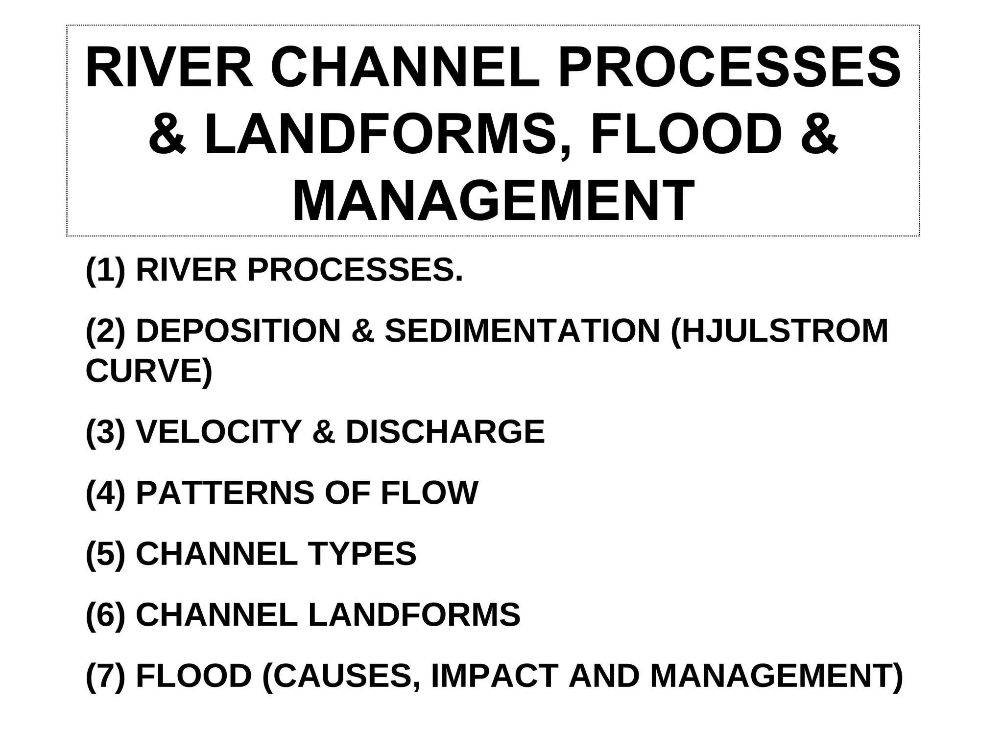
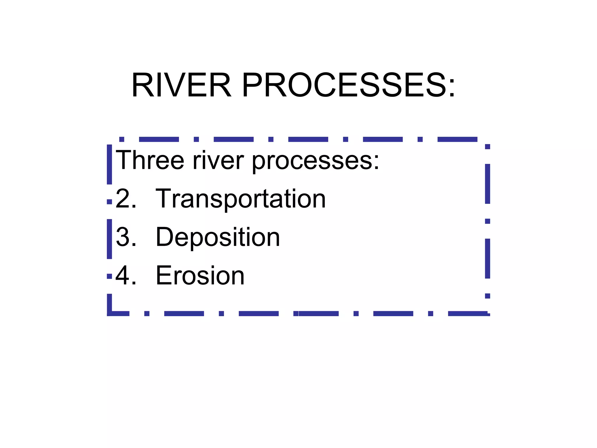
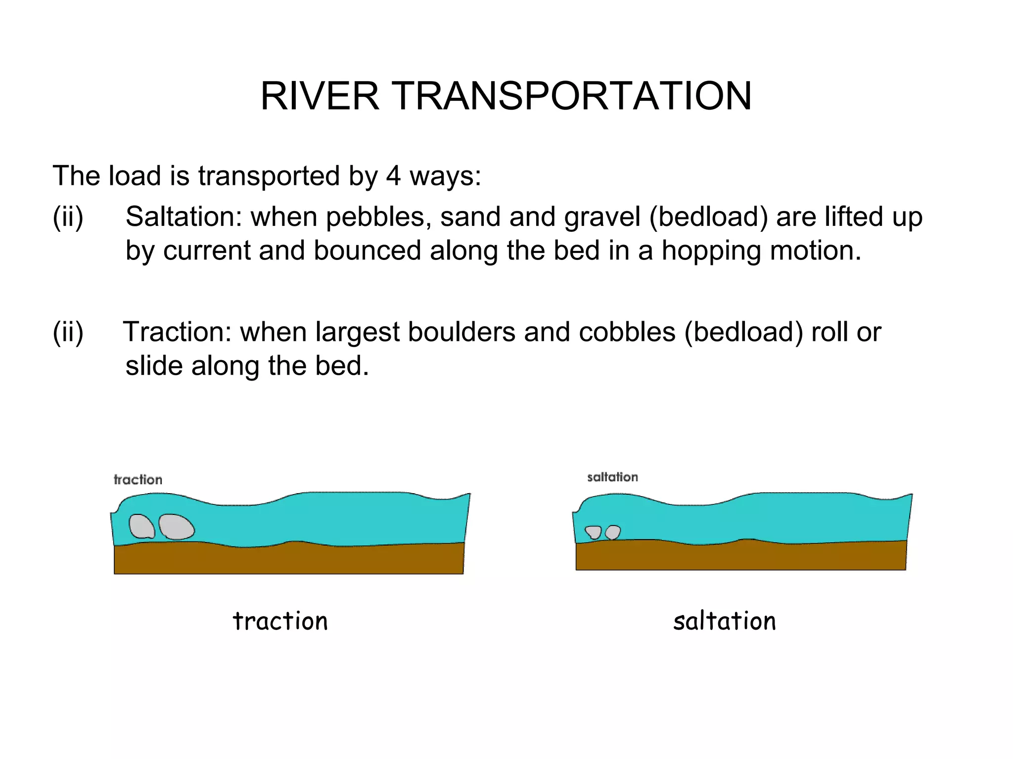
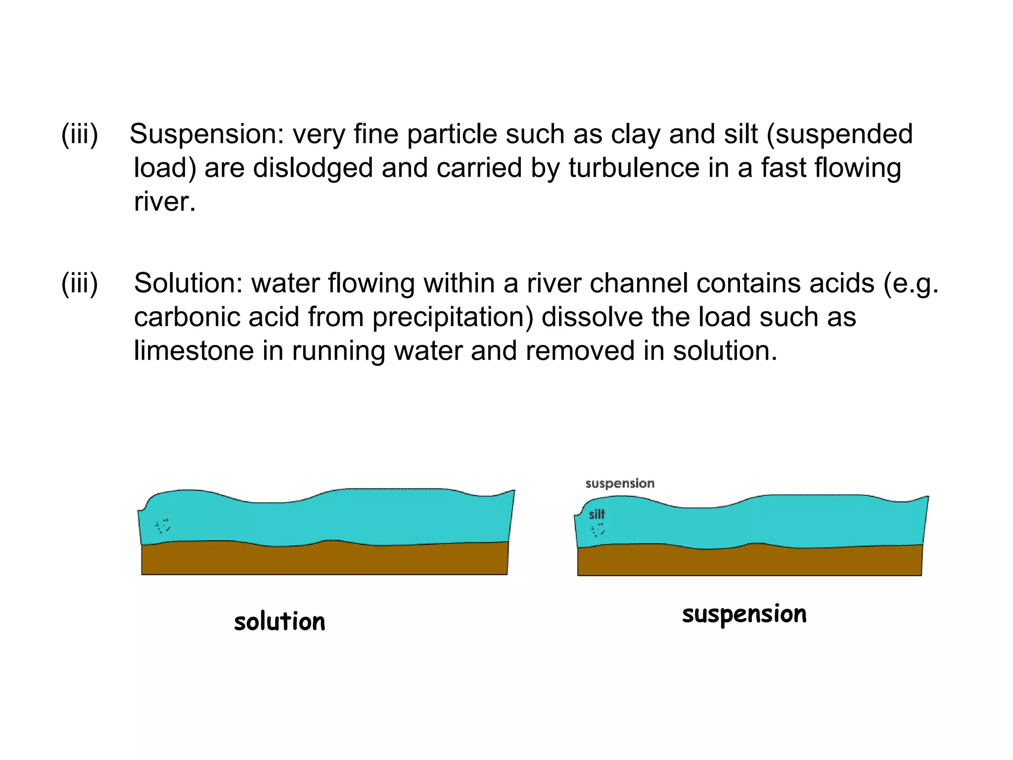
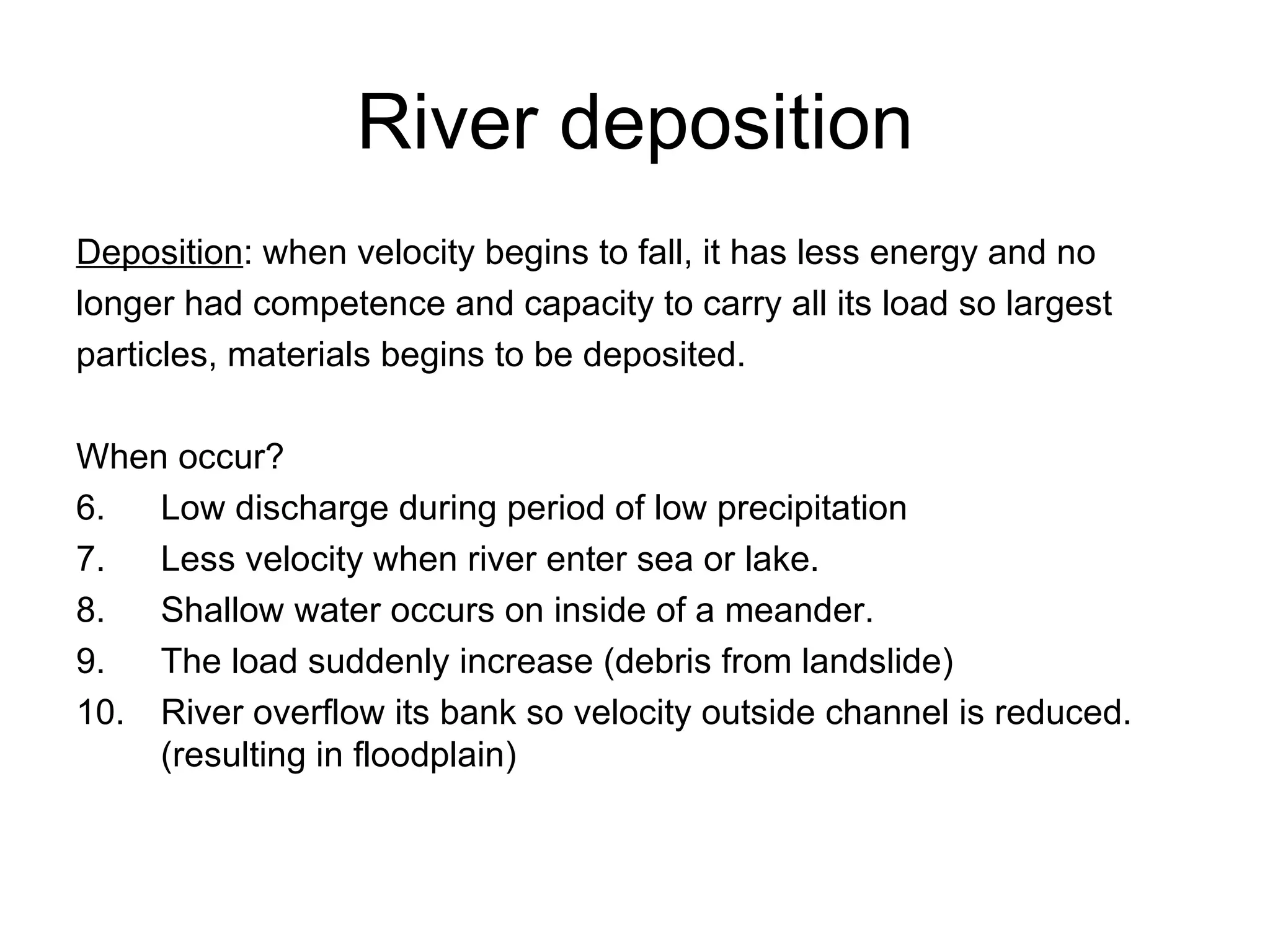
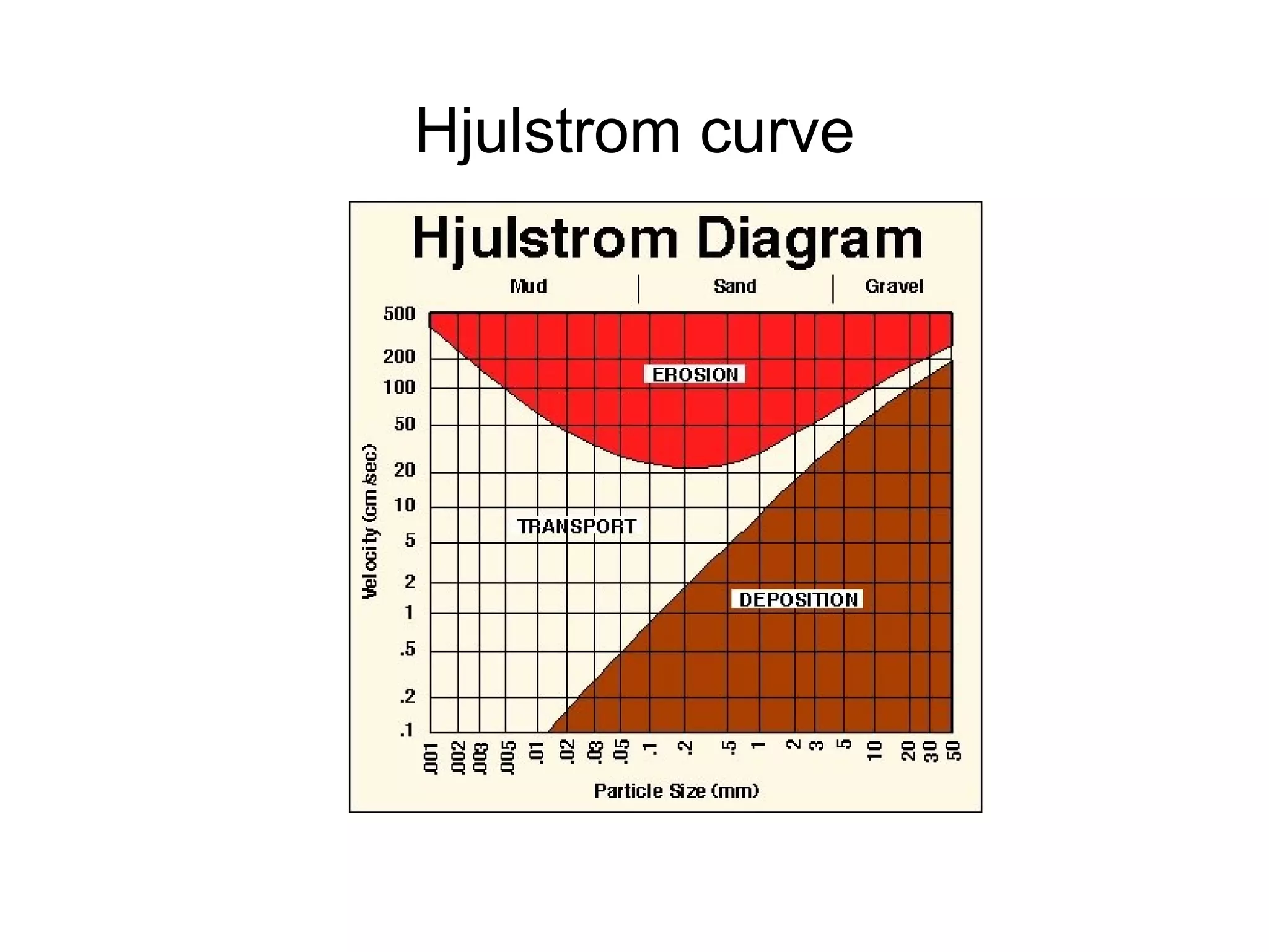
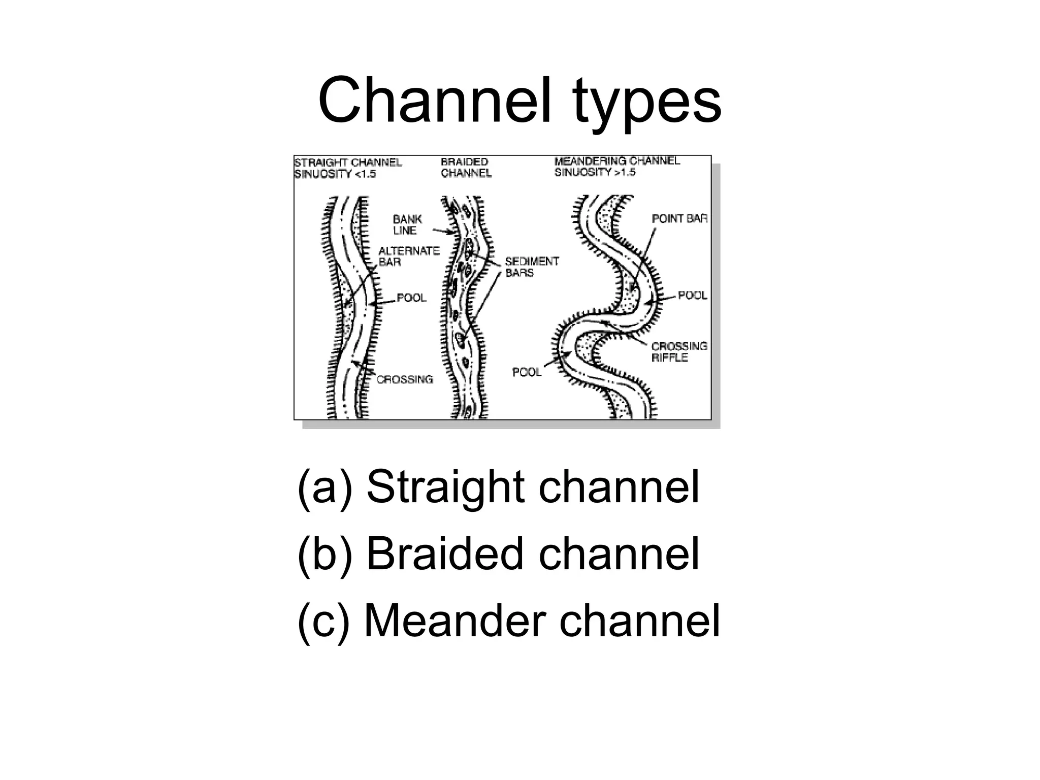
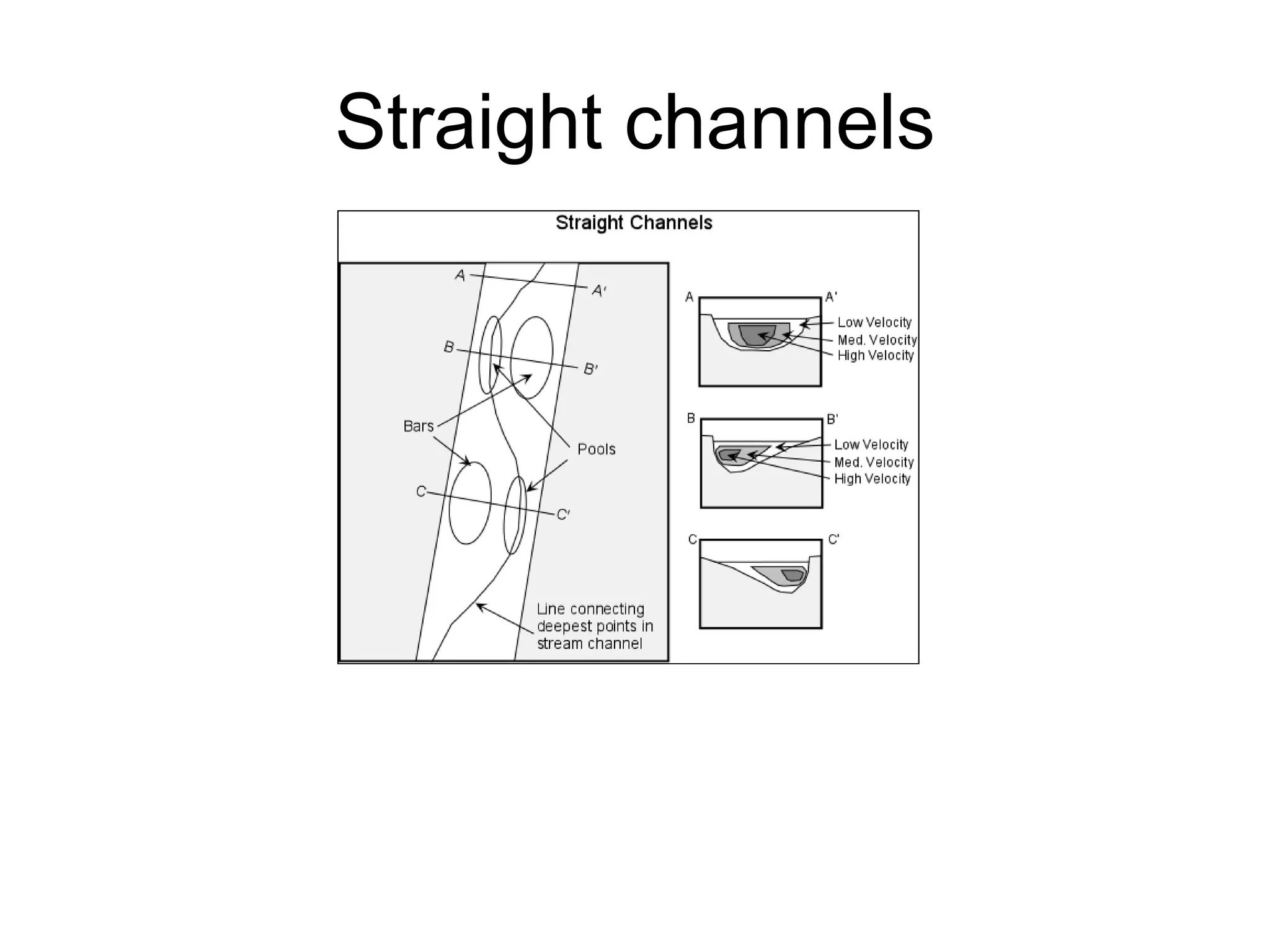
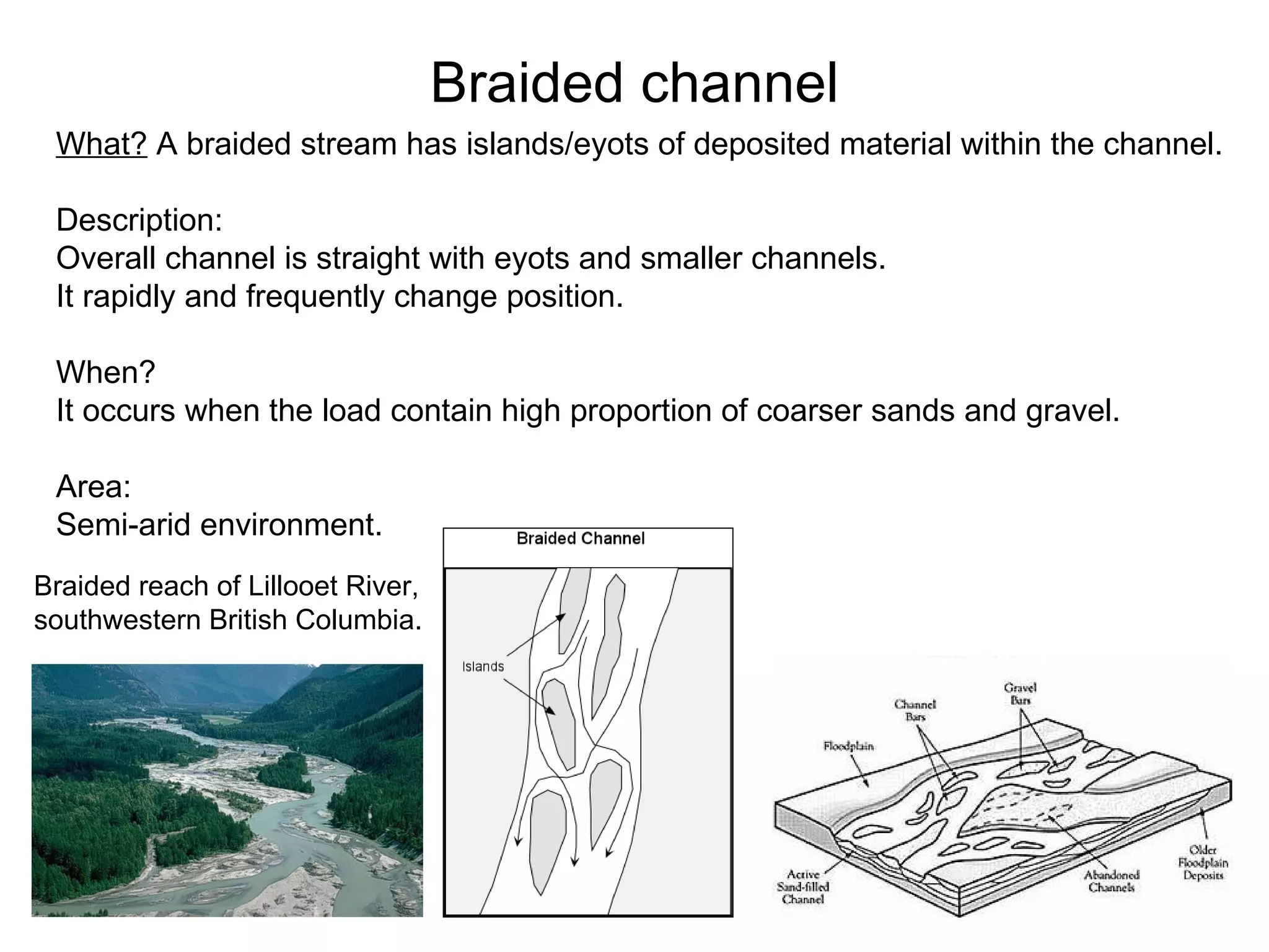
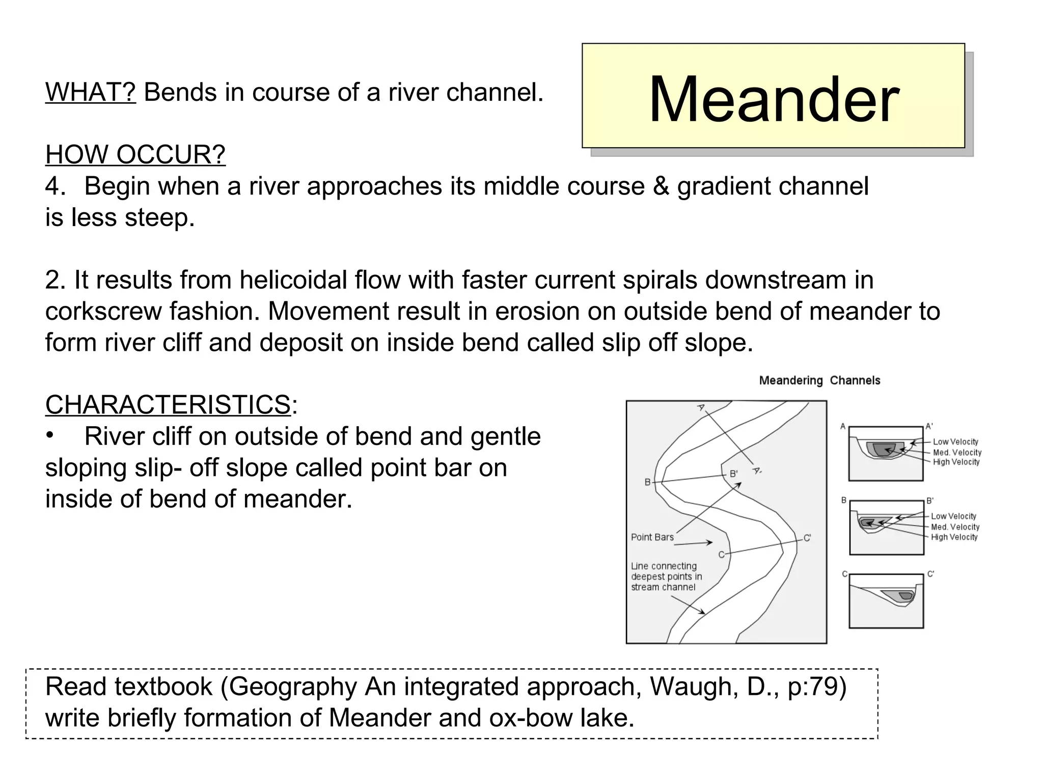

The document discusses river channel processes and landforms, including: 1. River processes like erosion, transportation, and deposition shape landforms through sediment movement. 2. Velocity and discharge impact a river's ability to erode, transport, or deposit materials based on the Hjulström curve. 3. Meanders, floodplains, and deltas are examples of landforms formed by fluvial erosion and deposition that impact human settlements.