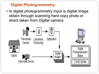
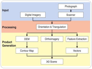
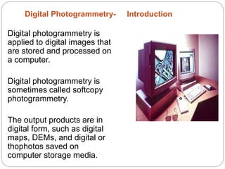
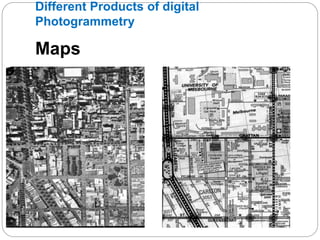
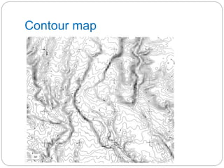
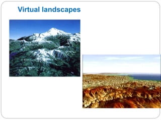
Presentation
on
Presented by
Mr .Amol V. Ghogare
Assistant Professor, Civil Engineering Dept.
SRES, SCOE, Kopargaon
.
 In digital photogrammetry input is digital image
obtain through scanning hard copy photo or
direct taken from Digital camera
Digital Photogrammetry-
Digital Photogrammetry- Introduction
Digital photogrammetry is
applied to digital images that
are stored and processed on
a computer.
Digital photogrammetry is
sometimes called softcopy
photogrammetry.
The output products are in
digital form, such as digital
maps, DEMs, and digital or
thophotos saved on
computer storage media.
Single or pairs of digital images are loaded into a
computer
with image processing capabilities.
Images may be from satellite or airborne scanners,
CCD
cameras or are conventional photographs captured by a
line
scanner.
Images are either displayed on the screen for operator
interpretation, enhanced by image processing or
Digital Photogrammetry
Applications of Photogrammetery
 Topographic mapping
 Creation of value added products:
– Ortho images
– Digital Elevation Models
– Virtual landscapes
 Nadir imagery is essential for mapping
 Overlap and sidelap is required to give 3D
information
Different Products of digital
Photogrammetry
Maps
DTMs
Sources of terrain models
– Stereo photogrammetry
– Interferometric radar
– Stereo radar
– Laser scanning
– Digitising maps
Contour digitizing
Digital terrain model –
Digitizing contour maps
Two step procedure:
click
on the contours, then
grid the data
Liable to error if the
DEM
spacing grid is too large
Contour map
Virtual landscapes
Ultimate Surface model
Thank you

Digital photogrammetry

  • 1.
    Presentation on Presented by Mr .AmolV. Ghogare Assistant Professor, Civil Engineering Dept. SRES, SCOE, Kopargaon .
  • 3.
     In digitalphotogrammetry input is digital image obtain through scanning hard copy photo or direct taken from Digital camera Digital Photogrammetry-
  • 6.
    Digital Photogrammetry- Introduction Digitalphotogrammetry is applied to digital images that are stored and processed on a computer. Digital photogrammetry is sometimes called softcopy photogrammetry. The output products are in digital form, such as digital maps, DEMs, and digital or thophotos saved on computer storage media.
  • 7.
    Single or pairsof digital images are loaded into a computer with image processing capabilities. Images may be from satellite or airborne scanners, CCD cameras or are conventional photographs captured by a line scanner. Images are either displayed on the screen for operator interpretation, enhanced by image processing or Digital Photogrammetry
  • 8.
    Applications of Photogrammetery Topographic mapping  Creation of value added products: – Ortho images – Digital Elevation Models – Virtual landscapes  Nadir imagery is essential for mapping  Overlap and sidelap is required to give 3D information
  • 9.
    Different Products ofdigital Photogrammetry Maps
  • 10.
    DTMs Sources of terrainmodels – Stereo photogrammetry – Interferometric radar – Stereo radar – Laser scanning – Digitising maps
  • 11.
    Contour digitizing Digital terrainmodel – Digitizing contour maps Two step procedure: click on the contours, then grid the data Liable to error if the DEM spacing grid is too large
  • 12.
  • 13.
  • 14.
  • 15.